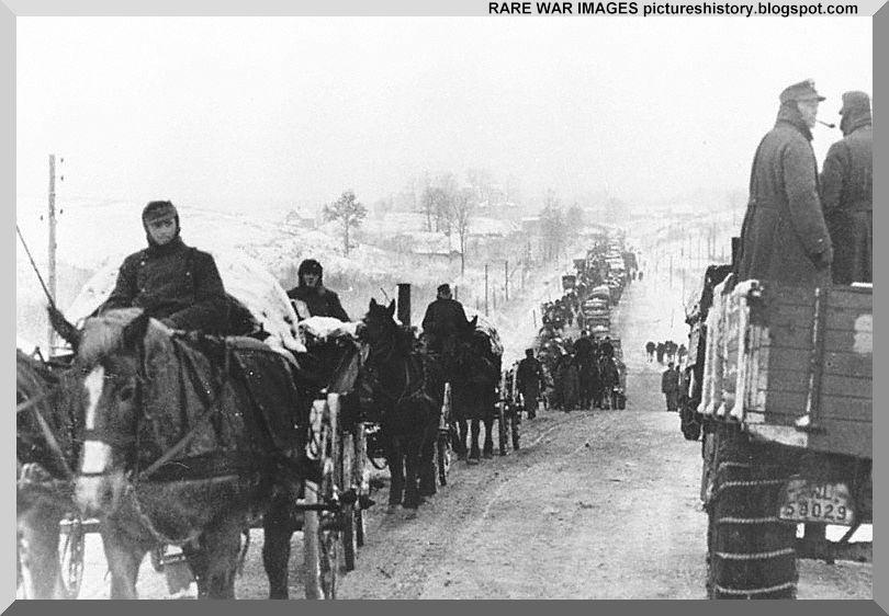
Zo571. GERMAN-ARMY-RUSSIA-SOVIET-UNION-WW2-SECOND-WORLD-WAR-IMAGES-PICTURES-PHOTOS-HISTORY-008
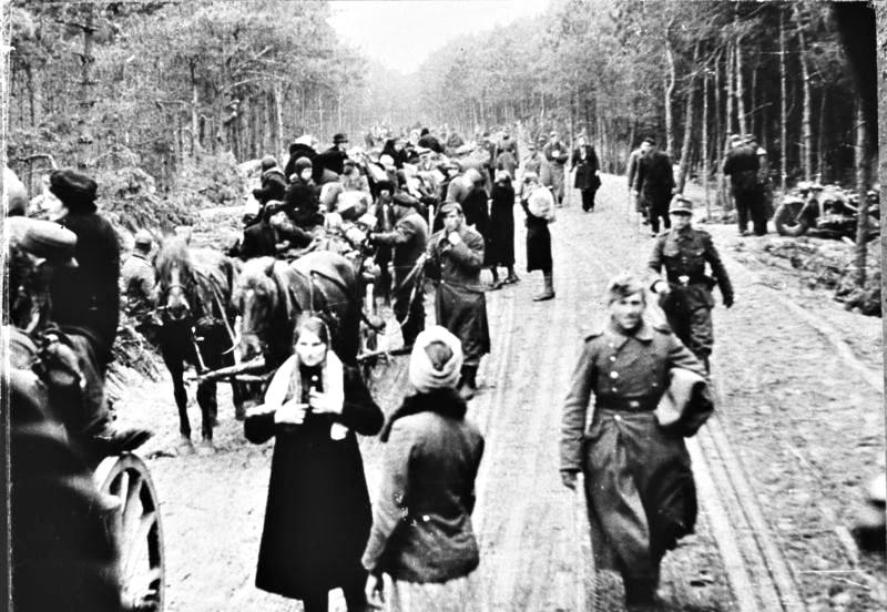
February 1944. A pathetic sight. The once mighty German army withdraws from Leningrad area on horse-carts. Curtesy of: https://pictureshistory.blogspot.com/ or click here
https://pictureshistory.blogspot.com/2010/07/germans-in-russia-later-years-retreat.html or click here
—————————————————–
A collection of WWII images from the world wide web (WWW). These are pictures that drew my attention or are telling me a story that interests me.
——————————————————-
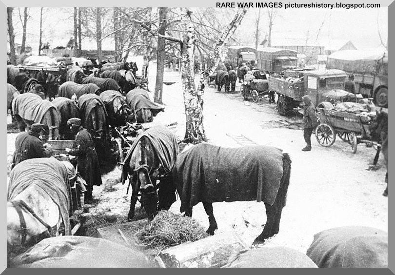
Zo572. GERMAN-ARMY-RUSSIA-SOVIET-UNION-WW2-SECOND-WORLD-WAR-IMAGES-PICTURES-PHOTOS-HISTORY-009
February 1944. A pathetic sight. The once mighty German army withdraws from Leningrad area on horse-carts. Curtesy of: https://pictureshistory.blogspot.com/ or click here
https://pictureshistory.blogspot.com/2010/07/germans-in-russia-later-years-retreat.html or click here
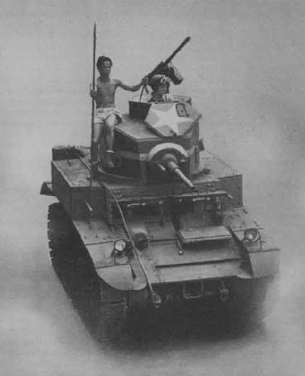
Zo573. Igorots: The unsung heroes of Bataan. The exploits of the Igorots were circulated in the US as part of the war drive. This photo appeared in one of those campaigns: Photo and words from batteryboy, Corregidor.proboard.com senior member batteryboy!
The story is told in this Corregidor.proboards.com webpage or click here:
https://corregidor.proboards.com/thread/384/igorots-unsung-heroes-bataan
Artemio S. Tipon contributed this story:
Apr 9, 2009 at 4:55pm
DURING the siege of Bataan in 1942, the Japanese landed at Anyasan, Quinauan and Longoskawayan Points at the western coast of Bataan, but they were quickly eliminated. The battle became known as the “Battle of the Points.”
The Japanese also infiltrated through gaps in the sector of the I Corps. The tanks sent by General Fidel Segundo to wipe out the pockets could not penetrate the jungle. The heroic action of Igorot troops in helping eliminate these pockets was described by the New York Times (Feb. 23, 1942) thus:
“Hampered by the dense undergrowth and lost in the confusing maze of bamboo thickets, vines, and creepers, the tankers would have been impotent had it not been for the aid of the Igorot troops of 2d Battalion, 11th Infantry. Hoisted to the top of the tanks where they were exposed to the fire of the enemy, these courageous tribesmen from north Luzon chopped away the entangling foliage with their bolos and served as eyes for the American tankers. From their position atop the tanks they fired at the enemy with pistols while guiding the drivers with sticks.” The pockets were eliminated.
This was called the “Battle of the Pockets.”
ARTEMIO S. TIPON,
Parañaque City
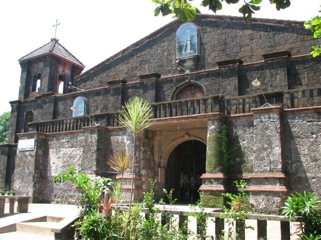
Zo574.The Morong church, shot by Vic, on our visit to Morong in 2009; Vic said this in this thread:
Finally visited Morong, Bataan with Karl. I promised Col. Ed Ramsey back in 2009 that on my next trip to the Philippines I’d visit Morong and take pictures for him. After walking around in Layac (First line of defense, into Bataan 7th Jan. 1942), we took the new highway to Subic and went down Bataan’s west road down to Morong.
Vic provided this link for the following, click here:
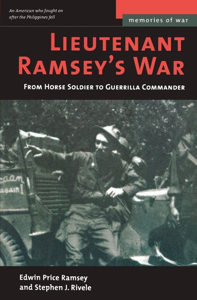
Zo575. Lieutenant Ramsey’s War: From Horse Soldier to Guerrilla Commander (Memories of War). Vic is or was the web master of the pinoyhistory.proboards.com and wrote the thread above; he said this about the picture Zo576:
I recently wrote about Ramsey and the Charge at Morong by 26th Cavalry Philippine Scouts. Worth noting that this was the last charge by a United States Cavalry Unit (The Scouts were US Army, not Commonwealth).
My copy of the book had a different cover. I think it’s the older printing. I was able to have mine signed by Ed Ramsey by mailing it to him. Philip on the other hand got lucky and actually got to meet the hero in person and with his pictures taken to boot.
(Excerpt from Lt. Ramsey’s War book)
“There were three trails branching left off the road through Morong toward the sea. I signaled column left at the middle one, deployed the platoon in column of squads of eight men each, and gave the command to raise pistols. We watched as the point riders entered the town. There was silence as they made their way among the thatched huts. I ordered the troop forward.
Morong looked deserted. The huts stood empty on their bamboo stilts, the pens beneath them long stripped of livestock by the retreating Allied army. The village center was the Catholic church, its only stone structure, and it too was closed up against the advancing Japanese. Beyond lay thick groves of coconut palms inclining through a swamp toward the sea, while to our right crossed by a single wooden bridge, was the narrow Batalan river, the line that Wainwright wanted to occupy.
We moved carefully toward the village center, the horses maneuvering head-high among the woven huts, the men alert for movement. I watched the point guard turn in at the church square and disappear from sight, and then there was an explosion.
Rifles and automatic weapons burst out from the center and northern end of the village, echoing among the huts and sending jungle birds screaming. In a moment the point men came galloping back, one of the privates streaming blood across his horse’s neck and flanks. An advance guard of the Japanese army had crossed the river and was passing near the church just as we had entered the village from the side.
Now I could see scores of Japanese infantries in brown fatigues firing from the village center, and behind them hundreds more wading the river and crowding toward the Batalan bridge (the river is now called the Morong River). In a few minutes more, the main body would be flooding across to seize Morong.
Over the rattling of gunfire, I ordered my troopers to deploy as foragers, and raised my pistol. A charge would be our only hope to break up the body of Japanese troops and to survive against their superior numbers. For centuries the shock of a mounted charge had proved irresistible; now the circumstances and all my training made it instinctual.
I brought my arm down and yelled to my men to charge. Bent nearly prone across the horses’ necks, we flung ourselves at the Japanese advance, pistols firing full into their startled faces. A few returned our fire, but most fled in confusion, some wading back into the river, others running madly for the swamps…
The charge broke clear through the advance unit and carried on to the swamp, where we dismounted and grabbed our rifles from the scabbards. I threw out a skirmish line of one squad along the river to keep the main column from crossing and led the rest back into Morong to search for snipers.”
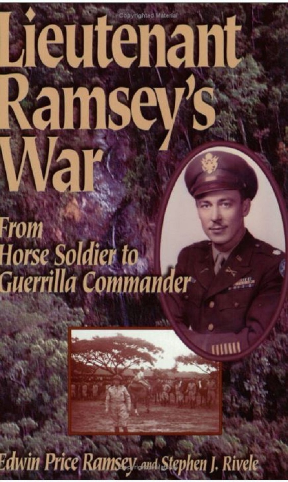
Zo576. An earlier or later issue of the book had this book cover. It came from this URL and had this description, click here:
After the fall of the Philippines in 1942 – and after leading the last horse cavalry charge in U.S. history – Lieutenant Ed Ramsey refused to surrender. Instead, he joined the Filipino resistance and rose to command more than 40,000 guerrillas. The Japanese put the elusive American leader at first place on their death list. Rejecting the opportunity to escape, Ramsey withstood unimaginable fear, pain, and loss for three long years. Lieutenant Ramsey’s War chronicles a remarkable true story of courage and perseverance.
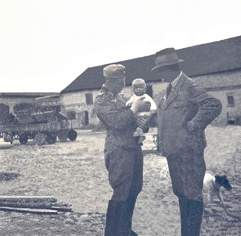
Zo577. 1942 my family farm in Tempel, now Templewo, established in the 1200s by the Knights of the Templars.
Left my uncle Helmut Voje, joined the Wehrmacht 1938, started in the cavalry, served thru the whole war, got killed on the 10th of May 1945 on his march with his troops from east to west thru the now Czech Republic. He is listed on a plaque in a German War Cemetery in the Czech Republic. His wife still lives, and is now 99 years young.
He is holding me, just a few months old. My family was able to flee before the Red Army arrived on the 30th of Jan. 1945. I grew up near Hamburg, emigrated to the U.S.Dec.1959, served in the U.S. Navy 1960-91. I retired in the Philippines outside the former Naval Base Subic Bay.
Right is my father, Karl Welteke, born 1900. During the war he managed our farm and others. In 1944 he was drafted into the Volkssturm and fell in the Battle of Berlin. The last we heard from him was on the 17th April 1945.
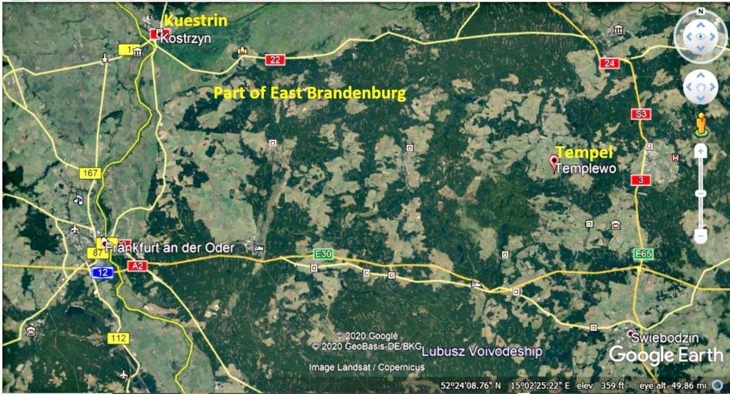
Zo578. A google Earth image of the area of the former German East Brandenburg province. My village Tempel is about 60 km east of Frankfurt on the Oder River but I don’t remember it or my father.
My memory starts in the spring of 1945 and in North Germany. I remember watching the nightly bomber streams and their flares, which the Germans called Christmas trees. Going into the cellar when fighter bombers were in the area. And one day the place was full of British tanks and they looked awfully big to a 3-year-old child.
Zo579. A picture of Germans in flight in East Prussia from Wikipedia.
My mother and us 3 small children, youngest sister 3 months old, oldest sister 1 year 9 months and me 2 years and 10 months were able to flee from the Red Army on the 30th Jan 1945.
A train came into Tempel, offloaded Volkssturm troops, and perhaps half of the village families decided to flee with the train, all the French POWs, working on the farms, also went. Then in the summer the remaining Germans were driven out on foot and with what they could carry.
We were taking in by my mother’s best friend’s family farm in Lower Saxony (home of a British King).
Japanese artillery in the Battle of Bataan and in the Siege of Corregidor, 3 images.
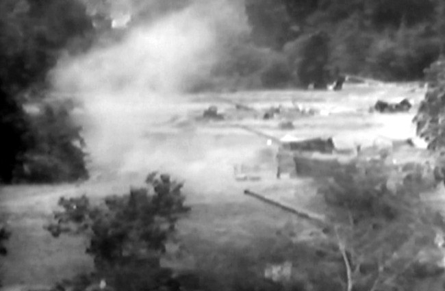
Zo580. A battery of Japanese 150mm Type 89 guns at located somewhere between the Lamao – Cabcaben area in 1942. This picture was provided by Tony Feredo, aka batteryboy. He posted 9 images in this thread or click here:
https://corregidor.proboards.com/thread/226/japanese-gun-batteries-on-bataan
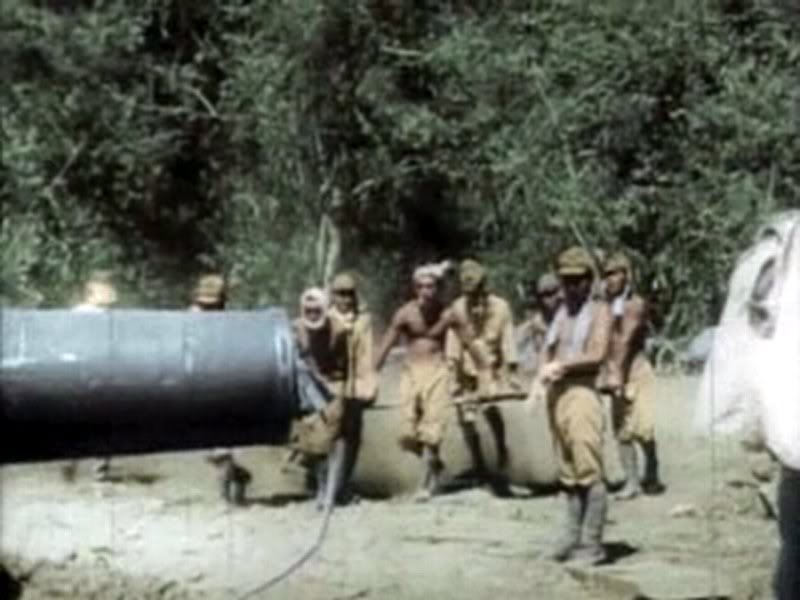
Zo581. Japanese setting up a 240mm Type 45 Howitzer before the Corregidor bombardment, crew men are dragging the gun shield. This picture was provided by Tony Feredo, aka batteryboy. He posted 9 images in this thread or click here:
https://corregidor.proboards.com/thread/226/japanese-gun-batteries-on-bataan
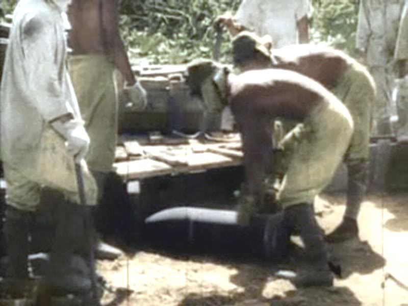
Zo582. Japanese setting up a 240mm Type 45 Howitzer before the Corregidor bombardment, crew men are handling some of the projectiles. This picture was provided by Tony Feredo, aka batteryboy. He posted 9 images in this thread or click here:
https://corregidor.proboards.com/thread/226/japanese-gun-batteries-on-bataan
———————————————
Philippine Silver dumbed into Manila Bay. Before the fall of Corregidor, it was decided to ship the gold out by submarine, burn and record the high money bills and bank documents and because of the weight factor to just dumb the silver Peso coins in the San Jose Bay.
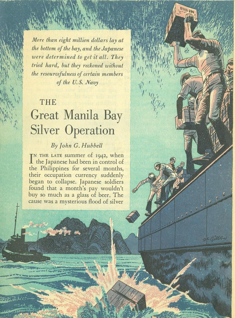
Zo583. This is one of 11 images and story presented in this Corregidor.proboard.com forum page. The story also includes that the Imperial Japanese occupiers forced U.S. Sailors, they held as POWs to dive to recover the silver. This is the URL, or click here:
http://corregidor.proboards.com/thread/1057/manila-bay-silver-56k-folks
————————————————-
Three high resolution images from the Defense of the Philippines: They are available in high resolution in this Flickr album, click here:

Zf139.-High resolution image of Filipinos destroying a bridge in 1942 during their retreat into Bataan in WWII. Picture is provided by the Army Lt. Chester K. Britt Research Team. They bought it in the internet. They were told that the picture was somewhere in the 20 (or 10) volume collection of the “Pictorial History of Second World War”.
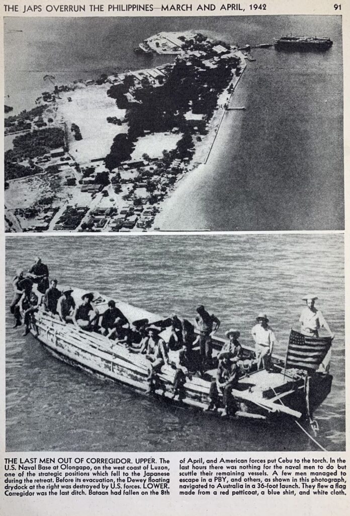
f140.- High resolution image of the Fleet Waiting Room in the Olongapo Naval Station in the Philippines; view 1. This is a very unique image of the Olongapo U.S. Naval Port; it is pre-war but was published in a post war collection of the “Pictorial History of Second World War”.
The bottom part of the picture shows Lt. Cmdr. Jack Morrill and part of the crew of USS Quail, escaping from the Manila Bay Harbor Defense Command by boat to Australia when General Wainwright was forced to surrender in 1942. Picture is provided by the Army Lt. Chester K. Britt Research Team. They bought it in the internet. They were told that the picture was somewhere in the 20 (or 10) volume collection of the “Pictorial History of Second World War”.

Zf141.-Cropped high resolution image of the Fleet Waiting Room in the Olongapo Naval Station in the Philippines; view 2. This is a very unique image of the Olongapo U.S. Naval Port; it is pre-war but was published in a post war collection of the “Pictorial History of Second World War”.
Picture is provided by the Army Lt. Chester K. Britt Research Team. They bought it in the internet. They were told that the picture was somewhere in the 20 (or 10) volume collection of the “Pictorial History of Second World War”.
The people of the Army Lt. Chester K. Britt Research Team are:
First are Dave Britt, LTC USAF (Ret), son of Chester K Britt, Vickie Graham CMSGT USAF (Ret), and John Duresky. They all graduated from Logan High School in La Crosse, Wisconsin in 1967, and are doing it as a team. Chester Britt graduated from Logan in 1933 and his mother Grace in 1934. Dave wrote most of the manuscript, John editing what he wrote and doing most of the research, and Vickie is the final editor with about 20 years of professional writing in her resume, largely with Airman Magazine.
They are planning to write a book about Army Lt. Chester K. Britt soon!
Uploaded their intention to the forum, POW/MIA, Army Lt. Chester K. Britt, Hell Ship Oryoku Maru: click here:
—————————————————–
Tunnels under Fort Bonifacio internet page has been repaired
This Corregidor Forum www page, about the two tunnels under the Bonifacio Global City (BGC), the former Fort Bonifacio, which was the Fort McKinley received maintenance, click here:
Dead links are restored, images in albums linked in this page had missing titles and descriptions replaced and the order of the images shown, are back in the correct order.
The webpage tells the history of the tunnels, the present condition and discussions for the future of the tunnels. The pictures were generated by a group of local people, coordinated by an old Philippine Hand, from Texas, who was born and raised here. He remembered playing at one of the tunnels when he was a child.
In the Corregidor Forum we have another Fort Bonifacio Tunnel page that has even greater and more exact information. It was created by my friend john Moffitt. The trouble with that www page is that the pictures hosted by Photobucket are watermarked, due the management of that image sharing company. But one of these days, maybe we will be able to correct it, click here:
For this page correction notification I repeat showing these 4 images:
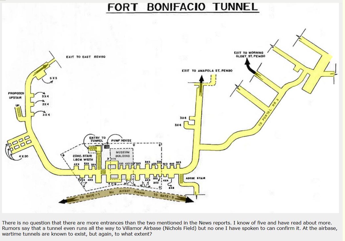
Zg455. This is a map of the Fort Bonifacio Tunnel, perhaps from the days when the Philippine Army Museum conducted tours of the Fort Bonifacio Tunnel.
———–
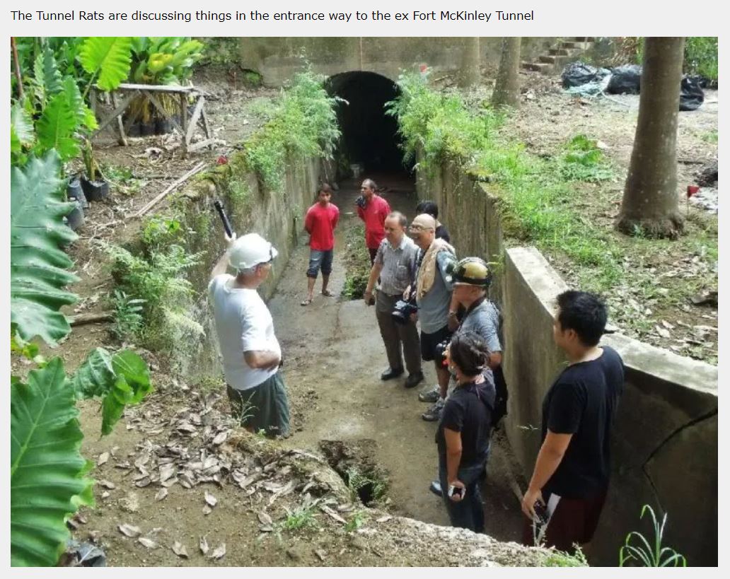
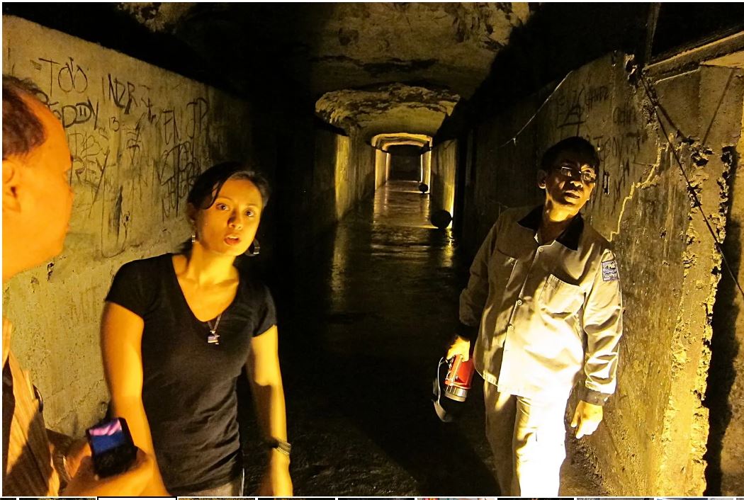
Zg456. The Tunnel Rats discussing the plan to enter the other tunnel under then Fort Bonifacio, an area which is now a residential area. I see the historian Rico Jose and the Document film producer Lucky Guillermo.
———–
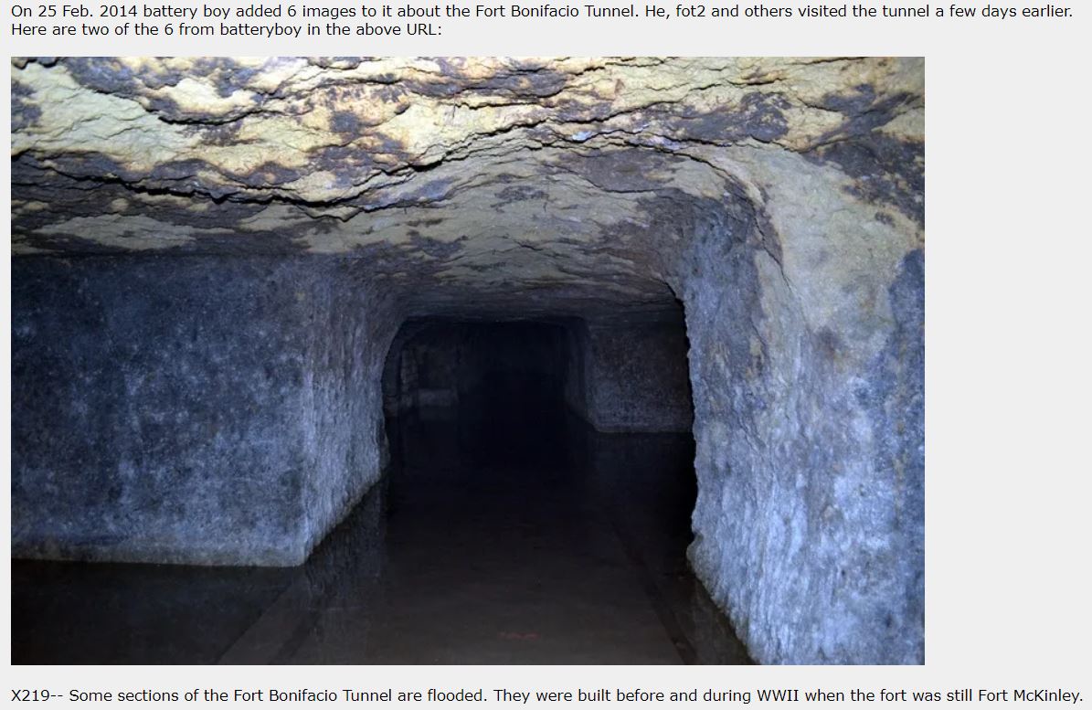
Zg457. The Fort Bonifacio Tunnel, this is a picture from Tony Feredo who is a most knowledgeable person about Philippine WWII history.
Zg458. This is the north tunnel, towards the Rembo exit, shot 2012-07-24 Ft. This is a Bonifacio (ex Ft. McKinley) Tunnel image from Leo D. Dominguez.
——————————————-
Mosaic Maps of the Manila American Cemetery and Memorial.
These large maps on the walls in the map rooms are great graphic art work to learn the WWII history. There are about 25 maps, too much to study in one visit to the memorial when there is so much more to see and contemplate. On the bottom of each of these high resolution jpg file image I added the descriptive text for easier reading and the link to download them, even bigger in other file formats. All this is courtesy of the ABMC.
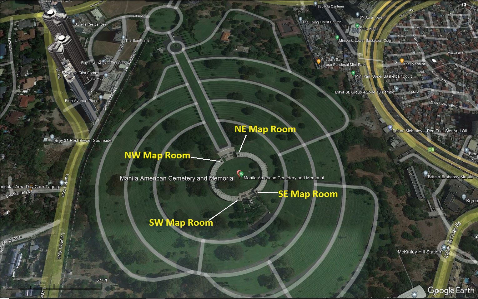
Zg459. (-01a). Location of the Map Rooms at the Manila American Cemetery and Memorial, from Google Earth
So far, I only uploaded one half of the maps, in high resolution as jpg files, about 12, at this Flickr album URL, click here:
This is the URL to a pdf file with all the Mosaic Maps of the Manila Mosaic Maps of the Manila American Cemetery and Memorial, which was provided by the Manila American Cemetery and Memorial (put it in your browser, takes time to download), click here:
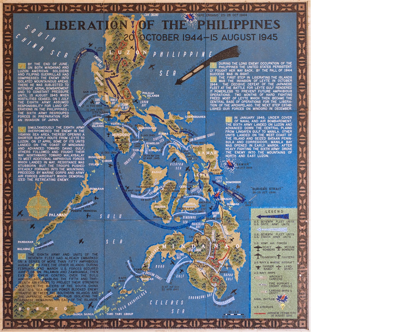
Zg460. (-08). LIBERATION OF THE PHILIPPINES 20 OCTOBER 1944-15 AUGUST 1945. This is a Manila American Cemetery and Memorial Mosaic Map.
For this Karl’s webpage presentation, only the location graph and one sample image are provided but I added the descriptive paragraphs on the image as a text, it can be downloaded in high resolution with this URL, click here:
-08. LIBERATION OF THE PHILIPPINES 20 OCTOBER 1944-15 AUGUST 1945.
DURING THE LONG ENEMY OCCUPATION OF THE PHILIPPINES, THE UNITED STATES PERSISTENTLY FOUGHT HER WAY BACK. BY THE FALL OF 1944 SUCCESS WAS IN SIGHT.
THE FIRST STEP IN LIBERATING THE ISLANDS WAS THE INVASION OF LEYTE IN OCTOBER 1944. THE DECISIVE DEFEAT OF THE JAPANESE FLEET AT THE BATTLE FOR LEYTE GULF RENDERED IT POWERLESS TO PREVENT FUTURE AMPHIBIOUS OPERATIONS. TWO MONTHS OF HARD FIGHTING FREED MOST OF LEYTE WHICH THEN BECAME THE CENTRAL BASE OF OPERATIONS FOR THE LIBERATION OF THE ARCHIPELAGO. THE NEXT STEP ESTABLISHED OUR FORCES ON MINDORO IN DECEMBER.
IN JANUARY 1945, UNDER COVER OF NAVAL AND AIR BOMBARDMENT, THE SIXTH ARMY LANDED ON LUZON AND ADVANCED DOWN THE CENTRAL PLAINS. OTHER UNITS LANDED ON THE WEST COAST OF THE ISLAND AND SEIZED BATAAN PENINSULA AND CORREGIDOR. MANILA BAY WAS OPENED IN EARLY MARCH. AFTER HEAVY FIGHTING THE SIXTH ARMY DROVE THE ENEMY INTO THE MOUNTAINS OF NORTH AND EAST LUZON.
THE EIGHTH ARMY AND UNITS OF THE SEVENTH FLEET HAD ALREADY EMBARKED ON A SERIES OF MORE THAN FIFTY AMPHIBIOUS ASSAULTS TO FREE THE OTHER ISLANDS. DURING FEBRUARY AND MARCH U.S. FORCES SECURED AIRFIELDS ON PALAWAN AND ZAMBOANGA, THEN EXTENDED THEIR CONTROL OVER THE SULU ARCHIPELAGO, ENABLING THE FIFTH AND THIRTEENTH AIR FORCES TO PROJECT THEIR STRENGTH FAR OVER THE WATERS OF THE SOUTH CHINA SEA. U.S. SEA AND AIR POWER BLOCKED ENEMY TRAFFIC BETWEEN THE SOUTHERN ISLANDS AND THE JAPANESE HOMELAND, THUS ISOLATING THE JAPANESE REMAINING ON EACH OF THE ISLANDS.
SIMULTANEOUSLY THE EIGHTH ARMY OVERPOWERED THE ENEMY IN THE VISAYAN SEA AREA, THEREBY OPENING A SHORTER SUPPLY ROUTE FROM
LEYTE TO LUZON. ON 17 APRIL SOME OF ITS UNITS LANDED ON THE COAST OF MINDANAO AND ADVANCED TOWARD DAVAO GULF; OTHERS FOLLOWED AND FOUGHT THEIR WAY NORTHWARD TOWARD MALAYBALAY TO MEET ADDITIONAL AMPHIBIOUS FORCES WHICH LANDED IN MAY. RESISTANCE WAS STUBBORN BUT THE TROOPS PUSHED STEADILY FORWARD INTO THE MOUNTAINS, PRECEDED BY MARINE CORPS AND ARMY AIR FORCES AIRCRAFT WHICH DEMORALIZED THE RETREATING ENEMY.
BY THE END OF JUNE, ON BOTH MINDANAO AND LUZON AMERICAN SOLDIERS AND FILIPINO GUERRILLAS HAD COMPRESSED THE ENEMY INTO ISOLATED MOUNTAINOUS AREAS. THERE HE WAS SUBJECTED TO INTENSIVE AERIAL BOMBARDMENT AND TO CONSTANT PRESSURE UNTIL 15 AUGUST 1945 WHEN HOSTILITIES CEASED. ON 1 JULY THE EIGHTH ARMY ASSUMED RESPONSIBILITY FOR LAND OPERATIONS IN THE PHILIPPINES; THE SIXTH ARMY REGROUPED FORCES IN PREPARATION FOR AN NVASION OF JAPAN.
——————————————-
Mosaic Maps of the Manila American Cemetery and Memorial.
2nd half of the 25 maps, the last 13 maps have been added.
These large maps on the walls in the map rooms are great graphic art work to learn the WWII history. There are about 25 maps, too much to study in one visit to the memorial when there is so much more to see and contemplate. On the bottom of each of these high resolution jpg file image I added the descriptive text for easier reading and the link to download them, even bigger in other file formats. All this is courtesy of the ABMC.
All 25 maps are uploaded now in high resolution as jpg files, into this Flickr album URL, click here:
This is the URL to a pdf file with all the Mosaic Maps of the Manila Mosaic Maps of the Manila American Cemetery and Memorial, which was provided by the Manila American Cemetery and Memorial (put it in your browser, takes time to download): https://philippine-sailor.net/wp-content/uploads/2023/08/Doc008-.pdf
For this 2nd webpage presentation, only one sample image are provided but I added the descriptive paragraphs from the image as a text: #18, Battle of the Philippine Sea 15-20 June 1944. This sample image can be downloaded in high resolution with this URL, click here:
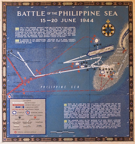
Zg461. (-18). BATTLE OF THE PHILIPPINE SEA 15-20 JUNE 1944.
Picture descriptions:
-I. WHEN, ON 15 JUNE 1944, THE U.S. FIFTH FLEET LANDED THE 2ND AND 4TH MARINE DIVISIONS OF THE V AMPHIBIOUS CORPS ON SAIPAN, THE JAPANESE REACTION WAS IMMEDIATE AND VIGOROUS. BY THE VERY NEXT DAY THE JAPANESE MOBILE FLEET, WHICH INCLUDED NINE FAST CARRIERS, HAD SET UNITS IN MOTION FROM MANY WIDELY SEPARATED AREAS, EFFECTED A RENDEZVOUS IN THE PHILIPPINE SEA, AND MOVED TO THE ATTACK. THE COMBAT ELEMENTS OF THE FIFTH FLEET, INCLUDING FIFTEEN FAST CARRIERS, IMMEDIATELY MOVED INTO POSITION TO COVER THE SAIPAN AMPHIBIOUS OPERATION WHILE ITS CARRIER-BASED AIRCRAFT CONTINUED THEIR DESTRUCTIVE ATTACKS UPON THE JAPANESE AIR BASES IN THE MARIANAS.
-II. THE JAPANESE, EARLY ON THE MORNING OF 19 JUNE, BEGAN LAUNCHING AIRCRAFT AT EXTREME RANGE, PLANNING THAT THESE SHOULD SUCCESSFULLY ATTACK THE AMERICAN SHIPS, THEN LAND AND REFUEL AT GUAM. FOUR SEPARATE ATTACKS WERE INTERCEPTED BY AIRCRAFT OF THE FIFTH FLEET; OVER 300 JAPANESE AIRCRAFT BEING SHOT DOWN BY AMERICAN INTERCEPTORS AND ANTI-AIRCRAFT FIRE, DESTROYED ON THE GROUND OR LOST AT SEA.
-III. ONLY A FEW JAPANESE AIRCRAFT WERE ABLE TO RETURN TO THEIR CARRIERS, WHICH IN THE MEANTIME BEGAN TO WITHDRAW TO THE NORTHWEST. THE FIFTH FLEET PURSUED BUT DID NOT LOCATE THE RETREATING ENEMY UNTIL THE AFTERNOON OF 20 JUNE WHEN AMERICAN AIRCRAFT WERE LAUNCHED AT SUCH LONG RANGE, SO LATE IN THE DAY, THAT A PERILOUS NIGHT RECOVERY WAS INEVITABLE. NEVERTHELESS, THE AMERICAN PILOTS BOLDLY PRESSED THEIR ATTACK AND SANK A CARRIER AND TWO TANKERS. MANY AIRCRAFT FAILED TO RETURN.
-IV. IN ADDITION TO THE DESTRUCTION INFLICTED BY U.S. NAVAL AIRCRAFT, SUBMARINES OF THE PACIFIC FLEET SANK TWO OTHER JAPANESE AIRCRAFT CARRIERS ON 19 JUNE.