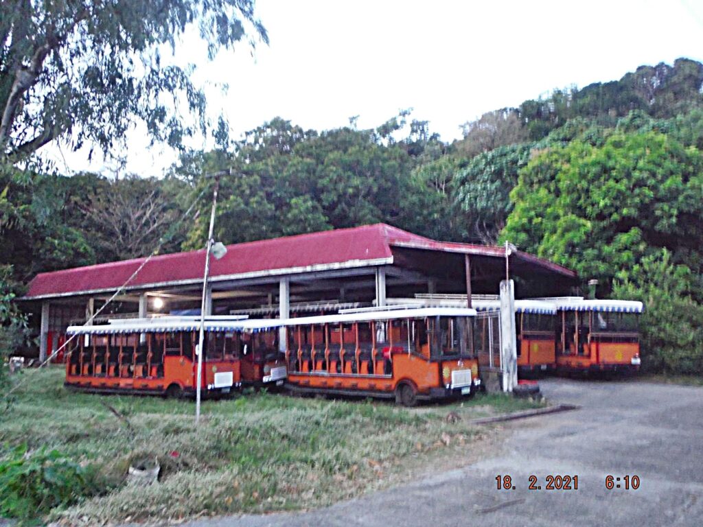
Zf001. I started walking from MacArthur Café to the Engineering Ravine. I came by here and noticed all the trolleys are left on the island by Sun Cruises Inc. They apparently belong to the Corregidor Foundation Inc (CFI) now. Not a good picture but the story is that the trolleys are still here and are being used by CFI. On the 16th Feb when Corregidor received its first visitors after the Virus Lockdown they were in use. Also during my visit here about 5 drivers from the Camaya Resort/Development arrived here for one day and night and practiced driving the trolleys and learned the visitor routes.
———————————————
That was the purpose of my visit but this album is about the 4th day visit, the 18th of Feb. 2021, a Thursday. That day I shot 193 images but in this album, presentation, I only use 80+ images and I will present it in segments because uploading pictures with descriptions is a lot of work.
And I will start out with images in this first segment and the next segment will have the report and the walking data.
————————————————
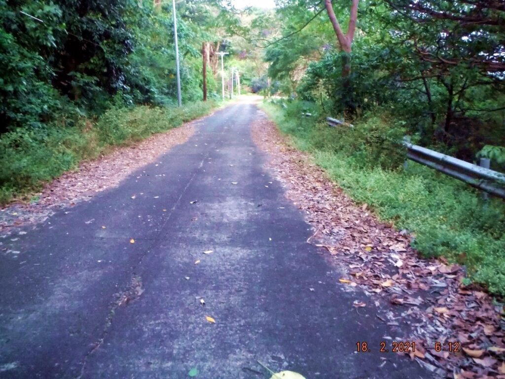
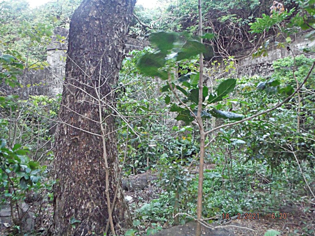
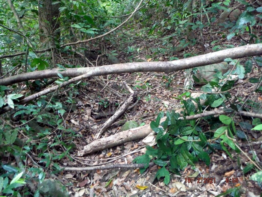
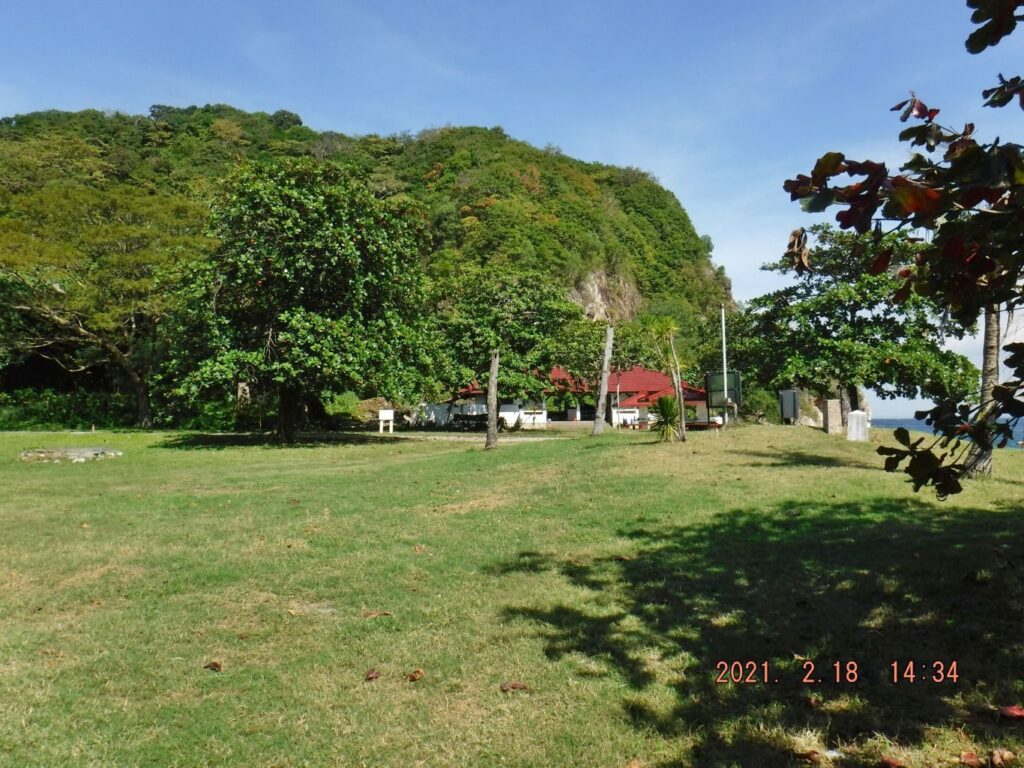
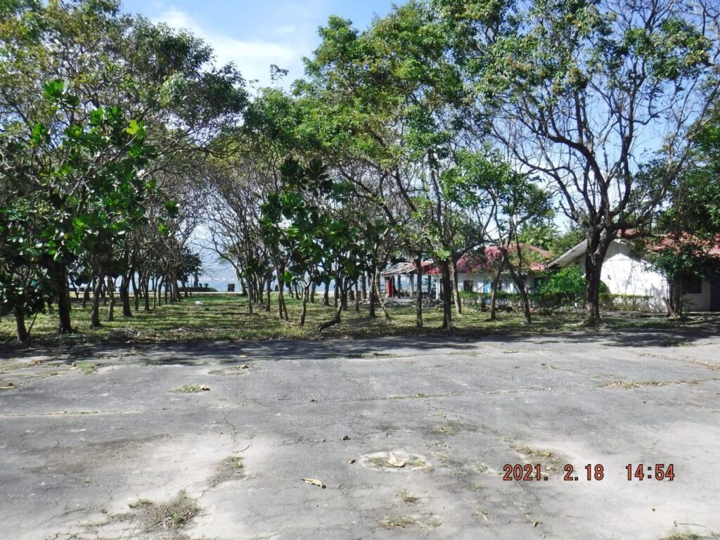
Zf002. This is the road to the engineering Ravine; there are not enough resources to sweep up the leaves any more. The Virus Lockdown and no visitors dried up the CFI resources.

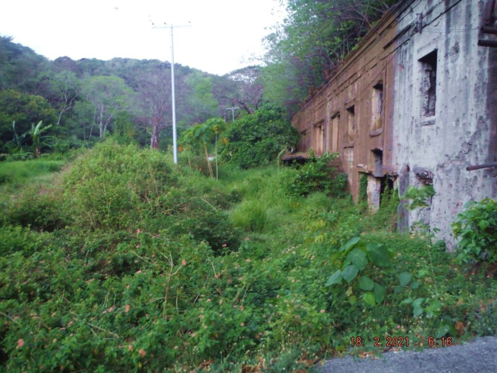
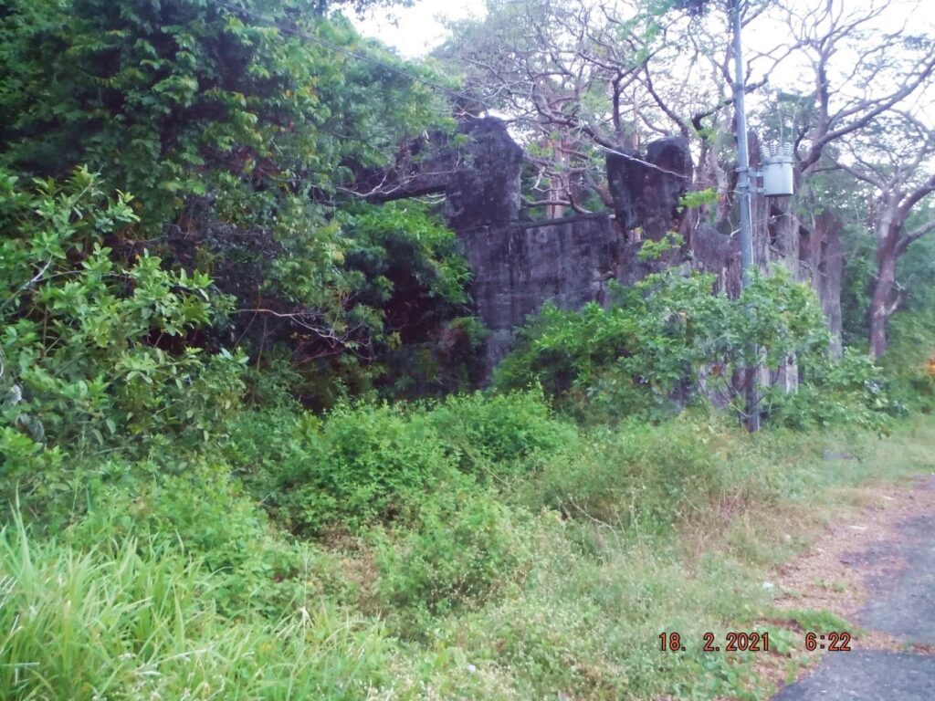
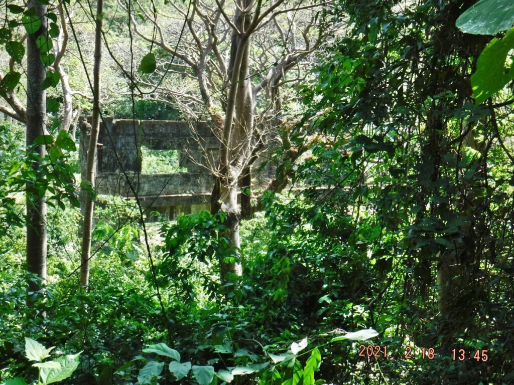
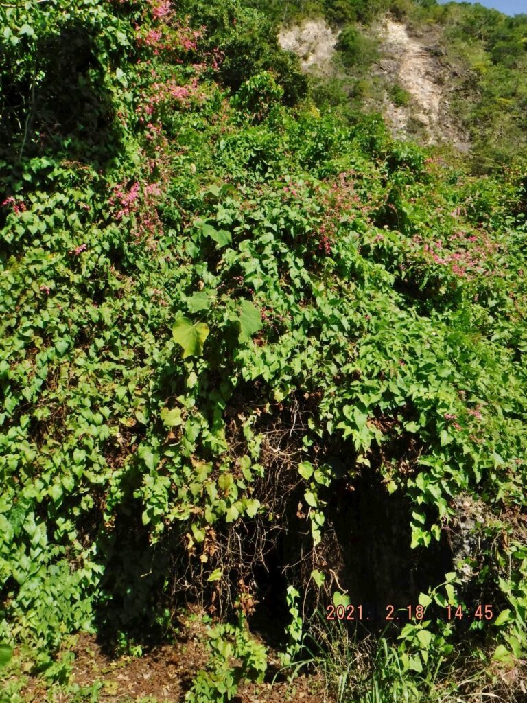
Zf003. This is the east end of the huge Fort Mills Coal fired Power Plant, Cold Storage and Ice Plant. The wild, uncontrolled vegetation is taking over.
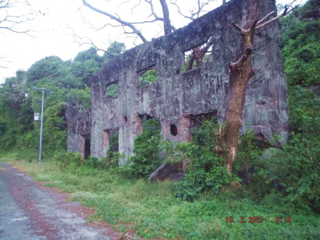
Zf004. This is the front of the huge Fort Mills Coal fired Power Plant, Cold Storage and Ice Plant. The wild, uncontrolled vegetation is taking over.
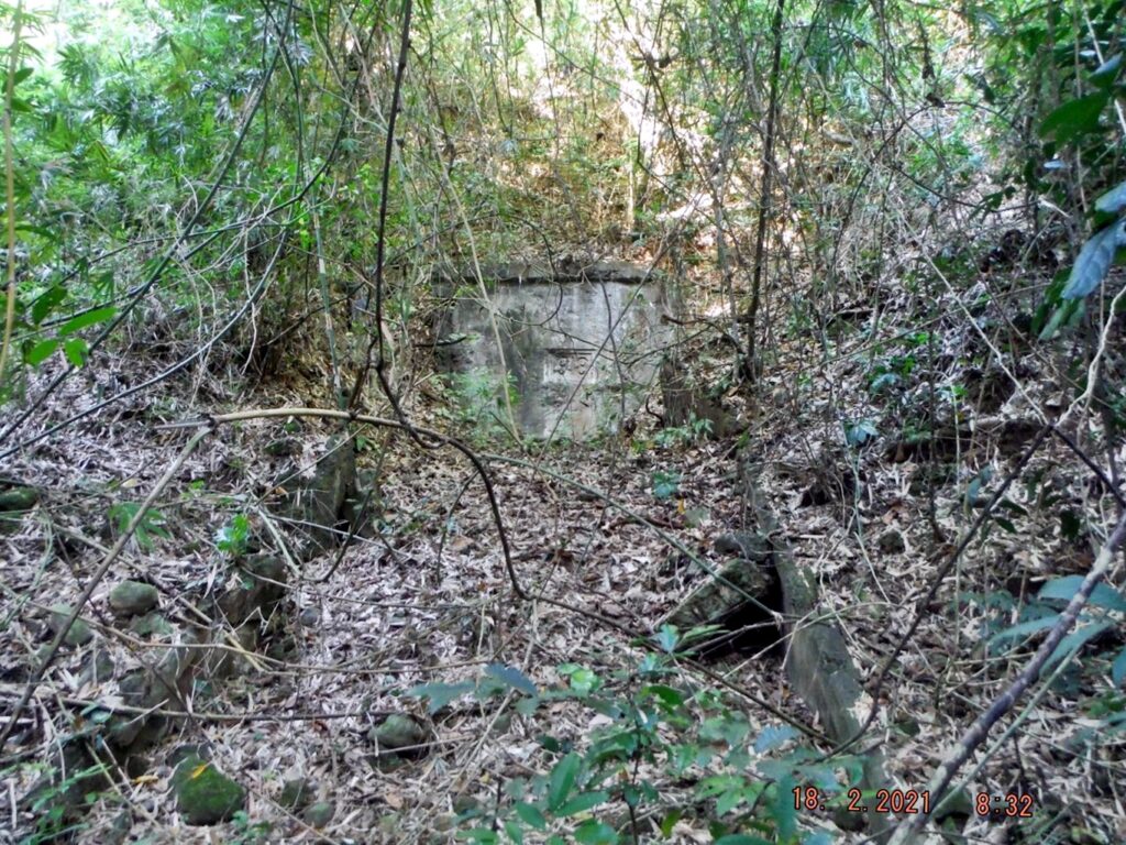
Zf005. We are in the Fort Mills Engineering Ravine on Corregidor Island. Fort Mills did keep up with the times and built a modern Diesel driven Power Plant; this is the front side.
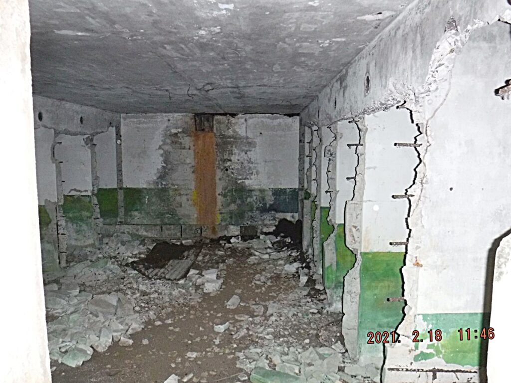
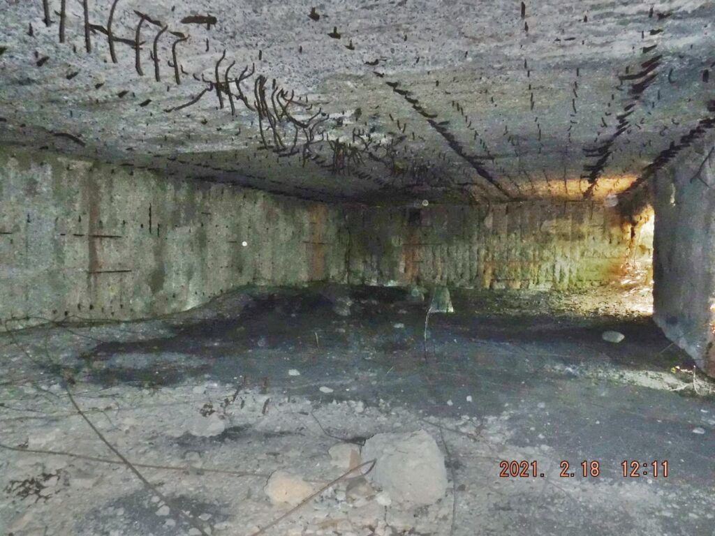
Zf006. We are in the Fort Mills Engineering Ravine on Corregidor Island. Fort Mills did keep up with the times and built a modern Diesel driven Power Plant; this is inside the power plant. All the diesel engines and generators are gone but unfortunately the wild vegetation is taking over.
Zf007. We are in the Fort Mills Engineering Ravine on Corregidor Island. Fort Mills did keep up with the times and built a modern Diesel driven Power Plant. This view is from the west. Immediately to the left in the bushes is a shortcut to the Fort Mills/Corregidor Southroad. I used it today when I came down from Morrison Hill today.
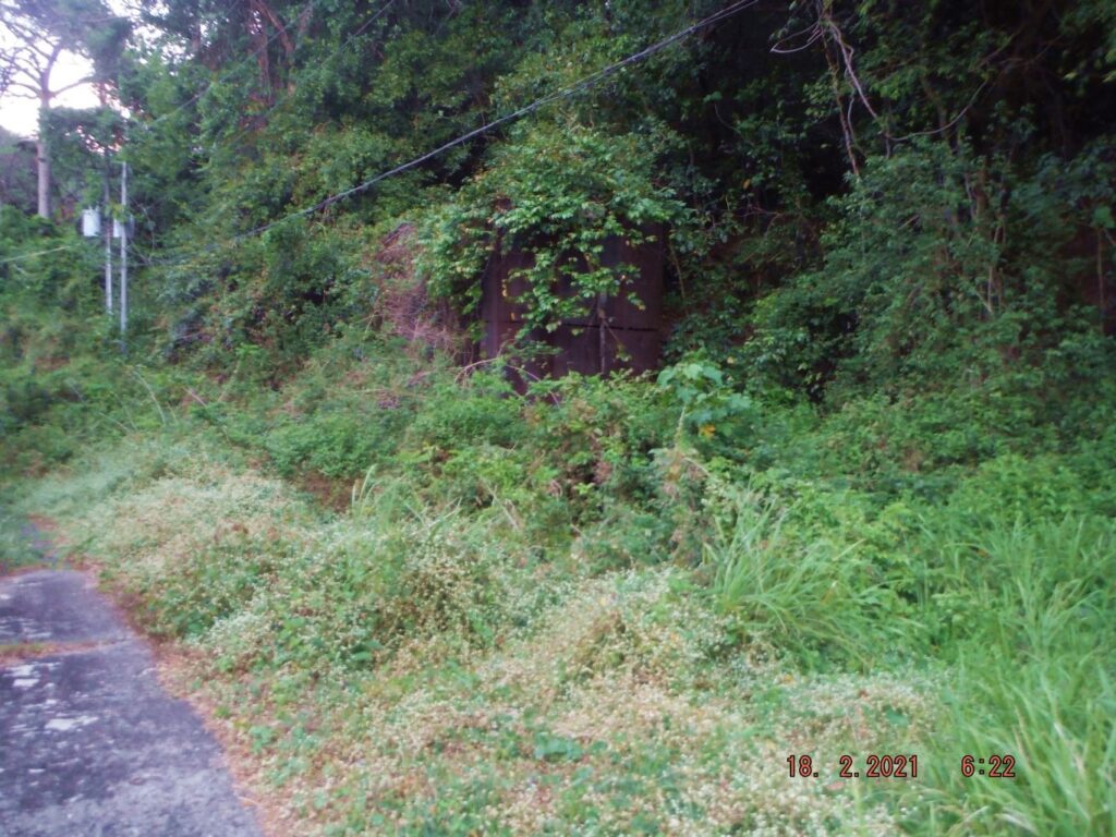
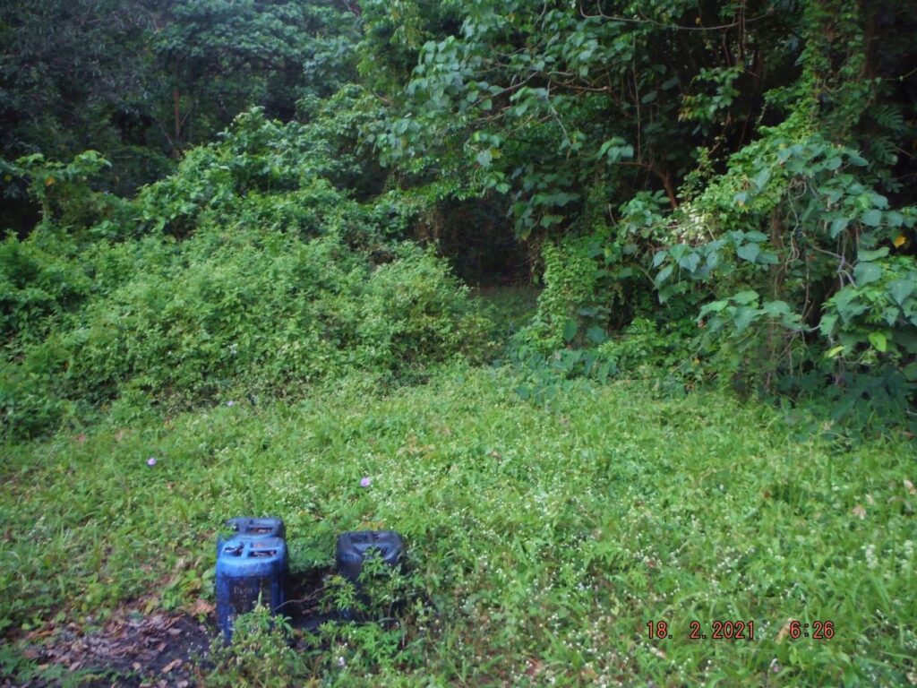
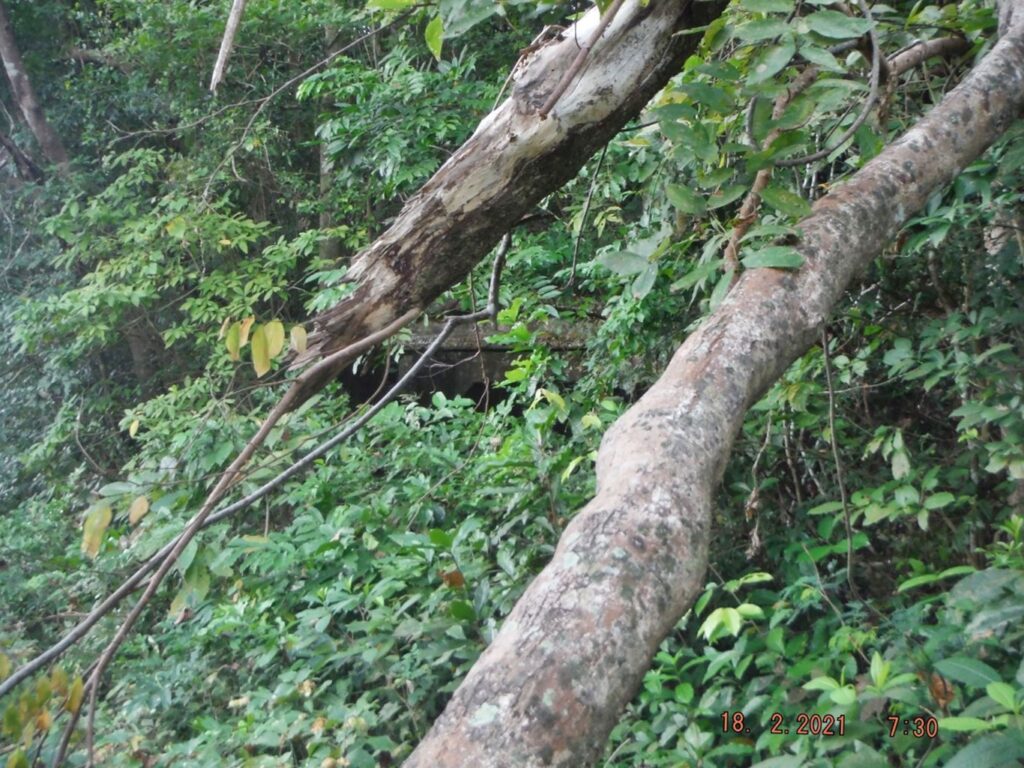
Zf008. These two steel fuel tanks are now almost hidden by the wild vegetation. I assume they held diesel for the Fort Mills Diesel Power Plant. They are located, maybe 60 paces east of the diesel power plant.
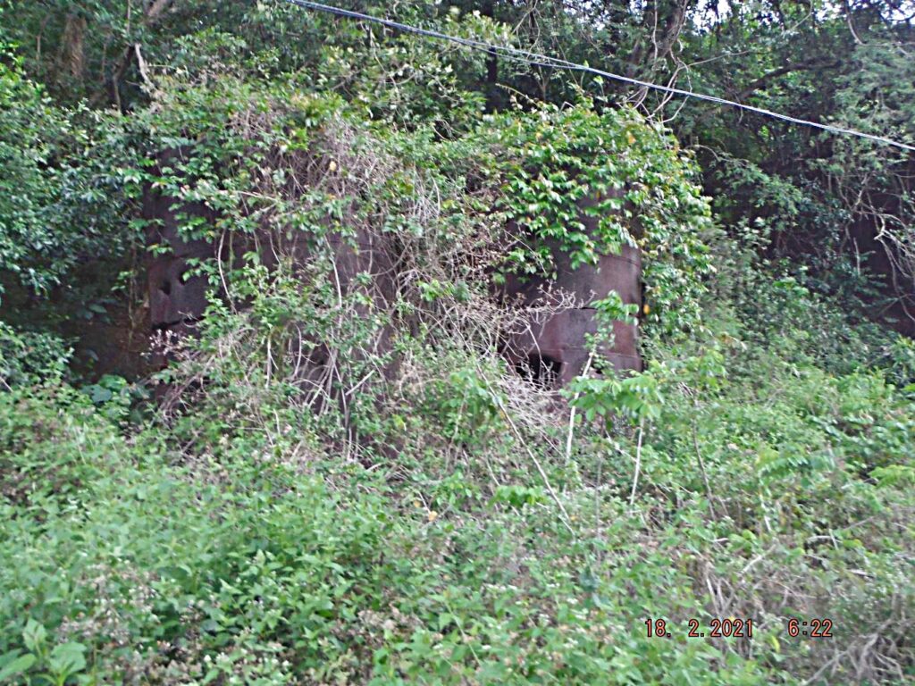
Zf009. These two steel fuel tanks are now almost hidden by the wild vegetation. I assume they held diesel for the Fort Mills Diesel Power Plant. They are located, maybe 60 paces east of the diesel power plant. Between these fuel tanks and the diesel power plant is a shortcut to the Fort Mills/Corregidor Southroad. I used it today when I came down from Morrison Hill today.
=======================================
2nd Segment. Fourth Day, First Flag Anniversary 2021-02-16, the 76th on Corregidor Island.
5 data images and the report.
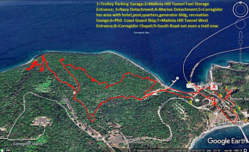
Zf017. My GPS track for this walk, Thursday, the 18th of Feb. 2021, in the former Fort Mills on Corregidor Island. In this image I marked in the locations of the end of my walk.
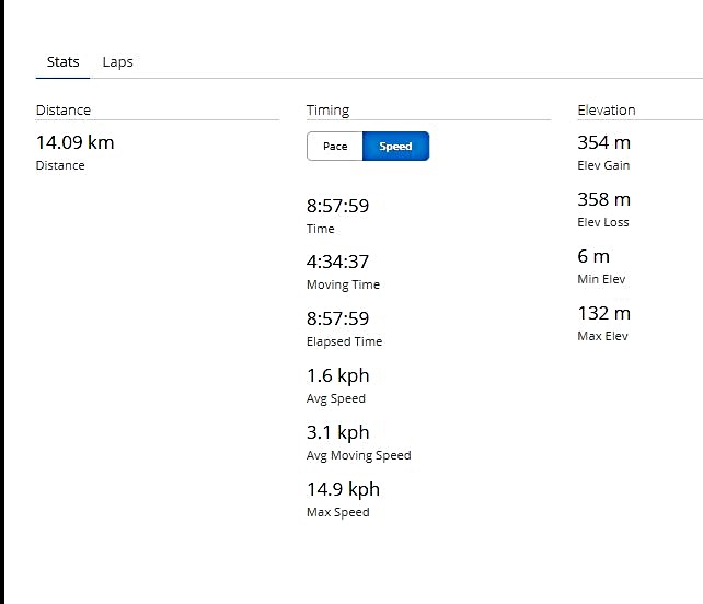
Zf018. This is the time, distance and elevation data of my walk, Thursday, the 18th of Feb. 2021, in the former Fort Mills on Corregidor Island.
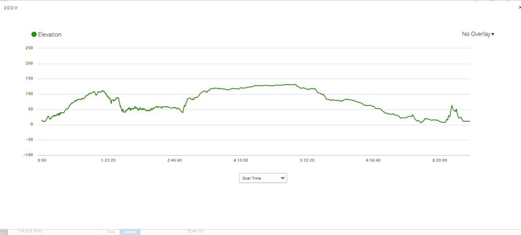
Zf019. This is the elevation graph of my walk, Thursday, the 18th of Feb. 2021, in the former Fort Mills on Corregidor Island.
Zf020. In this image I marked in the locations of Battery James, Battery Morrison and James Ravine. My GPS track for this walk, Thursday, the 18th of Feb. 2021, in the former Fort Mills on Corregidor Island.
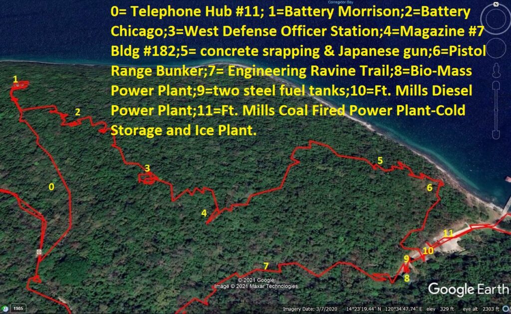
Zf021. This is the middle part of my GPS track for this walk, Thursday, the 18th of Feb. 2021, in the former Fort Mills on Corregidor Island. This image covers the Engineering Ravine and Morrison Hill.
Fourth and last Day, Thursday, the 18th Feb. 2021.
My goal for this day, mainly to check on venues on Morrison Hill, but also check on a few things in James Ravine first; and in the process to check on conditions of the roads and trails. I walked and checked in this order.
-The Engineering Ravine, most derelict vehicles gone, vegetation is advancing.
-The Engineering Trail to Middleside, it is getting bad.
-The road to Battery James and James Ravine, used by motorbikes only.
-Had a look at the gun storage on the road to Battery James, cleared growth for a better look.
-Battery James, situation hopeless.
-At James Ravine the water pumping venue and the mouth of the ravine, pumping, apparently, needs to be done only some of the time, nobody around.
-Found no trail to the beach, would take some effort to get there.
-At James Ravine, find the three Philippine Scouts grave head stones, found them.
-Find the bridge to the Mine Casemate, found it.
– Look at 1918 underground barracks, used new ways to and back from it, it is harder now.
-Returned via road and went to Battery Morrison, need a bolo-man to get there.
-Looked at telephone hub No 11 first.
-Went up Morrison Hill and found the northern, 1917-gun block.
-Looked at various Battery Chicago sites, including flash light shots under two concrete slabs.
-Looked at the two entrances to the 1917 AA magazine.
-Next I looked for the West Defense HQ Station, found it.
– Just got distance shots of the concrete fuel storage and the in-the-open fuel tank concrete resting bases.
-Descended further to find the 7th of 8 magazine structures and this one is the bombproof one, found it.
-Then descended thru the woods, down the slopes, thru some difficult vegetation to find the large discarded concrete blocks and found them. Fots2 and I once surprised some scrappers getting the rebar. I can report no one else has been there since. This location is near the only remaining Japanese artillery gun, still at its original location.
-Looked for and found the only in-place remaining Japanese Artillery, a tree fell on it but no damage.
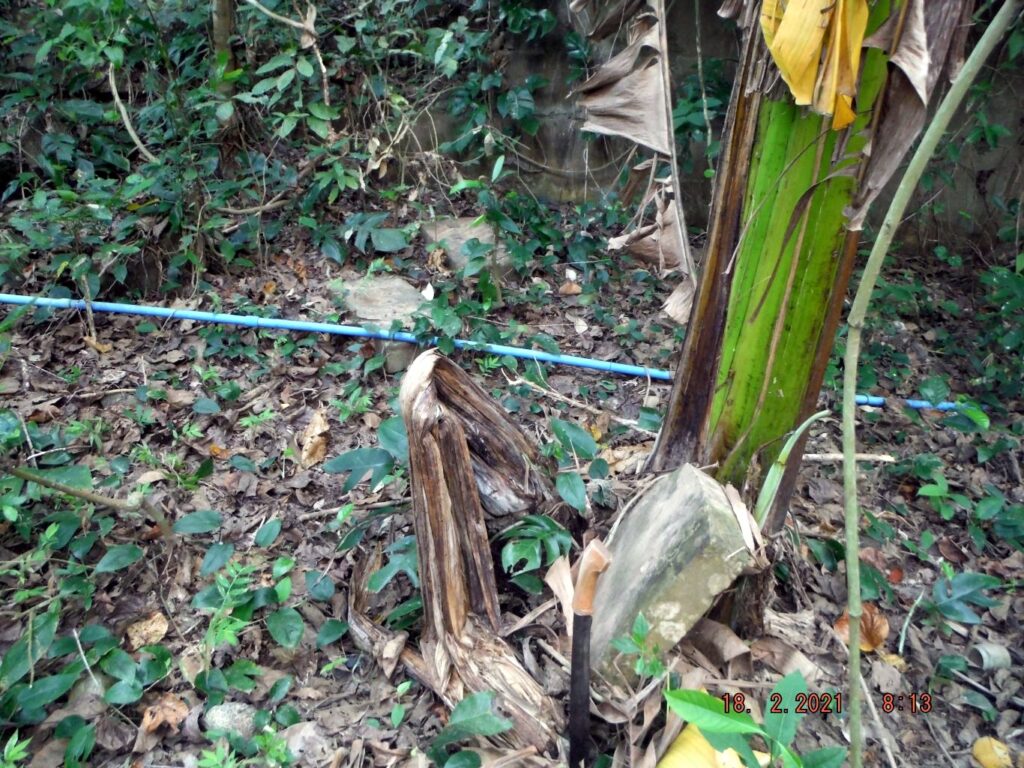
-Descended to the Engineering Ravine via the defense position VII-F-2 near the Japanese gun, the ammunition storage of the pistol range on the Corregidor Southroad and the short cut down to Engineering Ravine between the Fort Mills Diesel Power Plant and the two in-the-open steel full tanks, which are hidden now due to overgrowth.
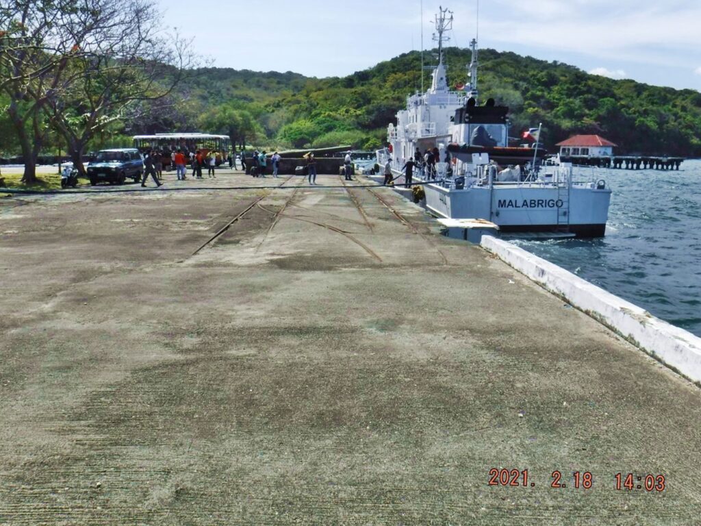
-Watched a Philippine Coast Guard Ship and its Corregidor visiting Party, load and depart, about 3 pm.
-Had a look at the Corregidor Inn, it is locked up but one can get to patio dining area.
-Then I went south side Bottomside, talked to a 4 people camping party, and took pictures of the two structures where the Philippine Navy and Marines are staying.
-Then had a look at the two west entrances of the Manila Tunnel. The movie and sound show was conducted today for 17 people from the Coast Guard visiting party.
– The last item I looked today was the Corregidor Chapel, it is beginning to need attention.
Then I called it a day, my legs and arms were scratched up pretty good from walking thru the woods, forgot to put on my long sleeve shirt today.
It got windy today and I begun fearing that my boat tomorrow gets cancelled. During the night when the wind was rattling things outside I continued fearing that. But like so many times before the Villa Carmen boat showed not only on time but like always, earlier. The boat crews know their stuff, when to slow down, speed up, what course to gain a lee earlier etc. One final shock, the Villa Carmen gate keeper, the husband of Imelda who took care of this in the past asked for 300 peso as a parking fee and I parked there 50 times plus before for free. I considered it part of the Villa Carmen deal.
It was another great Corregidor History trip, I was glad I did it, especially to continue the tradition of raising the 48th Star Flag on the 16th Feb. when the Paratrooper did it in 1945, like the Marines on Iwo Jima. Hooyah to all Service Men and Women of WWII and all the people who support them.
Also, I’m thankful that the authorities gave me permission to travel during this virus crisis and to CFI who is enthusiastic supporting this tradition. And thanks to CFI who succeeded to combine this tradition with opening of tourist visits to Corregidor.
==========================================
3rd Segment. Fourth Day, First Flag Anniversary 2021-02-16, the 76th on Corregidor Island.
From Engineering Ravine to Battery James.
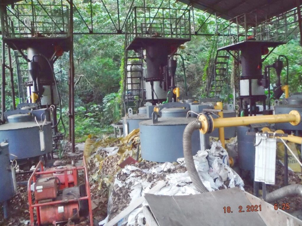
Zf022. This Biomass power unit never operated as far as I can tell. I wonder who paid for it? It seems to be a total waste of money and effort. I remember that many workers worked for days cutting the wood into small pellets, now they are rotten away.
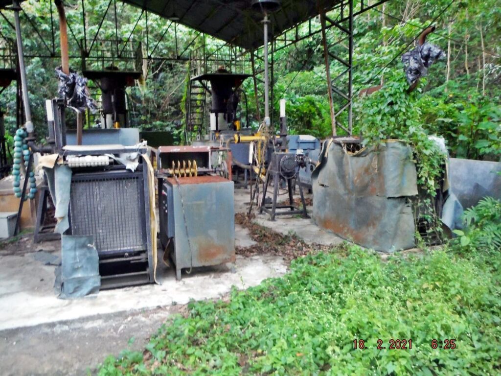
Zf023. This Biomass power unit never operated as far as I can tell. I wonder who paid for it? It seems to be a total waste of money and effort. The tarpaulins over the machinery are rotten away and pretty soon the machinery will rust to hell. I wonder who thought this was feasible option.
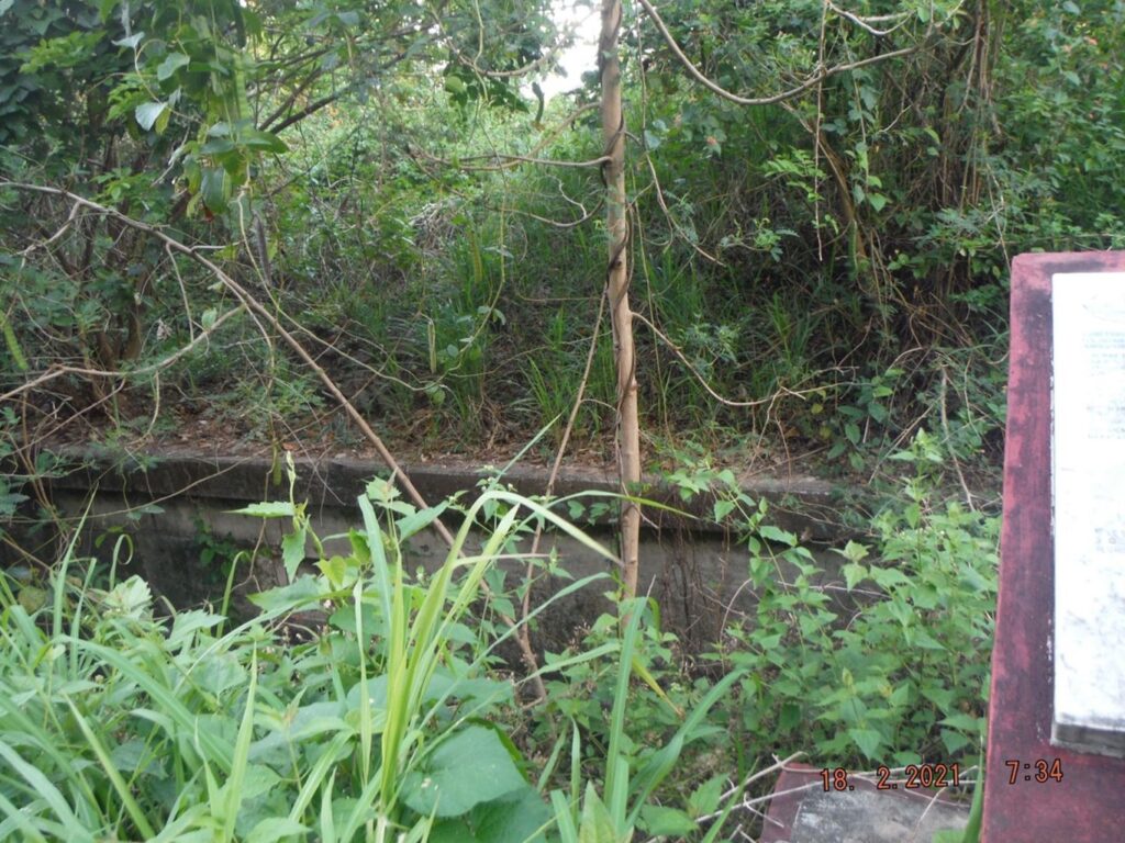
Zf024. This is the end of the Engineering Ravine and the beginning of the Fort Mills Southroad on Corregidor Island. This is just passed the Biomass power unit. Until recently the Southroad was blocked by trash and we had to climb over the Hotel renovation trash which was dumped here. But merciful a passage was made, so now we can enter the Southroad and the Engineering Ravine Trail.
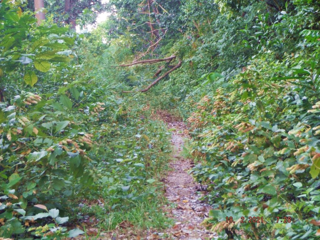
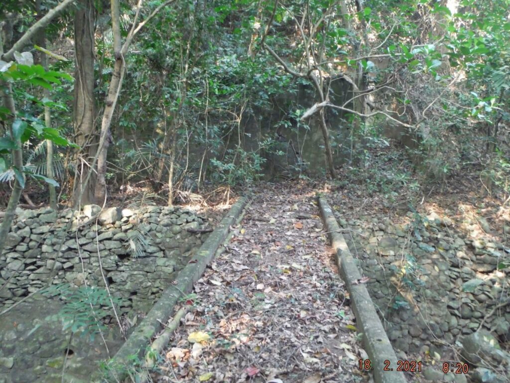
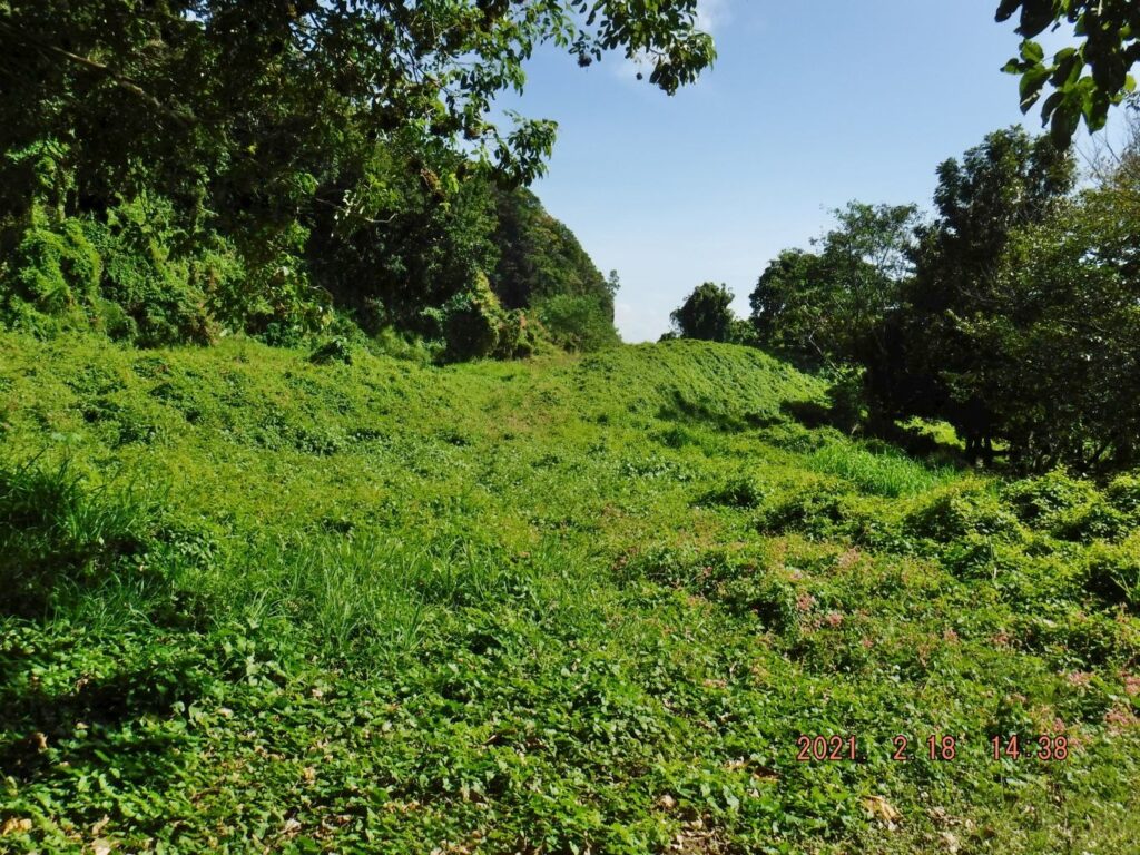
Zf025. This is the Engineering Ravine Trail going up to Middleside; I had to use my bolo a lot.
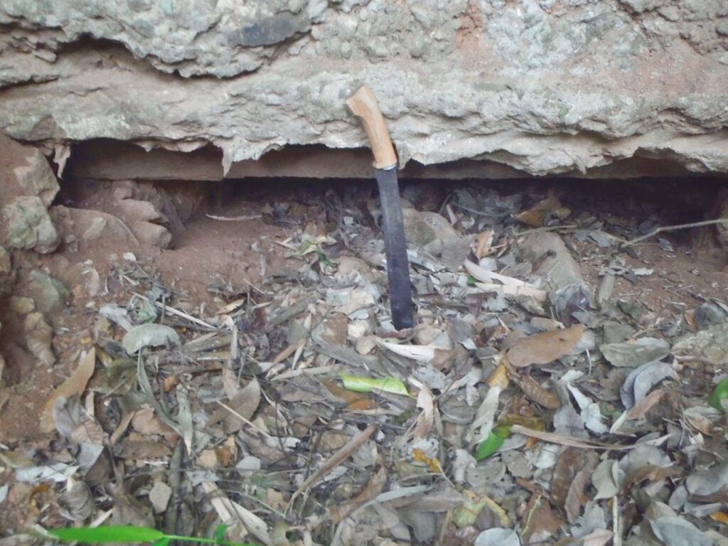
Zf026. This is the road to James Ravine and Battery James; it looks like it cannot be used by a vehicle anymore. It seems to the water pump at the ravine is service by motorcycle riding personnel. I can tell you exactly where this spot is; it is right in front of the 155mm GPF gun shelter about 200 feet from Battery James. Later when I returned I cleared the gun shelter.
Zf027. This is the road to James Ravine and Battery James; it looks like it cannot be used by a vehicle anymore. It seems to the water pump at the ravine is service by motorcycle riding personnel. I can tell you exactly where this spot is; it is right in front of the 155mm GPF gun shelter about 200 feet from Battery James. Later when I returned I cleared the gun shelter.
Zf028. Battery James is completely grown over again; it was to nicely cleared a few years ago. In this picture we are looking perhaps at gun #3, left of the display board honoring the battery’s Filipino Crew.
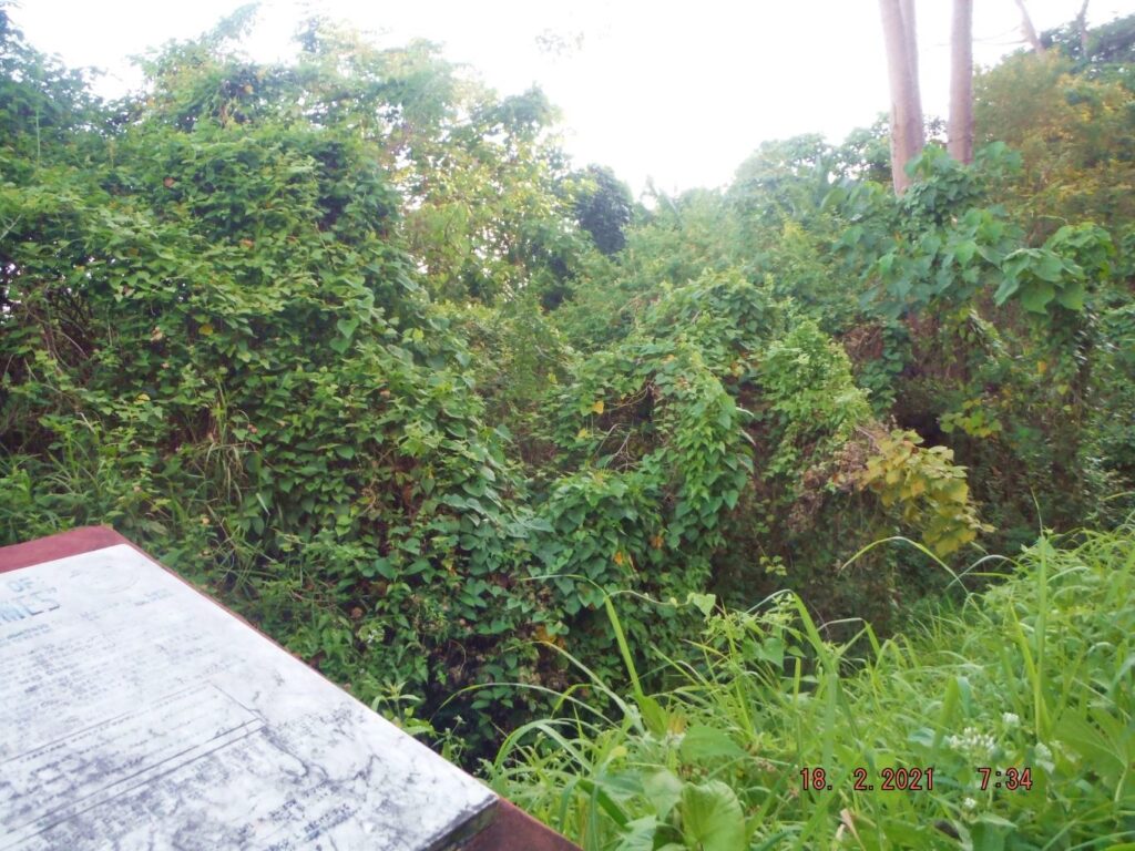
Zf029. Battery James is completely grown over again; it was to nicely cleared a few years ago. In this picture we are looking at the area of gun #1 & #2, right of the display board honoring the battery’s Filipino Crew.
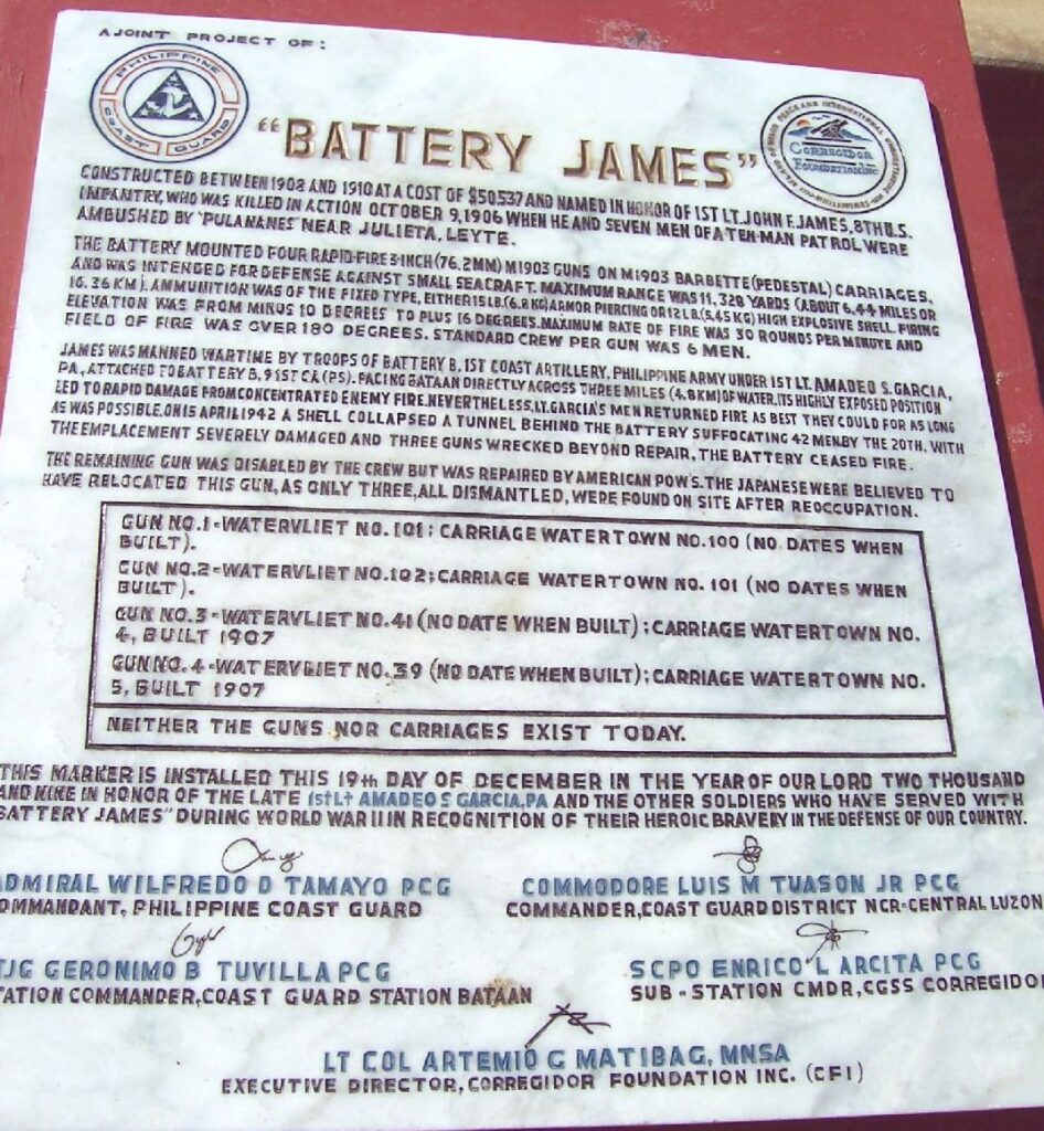
Zf029a. Battery James is completely grown over again; it was to nicely cleared a few years ago. This is a 2010 picture of display board honoring the battery’s Filipino Crew. This plaque was posted by the Philippine Coast Guard and is honoring particularly 1st lt. Amadeos Garcia Philippine Army (PA); there must be connection? A large group of Philippine Army Soldiers died here during the Siege of Corregidor. In their honor, I sure would like to see the battery cleared again.
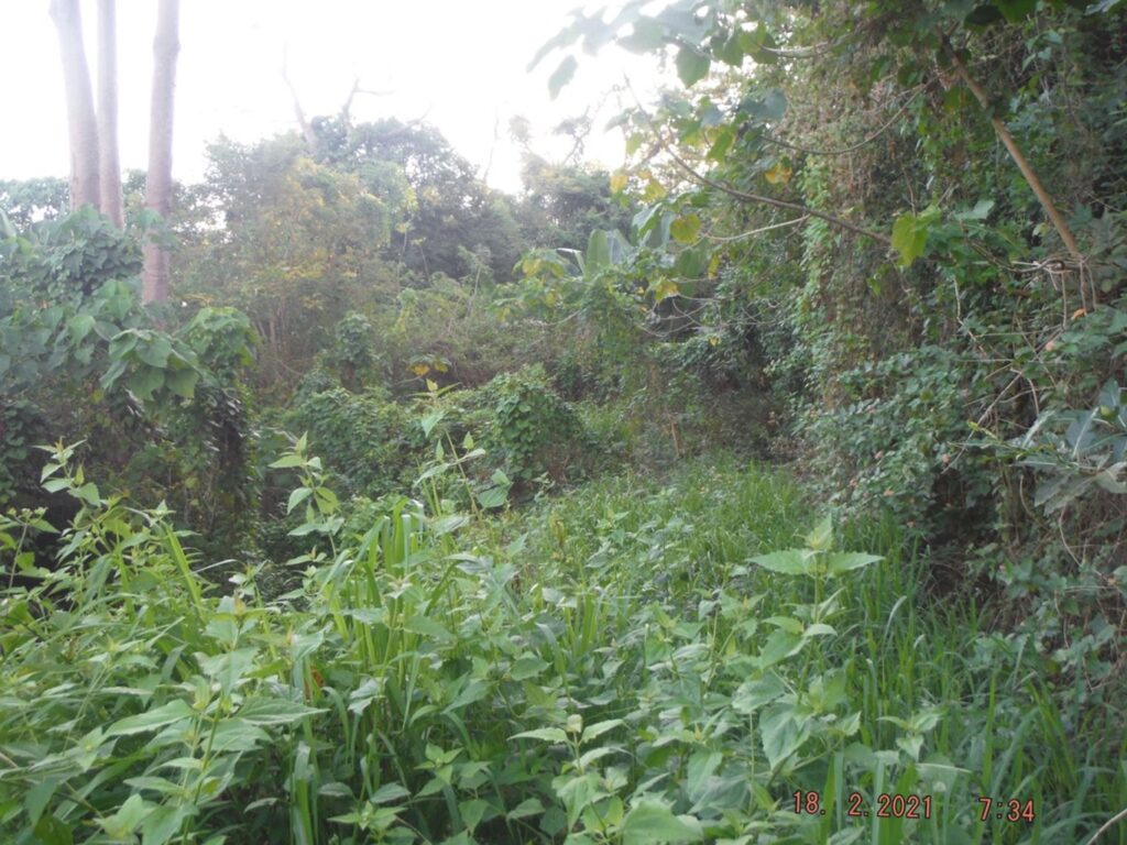
Zf030. This is the Fort Mills South Road in front of Battery James. A large group of Philippine Army Soldiers died here during the Siege of Corregidor. In their honor, I sure would like to see the battery cleared again.
====================================
4th Segment. Fourth Day, First Flag Anniversary 2021-02-16, the 76th on Corregidor Island.
James Ravine.
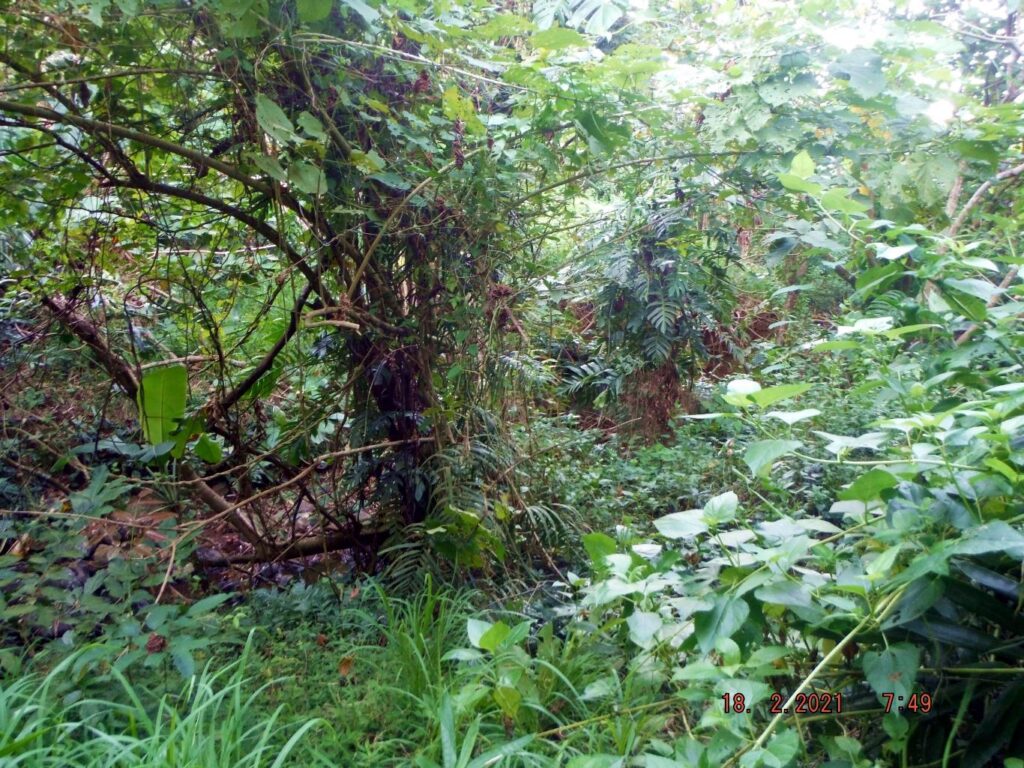
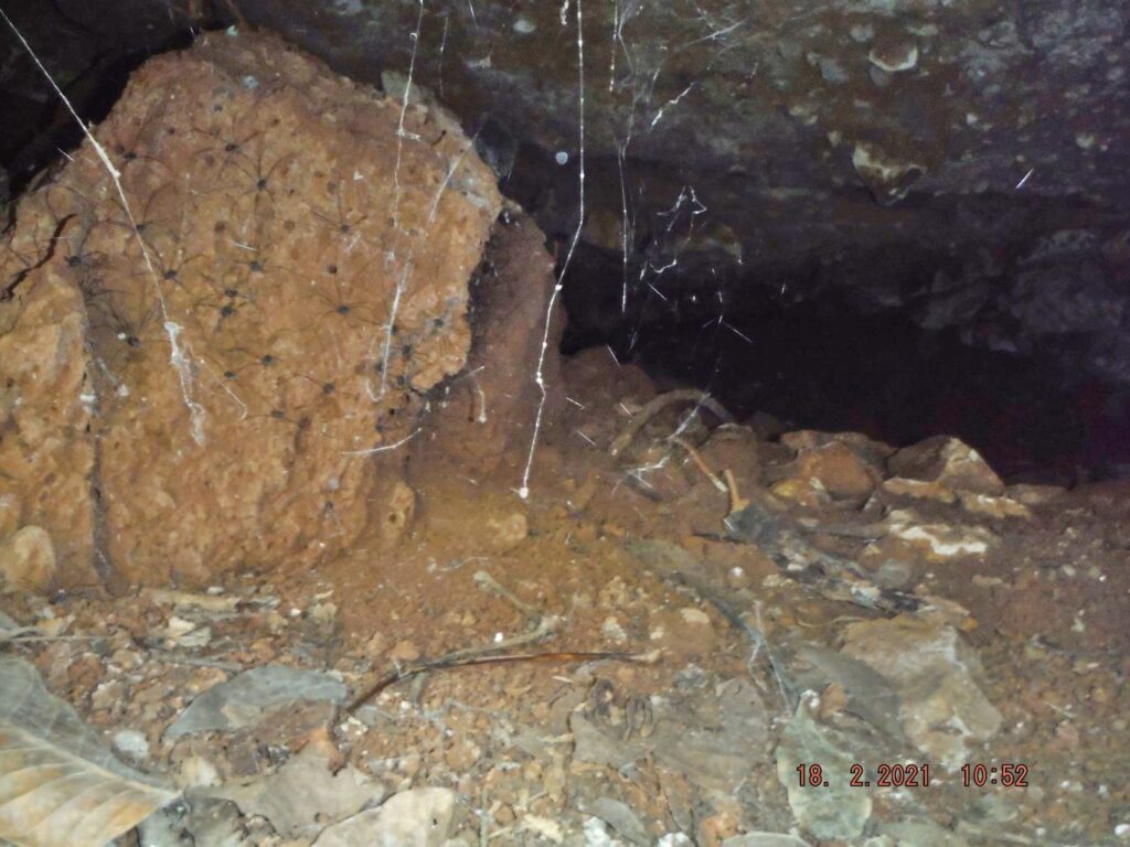
Zf031. This is vegetation at the mouth of James Ravine on Corregidor Island. I tried to find the trail to the beach but it appears it has disappeared, better, gown over; so I dropped the idea going to the beach.
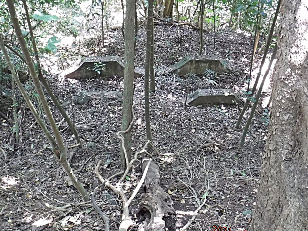
Zf032. The three US Army Philippine Scout’s Grave Stone, it took me some time to find them and I cleared some grass to find them. I really like to do something with them and I hope in the future they will be displayed somewhere on Corregidor. We have been told these three grave stone were rescued by a retired US Marine Officer (he is dead now) from the Fort Mills Cemetery on the Corregidor Tailend Cemetery because the other stones were disappearing.
Zf033. This is the bridge to the Fort Mills Mine Casemate in James Ravine, can you see the casemate, it is there, and I see it.
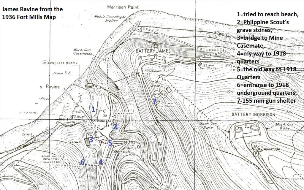
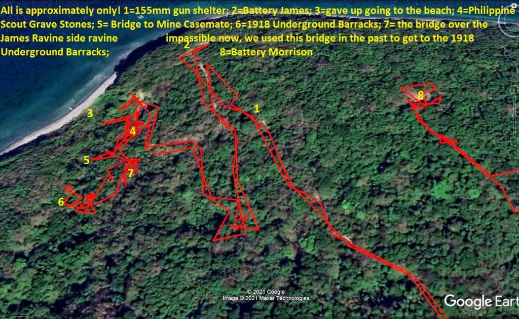
Zf034. This is a small section of the Fort Mills,-Corregidor map showing the mouth of the James Ravine and the places I looked at. Also, you can look back to earlier maps and data graphs in this thread. On this trip I did not enter the three tunnels we know of in James Ravine, the Mine Casemate, the 1918 underground Barracks or the Machinegun Casemates since I was alone.
Zf035. This is a bad picture of the bridge over the main James Ravine Creek leading to the 1918 underground troop barracks, but it illustrates how I got to the barracks this time. I’m looking up creek and I climbed up to my right and the entrance to the barrack is near there. This time it was the easiest way to get there.
Zf036. The way and distance to the entrance to the Fort Mills 1918 Underground Barracks from the bridge in the previous picture. I cut all that bamboo/vines vegetation out of the way, while there.
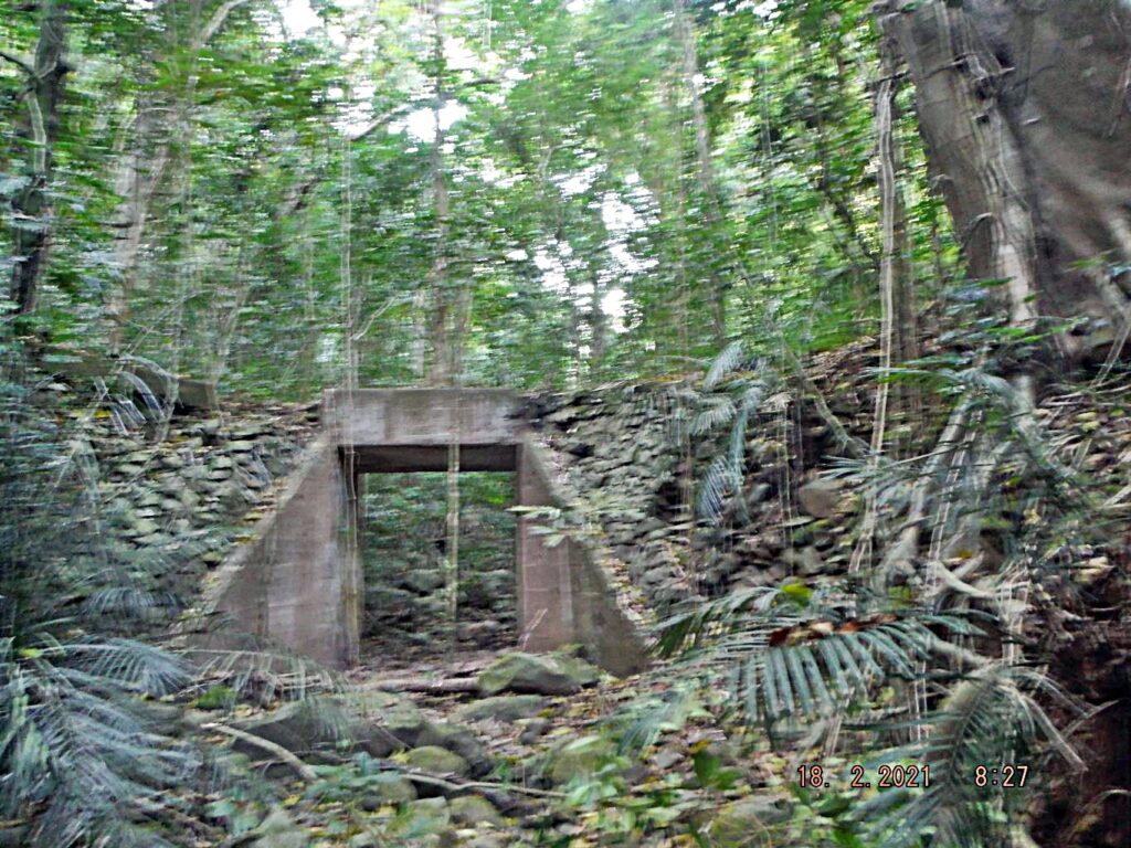
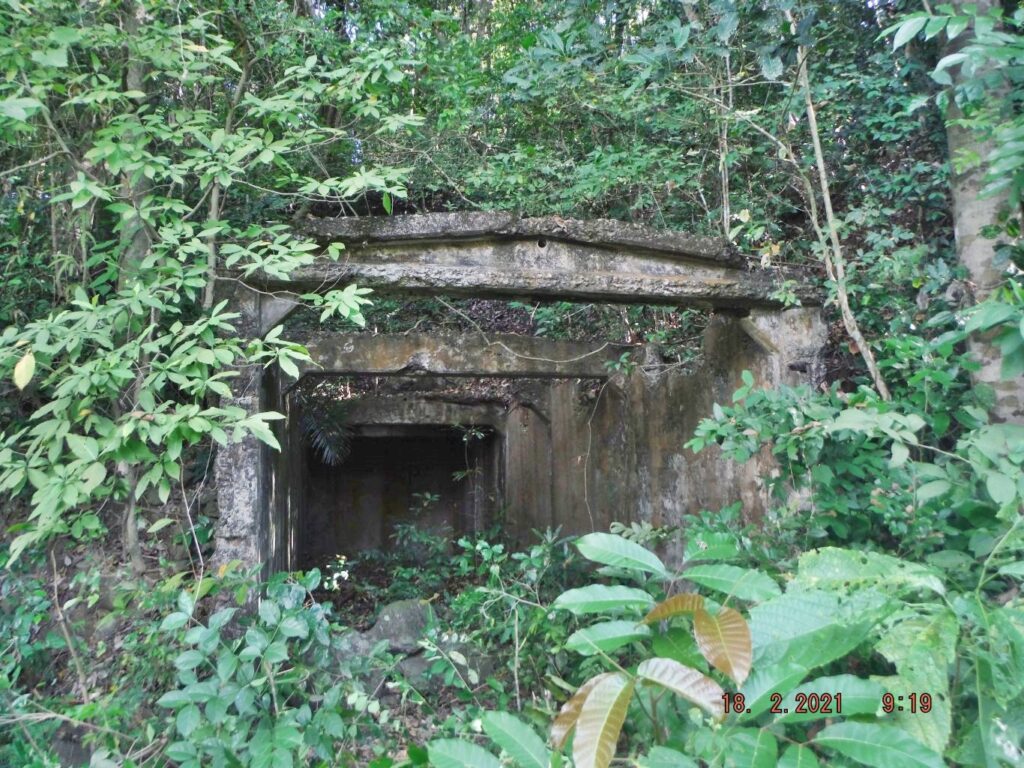
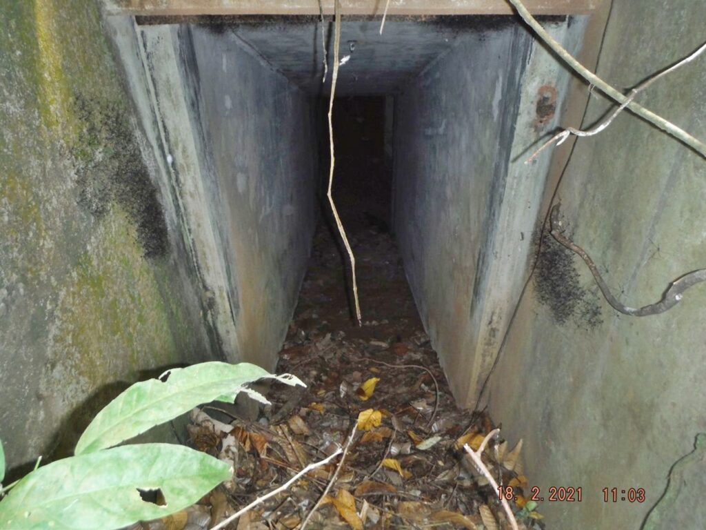
Zf037. This is the entrance to the Fort Mills 1918 Underground Barracks on Corregidor Island. I think, if we want to go inside again we have to move some of that dirt and those rocks.
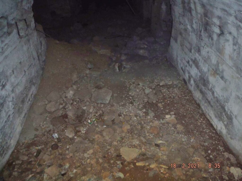
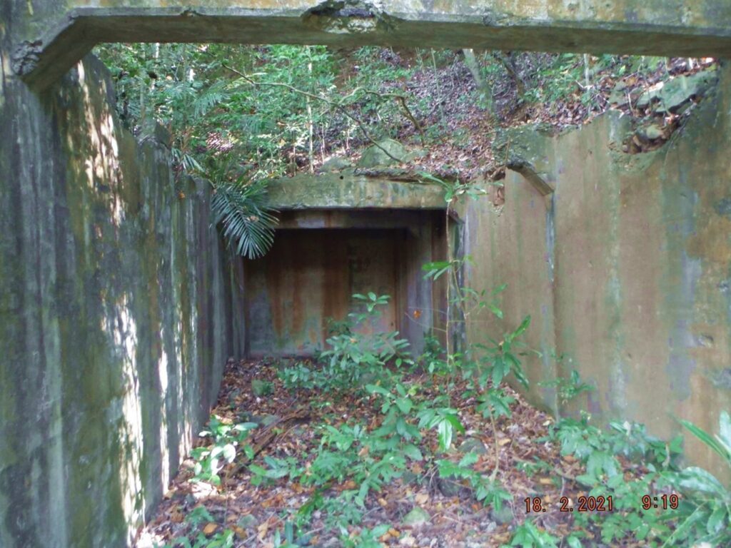
Zf038. I could not resist taking at least one shot of inside the Fort Mills 1918 Underground Barracks on Corregidor Island. Indeed it is still there, inviting to come in and have a look. Above the entrance in the last image are some ventilation grills and one can shoot a picture thru them.
Zf039. This is the bridge over the James Ravine contributing east side-ravine; in the past we used this bridge to reach the Fort Mills 1918 Underground Barracks on Corregidor Island. It has deteriorated further and my way this time may be a better way to reach the underground barracks.
Zf040. This is the bridge over the James Ravine contributing east side-ravine; in the past we used this bridge to reach the Fort Mills 1918 Underground Barracks on Corregidor Island. It has deteriorated further and my way this time may be a better way to reach the underground barracks.
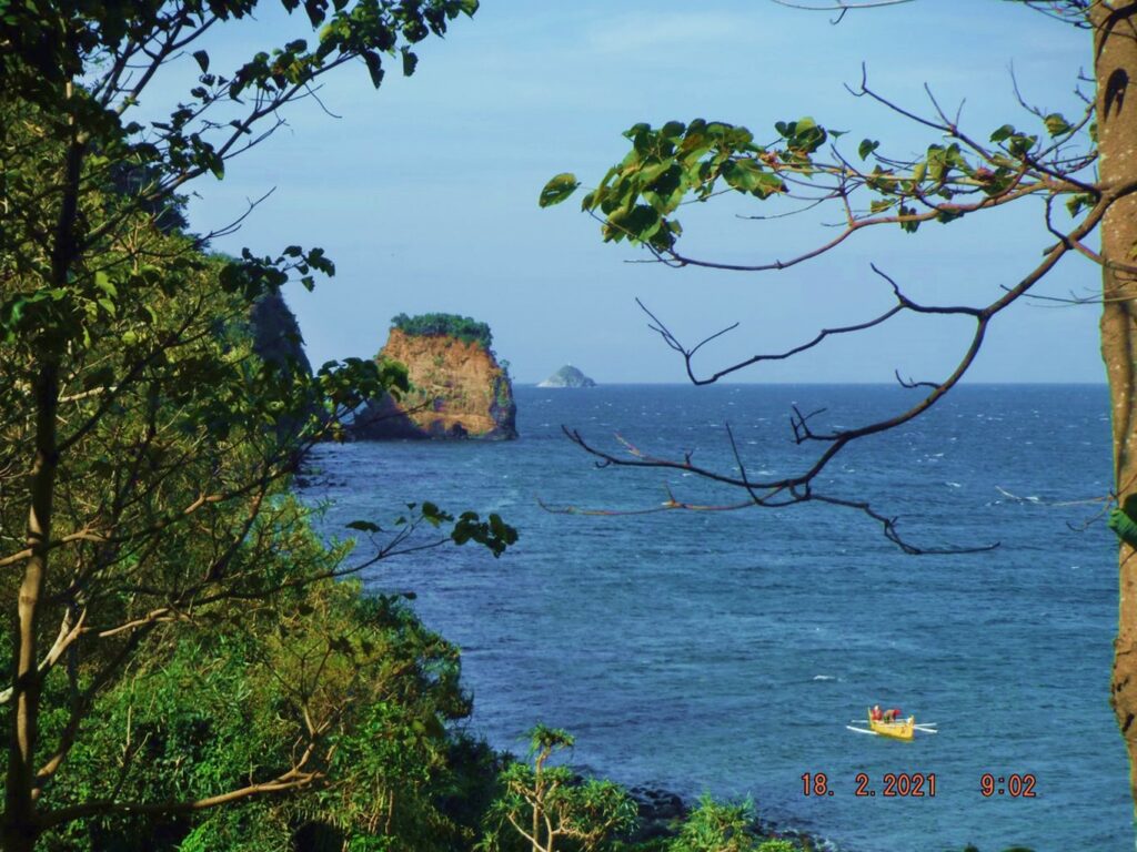
Zf041. I just added this picture because it is a nice shot of Rock Point on Corregidor Island and the Monja Island of Mariveles Bay. That was one reason I wanted to go the beach earlier but changed my mind because the trail is gone.
=============================================
5th Segment. Fourth Day, First Flag Anniversary 2021-02-16, the 76th on Corregidor Island.
Up to Morrison Hill.
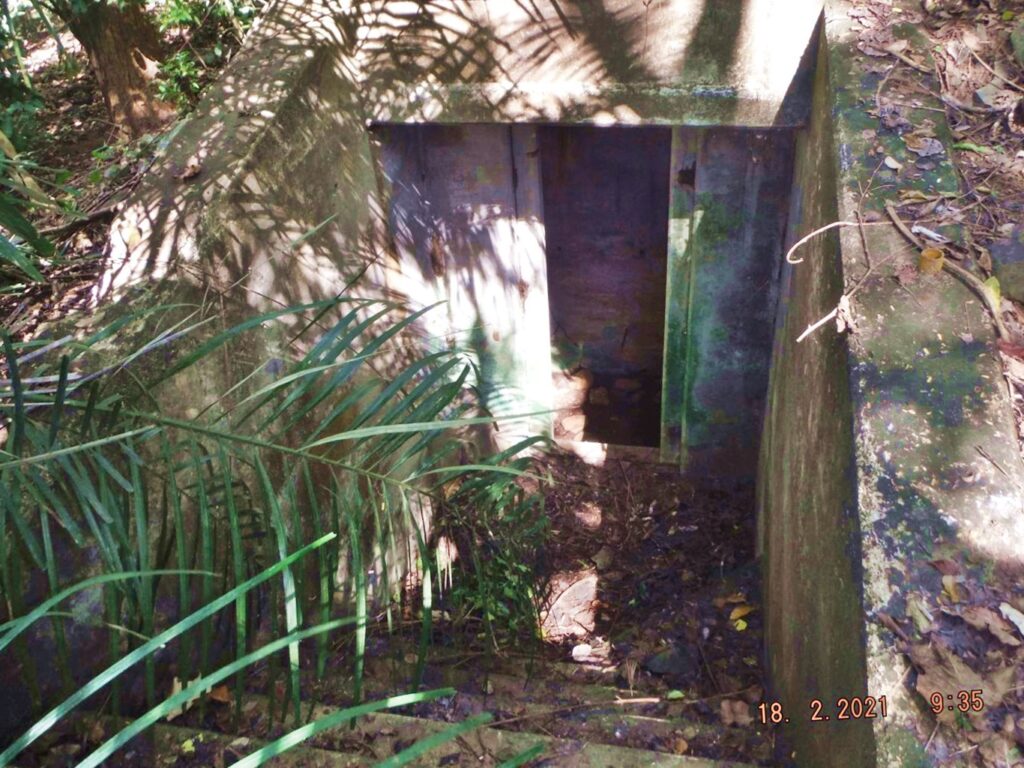
Zf042. One of the two 155mm Gun Shelters near Battery James. The Battery James Road had a fallen tree just before this shelter on the way to Battery James from Middleside. But I only cleared new plants/trees that have grown at the entrance of this shelter.
Zf043. One of the two 155mm Gun Shelters near Battery James. The Battery James Road had a fallen tree just before this shelter on the way to Battery James from Middleside. But I only cleared new plants/trees that have grown at the entrance of this shelter.
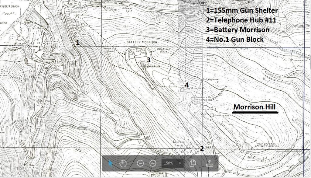
Zf044. This is a section of the Fort Mills 1936 map, and I marked the 4 venues for this 5th segment of my 4th Day report, visiting Corregidor for the 76th First Flag Anniversary.
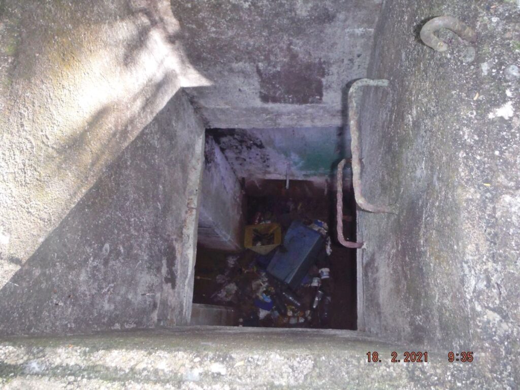
Zf045. This is one of 2 pictures of the Telephone/Communication Hub #11 on my long way to Battery Morrison from Battery James. All the Telephone/Communication Hubs in Fort Mills are constructed in different ways, not by a common blueprint. This one is elaborate and has steps going down to it.
Zf046. This is one of 2 pictures of the Telephone/Communication Hub #11 on my long way to Battery Morrison from Battery James. All the Telephone/Communication Hubs in Fort Mills are constructed in different ways, not by a common blueprint. This one is elaborate and has steps going down to it.
Zf047. Battery Morrison is slowly disappearing under the vegetation growth; this is No. 2 Gun.
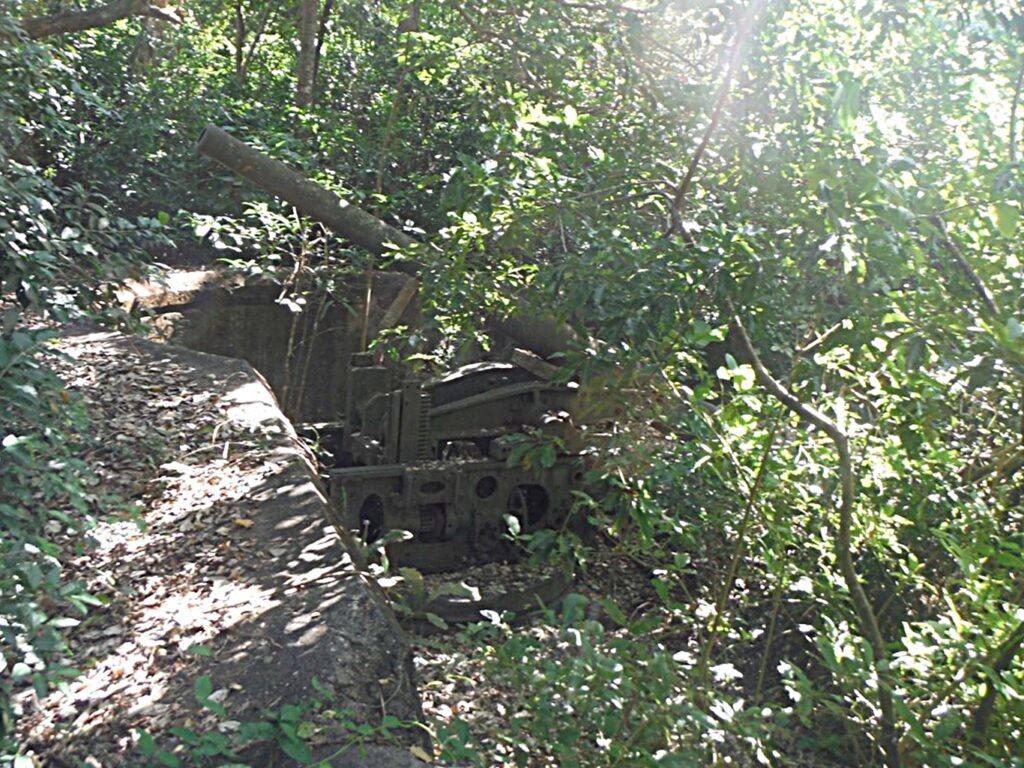
Zf048. Battery Morrison is slowly disappearing under the vegetation growth; this is No. 1 Gun.
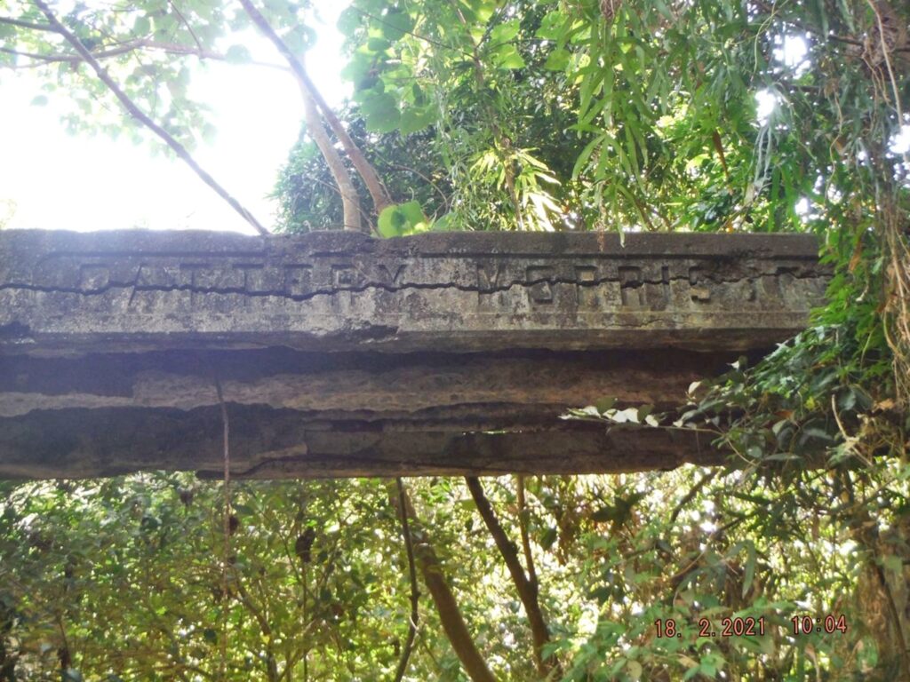
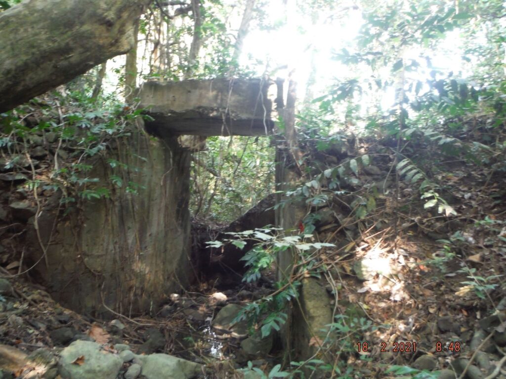
Zf049. Battery Morrison is slowly disappearing under the vegetation growth; this is the bridge to gun control which is severely destroyed from the shelling during the Siege. But there are steps also to get there onto the bridge and the gun control station.
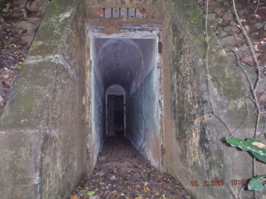
Zf050. This underground passage leads to the Battery Morrison Plotting Room; it is located very near to Battery Morrison and is under the destroyed Gun Control Station above. The battery spare gun rifle/barrel is lying between this entrance and the battery.
Zf051. This is the top of Morrison Hill and I promptly found the No.4 Gun Block, the northern one. This was for an anti aircraft battery, established in 1917 as a result of WW One (The Great War to end all Wars). There were 5 anti aircraft batteries/sites established in Fort Mills, on Corregidor Island at that time.
========================================
6th Segment. Fourth Day, First Flag Anniversary 2021-02-16, the 76th on Corregidor Island.
On top of Morrison Hill.
Zf052. One of several structures or earth heaps in the Anti Air Craft (AA) WWII Battery Chicago, which was placed in the 1917 built AA Battery area on Morrison Hill, Fort Mills on Corregidor Island. This, we believe was the Battery Chicago Range Finder Station built on an earth heap.
Zf053. One of several structures or earth heaps in the Anti Air Craft (AA) WWII Battery Chicago, which was placed in the 1917 built AA Battery area on Morrison Hill, Fort Mills on Corregidor Island. This, we believe was the Battery Chicago Range Finder Station built on an earth heap.
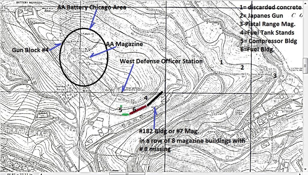
Zf054. This is a section of the 1936 Fort Mills on Corregidor Island map covering the images of this 6th and the next, # 7 segments, of this presentation. I marked the map with the subjects to be covered in this 6th and the next Segment.
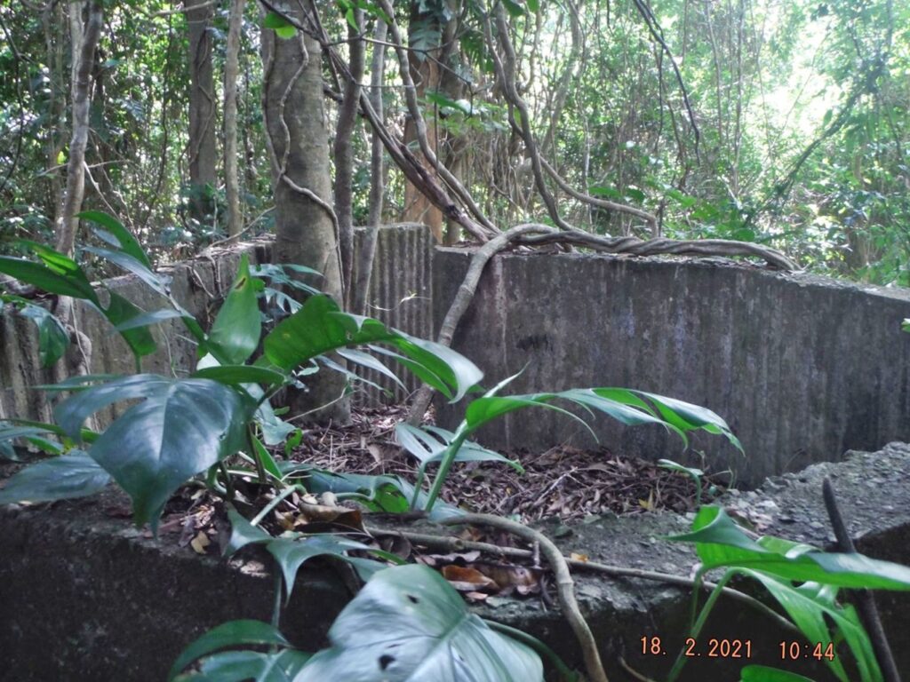
Zf055. One of several structures or earth heaps in the Anti Air Craft (AA) WWII Battery Chicago, which was placed in the 1917 built AA Battery area on Morrison Hill, Fort Mills on Corregidor Island. This was a concrete structure and it is mostly buried but I don’t know what it purpose it served.
Zf056. One of several structures or earth heaps in the Anti Air Craft (AA) WWII Battery Chicago, which was placed in the 1917 built AA Battery area on Morrison Hill, Fort Mills on Corregidor Island. This was a concrete structure and it is mostly buried but I don’t know what it purpose it served. I tried this shot under it, but I can’t figure it out.
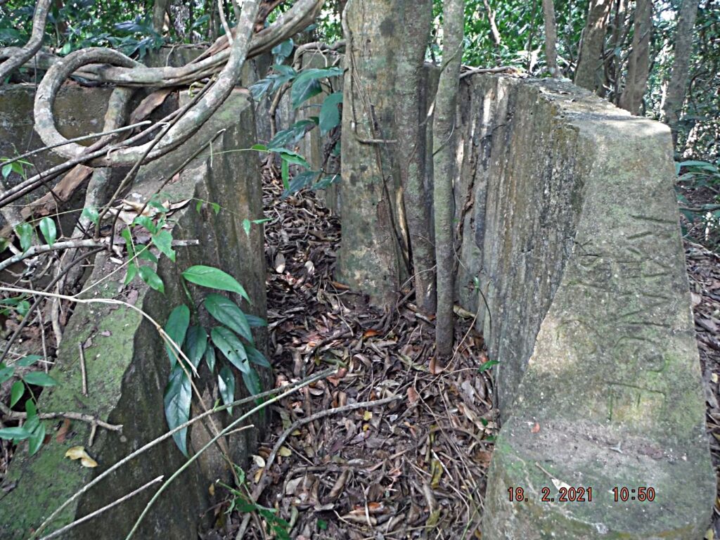
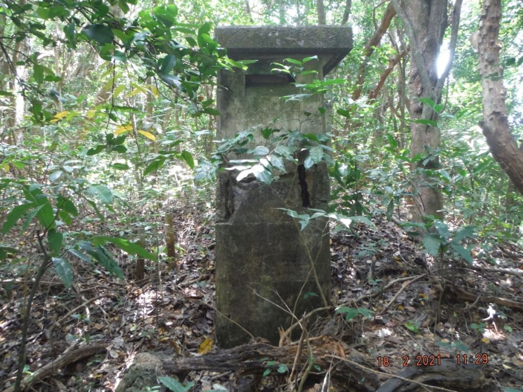
Zf057. This is one of the two stairway entrances to the 1917 AA Magazine; during WWII it became part of Battery Chicago
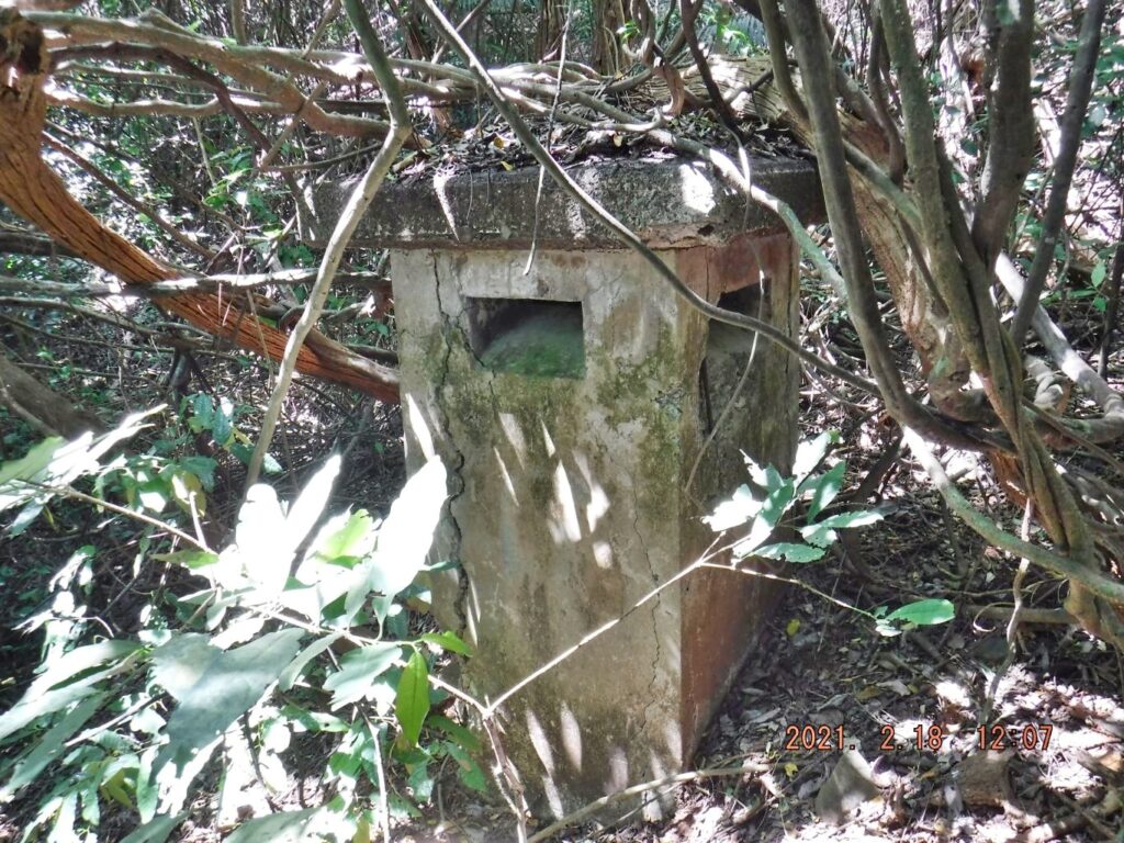
Zf058. Next, I was looking for the West Defense Officer Station and I promptly came across the vent of the structure.
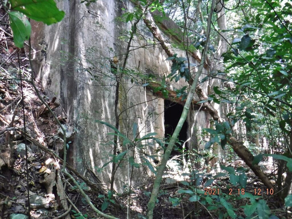
Zf059. It took a little doing but I got down and around to the entrance of the West Defense Officer Station of Fort Mills on Corregidor Island.
Zf060. This is a look into the West Defense Officer Station in Fort Mills on Corregidor Island.
Zf061. I continued my march on Morrison Hill and spotted the row of about 20 sets of open air fuel tank stands
===================================
7th Segment. Fourth Day, First Flag Anniversary 2021-02-16, the 76th on Corregidor Island.
Descending from Morrison Hill.
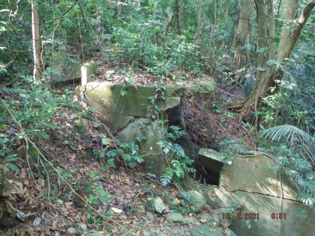
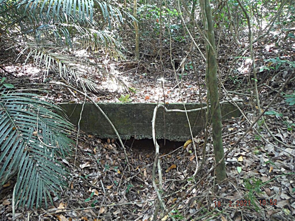
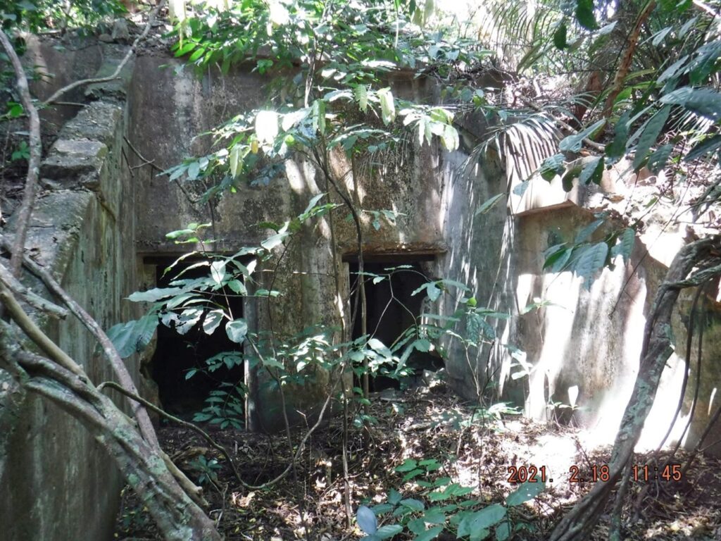
Zf062. Bingo, I hit the exhaust vent of the bomb proof Magazine Bldg.182; I call it Magazine #7 in a row of 8 Magazine/Ordinance buildings on Morrison Hill, in Fort Mills on Corregidor Island.
Zf063. This is the west end of the bomb proof Magazine Bldg.182; I call it Magazine #7 in a row of 8 Magazine/Ordinance buildings on Morrison Hill, in Fort Mills on Corregidor Island.
Zf064. This bomb proof Magazine Bldg.182; I call it Magazine #7, and it is a massive building. It stands in a row of 8 Magazine/Ordinance buildings on Morrison Hill, in Fort Mills on Corregidor Island. There is one other massive sister magazine next to the rail line to Battery Cheney. But building 183, the magazine I call #8 is completely gone. The area is level and certainly could have housed a large building but if it was there it left no trace.
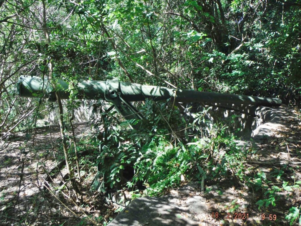
Zf065. I then descended thru the woods, down the slopes, thru some difficult vegetation to find the very large discarded concrete blocks and found them. Fots2 and I once surprised some scrappers getting the rebar. I can report no one else has been there since. This location is near the only remaining Japanese artillery gun, still at its original location. We still have not figured out from where it came, when and why it ended–up at that place.
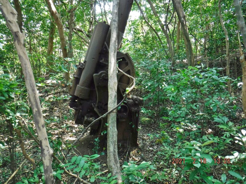
Zf066. Looked for and found the only in-place remaining Japanese Artillery Piece on Corregidor Island, a tree fell on it but no damage.
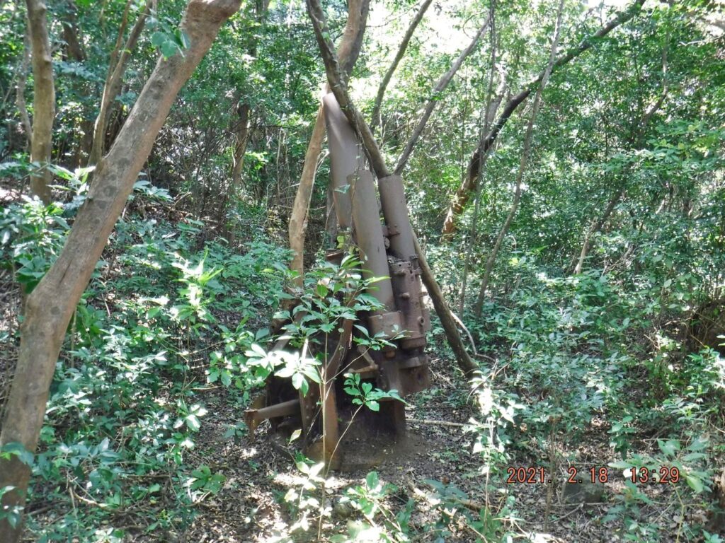
Zf067. Looked for and found the only in-place remaining Japanese Artillery Piece on Corregidor Island, a tree fell on it but no damage.
Zf068. Then I descended to the Engineering Ravine via the defense position VII-F-2 near the Japanese gun and the ammunition storage of the Pistol Target Range on the Corregidor North Road. This half moon storage has further deteriorated.
Zf069. This is a shot of the Fort Mills Diesel Power Plant from the Corregidor Island North Road; one seldom takes the time to have this view. I did have to use my bolo a few times to travel the short distance from the Pistol Target Range to the shortcut I used to descend to the Engineering Ravine. The shortcut is between the Diesel Power Plant and the two in-the-open steel full tanks, which are hidden now due to overgrowth. The Corregidor Foundation Inc (CFI) recently reported that 60% of the Corregidor North Road between Battery James and the Engineering Ravine is cleared and they hope it will be completely cleared by Easter.
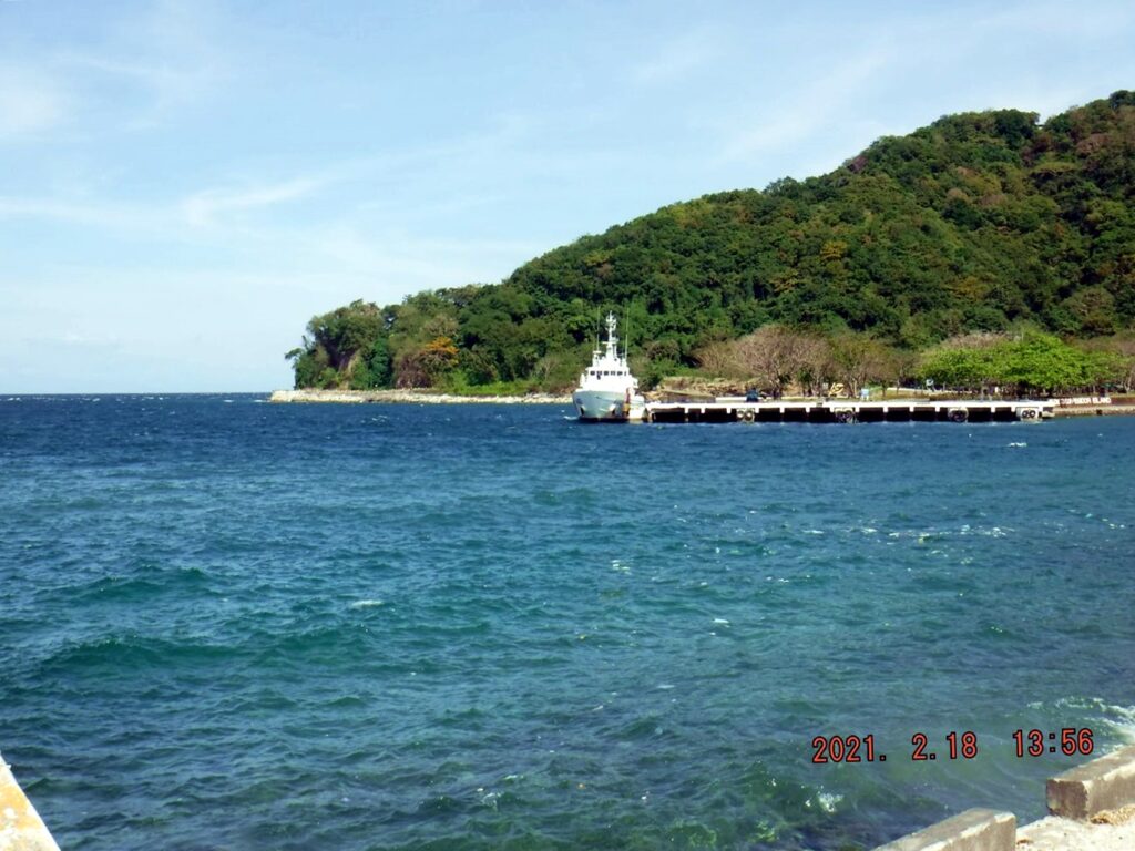
Zf070. On this day a Philippine Coast Guard Ship had an education and recreation visit to the former Fort Mills on Corregidor Island. They brought dependants or perhaps other civilian guests also. As I was finishing my walk they were preparing to depart from the former North Mine Dock.
Zf071. On this day a Philippine Coast Guard Ship had an education and recreation visit to the former Fort Mills on Corregidor Island. They brought dependants or perhaps other civilian guests also. As I was finishing my walk they were preparing to depart from the former North Mine Dock.
===================================
8th Segment. Fourth Day, First Flag Anniversary 2021-02-16, the 76th on Corregidor Island.
Corregidor Inn; formerly managed by the Sun Cruises Inc.
During my many visits to Corregidor, a few nights were spent in the Corregidor Inn. Accommodations were higher priced and after that huge, huge and costly renovation the room rates went thru the roof. But the hotel was a very unique hotel and I have many happy memories of my stays, the staff was always superb and most friendly. In the past they gave us free rides to our goal on the island and later they charged fees but they were manageable. Most guests loved the patio type dining areas with views of the other islands or forts in one direction and Bataan in the other direction. The virus from Red China killed the tourist industry and the Sun Cruises operation on the Corregidor Island completely dead. I wanted to see what is happening of our fond place of remembrance; here are some images:
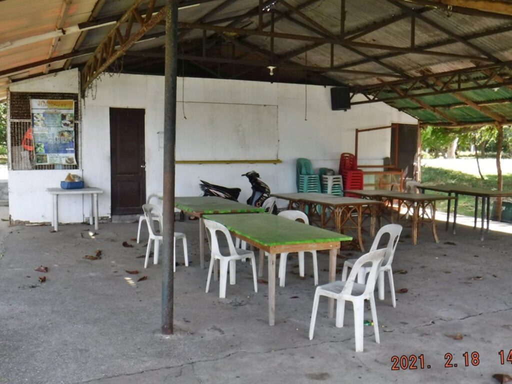
Zf072. First a picture of the former Boardwalk restaurant, it is located just inside to former Fort Mills Mine Dock and at the sea wall where the boats from Bataan land. With the hotel closure and the closure of this place there is now only one eating place on the island, the employees cook for them self. The only eating place is the former MacArthur Café and is managed by the Corregidor Foundation Inc. (CFI) and they also manage the former Mac Arthur rooms for rent. See their Facebook page for information, click here!
Zf073. I’m walking, on my way to the former Sun Cruises Hotel, the Corregidor Inn; right is the former Sun Cruises Inn Staff Building. It stands now empty and closed.
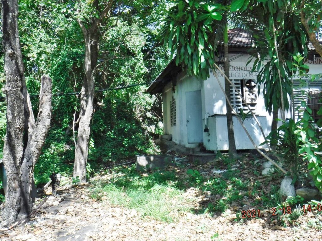
Zf074. I’m walking, on my way to the former Sun Cruises Hotel, the Corregidor Inn; left is the former Sun Cruises Inn Generator Building. It stands now empty and closed; it always provided reliable power supply. CFI is running a generator in the former Fort Mills Power Building but is running the power only from about 6 pm to 6am each day. Next to the generator building we see the shortcut path to the former MacArthur Café which is still in operation with a slightly different name and a different Management.
Zf075. I had to have a look at the shortcut path to the former MacArthur Café which is still in operation with a slightly different name and a different Management. One can still walk it but there is some rubbish on the way, that building was the former Sun Cruises Recreation Building but was used for many other purposes.
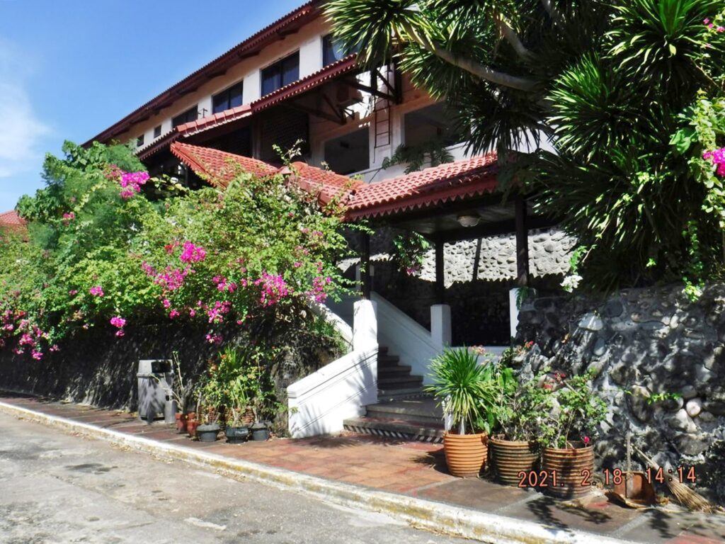
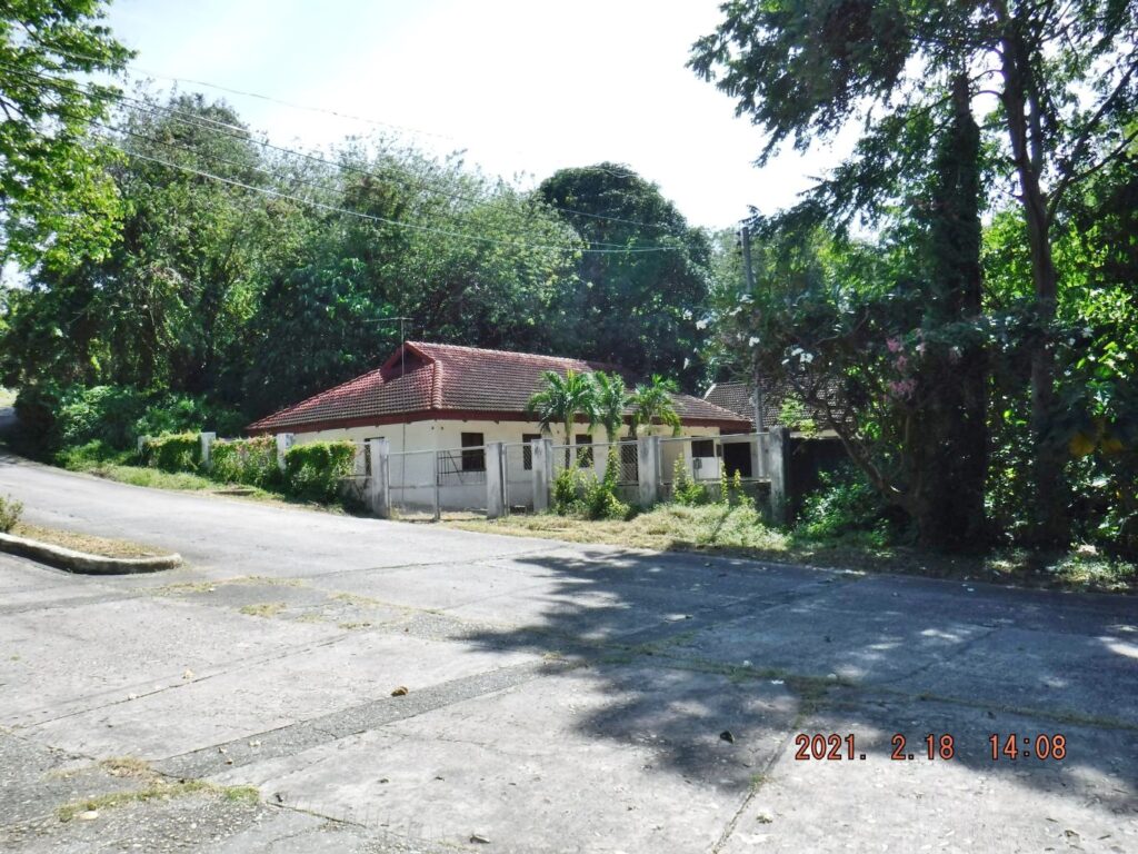
Zf076. The Corregidor Inn is still here although it is closed. This is the main entrance to the Inn/Hotel.
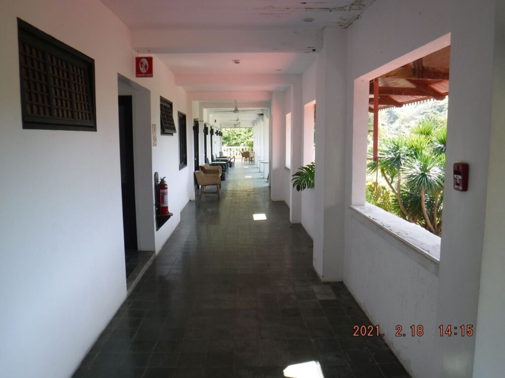
Zf077. Because of the huge Sun Cruise’s renovation of the Corregidor Inn, this new passage to the patio type dining area cannot be locked up right now.
Zf078. Because of the huge Sun Cruise’s renovation of the Corregidor Inn, this new passage to the patio type dining area cannot be locked up right now. That battery provides one of two lonely lights at night for the Corregidor Inn.
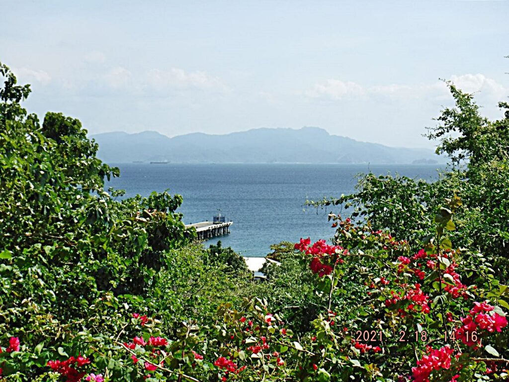
Zf079. From the patio type dining area of the former Corregidor Inn I still could enjoy one more time the grand view of the south mouth opening/entrance of Manila Bay and see two of the other three Islands/Forts; we see Fort Drum left and Fort Frank at right.
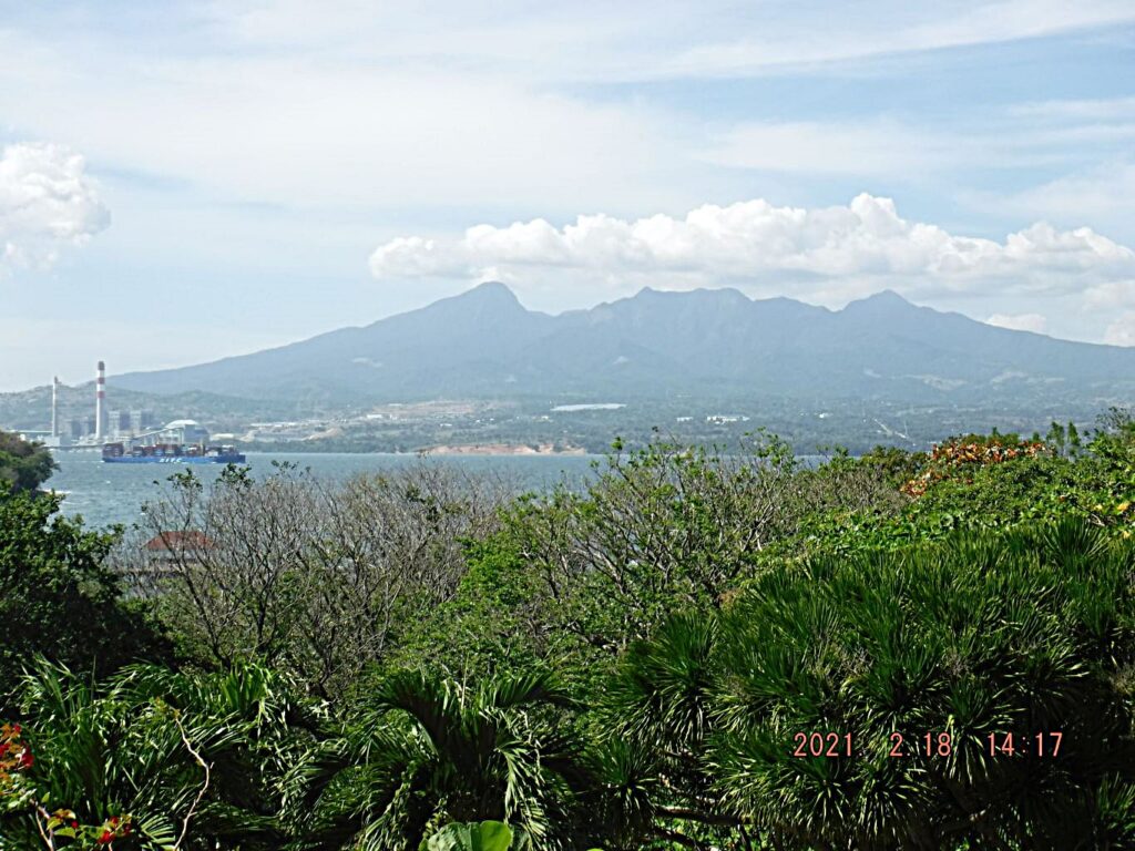
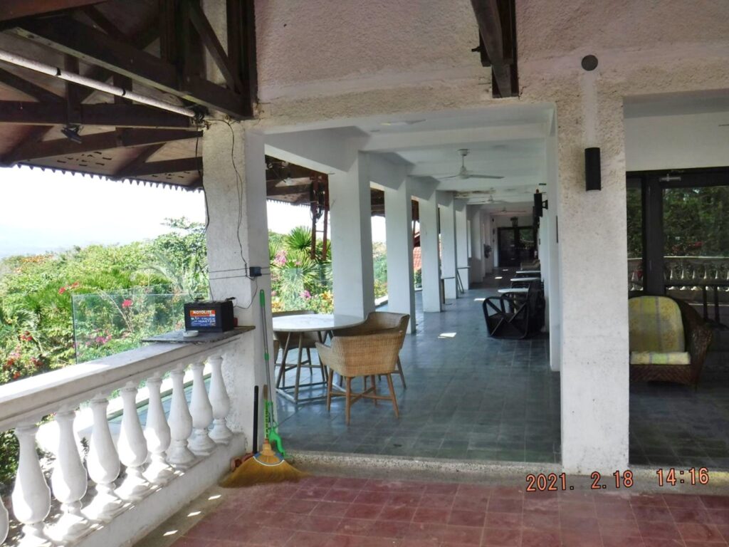
Zf080. From the patio type dining area of the former Corregidor Inn I still could enjoy one more time the grand view of the North Channel entrance of Manila Bay. I always enjoy this view and then remember the tragic Battle of Bataan. I particular remember the Dog fight of the 9th Feb 1942 between an American and a Japanese Pilot that caused both pilots to crash on Tarak Ridge which is located about center in this picture on top of the Mount Mariveles peaks.
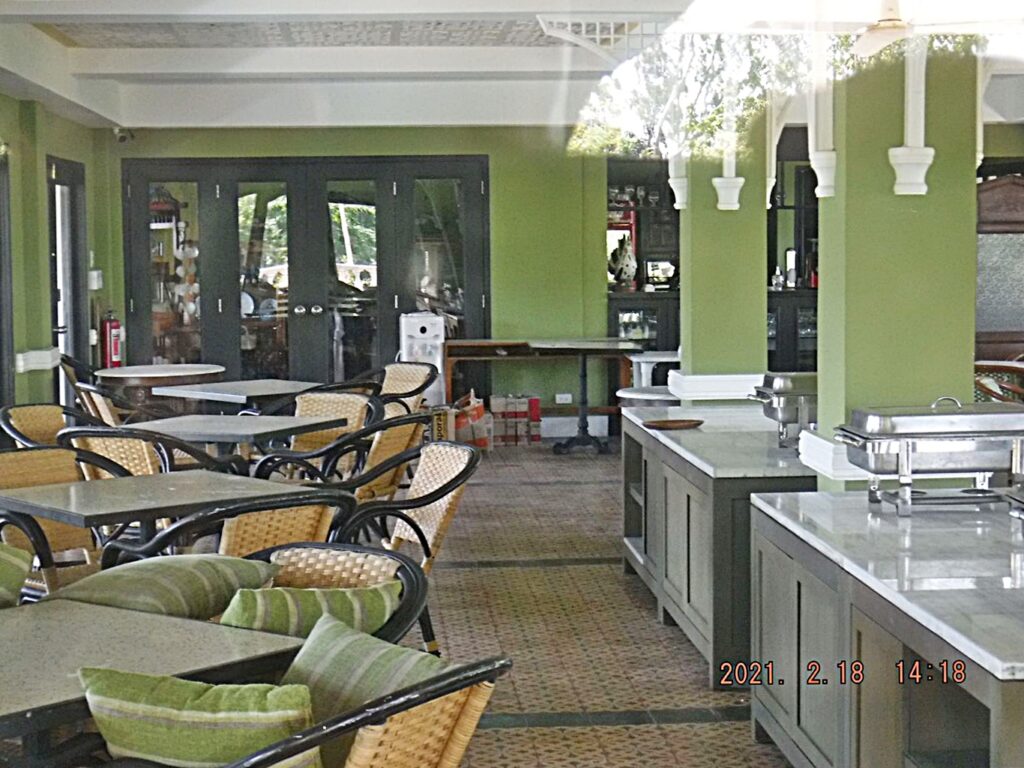
Zf081. Like the dining area of the Sun Cruises INC Corregidor inn is still in operation, all we have to do get the key to open and turn on the ovens. This shot is thru the glass from the patio type dining area. I have another shot thru the main door of the Hotel Lobby, also there, all is needed, is a key to open.
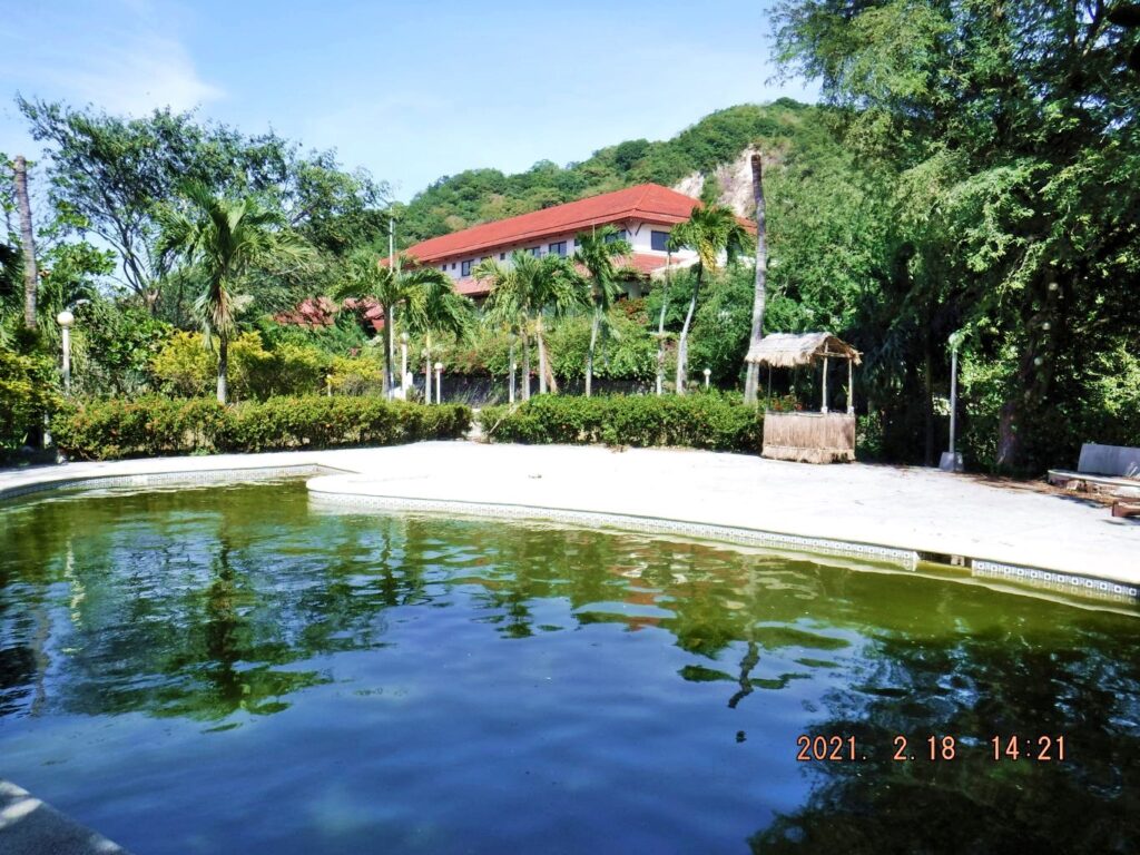
Zf082. Sad to see, but we are looking at the former Sun Cruises INC Corregidor Inn across their swimming pool; the water is now dirty brown.
====================================
9th and last Segment. Fourth Day, First Flag Anniversary 2021-02-16, the 76th on Corregidor Island.
Bottomside Views, former Fort Mills on Corregidor Island.
Zf083. This building, right now, houses a Philippine Navy Team (Navy SEALS) who help keeping Corregidor Island safe from marauders, scrappers, unauthorized visitors etc. This building is located in the former San Jose, the former main village on Corregidor, at the west foot of Malinta Hill. Before that it served as a restaurant with other services like renting a tent. It appears it was built by the Philippine Navy before I started visiting Corregidor in 2004, because 4 Navy Ratings are engraved at a former Flagpole base including their names and rates.
Zf084. This seems to have been a former CFI visitor reception and even a camping site; but now houses a Philippine Marine Detail who helps Corregidor save together with their Navy Comrades. Notice Malinta Hill is in back. Since the virus crises started it seems CFI did not renew or terminated the contract with a civilian security service and the Philippine Military sent two teams over here to help, apparently that stated in March or April last year. I did not take a picture but I talked to 3 young people who stayed one night and brought tents, they had rigged their tents not o far from the South Dock.
Zf085. I then walked to the west entrance of Malinta Hill Tunnel and had a look at that South Road going around Malinta Hill. I had intention to walk on it but the foot trail on the South Road has also disappeared, so I cancelled that until my next visit. The Navy Tunnels can be reached this way, next time.
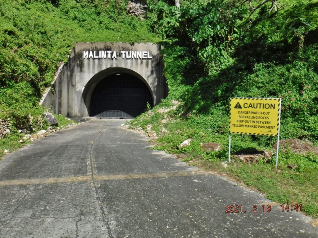
Zf086. This is the West Entrance of Malinta Hill Tunnel. In the about last 4 years or so rock slides at this entrance has become a problem. Hence, we see the new sign re the rock slides and a warning to stay out of the area. I assume when they had the Video Light and Sound Show during my visit days that the visitors entered and departed from the East Entrance.
Zf087. These are new electrical wires running from Bottomside to the Malinta Hill Tunnel; I assume the electricity for the Video Light and Sound Show comes directly from the CFI generators in the Engineering Ravine now.
Zf088. This is the entrance to the fuel storage of the former Fort Mills Malinta Hill Tunnel. It is also on the west side, a short distance behind the former Generator Building for the Video Light and Sound Show, when a contractor was running the show; near the main west entrance to the tunnel.
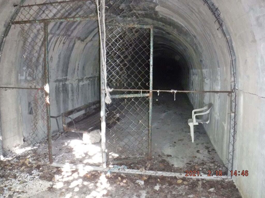
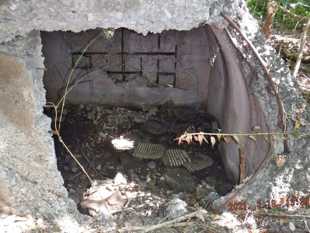
Zf089. This is the entrance to the fuel storage of the former Fort Mills Malinta Hill Tunnel, once one ducks under, thru that over growth in the last image. It is an awe inspiring sight to see the crumbled, crushed huge fuel tanks, caused by explosions in the tunnel.
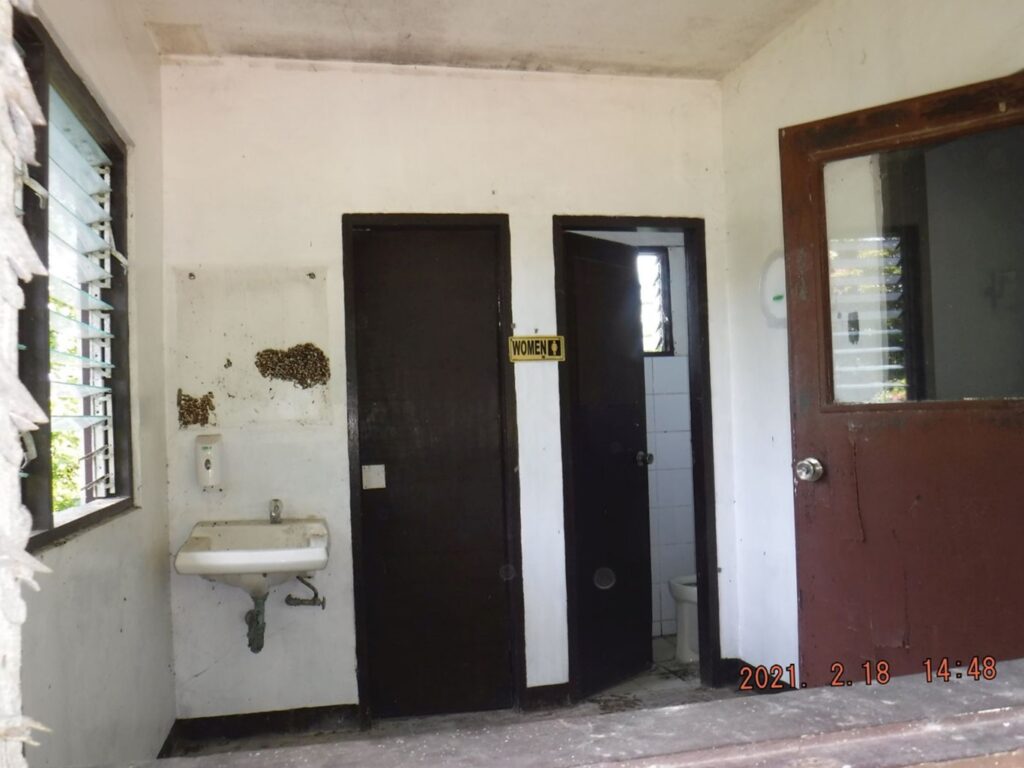
Zf090. This is the toilets at the West Entrance Malinta Hill Tunnel and they need attention. In view of these conditions I assume further that the west entrance to the Malinta Hill Tunnel is secured and the generator building plus this toilet facility are not needed right now.
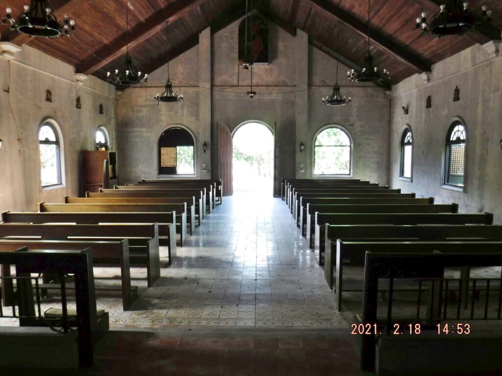
Zf091. The post war, rebuilt, San Jose Chapel on Corregidor Island at Bottomside. CFI is opening the doors and windows during the day and when no rain to air it, ventilate it, to help it stay in good conditions.
Zf092. These trees were planted between the former Gen. MacArthur Café and the Saluting Battery Hill and are hanging in there. This is a view from the chapel, thru the trees, towards Bataan. Not sure that these are the right trees for this soil but they are hanging in there and I take a picture, every time I come to see how they are doing.
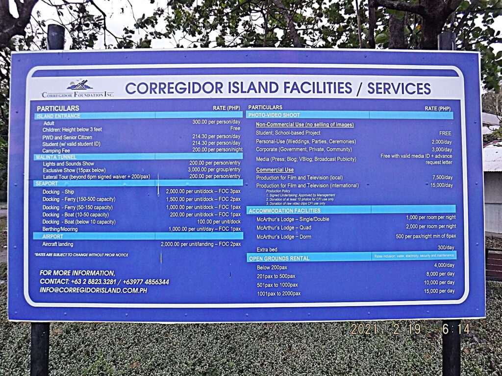
Zf093. This is the last picture of my visit, I actually only saw it on the 19th, Friday, the day of my departure. It is a new sign from the new CFI Management as to what the fees are. It is located where the boats from Bataan land, just inside the Fort Mills North Mine Dock, North Shore, Bottomside, Corregidor Island.