Tag: Olongapo City

Subic Bay & Olongapo City images, 2nd Half 2024
This image shows the former US Marines Green Beach training area, which became the Hanjin Shipyard; now, it is the Agila Subic Shipyard and the Agila Philippine Navy Operating Base with many of their larger vessels. —————————————————- This presentation has 44 images out of the original 72 images which are in this Flickr album and […]
Read More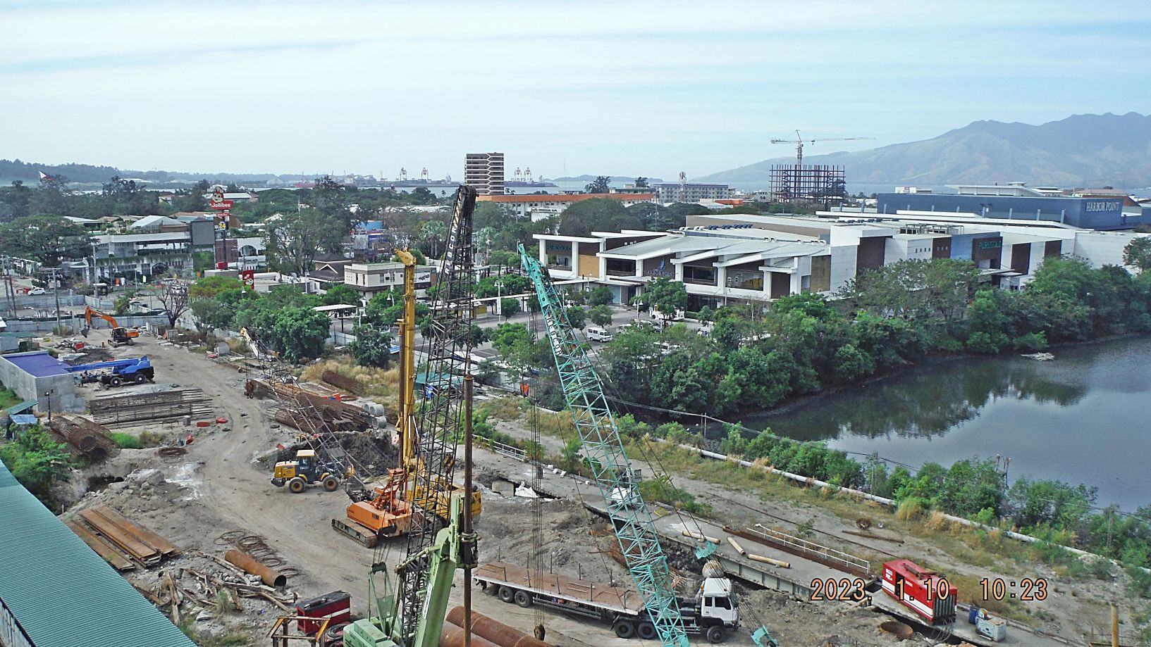
Subic Bay Views, 1st Half of 2023
Zg345. (-018 and 019) are/ is a view of the former main gate bridge of the former Subic Bay Naval Base being replaced. Work has been going on over 3 years now. The new Chairman of the Subic Bay Metropolitan Authority (SBMA) apparently reorganized the effort and it seems that progress is being made. On […]
Read More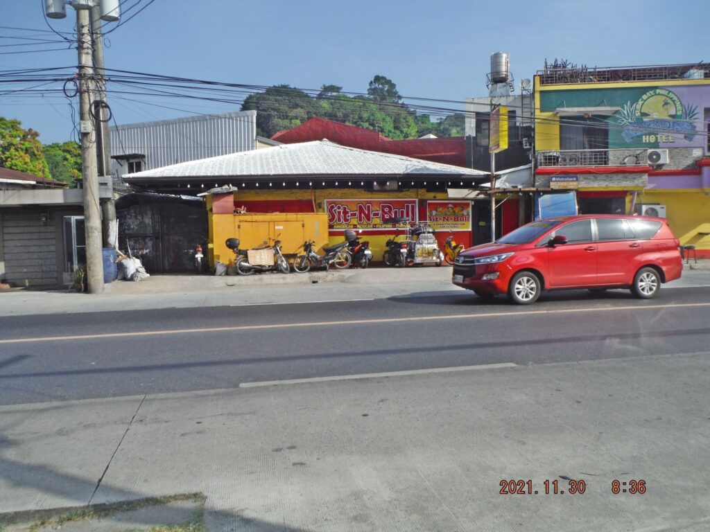
Subic Bay Area Random Shots Oct.-Dec. 2021
Zf481. 004 This is one random shot of the Subic Bay area in the Oct.-Dec. 2021 time frame. This is an important item; the Sit n Bull Restaurant in Barangay Barretto moved, it is now along the National Highway, next to the entrance of Dell Pilar Street and in the same complex where the Dryden […]
Read More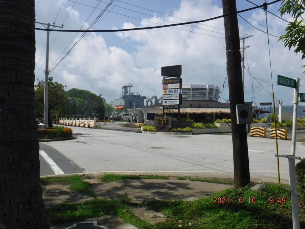
Subic Bay News as of 2021-06-10
Zf173. U.S. Navy ship in Subic Bay on the 10th of June 2021. This is the first foreign Navy ship I saw in 7 month, since Nov. 21 2020 when I returned to the Philippines. Before I left the Philippines on the 19th of Nov. 2019, MSC ships came regular to Subic Bay, even Navy […]
Read More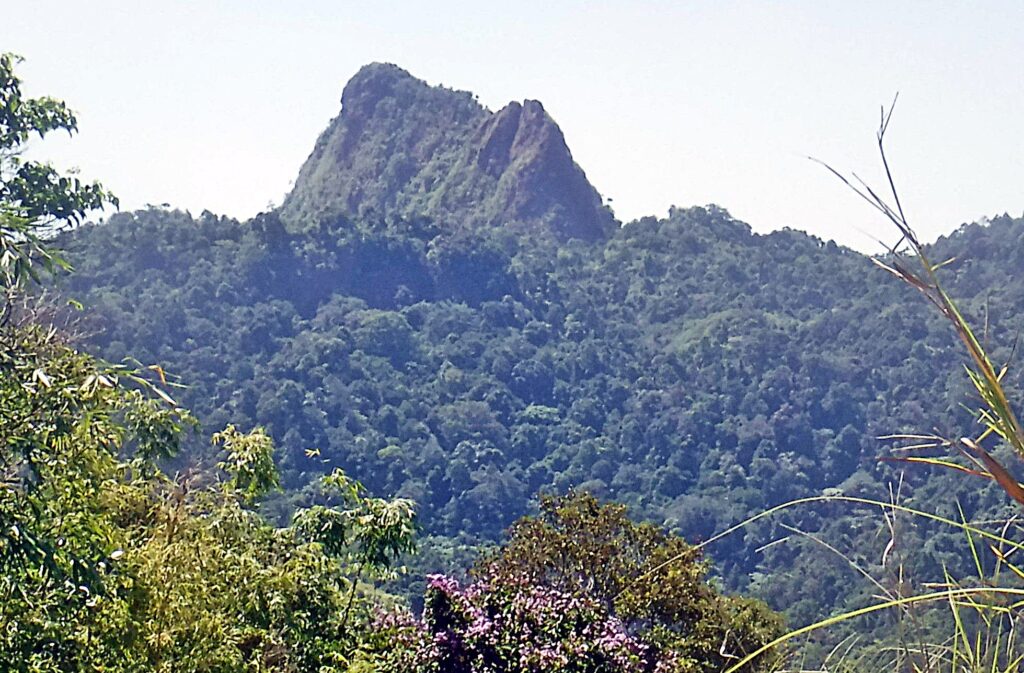
Two ex Roads to the Dizon Mine
Zf164. The Rocky, Monolith Peak or Peaks of Mount Balakibok. This peak or these peaks are prominent visible from just about anywhere in Olongapo. The Kalaklan Ridge leads to the peaks and a road and power lines to the Dizon Mine run along the ridge. The power lines are gone now and the road is […]
Read More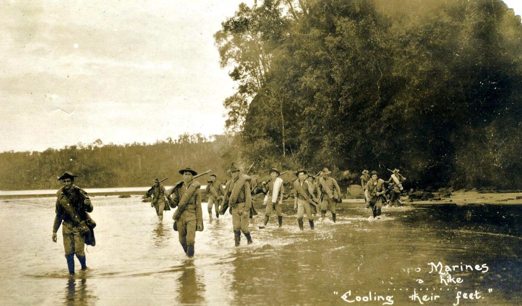
The U.S.M.C. Patrolling Subic Bay 1907 to 1911
Ze810. U.S. Marines patrolling, hiking in the Naval Reservation around the Olongapo Naval Station circa 1909. On this event wet boots are called for. This picture came from the Earl Hancock “Pete” Ellis Picture Collection in the U.S.M.C. Archives. ————————————- Early last century, during the Spanish-American War which extended into the Philippine-American War the U.S.M.C […]
Read More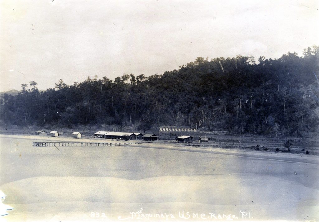
The U.S.M.C. Maquinaya Firing Range 1902 to 1910. Bo. Barretto now!
Ze788. The USMC Firing Range at Maquinaya in 1908. The river in this valley still has that Maquinaya name today but the area is now Barrio Barretto. My house, today, is near were the targets were. This picture came from the Earl Hancock “Pete” Ellis Picture Collection in the U.S.M.C. Archives. ————————————- Early last century, […]
Read More
Kalaklan Point & SBFZ Kalaklan Gate area 2019-03-14
Ze419. (-01) I start this album with 5 maps or images; this is a recent Google Earth image of the Kalaklan Point area in Olongapo and the Subic Bay Freeport Zone (SBFZ) Kalaklan Gate area. ———————————————– On this walk, the 14th of March 2019 I first took some pictures of the Kalaklan Point area in […]
Read More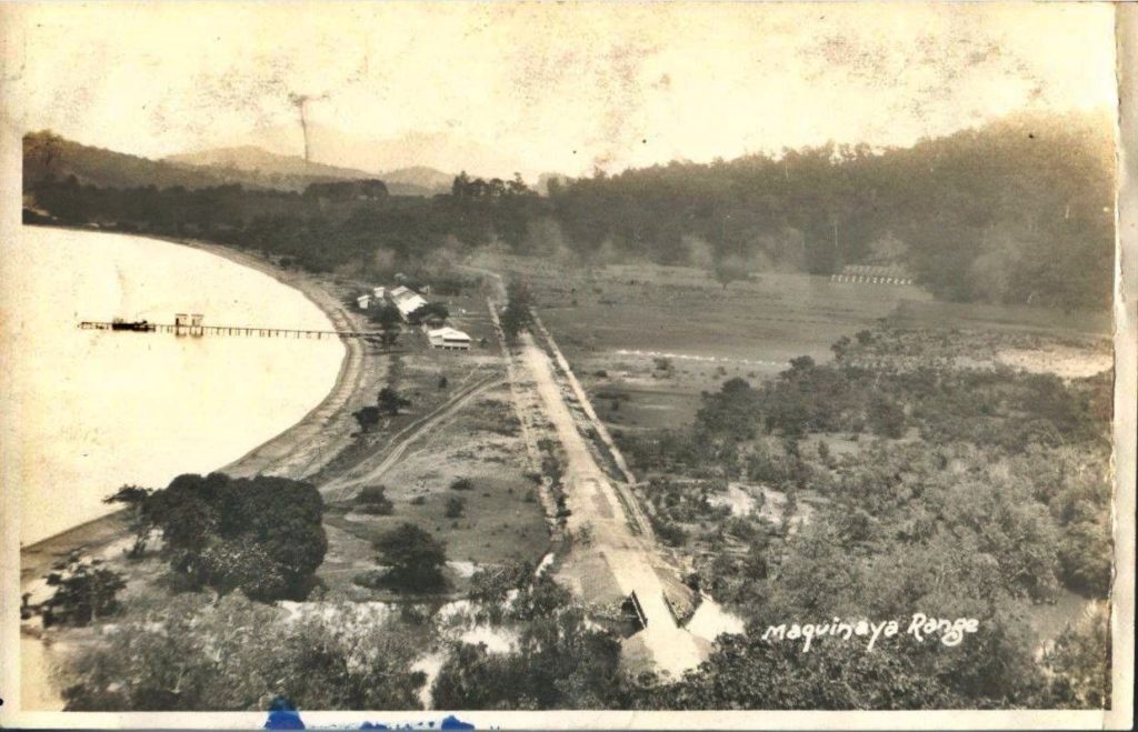
Barretto, Maquinaya, WWII
Zc728. This is a 1930 image of the Navy Rifle Range (a better description would be to call it the Marine Corps Rifle Range) located in the area called Maquinaya, This area became Barrio Barretto. The river is still called Maquinaya River. This picture was provided by my Marine friend Bert Caloud. ——————————– Barrio Barretto, […]
Read More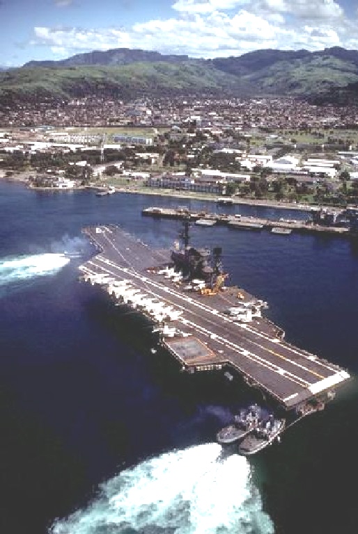
Subic Bay with CV41 after1980 from DVIC.
Zc665. ID: DNST8400333. A port quarter view of the aircraft carrier USS MIDWAY (CV 41) being maneuvered into Alava Pier by four tugs. This is a good shot into the Gordon Heights Valley. Date Shot: 14 SEP 1981 Camera Operator: PHCS STEVEN HARRIS —————————————– Page description: These pictures are about the Naval Base Subic Bay […]
Read More