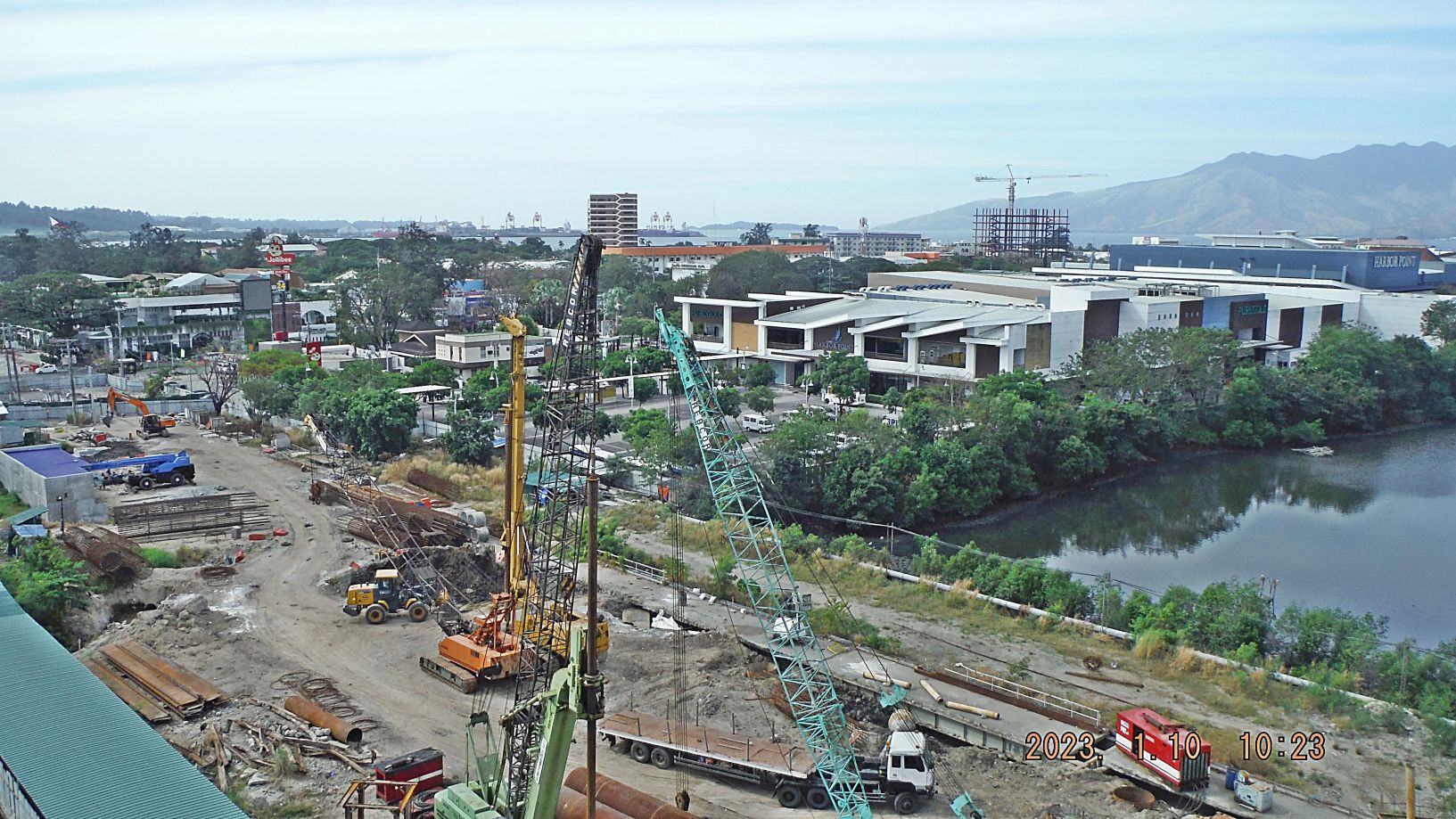
Zg345. (-018 and 019) are/ is a view of the former main gate bridge of the former Subic Bay Naval Base being replaced. Work has been going on over 3 years now. The new Chairman of the Subic Bay Metropolitan Authority (SBMA) apparently reorganized the effort and it seems that progress is being made. On picture #019 at right is the large and relative new Ayala Mall called Harbor Point. And we see the large and high Philippine Flag in front of our former Naval Base Head Quarter, now used for the same purpose by the SBMA.
————————————-
During this 1st Half of year 2923 I walked around Subic Bay and took these images. I post them now in 6 segments in various venues. The first 7 images are maps of the Subic Bay area which you may like to use to orient yourself to the location of the views. These 7 maps and all 230 images are posted in this Flickr album in high resolution, click here:
For this and the other venues I chose these fewer pictures and they are posted in low resolution only!!! The 2nd set of numbers on the picture descriptions: “000 to 230” refer to the numbers in the Flickr album.
—————————————–
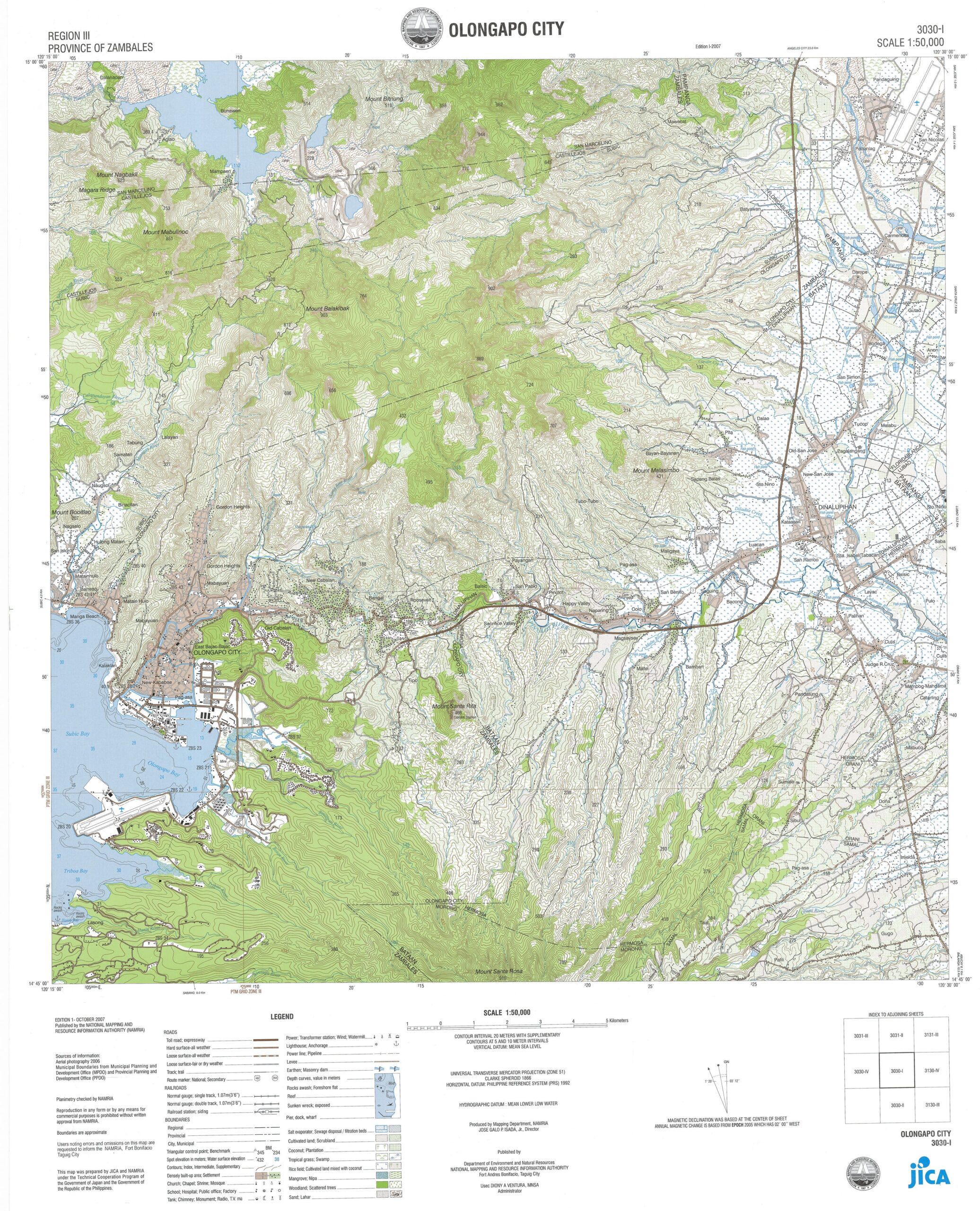
Zg333. (-000) is a topographic map of the greater Olongapo area.
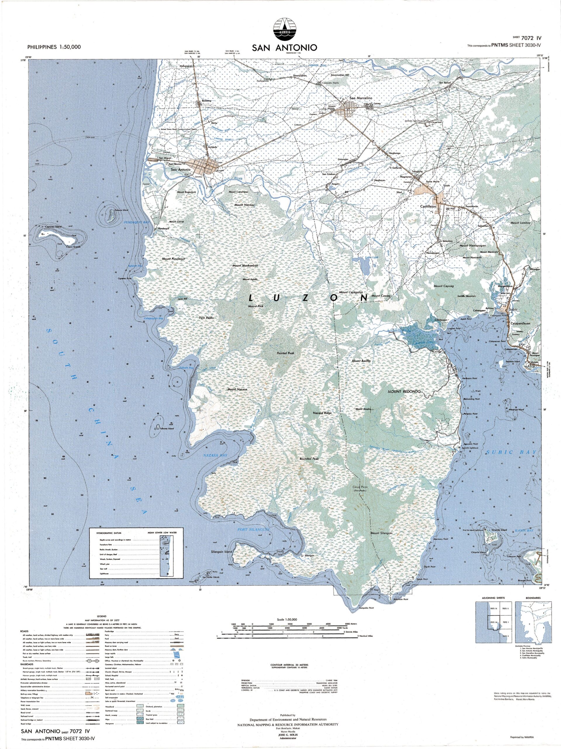
Zg334. (-001) is a topographic map of the greater bay area of Subic Bay.
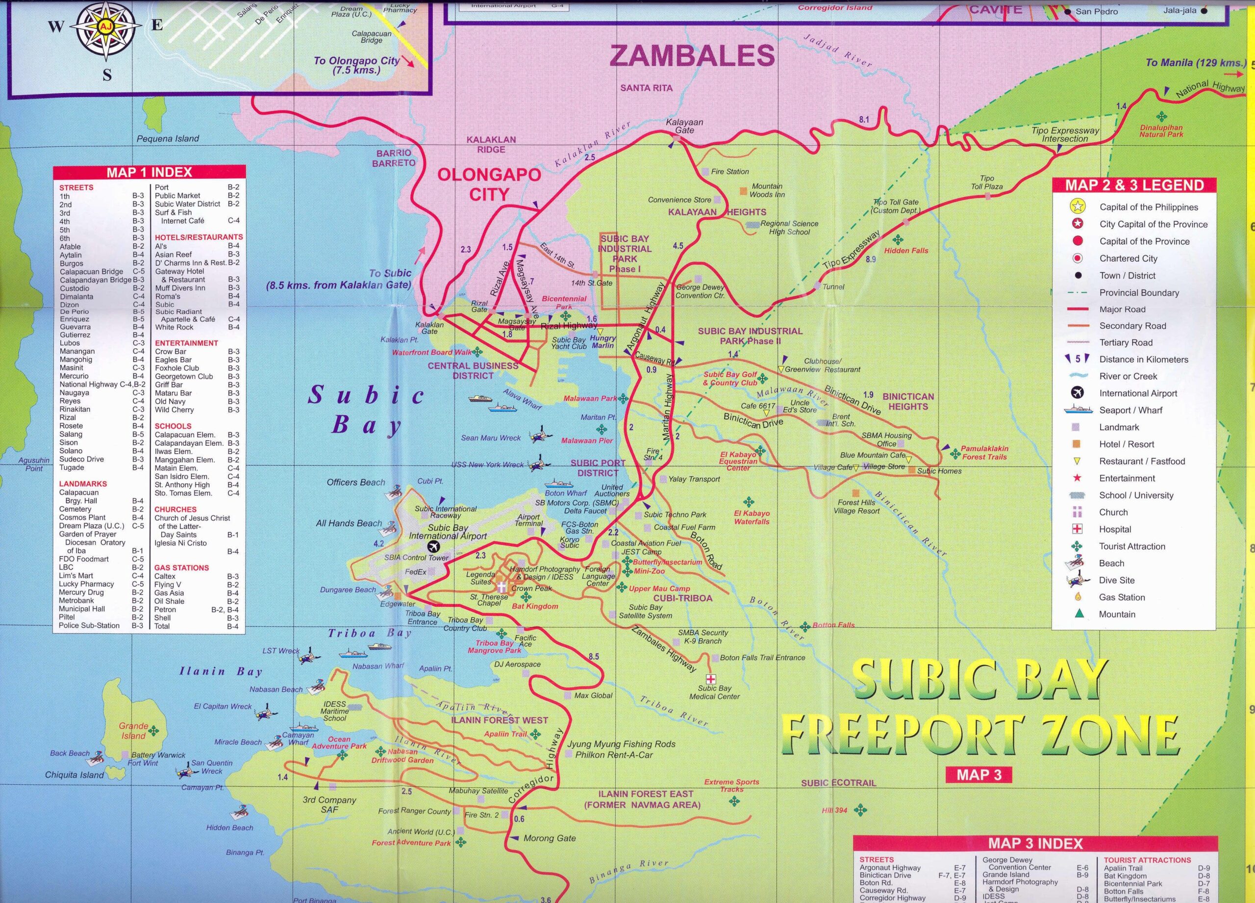
Zg335. (-002) is an EZ map of the Subic Bay Freeport Zone area (SBFZ) , the former Subic Bay Naval Base.
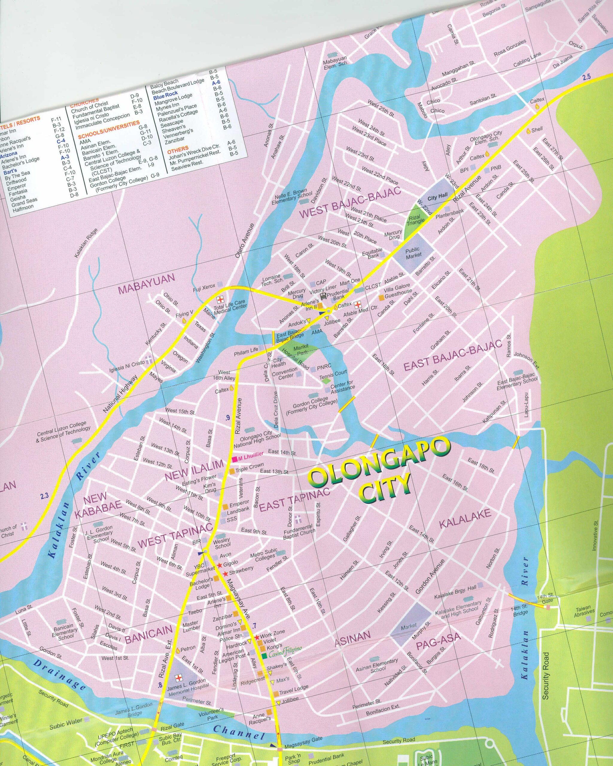
Zg336. (-003) is an EZ map of Olongapo City.
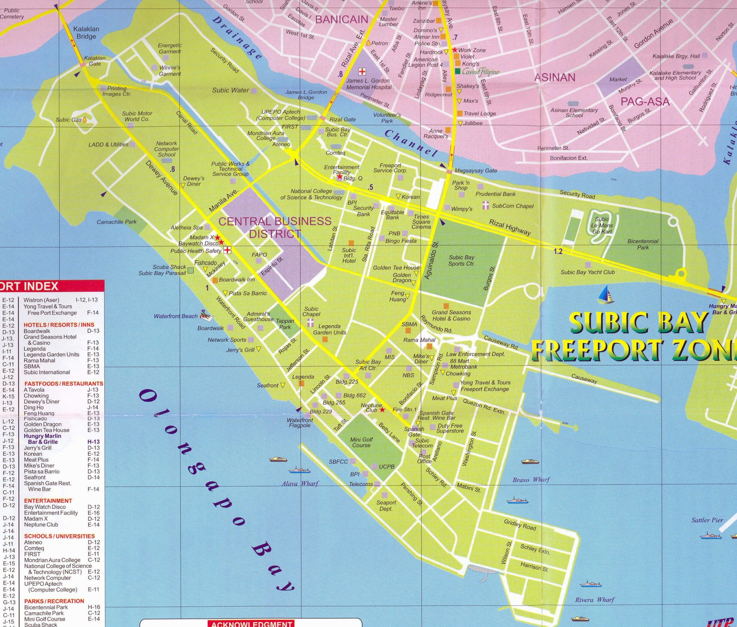
Zg337. (-004) is an EZ map of the Central Business District in the Subic Bay Freeport Zone area (SBFZ), the former Subic Bay Naval Base.
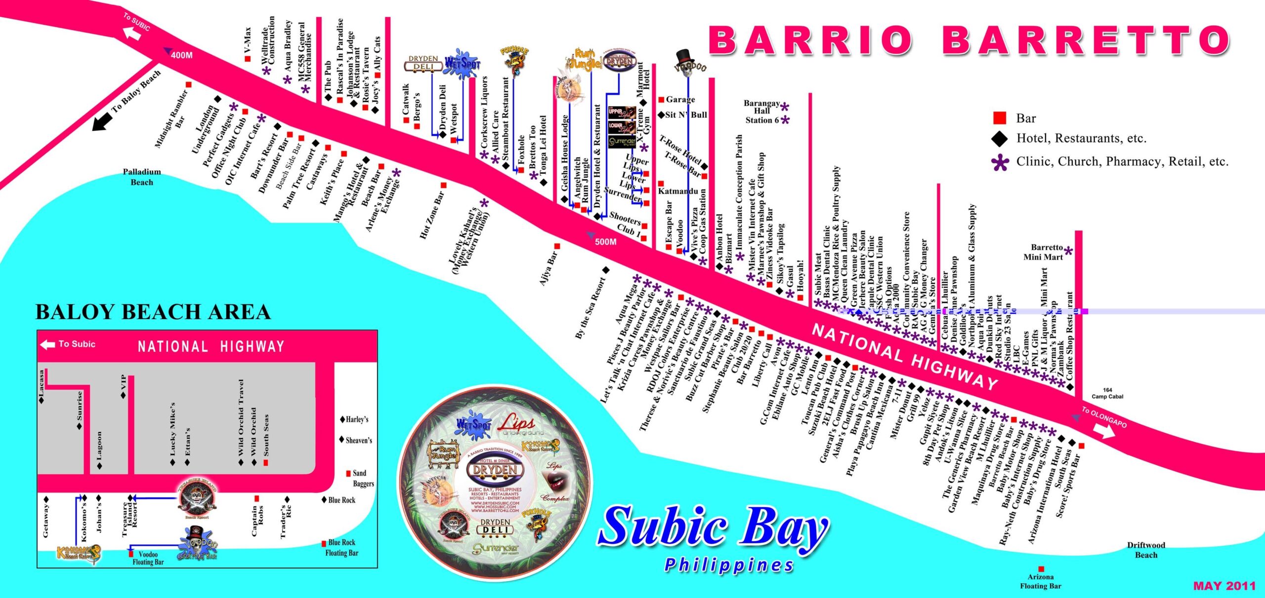
Zg338. (-005) is a May 2011 Barrio Barretto Tourist Map from a web page, I forget which one.
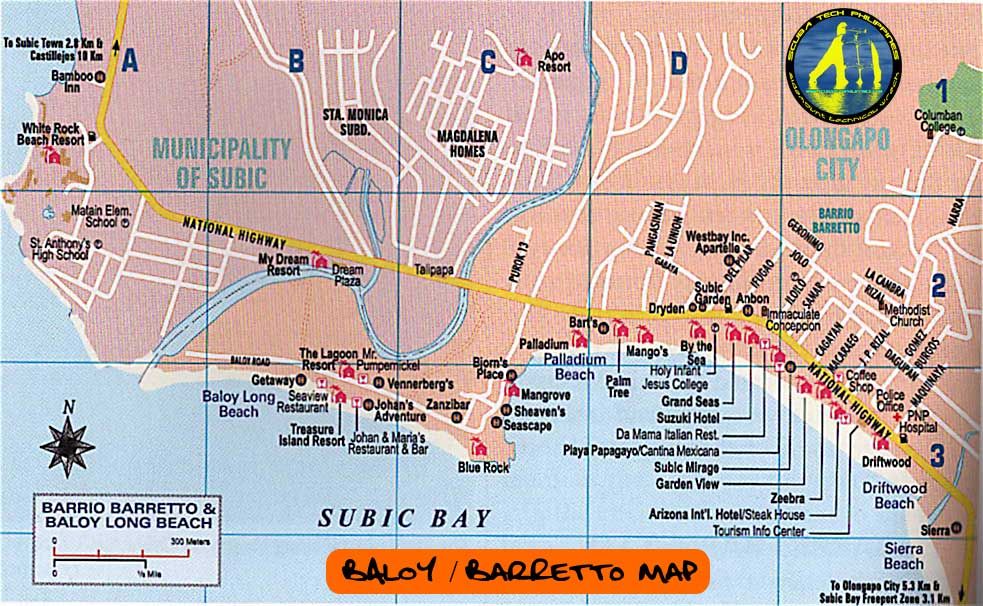
Zg339. (-006) is a Baloy Long Beach Map (Part of Bo. Barretto) from a web page, I forget which one; date unknown.
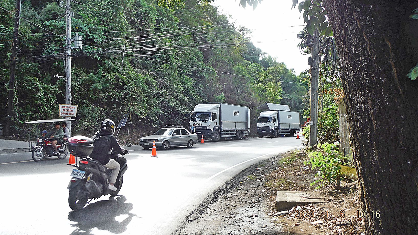
Zg340. (-007) this is at the entrance to Barretto, coming from Olongapo; left is Abra Street. A Philippine Navy truck stalled and another arrived and the cargo was shifted. They are most likely on their way to the Philippine Navy Training Center in San Antonio, Zambales, our former San Miguel Navy Communication Station.
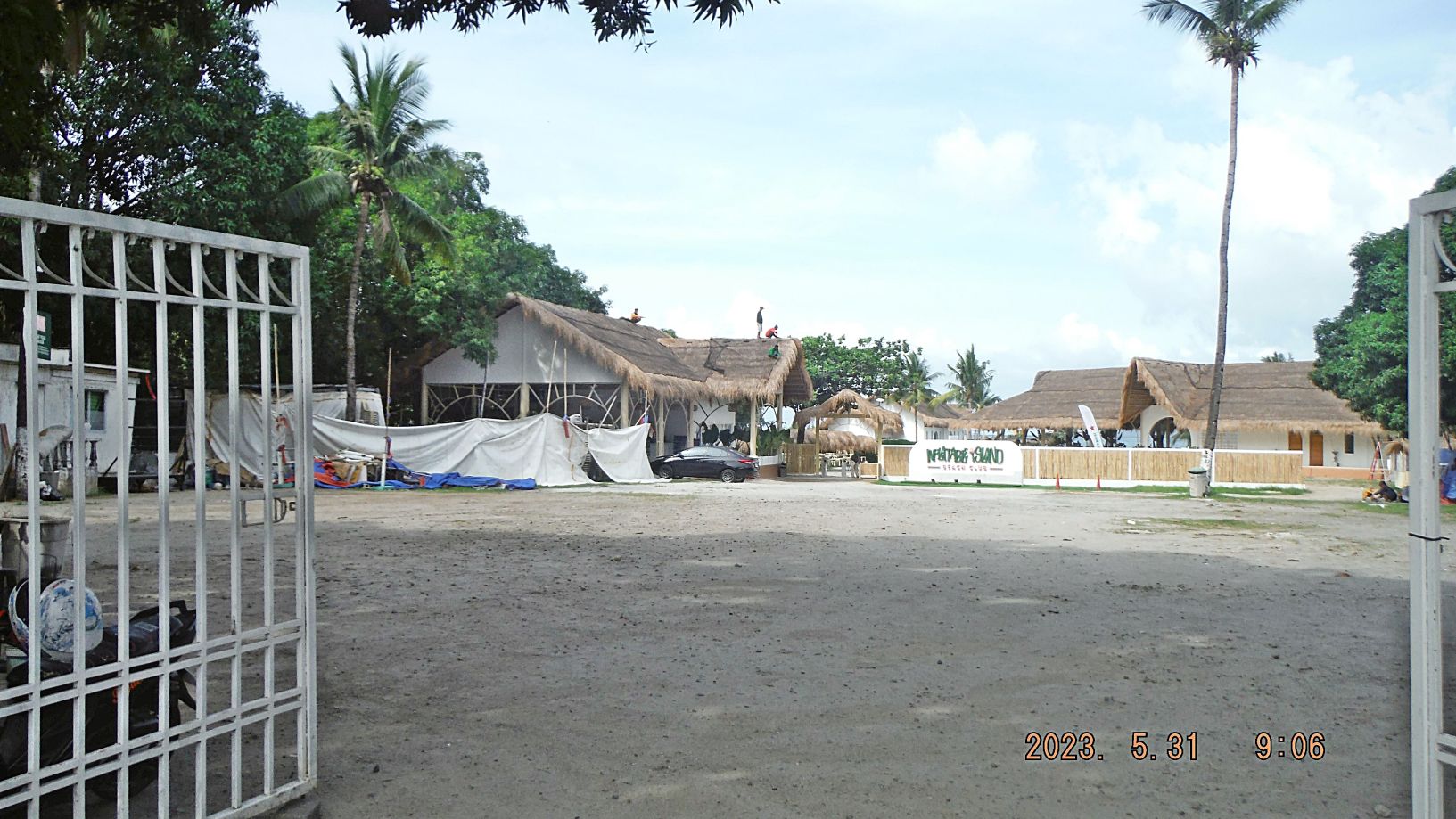
Zg341. (-008) this is going to be a floating bar at Baloy Beach; it was the only one this year. It wrecked after this picture, was rebuilt, opened but was closed soon because of the coming rainy season or perhaps other reasons.
Zg342. (-009) we are at the mouth of the Matain River flowing into Subic Bay at low tide. The concrete dolphins are the Dizon Port where copper/gold ore was loaded onto ships when the Dizon Mine was still operating. It closed in 1996 or 97 due to rain causing landslide in the open pit mine.
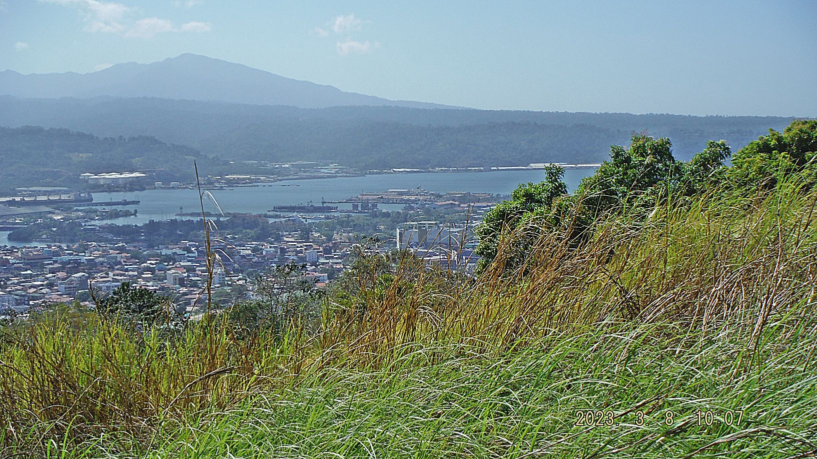
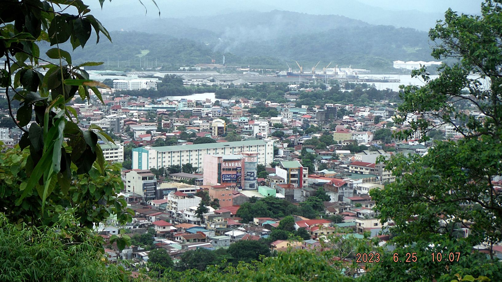
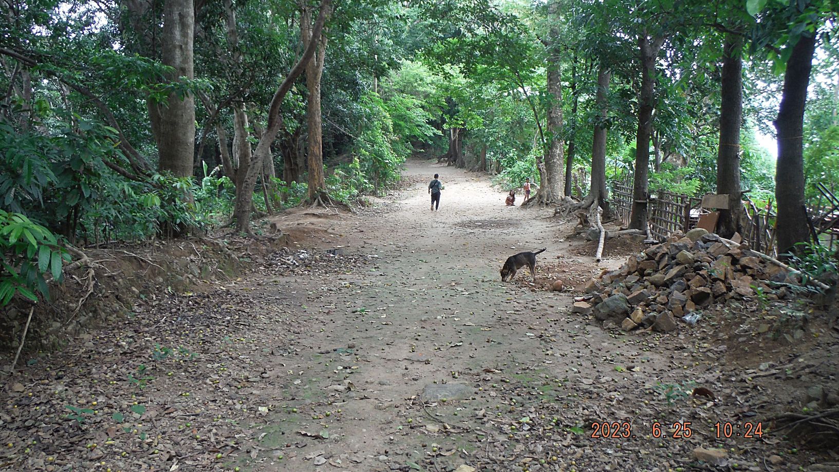
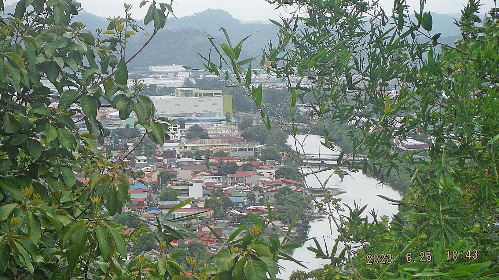
Zg343. (-010 to 017) are views/ is a view of the bay of Subic Bay, we see the former Hanjin Shipyard across the bay, the peaks of the Redondo Peninsular forming the west boundary of the bay, the north end of the bay, the valley from where Barrio Barretto which is directly under us, to the Municipality of Subic Town proper and the barrios in-between. The views were shot on the Kalaklan Ridge that separates Barrio Barretto from Olongapo City. It has a nice trail on top and some people live here. Many communication towers are located here on the ridge.
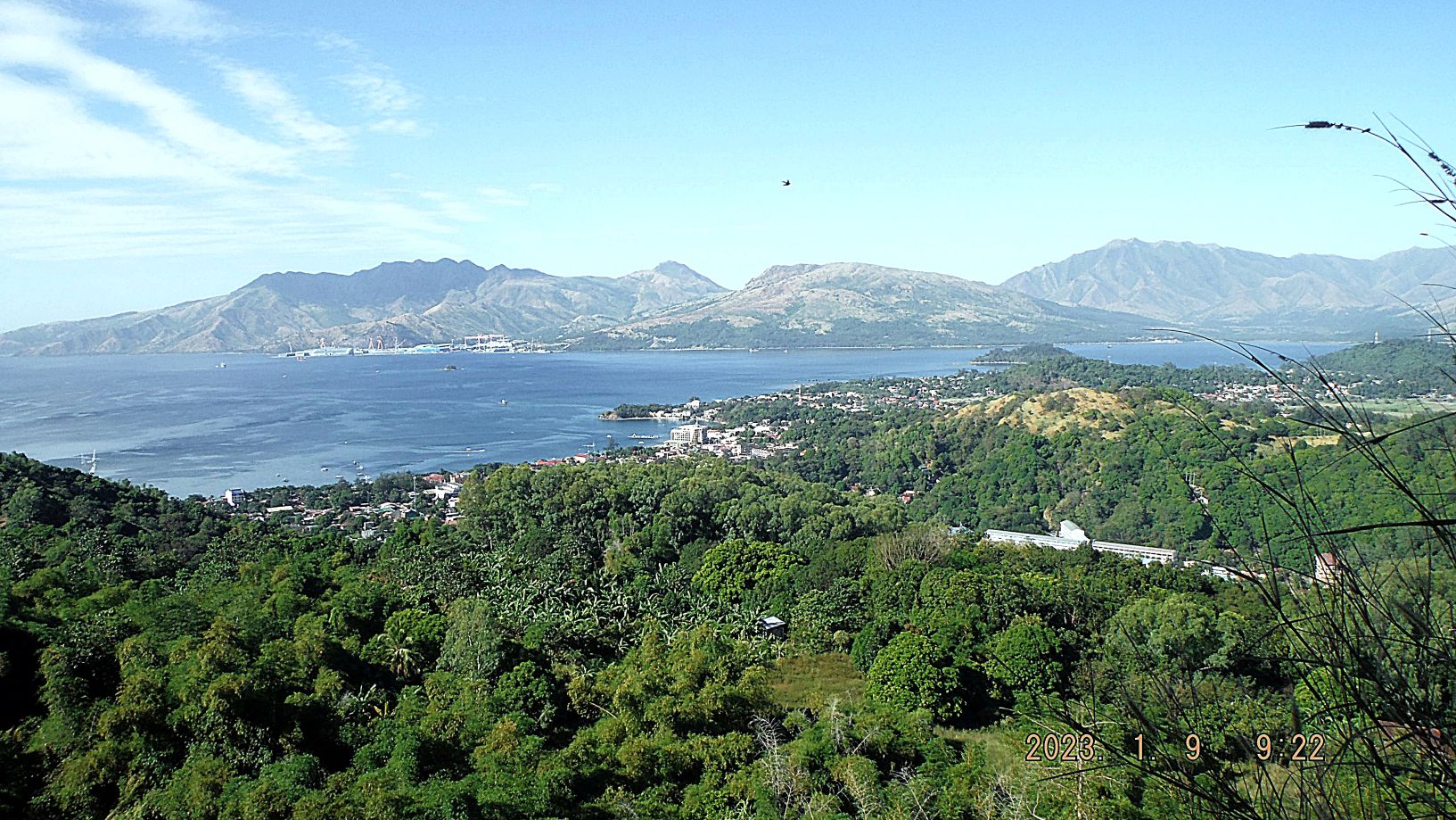
Zg344. (-010 to 017) are views/ is a view of the bay of Subic Bay, we see the former Hanjin Shipyard across the bay, the peaks of the Redondo Peninsular forming the west boundary of the bay, the north end of the bay, the valley from where Barrio Barretto which is directly under us, to the Municipality of Subic Town proper and the barrios in-between. The views were shot on the Kalaklan Ridge that separates Barrio Barretto from Olongapo City. It has a nice trail on top and some people live here. Many communication towers are located here on the ridge.
Zg345. (-018 and 019) are/ is a view of the former main gate bridge of the former Subic Bay Naval Base being replaced. Work has been going on over 3 years now. The new Chairman of the Subic Bay Metropolitan Authority (SBMA) apparently reorganized the effort and it seems that progress is being made. On picture #019 at right is the large and relative new Ayala Mall called Harbor Point. And we see the large and high Philippine Flag in front of our former Naval Base Head Quarter, now used for the same purpose by the SBMA.
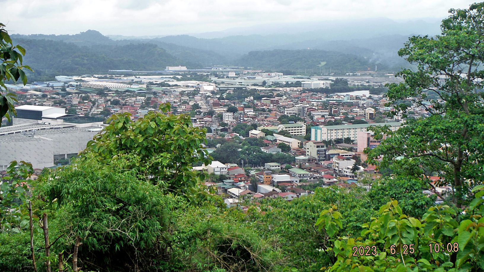
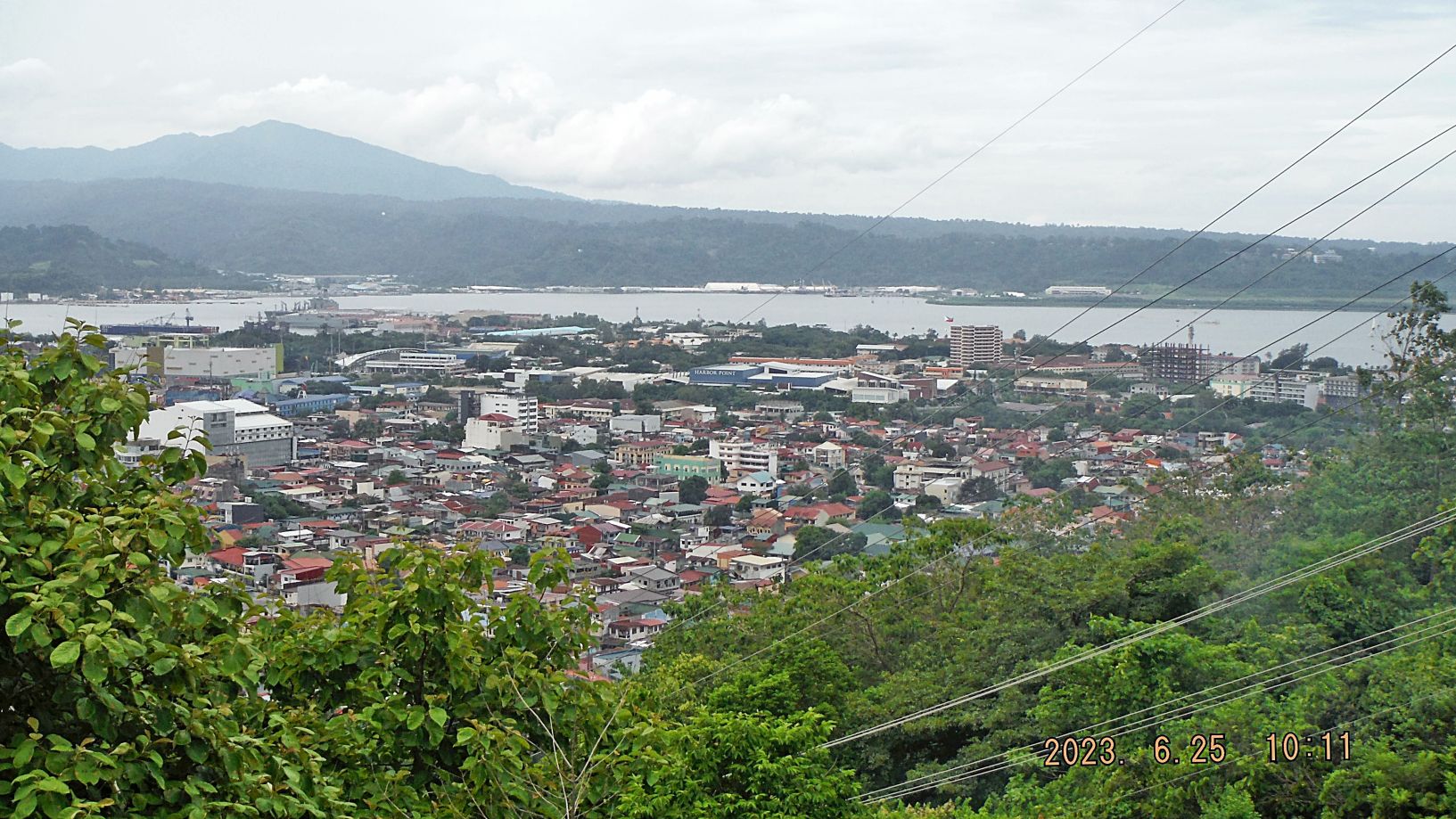
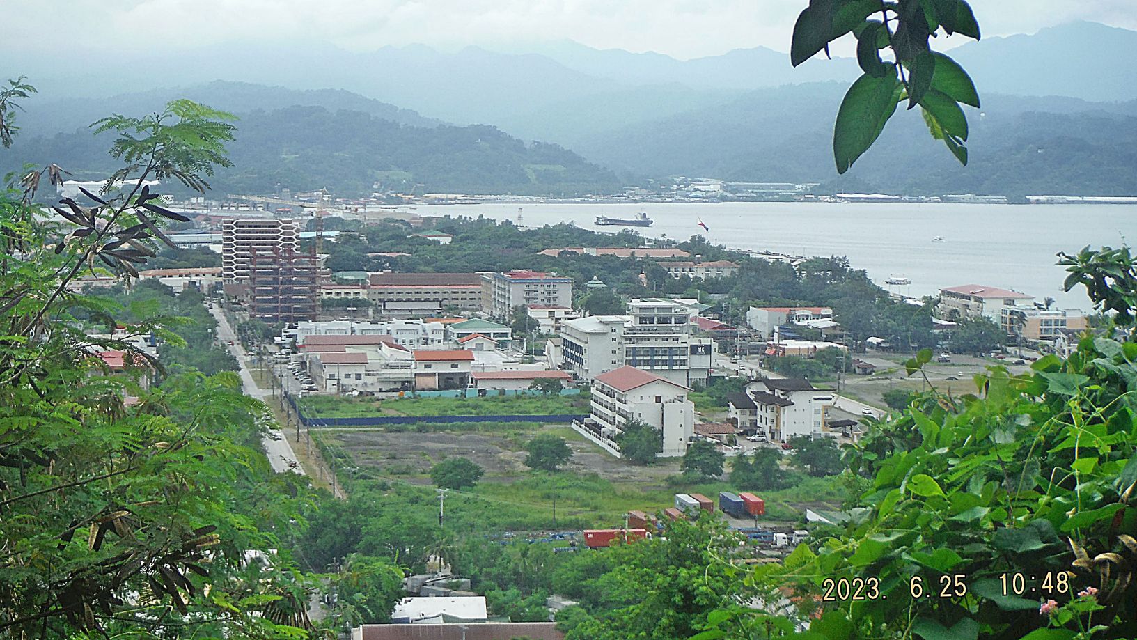
Zg346. (-020 to 034) are views/ is a view of Olongapo City, Subic Bay Freeport Zone area (SBFZ), the former Subic Bay Naval Base and the bay of Subic Bay. The 7 maps in front of the album may be helpful to you, to orient yourself.
Zg347. (-020 to 034) are views/ is a view of Olongapo City, Subic Bay Freeport Zone area (SBFZ), the former Subic Bay Naval Base and the bay of Subic Bay. The 7 maps in front of the album may be helpful to you, to orient yourself.
Zg348. (-020 to 034) are views/ is a view of Olongapo City, Subic Bay Freeport Zone area (SBFZ), the former Subic Bay Naval Base and the bay of Subic Bay. The 7 maps in front of the album may be helpful to you, to orient yourself.
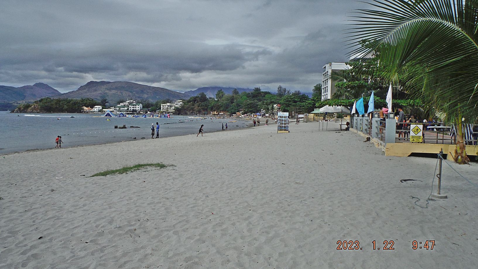
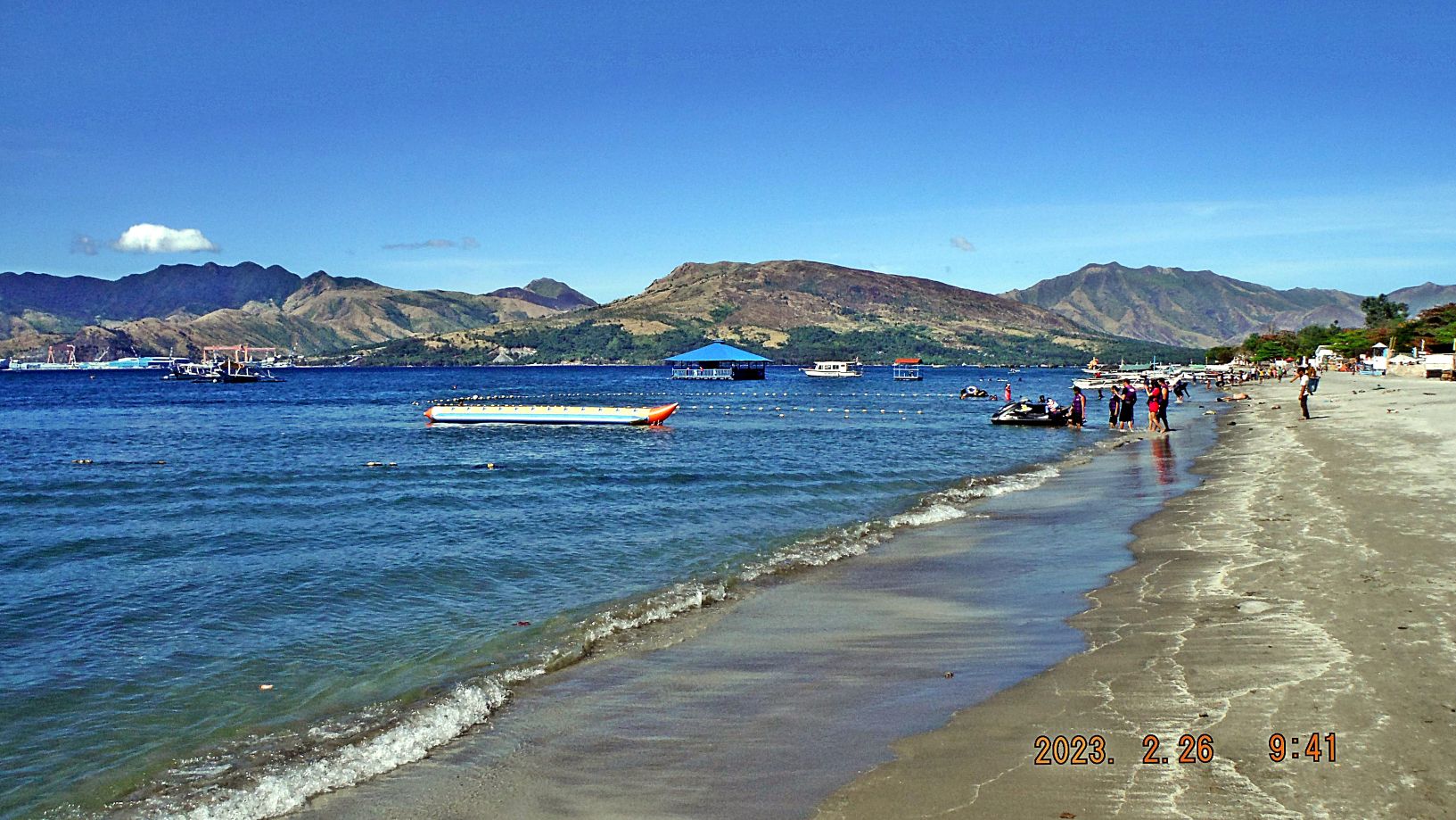
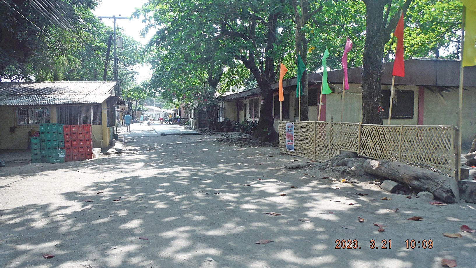
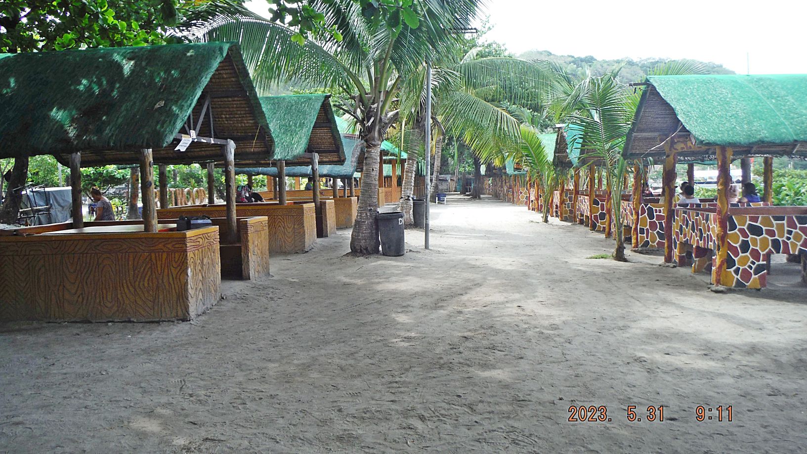
Zg349. (-035 to 039) are views/ is a view of Barrio Barretto Beach (officially now called: Barangay Barretto). It is a nice day and it is low tide, we see the remnants of the Navy cargo pier of 1945. The Barretto area in 1945 had become a Naval Supply Depot perhaps almost to 1959. Before that it was a naval rifle range and military training area, called Maquinaya after the river in this valley. It seems the area was turned over to the Philippine Authority, perhaps in 1959. The Zambales Governor had the name Barretto and hence the new name for this area. It then became a recreational area for old Petty Officers like me and now it is an international Tourist spot.
2nd of 6 Segments——
I chose 12 images out of the 2nd segment to be presented here. All pictures up to this 2nd segment are available in these 2 venues:
Uploaded into a Flickr album, in high resolution, over 220 images in 6 segments, click here:
Uploaded into my Facebook as an album, click here:
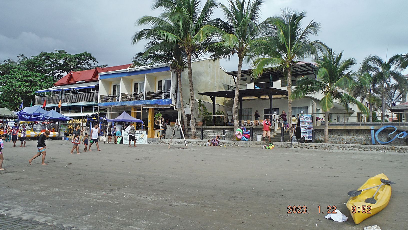
Zg350. (-040) the middle building is the Mangos Resort in Barrio Barretto, the right structure is a new hotel; “iCove”. The owner of the new hotel and property owner is the nice person, we Vets call: “Ike” who is also the owner of the Arlene money changer and other hotels in Olongapo. He had rented this lot to a Submariner who had run the Islander Bar here at this spot for years.
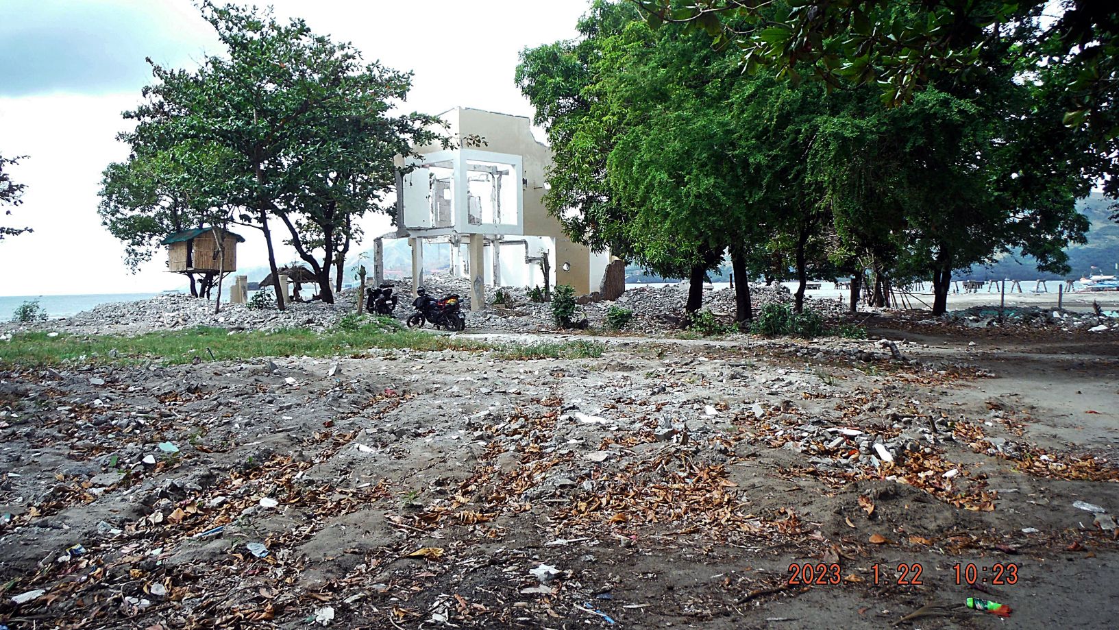
Zg351. (-045 to 047) are pictures of Baloy Long Beach in Barrio Barretto, which belongs to Olongapo City and Subic Bay. The last two pictures are of the NW end of Baloy Beach. A new investor bought the rights to develop here, cleared all the people out, and demolished all the buildings. The 2 story building was the last holdout, it had a sign posted and written on it the entire city permits for his house but it did not help!
Zg352. (-048) is a nice picture of the whole length of the Barrio Barretto Beach from a restaurant, hotel, called Harleys which is located at the entrance road to Baloy Beach. It is run by a Brit and many International tourists like to hang out here with this nice view!
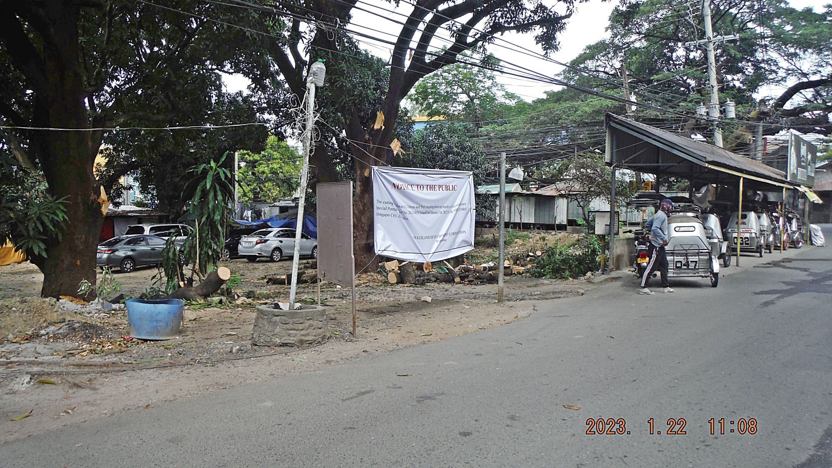
Zg353. (-049 and 050) are pictures of the entrance to Baloy Beach; an area next to the entrance road has been cleared for a development. There were big trees but they got cut. Rumor has it; a McDonald is going to rise here.
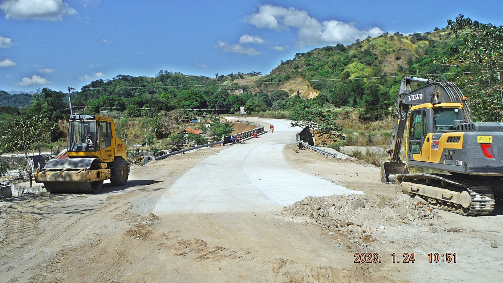
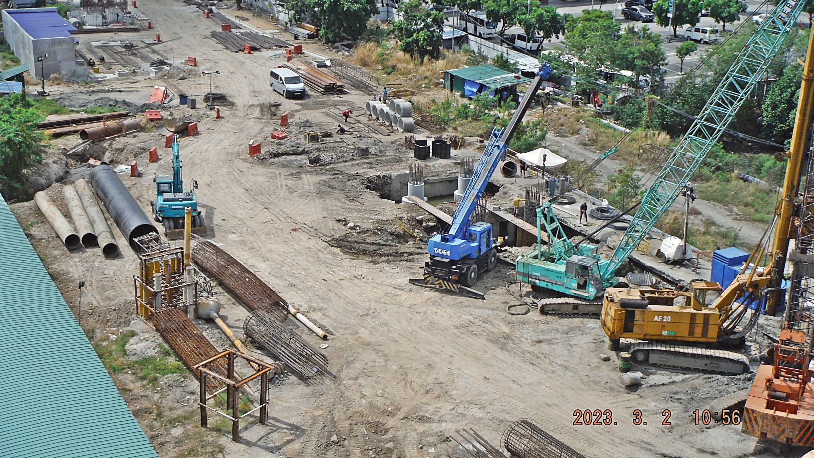
Zg354. (-051 to 052) are pictures of a bridge over the Matain River and a road to it from Subic Town. It is located about 4 km up-river from the National Highway, about the area of Baloy Beach. There is road construction going on; on this side of the bridge proclaiming to be a By-Pass road around Barretto.
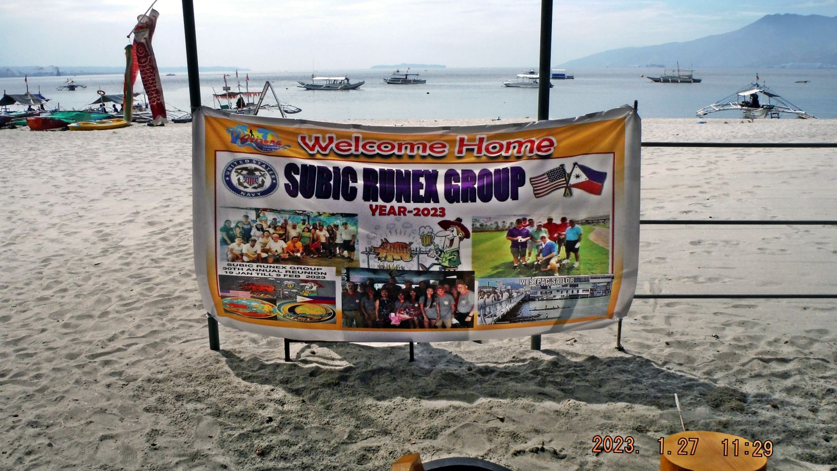
Zg355. (-053) is a sign of the Subic Runex Group gathered here at the Arizona Hotel, Barretto, Olongapo City for their annual meeting. They said most of them stayed about a week. I never heard of them or could find them in the www. Most of them are US Vets. The Arizona Hotel was our sailor’s great hang-out “Uncle Bob’s”.
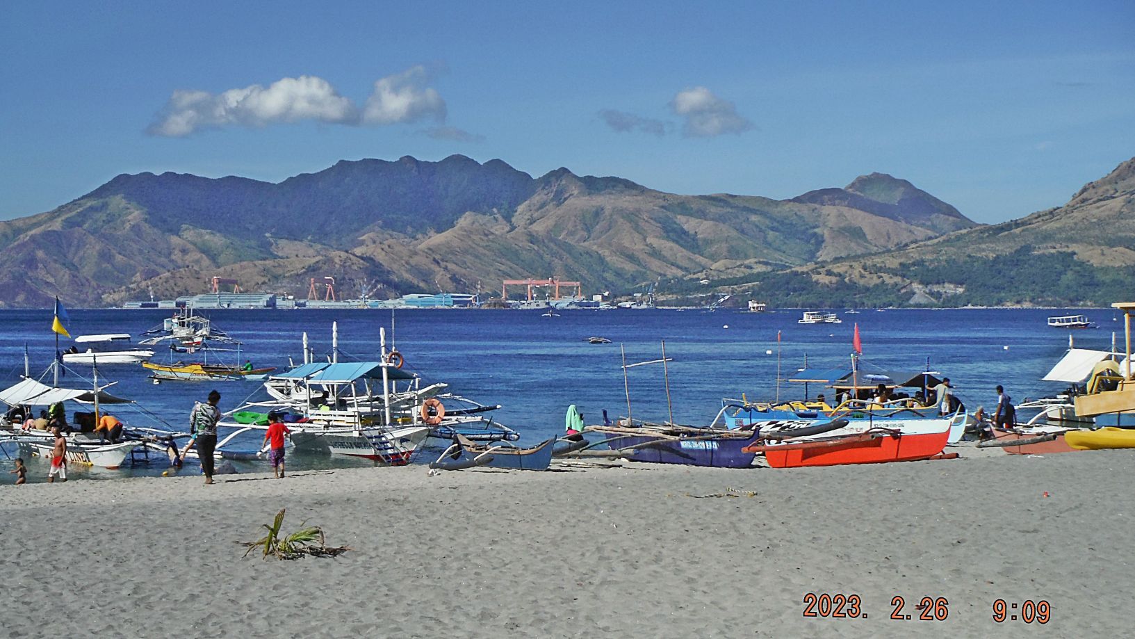
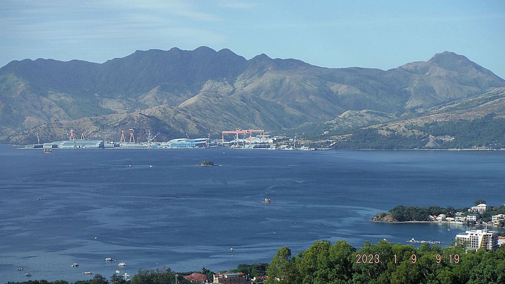
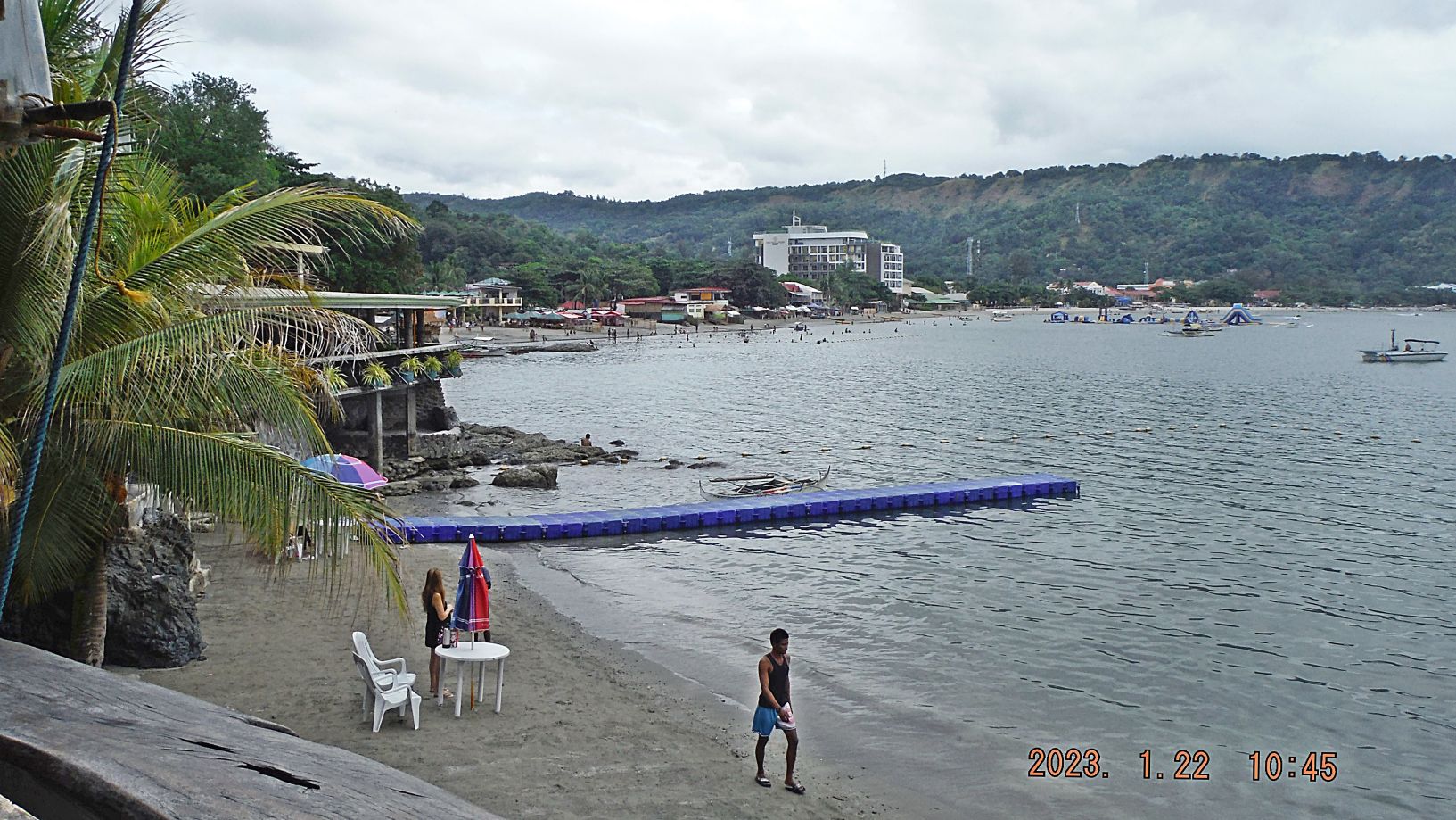
Zg356. (-055 to 060) are shots of the Barrio Barretto Beach in Olongapo and Subic Bay. We are catching views of the Redondo Peninsular, the former Hanjin Shipyard, which is now a Philippine Naval Base and the rest is managed by US investors. We see Grande Island which used to be the U.S. Army Fort Wint and served other masters before and after. It is now a resort.
Zg357. (-061 to 071) are pictures of the Baloy Long Beach, part of Barrio Barretto and belongs to Olongapo City and Subic Bay. All the views here, I described before, so I leave it at that. On my walks it draws me again and again to the beaches of Subic Bay. I enjoy this beautiful bay which is most of the time calm and sunny and full of life. I enjoy the view and sometime I sit down at a place and drink a soda or a beer. Then I tell myself; “ Karl, you had a great life as a Sailor”!
Zg358. (-054) works is continuing to replace the former Subic Bay Naval Base Main Gate Bridge. Left is the Remy Sports Field, much has changed there. These bridge shot are shot from the relative new 5th floor of the 7 floor SM Mall just on the Olongapo side of the bridge.
Zg359. (-074 and 075) are views of the former Subic Naval Station (NAVSTA), the former Ship Repair Facility (SRF), the Naval Supply Depot (NSD) and the Boton Pier area which are now, all now part of the Subic Bay Freeport Zone (SNFZ). I see a small and medium size floating dry dock, new big fuel tanks, in the Boton Valley are new big light industry manufacturing buildings etc. I also see the relative new SM Mall Olongapo City Down-Town on Magsaysay Drive just across the base bridge.
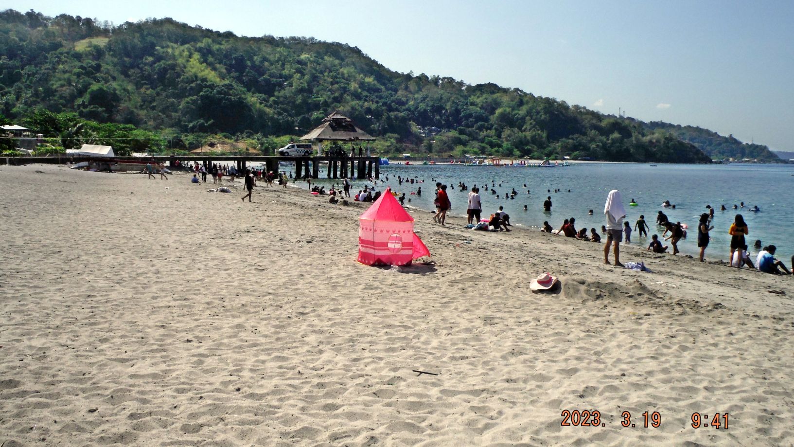
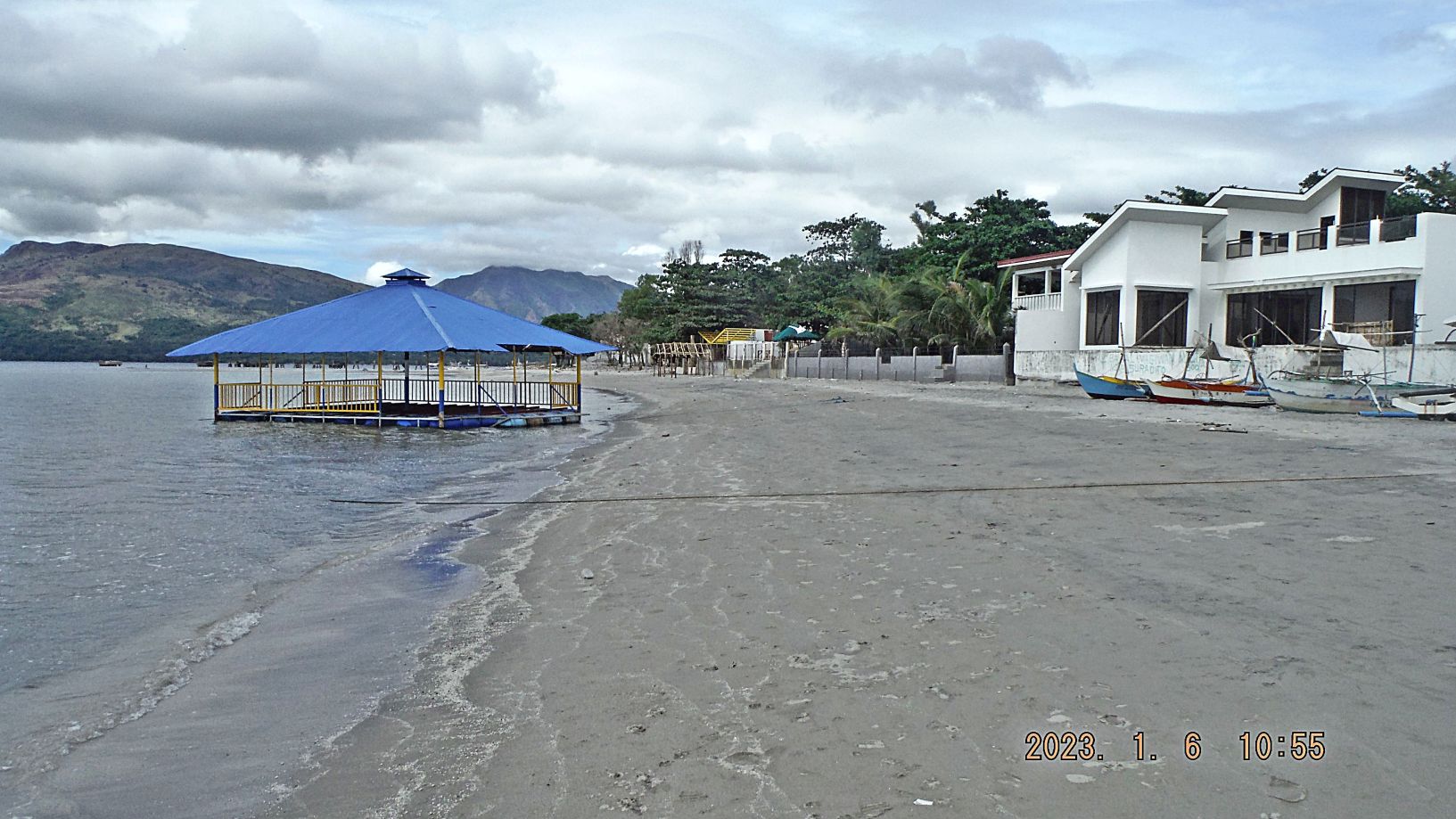
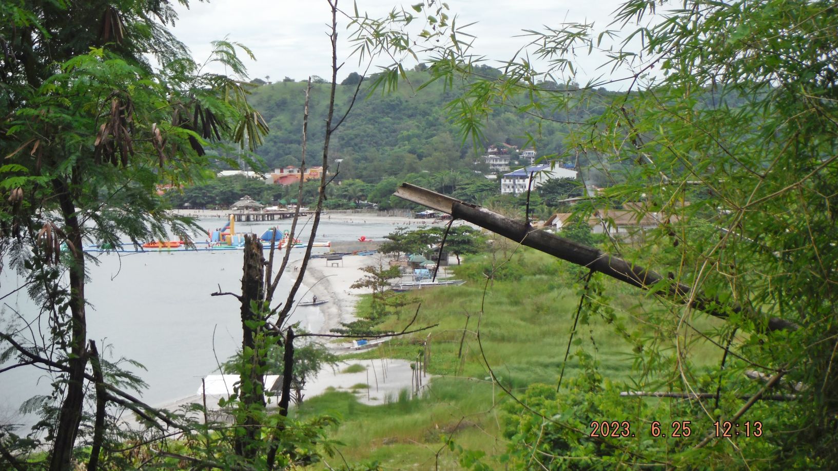
Zg360. (-076) This is Barrio Barretto’s public beach, called Driftwood Beach, on weekends it is busy now since that virus from Red China is almost gone. Further down by the mouth of the Maquinaya River is a floating island resort.
Zg361. (-079) this is a view of the Baloy Beach Road it is almost completely concreted.
3rd of 6 Segments——
I chose 10 images out of the 3rd segment (32 images) to be presented here. All pictures up to this 3rd segment are available in these 2 venues, about 120 pics now:
Uploaded into a Flickr album, in high resolution, over 220 images in 6 segments, click here:
Uploaded into my Facebook as an album, click here:
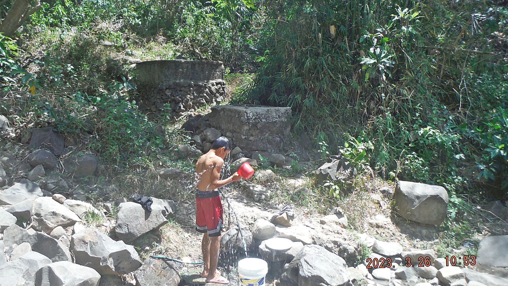
Zg362. (-086) are views of Olongapo, Subic Bay and SBFZ from the Kalaklan Ridge above Gordon Heights in Olongapo. Two shots are of a water spring and a tree scene with a lot of leaves on the ground; this is near from where I shot the pictures. (That is the way we showered in Viet Nam and even today at my home, I shower that way in the back of my house)
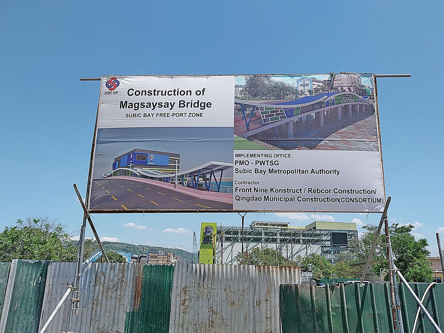
Zg363. (-087) this picture is from my friend Carlito, a Brown Shoe. The new Chairman of the Subic Bay Metropolitan Authority (SBMA) is pushing for the early completion of the Magsaysay Bridge and he put up this sign.
Zg364. (-088 and 089) this is the sign and the road being built from the Subic Town by-pass road to the new bridge over the Matain River and it will be part of the Barretto by-pass road. The hill in front is the Kalaklan Ridge that separates Olongapo from Barretto and Subic Town. The 2nd picture is a look back from the spot where the first picture was shot and it shows the area inland from the Santa Monica Subdivision.
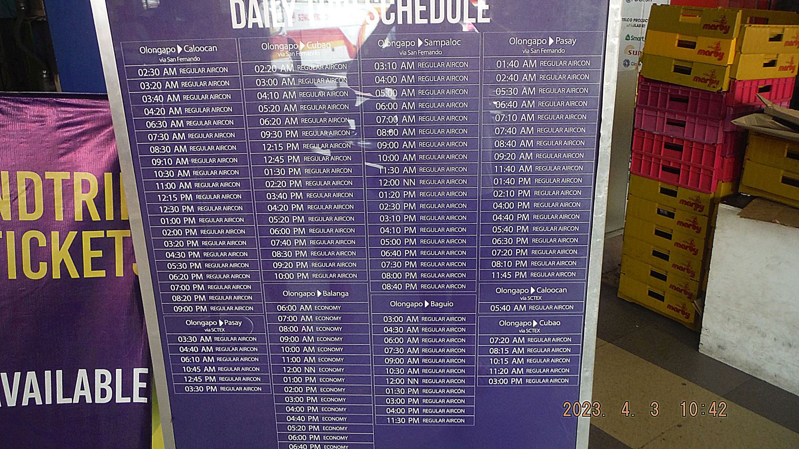
Zg365. (-096 and 097) are images of the Victory Liner bus schedule as posted in the Victory Liner Bus Terminal in Olongapo. We can say the bus traffic is back to normal as it seems the virus from Red China is almost gone.
Zg366. (-098 to 104) are images of the bay of Subic Bay, the new Container Port at Cubi Point, Naval War and logistic ships anchored in Subic Bay, views of Barrio Barretto. All these pictures were shot from the Kalaklan Ridge that separates Olongapo from Barrio Barretto and Subic Town. One shot is of the top of the ridge where I took the images.
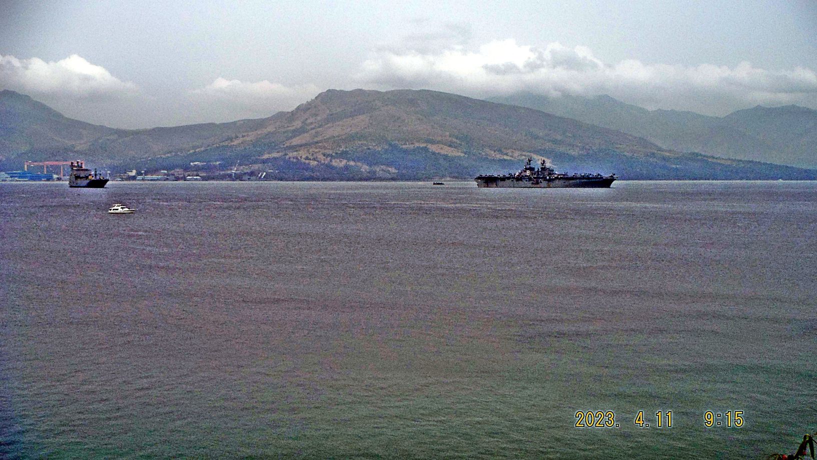
Zg367. (-105 to 110) are images of the Barrio Barretto Public Beach called “Driftwood” or are shots of the bay of Subic Bay and the Driftwood Beach, beaches left and right of it. It must be a Sunday; busses have brought many Barretto Beach visitors. We see the entrance of Subic Bay, Grande Island which is guarding it and a few Naval Amphibious Transport Vessels.
Zg368. (-105 to 110) are images of the Barrio Barretto Public Beach called “Driftwood” or are shots of the bay of Subic Bay and the Driftwood Beach, beaches left and right of it. It must be a Sunday; busses have brought many Barretto Beach visitors. We see the entrance of Subic Bay, Grande Island which is guarding it and a few Naval Amphibious Transport Vessels.
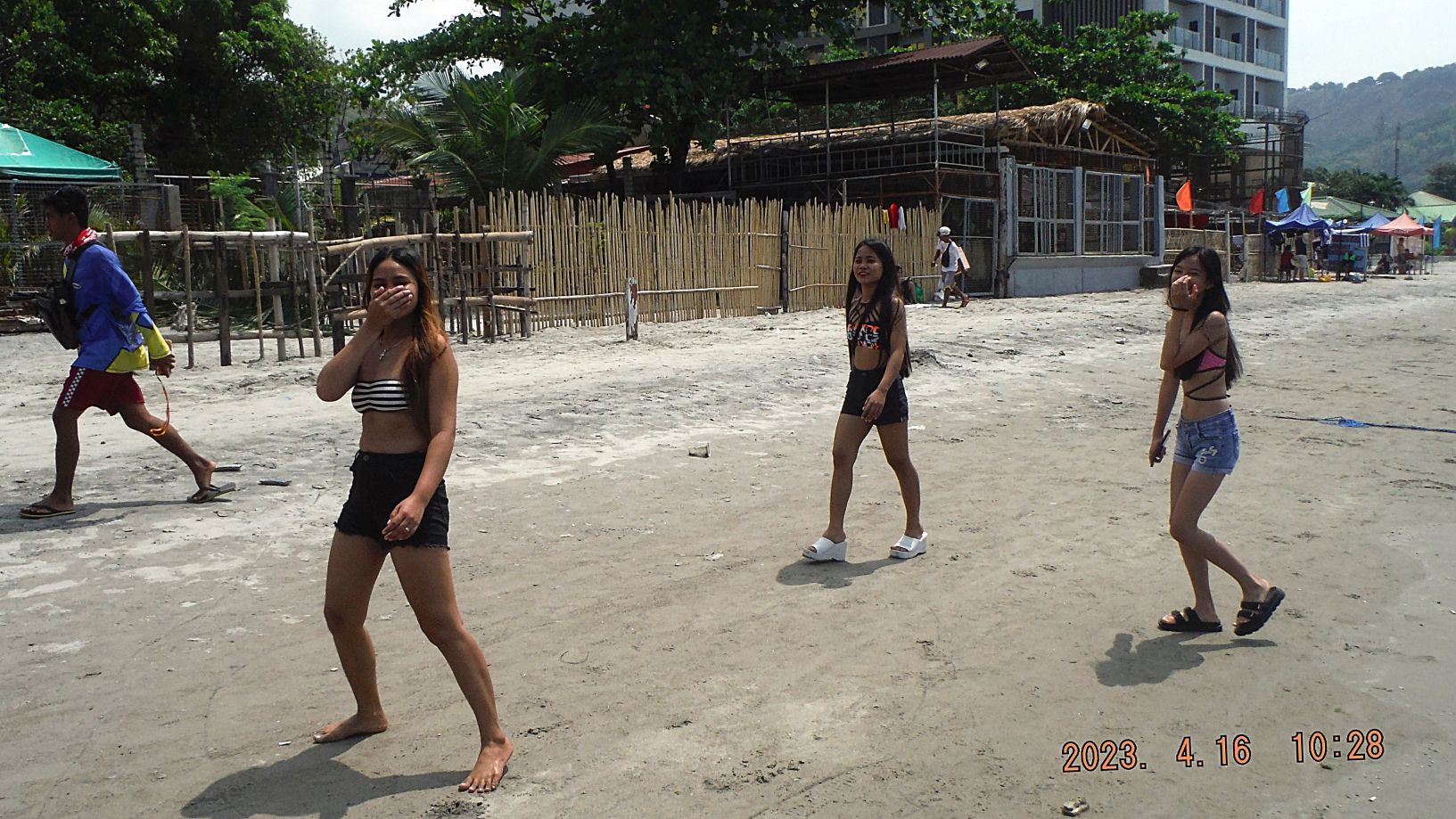
Zg369. (-111 to 117) are images of the Barrio Barretto Beach which is part of Olongapo and Subic Bay. Yes, in the Philippines are still pretty young women (3 pictures). We see a lot of beach and bay activities on this sunny weekend in Subic Bay.
Zg370. (-111 to 117) are images of the Barrio Barretto Beach which is part of Olongapo and Subic Bay. Yes, in the Philippines are still pretty young women (3 pictures). We see a lot of beach and bay activities on this sunny weekend in Subic Bay.
Zg371. (-118 to 121) are images of the Baloy Long Beach which is part of Olongapo and Subic Bay. We see Grande Island, Castle Island and one Naval Amphibious Transport Vessel. Three shots were shot at the NW end of Baloy Beach, at the mouth of the Matain River and the area that used to be the Dizon Port for the Dizon Mine behind the Olongapo Mountains. Also at this end a large area was cleared of people and buildings for a new development. This is the last independent business before the cleared area for a new development and was recently renovated.
4th Segment——
I chose 12 images out of the 4th segment (40 images) to be presented here. All pictures up to this 4th segment are available in these 2 venues, about 160 pics now:
Uploaded into a Flickr album, in high resolution, over 220 images in 6 segments, click here:
Uploaded into my Facebook as an album, click here:
Zg372. (-125) is our relative new hospital at the south end of Barrio Barretto, which went broke, is nearing completion after a complete renovation and adding one more storey under new ownership and management. We Vets hope they will engage TRICARE and get an agreement for it to be accepted here. In any case it will be a close emergency clinic for people in the Barretto and surrounding neighborhood.
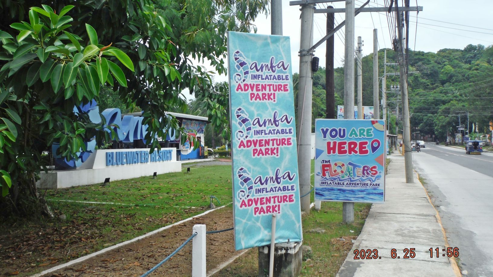
Zg373. (-126) is a new business, offering a floating island for recreation, on the bay of Subic Bay. It is located diagonal across the Maquinaya River and bridge. This is the 2nd such entertainment place in Barrio Barretto now and the 3rd and biggest one is at Half Moon Beach, between here and the SBFZ, the former Naval Base.
Zg374. (-127 to 132) are images of the Barrio Barretto Beach which is part of Olongapo City and Subic Bay. The first 3 images are of the Driftwood Beach which is a Public Beach, managed by the Barretto Government. It is located across the National Highway from the Olongapo Police Head Quarter which is commonly referred to as “164”. I don’t know why but speculate some military or police unit with that designation was stationed here at one time.
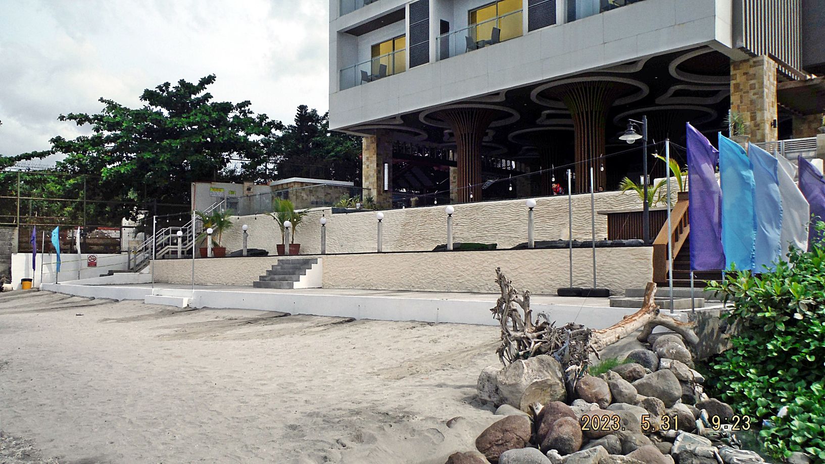
In the next three pictures we are walking down the Barretto Beach, past some fishing boats and then we have a shot of the Papagayo Resort, a very nice hotel which existed already during our Naval Base Days. The last pic is of our new and only High Rise Hotel and building in Barretto. They just finished beautifying their beach front. At this place the Former Marmont Hotel had built a large 3 story hotel and was never allowed to open it.
Zg375. (-127 to 132) are images of the Barrio Barretto Beach which is part of Olongapo City and Subic Bay. The first 3 images are of the Driftwood Beach which is a Public Beach, managed by the Barretto Government. It is located across the National Highway from the Olongapo Police Head Quarter which is commonly referred to as “164”. I don’t know why but speculate some military or police unit with that designation was stationed here at one time.
In the next three pictures we are walking down the Barretto Beach, past some fishing boats and then we have a shot of the Papagayo Resort, a very nice hotel which existed already during our Naval Base Days. The last pic is of our new and only High Rise Hotel and building in Barretto. They just finished beautifying their beach front. At this place the Former Marmont Hotel had built a large 3 story hotel and was never allowed to open it.
Zg376. (-133 to 139) are picture shot at Baloy Long Beach, part of Barrio Barretto and belong to Olongapo City and Subic Bay. The first 5 images are views of Subic Bay, we see Camaya Point, the end of the former Naval Magazine; Grande Island, the former Fort Wint; Redondo Peninsular with the former Hanjin Yard, now Called Agila Subic, which houses a Philippine Naval Base now. And we see the mouth of Matain River with concrete dolphin structures of the former Port Dizon. The last two pictures are of the NW end of Baloy Long Beach, the area that was cleared of people and buildings for a new development. A wall is being built and guards are guarding the area.
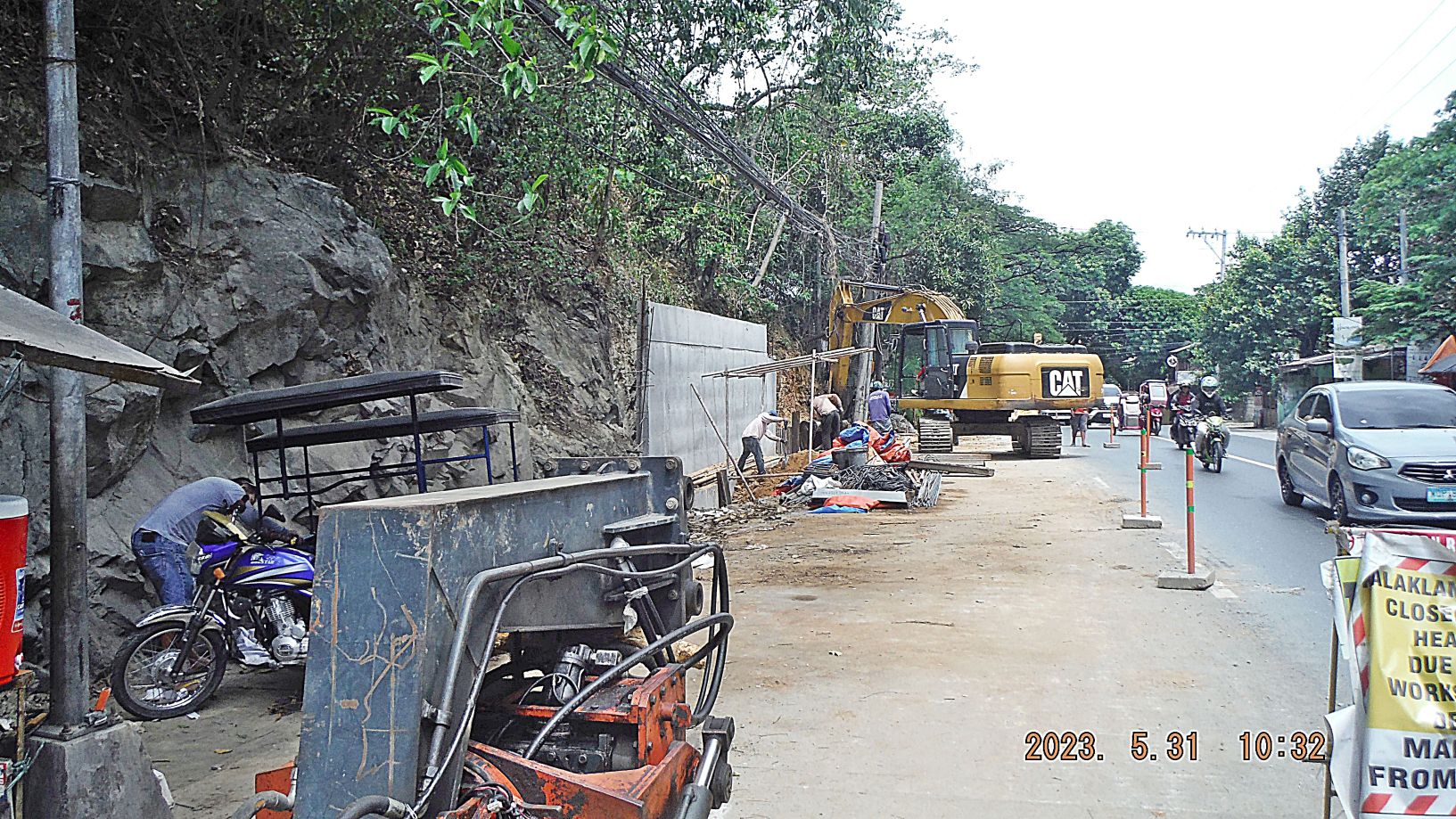
Zg377. (-140, later 154 and 155) this is a road cut thru the ridge that forms Baloy Beach. The national Highway to Zambales goes thru here. Apparently a contract was opened to finish widening the cut and securing the shoulders.
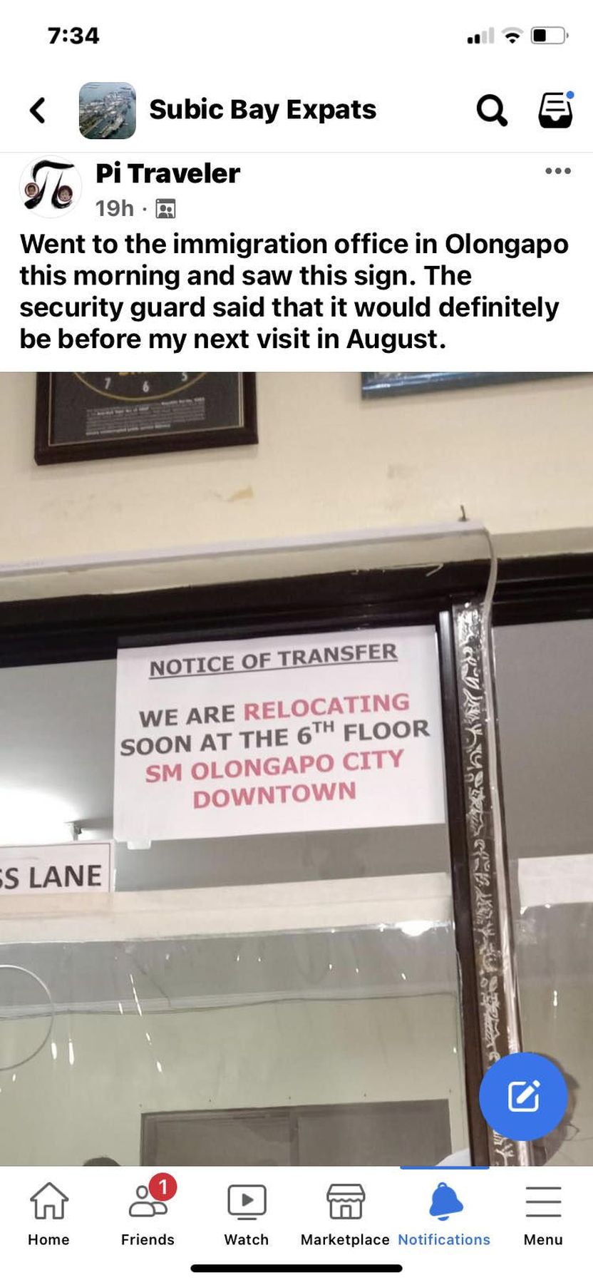
Zg378. (-141) this was notice that recently was posted in social media and I copied it here. It may be of interest to many of us foreigners.
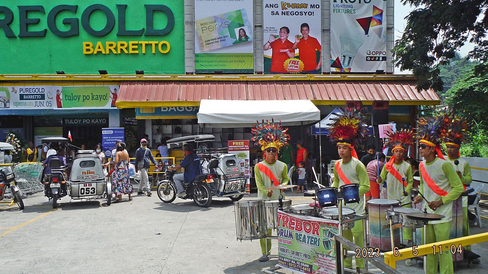
Zg379. (-142) believe it or not, two very large structures have been built between the entrance to Baloy Beach and the Matain River and bridge, at the inland side of the highway. The biggest one is modern Hardware outlet Wilcon and this picture shows a department store “Divimart” which was bought by Puregold. It is certainly more convenient to have these two facilities near our home.
Zg380. (-148). Another old business ate the dust and something new is being built. For your orientation, right of this property used to be the two storey Mayflower Bar, and left in the picture you should be able to recognize our new high rise hotel.
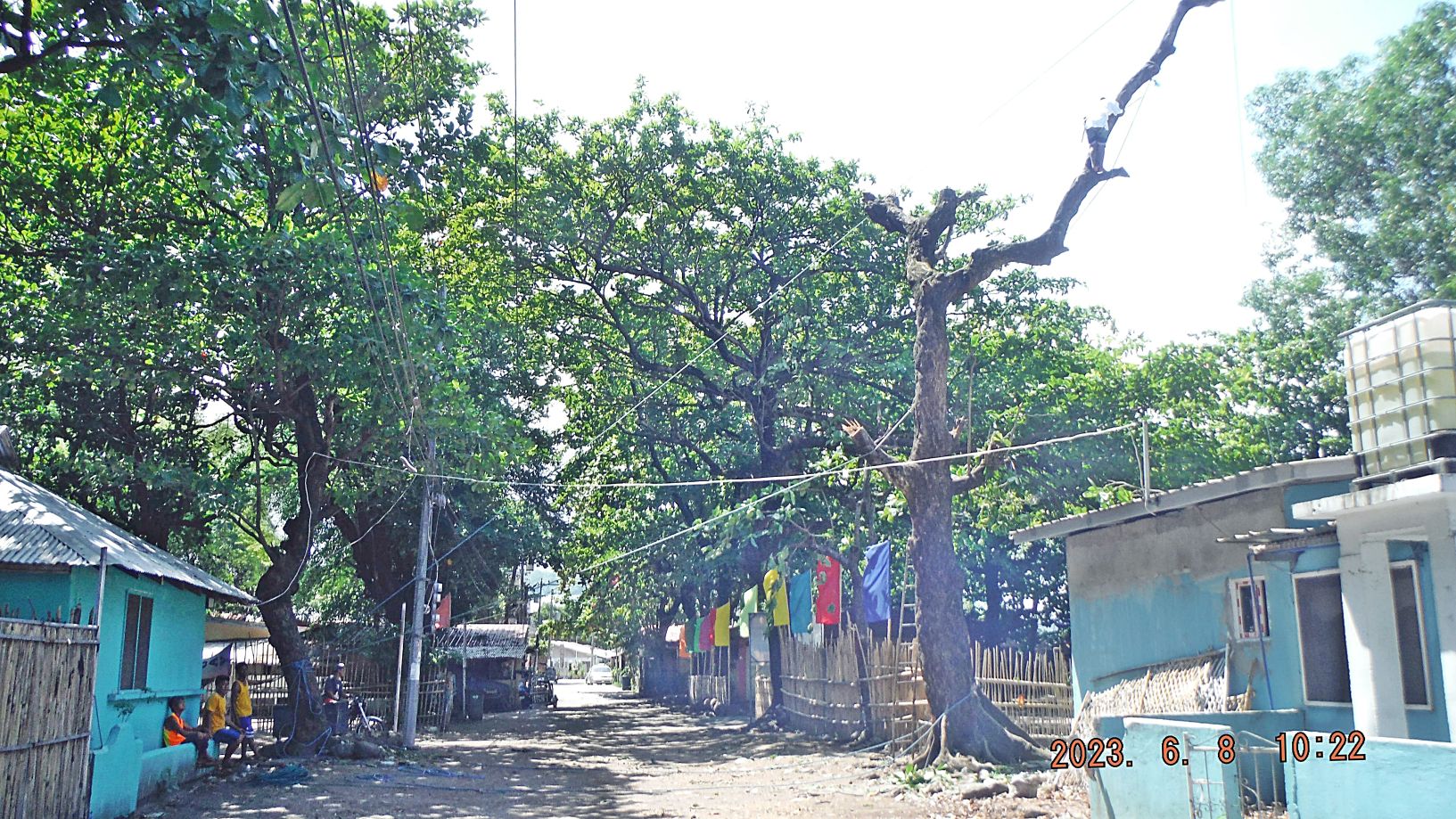
Zg381. (-149 to 153) are pictures of Baloy Beach, along its road. A new business is renovating and it is called: “De Perio’s” they have permission to cut dead trees. In picture #150 you see a person on the tree, hacking away with a bolo and other men have lines rigged to make the cut portion fall to a safe place.
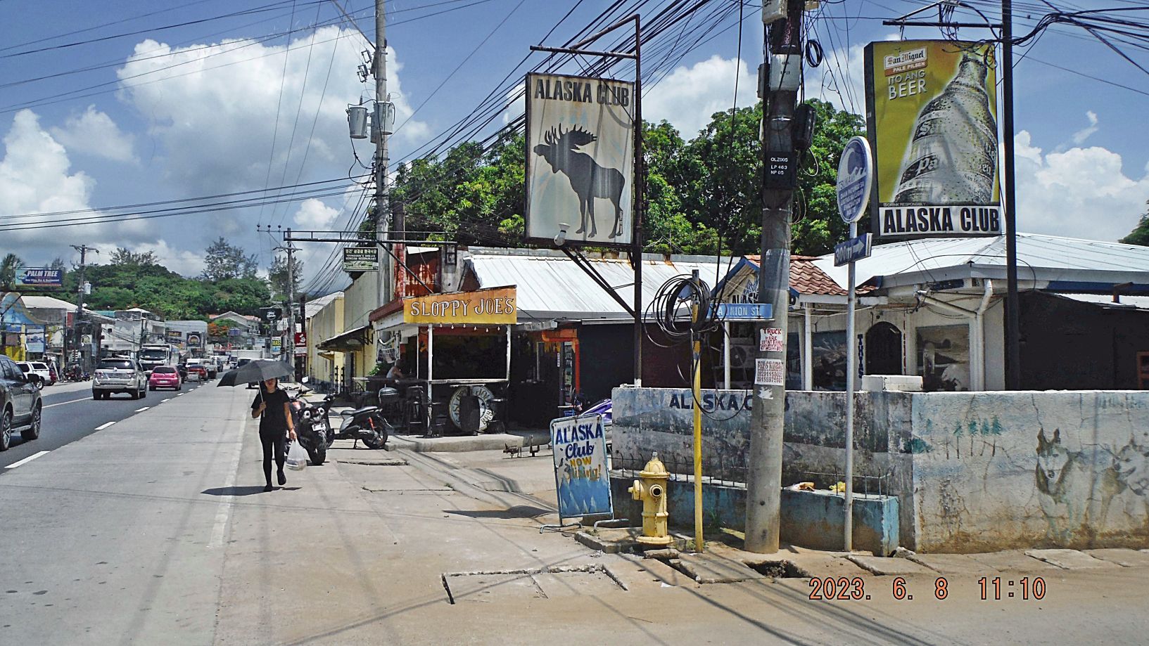
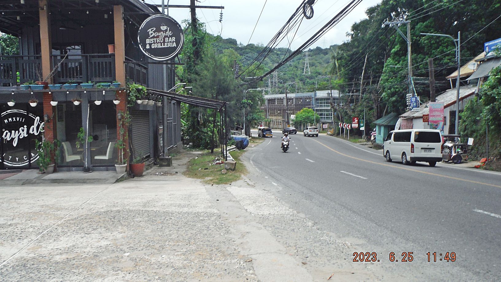
Zg382. (-156) we are at the intersection of La Union Street and the National Highway in Barrio Barretto. This Alaska Club been around for a while, Spaghetti Eddy used to be located here. You see a new place called: “Sloppy Joe’s” which is new watering hole, to sit there, sip on a San Miguel Beer and watch the world go by. I noticed several new watering holes and bars that have opened in Barrio Barretto, business is picking up.
Zg383, (-157 and 158) are the Kalaklan Ridge at right and a split off ridge towards the village Naugsol, to the left. Today it was unusual hazy, don’t know why. Behind that low ridge in picture 158 is where the Barretto Bypass road is being cut, going to the right, up, towards the Kalaklan Ridge.
==========================================================
5th of 6 Segments (24 images) Views of Subic Bay, First Half of 2023, this segment has more pics of Olongapo and the former base.
I chose 17 images out of the 5th segment (24 images) to be presented here. All pictures up to this 5th segment are available in these 2 venues, about 185 pics now:
Uploaded into a Flickr album, in high resolution, over 220 images in 6 segments, click here:
Uploaded into my Facebook as an album, click here:
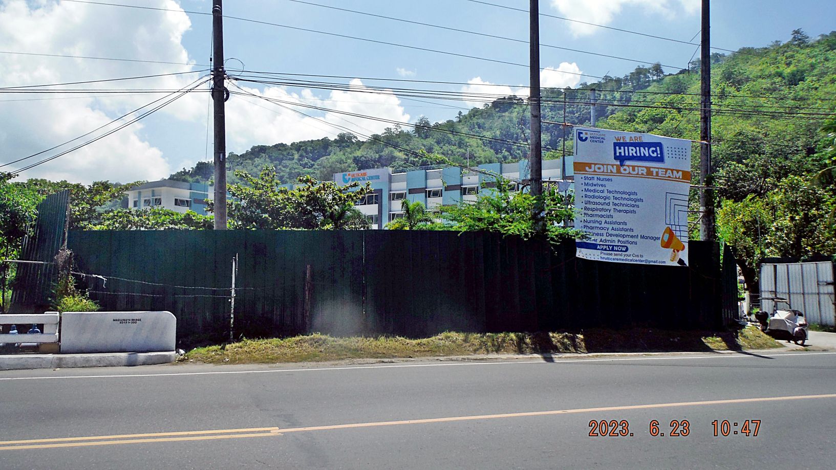
Zg384. (-163) is our relative new hospital at the south end of Barrio Barretto, which went broke, is nearing completion after a complete renovation and adding one more storey under new ownership and management. We Vets hope they will engage TRICARE and get an agreement for it to be accepted here. In any case it will be a close emergency clinic for people in the Barretto and surrounding neighborhood.
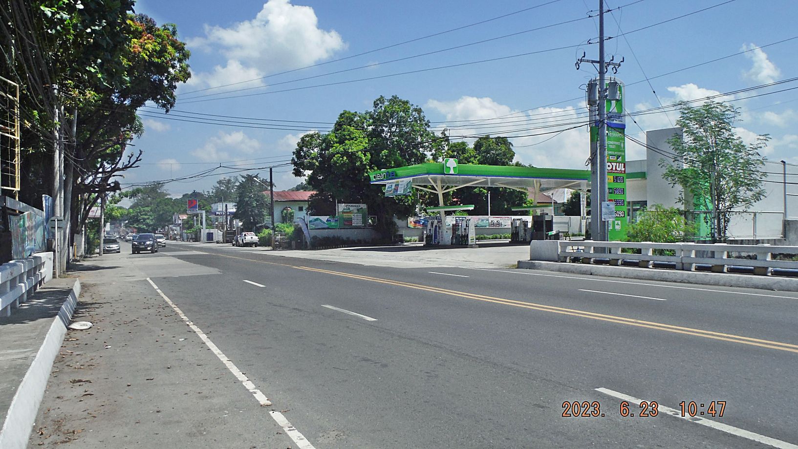
Zg385. (-164) is one more gas station in Barrio Barretto, we have now three. This picture is shot across the Maquinaya Bridge, the name of the river in Barretto, which had given its name to the Naval Rifle Range which used to be here until the Japanese occupation.
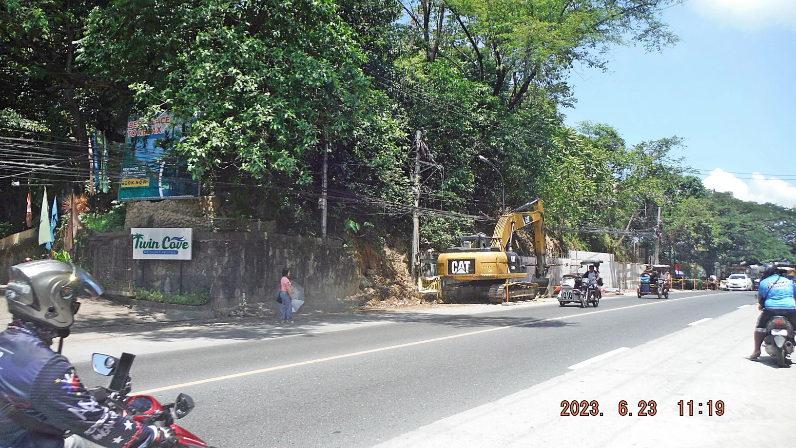
Zg386. (-165) this is the road cut thru the ridge line which forms a point in Subic Bay and is now called Baloy Long Beach (part of Barretto and Olongapo City); this is the National Road to Zambales, our province. The road has been widened to 4 lanes and the new project is the road shoulders and securing the embankment on both sides of cut, of this highway.
————————
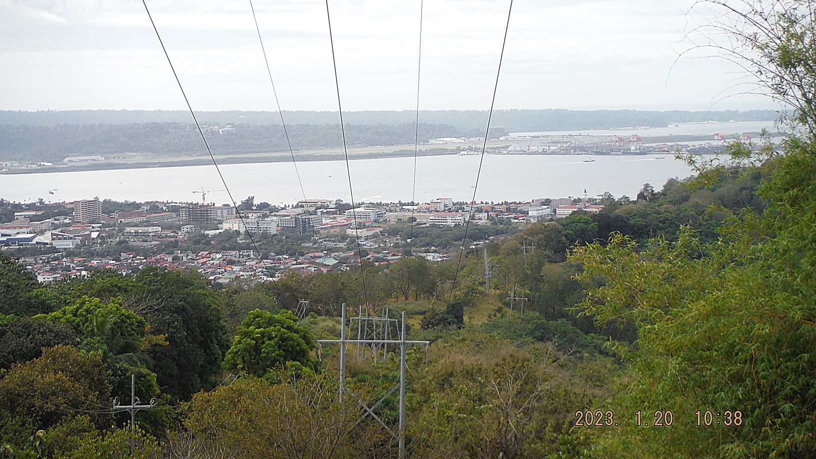
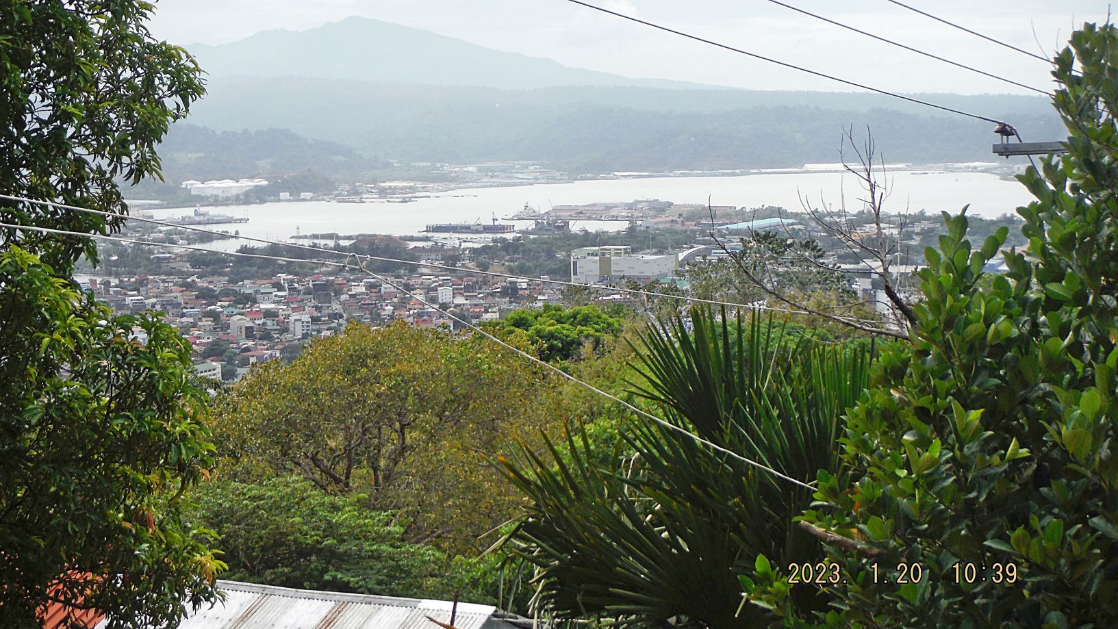
-170 to 176 (5 images, some have not been used for this presentation) are shots of Olongapo City and the former Naval Station Subic Bay, the former Naval Supply Depot (NSD) and even parts of Cubi Point Naval Air Station etc. This Subic Bay complex is now called the Subic Bay Freeport Zone (SBFZ) and is managed by the Subic Bay Metropolitan Authority (SBMA). Before the war it was all Olongapo but now we use the term Subic Bay.
Zg387. (Image 170) shows the new large SM Mall (SM=Shoe Mart) where the Olongapo Hospital used to be, and we see Santa Rita Mountain with its tower.
Zg388. (Image 171) shows a medium floating dry-dock, a Naval MSC ship at Rivera Wharf, the ex Naval fuel piers, with a 2nd pier and new big tanks left of it.
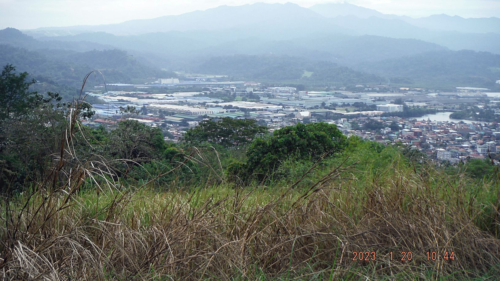
Zg389. (Image 173) shows Olongapo City in front, the former NSD with old and new warehouses with a merchant ship in. Left of it we see the former Naval Base power plant and the new one with a high exhaust stack; left of that we see one of the golf greens near the Binictican road.
Zg390. (Image 174), for your orientation, left is the new SM Mall of Olongapo, where the Olongapo Hospital used to be. This picture really shows the big change from the Naval Base to a Freeport Zone. All the big structures left of the former NSD and behind Olongapo are all new and big structures of the Subic Bay Industrial Park which stretches all the way to the Binictican Golf Course.
Zg391. (Image 176) also shows many changes. We see the Philippine Flag left of a high-rise and many other large buildings have been built on the former Naval Station. You should make out the words Harbor Point, that is a new Ayala Mall on the former Base (we have 4 Malls now in Olongapo and Subic Town). The drainage canal that separates the base from Olongapo is on this side of the Harbor Point Mall. To the left of it we see the SM Mall Olongapo City Down-Town just outside the former base and across the main gate bridge, now the Magsaysay Bridge. To the right we see one of the hangars of the former Cubi Point Naval Air Station which is now the Subic Bay International Airport terminal. To the right and higher is the former Famous Cubi Point Officer Club, now a residential area and in 1996 it was the location for the APEC meeting. The Boton Wharf area and more so in the Boton River Valley are fully occupied with new big commercial enterprises.
————-
Zg392. (-185 and 186) plus the earlier image #177 are images on top of the Kalaklan Ridge Road/Trail at the approximate area above the Half Moon Beach area which houses the electric NGCP Olongapo Substation. On top of the trail people do live and at places the road is drivable. But today vehicles use a road from Gordon Heights to drive up here.
Zg393. (-185 and 186) plus the earlier image #177 are images on top of the Kalaklan Ridge Road/Trail at the approximate area above the Half Moon Beach area which houses the electric NGCP Olongapo Substation. On top of the trail people do live and at places the road is drivable. But today vehicles use a road from Gordon Heights to drive up here.
————————-
-187 to 189 are three pictures from near the end of the Kalaklan Ridge and near the Olongapo City Cemetery of Olongapo City, of views down to Barrio Barretto and Cubi and Camayan Points in Subic Bay.
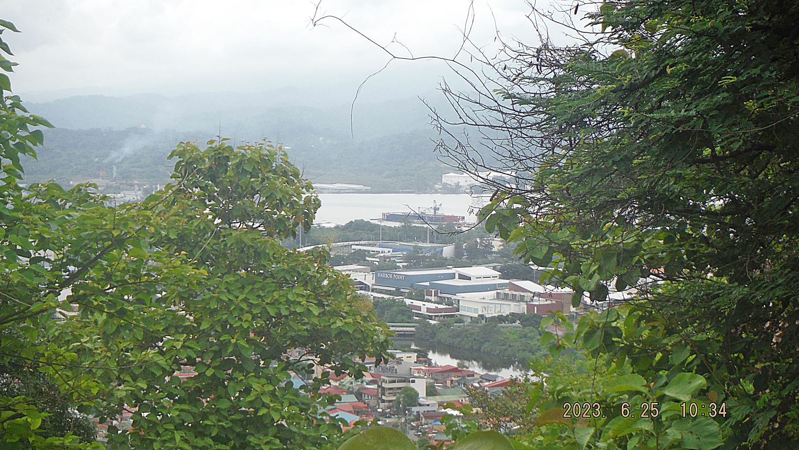
Zg394. (In picture 187) we see the new Harbor Point Mall, the medium floating dry-dock and the new and very big fuel tanks.
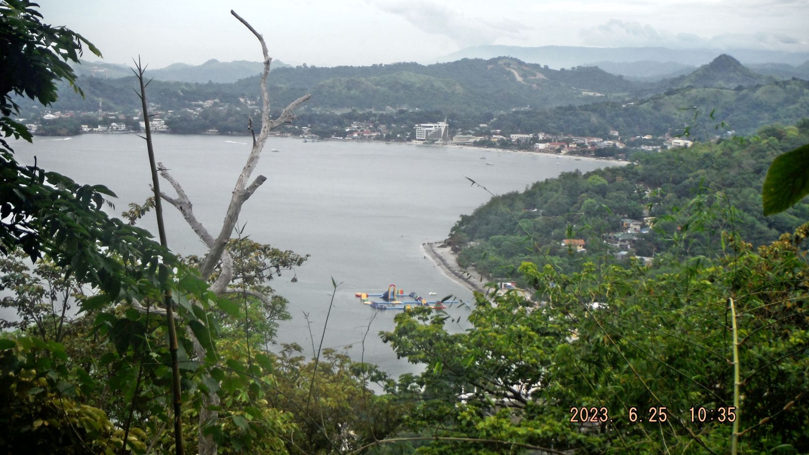
Zg395. (In picture 188) we see the floating island at Half Moon Beach, the new High-Rice hotel in Barretto and on slopes above the former Subic Municipality Landfill a new housing development.
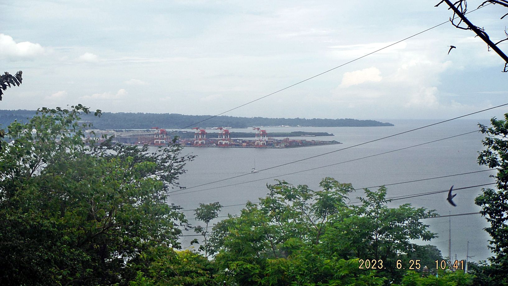
Zg396. (In picture 189) we see the former Cubi Point (actual geographic point) which has become a container port, we see the SW End of the Cubi Point run way and we see the two former ammunition wharfs which are now commercial enterprises. The last point at right is Camayan Point; I remember doing here requalification’s working with explosives.
————————-
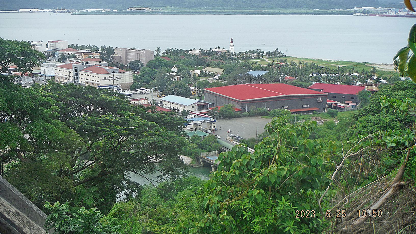
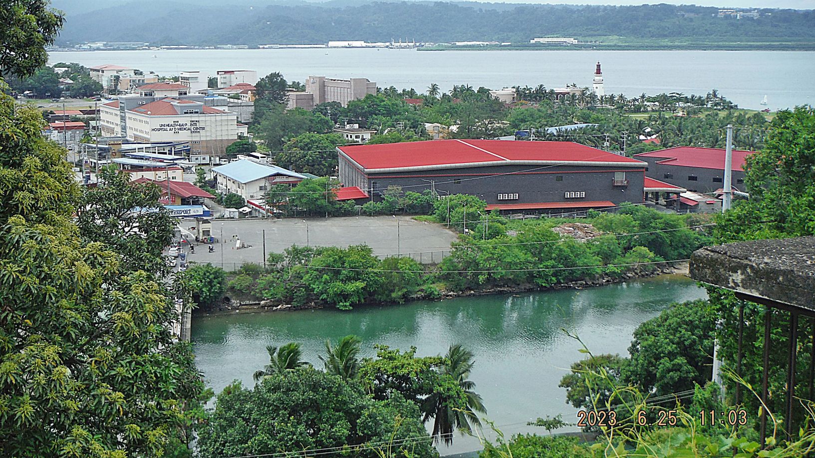
-190 to 193 are shot from the Olongapo City Cemetery above Kalaklan Point and cover the area of the bridges and the NW end of the former Naval Station or the Central Business District of the SBFZ.
Zg397. (In picture 190) we see the two bridges from the SBFZ to Olongapo City. The 2nd bridge is the former Naval Base main gate bridge, being replaced right now. The closer bridge was built by the SBMA, the new Management and connects Manila Ave on Base to Rizal Ave in Olongapo.
Zg398. (In picture 191) we can recognize the large and high Philippine Flag. It flies at the same area where we flew the US and Philippine flags at lower flag poles, those two poles are still there. The road at left is the Canal Road. If you look sharp you should be able to spot the round roof of the pavilion in the Tappan Park. And you have a clear view how fully developed the Boton Valley is now!
Zg399. (In picture 192) you should be able to recognize the few structures left from our Navy time. Right under us are the 4 barracks of the Transfer Personnel Unit (TPU), the Officer in charge in about the 80s told me he had about 64 Legal Hold-over’s. And you should be able to spot our long, 4 storey’s high, enlisted Barracks, near the left edge of the picture.
Zg400. (Picture 193) really demonstrates how much has changed from the former Naval Base to the present SBFZ. I recognize only two structures from our Navy time the old and closed Kalaklan Bridge, closed right now and a large Quonset hut and it was built in 1991 after the Mt. Pinatubo eruption.
————————————————————
6th and last of 6 Segments (31 images) Views of Subic Bay, First Half of 2023, this segment covers the area from Kalaklan Point to Barrio Barretto.
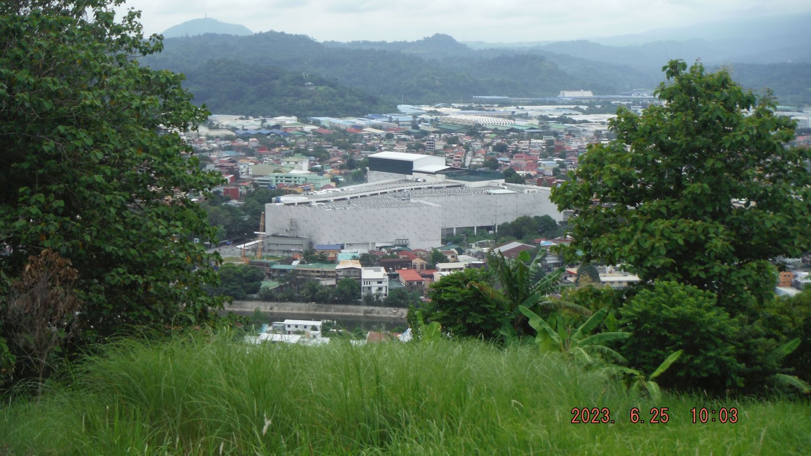
Zg413. (-196 to 198) are pictures from the Olongapo Cemetery down to the NW end of the former Subic Bay Naval Station with sweeping views of the Boton Wharf area, the former Naval Air Station Cubi Point and we even see the munitions wharfs of the former Naval Magazine area. All of this is now the Subic Bay Freeport Zone (SBFZ) managed by the Subic Bay Metropolitan Authority (SBMA), it is amazing how much has changed in 30 years!
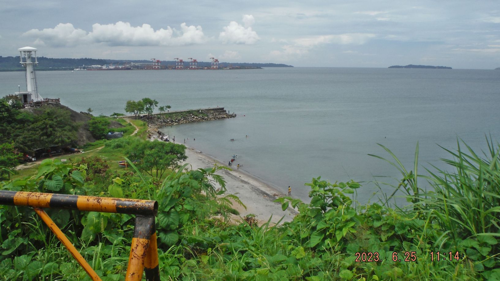
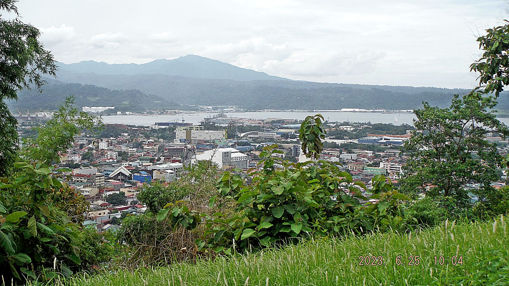
Zg414. (-199 to 208) are pictures of the Kalaklan Point area, at the mouth of the Kalaklan River and Kalaklan Light House. We see views of the Kalaklan Olongapo Cemetery, the Kalaklan Point, views of Subic Bay, SBFZ, the former Subic Bay Naval Base, Grande Island and the National Highway going around Kalaklan Point to Zambales. Over the years there was a certain spot at the Kalaklan Point bend that kept damaging the highway. So finally the authorities had to take steps to reinforce the embankment at this Kalaklan Point and we see work going on for that purpose.
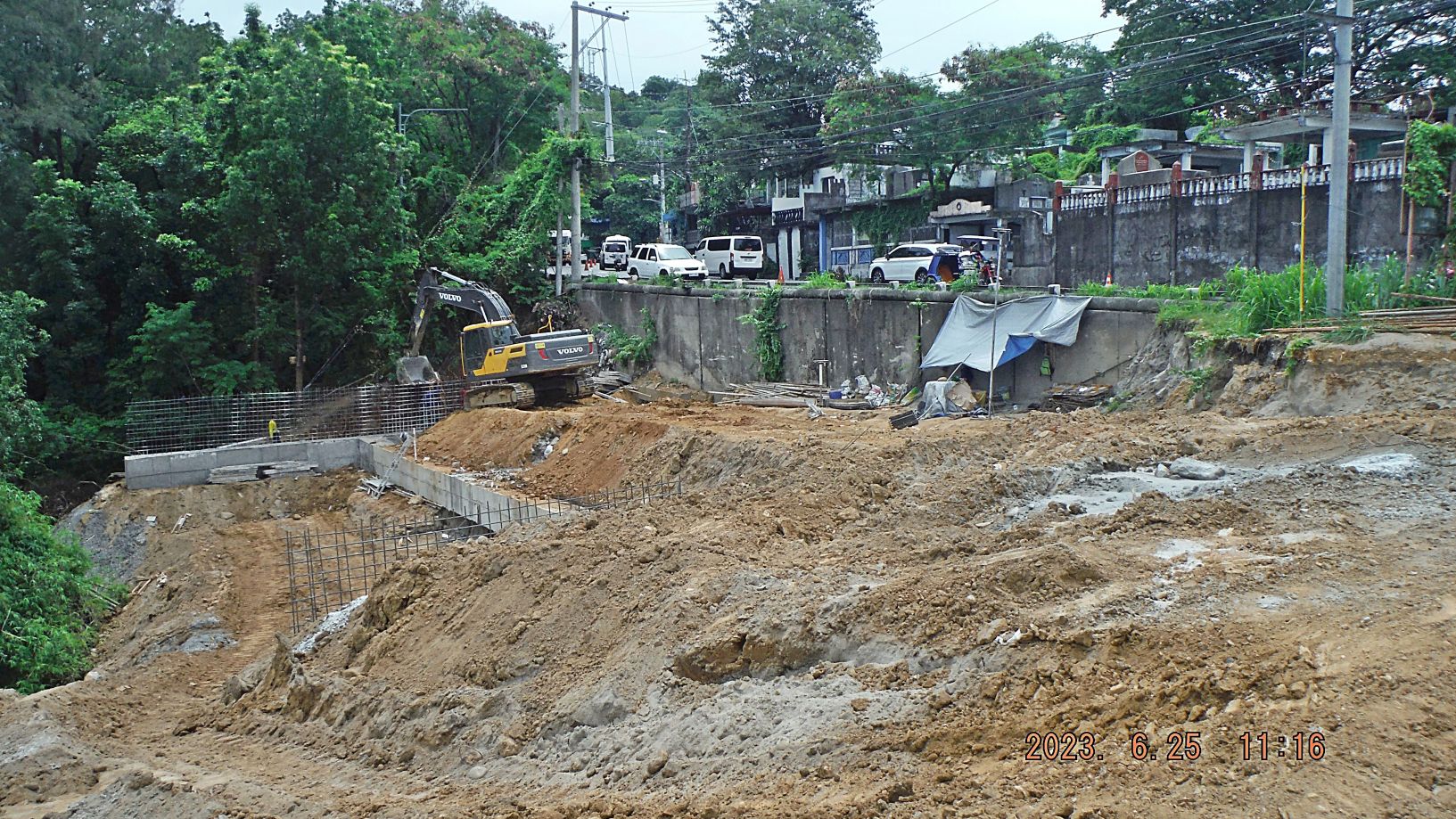
Zg415. (-199 to 208) are pictures of the Kalaklan Point area, at the mouth of the Kalaklan River and Kalaklan Light House. We see views of the Kalaklan Olongapo Cemetery, the Kalaklan Point, views of Subic Bay, SBFZ, the former Subic Bay Naval Base, Grande Island and the National Highway going around Kalaklan Point to Zambales. Over the years there was a certain spot at the Kalaklan Point bend that kept damaging the highway. So finally the authorities had to take steps to reinforce the embankment at this Kalaklan Point and we see work going on for that purpose.
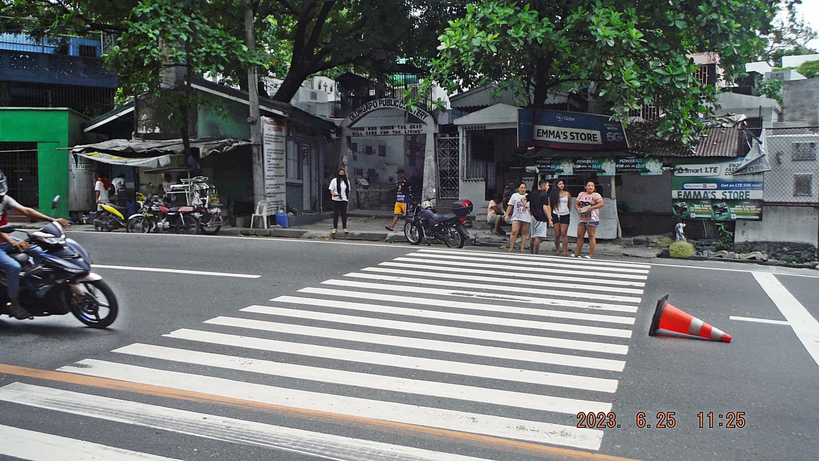
Zg416. (-209 to 211) are pictures of the Olongapo City Public Cemetery; we see the gate to the cemetery which is from the Naval Reservation Days when this was the Olongapo Port and Naval Station before the war. One picture is the gravesite of the Gordon Family who played a prominent part in the development of the present Olongapo City and the last pictures shows a burial procession coming around one of highway bends, going around the cemetery.
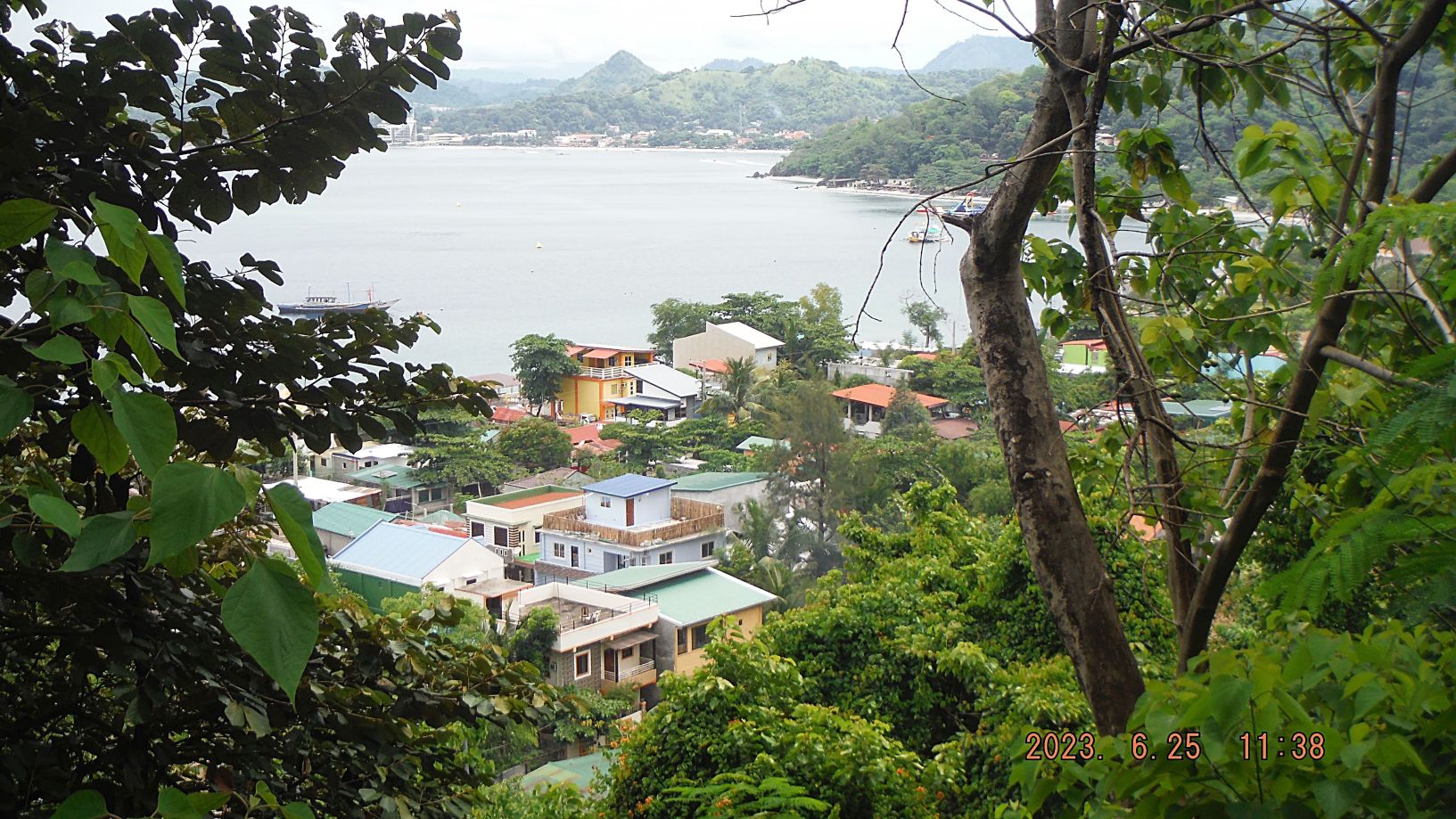
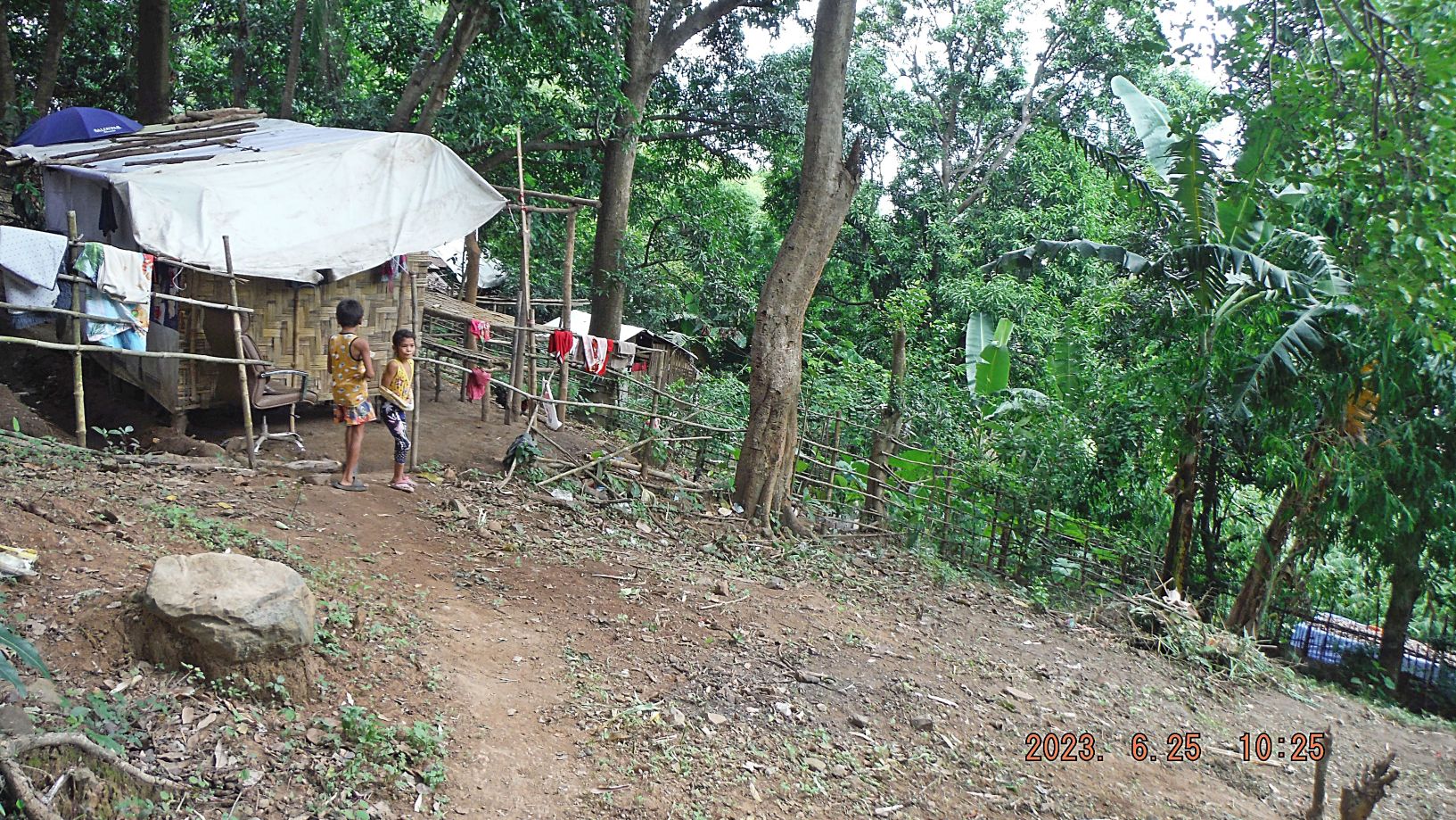
Zg417. (-212 to 223) are pictures and views of a walk from Kalaklan Point to Barrio Barretto. Again we have views of the bay, the slopes where people live and have to worry about landslides, near the bay beaches new communities developed. New business have been established, some old ones are hanging on such as the Half Moon Hotel and the Nipa Hut establishment. At the Half Moon cove/valley is the home of the important electric transformer station and across the street a new popular water sport resort has been developed. Image 222 is a view across Sierra Beach to Driftwood Beach in Barrio Barretto.
Zg418. (-212 to 223) are pictures and views of a walk from Kalaklan Point to Barrio Barretto. Again we have views of the bay, the slopes where people live and have to worry about landslides, near the bay beaches new communities developed. New business have been established, some old ones are hanging on such as the Half Moon Hotel and the Nipa Hut establishment. At the Half Moon cove/valley is the home of the important electric transformer station and across the street a new popular water sport resort has been developed. Image 222 is a view across Sierra Beach to Driftwood Beach in Barrio Barretto.
Zg419. (-212 to 223) are pictures and views of a walk from Kalaklan Point to Barrio Barretto. Again we have views of the bay, the slopes where people live and have to worry about landslides, near the bay beaches new communities developed. New business have been established, some old ones are hanging on such as the Half Moon Hotel and the Nipa Hut establishment. At the Half Moon cove/valley is the home of the important electric transformer station and across the street a new popular water sport resort has been developed. Image 222 is a view across Sierra Beach to Driftwood Beach in Barrio Barretto.
Zg420. (-212 to 223) are pictures and views of a walk from Kalaklan Point to Barrio Barretto. Again we have views of the bay, the slopes where people live and have to worry about landslides, near the bay beaches new communities developed. New business have been established, some old ones are hanging on such as the Half Moon Hotel and the Nipa Hut establishment. At the Half Moon cove/valley is the home of the important electric transformer station and across the street a new popular water sport resort has been developed. Image 222 is a view across Sierra Beach to Driftwood Beach in Barrio Barretto.
Zg421. (-224 and 225) are pictures of the renewed effort to finish replacing the old Main Gate Bridge of the former Naval Base. This is a project of the new Subic Bay Management, called now SBMA which runs this new SBFZ and the new bridge name is Magsaysay Bridge. SBFZ has also built two other bridges many years ago, a big one that connects the Manila Ave on the SBFZ to the Rizal Ave in Olongapo City and the 2nd new bridge connects to the 14th Street in Olongapo. The Kalaklan Bridge has also been replaced already. One thing I like about the new bridges, they have a covered pedestrian walkway, covering you from sun and rain.