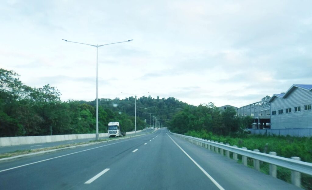
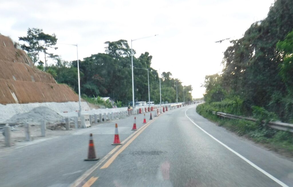
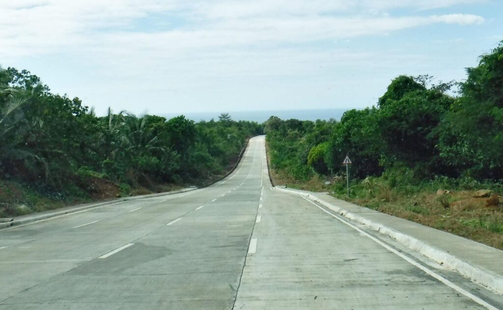
Zd840. This is one of 6 images of the Subic Freeport Expressway on the 15th Jan 2021. I started my Bataan trip this way. This is the first section as you leave the former Navy Exchange area.
——————————————
This was an exploration trip of changes in Bataan during the virus crisis, I had to get permission from my Barangay (Village) Captain, the Barangay Medical Department and the Olongapo Police Head Quarters. I have been absent from the Philippines for 15 months and we all have suffered from the Red China Virus for 9 months or so. What has changed in Bataan?
—————————————-
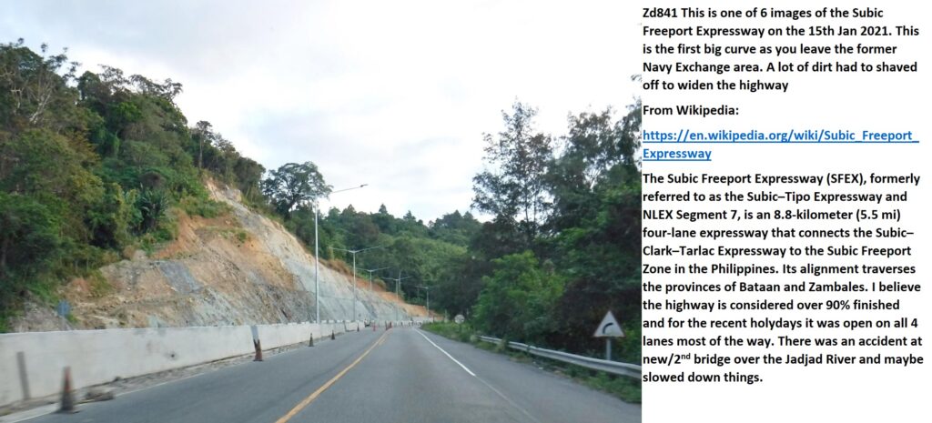
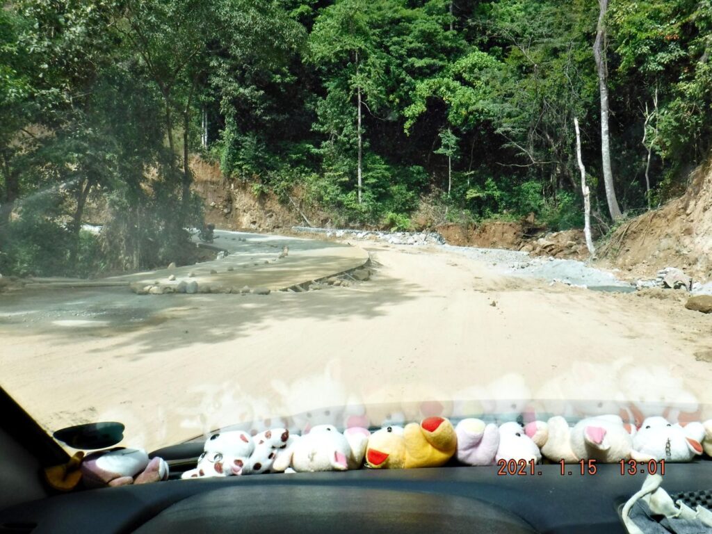
Zd841 This is one of 6 images of the Subic Freeport Expressway on the 15th Jan 2021. This is the first big curve as you leave the former Navy Exchange area. A lot of dirt had to shaved off to widen the highway
From Wikipedia:
https://en.wikipedia.org/wiki/Subic_Freeport_Expressway
The Subic Freeport Expressway (SFEX), formerly referred to as the Subic–Tipo Expressway and NLEX Segment 7, is an 8.8-kilometer (5.5 mi) four-lane expressway that connects the Subic–Clark–Tarlac Expressway to the Subic Freeport Zone in the Philippines. Its alignment traverses the provinces of Bataan and Zambales. I believe the highway is considered over 90% finished and for the recent holydays it was open on all 4 lanes most of the way. There was an accident at new/2nd bridge over the Jadjad River and maybe slowed down things.
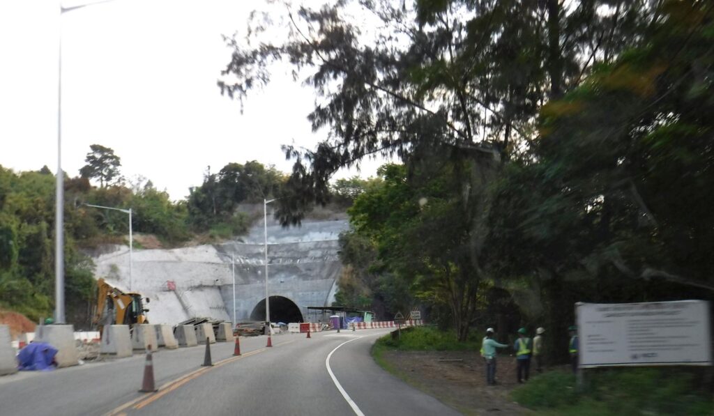
Zd842. This is one of 6 images of the Subic Freeport Expressway on the 15th Jan 2021. The new Tunnel is in sight.
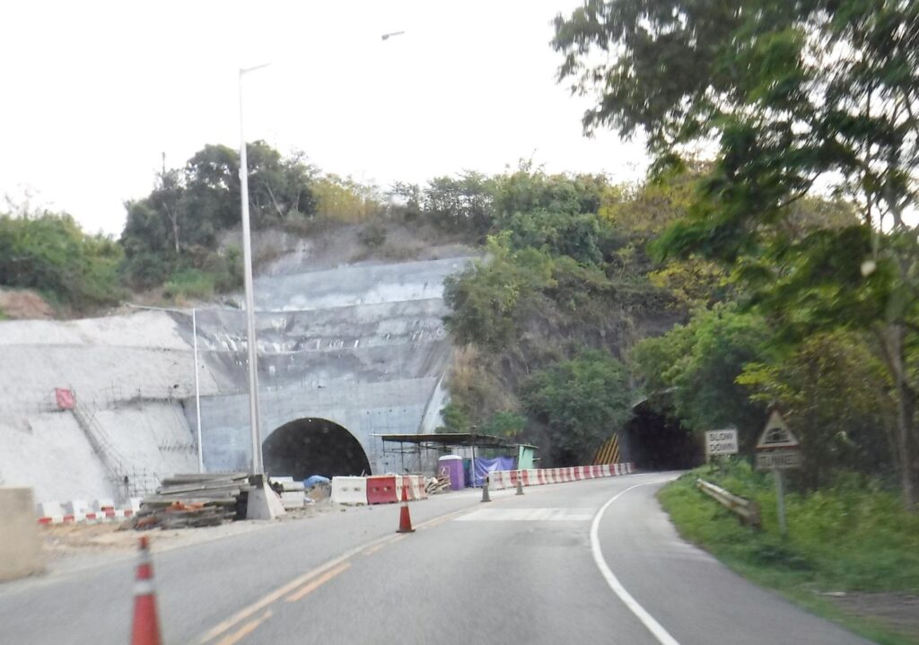
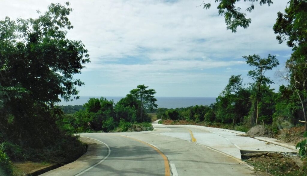
Zd843. This is one of 6 images of the Subic Freeport Expressway on the 15th Jan 2021. Both tunnels are in sight.
Zd844. This is one of 6 images of the Subic Freeport Expressway on the 15th Jan 2021. WE are thru the tunnel and have this sight.
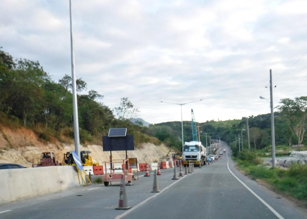
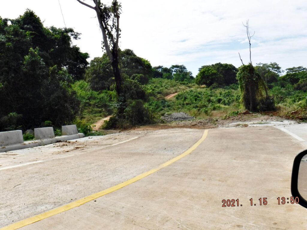
Zd845. This is one of 6 images of the Subic Freeport Expressway on the 15th Jan 2021. We are approaching the old and new bridge to be built over the Jadjad River. Here was the accident which caused some fatalities.
——————————
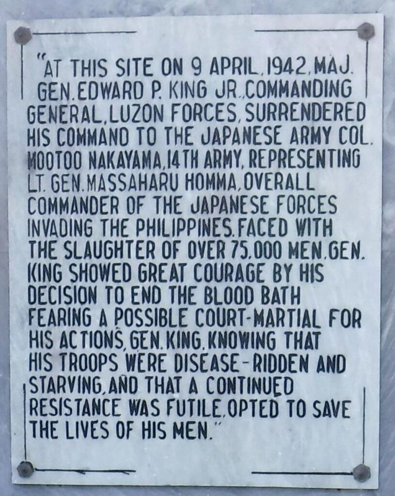
The Bataan Surrender Memorial in Lamao
Bataan Trip 21-01-15. My next stop was the municipality of Lamao I wanted to see the Bataan Surrender Memorial there. I knew that it was built by the Battlin Bastard of Bataan and they had a strong desire to build it there because that is where their General surrendered, not in Balanga! They always expressed the opinion that history shall be told accurately.
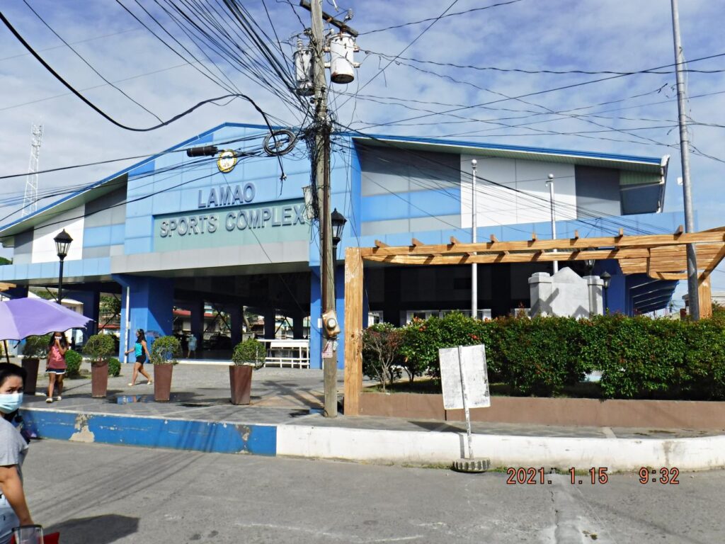
I wanted to see how it looks now and it looks just fine, all the market vendors are gone and it has a secure open spot in a large sport complex in the center of village compound. I’m sure that makes the Battlin Bastard of Bataan happy, I think most of them are in Heaven now.
It would be nice, if the authorities would fly both National Flags, at least on some important anniversary dates!
Wikipedia says this about Lamao:
https://en.wikipedia.org/wiki/Lamao,_Limay
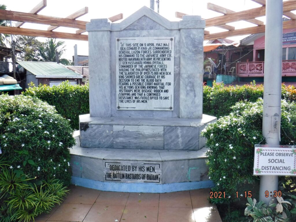
On April 9, 1942, under the Big Mulberry Tree in front of the old administration building, right in the heart of Lamao, Gen. Edward P. King, Jr. signed the official surrender paper of 78,000 soldiers of the USAFFE under him to Masahara Homma of the Japanese Imperial Army.[1]
Lamao is a barangay in Limay, Bataan, facing the Manila Bay in the Philippines. The population of Lamao is about 18,000, which made it the most populous barangay in Bataan. The current Barangay Chairman of Lamao is Restituto “Bart” Reyes. Lamao is the home of Camp General Antonio Luna which incorporates the Government Arsenal.
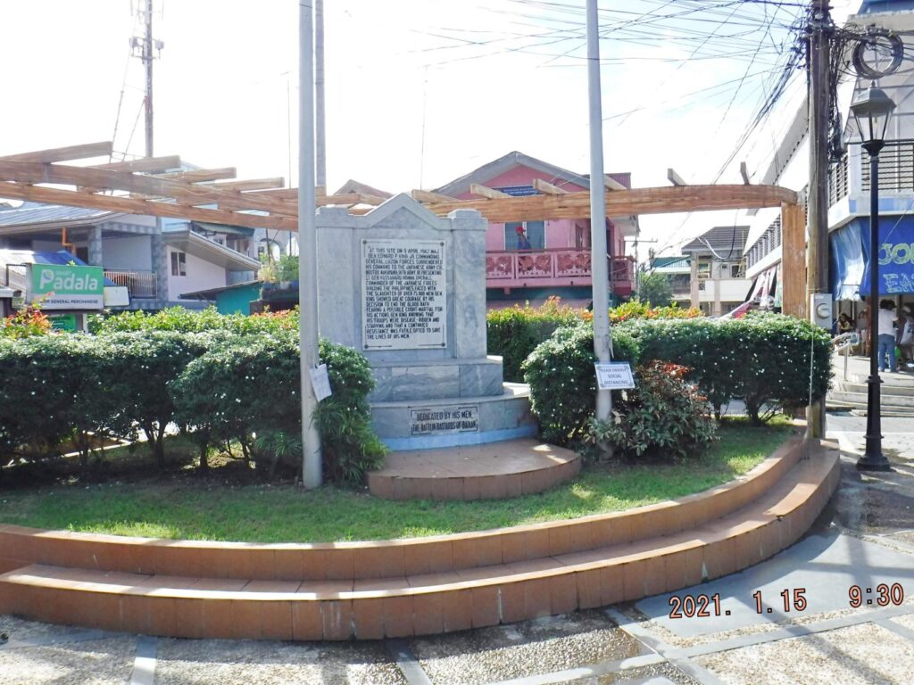
Zd846. This is one of 5 images of the Bataan Battle Surrender Memorial, in Lamao Bataan, shot on the 15th of Jan. 2021. It was built by the Battlin Bastards of Bataan with the proud consent of the people of Bataan.
Zd847. This is one of 5 images of the Bataan Battle Surrender Memorial, in Lamao Bataan, shot on the 15th of Jan. 2021. It was built by the Battlin Bastards of Bataan with the proud consent of the people of Bataan.
Zd848. This is one of 5 images of the Bataan Battle Surrender Memorial, in Lamao Bataan, shot on the 15th of Jan. 2021. It was built by the Battlin Bastards of Bataan with the proud consent of the people of Bataan.
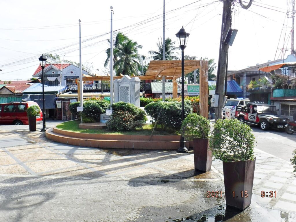
Zd849. This is one of 5 images of the Bataan Battle Surrender Memorial, in Lamao Bataan, shot on the 15th of Jan. 2021. It was built by the Battlin Bastards of Bataan with the proud consent of the people of Bataan.
Zd850. This is one of 5 images of the Bataan Battle Surrender Memorial, in Lamao Bataan, shot on the 15th of Jan. 2021. It was built by the Battlin Bastards of Bataan with the proud consent of the people of Bataan.
——————————————–
The Surrender Marker of Gen. Wainwright
In Cabcaben, at this spot Gen. Homma told Gen Wainwright surrender all his Forces in the Philippines or forget it; the Battle of Corregidor will continue. Gen. Wainwright had no choice; Washington had appointed him Overall Commander in the Philippines. That is exactly why Gen. MacArthur wanted to keep the Command and direct it now from Australia, so that Gen Wainwright only had authority over the Luzon Forces.
Anyway, in a house at this spot, Gen. Wainwright was forced to surrender all of the Philippine Islands on the 6th of May 1942, and the painfully occupation of the Philippines begun and lasted until the so joyful liberation, about 2 ½ year later.
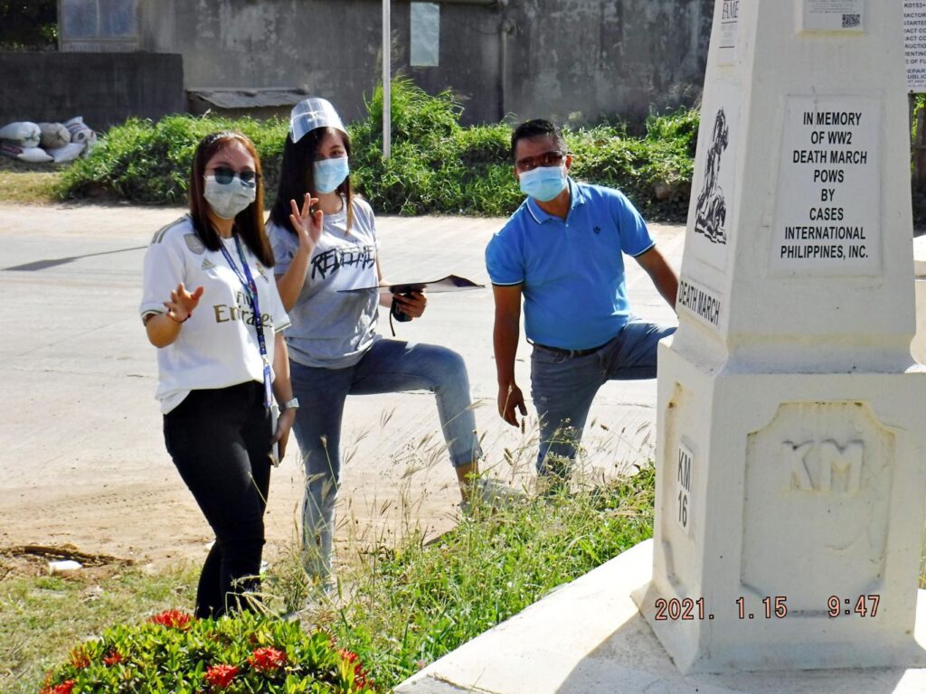
While there, I met three young people and I asked them what they were doing. They said they were from the Provincial Government and were taking notes of the condition of the Marker/Memorial. Interesting, maybe something will come of it. The Marker/Memorial is in Filipino.
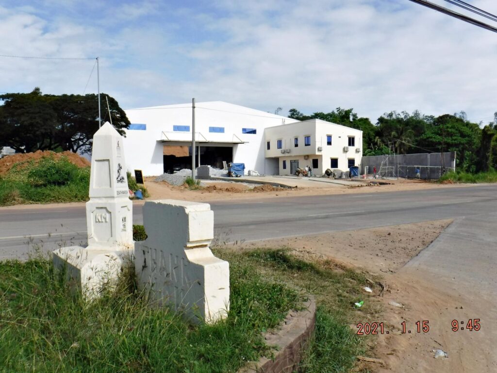
This Marker/Memorial is located exactly in the fork, where the old National Road splits away from the post WWII, toll-free, Bataan Expressway to Mariveles. And it seems that the Barangay (Village) Cabcaben has split up, and now there are two Barangays now, Cabcaben and Townsite.
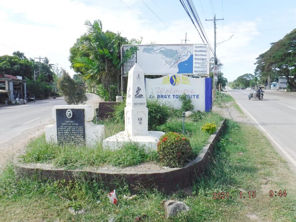
Zd851. This is one of 5 images of the Surrender Marker of Gen. Wainwright in Cabcaben/Townsite, shot on the 15th of Jan. 2021. It was built by the Philippine Authorities and is in Filipino. The # 16 Death March Marker is also located at this spot. Barangay Townsite has a welcome sign and village map on display.
Zd852. This is one of 5 images of the Surrender Marker of Gen. Wainwright in Cabcaben/Townsite, shot on the 15th of Jan. 2021. It was built by the Philippine Authorities and is in Filipino. The # 16 Death March Marker is also located at this spot. Barangay Townsite has a welcome sign and village map on display.
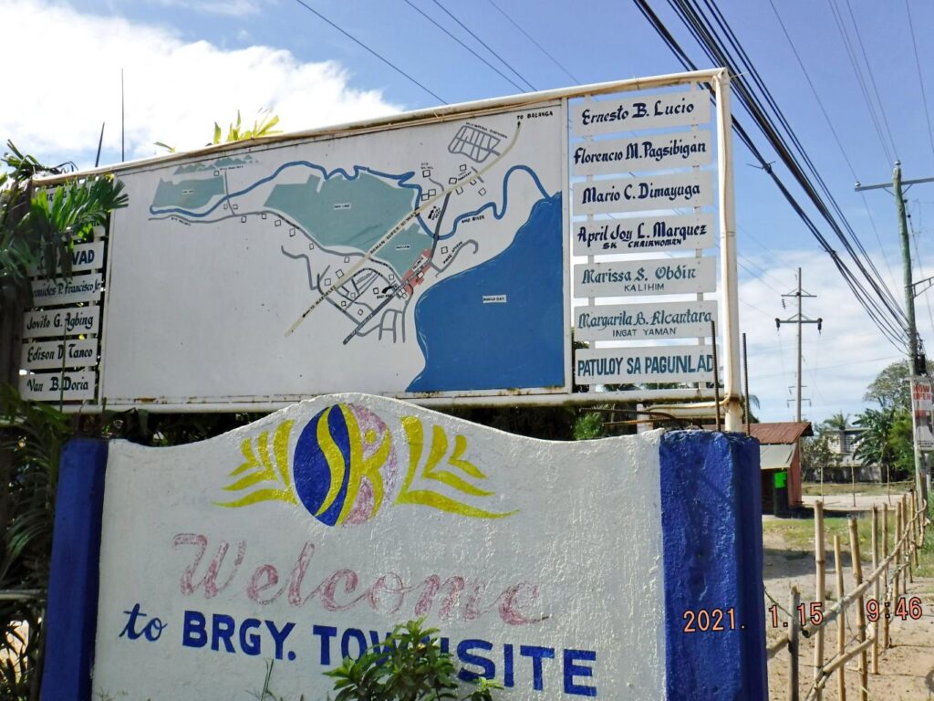
Zd853. This is one of 5 images of the Surrender Marker of Gen. Wainwright in Cabcaben/Townsite, shot on the 15th of Jan. 2021. It was built by the Philippine Authorities and is in Filipino. The # 16 Death March Marker is also located at this spot. Barangay Townsite has a welcome sign and village map on display.
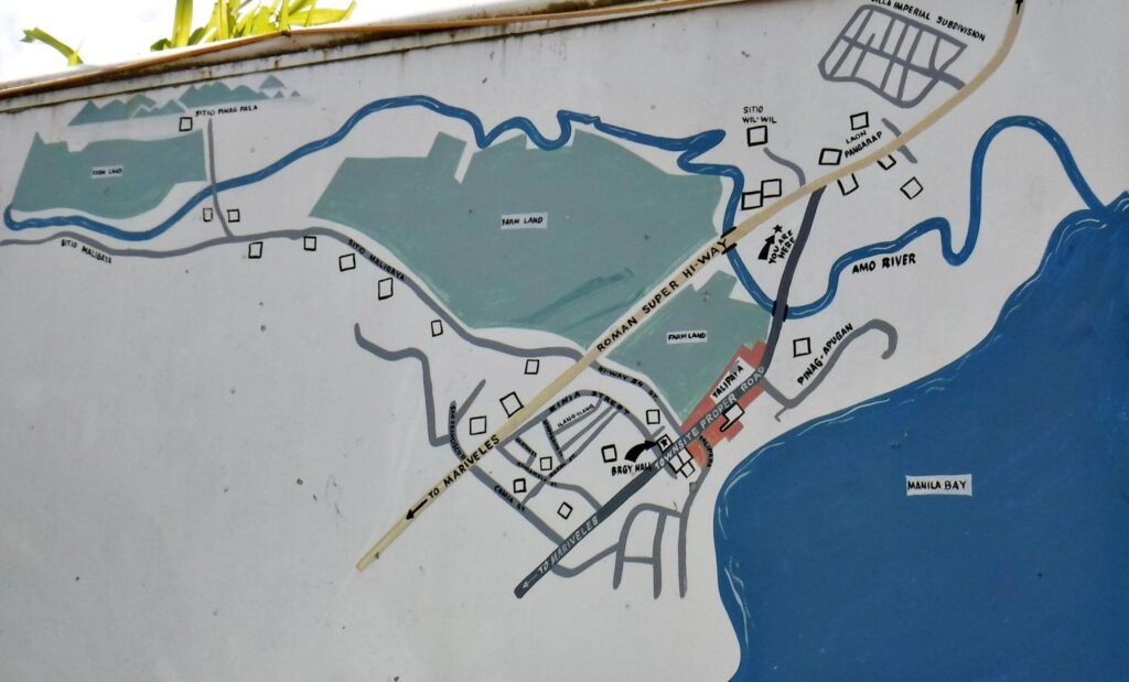
Zd854. This is one of 5 images of the Surrender Marker of Gen. Wainwright in Cabcaben/Townsite, shot on the 15th of Jan. 2021. It was built by the Philippine Authorities and isin Filipino. The # 16 Death March Marker is also located at this spot. Barangay Townsite has a welcome sign and village map on display.
Zd855. This is one of 5 images of the Surrender Marker of Gen. Wainwright in Cabcaben/Townsite, shot on the 15th of Jan. 2021. It was built by the Philippine Authorities and is in Filipino. The # 16 Death March Marker is also located at this spot. Barangay Townsite has a welcome sign and village map on display.
———————————
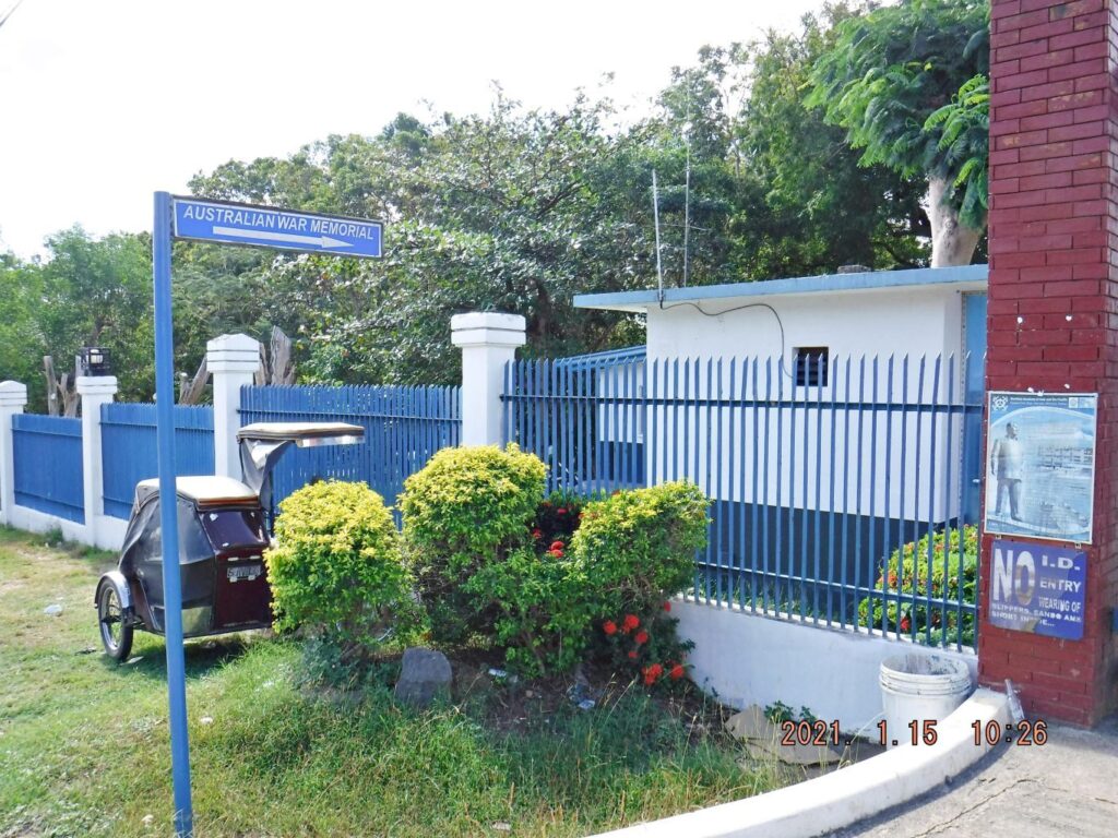
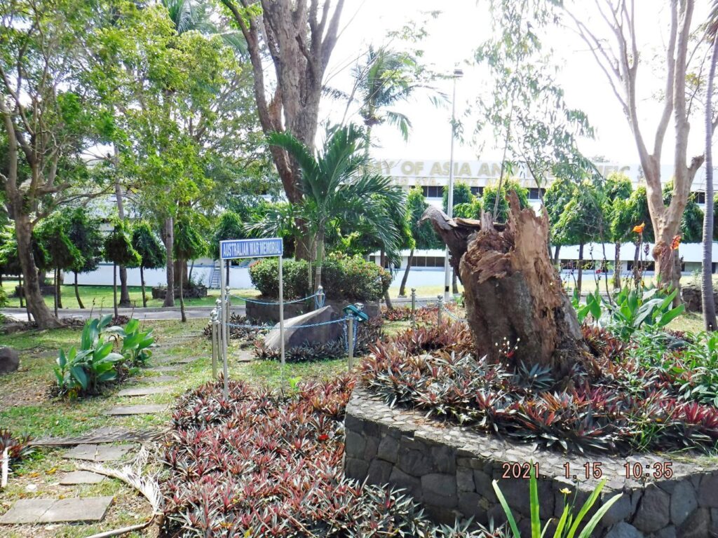
Australian WWII Memorial on Bataan
On this Bataan trip I visited Bob Hudson in Limay to see how he is doing. He told me that an English friend and he just by accident discovered the sign for the Australian Memorial and Bob told how to find it, and I sure took him up on it. Thanks Bob, he has an interesting personal blog: http://bataanson.blogspot.com/
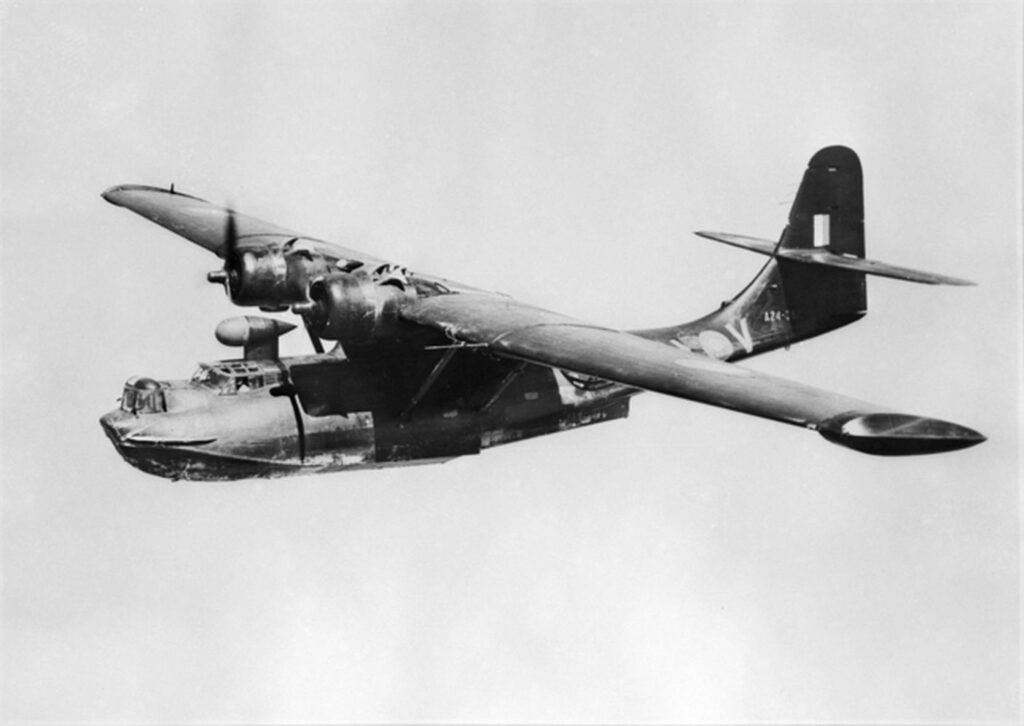
Zd901. 43_sqn_(AWM_128022) Black Cat Catalina. A Black Cat Catalina like this one is assumed to went down with the loss of the whole crew in Manila Bay.

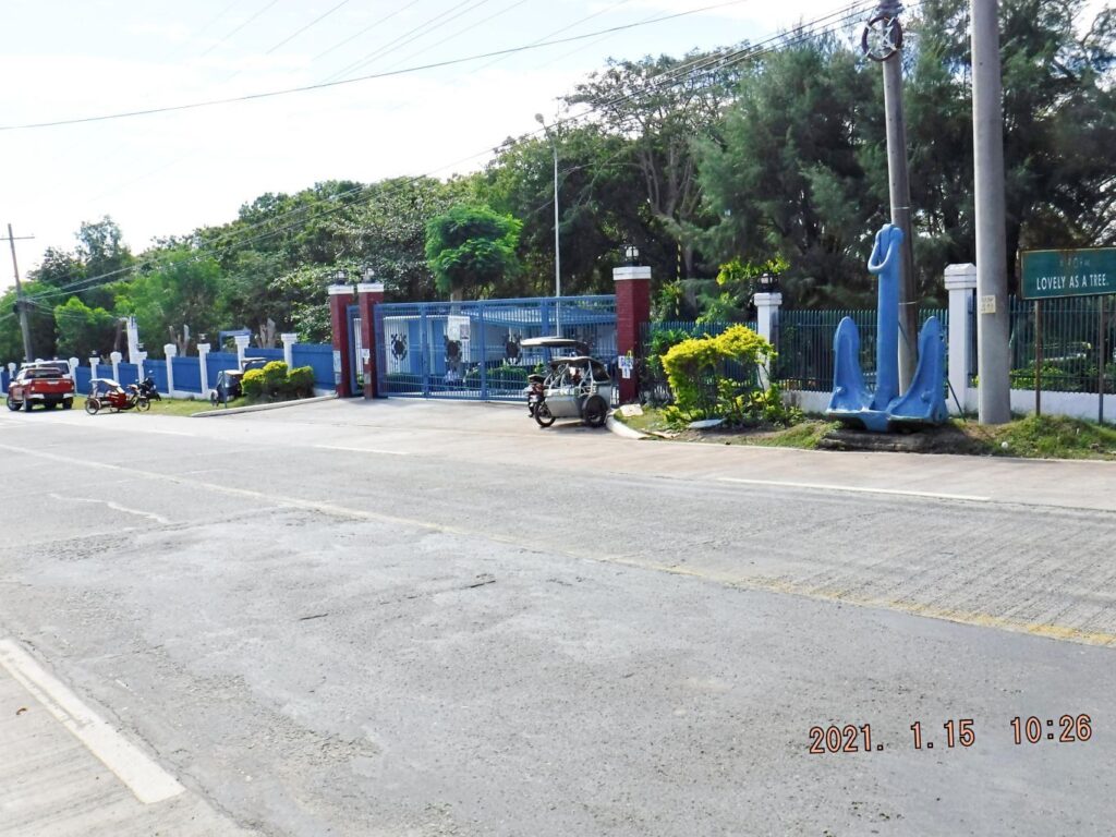
Zd902. One of several images of the Australian WWII Memorial located just inside the Main Gate of the Maritime Academy of Asia and the Pacific (MAAP). The gate is located, right side on the long road down to Kamaya Point Piers from the Cabcaben to Mariveles Road. This is part of Barangay Alas-asin, Mariveles, Bataan.
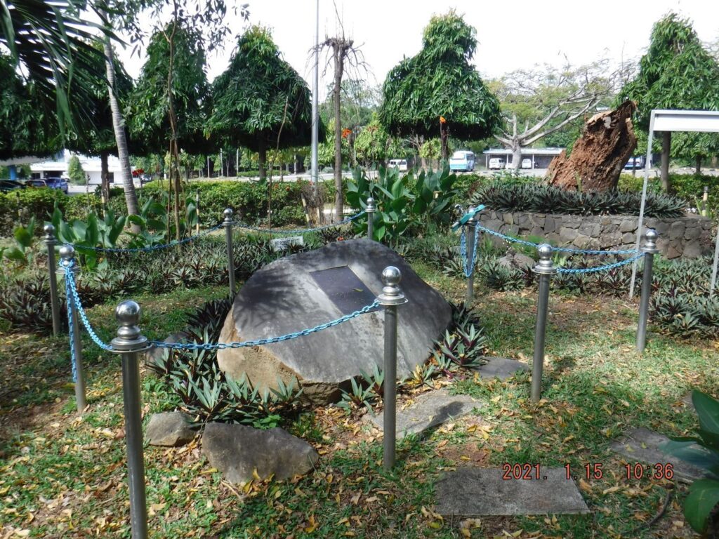
Zd903. One of several images of the Australian WWII Memorial located just inside the Main Gate of the Maritime Academy of Asia and the Pacific (MAAP). The gate is located, right side on the long road down to Kamaya Point Piers from the Cabcaben to Mariveles Road. This is part of Barangay Alas-asin, Mariveles, Bataan.
Zd904. One of several images of the Australian WWII Memorial located just inside the Main Gate of the Maritime Academy of Asia and the Pacific (MAAP). The gate is located, right side on the long road down to Kamaya Point Piers from the Cabcaben to Mariveles Road. This is part of Barangay Alas-asin, Mariveles, Bataan.
Zd905. One of several images of the Australian WWII Memorial located just inside the Main Gate of the Maritime Academy of Asia and the Pacific (MAAP). The gate is located, right side on the long road down to Kamaya Point Piers from the Cabcaben to Mariveles Road. This is part of Barangay Alas-asin, Mariveles, Bataan.
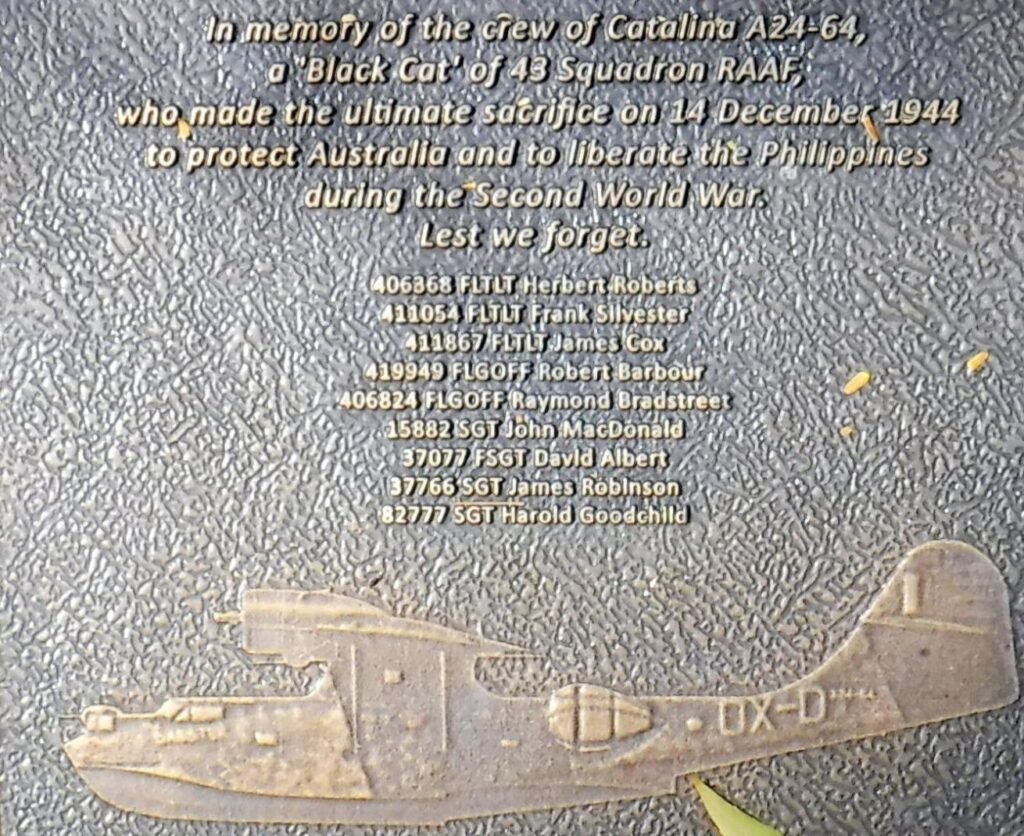
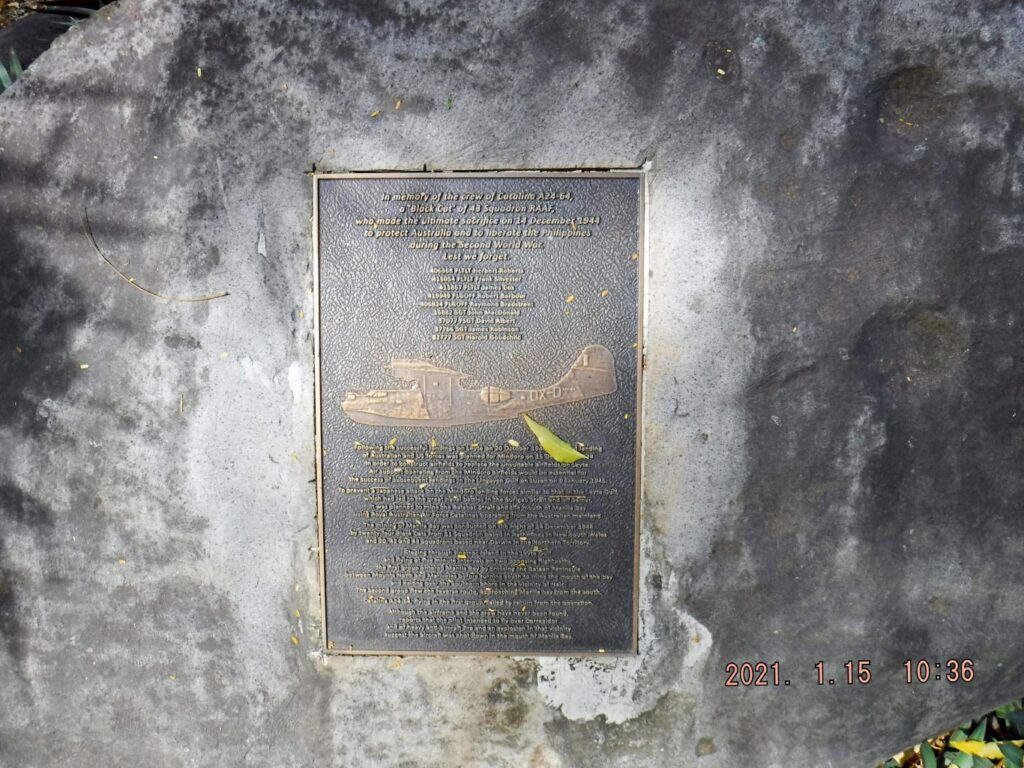
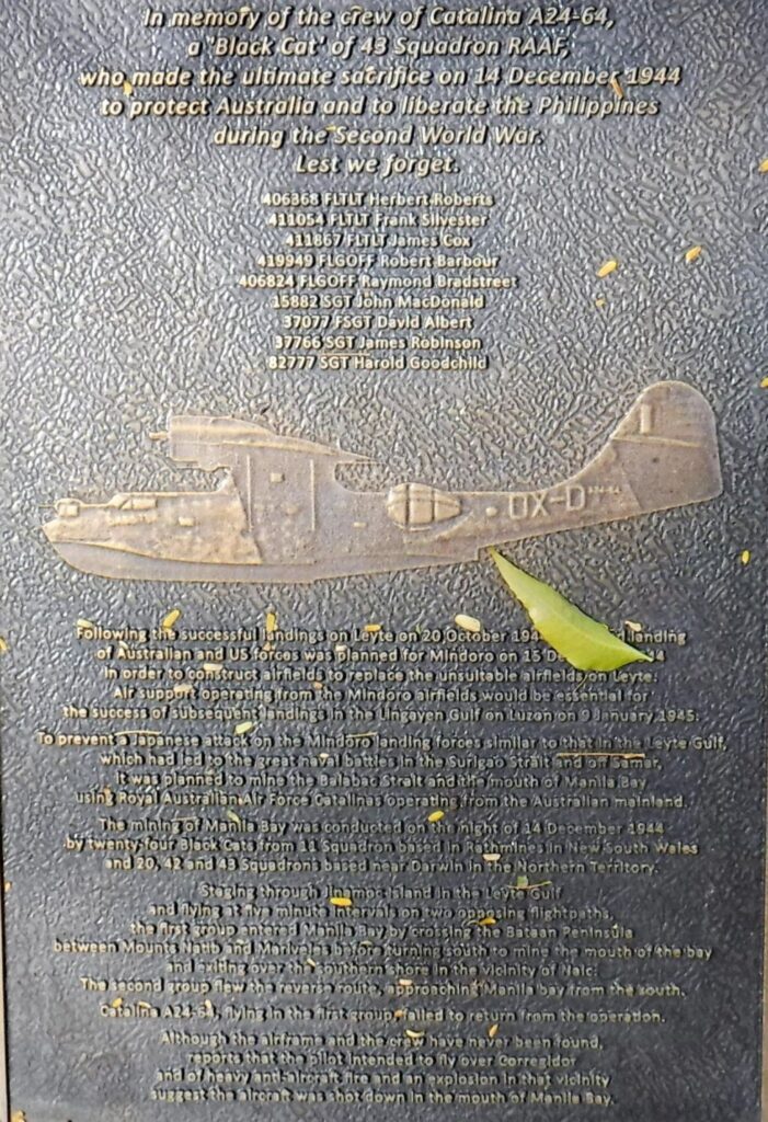
Zd906. In memory of the crew of Catalina A24-64, a Black Cat” of 43 Aquadron RAAF who made the ultimate sacrifice on 14th December 1944 to protect Australia and liberate the Philippines during the Second World War. Les we forget.
406368 FLTLT Herbert Roberts
411054 FLTLT Frank Silvester
411867 FLTLT James Cox
419949 FLGOFF Robert Barbour
406824 FLGOFF Raymond Bradstreet
15882 SGT John MacDonald
37077 FSGT David Albert
37766 SGT James Robinson
82777 SGT Harold Goodchild
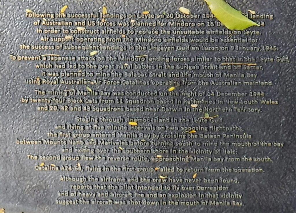
Zd907. On 14 December 1944, No. 43 Squadron, augmented by Catalinas from No. 11 Squadron based at Rathmines, New South Wales, mined Manila Bay to keep Japanese shipping “bottled up”, thus supporting the Allied landing at Mindoro taking place the next day. Flying from Leyte, the 24 Catalinas successfully dropped 60 mines in the heavily defended target area for the loss of one of their number, and returned to base at the limit of their fuel reserves
Zd908. One of 5 images of the Main Gate area of the Maritime Academy of Asia and the Pacific (MAAP). The Australian WWII Memorial is located just inside the Main Gate of MAAP. The gate is located, right side on the long road down to Kamaya Point Piers from the Cabcaben to Mariveles Road. This is part of Barangay Alas-asin, Mariveles, Bataan.
Zd909. One of 5 images of the Main Gate area of the Maritime Academy of Asia and the Pacific (MAAP). The Australian WWII Memorial is located just inside the Main Gate of MAAP. The gate is located, right side on the long road down to Kamaya Point Piers from the Cabcaben to Mariveles Road. This is part of Barangay Alas-asin, Mariveles, Bataan.
Zd910. One of 5 images of the Main Gate area of the Maritime Academy of Asia and the Pacific (MAAP). The Australian WWII Memorial is located just inside the Main Gate of MAAP. The gate is located, right side on the long road down to Kamaya Point Piers from the Cabcaben to Mariveles Road. This is part of Barangay Alas-asin, Mariveles, Bataan.

Zd911. One of 5 images of the Main Gate area of the Maritime Academy of Asia and the Pacific (MAAP). The Australian WWII Memorial is located just inside the Main Gate of MAAP. The gate is located, right side on the long road down to Kamaya Point Piers from the Cabcaben to Mariveles Road. This is part of Barangay Alas-asin, Mariveles, Bataan.
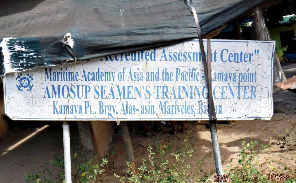
Zd912. One of 5 images of the Main Gate area of the Maritime Academy of Asia and the Pacific (MAAP). The Australian WWII Memorial is located just inside the Main Gate of MAAP. The gate is located, right side on the long road down to Kamaya Point Piers from the Cabcaben to Mariveles Road. This is part of Barangay Alas-asin, Mariveles, Bataan. This discarded sign was located at a vendors stall just across the street from the Main Gate
—————————————
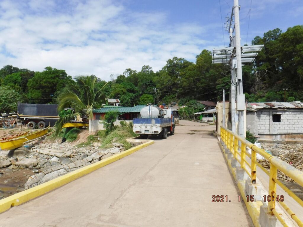
Camaya Point views.
Camaya Point Pier, Harbor is at the end of the road that runs from the Cabcaben-Mariveles Bataan
Express Way to the North Channel of the Manila Bay entrance. One can rent boats here to Corregidor and the Maritime Academy of Asia and the Pacific (MAAP) uses it for their training. The Camaya Point Pier was used by an entrepreneur to ferry visitors to Corregidor from here. This pier is also used by the Maritime Academy of Asia and the Pacific (MAAP). This academy has provided honor guards for anniversaries on Corregidor. I contacted the owner of the boats, Mr. Wilfredo Labrador; he said that he had to stop operations because the virus crisis killed his business in March 2020. His boats and vehicles are on Corregidor, available to be bought at a bargain price. Corregidor is in sight from this location! On the map I provided, the name “Camaya Point” is not being used. I recently read that Mariveles was called Camaya, a long time ago, is there a connection?
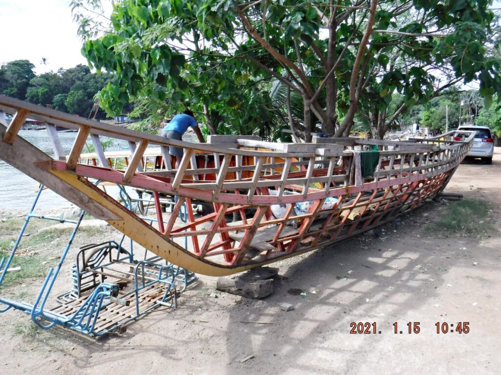
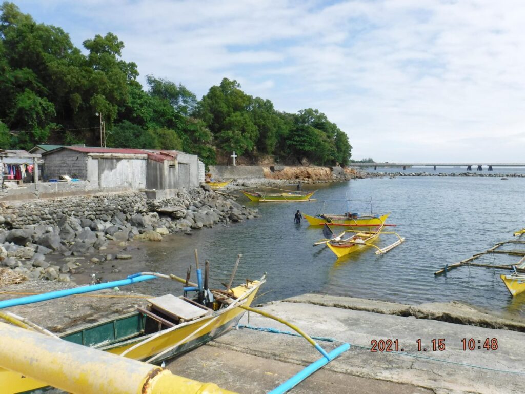
Zd913 this is a view at Camaya Point, Brgy. Alis-asin, Mariveles Bataan, the skeleton of a Bangka boat.
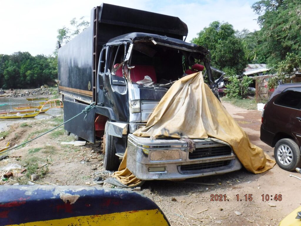
Zd914 this is a view at Camaya Point, Brgy. Alis-asin, Mariveles Bataan; this is the truck that lost control and killed the Corregidor Boat Service coordinator about 2 years ago.
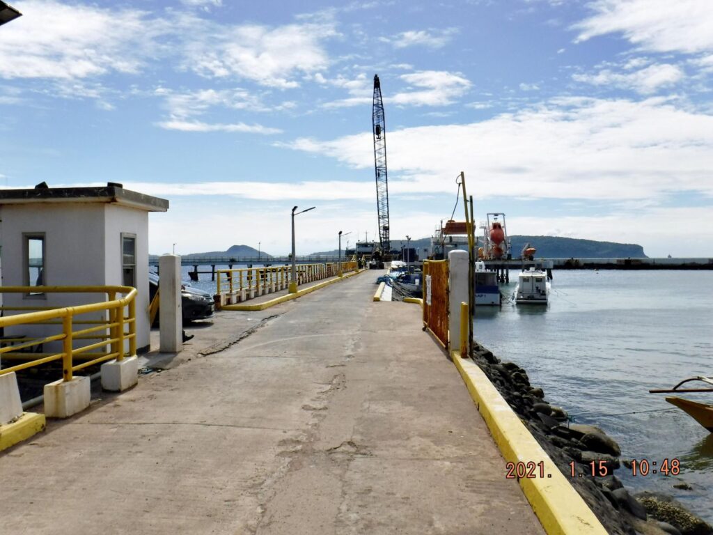
Zd915. This is the Camaya Point Pier. The Camaya Point Pier was used by an entrepreneur to ferry visitors to Corregidor from here. This pier is also used by the Maritime Academy of Asia and the Pacific (MAAP). This academy has provided honor guards for anniversaries on Corregidor. I contacted the owner of the boats, Mr. Wilfredo Labrador; he said that he had to stop operations because the virus crisis killed his business in March 2020. His boats and vehicles are on Corregidor, available to be bought at a bargain price. Corregidor is in sight in back of this picture! On the map I provided, the name “Camaya Point” is not being used. I recently read that Mariveles was called Camaya, a long time ago, is there a connection?
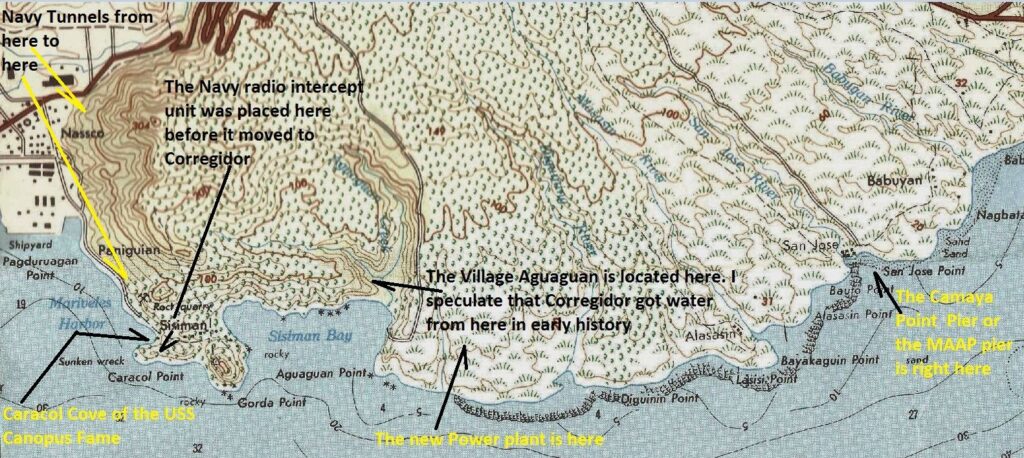
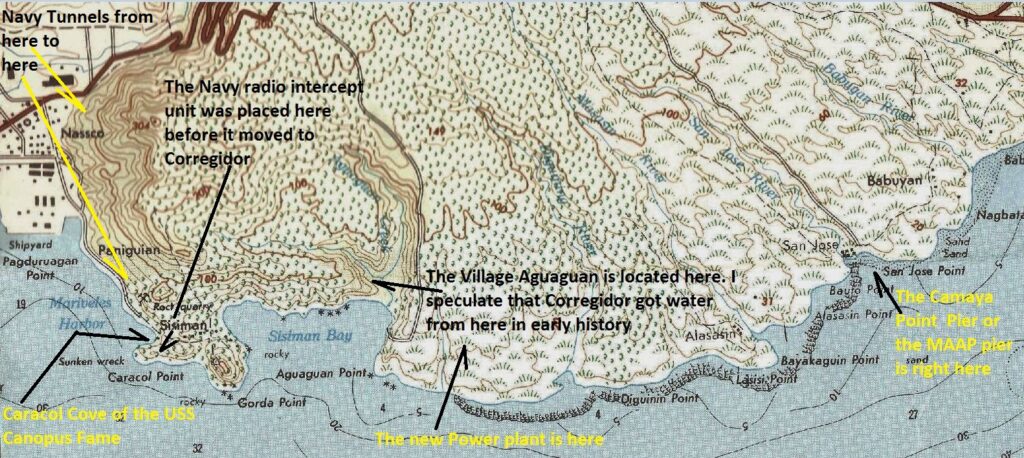
Zd915a. This is a section of an old 1:50000 map of the Mariveles area. I marked it up to point out some historical venues.
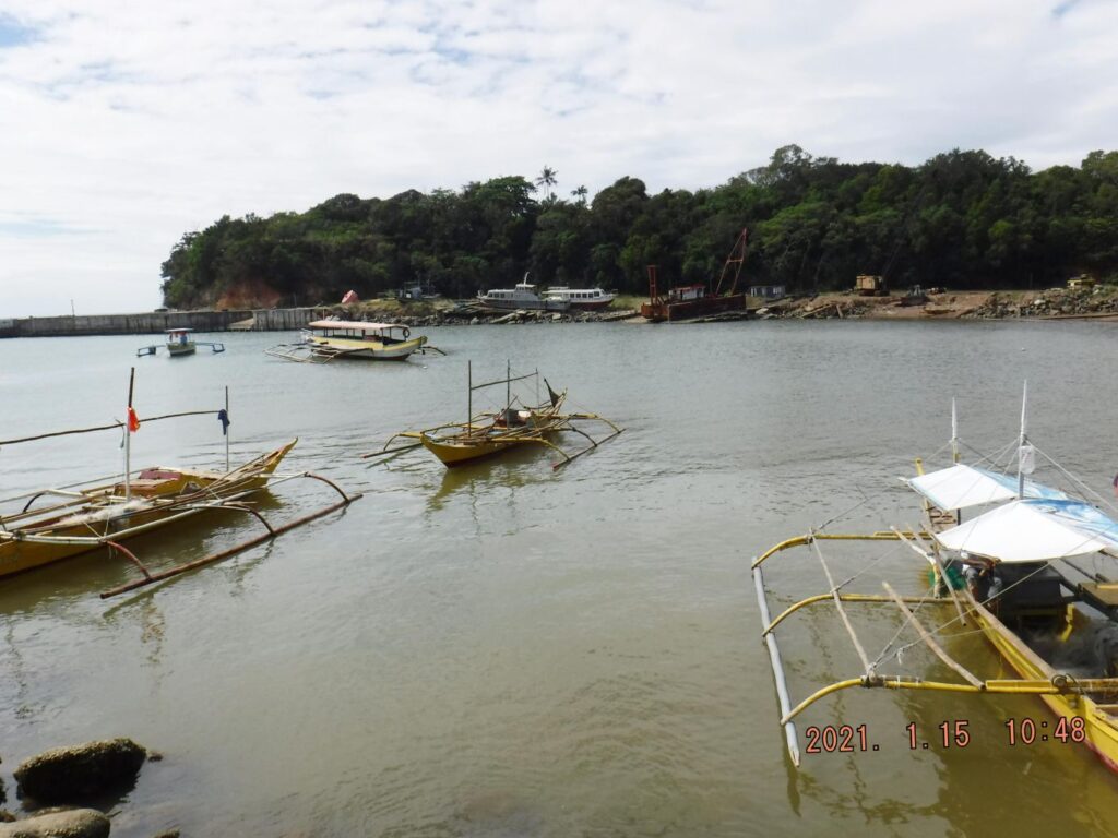
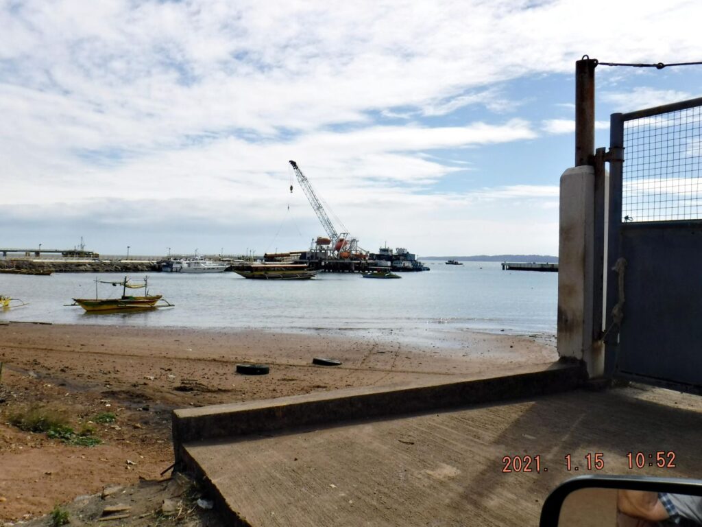
Zd916. This is a view of the harbor from the pier at Camaya Point, Brgy. Alis-asin, Mariveles Bataan.
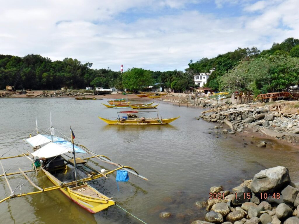
Zd917. This is a view of the harbor from the pier at Camaya Point, Brgy. Alis-asin, Mariveles Bataan.
Zd918. This is a view of the harbor from the pier at Camaya Point, Brgy. Alis-asin, Mariveles Bataan.
Zd919. This is a view of the harbor from the pier at Camaya Point, Brgy. Alis-asin, Mariveles Bataan.
Zd920. This is a view of the harbor from the western end of Camaya Point, Brgy. Alis-asin, Mariveles Bataan.
——————————————————–
Sisiman Bay views, 2021-01-15
Zd921. This is a section of an old 1:50000 map of the Mariveles area. I marked it up to point out some historical venues.
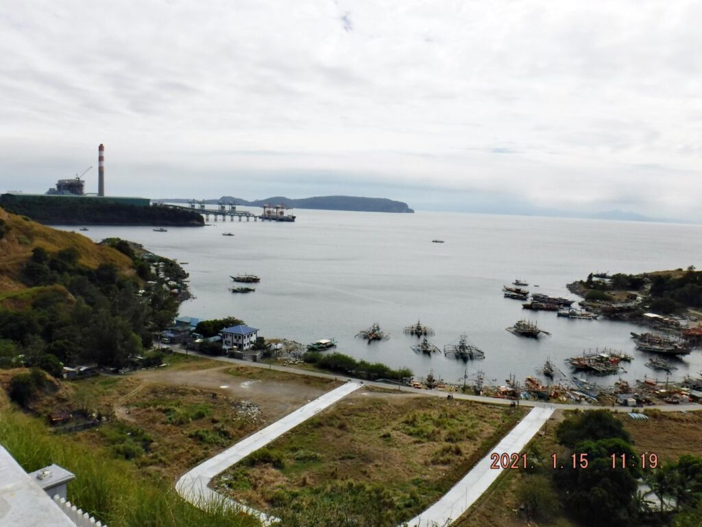
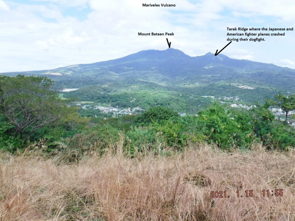
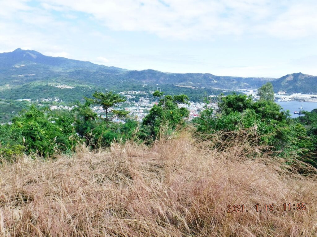
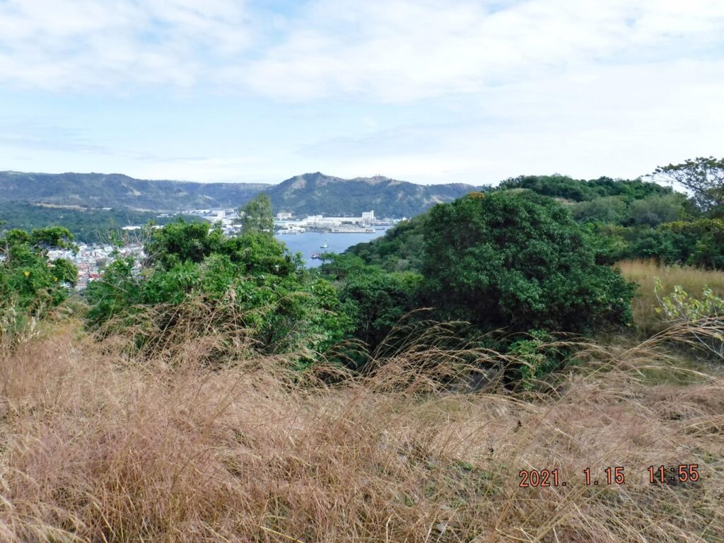
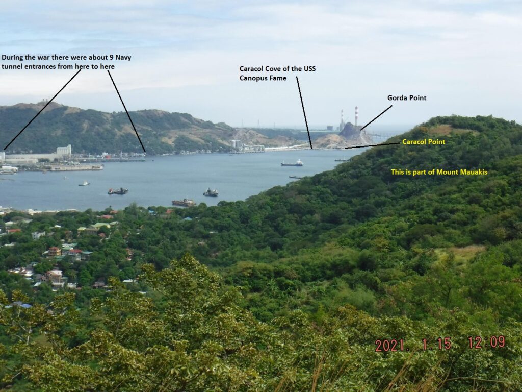
Zd922. One of three images, left to right of the Sisiman Bay. It is very scenic and a new viewing deck has been built and this is where I shot the pictures from. The power plant has expanded and has now two stacks which did not get on the picture. From Corregidor it looks like they also established a solar field. Corregidor is in view. Sisiman Bay, of course, is famous because it was home of the PT Boat squadron that attacked Japanese held Subic Bay, sunk a Japanese boat landing troops behind the Bataan defense line, rescued over two hundred perhaps, survivors of the SS Corregidor, sunk in the Corregidor minefield. The PT boats are most famous for breaking thru the Japanese lines and delivering Gen. MacArthur to Mindanao. They started from here and picked up the General and his staff
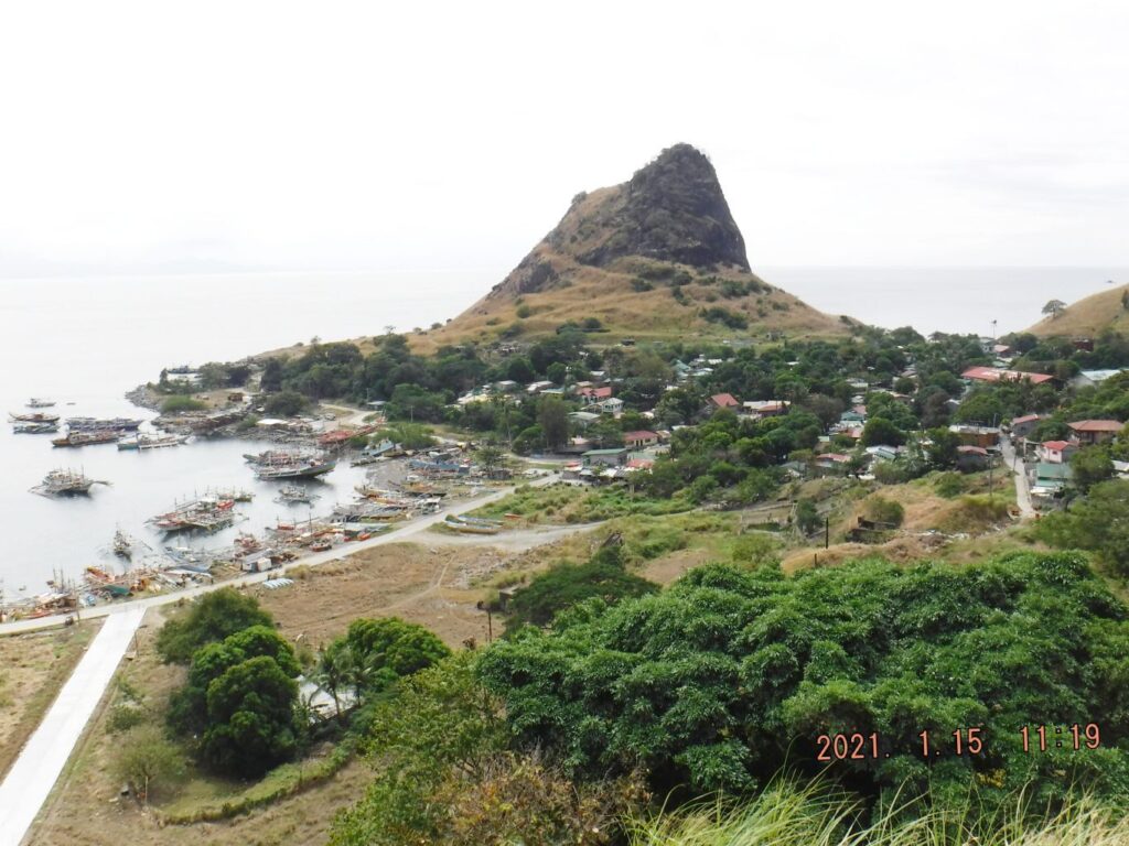
Zd923. . Gorda Point and Barrio Sisiman. John and I found it interesting to walk around this hill!
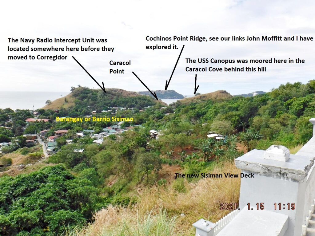
Zd924. A view west across the Mariveles Bay or Harbor from the Sisiman View Deck, marked up with some interesting historical points.
John Moffitt (aka fots2) and I have teamed up and explored these areas and the Corregidor.org webmaster established these three very interesting PICTURE Field Notes, take a chance and enjoy them.
John Moffitt’s Field Notes:
FIELD NOTE: PART 3 – MARIVELES AREA SCENERY TODAY, click here:
FIELD NOTES: PART 2 – COCHINOS & LONGOS KAWAYAN POINTS, click here:
FIELD NOTES: PART 1 – THE U.S.N. TUNNELS TODAY, click here:
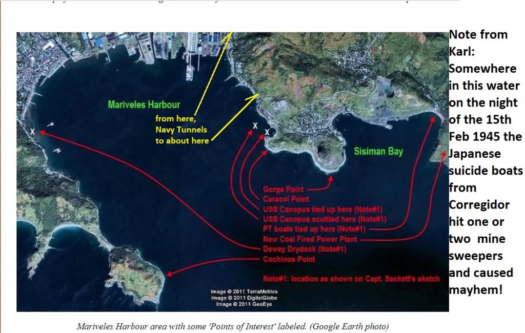
Zd925. Mariveles Harbor Map drawn by Captain (later Rear Admiral) Sackett during the war,
corregidor.proboards.com/thread/2124/mariveles-harbor-map-sackett
I marked in, the approximate location of the , Navy Tunnels and made the note about the suicide boats that caused more casualties and need to be counted when looking at the cost of liberating Bataan and Corregidor.
————————————-
Mariveles town Views from Mount Mauakis
Mariveles is scenic and I enjoy scenery.
https://philippine-sailor.net/wp-content/uploads/2021/02/Zd926.jpg
Zd926. This is a section of a 1:50000 map of the Mariveles area.
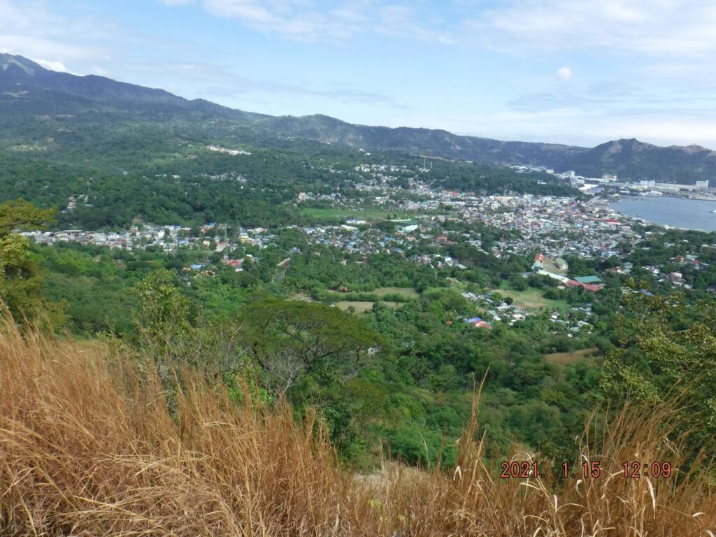
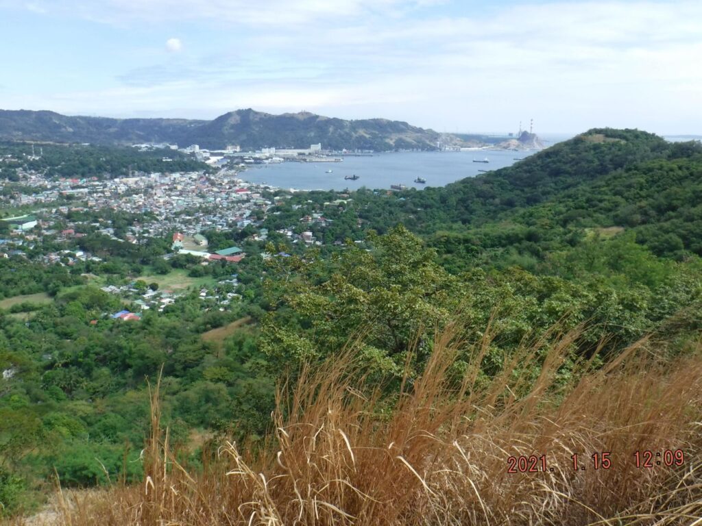
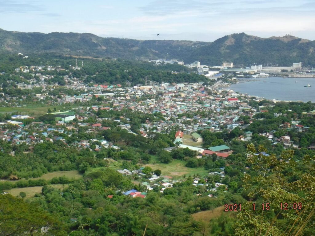
Zd927. One of three images, left to right, of the Mariveles Town and Economic Zone from Mount Mauakis which forms the west boundary of the Mariveles Harbor.
Zd928. One of three images, left to right, of the Mariveles Town and Economic Zone from Mount Mauakis which forms the west boundary of the Mariveles Harbor.
Zd929. One of three images, left to right, of the Mariveles Town and Economic Zone from Mount Mauakis which forms the west boundary of the Mariveles Harbor.
Zd930. One of five images, left to right, of the Mariveles Town and Economic Zone from Mount Mauakis which forms the west boundary of the Mariveles Harbor.
Zd931. One of five images, left to right, of the Mariveles Town and Economic Zone from Mount Mauakis which forms the west boundary of the Mariveles Harbor.
Zd932. One of five images, left to right, of the Mariveles Town and Economic Zone from Mount Mauakis which forms the west boundary of the Mariveles Harbor.
Zd933. One of five images, left to right, of the Mariveles Town and Economic Zone from Mount Mauakis which forms the west boundary of the Mariveles Harbor.
Zd934. One of five images, left to right, of the Mariveles Town and Economic Zone from Mount Mauakis which forms the west boundary of the Mariveles Harbor.
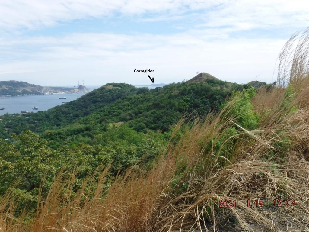
Zd935. One of three close-up images, left to right, of the Mariveles Town and Economic Zone from Mount Mauakis which forms the west boundary of the Mariveles Harbor.
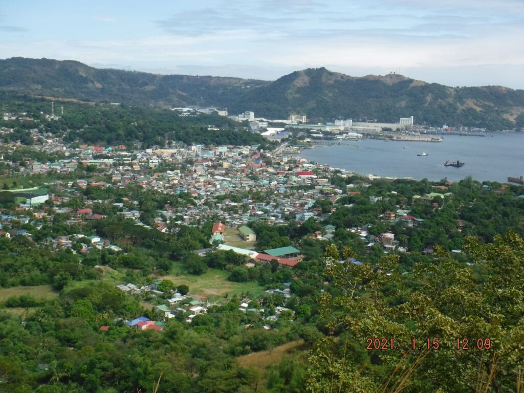
Zd936. One of three close-up images, left to right, of the Mariveles Town and Economic Zone from Mount Mauakis which forms the west boundary of the Mariveles Harbor.
Zd937. One of three close-up images, left to right, of the Mariveles Town and Economic Zone from Mount Mauakis which forms the west boundary of the Mariveles Harbor.
———————————————
Longos Kawayan Point Views 2021-01-15
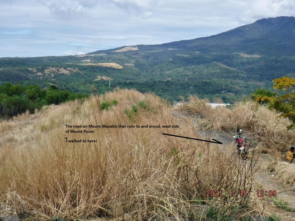
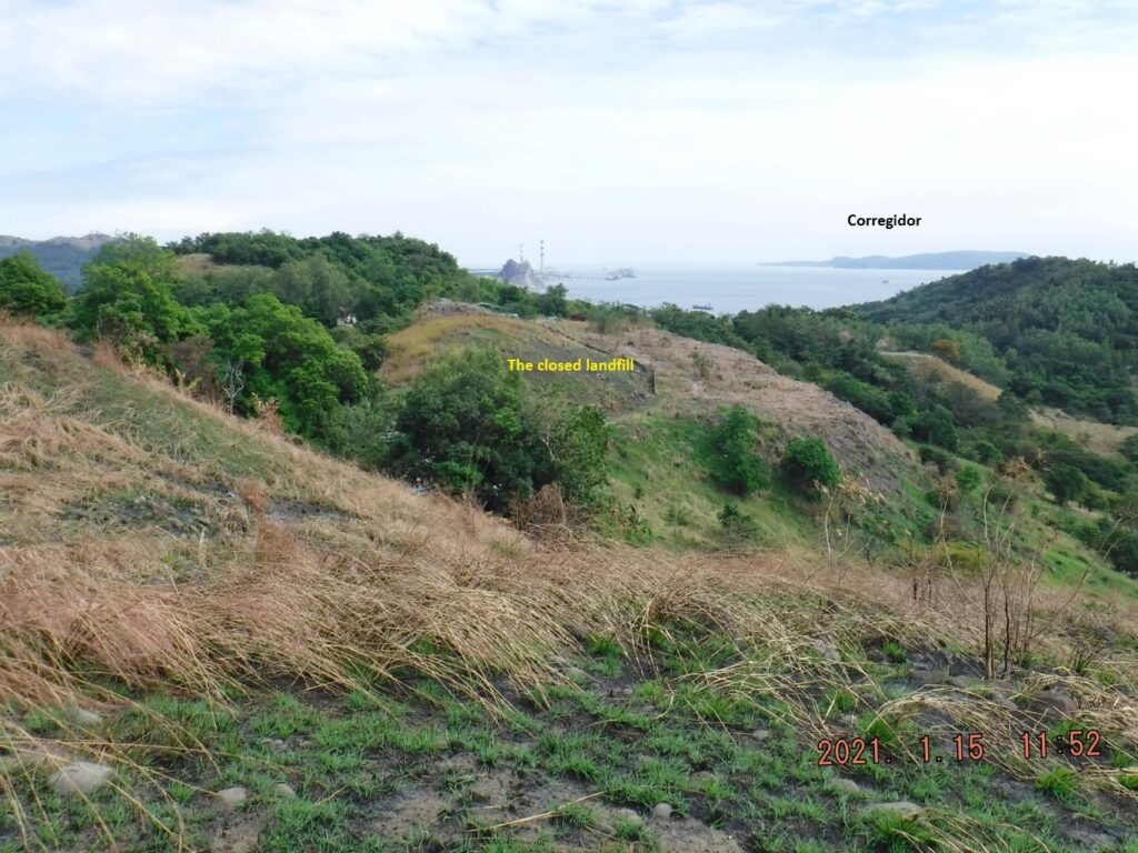
Longos Kawayan Point is famous because it is a WWII Battlefield; the combined forces of Gen MacArthur defeated the enemy here, they wiped them out, because the Japanese don’t surrender. It is relative easy to walk or drive onto the road on Mount Mauakis and view this and other points. I used the road to the nearby, now closed landfill, parked and walked along the road on Mount Mauakis and enjoyed these views.
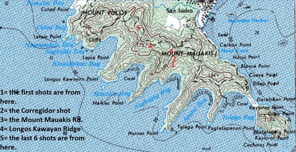
Zd938. A map with the famous Battle of the Point Longos Kawayan Point and the other nearby bay, ridges on Mount Mauakis. It also tells where the pictures were shot from.
Zd939. This is one of 5 images shot from location No.1, me, standing up on the Naiklec Ridge; the pictures were shot from left to right.
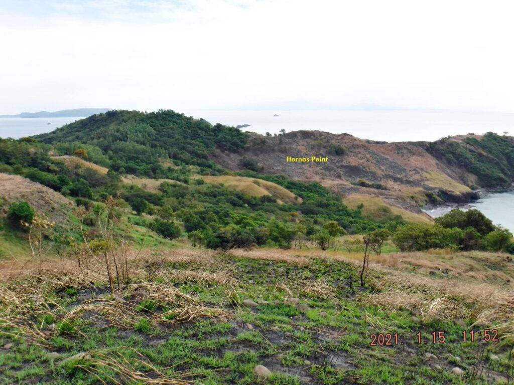
Zd940. This is one of 5 images shot from location No.1, me, standing up on the Naiklec Ridge; the pictures were shot from left to right.
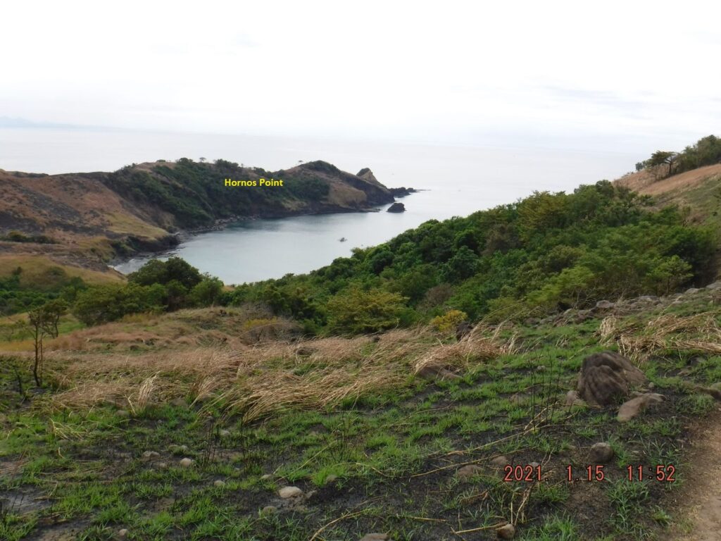
Zd941. This is one of 5 images shot from location No.1, me, standing up on the Naiklec Ridge; the pictures were shot from left to right.
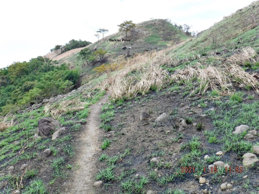
Zd942. This is one of 5 images shot from location No.1, me, standing up on the Naiklec Ridge; the pictures were shot from left to right.
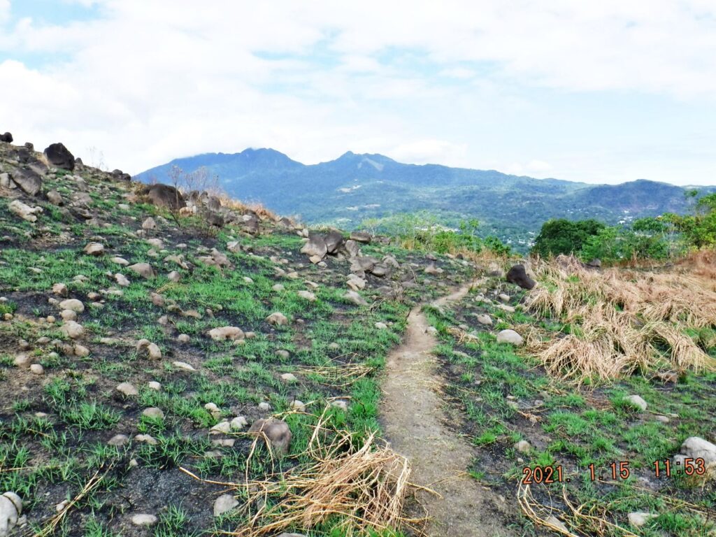
Zd943. This is one of 5 images shot from location No.1, me, standing up on the Naiklec Ridge; the pictures were shot from left to right.
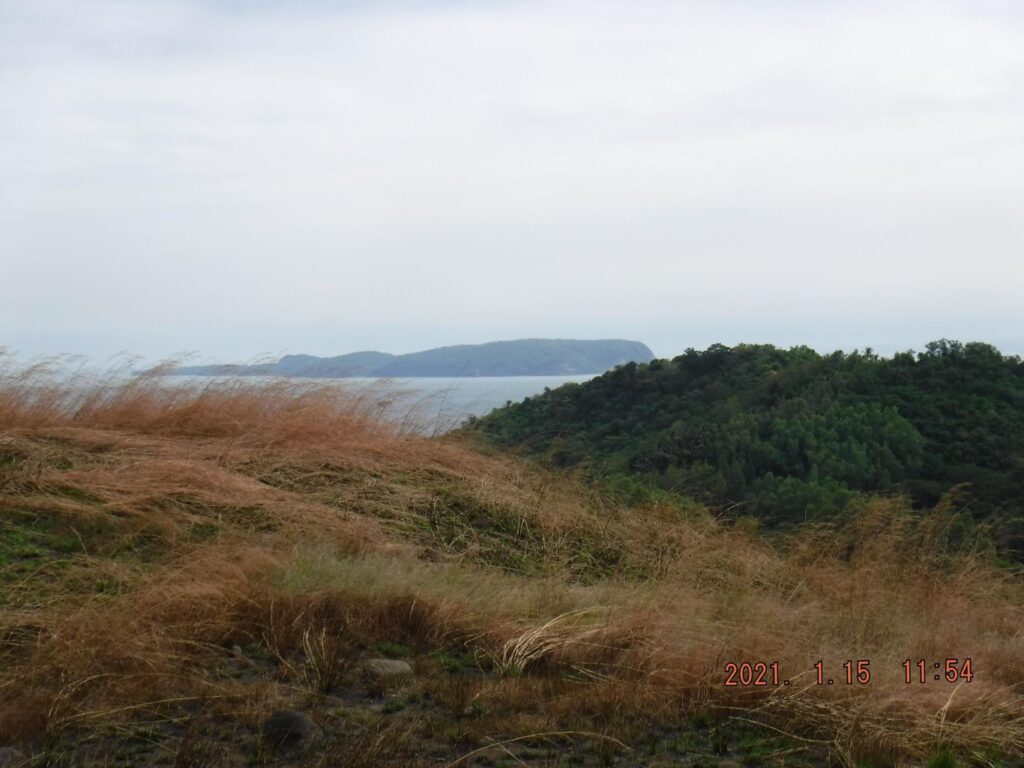
Zd944. This is a parting shot of Corregidor from location No2.
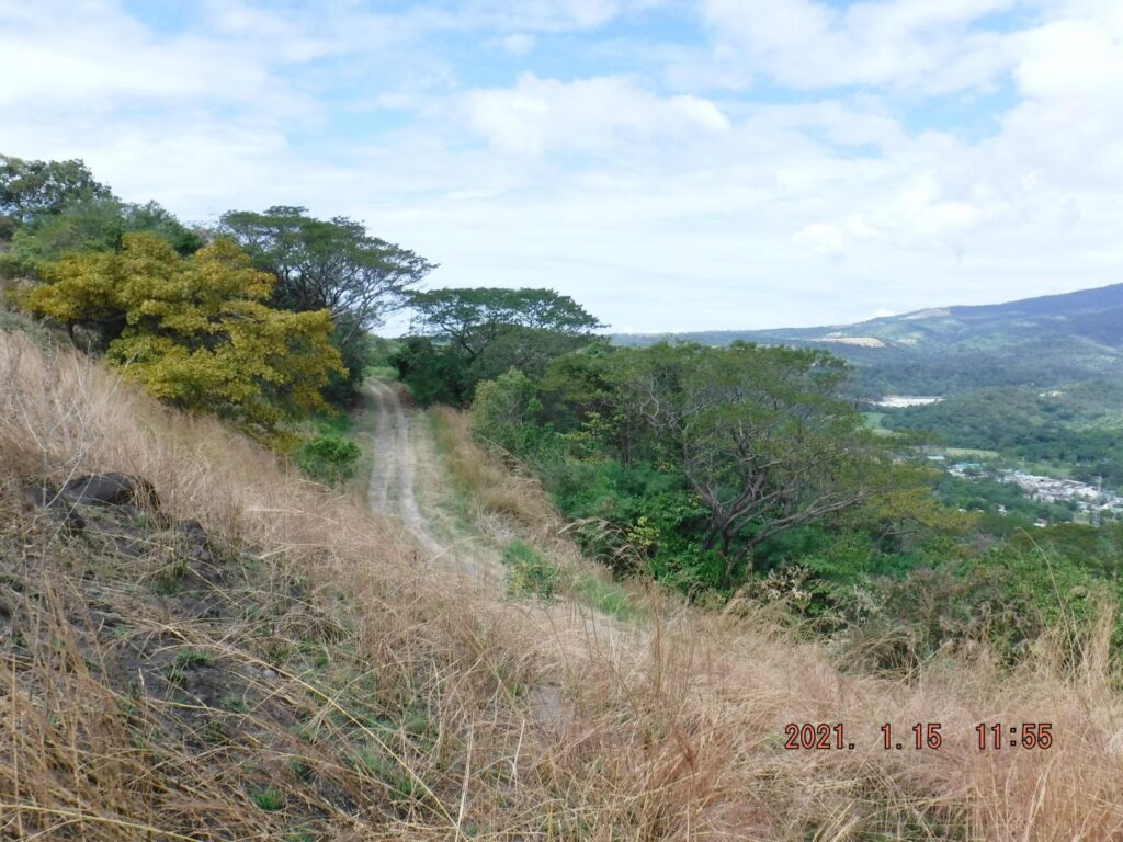
Zd945. This is a shot of the Mount Mauakis road from location No. 3.
Zd946. In this shot from location No. 4; I’m looking back and I just passed the private entrance to Longos Kawayan Point, which is the best way to go to that point.
Zd947. In this shot I’m approaching location spot No. 5.
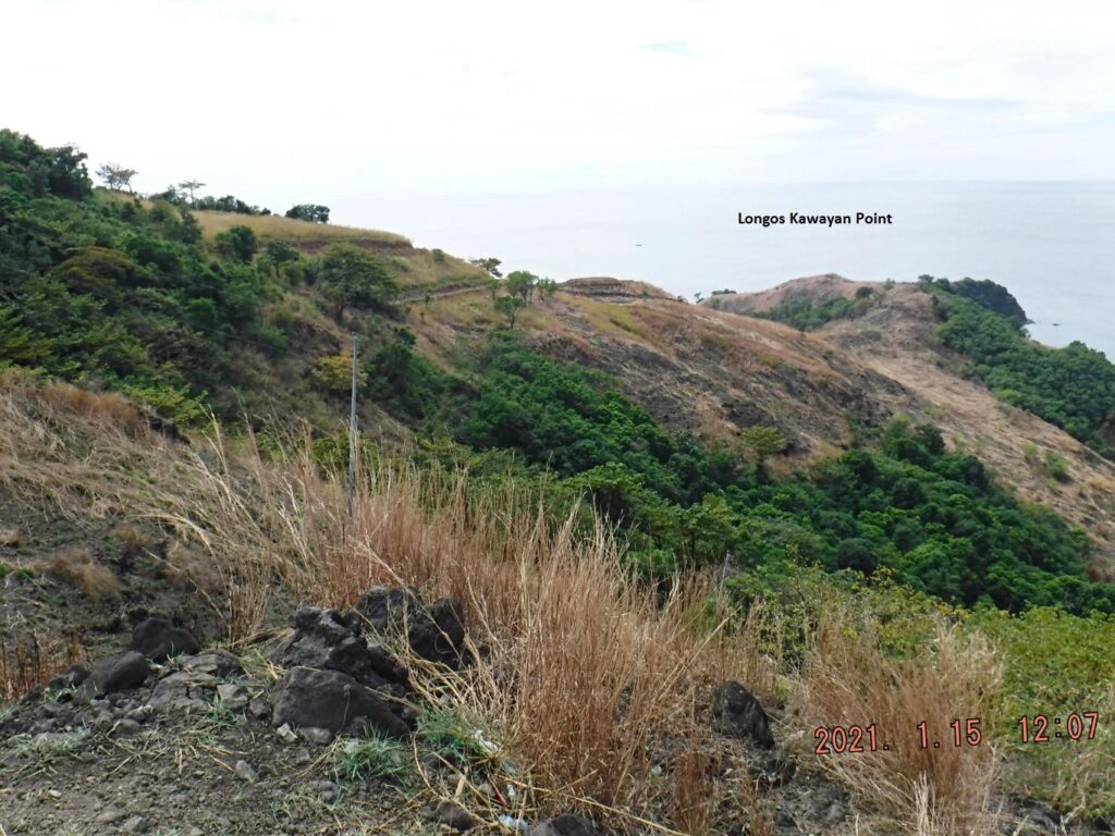
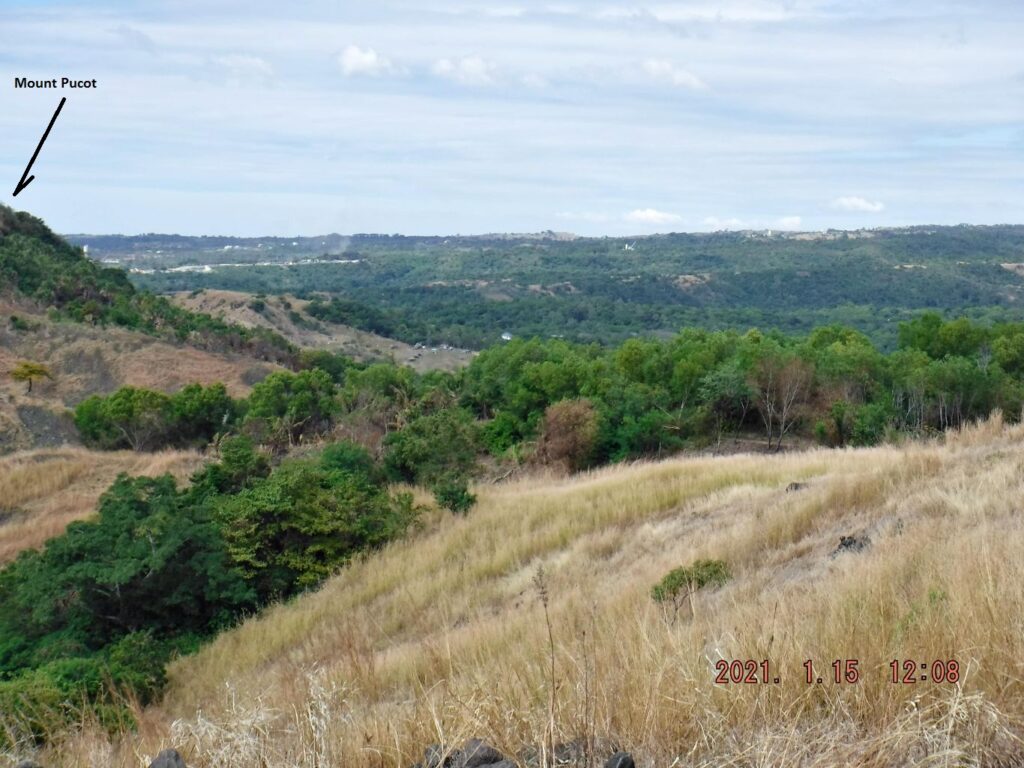
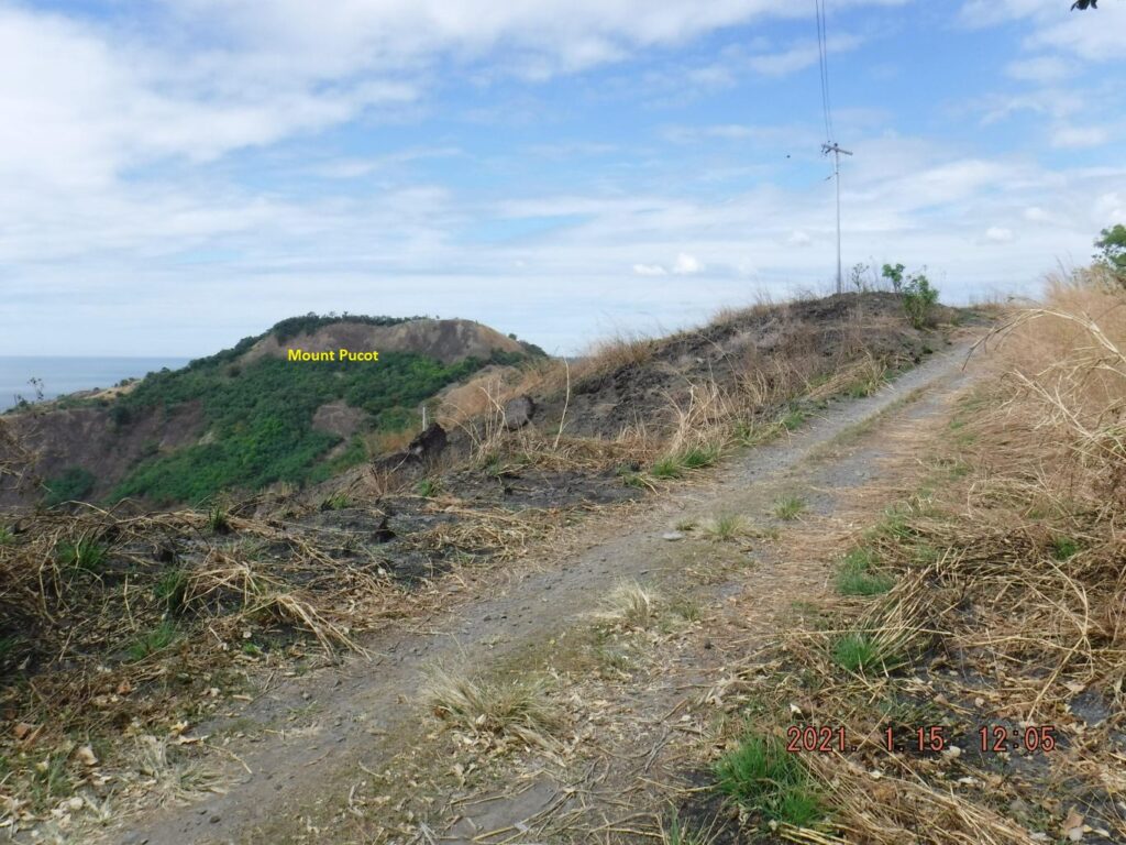
Zd948. This is one of 5 shots, shot left to right, from Longos Kawayan Point, across Kinalalakan Bay, to Lapia Point and then to Mount Pucot.
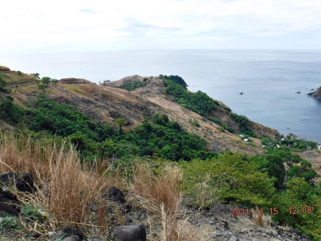
Zd949. This is one of 5 shots, shot left to right, from Longos Kawayan Point, across Kinalalakan Bay, to Lapia Point and then to Mount Pucot.
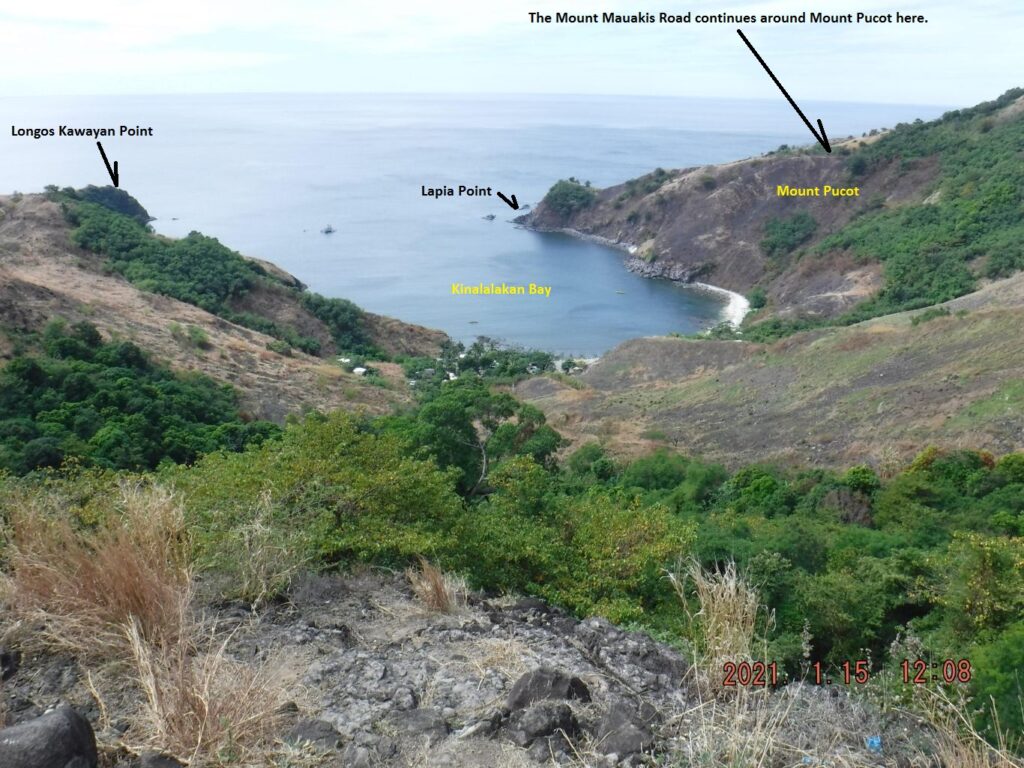
Zd950. This is one of 5 shots, shot left to right, from Longos Kawayan Point, across Kinalalakan Bay, to Lapia Point and then to Mount Pucot.
Zd951. This is one of 5 shots, shot left to right, from Longos Kawayan Point, across Kinalalakan Bay, to Lapia Point and then to Mount Pucot.
Zd952. This is one of 5 shots, shot left to right, from Longos Kawayan Point, across Kinalalakan Bay, to Lapia Point and then to Mount Pucot.
———————————————-
My Bataan reconnaissance drive 2021-01-15
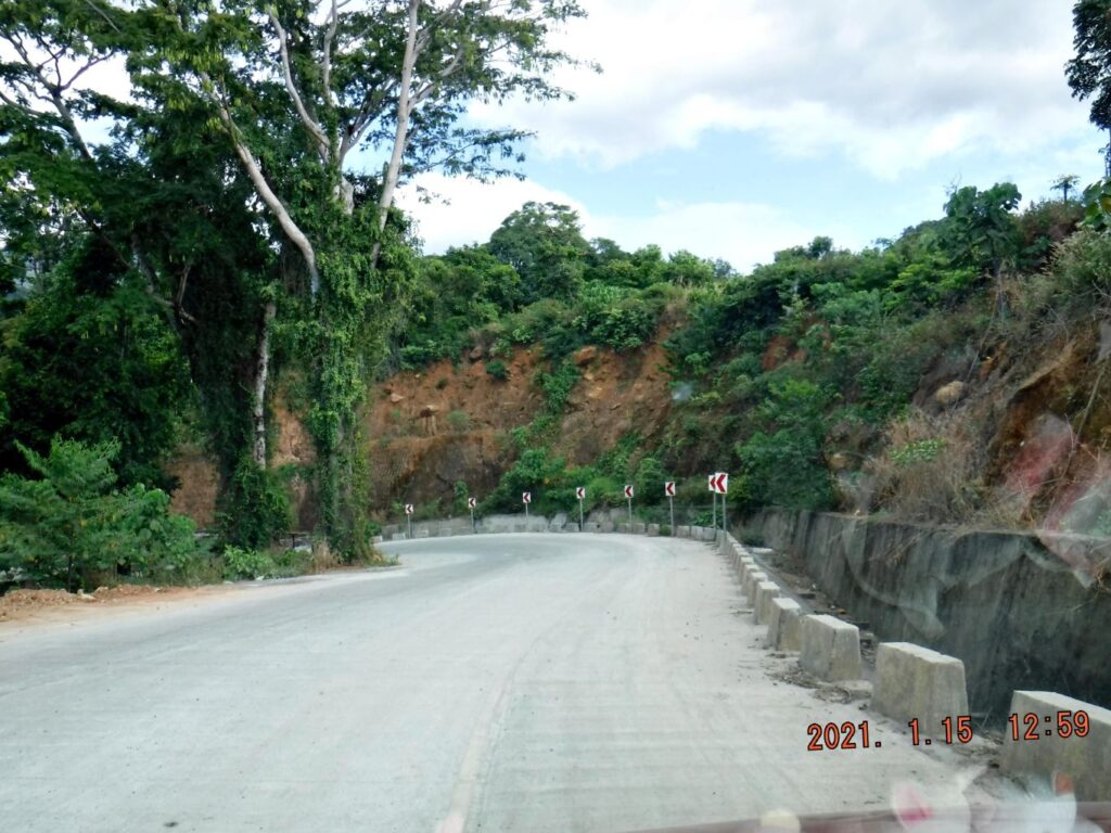
This is the last segment; it is about the Bataan West Road. It is about 43 km from Mariveles to Bagac and the road is now 99% finished with concrete and at least 2 lanes and solid bridges and the slopes are mostly stable. Only at very few places does the road have trouble with the road banks, up slope or down slope. It is safe to drive, very scenic and hardly any traffic, although many curves!
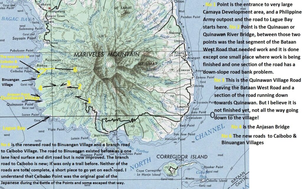
Zd953. This is a cropped section of a prewar US Army 1: 250000 map of the Manila area but it has all of Bataan and the Bataan West Road. The northern part of Bataan is cropped away! I marked up for your morientation.
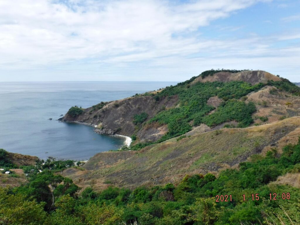
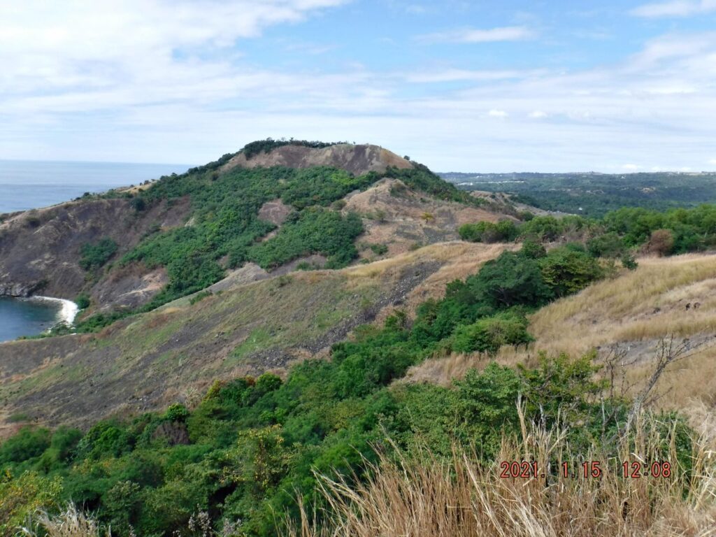
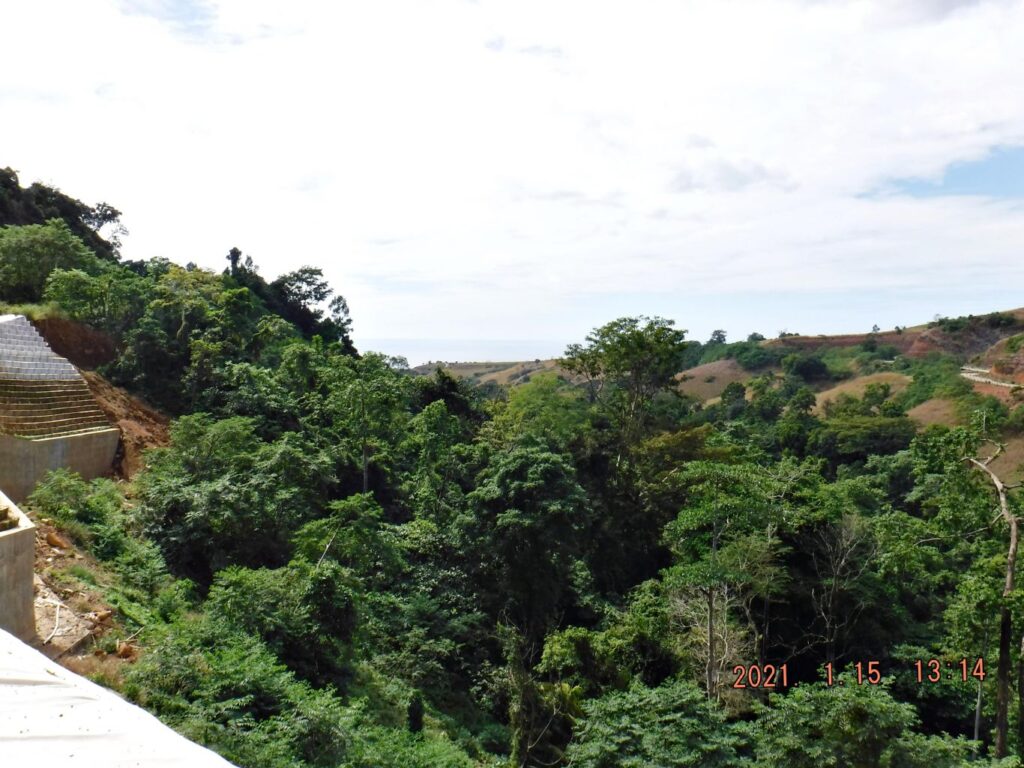
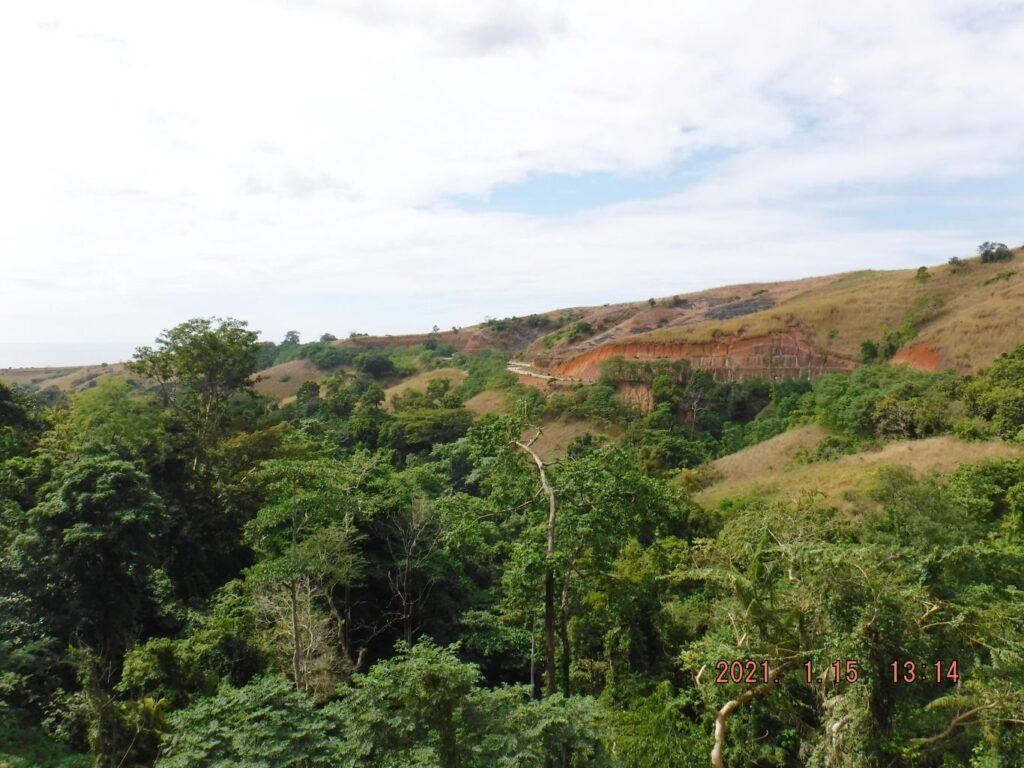
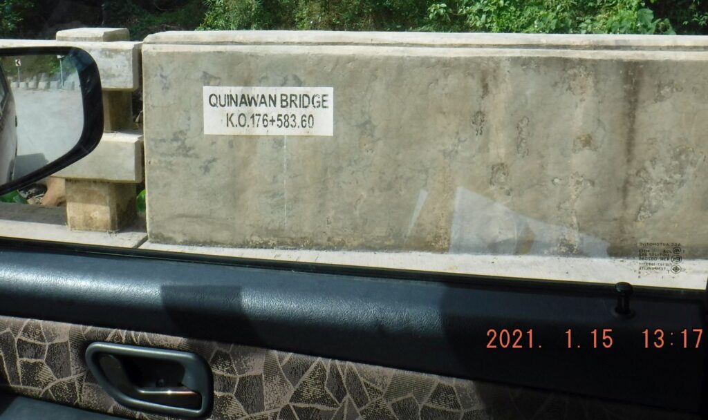
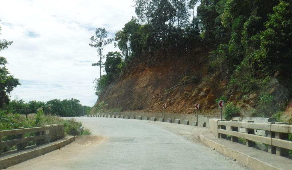
Zd954. This is one of 10 images of the Bataan West Road between point No1 and point No 2 on the map of image No. Zd953. No 1 Point is the entrance to very large Camaya Development area, and a Philippine Army outpost and the road to Lague Bay starts here. No 2 Point is the Quinauan or Quinawan River Bridge, between those two points was the last segment of the Bataan West Road that needed work and it is done except one small place where work is being finished and one section of the road has a down-slope road bank problem. Now it is a nice scenic cruising road!
Zd955. This is one of 10 images of the Bataan West Road between point No1 and point No 2 on the map of image No. Zd953. No 1 Point is the entrance to very large Camaya Development area, and a Philippine Army outpost and the road to Lague Bay starts here. No 2 Point is the Quinauan or Quinawan River Bridge, between those two points was the last segment of the Bataan West Road that needed work and it is done except one small place where work is being finished and one section of the road has a down-slope road bank problem. Now it is a nice scenic cruising road!
Zd956. This is one of 10 images of the Bataan West Road between point No1 and point No 2 on the map of image No. Zd953. No 1 Point is the entrance to very large Camaya Development area, and a Philippine Army outpost and the road to Lague Bay starts here. No 2 Point is the Quinauan or Quinawan River Bridge, between those two points was the last segment of the Bataan West Road that needed work and it is done except one small place where work is being finished and one section of the road has a down-slope road bank problem. Now it is a nice scenic cruising road!
Zd957. This is one of 10 images of the Bataan West Road between point No1 and point No 2 on the map of image No. Zd953. No 1 Point is the entrance to very large Camaya Development area, and a Philippine Army outpost and the road to Lague Bay starts here. No 2 Point is the Quinauan or Quinawan River Bridge, between those two points was the last segment of the Bataan West Road that needed work and it is done except one small place where work is being finished and one section of the road has a down-slope road bank problem. Now it is a nice scenic cruising road!
Zd958. This is one of 10 images of the Bataan West Road between point No1 and point No 2 on the map of image No. Zd953. No 1 Point is the entrance to very large Camaya Development area, and a Philippine Army outpost and the road to Lague Bay starts here. No 2 Point is the Quinauan or Quinawan River Bridge, between those two points was the last segment of the Bataan West Road that needed work and it is done except one small place where work is being finished and one section of the road has a down-slope road bank problem. Now it is a nice scenic cruising road!
Zd959. This is one of 10 images of the Bataan West Road between point No1 and point No 2 on the map of image No. Zd953. No 1 Point is the entrance to very large Camaya Development area, and a Philippine Army outpost and the road to Lague Bay starts here. No 2 Point is the Quinauan or Quinawan River Bridge, between those two points was the last segment of the Bataan West Road that needed work and it is done except one small place where work is being finished and one section of the road has a down-slope road bank problem. Now it is a nice scenic cruising road!
Zd960. This is one of 10 images of the Bataan West Road between point No1 and point No 2 on the map of image No. Zd953. No 1 Point is the entrance to very large Camaya Development area, and a Philippine Army outpost and the road to Lague Bay starts here. No 2 Point is the Quinauan or Quinawan River Bridge, between those two points was the last segment of the Bataan West Road that needed work and it is done except one small place where work is being finished and one section of the road has a down-slope road bank problem. Now it is a nice scenic cruising road!
Zd961. This is one of 10 images of the Bataan West Road between point No1 and point No 2 on the map of image No. Zd953. No 1 Point is the entrance to very large Camaya Development area, and a Philippine Army outpost and the road to Lague Bay starts here. No 2 Point is the Quinauan or Quinawan River Bridge, between those two points was the last segment of the Bataan West Road that needed work and it is done except one small place where work is being finished and one section of the road has a down-slope road bank problem. Now it is a nice scenic cruising road!
Zd962. This is one of 10 images of the Bataan West Road between point No1 and point No 2 on the map of image No. Zd953. No 1 Point is the entrance to very large Camaya Development area, and a Philippine Army outpost and the road to Lague Bay starts here. No 2 Point is the Quinauan or Quinawan River Bridge, between those two points was the last segment of the Bataan West Road that needed work and it is done except one small place where work is being finished and one section of the road has a down-slope road bank problem. Now it is a nice scenic cruising road!
Zd963. This is one of 10 images of the Bataan West Road between point No1 and point No 2 on the map of image No. Zd953. No 1 Point is the entrance to very large Camaya Development area, and a Philippine Army outpost and the road to Lague Bay starts here. No 2 Point is the Quinauan or Quinawan River Bridge, between those two points was the last segment of the Bataan West Road that needed work and it is done except one small place where work is being finished and one section of the road has a down-slope road bank problem. Now it is a nice scenic cruising road!
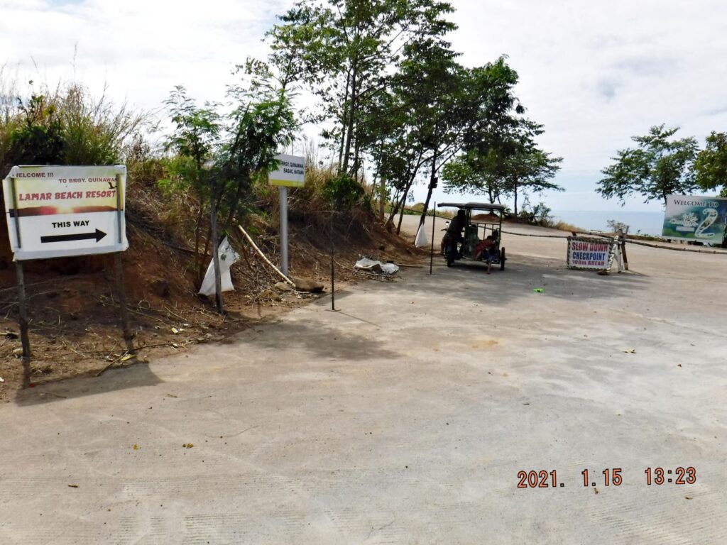
Zd964. This is one of three images of the Quinawan Village Road leaving the Bataan West Road and a section of the road running down towards Quinawan. But I believe it is not finished yet, not all the way going down to the village!
Zd965. This is one of three images of the Quinawan Village Road leaving the Bataan West Road and a section of the road running down towards Quinawan. But I believe it is not finished yet, not all the way going down to the village!
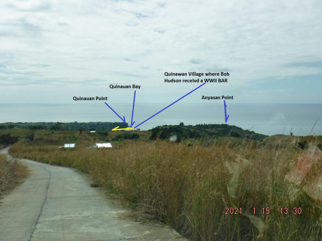
Zd966. This is one of three images of the Quinawan Village Road leaving the Bataan West Road and a section of the road running down towards Quinawan. But I believe it is not finished yet, not all the way going down to the village!
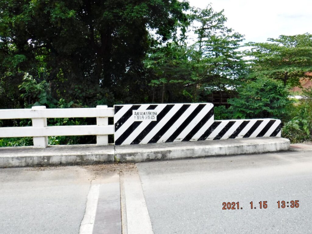
Zd967. This is the Anjasan River Bridge.
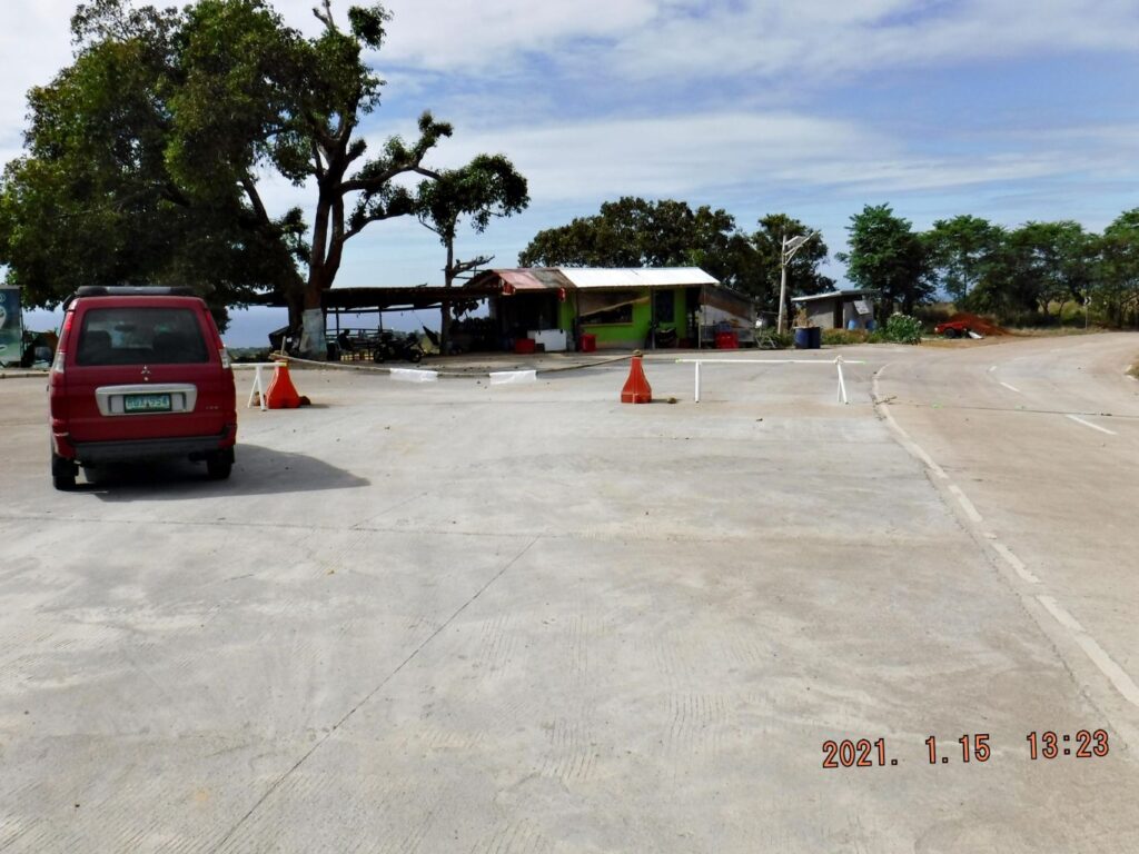
Zd968. This is one of three images of the renewed road to Binuangan Village and a branch road to Caibobo Village. The road to Binuangan existed before as a one lane hard surface and dirt road but is now improved. The branch road to Caibobo is new; it was only a trail before. Neither of the roads are total complete, a short piece to go yet on each road. I understand that Caibobo Point was the original goal of the Japanese during the Battle of the Points and some escaped that way.
Zd969. This is one of three images of the renewed road to Binuangan Village and a branch road to Caibobo Village. The road to Binuangan existed before as a one lane hard surface and dirt road but is now improved. The branch road to Caibobo is new; it was only a trail before. Neither of the roads are total complete, a short piece to go yet on each road. I understand that Caibobo Point was the original goal of the Japanese during the Battle of the Points and some escaped that way. The right one goes to Caibobo, the left one to Binuangan.
Zd970. This is one of three images of the renewed road to Binuangan Village and a branch road to Caibobo Village. The road to Binuangan existed before as a one lane hard surface and dirt road but is now improved. The branch road to Caibobo is new; it was only a trail before. Neither of the roads are total complete, a short piece to go yet on each road. I understand that Caibobo Point was the original goal of the Japanese during the Battle of the Points and some escaped that way. A little more to go to Caibobo.