Zg070. -#33 to 37. This is the panorama view of the new massive investment of the Tipo Hightech ECO Park on the SBFZ near its Tipo Security Gate. It is still under construction but it has a page on the www. These views are from the west; this is the Subic Bay area. This picture is one of several of these views.
————————————————–
News about the Subic Bay Freeport Zone (Former Subic Bay Naval Base) and the greater Subic Bay Area for the year 2023, in one or perhaps more albums.
—————————————————-
Tipo Hightech ECO Park Trail.
The Tipo Hightech ECO Park is a massive new investment in the former Naval Base Subic Bay, which is now the Subic Bay Freeport Zone (SBFZ) A SBFZ resident told me about the trail and I walked it on the 11th Jan. 2023 and took these pictures.
42 images have been posted in this Flickr album, if you are interested about news of SBFZ or the former Naval Base Subic Bay. They show images of the Kalayaan Housing area, where I started the walk. They show the trail thru the Subic Bay Rainforest, trails of the Aeta (Negritos) people and how they use the forest. Thru this project, they lost some of their forest. And here are numerous images about the construction of this investment with geographic landmarks indicated.
-Uploaded to Flickr as an album, click here:
-For this webpage presentation I only chose these 5 images and used my album image descriptions and let them stand here:
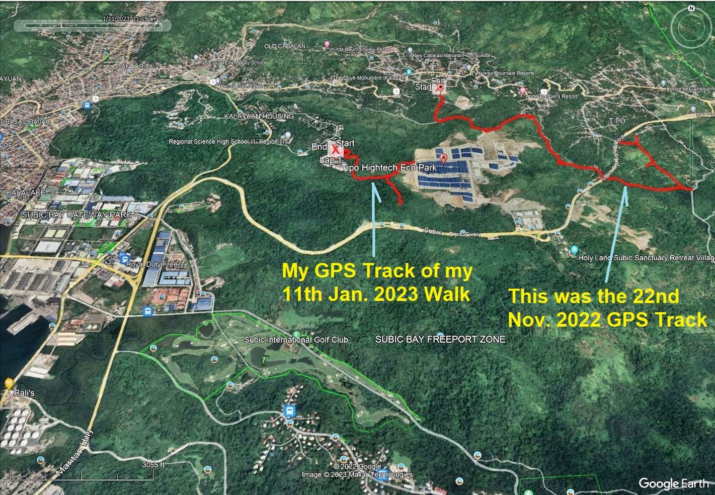
Zg066. # 00 to 06. This is one of several images of my walk to the Tipo Hightech ECO Park on SBFZ on the 11th of Jan. 2023. They predict, show my GPS track, maps and other data of this walk. This presentation has only 42 images from the collection of 52 images I have in my file.
On the 20th Nov 2022 I made a similar walk on the east side of this investment and posted about 20 images in my webpage, click here:
-#07 to 19. This is one of several images of the SBFZ Kalayaan Housing area and the street Greyback, where I started my walk to the Tipo Hightech Eco Park. The trail really starts at the water tank, just above the housing area.
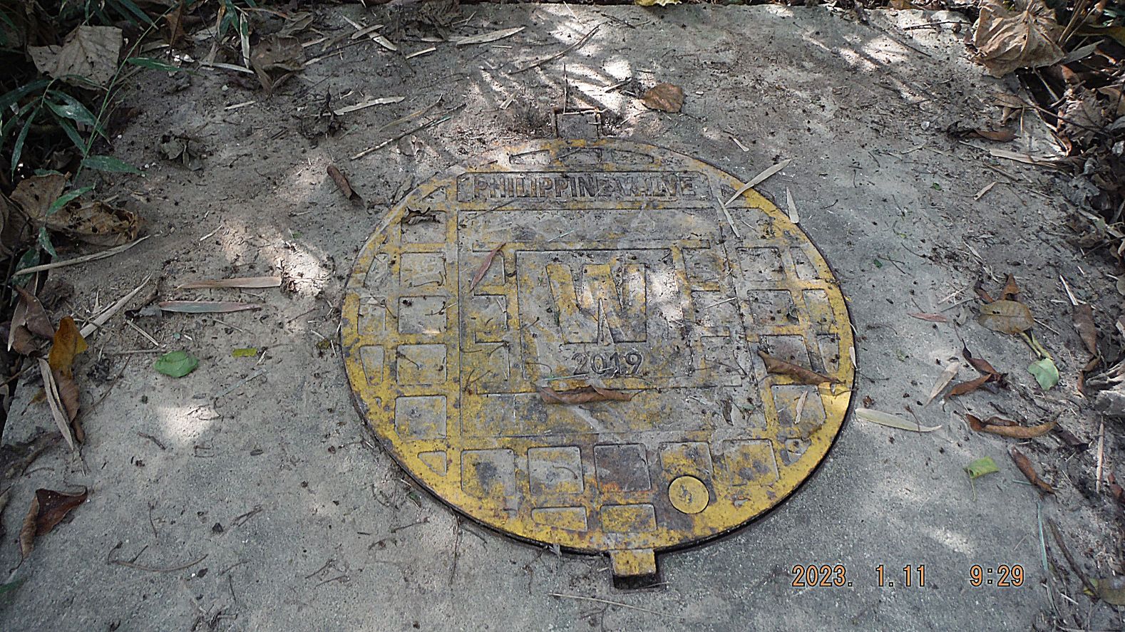
Zg067. -21 to 26. This is one of several images of the trail from the water tank in Kalayaan Housing to the new massive Tipo Hightech Eco Park. The trail may have been recently cut/made to lay a water pipe to this new high tech park. Near the park, the end of this trail was a water valve. One picture shows that wild pics have dug in this ground looking for food.
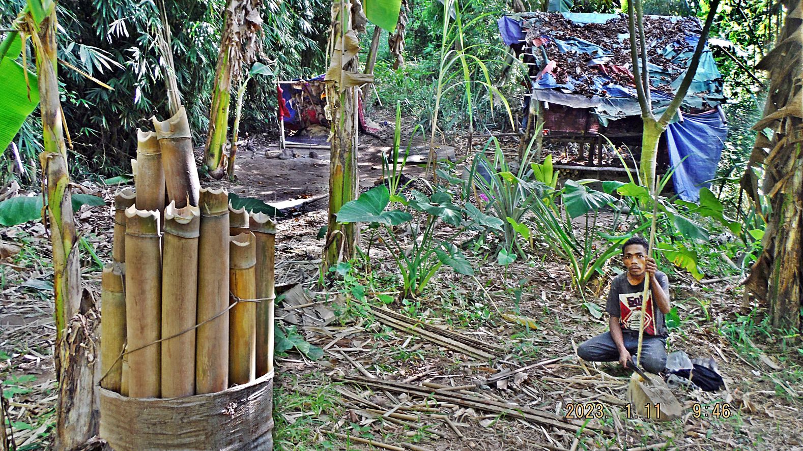
Zg068. -#28 to 32. A well used foot trail went off to the right, the direction of the Tipo-Subic Expressway. Other trails split away also, but I did not follow them (in the future). This area seems to be used by the Aetas; I came across banana and taro patches and three small native temporary structures. One native had cut some bamboo, he said for tourists.
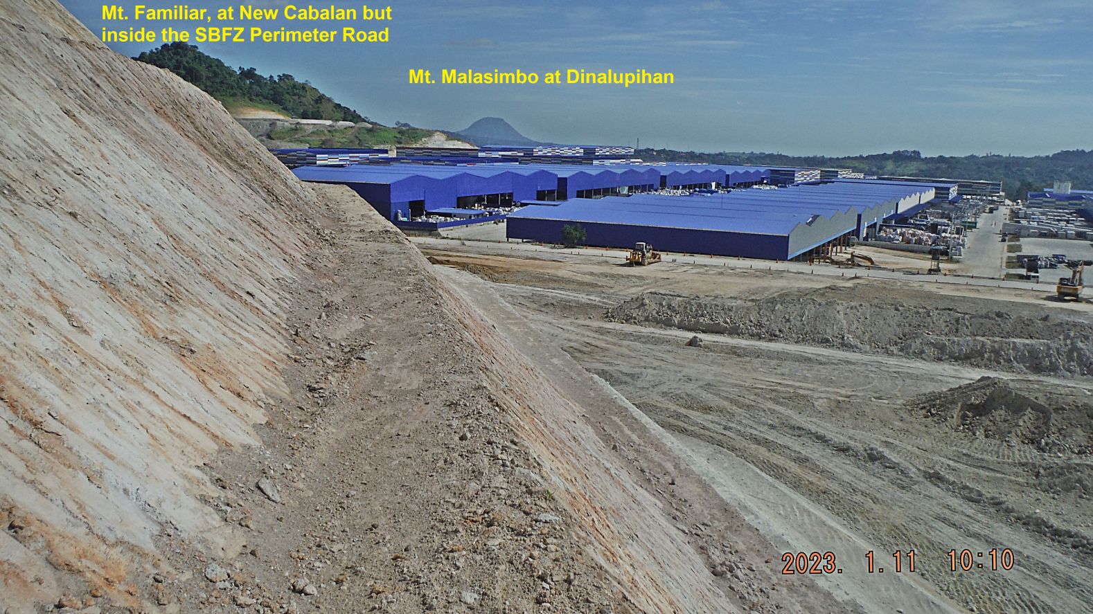
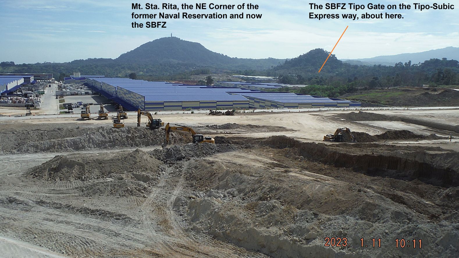
Zg069. -#33 to 37. This is the panorama view of the new massive investment of the Tipo Hightech ECO Park on the SBFZ near its Tipo Security Gate. It is still under construction but it has a page on the www. These views are from the west; this is the Subic Bay area. This picture is one of several of these views.
Zg070. -#33 to 37. This is the panorama view of the new massive investment of the Tipo Hightech ECO Park on the SBFZ near its Tipo Security Gate. It is still under construction but it has a page on the www. These views are from the west; this is the Subic Bay area. This picture is one of several of these views.
-#38 to 50. This is one of several images of the end of my walk to the Tipo Hightech ECO Park on SBFZ. I descended down the construction site. All the machinery stopped working about 10 am; it may be a coffee break. I came across a work gang laying more water pipes. I also came across a party of 3 Aetas who said they were going to the Royal Supermarket which is located in the buildings of our previous Navy Main Navy Exchange and Commissary.
===================================================
SBFZ Main Gate Bridge 2020 to 2023
The Main Gate Bridge is to be replaced by the new management of the Subic Bay Freeport Zone (SBFZ) the former Naval Base Subic Bay. There is obviously a problem, contract or otherwise, 3 full years it is in the works now. But maybe the tide is turning. As a former member of the base and residing here in Subic Bay my friends and I are interested in our former base and we collected these pictures over a 3 year period. Several pictures are from my friend Carlito Pickering.
-Uploaded to Flickr as an album with 36 images, and most are in high resolution, click here:
For this Subic Bay News presentation I chose these 5 pictures but I let the picture descriptions for the Flickr album stand here, Pictures #00 to # 03 show the beginning work of replacing the SBFZ Main Gate Bridge (ex Subic Bay Naval Base) in January 2020. Notice the Shoemart (SM) Mall on the Olongapo side of the drainage canal; this is the 3rd Mall we have now in Olongapo City and the SBFZ, I like it.
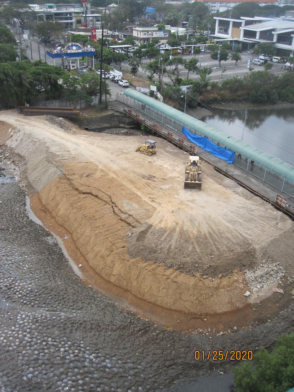
Zg071. -Pictures #00 to # 03 show the beginning work of replacing the SBFZ Main Gate Bridge (ex Subic Bay Naval Base) in January 2020. Notice the Shoemart (SM) Mall on the Olongapo side of the drainage canal; this is the 3rd Mall we have now in Olongapo City and the SBFZ, I like it.
Zg072. -Pictures #00 to # 03 show the beginning work of replacing the SBFZ Main Gate Bridge (ex Subic Bay Naval Base) in January 2020. Notice the Shoemart (SM) Mall on the Olongapo side of the drainage canal; this is the 3rd Mall we have now in Olongapo City and the SBFZ, I like it.
-Picture # 3a shows the Naval Base Subic Bay Main Gate Bridge in the 1980-82 period. This picture came from: Olongapo 80-82, Flickr, mtfrazier, bridge.
-Pictures # 04 to # 06 show the work progress in 2020, one sees a new covered walkway is being constructed. The old walkway was removed and our former Naval Base Gate is also gone now.
-Pictures # 07 to # 12 show the new temporary covered walkway across the SBFZ Main Gate Bridge 2020 to 2023. It leads from or to the SM Olongapo City (Down Town) Mall Boardwalk. I like the new covered SBFZ Main Gate Bridge walkway and the SM Boardwalk; it keeps you protected against rain and sun.

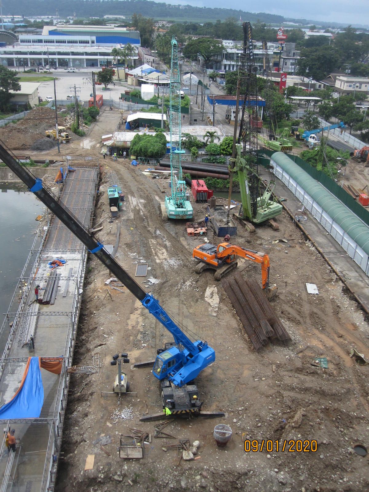
Zg073. -Pictures # 13 to # 23 show the work progress or lack thereof in 2021 of the SBFZ Main Gate Bridge (ex Subic Bay Naval Base) project. The pictures include some nice views of the SBFZ, the former Naval Base Subic Bay. Some of the pictures were shot from the 7th Floor of the SM Olongapo City (Down Town) Mall’ the 5th and 6th are covered parking areas, nice view points towards the former Naval Base Subic Bay.
-Pictures # 24 to # 26 show only slow progress at this SBFZ Main Gate Bridge (ex Subic Bay Naval Base) project. If you look close, you can see the Aguinaldo Street (our old “Liberty Route”) between the CPO Club Parking lot and the Remy Sports Field being concreted.
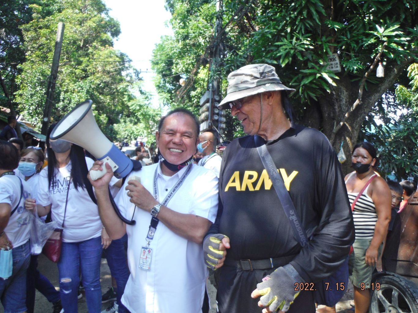
Zg074. -Picture # 27 is a Picture of the new SBFZ Chairman Rolen Paulino Sr. who took over in March 2022; he was the Mayor of Olongapo after the Gordon’s lost the election for mayor. In this picture, I met him on Abra Street, in Barrio Barretto where he was handing out rice. I had asked him for a picture and he friendly agreed, so I got a nice picture. I asked him about the Main Gate Bridge and he said something will happen soon. Why, me in an Army shirt, I like that shirt for walking and besides the Army fellows are my brothers and sisters.
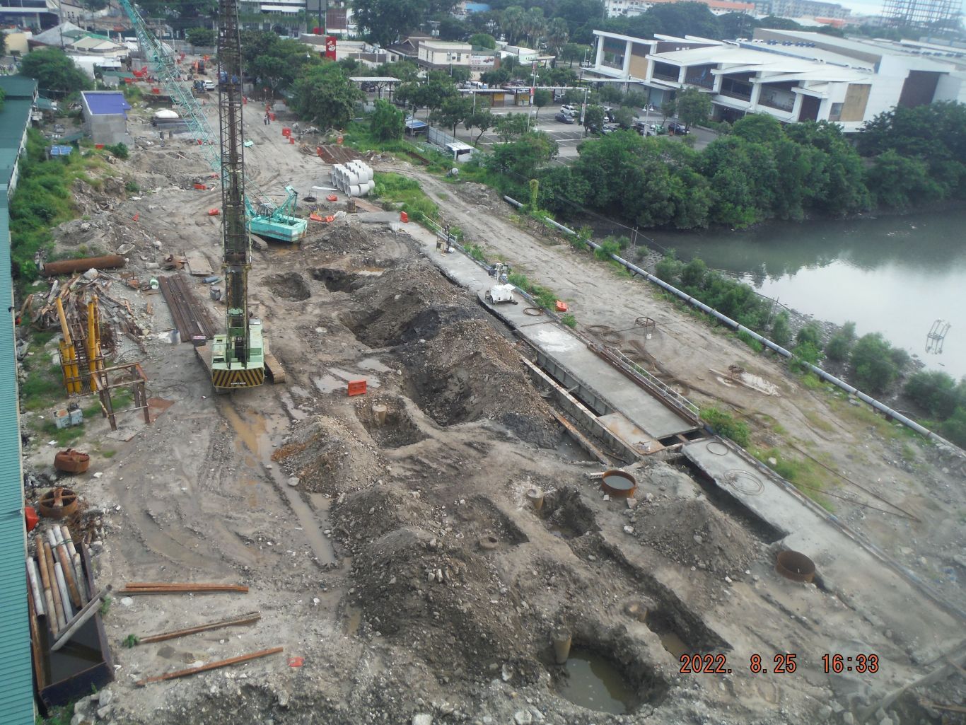
Zg075. -Pictures # 28 to # 34. I t seems work has picked up in this 2nd half of 2022 on the SBFZ Main Gate Bridge (ex Subic Bay Naval Base) project but I’m not sure. We hope they will get it done this year, 2023!
=============================================
Olongapo Bypass Road????
For the last two years I have been watching this project. There is no project sign and people just said it is a new road to Bataan. First when the bridge was built, I said to myself; “a bridge to nowhere”. But I think it only could serve the purpose of a bypass road, around Olongapo. They have continued about 200 meter across the bridge, towards the east, but no further. Waiting for a new budget allocation, I speculate. The Zambales traffic, thru Olongapo, has increased tremendously and a bypass road is needed
I established an album in my Flickr account with 16 images in high resolution; this is the URL, click here:
For this Subic Bay News presentation I chose these 5 images but they are much smaller. And I let stand here all the descriptions used in the Flickr album.
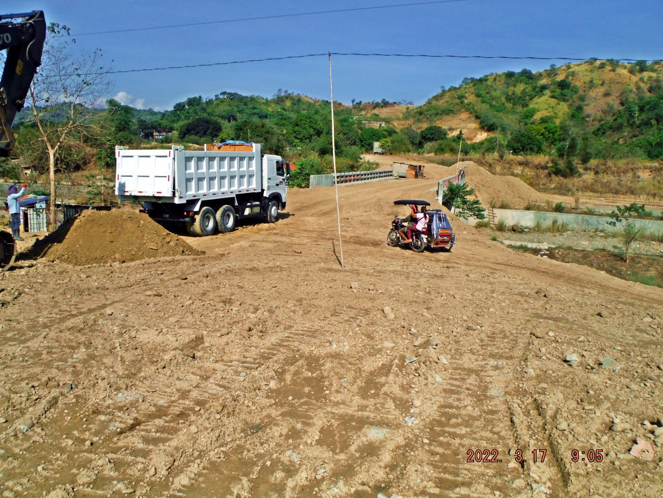
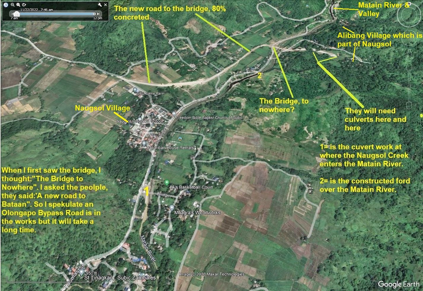
Zg100. (-00) Image. The new bridge over the Matain River, it only could serve the purpose of having an Olongapo Bypass Road, I speculate.
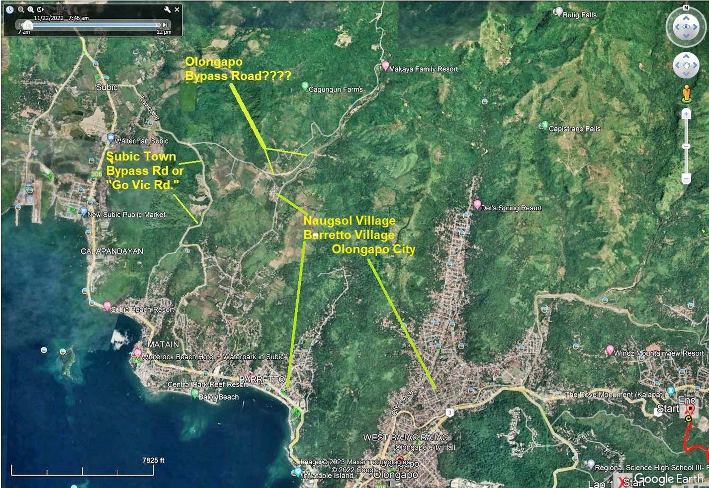
Zg101. (-00a & 00b) Images. Maps for this story about an Olongapo Bypass Road.
Zg102. (-00a & 00b) Images. Maps for this story about an Olongapo Bypass Road.
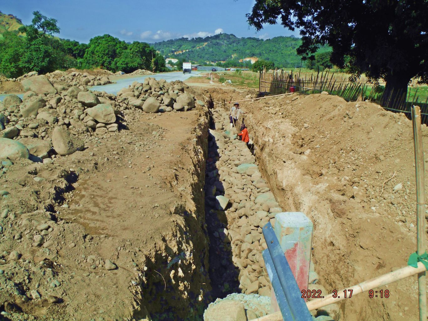
Zg103. (-01) The suspected Olongapo Bypass Road is being improved with proper shoulders and embankments. This is about ½ km west of the new Matain River Bridge.
-02, -05, -07, -08, -09 images show that dirt; earth has been deposited for the Olongapo Bypass Road bed to advance the road about 200 meters towards the east and east of the new Matain River Bridge. -08. Shows an Alibang farmer preparing a field for planting.
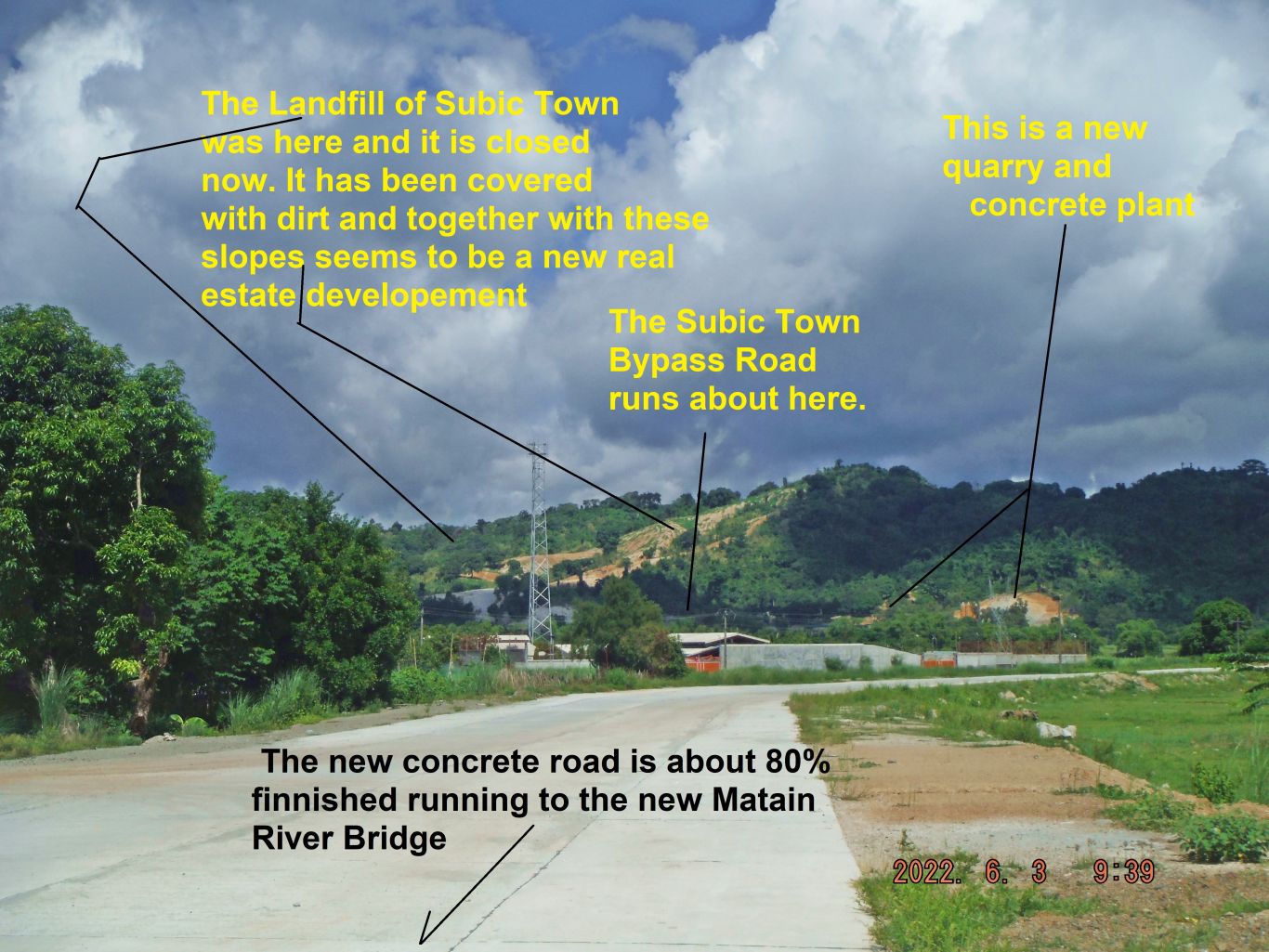
Zg104. (-03) Image; a view from the new concrete road back, which is running towards the new Matain River Bridge.
-04, -11. Images show the ongoing culvert work of the Naugsol Creek/River at its mouth where it flows into the Matain River, just before one enters Naugsol.
-06. Image shows the Matain River, about 400 meter up-river from the new Matain River Bridge. The two peaks at right, the right one I climbed a few times, the left one I failed to climb, underbrush was to thick or slopes too steep.
-10. Image shows the Matain River Bridge, which I speculate is part of a future Olongapo Bypass Road. As of yesterday the 25th of Jan. 2023 work was ongoing at this bridge, about 100 meter of two lane road have been poured at either end of the bridge and the embankment slopes have been fortified with coconut fiber netting to help vegetation to take roots. This bypass road, if indeed it is, will have to conquer many ridges and valleys before it reaches the SCTEX in Bataan.
-12. Image shows a constructed ford over/under the Matain River, it is located about 400 meters down-river from the new Matain River Bridge. I thought it is a unique way/work of a private enterprise. Right next to it used to be private concrete bridge but did not stand-up against the test of time.
-13. Show the 200 meter of dirt/earth deposited on the east side of the Matain River Bridge. The engineers, people of Alibang realized this cut had to be made and in the future a culvert is needed here. In back is Kalaklan Ridge, which is the first ridgeline this new road has to conquer.
================================================
Beach Bash 2023, VFW 11447 Subic Bay, 19th Feb. Sunday
6 pictures, in low resolution, are presented here. 101 images have been uploaded in high resolution into this Flickr album, click here:
A short presentation of 14 images is in my Facebook and is shared with: Subic Bay Expats, Barretto Bars, SBH3, WESTPAC SAILOR, Raging Main, Retired Sailor, I remember NAVSTA & AIRSTA CUBI, RUMP PHIL, click here:
This is an album of the 29th Beach Bash, organized by the VFW Post 11447 in Barrio Barretto in Olongapo City between the 16th to 19th Feb 2023. The 1st one after the virus from Red China! These are raw pictures, not edited nor are people indentified or actions are described. They are in high resolution.
Because I was on a exploring and flag raising anniversary trip to Corregidor, I only observed about 4 hours Sunday afternoon and when the Miss Beach Bash competition started, I called it quits; other matters required my attention.
My impression was that this event was well organized and attended today. The venue at the Arizona Hotel also seemed to be a good choice.
To my diver friends, 4 divers are shown ( in the long album)!
The same picture description for all pictures
This is a picture of the 29th Beach Bash, organized by the VFW Post 11447 in Barrio Barretto in Olongapo City between the 16th to 19th Feb 2023. The 1st one after the virus!
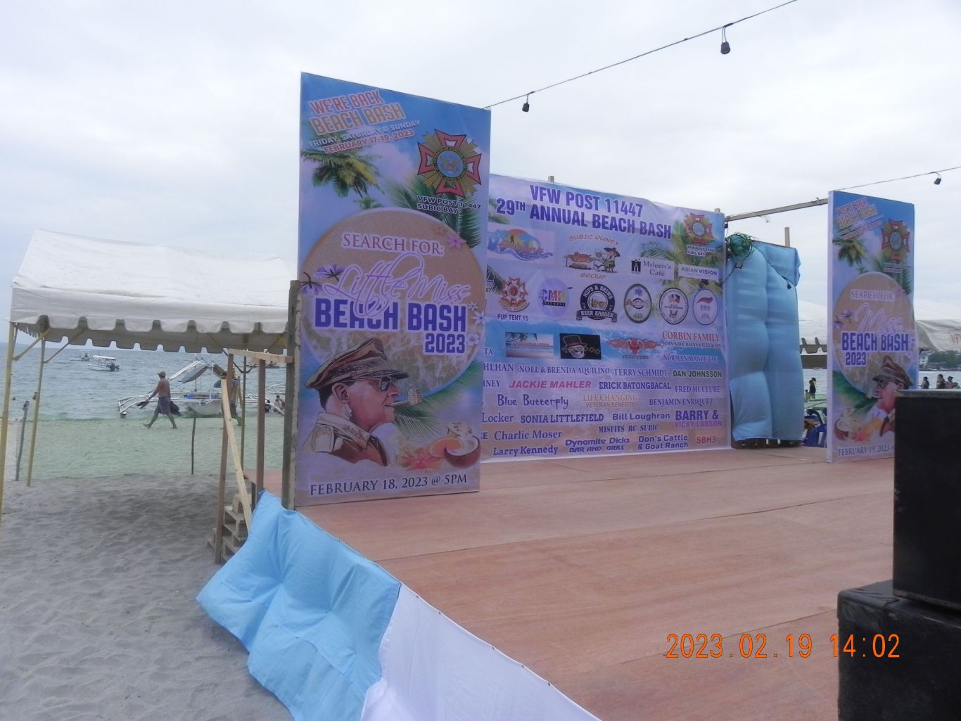
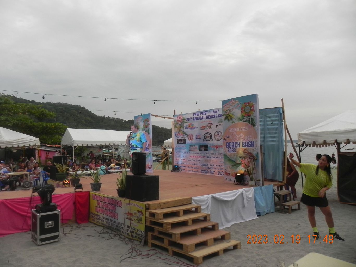
Zg135. The Beach Bash stage! At the left edge of the picture we can see Grande Island, the former Fort Wint.
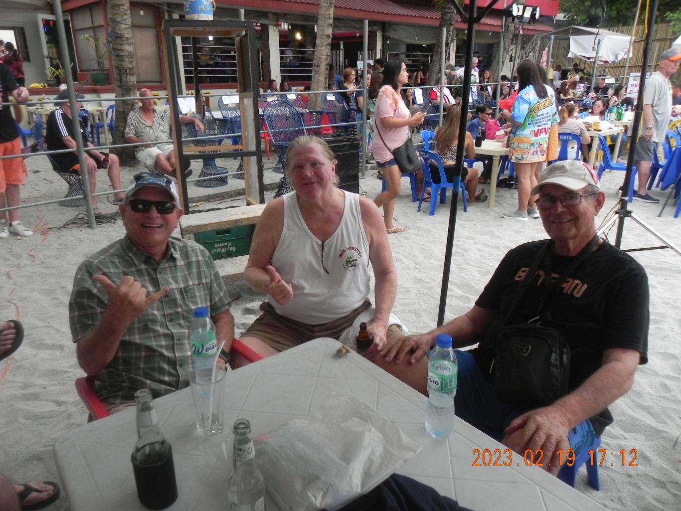
Zg136. Three shipmates, we were stationed together in the Pearl Harbor Navy Diving School in the first half of the 1980s decade. It was moving from the Sub-Base to Fort Island then.
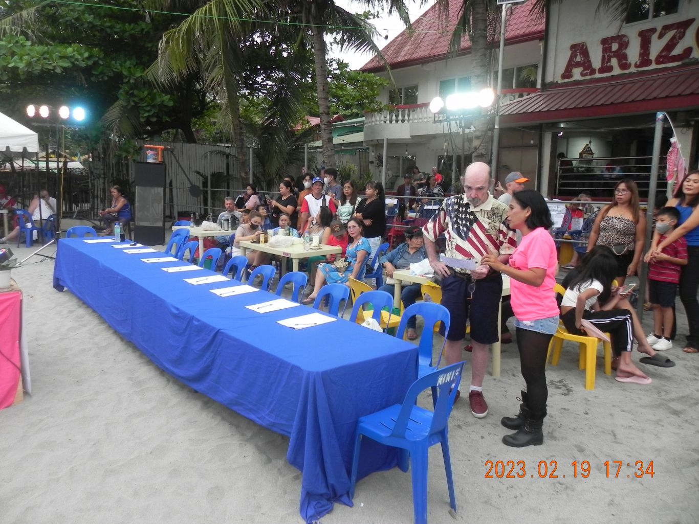
Zg137. The judges’ tables for the Miss Beach Bash competition, the two important players for this event have a discussion.
Zg138. The Commander of VFW Post 11447 is giving the opening remarks for the Miss Beach Bash competition.
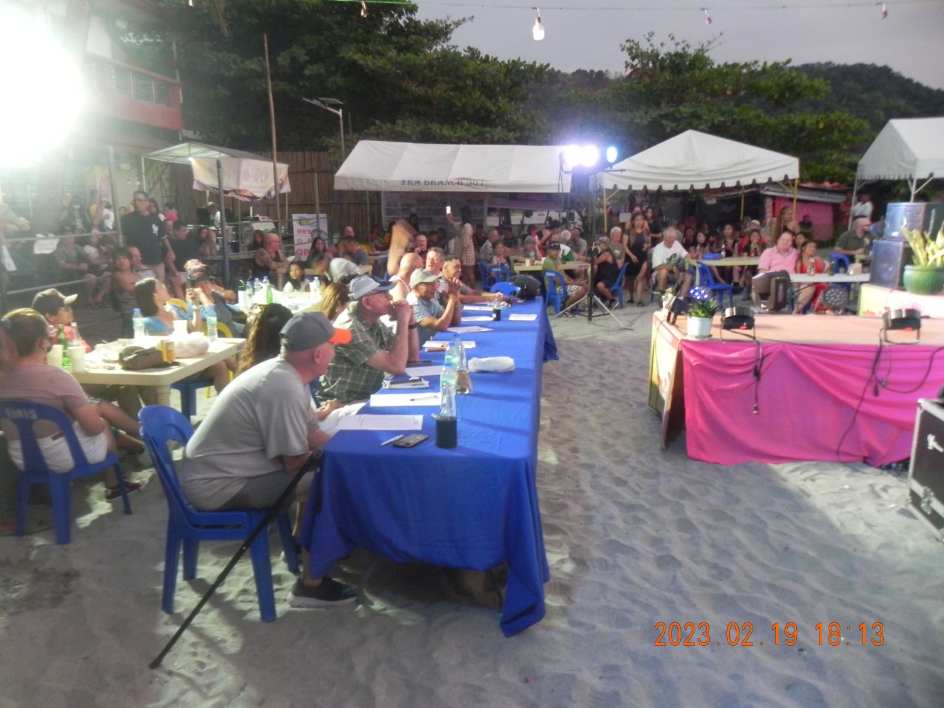
Zg139. The show of the Miss Beach Bash competition is about to begin, the judges are seated.
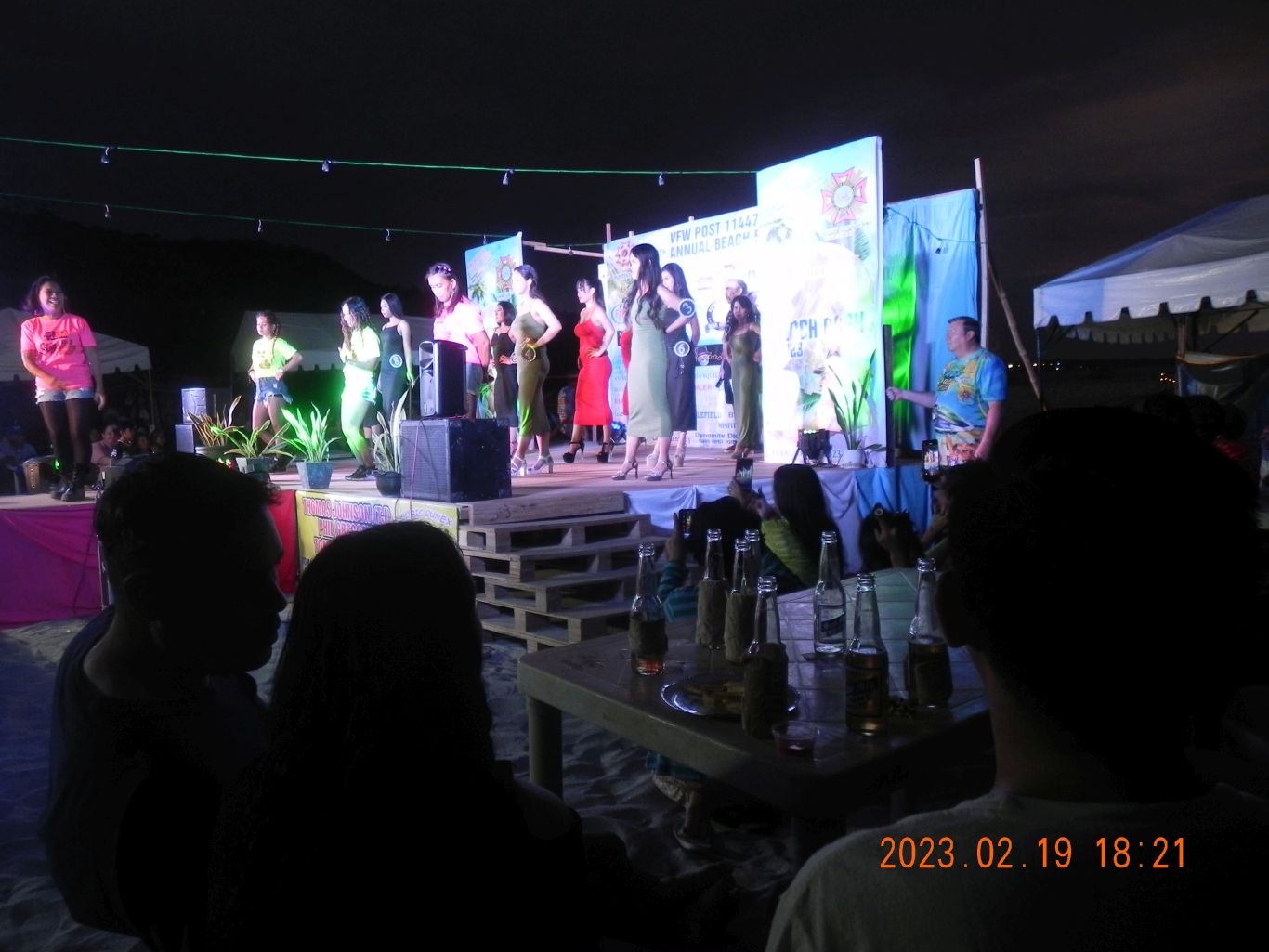
Zg140. This is the opening move for the Miss Beach Bash competition; all the contestants are on the stage and do a short dance routine.
————————————————————————-
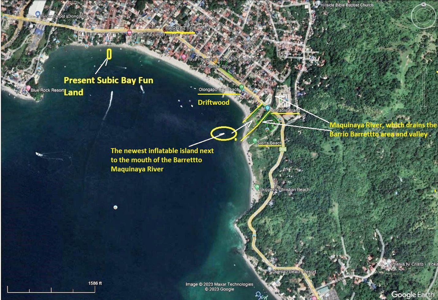
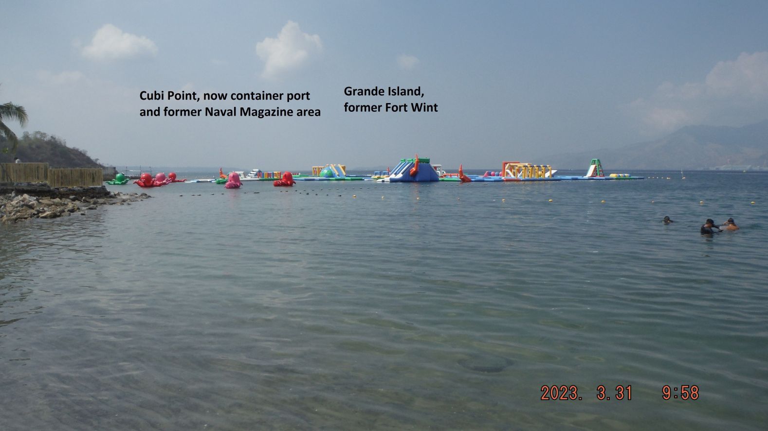
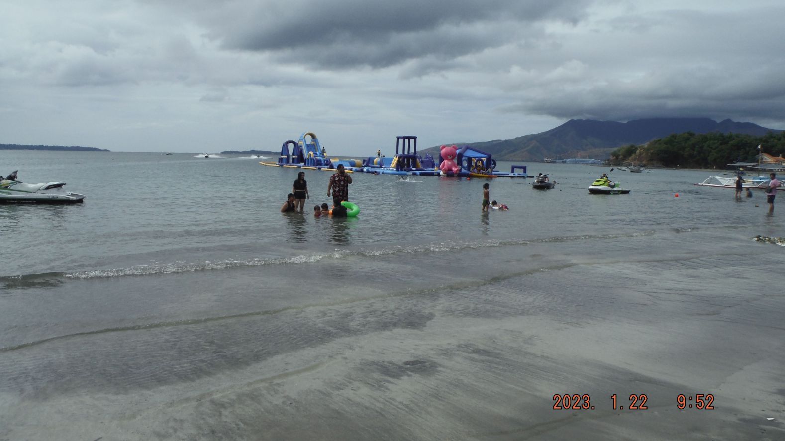
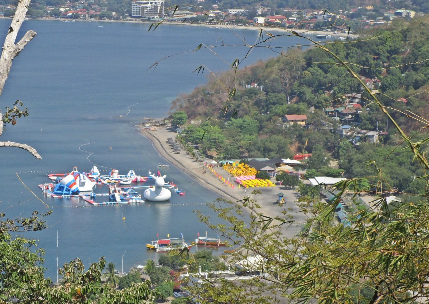
Inflatable Islands in Subic Bay 2023
Just another Tidbit Story from the former home of the US Navy. It is April 2023 tomorrow and that is when here the local summer starts. Indeed the temperature raised 2 to 3 degree Celsius about 3 days ago.
If you are interested 18 images are uploaded into this new Flickr album in high resolution, click here:
4 images were chosen for this Subic Bay News presentation, image numbers refer to the 18 image collection in the Flickr album:
Zg193. (02)
-#01 to #06 images show the highway side of this new business, which seems to be called “Inflatable Island” for right now. It is on a large lot at the west side of the mouth of the Maquinaya River which never was commercial utilized except as truck storage site, just for 2 or 3 years or so and only in recent times. The Maquinaya River gave its name of the present Barrio Barretto area. This Maquinaya Area or now called Barretto used to be the Naval Rifle Range and was also used for field training by the US Marines and US Army (Fort Wint-Grande Island) until Christmas 1941 when the Philippine and US Forces retreated to Bataan in WWII. In 1945, after liberation the area became the US Naval Supply Depot, perhaps until 1959 when it was returned to the Philippine authority. Two pictures show that the facilities, inside, are being built with native material. If you are interested I collected some historical Images of this area and posted them into this URL, click here:
Zg194. (09)
-#07 to #14 images show this new Inflatable Island from the west beach side and at the actual beach inside the compound. The pictures show as I approach this new Inflatable Island compound from the west and as I depart to the west. The pictures show the new Inflatable Island it seems to be all there already, but it is not open yet. On some pictures I marked the land marks to help you in your geographic orientation. And we can see the facilities are being built from native material. This new business does have a webpage, click here:
Zg195. (15)
-#15 is a picture of another inflatable island, maybe already in use maybe 2 years. The name for this enterprise is: Subic Fun Land and they have a Facebook page. It is nearby on the Barretto Beach in front of the business Palm Tree Resort, which is adjacent, and west of the famous Mango Resort which just a few days ago celebrated its 30 year Anniversary. Check out their anniversary URL, click here:
Zg196. (16)
-#16 to #18 images are of the first and original inflatable Island, which is called Samba Bluewater Resort. It is located at the Half Moon Beach and cove; this area was also called Kale Beach for a couple of decades but the name seems to be fading. It seems to be an impressive inflatable island and on weekends their parking lot seems to be packed.
Here is their active webpage, click here