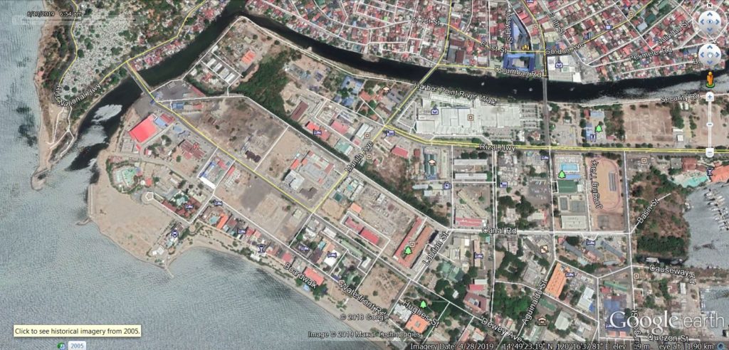
Ze419. (-01) I start this album with 5 maps or images; this is a recent Google Earth image of the Kalaklan Point area in Olongapo and the Subic Bay Freeport Zone (SBFZ) Kalaklan Gate area.
———————————————–
On this walk, the 14th of March 2019 I first took some pictures of the Kalaklan Point area in Olongapo and the Subic Bay Freeport Zone (SBFZ) Kalaklan Gate area. It is a story about change and how the place looks now. In front are old maps or images so you can compare the changes right away. This presentation has 36 images.
If you like to look at 58 images of this album and in high resolution, click here:
If you like to look at 83 images of this album and in low resolution, click here:
————————————–
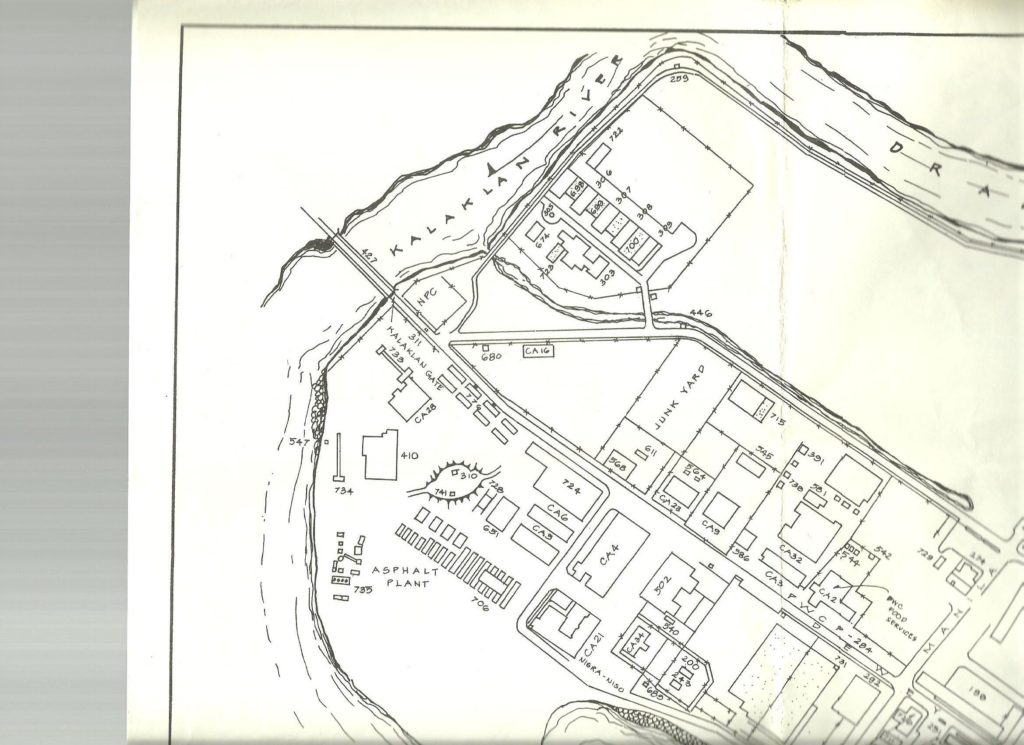
Ze420. (-03) I start this album with 5 maps or images; this is a 1977 Subic Bay Naval Station facility map of the Kalaklan Point area in Olongapo and the Subic Bay Naval Base Kalaklan Gate area. A good friend, Chad Hill, provided it.
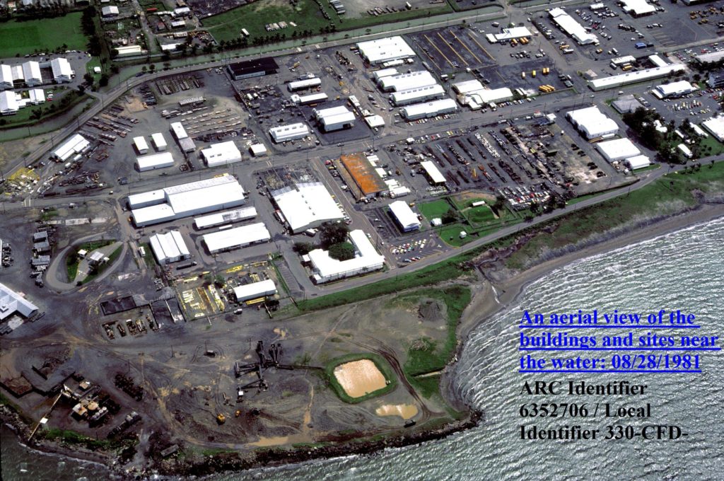
Ze421. (-05) I start this album with 5 maps or images; this is a 1981 Subic Bay Naval Station facility image of the Kalaklan Point area in Olongapo and the Subic Bay Naval Base Kalaklan Gate area. My nice Uncle Sam provided it.
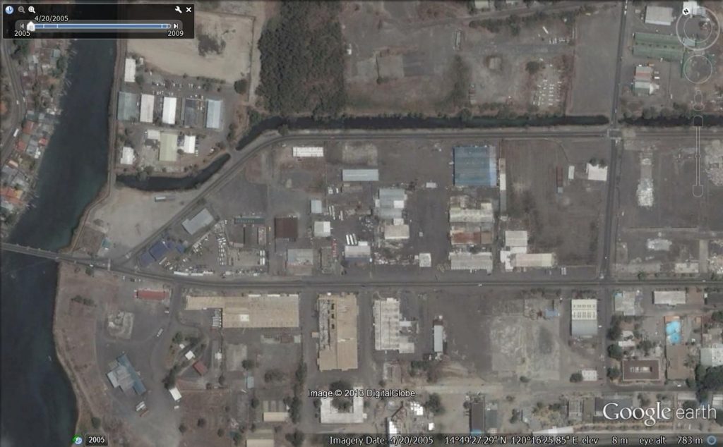
Ze422. (-07) I start this album with 5 maps or images; this is a 2005 Google Earth image of the Kalaklan Point area in Olongapo and the Subic Bay Freeport Zone (SBFZ) Kalaklan Gate area.
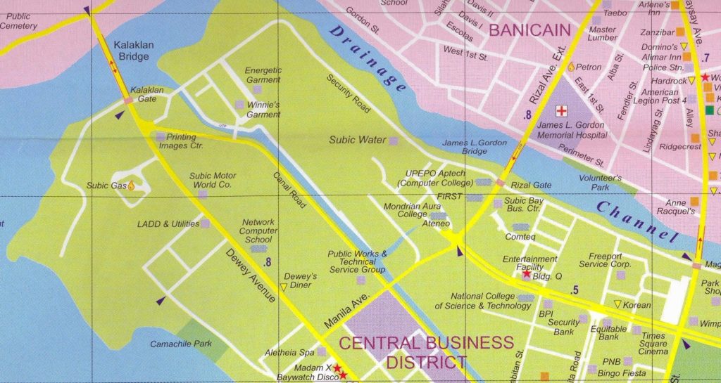
Ze423. (-09) I start this album with 5 maps or images; this is a section of the Subic Bay Freeport Zone map. It is out of date already because of the many changes that occur here all the time. This section of map shows the Kalaklan Point area in Olongapo and the SBFZ Kalaklan Gate area. Thank you EZ maps!
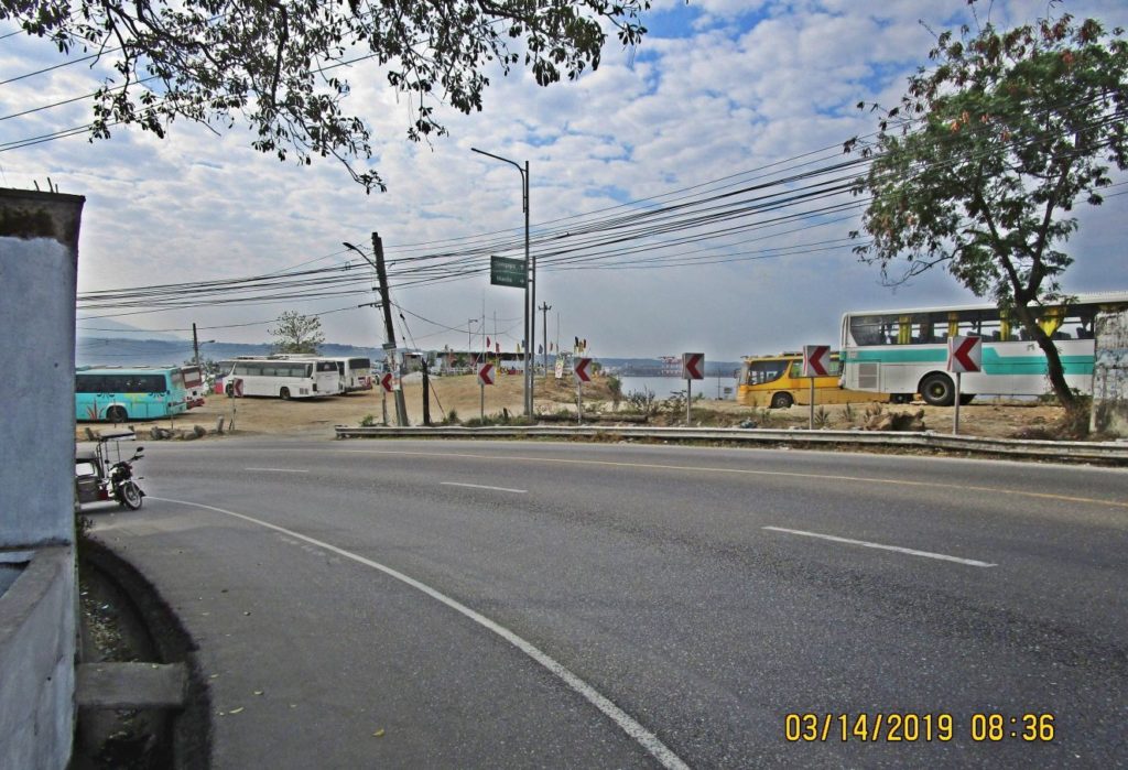
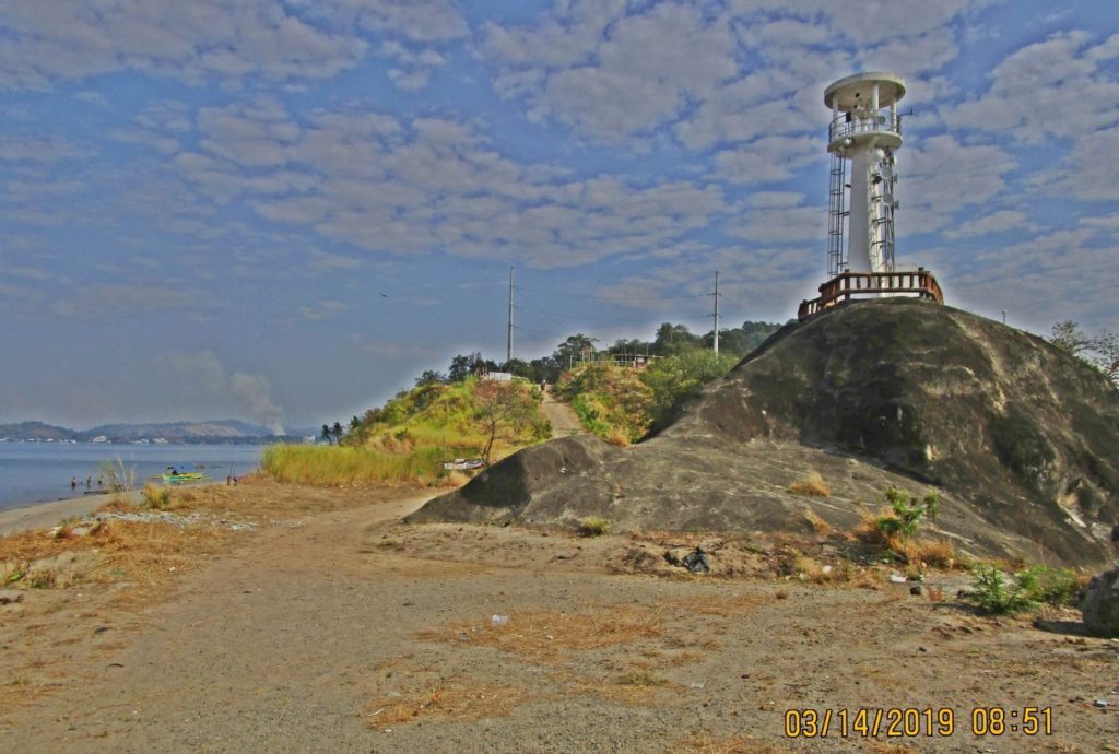
Ze424. (-11) this is Kalaklan Point in Olongapo City, Subic Bay, 2019-03-14. The busses park there until the time to pick up workers on the base (SBFZ).
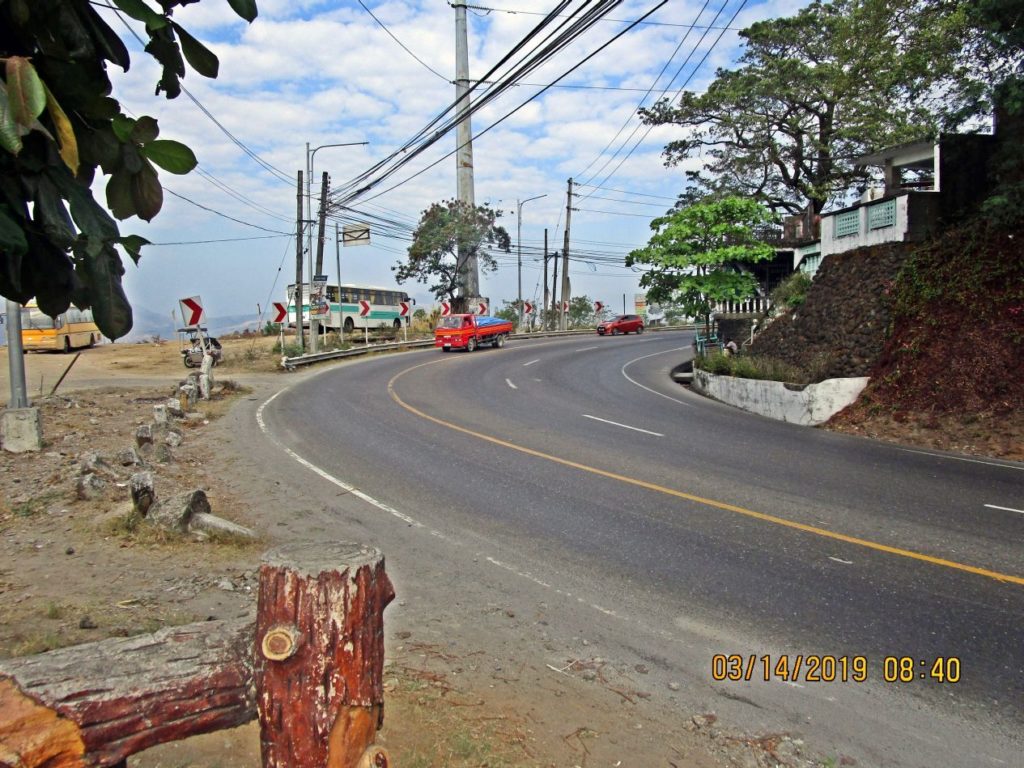
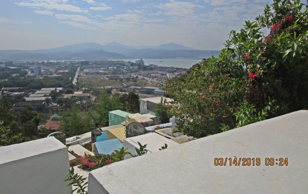
Ze425. (-12) this is the famous Kalaklan Point-Curve and Olongapo City Cemetery. This Kalaklan Point-Curve is a dangerous one; many a motorbike rider laid down his machine here!
Ze426. (-13) this is the famous Kalaklan Point-Curve and Olongapo City Cemetery.
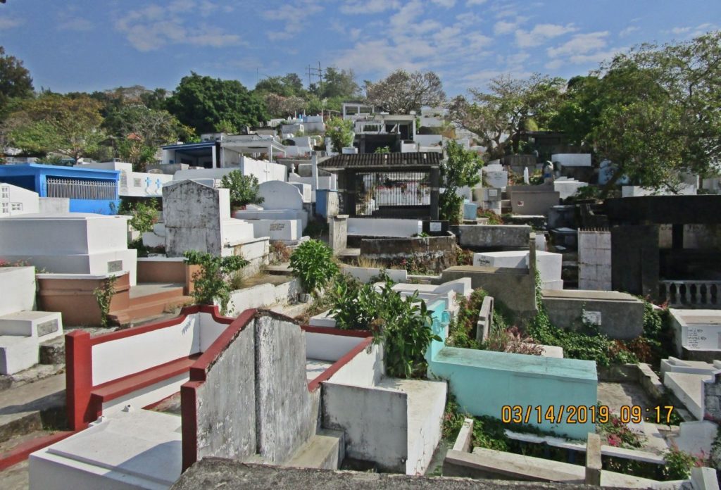
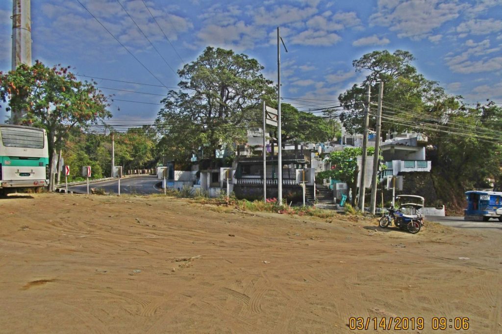
Ze427. -14 this is the Olongapo City Cemetery at the Kalaklan Point; I use this route sometime to get on top of Kalaklan Ridge here.
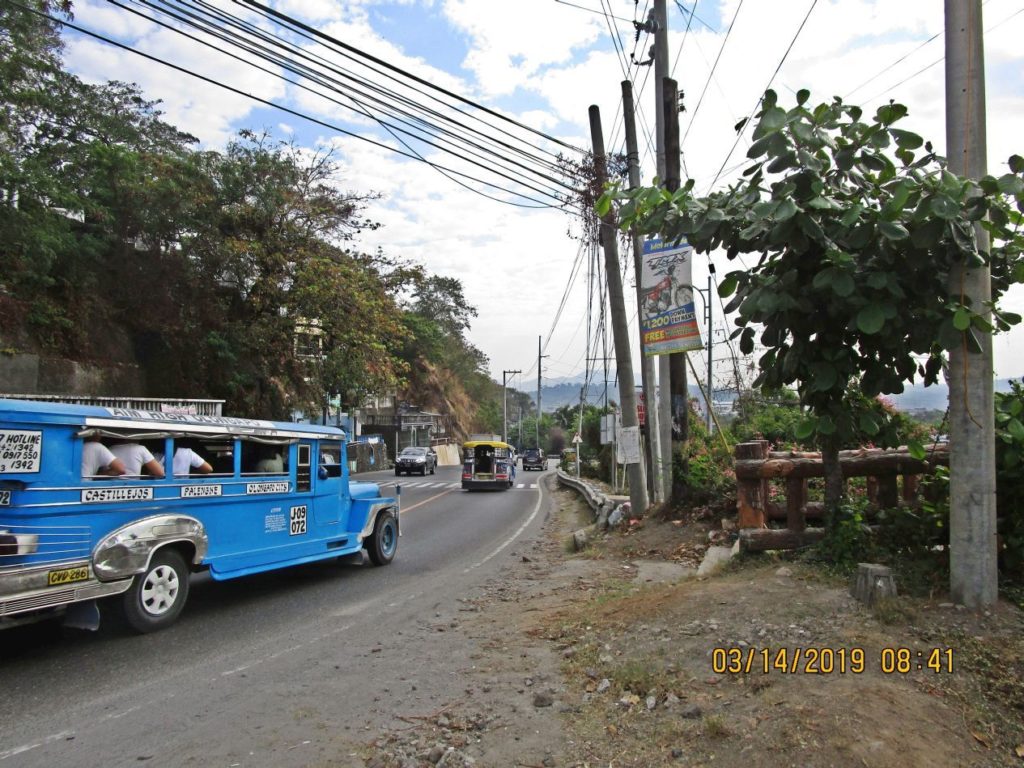
Ze428. (-15) it is about only 120 yards for that blue jeepney to bypass the bridges to the SBFZ Kalaklan Gate.
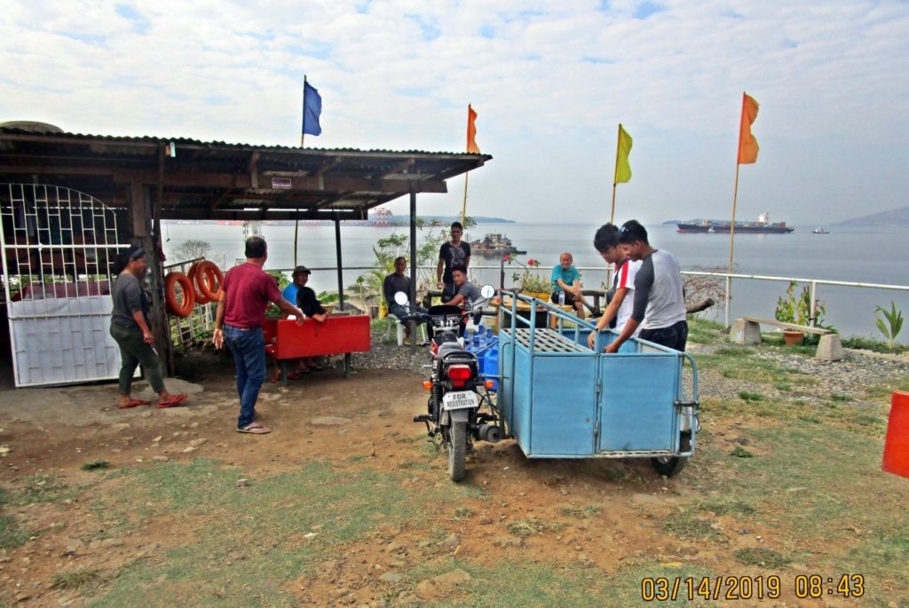
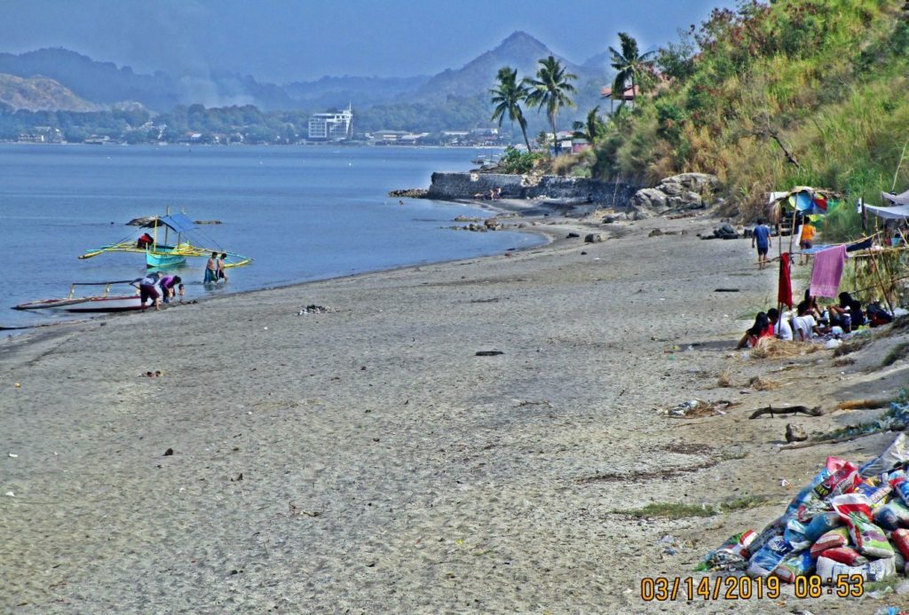
Ze429. (-16) this seems to be an outpost at the Kalaklan Point in Olongapo City, Subic Bay; boats from small communities along the Subic Bay entrance come here in order go to Olongapo or other places.
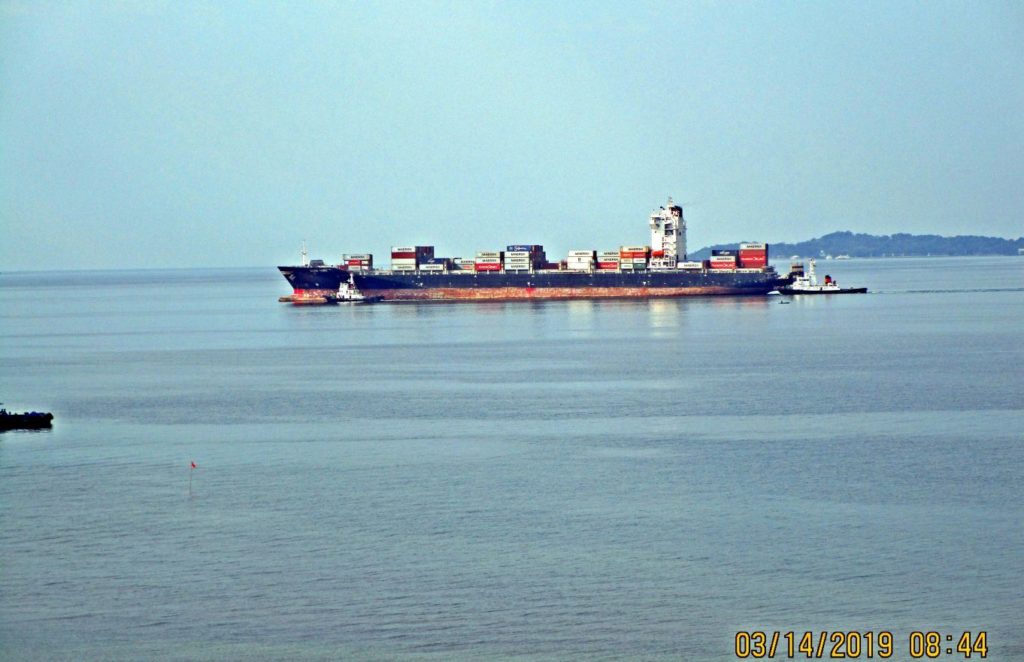
Ze430. (-17) a container ship is passing Kalaklan Point in Subic Bay and will go to the former NSD piers. It is bypassing the new container port.
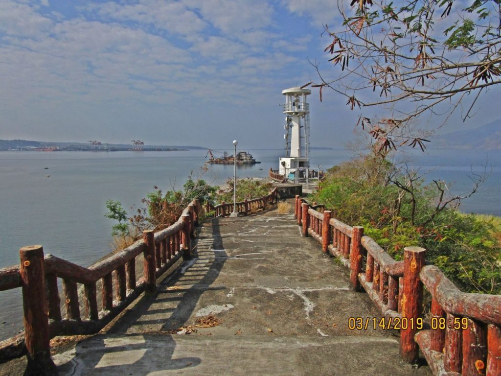
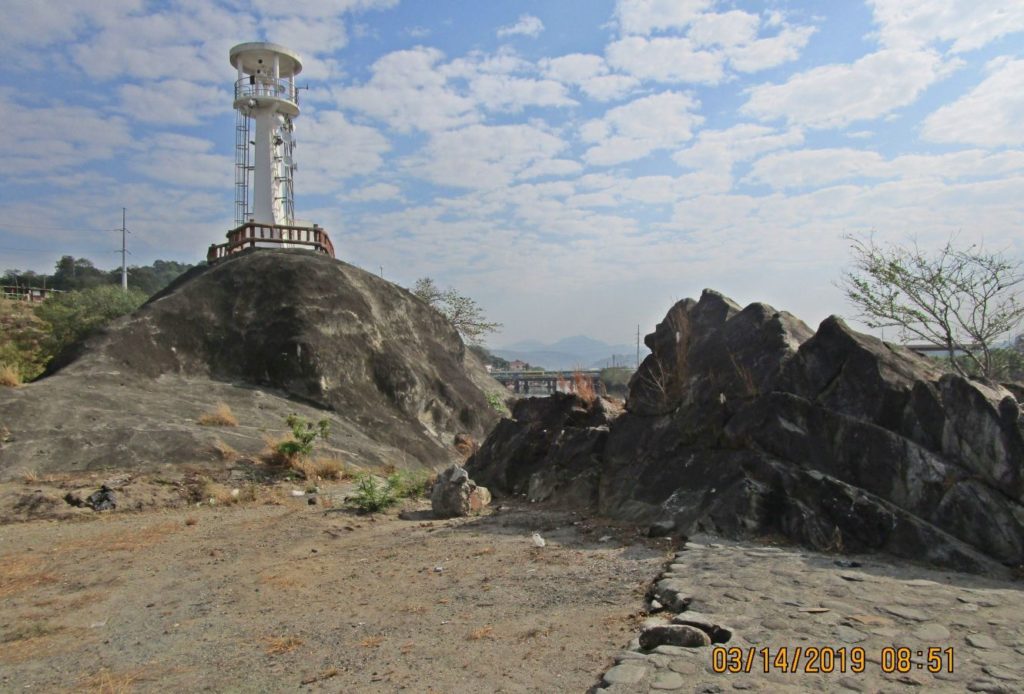
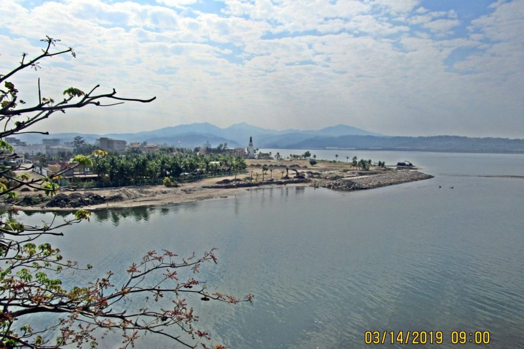
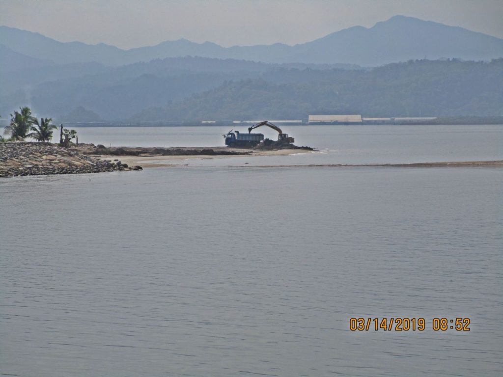
Ze431. (-18) Kalaklan Point in Olongapo City, Subic Bay, 2019-03-14. The point and navigational light have been renovated since the Subic Bay Naval Base closure. I believe that dredge is doing quarrying work. Left is the new SBFZ Container Port at the actual “Cubi Point”.
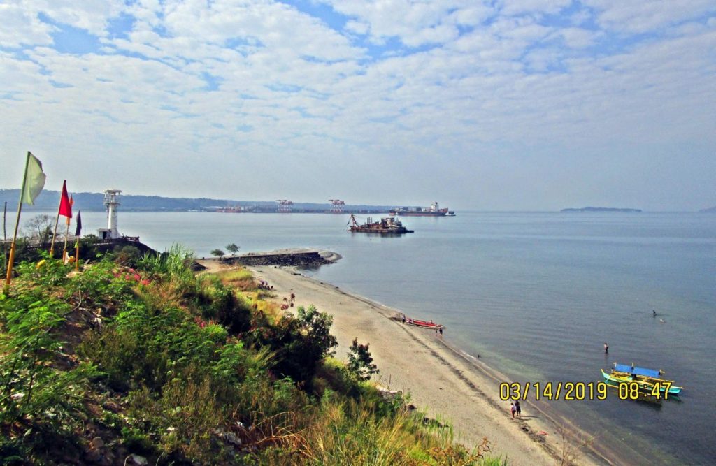
Ze432. (-19) Kalaklan Point in Olongapo City, Subic Bay, 2019-03-14. The point and navigational light have been renovated since the Subic Bay Naval Base closure. I believe that dredge is doing quarrying work. Left is the new SBFZ Container Port at the actual “Cubi Point”. This is the beach were boats bring or pickup passengers from communities around the bay.
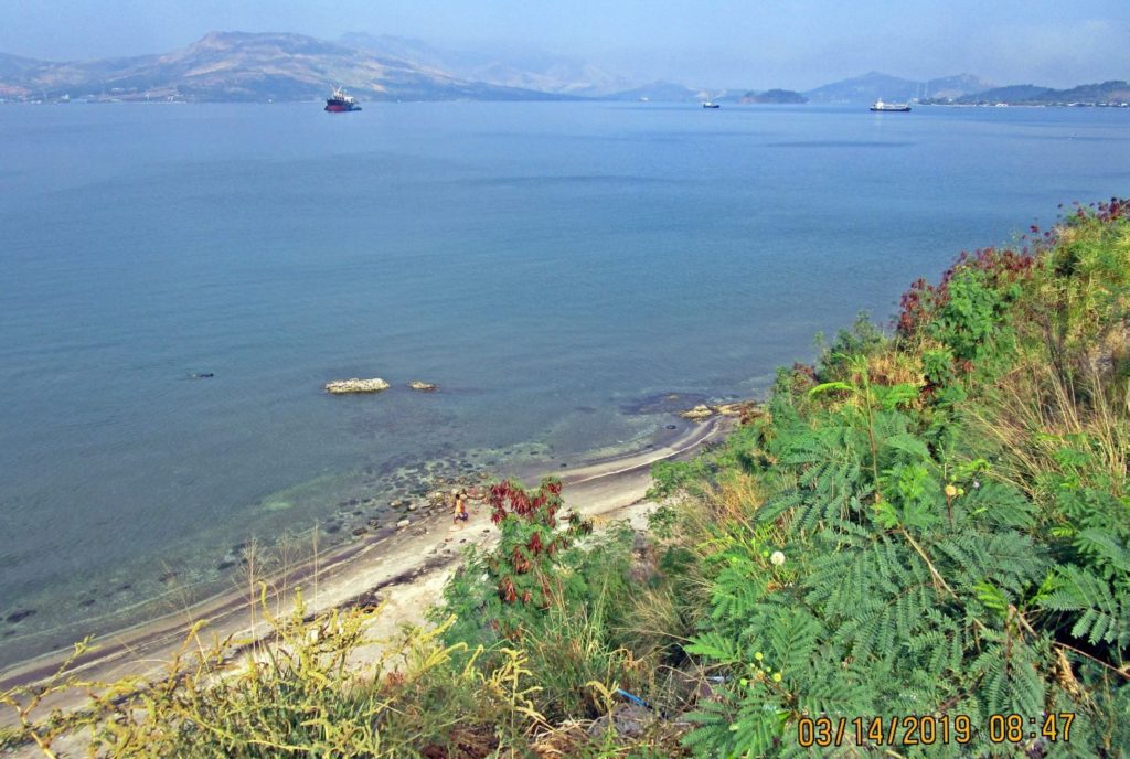
Ze433. (-20) this is a full view of the bay of Subic Bay; we are looking in a NW direction to the NW end of the bay.
Ze434. (-21) this is a view from Kalaklan Point along the east Subic Bay shoreline towards Barrio Barretto. Notice the high rise in Barretto.
Ze435. (-22) this is a view from Kalaklan Point along the east Subic Bay shoreline towards Barrio Barretto. Notice the high rise in Barretto.
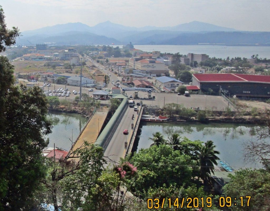
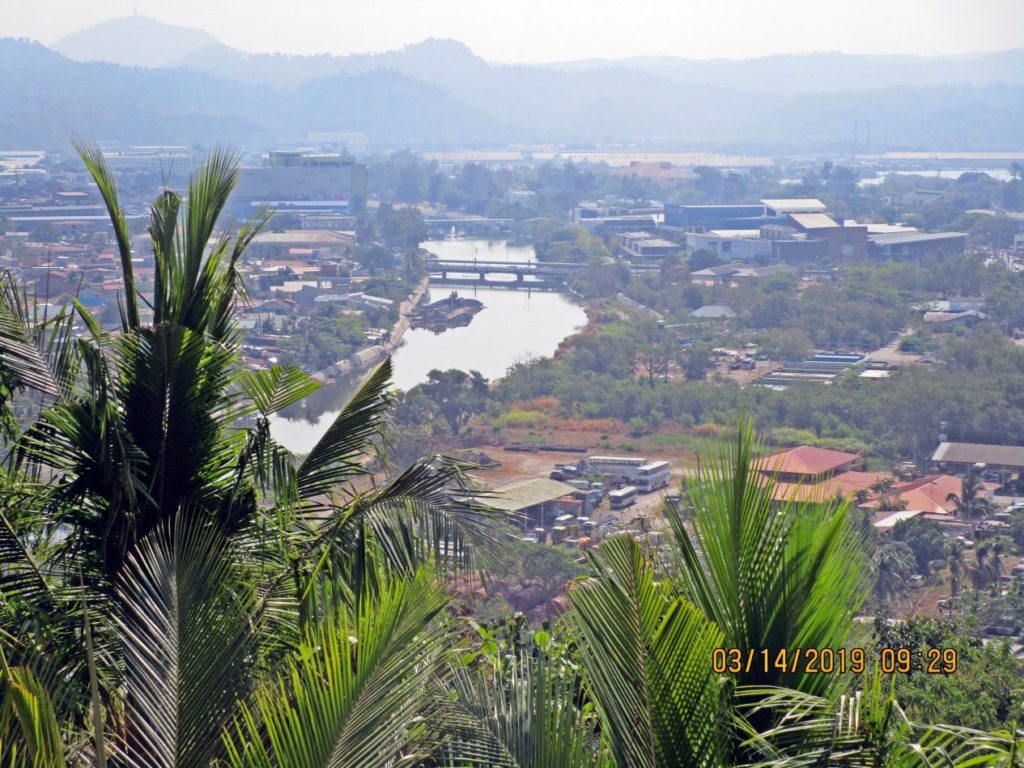
Ze436. (-23) this is a view from Kalaklan Point, up Kalaklan River and we even see the Kalaklan Bridges.
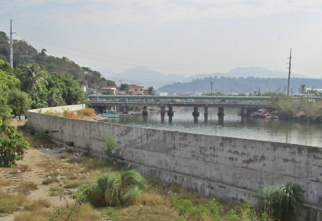
Ze437. (-24) this is a new Kalaklan River Bank Wall, new and old SBFZ Kalaklan Bridges to enter the famous and beloved former Subic Bay Naval Base.
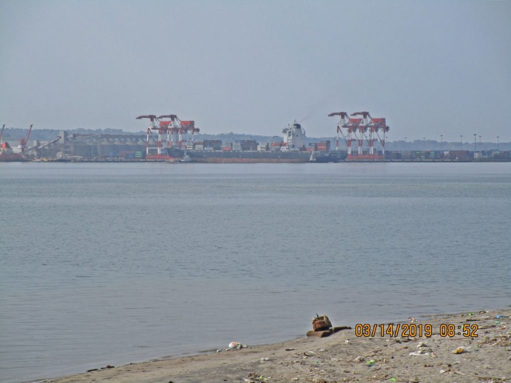
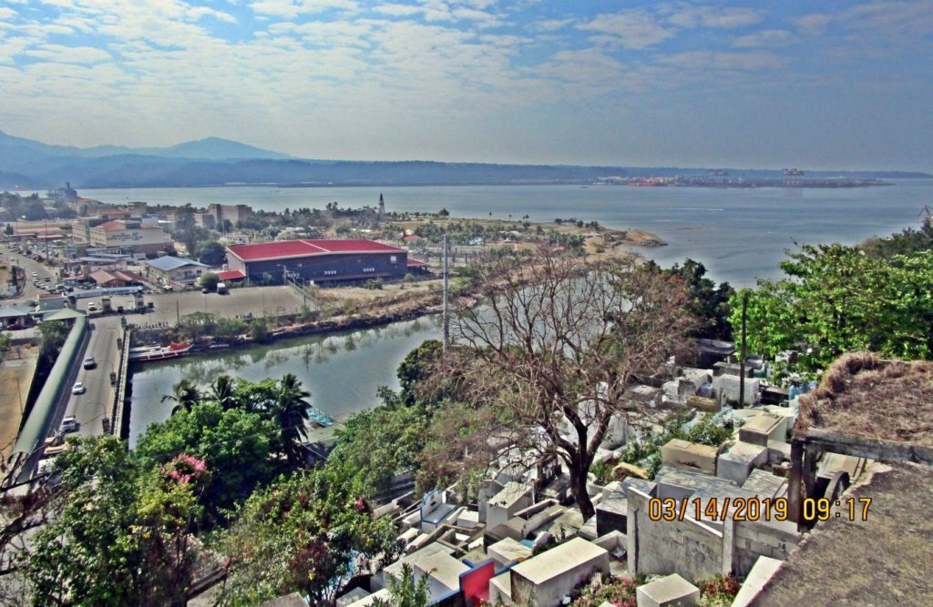
Ze438. (-25) this is a wider view of the Olongapo Kalaklan Point and Subic Bay; the new SBFZ Container Port is in back. It is located at the actual Cubi Point which was also the Naval Base Officer’s Beach.
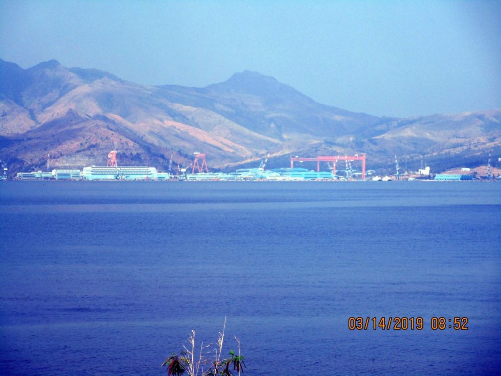
Ze439. (-26) across the Subic Bay we are looking at the Korean Hanjin Shipyard, it went bankrupt this year, because it has received no more orders.
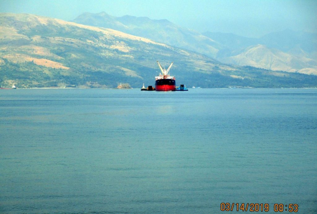
Ze440. (-27) this is a rare site in Subic Bay, it seems this ship is unloaded by barges, we don’t see that much anymore.
Ze441. (-29) This is the mouth of the Kalaklan River, looking across the river from Kalaklan Point in Olongapo City in Subic Bay. Since the Navy left a new bridge has been built to the SBFZ Kalaklan Gate.
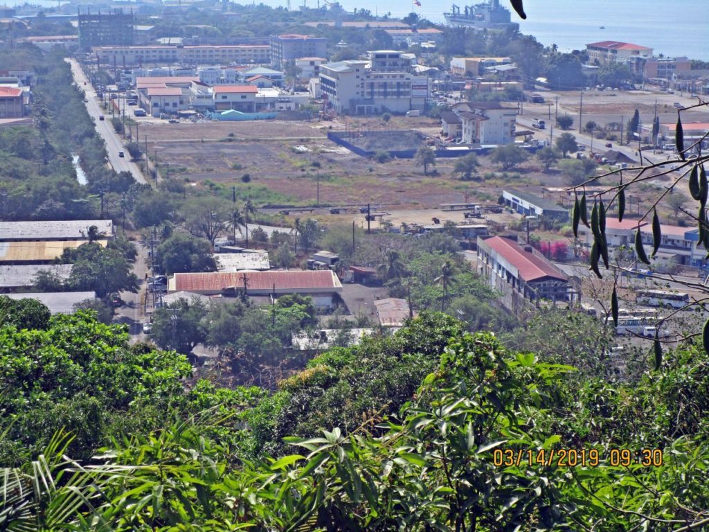
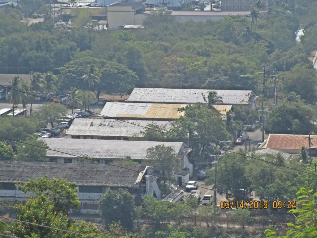
Ze442. (-30) this shot covers the area just inside the Kalaklan Gate in the SBFZ, the former Naval Station Subic Bay. This was shot from the Olongapo Cemetery 2019-03-14. This is a new factory building, inside SBFZ, next to the mouth of the Kalaklan River.
Ze443. (-31) this shot covers the area just inside the Kalaklan Gate in the SBFZ, the former Naval Station Subic Bay. This was shot from the Olongapo Cemetery 2019-03-14. This is a new water park, inside SBFZ, next to the mouth of the Kalaklan River. SBFZ is trying to stabilize and beautify the area.
Ze444. (-32) this shot covers the area just inside the Kalaklan Gate in the SBFZ, the former Naval Station Subic Bay. This was shot from the Olongapo Cemetery 2019-03-14. SBFZ is trying to stabilize and beautify the area.
Ze445. (-33) this is a view of the drainage canal that separates SBFZ from Olongapo city. Notice, there are now two bridges crossing the canal. Right, between the two bridges is the new large Ayala Mall called Harbor Point.
Ze446. (-34) Zoomed in. This is a view of the NW corner of the large area between Dewey Ave and Canal Rd. in the SBFZ. This was shot from the Olongapo Cemetery.
Ze447. (-35) this is a view of the NW corner of the large area between Dewey Ave and Canal Rd. in the SBFZ. This was shot from the Olongapo Cemetery. Notice a Navy logistic ship is moored along Alava Extension Wharf and the Philippine Flag next to it.
Ze448. (-37) zoomed in; this is a view of the NW corner of the large area between Dewey Ave and Canal Rd. in the SBFZ. This was shot from the Olongapo Cemetery. Notice a Navy logistic ship is moored along Alava Extension Wharf and the Philippine Flag next to it.
Ze449.(-38) this shot covers the area just inside the Kalaklan Gate in the SBFZ, the former Naval Station Subic Bay. This was shot from the Olongapo Cemetery 2019-03-14. Everything near the shoreline is a hotel, restaurant or other entertainment business.
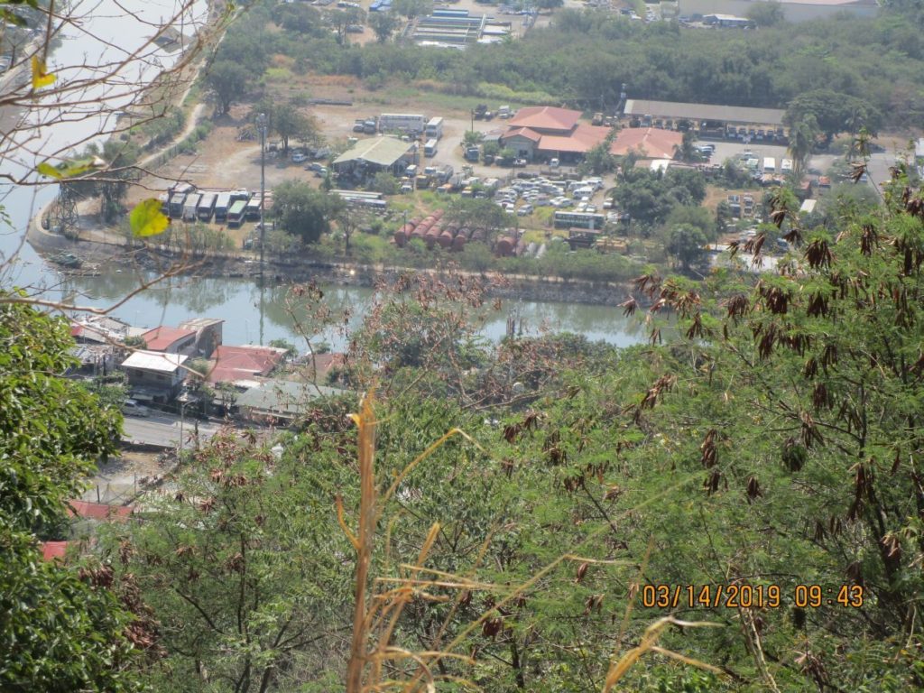
Ze450. (-39) this is a view onto SBFZ, the area of the former Subic Bay Naval Station, in front is the Kalaklan River and at left is the drainage canal that separates SBFZ from Olongapo city. That compound is now the SBFZ vehicle yard, it is next to the former TPU.
Ze451. (-40) this is a view of the former Subic Bay Naval Station Transient Personnel Unit (TPU), I remember at one time it held 64 sailors on legal hold. The building at right is where all the Filipino US Navy volunteers started their career.
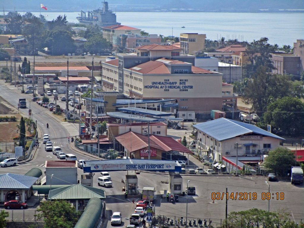
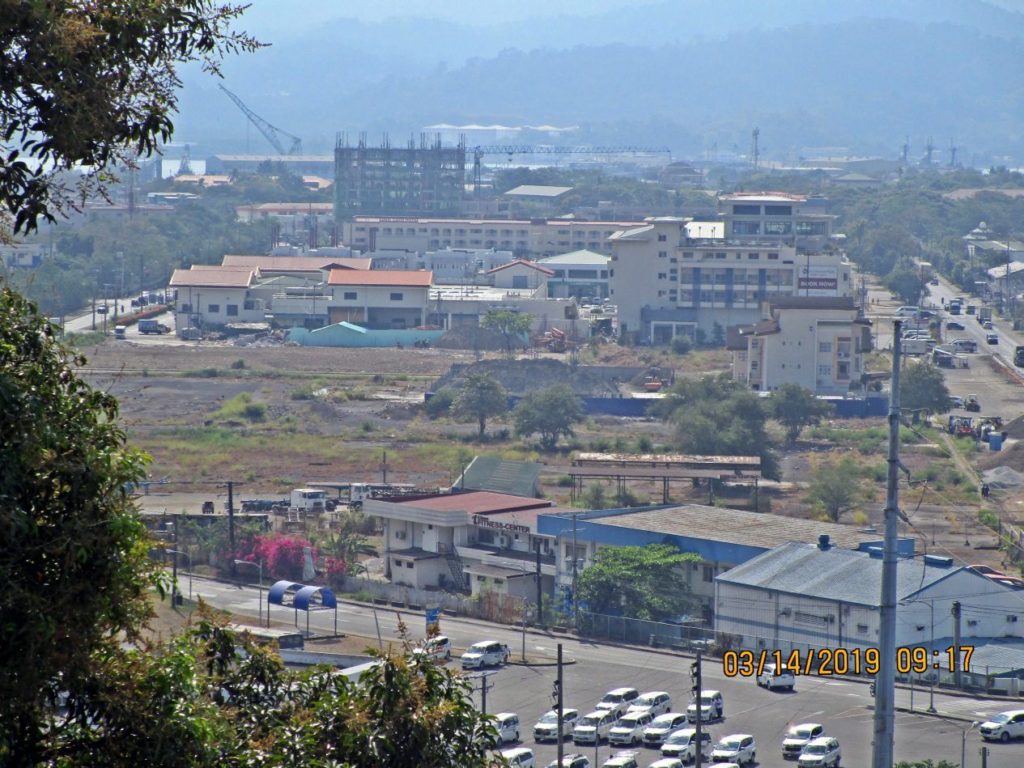
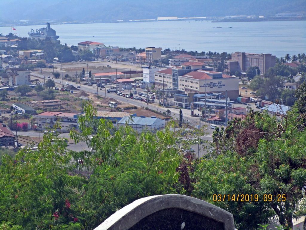
Ze452. (-42) this shot covers the area just inside the Kalaklan Gate in the SBFZ, the former Naval Station Subic Bay. This was shot from the Olongapo Cemetery 2019-03-14. Between the new hospital and the gate are two Korean businesses.
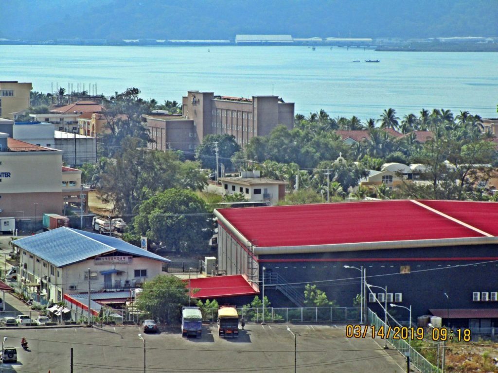
Ze453. (-43) Zoomed in. This shot covers the area just inside the Kalaklan Gate in the SBFZ, the former Naval Station Subic Bay. This was shot from the Olongapo Cemetery 2019-03-14. Everything near the shoreline is a hotel, restaurant or other entertainment business. The red roof is a brand new business, but I don’t know what. In front of that tall and brown building used to be the Navy NIS building.
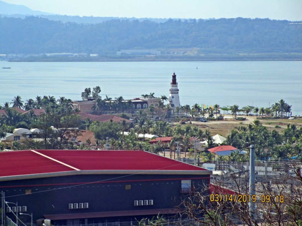
Ze454. (-44) Zoomed in. This shot covers the area just inside the Kalaklan Gate in the SBFZ, the former Naval Station Subic Bay. This was shot from the Olongapo Cemetery 2019-03-14. Everything near the shoreline is a hotel, restaurant or other entertainment business. The red roof is a brand new business, but I don’t know what. The lighthouse is the Lighthouse Hotel. Across the bay is the former Cubi Point Naval Air Station.
Hello, Karl.
I was sorting through old photos, putting some into the “Life Story” section of my Ancestry genealogy account. A couple of them were from my tour at NAS Cubi Point during a 6-month period back in 1969. One of them was a shot of Olongapo, taken from the old aircraft carrier pier at Cubi (now a container ship facility). I didn’t notice it when I took the photo, but there was a lighthouse on a small cliff to the west of Olongapo. It took some time, but I finally identified it as the Kalaklan Point lighthouse. But it didn’t look like the one in my photo. Further research revealed that it was “refurbished” in 2007. Evidently they tore down the old one and put up something visibly different. So much for Historic Preservation. Eventually I found your website and took the Google street view tour around the lighthouse. Got a kick out of your photo from behind the lighthouse, looking back at the location from where I took my photo all those years ago. Quite a difference a few decades made.
You gave us a great photo tour. Appreciated the descriptions of the changes. I wasn’t that familiar with the naval station because I only passed through there going back & forth between Cubi Point and Olongapo. 😉
You are most welcome.