Tag: Subic Bay Naval Base

Grande Island, ex Ft. Wint, SBFZ trip, 2024-12-11
#P13 image is one of the first 3 pictures of our return ride, leaving Grande Island. #P13 shows the former US Army, Ft. Wint Wharf as we depart. #P14 shows Camayan Point, the former ammunition wharf but is now a beach resort and the famous Ocean Adventure Park. #P15 image shows the former Nabasan […]
Read More
Subic Bay & Olongapo City images, 2nd Half 2024
This image shows the former US Marines Green Beach training area, which became the Hanjin Shipyard; now, it is the Agila Subic Shipyard and the Agila Philippine Navy Operating Base with many of their larger vessels. —————————————————- This presentation has 44 images out of the original 72 images which are in this Flickr album and […]
Read More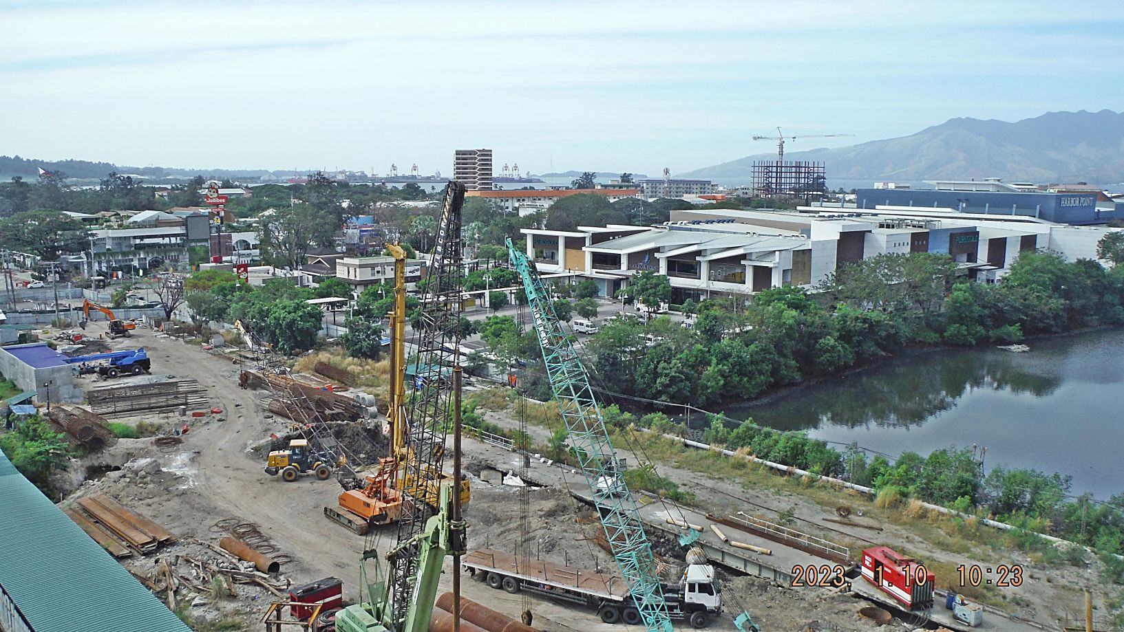
Subic Bay Views, 1st Half of 2023
Zg345. (-018 and 019) are/ is a view of the former main gate bridge of the former Subic Bay Naval Base being replaced. Work has been going on over 3 years now. The new Chairman of the Subic Bay Metropolitan Authority (SBMA) apparently reorganized the effort and it seems that progress is being made. On […]
Read More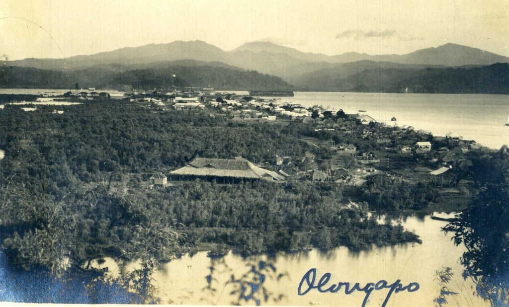
USMC, Earl Hancock “Pete” Ellis U.S.M.C. Photographs, Olongapo, early 1900s
Ue711. Olongapo, circa 1909, this is the best picture I seen so far of Olongapo from the Kalaklan Ridge. This is a Earl Hancock “Pete” Ellis picture from the U.S.M.C. Archives. ——————————————————– Earl Hancock “Pete” Ellis U.S.M.C. was a career officer in the Corps in the early 1900, took many pictures and they are now […]
Read More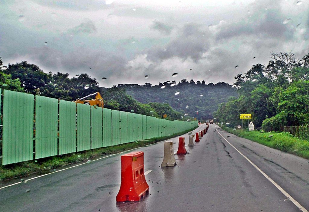
The Subic-Tipo Expressway is widened!
The Subic-Tipo Expressway is widened! Ze535. This is the starting end of the Subic-Tipo Expressway, at this end there were already 4 lanes, they are separated now to construct the new connections to the SBFZ roads. ——————————————- The Subic-Tipo Expressway is built by the Subic Bay Metropolitan Authority (SBMA) after the U.S. Navy left and […]
Read More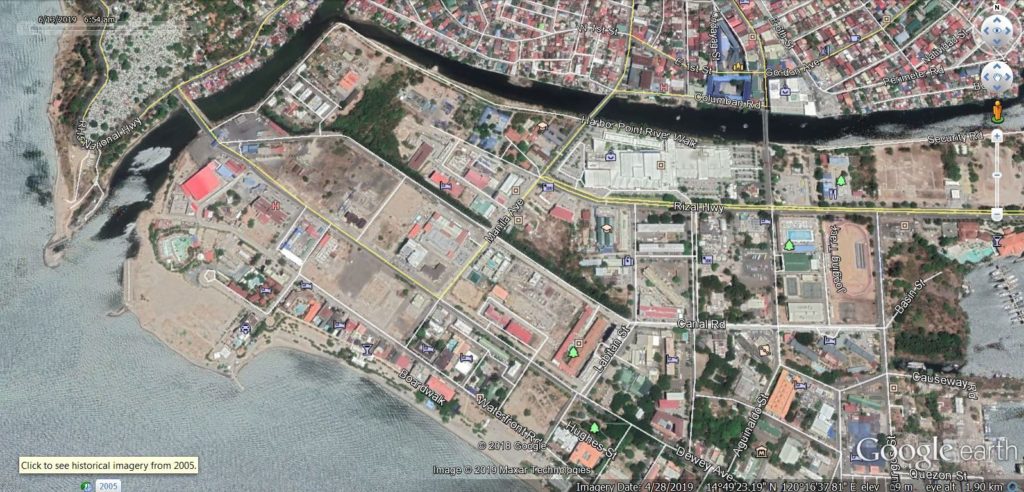
Kalaklan Point & SBFZ Kalaklan Gate area 2019-03-14
Ze419. (-01) I start this album with 5 maps or images; this is a recent Google Earth image of the Kalaklan Point area in Olongapo and the Subic Bay Freeport Zone (SBFZ) Kalaklan Gate area. ———————————————– On this walk, the 14th of March 2019 I first took some pictures of the Kalaklan Point area in […]
Read More