Tag: Subic Bay Freeport Zone
Subic Bay News 2023, 2nd Album
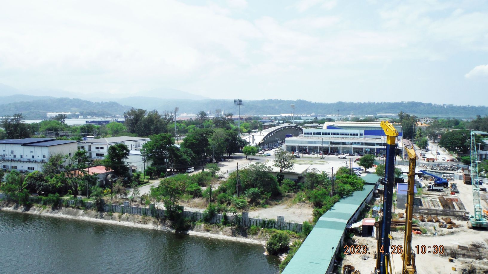
Zg239. This is one of 5 images, shot in 2023, of the SBFZ Magsaysay Bridge being reconstructed. The picture of the bridge construction sign was shot by Carlito Pickering. Notice all the changes of construction in the SBFZ around the entrance of the New Magsaysay Bridge. Aguinaldo Street, our former Liberty Route is also newly […]
Read More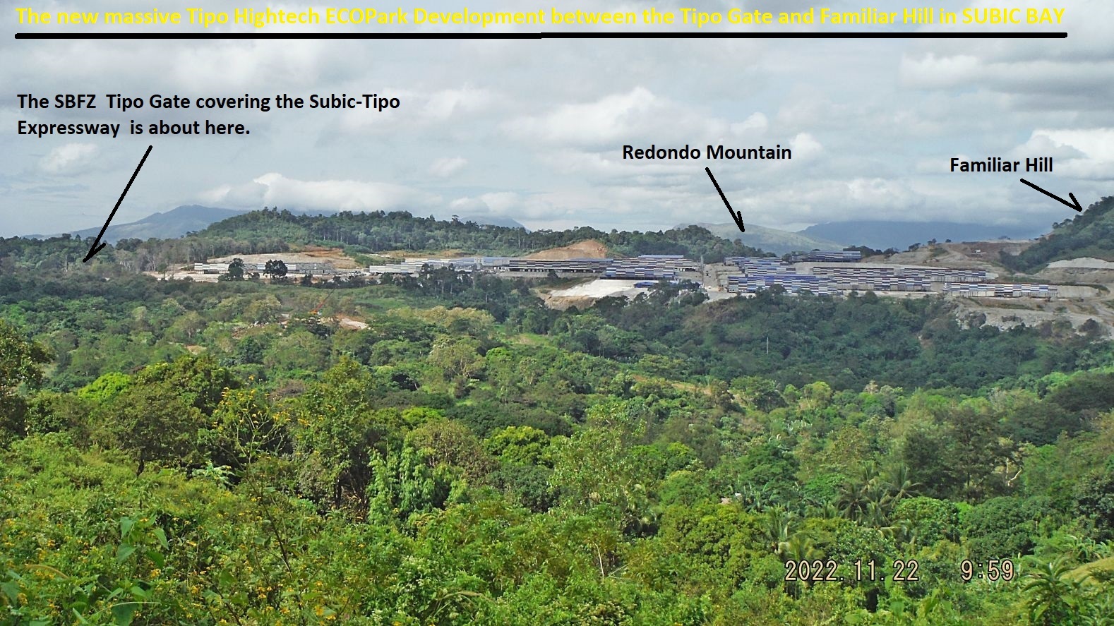
SBFZ Perimeter Walk 22-11-22
Zg008. Pictures #045 to 065 are from my side trip to Brgy. Tipo. First of all we get a great view of the massive development/investment of the Xantheng Corp. thru their Tipo Hightech ECO Park Company. They have spread out from the SBFZ Tipo Gate at left to the Familiar Hill at right. We also […]
Read More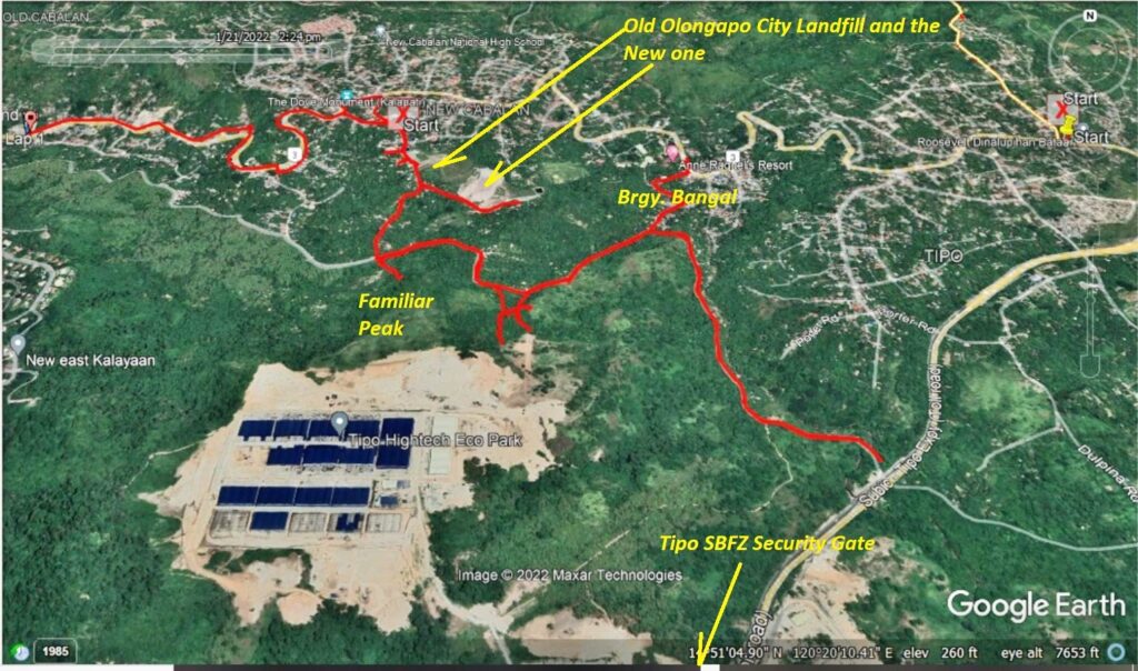
SBFZ Fence around the Familiar Peak on SBFZ 2022-01-21
Zf510. (007) this is one of 13 images in the above album about my track of this -along the SBFZ Fence around the Familiar Peak- walk from Google Earth and my Garmin account and they give other relevant information. In new Cabalan I forgot to safe my GPS track, so the last 2 km of […]
Read More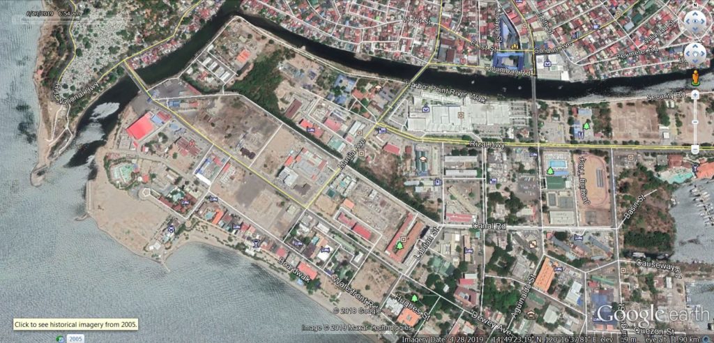
Kalaklan Point & SBFZ Kalaklan Gate area 2019-03-14
Ze419. (-01) I start this album with 5 maps or images; this is a recent Google Earth image of the Kalaklan Point area in Olongapo and the Subic Bay Freeport Zone (SBFZ) Kalaklan Gate area. ———————————————– On this walk, the 14th of March 2019 I first took some pictures of the Kalaklan Point area in […]
Read More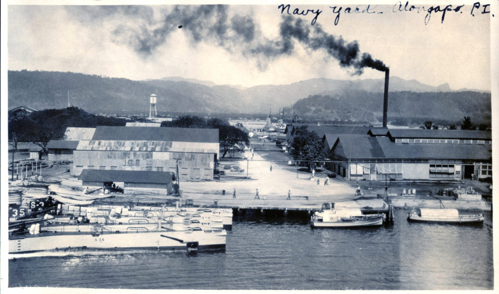
Submarine Base Subic Bay
Zc754. This is the Navy Yard in Olongapo 1926; it seems the yard was located exactly where the Subic Bay Ship Repair Facility (SRF) was established during the Viet Nam War. That is the area of the Rivera Wharf now-a-days; 4 submarines are in a nest alongside the wharf. This picture was sent to me […]
Read More