Category: Subic Bay
This category will include images and stories from SBFZ, the former Naval Base, Olongapo City, Barrio Barretto and everything else related to Subic Bay.
Zc232. Aerial shot of the Subic Bay Freeport Zone (SBFZ), the ex Subic Bay Naval Base. Photo credit- SBFZ. This photo is related to this web page:
https://business.mb.com.ph/2018/07/02/subic-freeport-gets-new-areas-to-host-more-investors/

Barretto Bypass Road 2024-06-14
This is my 3rd Segment! It is being worked on. Highlights are, the two main culverts are finished and the road work has been lengthened about 100 meters. Judging by the direction of the lengthening, the road seems to aim in the direction of the Rizal Ext. in Barrio Barretto. Keep in mind the present […]
Read More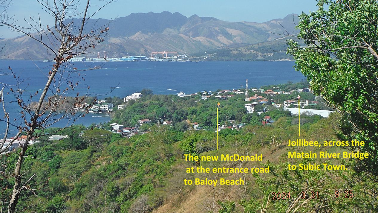
Subic Bay News as of 2024
Zg766. This is one of 5 images I shot on the 31st of March 2024 (Easter Sunday) from the ridge behind my house which I like to call the Hotel Marmont Ridge. The pictures are of Barrio Barretto and Subic Bay, shot from right to left and they are uploaded here in high resolution. […]
Read More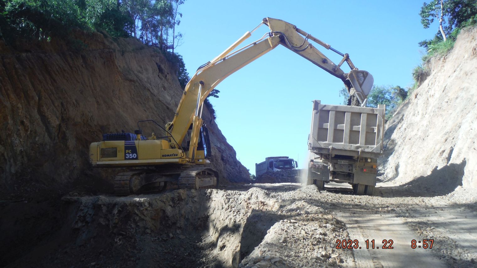
Barrio Barretto Bypass Road
Zg619. (#41) image is the ridgeline where the road cut is made deeper and the material is used for fill to build the road further on. ———————————— In our larger Subic Bay and Olongapo City area a road construction has been started which is called “Barretto Bypass”. Many of people that live here are […]
Read More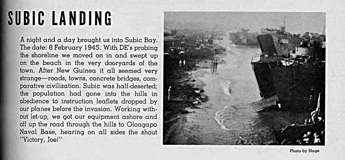
115 Naval Construction Battalion, 1943-1945
Zg480. Naval Construction Battalion 115 lands at Subic Bay, the 8th of Feb. 1945. ————————————————————————————- 115 Naval Construction Battalion, 1943-1945 This is the 115 Naval Construction Battalion, 1943-1945 Unit Book during WWII. They also served in Subic Bay, hence my interest! This book is published by and for the men of the 115th Battalion. Photos other […]
Read More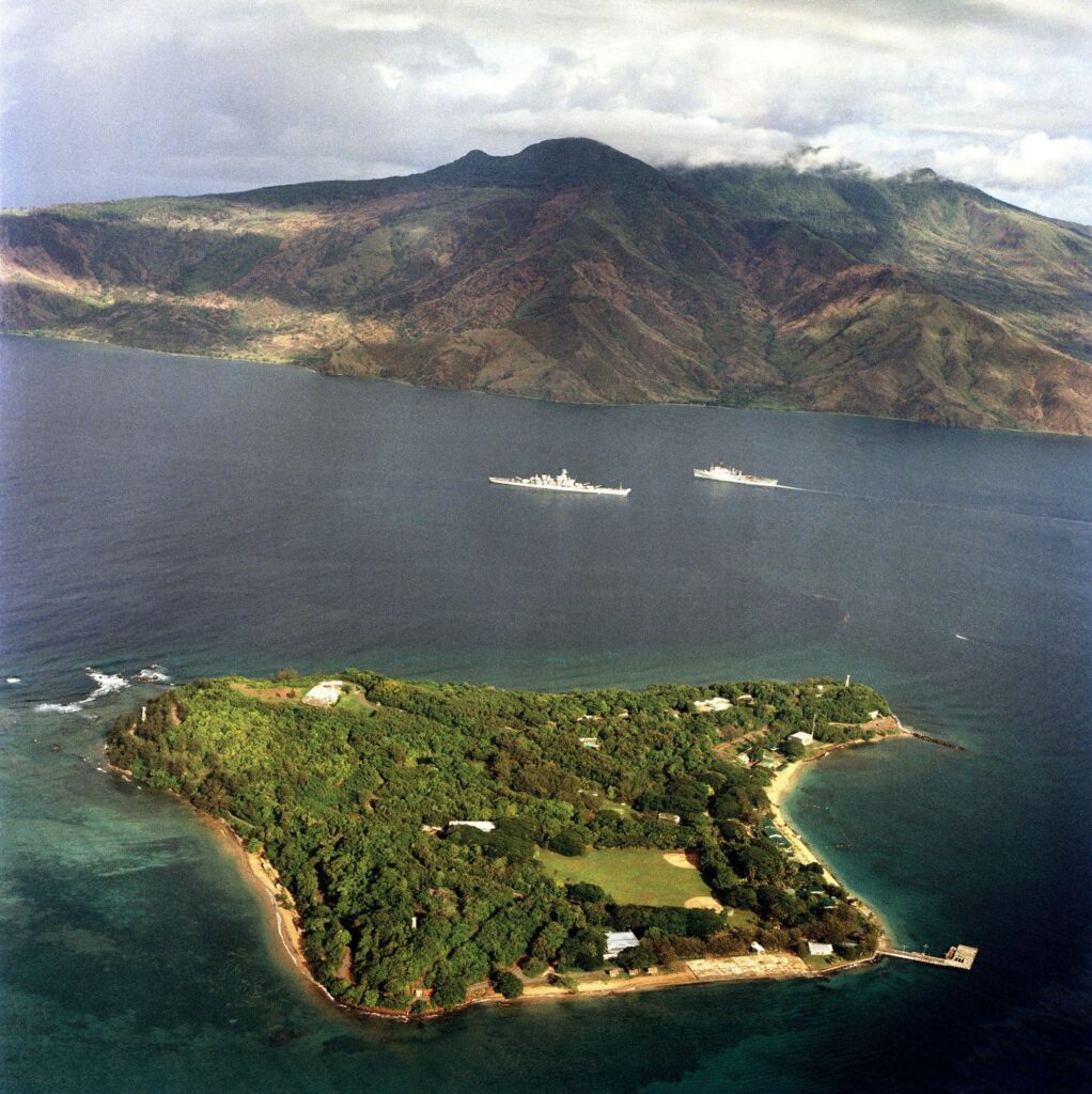
War in Subic Bay and Olongapo 1941
Zd869. This is a 1983-02-14 Grande Island picture from NARA via Wikipedia with Battleship New Jersey BB-62 and a LSD or LPD passing each other. Now that is a Navy picture, it makes a sailor like me, proud as heck; did diving work under that Battle wagon in Subic and served on two LSDs. This […]
Read More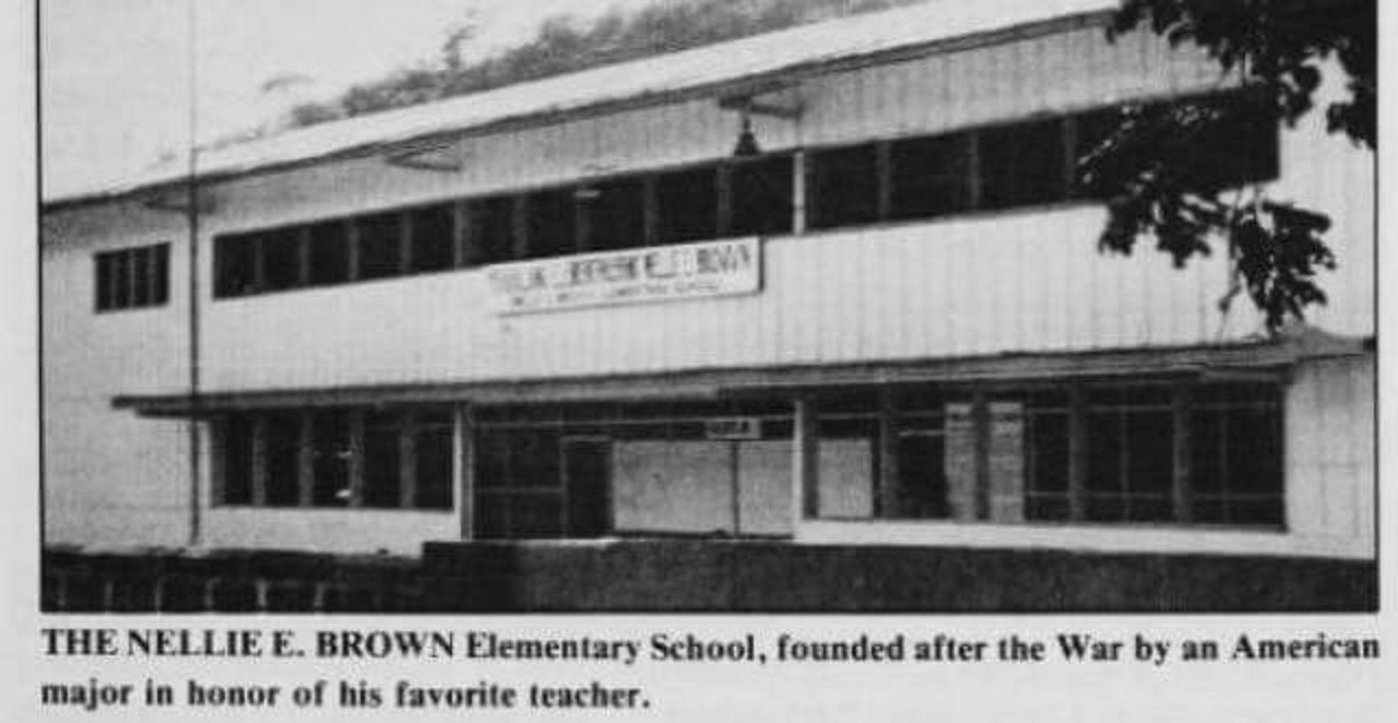
Olongapo History, Album No.1
——————————————- Olongapo is an important place, I know it since 1962. The US Navy and Olongapo were ONE ENTITY for decades. It has become my home. It was, it is, important in my life. Hence it needs its own albums! ——————————————- A friend asked me about an Olongapo school name, so I started researching, this […]
Read More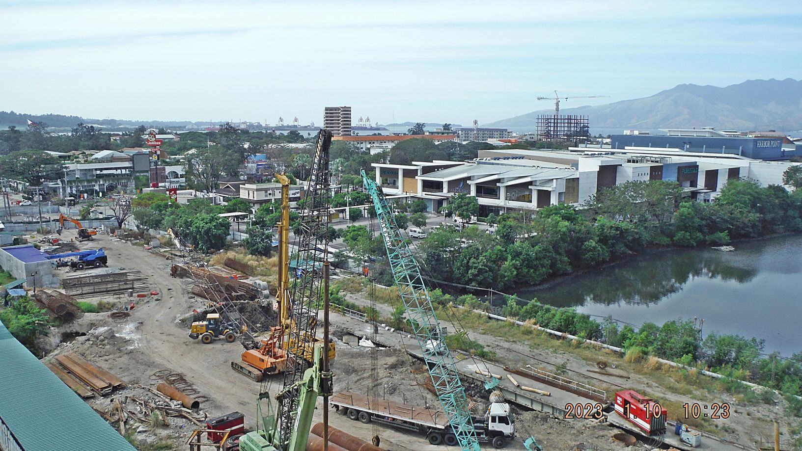
Subic Bay Views, 1st Half of 2023
Zg345. (-018 and 019) are/ is a view of the former main gate bridge of the former Subic Bay Naval Base being replaced. Work has been going on over 3 years now. The new Chairman of the Subic Bay Metropolitan Authority (SBMA) apparently reorganized the effort and it seems that progress is being made. On […]
Read More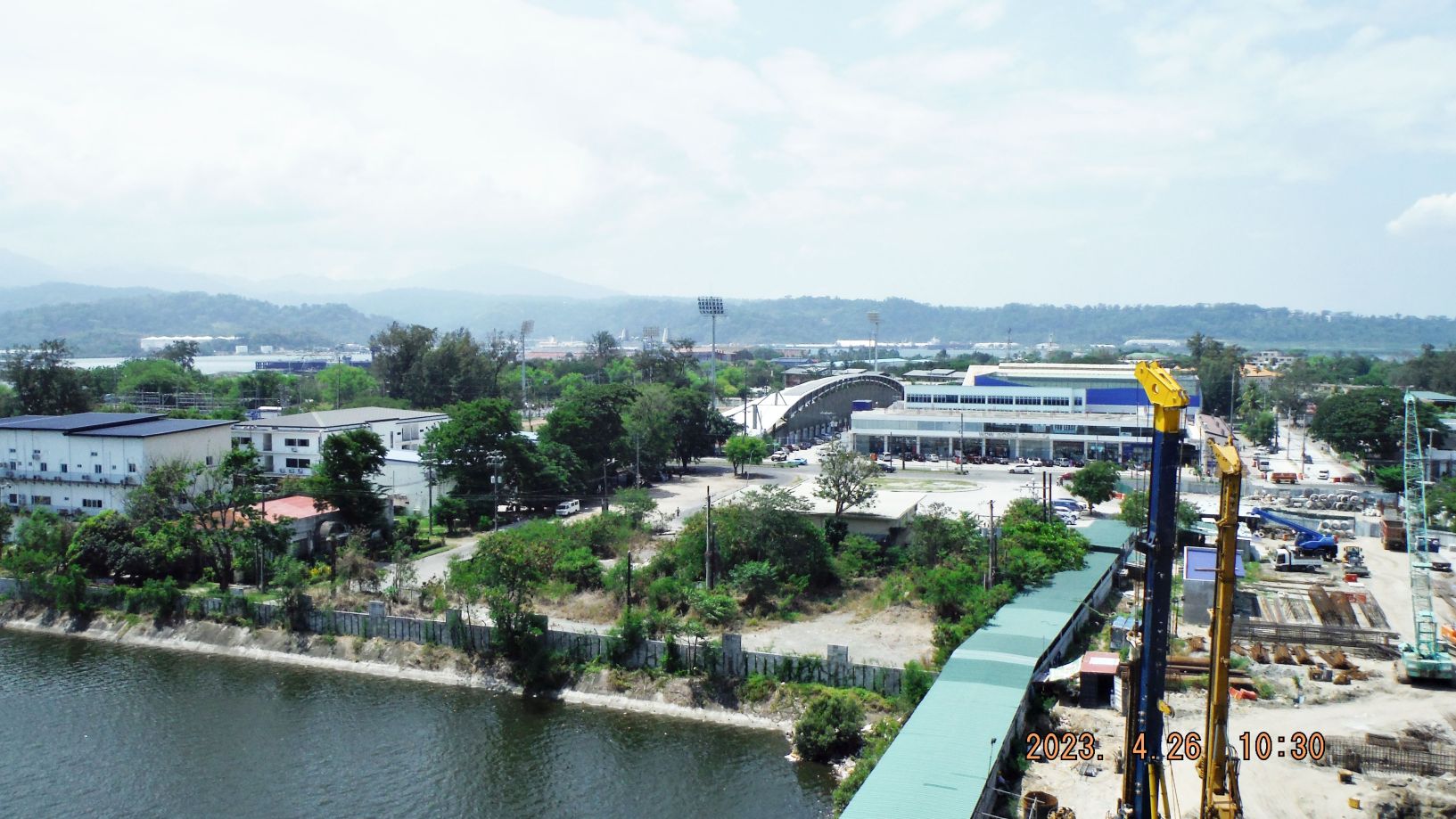
Subic Bay News 2023, 2nd Album
Zg239. This is one of 5 images, shot in 2023, of the SBFZ Magsaysay Bridge being reconstructed. The picture of the bridge construction sign was shot by Carlito Pickering. Notice all the changes of construction in the SBFZ around the entrance of the New Magsaysay Bridge. Aguinaldo Street, our former Liberty Route is also newly […]
Read More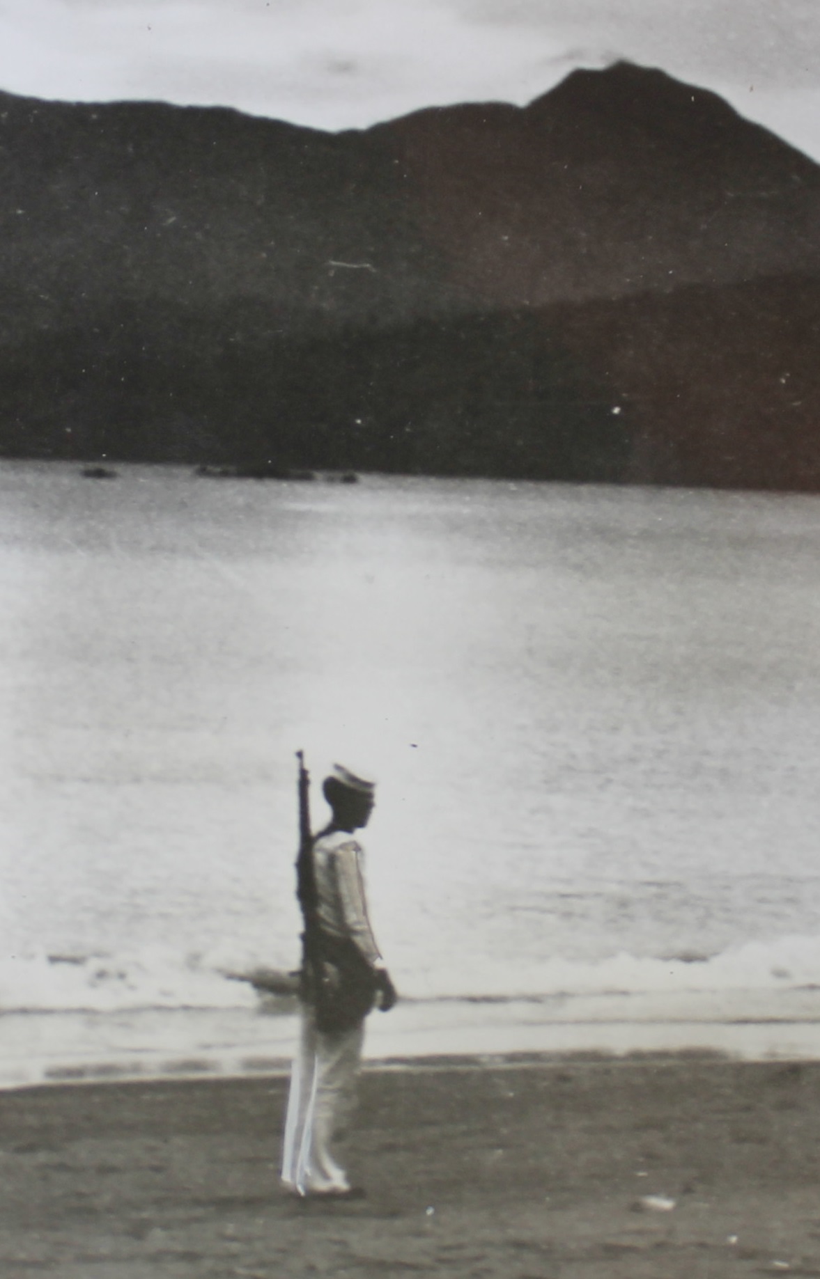
Two Historic Olongapo Pictures
Zg167 image I love this picture; this is an US Navy Sailor standing guard at the Barrio Barretto Beach (present name) and in his white Uniform. I’m a retired sailor and reside in Barretto now, this is my home now! This area was called Maquinaya, from the river’s name that drains this area; it has […]
Read More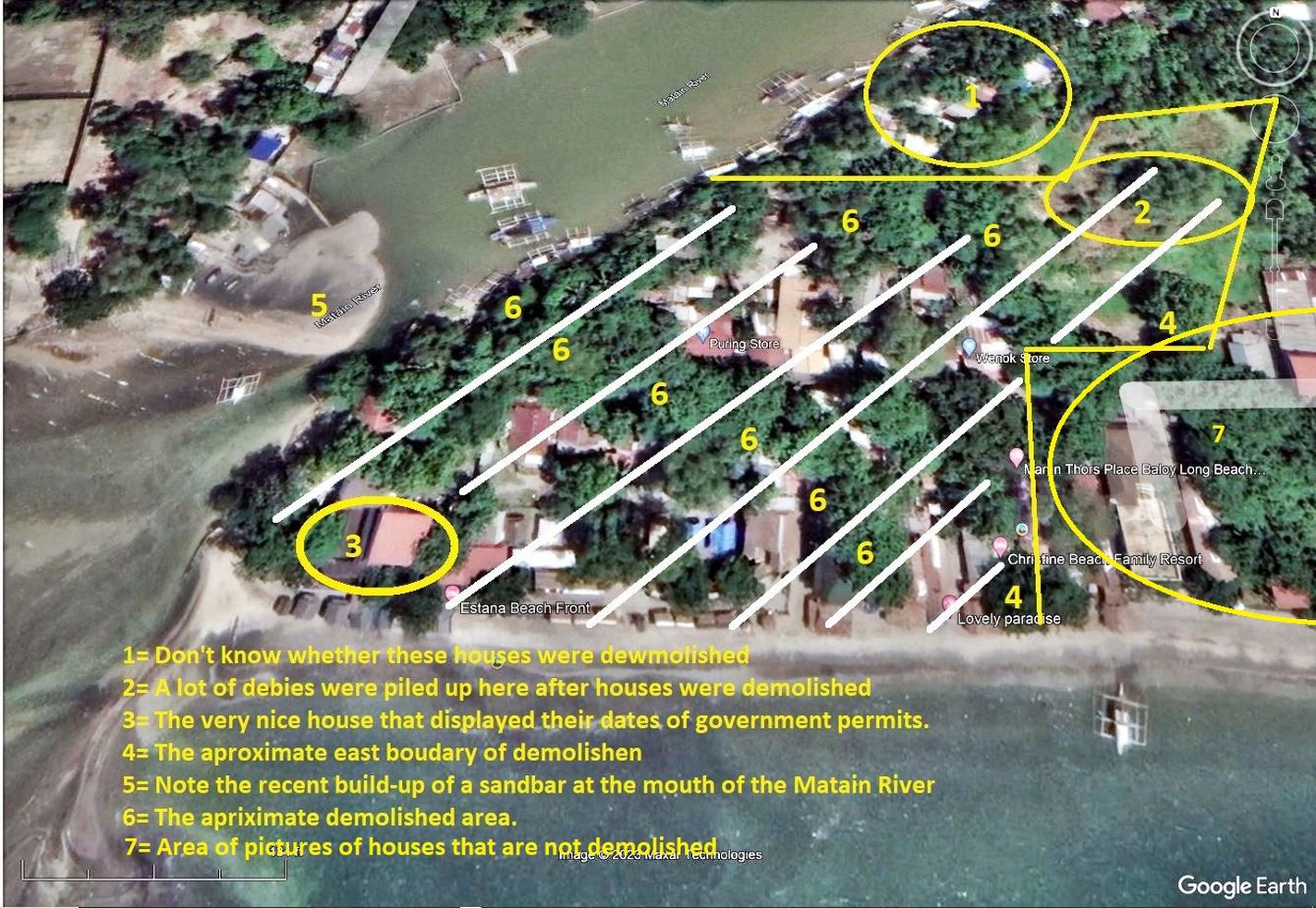
Baloy Long Beach West End Demolished for development 2022/23
Zg156. (-Pictures # 00 & 01). Google maps of the demolished area. ——————————————————– In the last 4 month I saw the demolishment of the Baloy Long Beach West End and it seems for a large development. Baloy Long Beach is part of Olongapo and has the best beaches, easily reachable, in the Olongapo and Subic […]
Read More