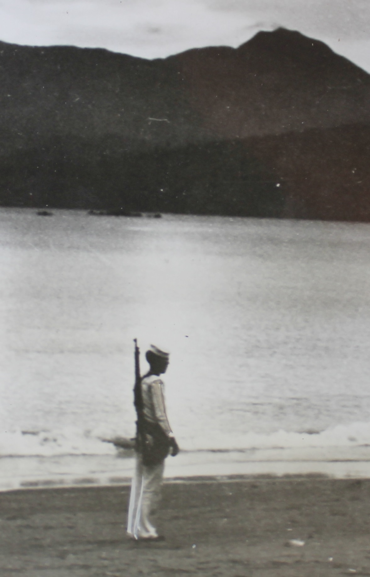
Zg167 image I love this picture; this is an US Navy Sailor standing guard at the Barrio Barretto Beach (present name) and in his white Uniform. I’m a retired sailor and reside in Barretto now, this is my home now! This area was called Maquinaya, from the river’s name that drains this area; it has long military history. I established an album about this Maquinaya Rifle Range, Naval Supply Depot Maquinaya and Barrio Barretto area. This is the URL, click here:
——————————————————-
These two pictures were bought in the www by the John Duresky who is the researcher of the writing team of the new book “Relentless Hope: A True Story of War and Survival, by David L. Britt”. He is letting me use them. They were published during the war by National News Papers but originate perhaps from as early as the 1920s.
———————————————————–
Zg167 image I love this picture; this is an US Navy Sailor standing guard at the Barrio Barretto Beach (present name) and in his white Uniform. I’m a retired sailor and reside in Barretto now, this is my home now! This area was called Maquinaya, from the river’s name that drains this area; it has long military history. I established an album about this Maquinaya Rifle Range, Naval Supply Depot Maquinaya and Barrio Barretto area. This is the URL, click here:
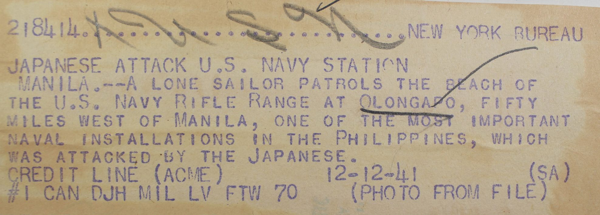
Zg168 image is the original source of the image of an US Sailor guarding the beach at the Maquinaya Rifle Range. The picture was used in 1941 but it is from an earlier time.
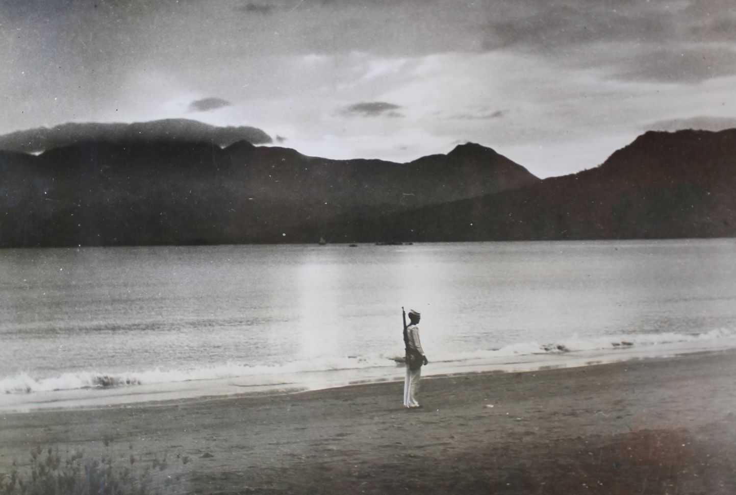
Zg169 image is the copy of the original image bought in the www. This picture shows an US Sailor guarding the beach at the Maquinaya Rifle Range. The picture was used in 1941 but it is from an earlier time. In back is the Redondo Peninsular.
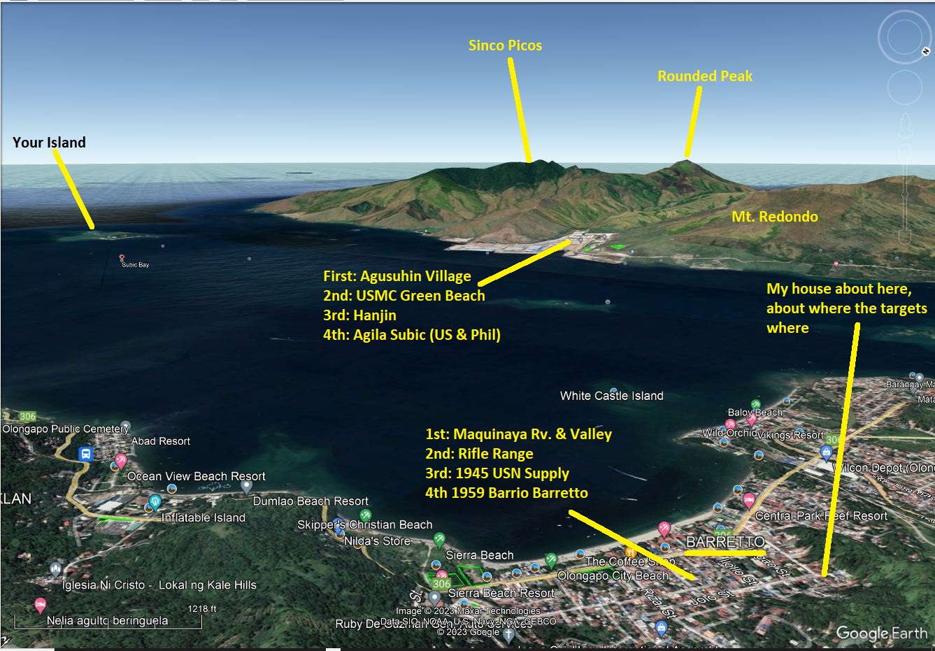
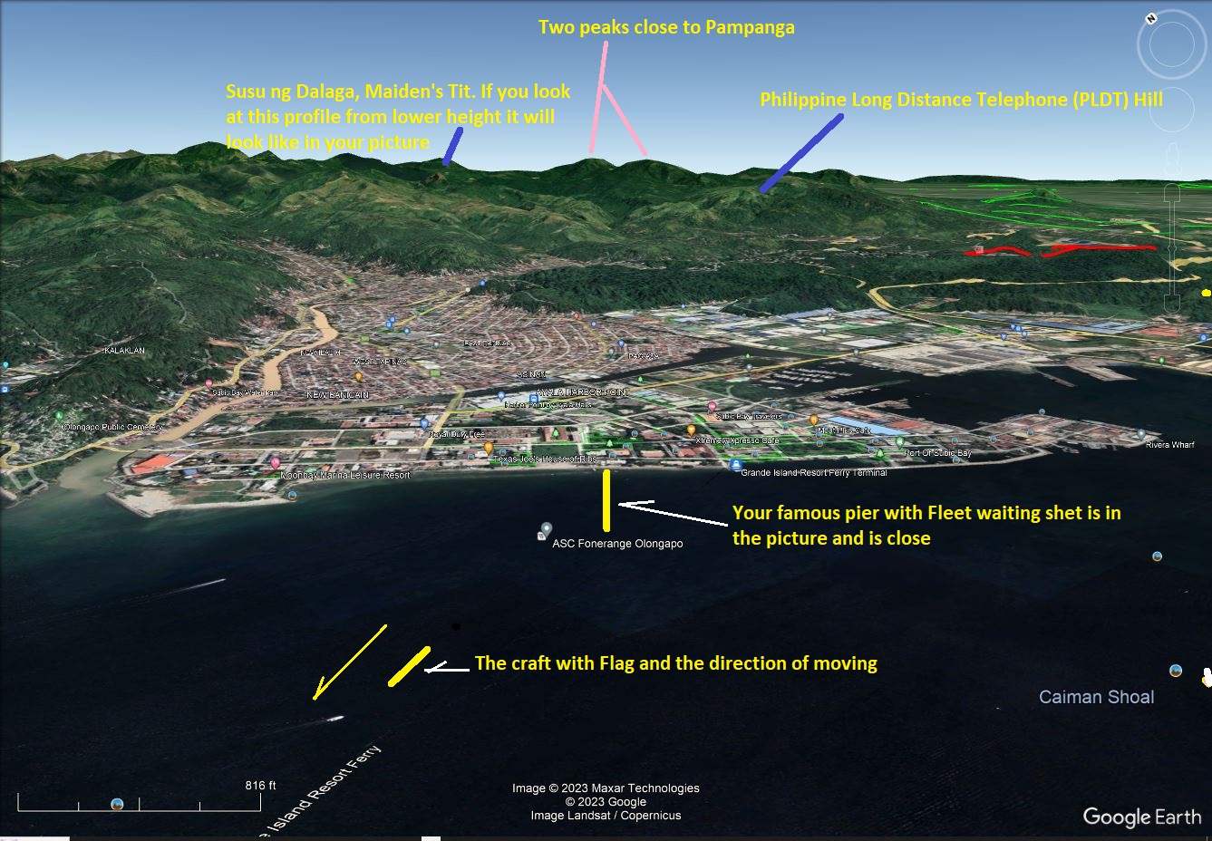
Zg170 image is my attempt to fit the sailor picture into a bigger Google Earth image of much of the Subic Bay area.
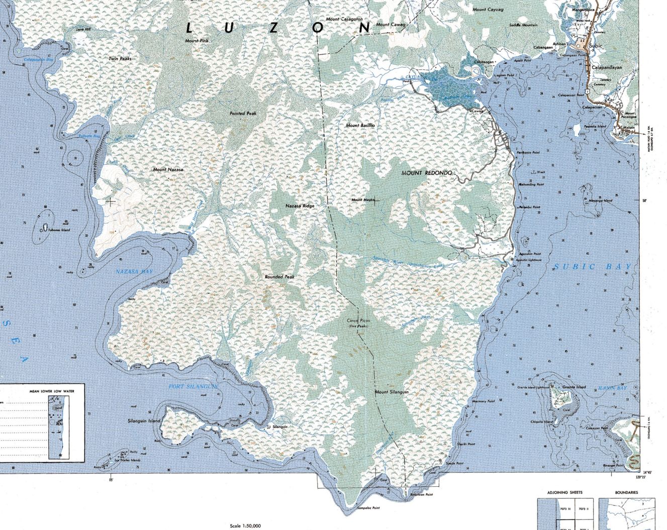
Zg171 image is a portion of the 1:50000 San Antonio map and it covers the Redondo Peninsular.
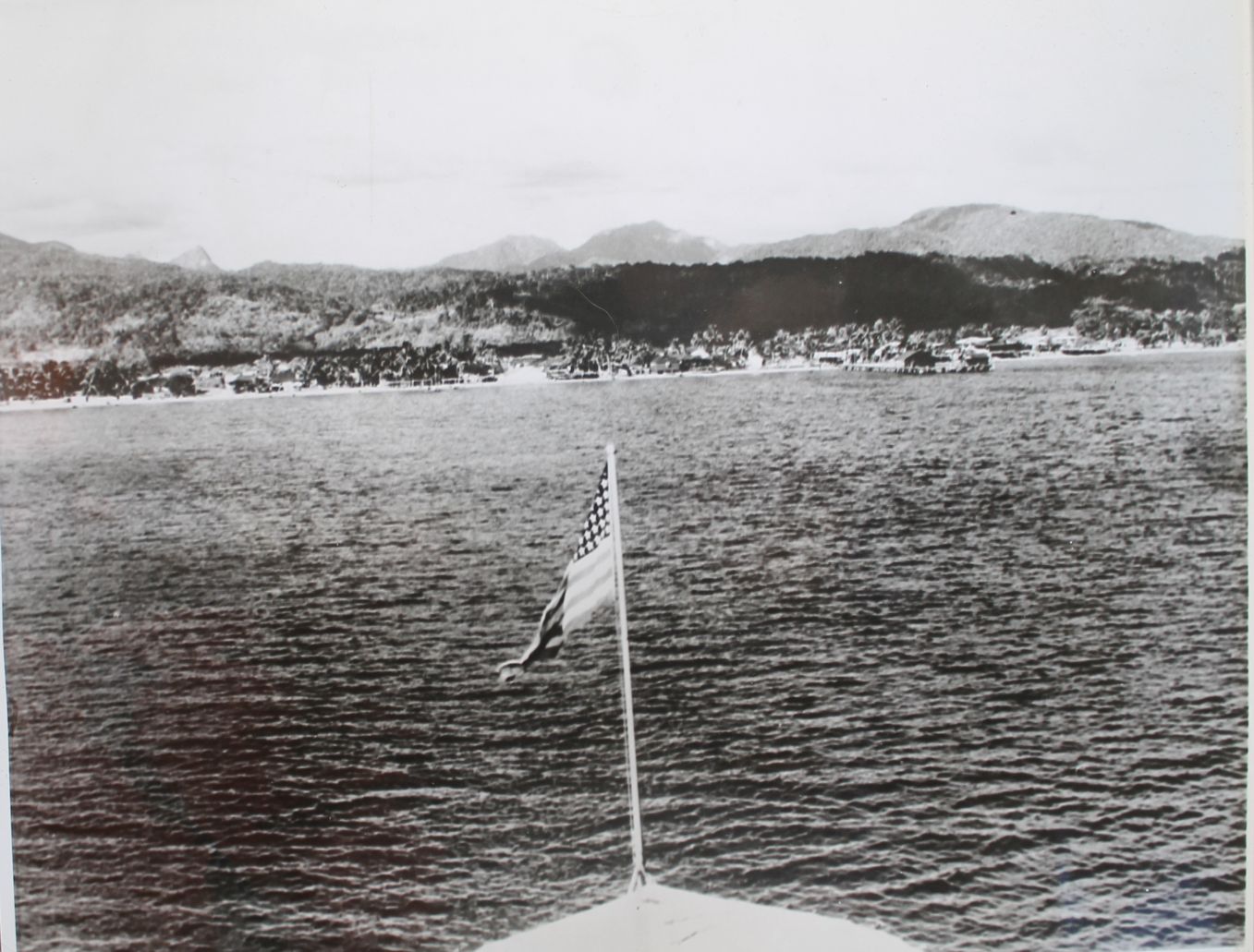
Zg172 Image shows a ship or boat departing the Olongapo Naval Station and Yard. I certainly recognize the mountain peaks as indicated in one of the following image. Again this picture was used in 1941 in National News Papers to cover the war but it was shot earlier. Like the other image, this one was recently bought in the www by John Duresky.
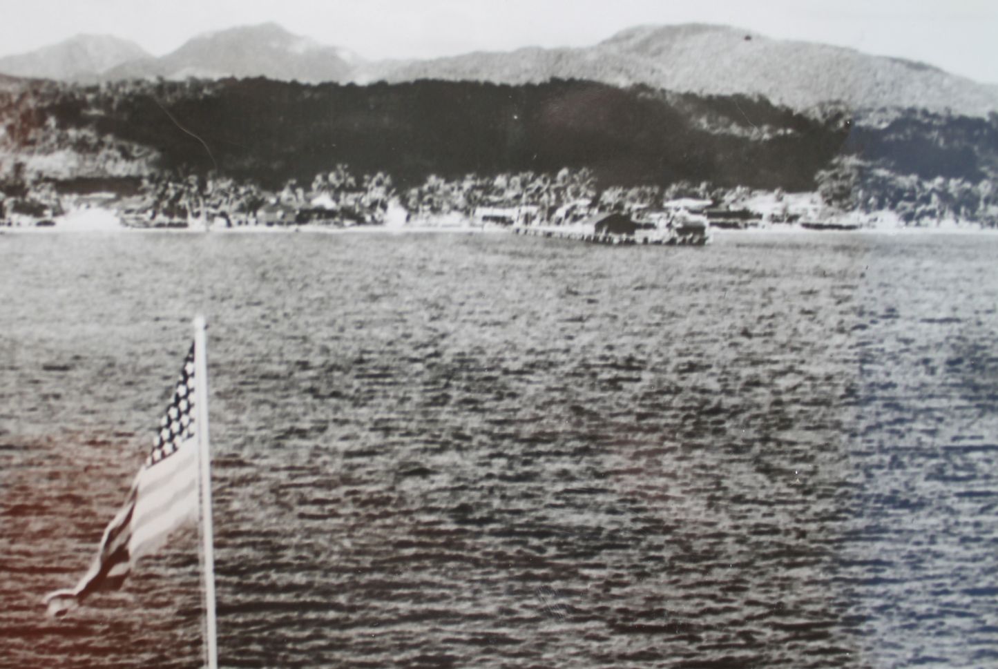
Zg173 image is a zoomed-in picture of the previous image of a ship or boat departing the Olongapo Naval Station and Yard. Again this picture was used in 1941 in National News Papers to cover the war but it was shot earlier. We recognize the pier that was used by the US Army Fort Wint on Grande Island personnel and by the US Fleet when anchored out in the Bay. I done that in 1962 but the boat landing pier was at a different location then.
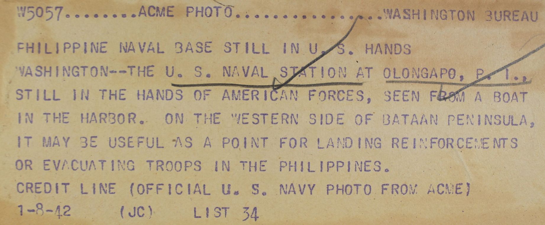
Zg174 image is the original source of the image of a ship or boat departing the Olongapo Naval Station and Yard before 1941.
Zg175 image is my attempt to fit the departing boat or ship into a bigger Google Earth image with the peaks in back of Olongapo.