Zg262. The Battle of the Philippine Sea (June 19–20, 1944), from Wikipedia, the free encyclopedia.
The Battle of the Philippine Sea (June 19–20, 1944) was a major naval battle of World War II that eliminated the Imperial Japanese Navy’s ability to conduct large-scale carrier actions. It took place during the United States’ amphibious invasion of the Mariana Islands during the Pacific War. The battle was the last of five major “carrier-versus-carrier” engagements between American and Japanese naval forces, and pitted elements of the United States Navy’s Fifth Fleet against ships and aircraft of the Imperial Japanese Navy’s Mobile Fleet and nearby island garrisons. This was the largest carrier-to-carrier battle in history, involving 24 aircraft carriers, deploying roughly 1,350 carrier-based aircraft.
Wikipedia failed to mention this Coast Watcher report.
WWII Coast-Watcher at Balicuatro Point, NW Samar. (1st Seg)
—————————————————————–
This information is copied from notices and reports of the American Guerrillas of Mindanao Association (AGOM).
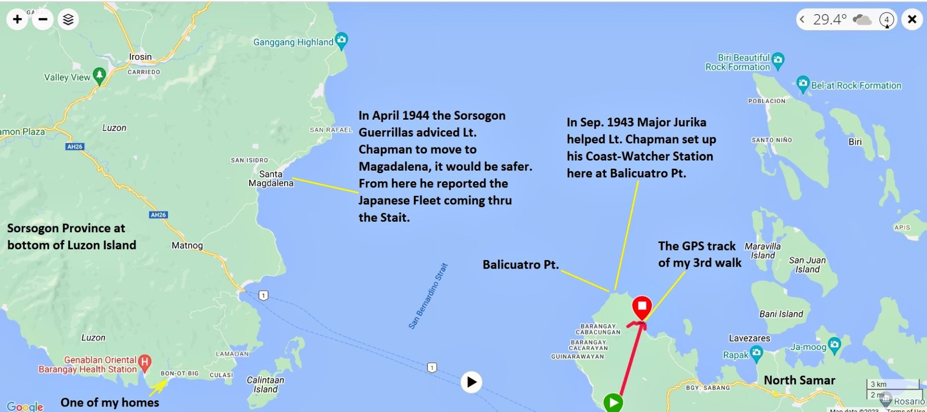
Lt. Chapman, and his Philippine Crew started out in Samar but made his big catch of spotting and reporting the Japanese Fleet sailing thru the San Bernadino Strait to the demise in the “Great Marianna Turkey Shoot” from Sorsogon.
My Filipino Family is from this general area, we visit here every year, hence my interest! So in May 2023 I went there to check out the geography. That will be in 3 following segments.
Segment #1
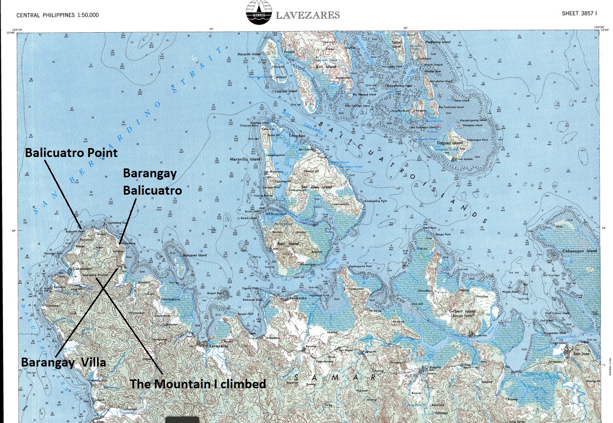
Zg263. North Samar map, Balicuatro Point area.
Coast Watcher Station MAG commanded by 2nd Lt. Gerald S. Chapman was set up on the Northwestern tip of Samar in late September, 1943, with the primary mission to report on shipping through the San Bernardino Straits. Additional tasks were to report on aircraft and any significant ground activity of the Japanese forces.
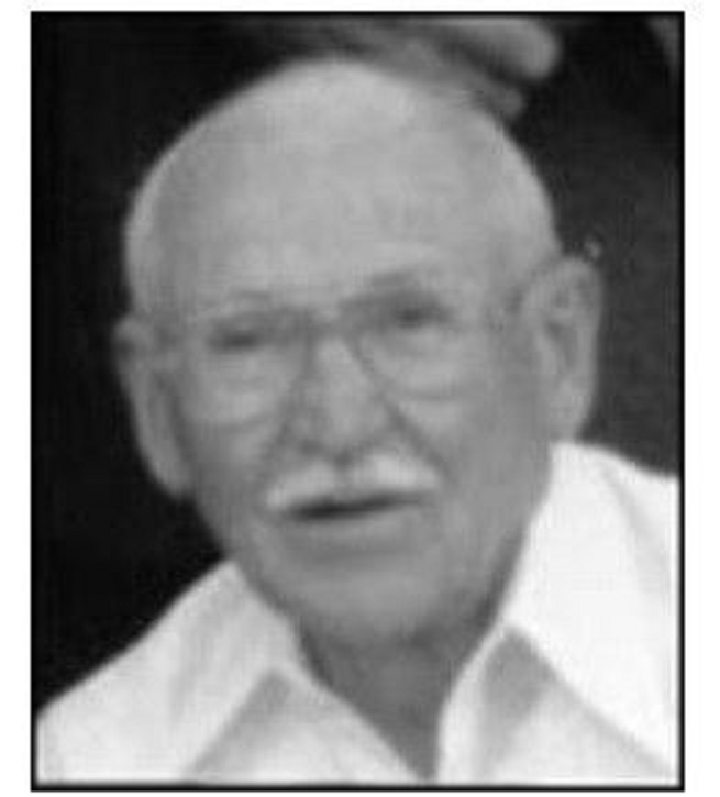
Zg264. Lt. Chapman, cropped form 1994 AGOM reunion.
In the spring of 1944, there was a significant increase in enemy activity around the small peninsula where the station was located and intelligence indicated that the Japanese were aware that the station was in the area and were trying to pinpoint the location. Because of this threat to our security, a decision was made to move the station across the Straits to Sorsogon. The move was made of the night of 4 April, 1944.
In many ways, the move enhanced our mission by getting access to intelligence information on the disposition of Japanese forces in the Southern Luzon area, gaining a better vantage point for observing the Straits and improving our source of supplies.
Coast Watcher operations are pretty much routine but they make a significant contribution to the war effort primarily by giving bits of intelligence on the enemy situation that can be pieced together at command level to give an overall picture of what the enemy is doing in the area. However, there are occasions when events of special significance occur that highlight the important role that these units play in the war effort. Station MAG, along with several other stations in the Philippine area experienced such an event in the summer of 1944.
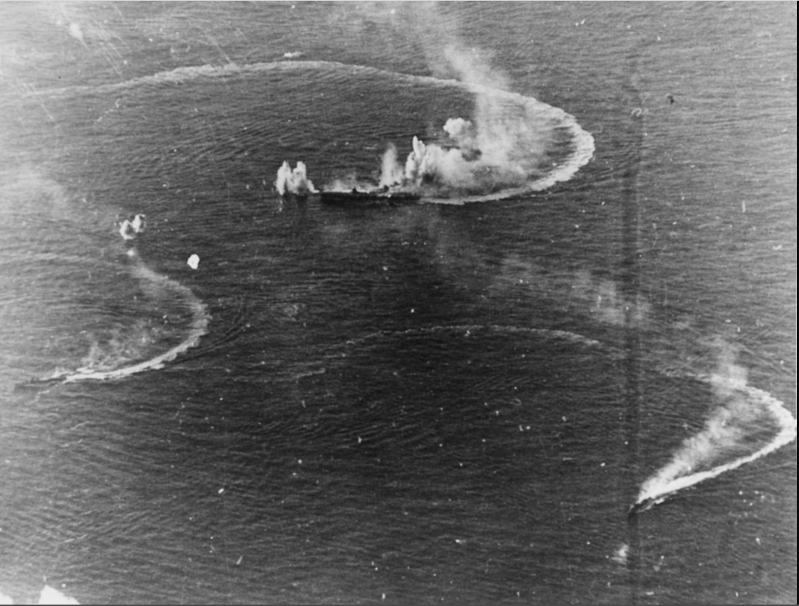
June 15, 1944 started like most other days at Station MAG; house-keeping chores, contact with the net control station and preparation of a couple of reports on aircraft sightings. At 1430, the observer from the lookout point called me to check on some ships entering the Straits from the west. On arrival at the outpost, I was surprised to see several large Japanese naval vessels beginning their passage through the Straits in single file. With my identification pamphlet in hand, I began recording them in order as follows:
2 Small Patrol Boats 2 Destroyers,
2 Cruisers Atago class 2 Cruisers Mogami class,
2 Cruisers Tone class 2 Destroyers,
2 Battleships Kongo class 3 Aircraft Carriers,
1 Light Cruiser Agano class 2 Cruisers Nachi class,
2 Destroyers 3 Aircraft Carriers,
2 Destroyers 3 Aircraft Carriers,
1 Destroyer 1 Battleship Nagato class
1 Cruiser Tone class.
The last ship passed our lookout post at 1630. As they left the Straits, we could see the ships begin to spread out.
On the 26th of June, received the following message from our net control station, relative to the above event: “CMDR SEVENTH FLEET SAYS QUOTE WELL DONE ON JAP BATTLE FLEET Unquote PD STAHL TO CHAPMAN CONGRATS OLDMAN PD.”
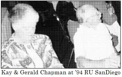
Zg265. Kay & Gerald Chapman at ’94 RU San Diego
============================================================
WWII Coast-Watcher at Balicuatro Point, NW Samar. (2nd Seg)
Two U.S. Officers set up the Coast-Watcher Station at Balicuatro Point Station
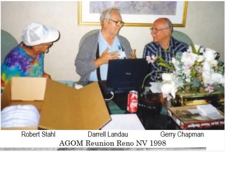
Zg266. LT Gerald S. Chapman, Robert Stahl, Reno, AGOM Reunion 1998
Here are two of Lt. Col. C. M. Smith coast watchers. This picture came from this URL; it is the fascinating story of Robert Stahl, click here:
Gerald S. Chapman, stationed in Magdalena, Sorsogon Province, reported the Japanese Fleet going thru the San Bernardino Straits, going to its doom at the Mariana Turkey Shoot. Robert Stahl, stationed on the Bondoc Peninsular, had to relay the message because Gerry Chapman’s effort was not received by anyone.
Lt Gerald S. Chapman was interviewed by James Zobel, the Archivist of the Gen. of the Army Douglas MacArthur Memorial in Norfolk and by Louis Lee Jurika, the son of Tom Jurika. The interview is recorded in three-word documents and the MacArthur Memorial shared them with me. Here are the word document URLs and a few sample paragraphs of the interview.
———————————————————-
-Army Career and how he got to Mindanao and did not surrender. Right click and follow the instructions, click here:
Mr. Zobel – Were they going in the hills as well?
Mr. Chapman – Oh yeah. But they had a plan. We did not have a plan. We did not know where the hell we were going. Since we did not know where we were going, we said, no problem, we will just go with you. So, we loaded on board their truck and off we go towards Malaybalay. Before we get to Malaybalay, they turned off on a little side road and we went down that a while and we wound up going through the field. Trucks apparently had used this side road and we get up towards where we are getting into the mountainous area and the jungle is already closing in on us. Cannot go any further because there is a GI truck parked there. Somebody has already taken off for the hills and left their GI truck there because they could not go any further. So, we disembarked from our truck there and we took off and headed up the mountain. We were headed toward Agusan, south of Malaybalay, and we went up the hill and somewhere up here is a little settlement. It was on the engineering map I have. It may be on here. I cannot read it. But it is Celie, I think it is. Celie.
——————————————————————————–
-How he became a guerrilla and his orders to Samar and setting up Station: Right click and follow the instructions, click here:
Mr. Zobel – And this is Tom Jurika?
Mr. Chapman – Yes. Tom Jurika. To move the station north to northern Samar. We had an argument over that and I told him that I really didn’t want to move and that St. John was available there and he could go instead of me. Tom says, sorry, you’re the one that has been designated and you’re going. I said, supposing I don’t go. He said, well if you don’t go, I will be happy to arrange for a ride in submarine to Australia where you will undoubtedly be rejoined with the U.S. military and the infantry or somewhere. However, if you want to accept this assignment, when we get up and get your station in place, you can write a letter to your mother and I will take it and make sure that she gets it. I said, you just made the deal. An offer I can’t refuse. So, we packed up and started our move.
Mr. Zobel – Who packed up? You and your Filipino guys?
Mr. Chapman – Yeah.
Mr. Zobel – Did you go overland, up through Leyte?
Mr. Chapman – No, we left ……………… on the wildest launch. This was a launch that had been captured by the Leyte guerrillas I guess from the Japanese. It was a former fishing boat, I guess, and it had a one-cylinder diesel engine, but the one cylinder was about like this and they had stripped the superstructure from this thing to keep it a low profile and so it did not have much superstructure on it. We loaded on board that thing in the evening to sail across the Leyte Gulf at night. When we got that thing going, I was not sure whether it had a propeller or whether we were just going like this because that one-cylinder diesel made boat wiggle.
Mr. Zobel – Was it Tom Jurika that took you up there?
Mr. Chapman – Oh, yeah. As a matter of fact, that was how I happened to meet Lou. Lou called me one day at home and said that he was going to follow his father’s steps up Samar and knew that I had gone with him and wanted to know if I would like to go with him.
Mr. Jurika – How many people were left there with you?
Mr. Chapman – Well, I had my two radio operators, Abigato and DeLao. They stayed with me. Then I had, oh I forgot to mention, my bodyguard then. My other helper was Sgt Arab (?), a former Philippine scout had joined my cortege as a bodyguard. He was one tough Moro. He was a Moro. He didn’t eat ham or anything like that. He was something. Really tough guy. He still had his Garand rifle. Nobody was going to take that away from him. So, he was there with us and he was sort of the camp guard, radio operators, and me, and that was about it. We did have a couple of Filipino boys that were the observers and general helpers. They did the observation tasks
———————————————————————–
The end of the Station: Right click and follow the instructions, click here:
Mr. Jurika – Tell me, between the time of sighting the 35-ship Japanese fleet that eventually went out to the Mariana’s Turkey Shoot and your sighting the remnants of the Japanese fleet coming back from the action at Leyte Gulf; there’s a period there from July to October, anything special happen in those 4 months? Just settled back down to boredom? Did you call any…..
Mr. Chapman – Well, we had a lot of flying activity. I recall one morning we saw a whole flock of Navy planes, came over. I think they were heading for to attack. I think that’s where we got one of the ….
Mr. Jurika – Navy pilots.
Mr. Chapman – Yeah, the fighter or the TBM that got knocked down and came to our place.
Mr. Jurika – So now that they’ve landed in Leyte and they’re moving up the coast, what happened to you after that?
Mr. Chapman – Well, of course, prior to the landings in Leyte, and I’m sure we were on alert to report all movements and we would go on the air in the clear and send our messages out in the clear, you know, airplanes that flew over and any ships that we saw.
——————————————————————
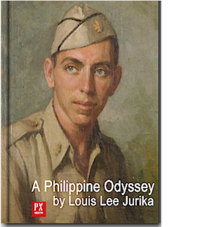
Zg267. Major Tom Jurika painted in 1945
Coast -Watcher Lt Chapman was installed in NW Samar by Major Tom Jurika, an old Philippine Hand. His son Louis Lee Jurika has contributed two stories about the exploits of his father in our Corregidor Forum. Here are two URLs and just a very few paragraphs from the URLs, click here:
A Philippine Odyssey by Louis Lee Jurika
Louis Jurika was born in Manila shortly after the war ended. Both his father and mother’s families were long-time residents of Mindanao whose lives were torn apart by the Japanese invasion; but they resisted in every way they could. Based on extensive research, he tells the story of his father, Major Tom Jurika, and his odyssey from the time he was a guerrilla in the Visayas and Mindanao until he returned to Manila, assigned by General MacArthur to the administration of Santo Tomas Internment Camp, where he commenced his search for his mother, Blanche, who he had last seen in Manila in November of 1941 Tom was 13 years junior to his brother-inlaw Chick Parsons, a legend in the Philippine guerrilla movement, and became Chick’s right-hand-man in the islands after Chick was repatriated from the Philippines and secretly returned to direct guerilla operations. The Japs had been looking for Tom ever since he had burned and destroyed equipment and war materiel useful to them during the defense of Cebu in April 1942. He was wanted dead or alive and the price tag on his head was second only to the price on Chick’s head. It was no longer safe for him to remain; but more importantly, someone from the Philippines was needed in Australia who knew exactly what the guerrillas needed sent in by submarine.
Tom’s last guerrilla mission was to install a radio and coast-watcher at San Bernardino Straits between Luzon and Samar. Then he was ordered out on the submarine Narwhal in February 1944.
————————————————————–
This is a text of the speech which Lou Jurika gave at the MacArthur Memorial, Norfolk, VA, USA, April 26, 2014. This posting is copyright, but has been posted with the Author’s permission. – EXO
A Guerrilla Odyssey – Tom Jurika & Chick Parsons
“At the Crossroads of History and in the Crosshairs of the Enemy.” Click here:
Down south Tom was working for Cebu Stevedoring in Cebu City as the right-hand-man of owner Captain Clarence John Martin who went everywhere by the nickname “Cap”. Tom was responsible for managing the fleet of tugboats and lighters that operated from Cebu to mines throughout the central Visayas Islands and Mindanao, hauling copper, manganese, and chromium ore from area mines to various ports or ships waiting offshore. Born in Zamboanga in 1914, Tom knew the country well from top to bottom as a result of travels in his youth and later his career in the mining industry.
Travelling by banca on the water and hiking overland, when possible, with his 10-man group, Tom passed through a succession of bandit guerrilla areas until he reached a remote spot 2,000 feet above Balicuatro Point that overlooked the straits. Here he installed the new radio brought in by submarine and set up Chapman with bodyguards and sentries to protect the operation. Testing the radio to establish contact with Australia and with Fertig in Mindanao, the first message that came back contained the news that Tom’s mother Blanche had just been rounded up in Manila with other members of an underground group of civilians who had been raising funds and supplies for the guerrillas outside Manila. The whole group had been betrayed by a Filipino traitor, a double-agent named Franco Vera Reyes, and they were now all imprisoned in Fort Santiago, often being tortured while awaiting trial.
Early the next morning in the dark Tom left Guimba and headed down the highway with a column of tanks and jeeps. Up ahead the sound of fighting could be heard and traffic slowed to a crawl. As Tom was familiar with the routes through central Luzon, he had the driver turn off the road and drive through dry, flat rice paddies to the railroad that paralleled the highway to Manila. The first glow of dawn found them bumping unmolested over the railroad ties, headed south. But then up ahead, to everyone’s amazement an army jeep came into view, headed for them on the same railroad tracks. It was hard to believe anyone had gotten ahead of them, but at least they knew that the Japs possessed nothing like a jeep. They slowed down and waited for the jeep to approach them. With guns at the ready they waited, then looked through the jeep’s windshield to see an army driver at the wheel. Sitting in the right-hand seat next to the driver was Douglas MacArthur, out doing some reconnaissance of his own without a small force to protect him, not even photographers, at those times when he possibly deemed it superfluous. After an exchange of pleasantries, in obvious deference Tom had his driver move the truck off the tracks to allow the smaller jeep to pass. With only a salute, they were on their way south again.
========================================================
WWII Coast-Watcher at Balicuatro Point, NW Samar. (3rd Seg)
A try to retrace the tracks of Major Tom Jurika and Lt. Gerald S. Chapman WWII Guerrillas, both U.S. Army.
Zg268 The San Bernardino Strait between the Islands of Luzon and Samar. My family has property here and my military background got me interested in doing it.
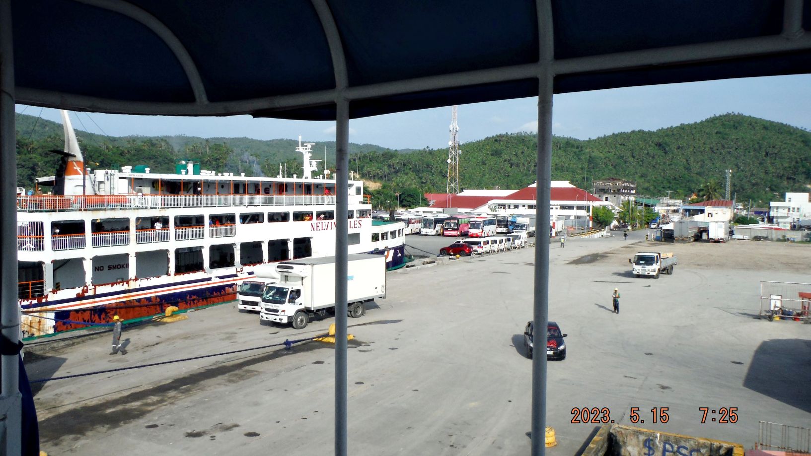
Zg269. First step was to get on a ferry with my car at Matnog. If you want to use the ferry service, you must stop about 9km from Matnog and register at a checkpoint. There they tell where to go next to buy the ticket and pay all the fees. For me and my SUV it was about 1800 pesos.
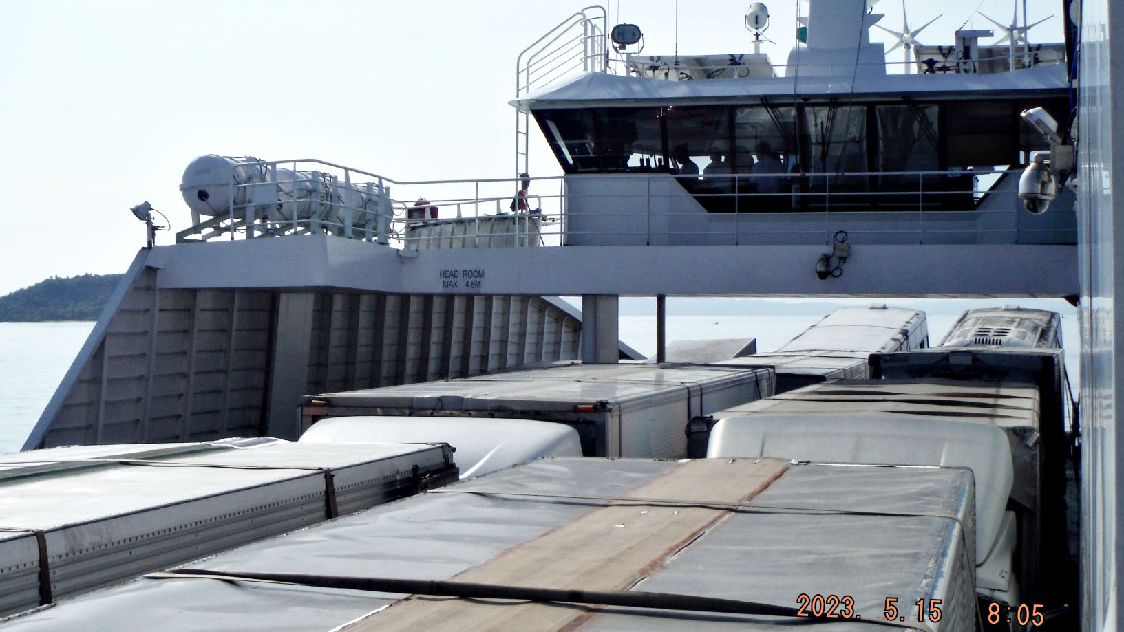
Zg270. I am using a FastCat Ferry and we are steaming by the island of Ticlin just off Matnog Ferry Port.
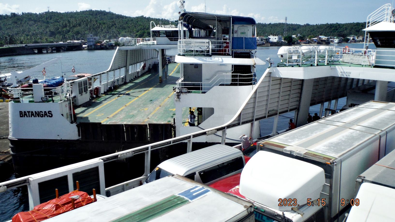
Zg271. We landed at the DapDap Ferry Terminal. On the FastCat ferry it is only one way on and one way off so the trucks and busses back on to the ferry and are drive off at the destination. This was a tight landing spot and the ferry skipper had to twist it around to get the stern end to the offloading ramp. He done a good job but the sea and wind were no problem today. It seems Port Allen has three terminals and there may be one more further south.
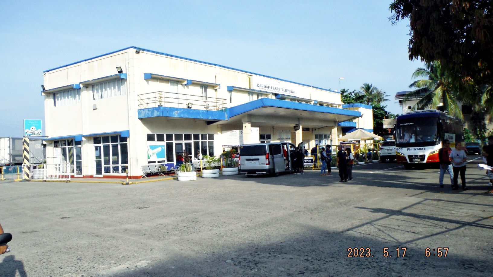
Zg272. The DapDap Ferry Terminal in Port Allen on Samar.
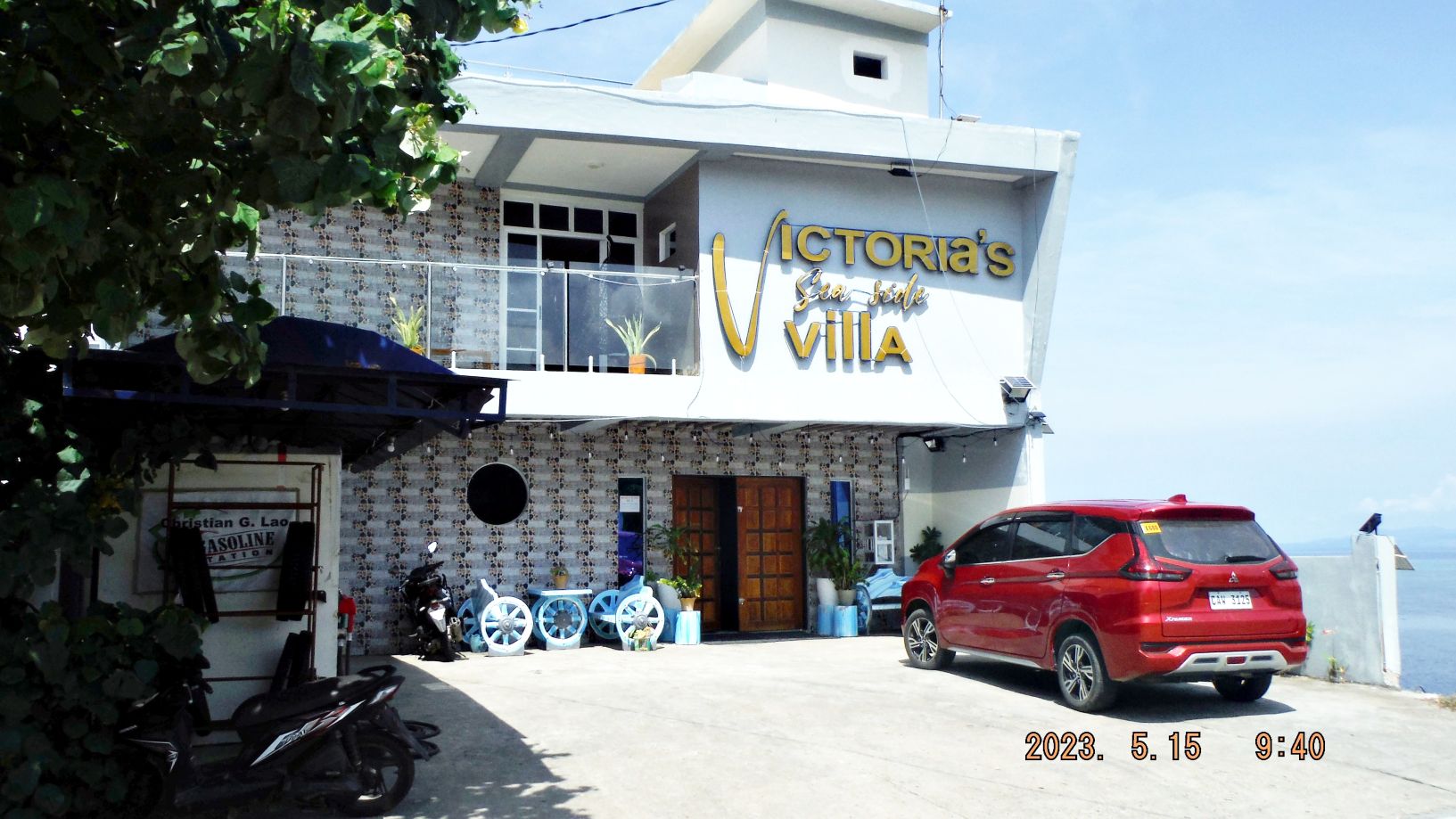
Zg273. I drove to my hotel, the Victoria’s Sea Side Villa, about 2 km north of Port Allen. I arranged it thru Facebook. No TV but good internet, 2500 peso a night and the included breakfast was good.
=======================================
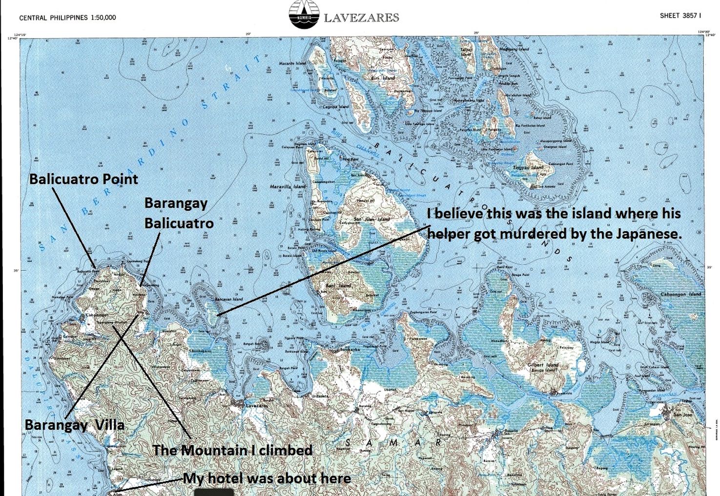
Zg274. The Balicuatro Point Peninsular where the Coast-Watcher Station for Gen MacArthur was set up. Where do I start? I only had one geographic name, Balicuatro Point but I had the description of Lt. Chapman from the interview, which follows here:
————————————————-
Lt Chapman Interview:
This was in September of 1943.
So, we started across the northern coast, marched across there and had no serious incidents going across there. Two days walking going across there possibly, maybe not even the full two days. We to the other side and if you look at a map of northern Samar, it is flat across the top and at the western end there is a little nub of a peninsula that sticks out. That nub of a peninsula is only about 3 or 4 miles wide and maybe 5 or 6 miles long, extending out into the San Bernardino Strait. Well, our objective was to set up that radio station on top of the mountain there at the end of that peninsula. So that is what we did. We went out there to the end of the peninsula.
Mr. Jurika – Balicuatro Point
Mr. Chapman – Balicuatro Point, yes, you got it. We got on top of the mountain there and found a suitable spot where we could observe the entire surroundings and we sat a radio station in a Filipino type house of there that was on the top and we set up an outpost. The house where we were at, although we could see down on the east side, we could not see over to the west side. So, we set an outpost up at the tip of this peninsula and we would have a guy posted there all during the day, every day to watch the traffic and so on.
We established contact with the local village down on the east side of the peninsula because we needed help with charging our batteries. We found out down there they had an old rice mill. They had a diesel engine there that ran things and we were able to set up a deal whereby we could charge our batteries. So, we had a deal where we would take our batteries down there in the evening and get them charged and that is the way we operated the radio. We had established a supply arrangement and with the local guerrilla leader, not Pedro Marin, but the local commandant of the area, we made arrangements to get supplies, kamotes, some corn. Supplies was the most difficult part about this whole thing, was making sure we had something to eat.
Mr. Jurika – Did the Japanese ever come looking for you?
Mr. Chapman – Well, yes. Later on, after I’d been there a while the local people brought me information that the Japanese were looking for a Captain Chapman, or at least that’s the name they gave and they thought there was some such person in the area. You be good Filipinos and let us know if you see him anywhere. Well, they let me know that that was happening. We started seeing patrol boats come. The patrol boats would come around the peninsula. I would see them go around. Then this was about in March or April of ’44. They started doing this more often. On one of these patrols, they stopped off at the little village below me where they had been supporting me by doing the battery charging and all and they had this man down there who was an engineer and he was doing all this stuff for me. They came in and they landed there. Now, in addition to the little settlement down at the bottom of the hill, there was a little island right there next to it and a lot of the people lived over there. So, they went over to their little island and they sort of harassed the people, asking about any Americans around. My engine mechanic, who was doing the charging was around there and the next thing I know, they are really harassing him and they finally started beating on him. His wife was pregnant and they shot him because he wouldn’t give them the information. This was a blow to us there in our camp.
———————————————————–
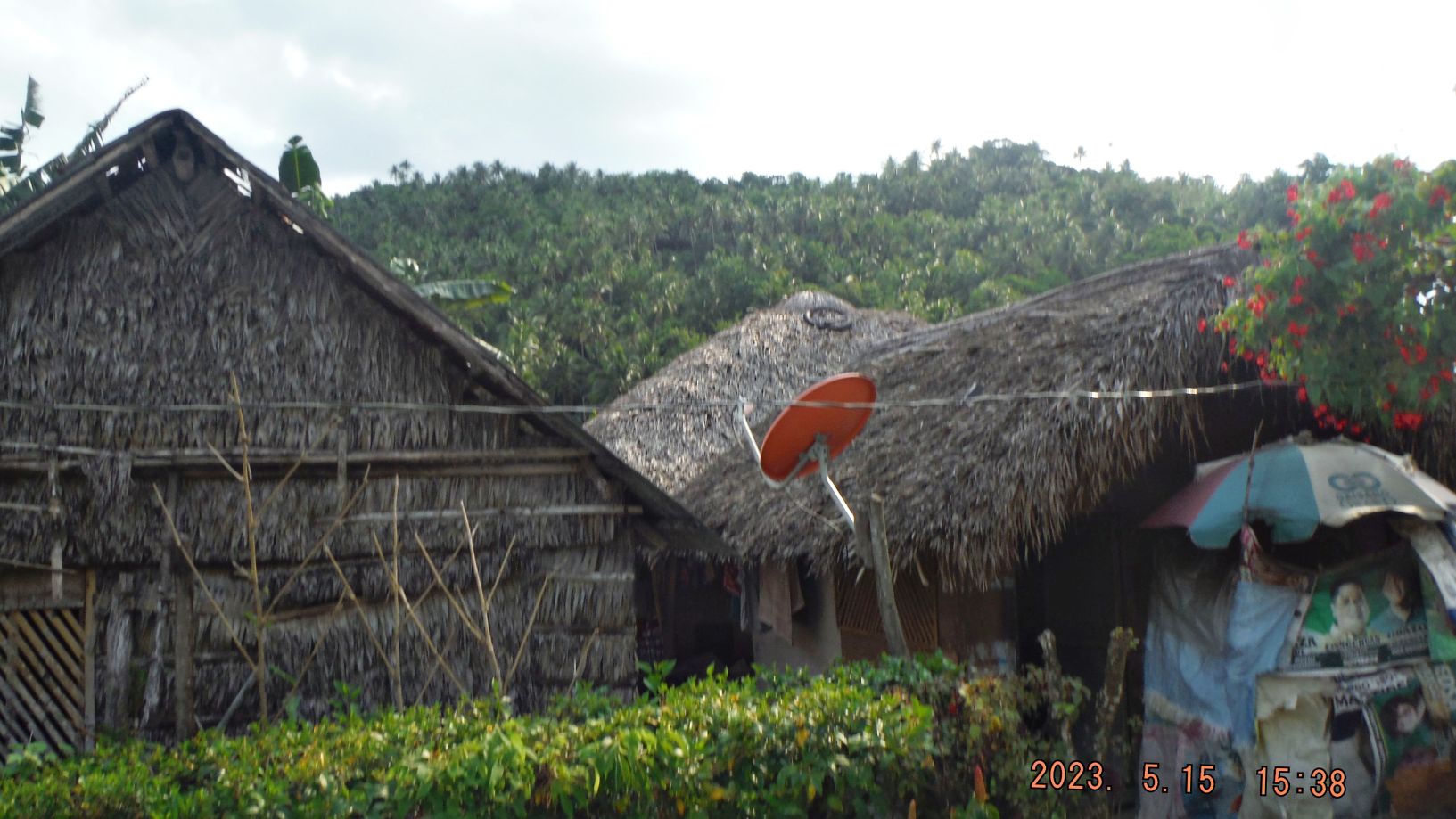
After I checked into the hotel, I drove around the Balicuatro Point Peninsular to reconnaissance the Peninsular. The next 8 images show the result of this reconnaissance:
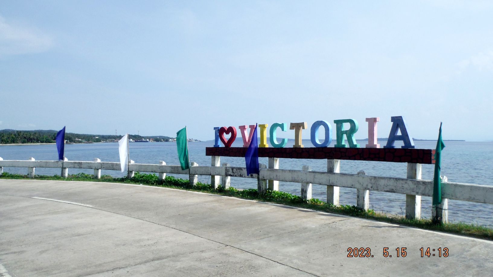
Zg275. The peninsular is about 9km long from Port Allen and I drove up the west side of the peninsular all the way to about the area of Balicuatro Point. The road now is very good, seems to be relatively new and is wide enough. As you can see, I just left Barangay Victoria, a WWII name?
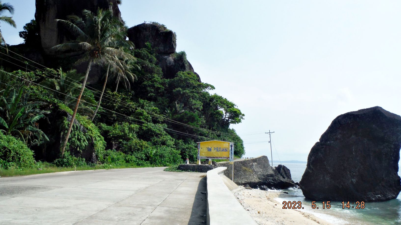
Zg276. Somewhere on the west coast of the Balicuatro Point Peninsular, this peninsular seems to have many of these large big rocks, port of its geology!
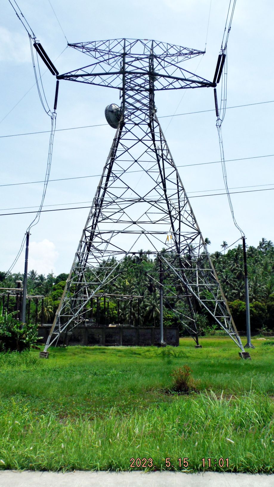
Zg277. Close to the end of the Balicuatro Point Peninsular the National High Voltage powerline seems to go underground or comes from underground and perhaps runs under the San Bernardine Strait.
Zg278. What a surprise, the first Barangay around the Balicuatro Point, on the east side of the peninsular has the name Balicuatro. Notice the road, it is older here and narrower. It is like that all along the east coast of the peninsular.
Zg279. At Barangay Balicuatro I looked up the hill and this afternoon I will go up there.
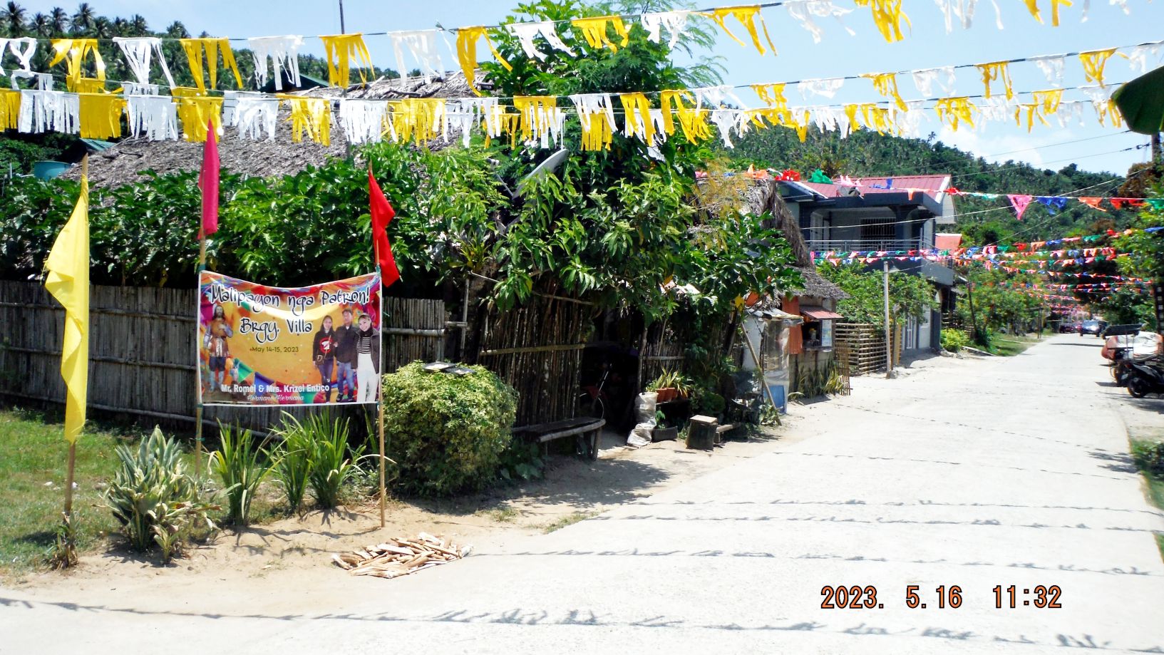
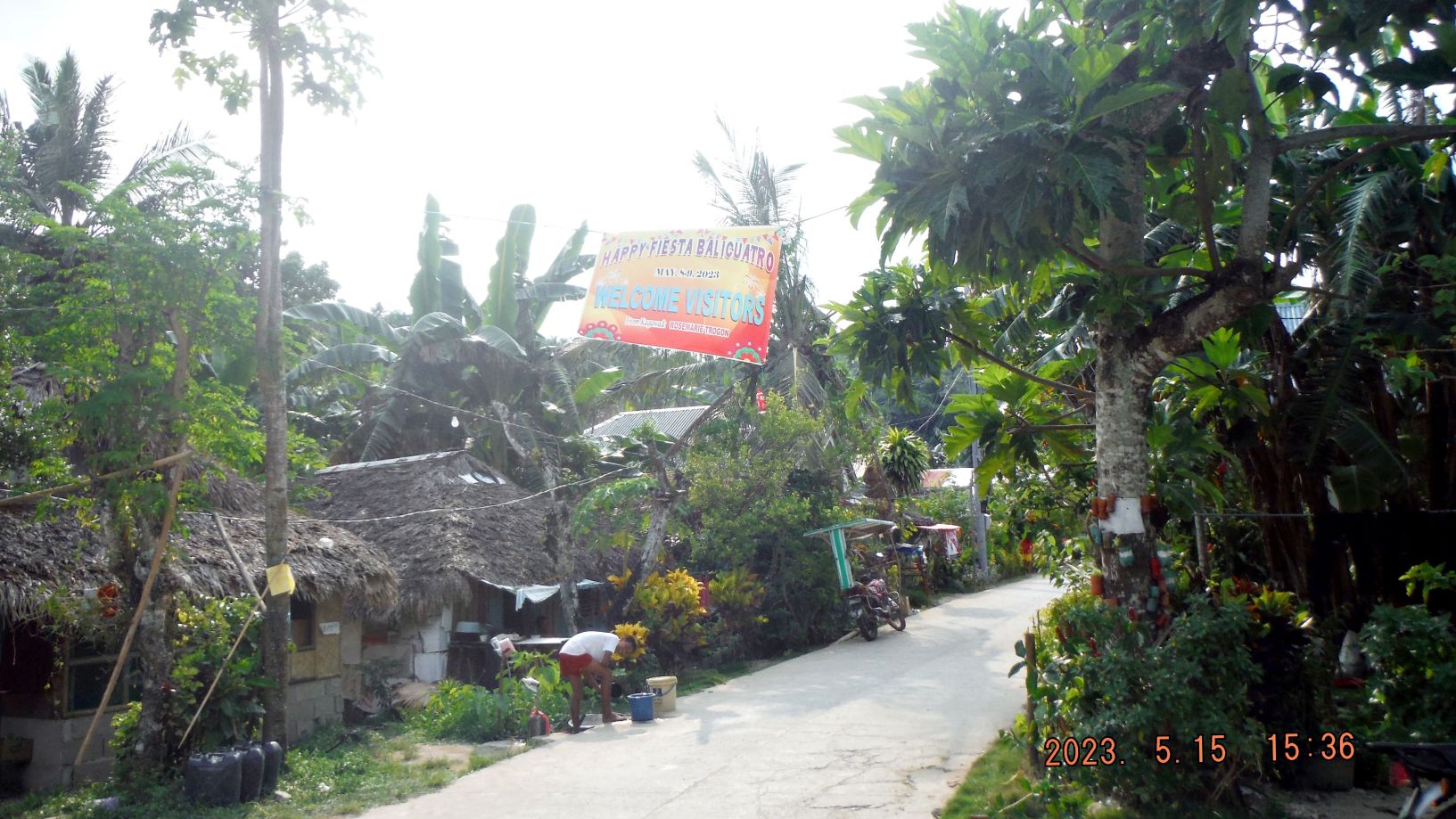
Zg280. The next village is Barangay Villa which had its annual Fiesta today and it was very busy and it was hard to drive on the road with all fiesta activities going on. I believe that is the village Lt Chapman operated out of. And just a little distance in the bay is the island of Bancauan where his helper got murdered by the Japanese.
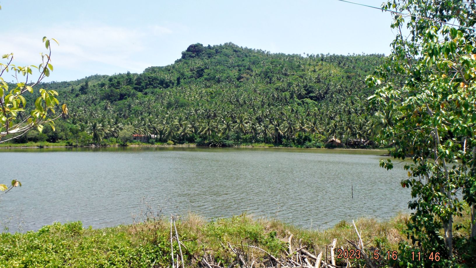
Zg281. At the end of the village, I had a look back and noticed on the top is prominent rock which is also indicated on the map as “Bulawan sa tarangban”. That will be my goal for tomorrow.
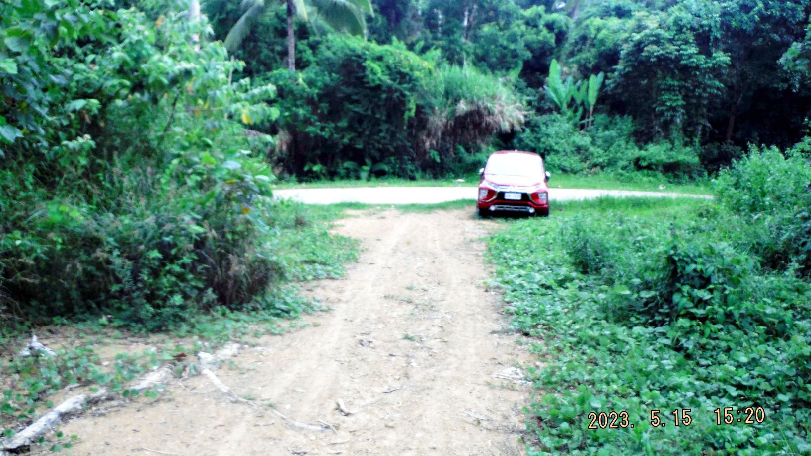
Zg282. On my reconnaissance drive at the end of the peninsular, where the road crosses from west to east I noticed this dirt road going down to the coast, to the area of Balicuatro Point. Also across the road was a good trail going up the hill that would be above Barangay Balicuatro. I will walk that this afternoon.
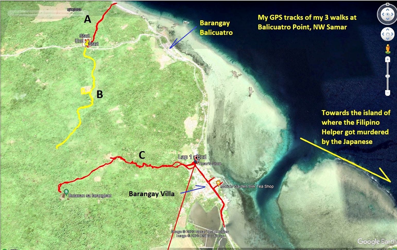
Zg283. These are my 3 GPS tracks of my walks in this area on the 15th and 16th of May 2023.
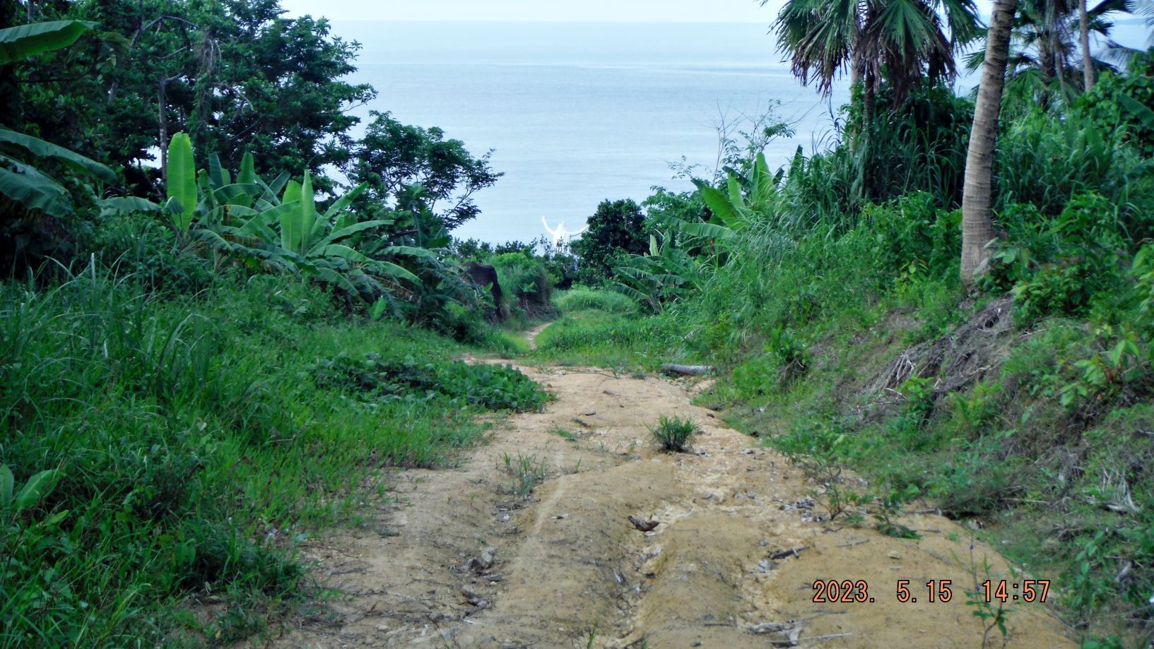
Zg284. My walk of track #A down to Balicuatro Point and I found a Jesus stature near the beach.
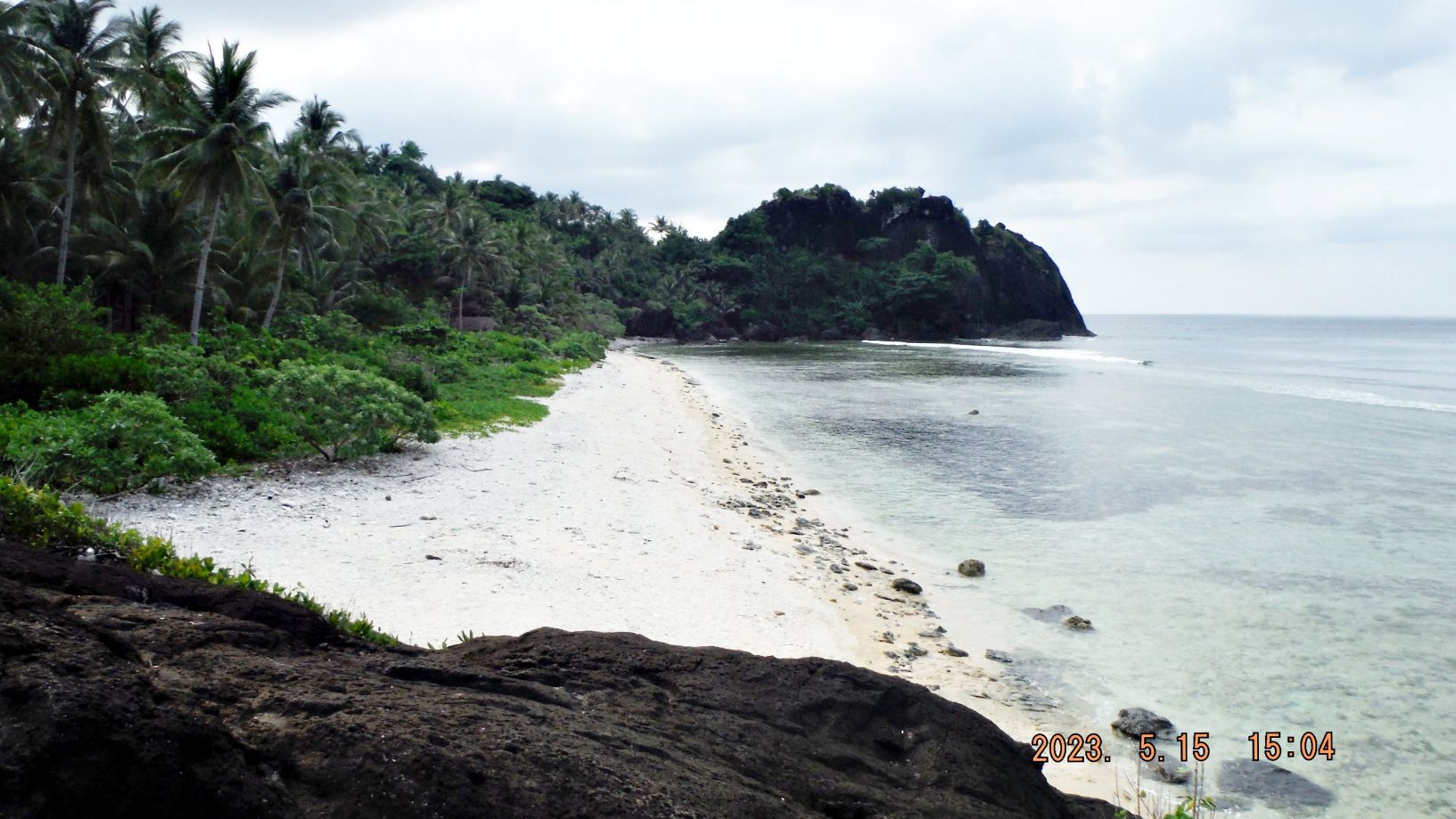
Zg285. A view left or west from the Jesus Stature, that must be Balicuatro Point. Here is my note for this Track #A:
I saw this dirt road going towards Balicuatro Point, so, I parked and followed it down. Near the beach was a large Jesus Stature. The point left, I believe must be the Balicuatro Point. But as far as vista I do not have a view towards Luzon and would not be able to view the whole San Bernadino Strait from here. I need to go around that point to get that view.
Zg286. This is a view on the top of this hill on my GPS track B, this is my GPS track B note:
In the afternoon after I had a good look at Barangay Balicuatro, I returned to the dirt road to Balicuatro Point but this time I went up hill. After I studied my GPS track later, I was surprised that I almost made it to the “Bulawan sa tarangban”. That is the hill and top I reached the next day starting from Barangay Villa.
But I never had a clear view of the San Bernardino Strait but I am sure I would be able to find a view point to cover the San Bernardino Strait if I had more time and some bolo helpers.
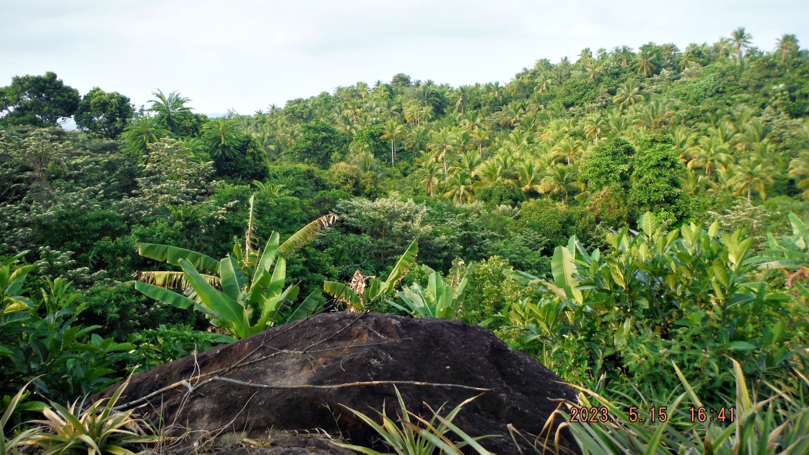
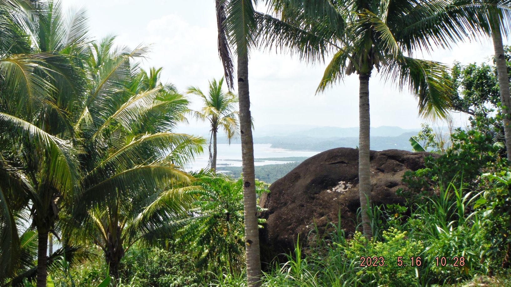
Zg287: This is the big rock on top of this hill called: “Bulawan sa tarangban”. Here is my GPS note:
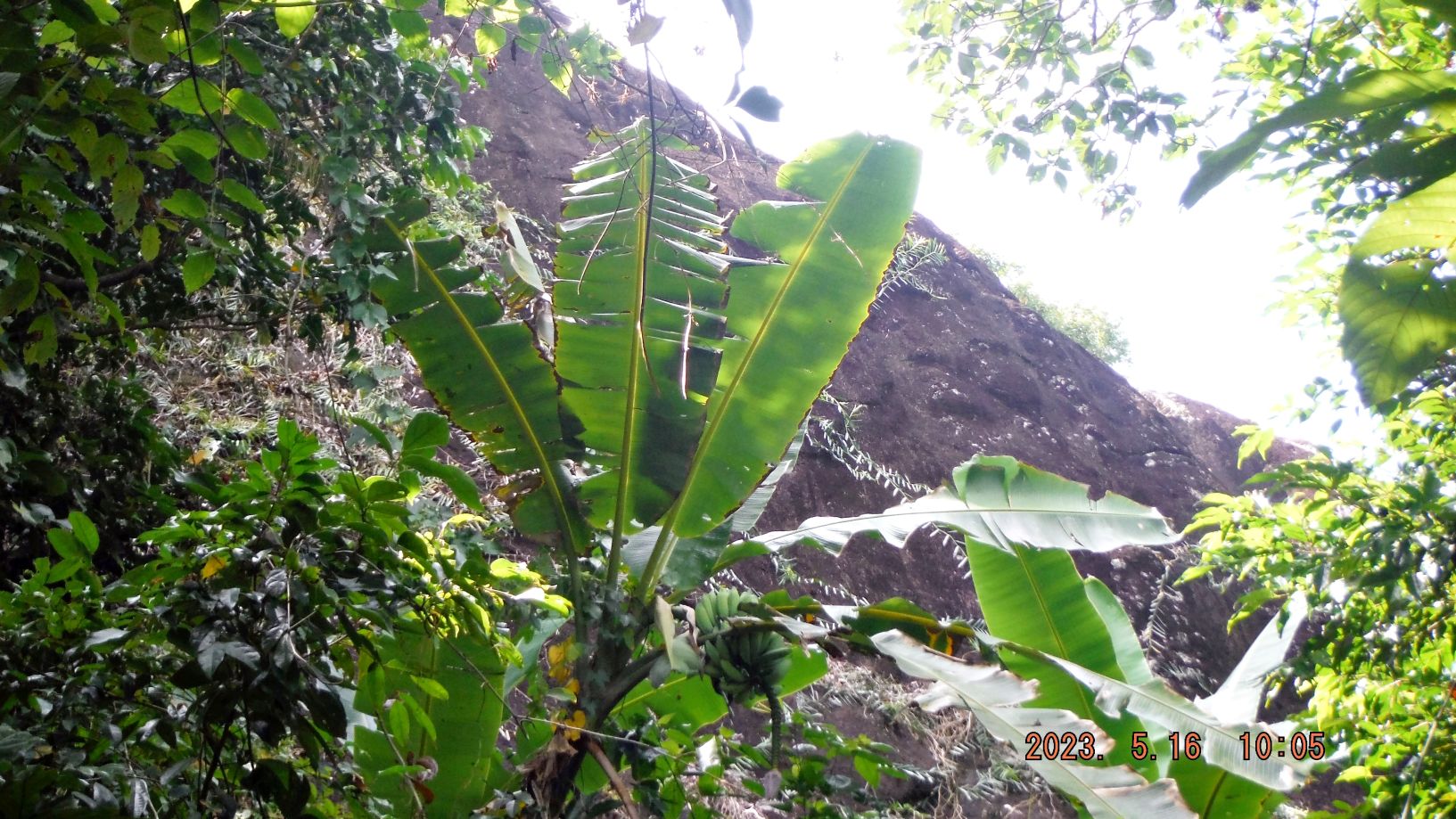
The next day I drove to barangay Villa. Yesterday they had their Fiesta and it was super crowded. Today no problem, got a guide right away and went off, up the hill to that prominent Rock. My guide was a 22-year-old and he killed me. But I made it but I did not climb up that big rock. Afterwards I walked around the village. I failed to clear my GPS device properly and you see the strait line to my hotel, but I did get the track of the walk.
But I never had a clear view of the San Bernardino Strait but I am sure I would be able to find a view point to cover the San Bernardino Strait if I had more time and some bolo helpers.
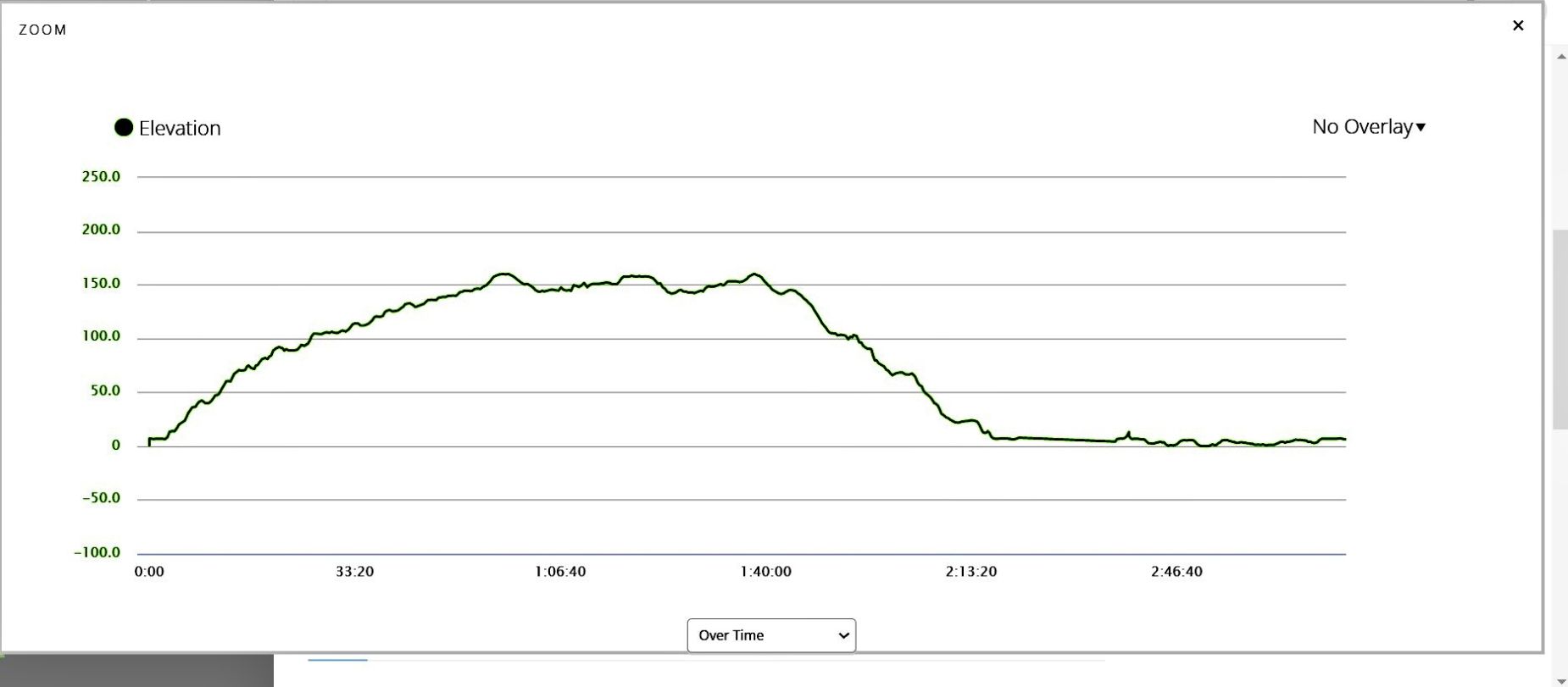
Zg288. My elevation profile of my GPS track #C. It exhausted me it is May, sun straight up, no wind, 81 years old and a 22 young man setting the pace.
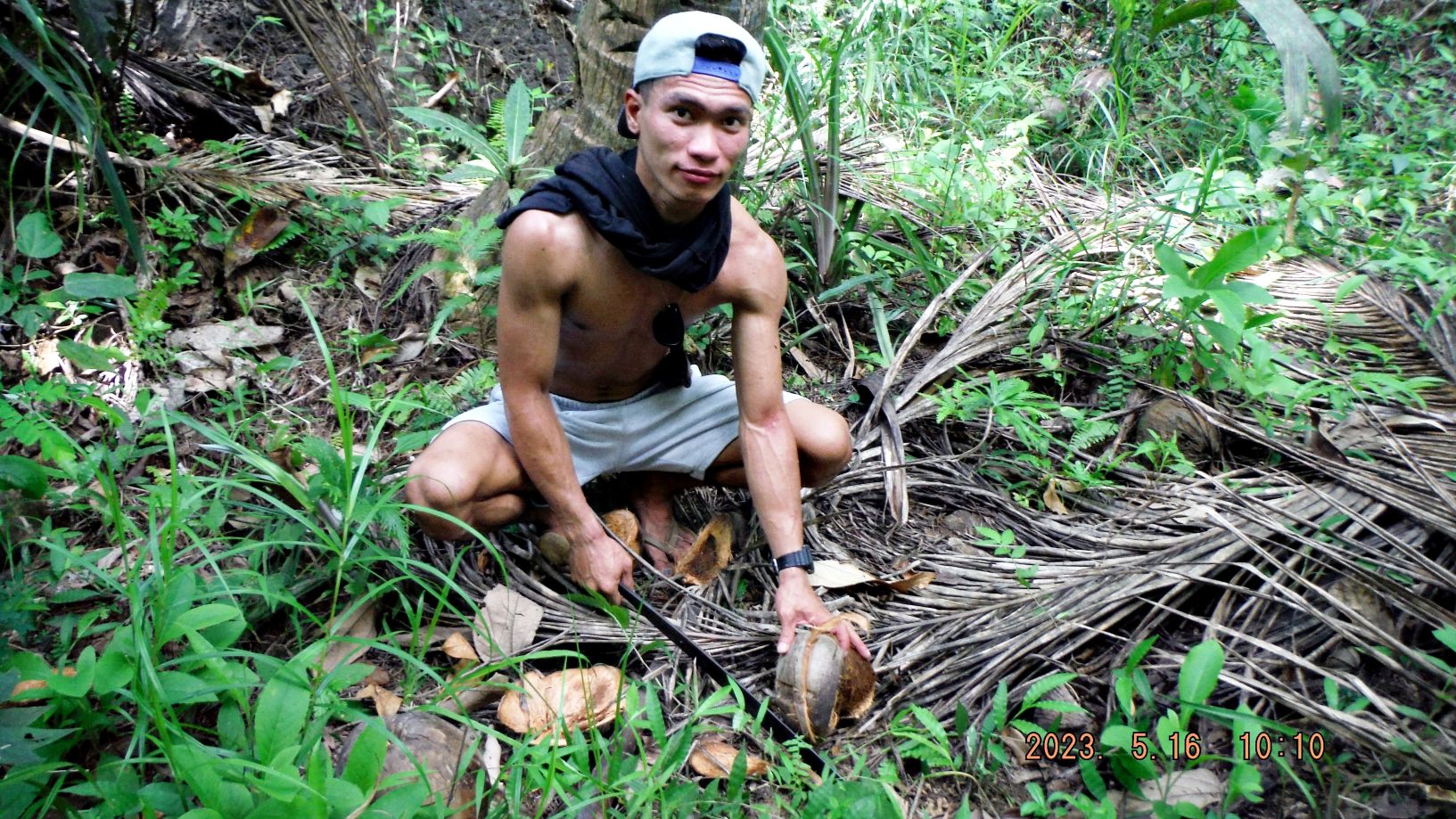
Zg289. My 22-year-old guide. He found 2 coco nuts and prepared them to be carried a lot lighter in weight. He also found some pili nuts, cracked them, and gave them to me to eat.
Zg290. Only got a view of the islands north of Samar but like I said this hill would be perfect to find and clear a view point to cover the San Bernardino Strait. It was an adventure, I’m glad that I’m still able to do it.
Sir, the strip of white sand at the right side of the The RisenChrist statue is owned by me…if you want to build a beachhouse there, I can spare you a space for free so when you try to visit the area you have a place to stay. Only if you like.
Thank you but I don’t have plans for that