Zg107. (-107), Image is a portion of my walk when I walked to Mt. Bagang and climbed to some height to take pictures. I saw tourist traffic coming and going to the east to the pine forested area on the north shore of the new Mapanuepe Lake (not in picture); I learned a tourist spot, called “New Zealand has opened business there. Most important I got a good view of the new Santa Cruz Solar Energy INC Project. It is being set up on the Lahars fields which were created before the Mt. Pinatubo Lahars Fields. The Marella River which comes from Mt. Pinatubo runs now between that new solar project and Mt. Bagang where I took the pictures from.
—————————————————–
This day walked to the ex Chinese Black Sand Mine (near Dalanawan), found the valley road in good shape, the mine buildings razed, nothing left, the steel bridge across the Mapanuepe River and the trail to Sitio Dalanawan ok. A new Solar Power Plant is in the works, on the Lahar Field from the previous explosion, not the 1991 one; the project is called: Santa Cruz Solar Energy INC. Walked around Mt. Bagang and took pictures of the project.
I established 3 albums if you are interested:
Uploaded to Facebook with 15 images and shared with: Barretto Bars, Subic Bay Expats, SBH3, The Raging Main, click here:
Uploaded to a Flickr album, 39 images in HR, click here:
Uploaded 209 images to Photobucket, Philippines including my walks, Zambales albums, Aglao Hikes, click here:
———————————————————————–
For this web presentation I chose these 7 images
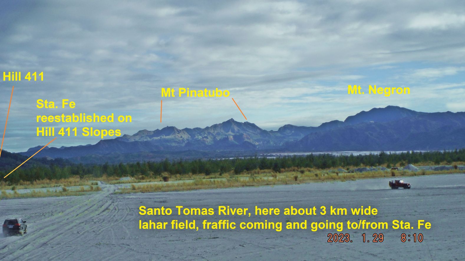
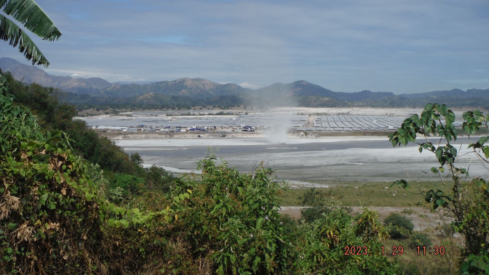
Zg105. (-002) image is a nice picture of Mt. Pinatubo, Santo Tomas River with traffic coming and going to and from Santa Fe.
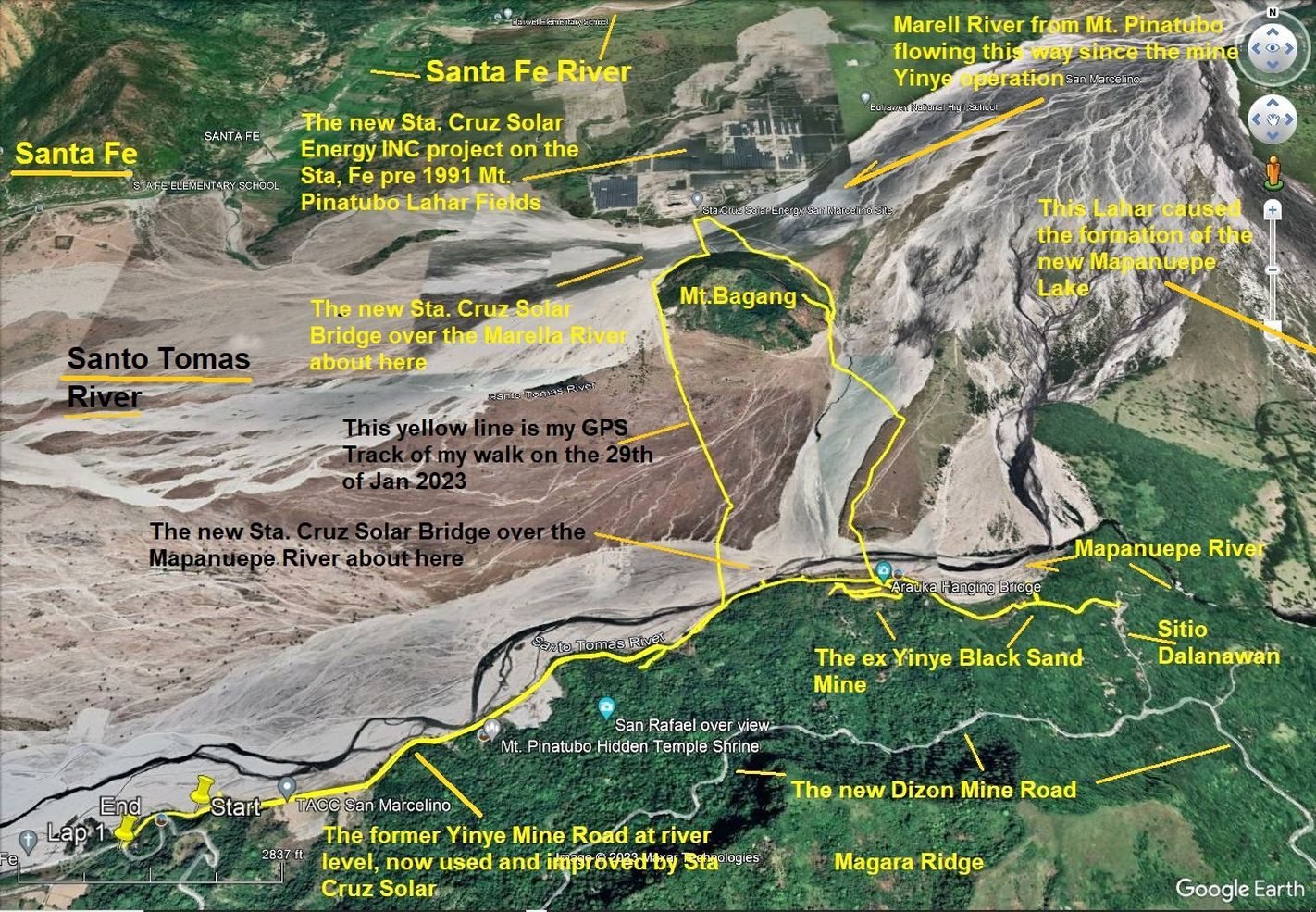
Zg106. (-004b) are data images of my GPS walk on the 29th of Jan 2023 in the San Marcelino, Mt. Pinatubo lahars fields.
Zg107. (-107),Image is a portion of my walk when I walked to Mt. Bagang and climbed to some height to take pictures. I saw tourist traffic coming and going to the east to the pine forested area on the north shore of the new Mapanuepe Lake (not in picture); I learned a tourist spot, called “New Zealand has opened business there. Most important I got a good view of the new Santa Cruz Solar Energy INC Project. It is being set up on the Lahars fields which were created before the Mt. Pinatubo Lahars Fields. The Marella River which comes from Mt. Pinatubo runs now between that new solar project and Mt. Bagang where I took the pictures from.
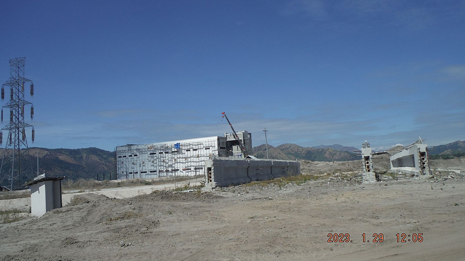
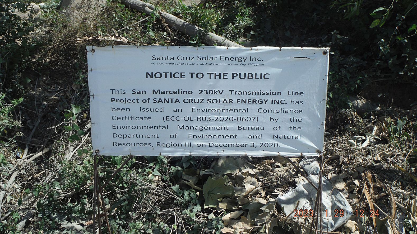
Zg108. (131.) are images of my effort going around the north side of Mt. Bagang and use the new bridge over the Marella River, see a new large building going up at the solar project, see a container truck departing, going thru the Lahars and capture another sign of the solar project.
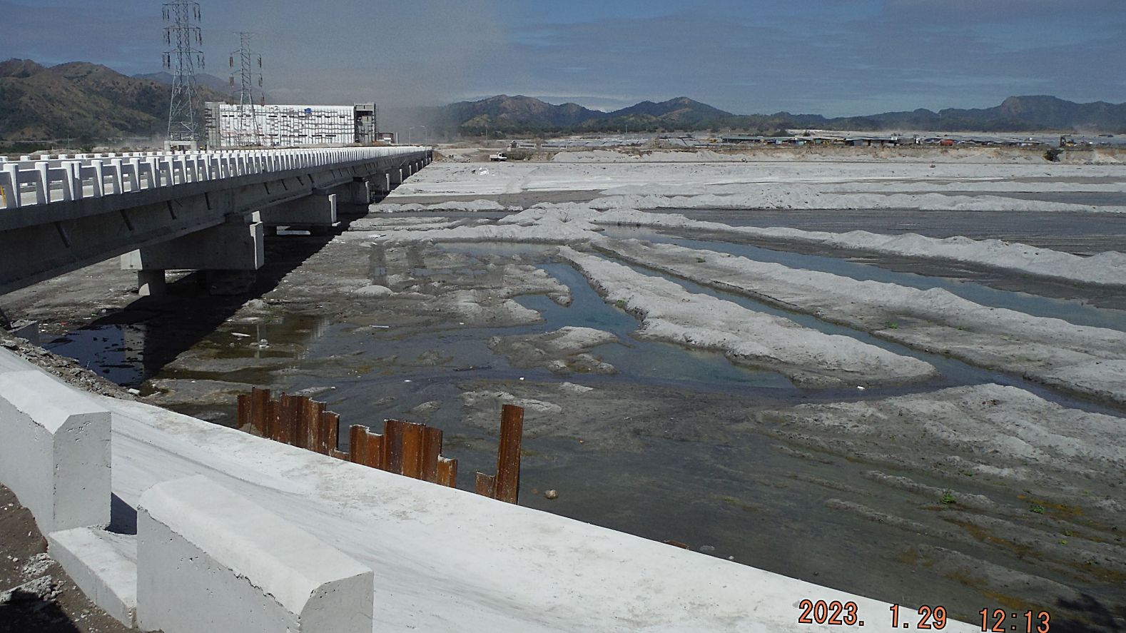
Zg109. (143), are images of my effort going around the north side of Mt. Bagang and use the new bridge over the Marella River, see a new large building going up at the solar project, see a container truck departing, going thru the Lahars and capture another sign of the solar project.
Zg110. (157). Are my parting images from this solar project and my walk. Images -162 shows the south side of Mt. Bagang and shows that several native hootches have been built by the Aeta people; that has only started with all this new commercial activity and the other three images are of some of the high voltage line work.
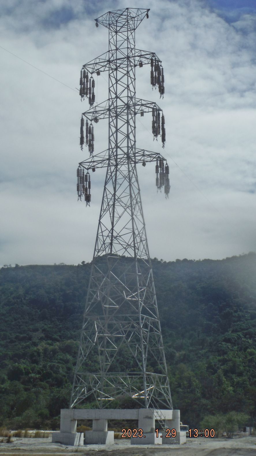
Zg111. (170). Are my parting images from this solar project and my walk. Images -162 shows the south side of Mt. Bagang and shows that several native hootches have been built by the Aeta people; that has only started with all this new commercial activity and the other three images are of some of the high voltage line work.