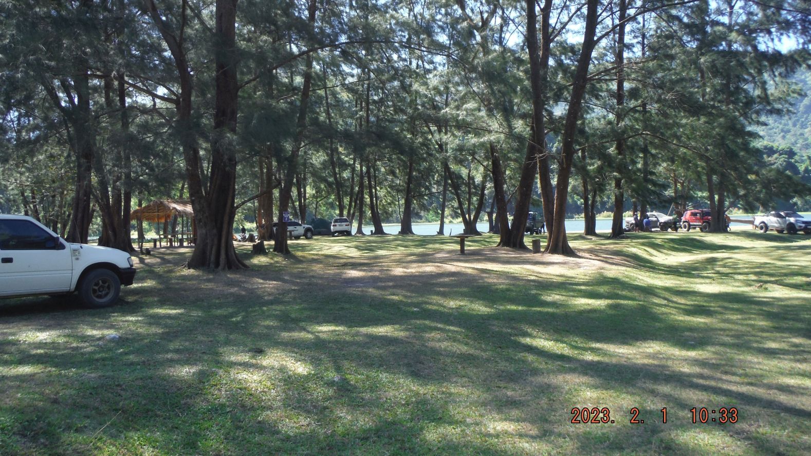
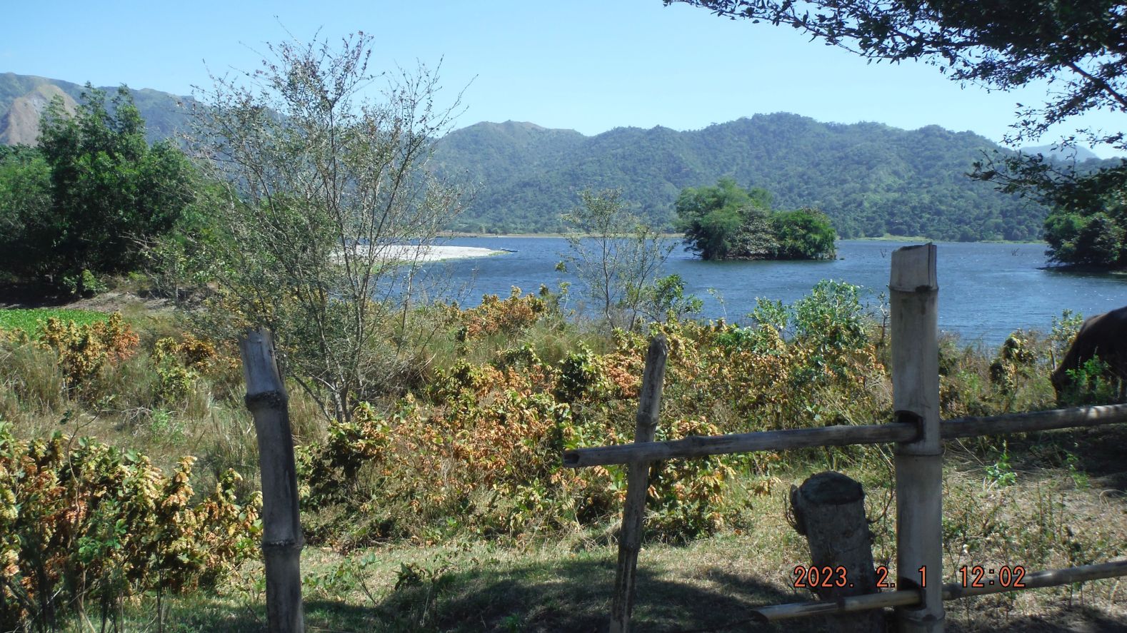
Zg116. This is picture #048 but is numbered in this album as Zg116. Pictures # 030 to 066 are of the area that people are calling and are visiting, the New Zealand tourist spot. Under those trees, in their cool shade and with the lawn type grass covering the grounds and the calm waters of the lake shores make this a lovely place. Some entrepreneurs are building toilet facilities and Sari Sari Stores, some of which can cook a limited menu. I saw a sign “No Swimming” and I speculate fishing is not recommended either; the lake most likely is contaminated from the closed Gold and Copper Dizon Mine which is upriver of this lake and the Mapanuepe River which flows into it.
——————————————————
This 1st of Feb. 2023 I wanted to check out the new tourist spot “New Zealand” (on the shores of Mapanuepe Lake) and find, explore the land way to Sitio Lumibao on the north side of Mapanuepe Lake. I succeeded and the pictures in this album are of this exploring hike.
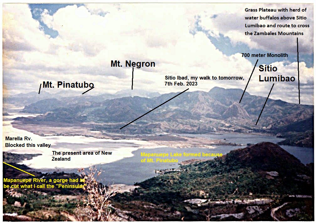
The NW shore of the new Mapanuepe Lake is now a tourist spot called New Zealand because now many pine like/type trees have grown and the place looks lovely. Many visitors come by car and one has to drive thru the Lahars and local guides are available. Then I walked to Sitio Lumibao, a small Aeta village at the north Shore of Mapanuepe Lake. Lumibao is the end or starting point of crossing the Zambales Mountains to or from the Basa Airbase area in Pampanga. The Lahars have changed much since my last visit.
The picture numbers are based on the 128 images of this walk in my Photobucket album.
Uploaded to PHB 128 images, Philippines including my walk, Zambales albums, Aglao Hikes, click here:
Uploaded 57 images to this Flickr album in high resolution, click here:
Uploaded 33 images into an album in my Facebook account and shared with: I remember Subic Naval Station, I lived in Subic NavSta and Cubi, Barretto Bars, SBH3, click here:
————————————————————-
Zg112. This is picture #001 but is numbered in this album as Zg112. Pictures # 000 to 005 are pictures of where I parked and started my hike, at the ex-Chinese Yinyi Mine and show the initial stretch of the hike, crossing the Mapanuepe River on the old steel bridge of the Yinyi Mine, over Lahar and in a direction of keeping Mt. Bagang to my left. We also catch a view of the new large Solar Project on top of old Lahar field in the Barangay Santa Fe area. They also have maps and data of my hike with the GPS track and landmarks put on the maps of my New Zealand & Lumibao Hike, 230201.
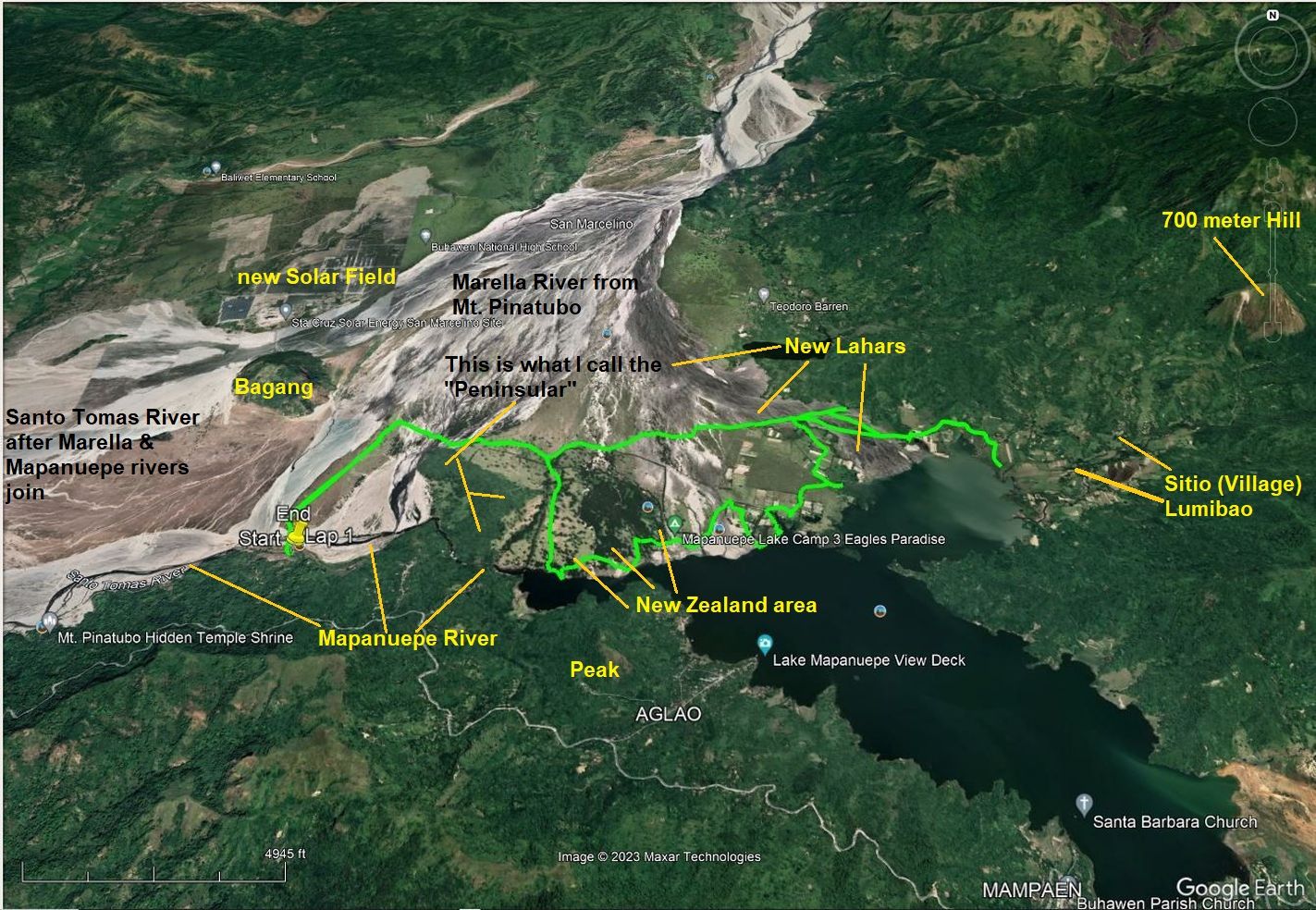
Zg113. This is picture #003 but is numbered in this album as Zg113. Pictures # 000 to 005 are pictures of where I parked and started my hike, at the ex-Chinese Yinyi Mine and show the initial stretch of the hike, crossing the Mapanuepe River on the old steel bridge of the Yinyi Mine, over Lahar and in a direction of keeping Mt. Bagang to my left. We also catch a view of the new large Solar Project on top of old Lahar field in the Barangay Santa Fe area. They also have maps and data of my hike with the GPS track and landmarks put on the maps of my New Zealand & Lumibao Hike, 230201.
Zg114. This is picture #028 but is numbered in this album as Zg114. Pictures # 011 to 029 are of the hike, walking around a long strip of ridge which I call the Peninsular. This Peninsular sticks out into the lahars and it come from Magara Ridge. This walk starts at the ex black sand Yinyi Mine steel bridge, goes/curves around the Peninsular and enters the Lahars area that caused the blockage of the Mapanuepe River which caused the creation of the large Mapanuepe Lake. Many pine trees have grown on this Mt Pinatubo Lahars Sand and with lawn type grass under them and next to the shore of the lake make it a lovely area. A caution from me, going there, even with a guide may be risky for two wheel drive vehicle.
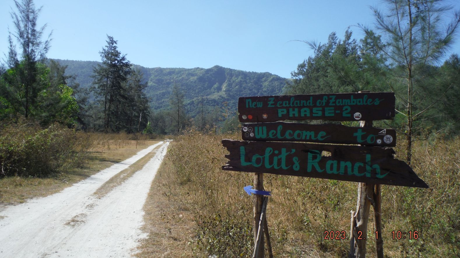
Zg115. This is picture #031 but is numbered in this album as Zg115. Pictures # 030 to 066 are of the area that people are calling and are visiting, the New Zealand tourist spot. Under those trees, in their cool shade and with the lawn type grass covering the grounds and the calm waters of the lake shores make this a lovely place. Some entrepreneurs are building toilet facilities and Sari Sari Stores, some of which can cook a limited menu. I saw a sign “No Swimming” and I speculate fishing is not recommended either; the lake most likely is contaminated from the closed Gold and Copper Dizon Mine which is upriver of this lake and the Mapanuepe River which flows into it.
Zg116. This is picture #048 but is numbered in this album as Zg116. Pictures # 030 to 066 are of the area that people are calling and are visiting, the New Zealand tourist spot. Under those trees, in their cool shade and with the lawn type grass covering the grounds and the calm waters of the lake shores make this a lovely place. Some entrepreneurs are building toilet facilities and Sari Sari Stores, some of which can cook a limited menu. I saw a sign “No Swimming” and I speculate fishing is not recommended either; the lake most likely is contaminated from the closed Gold and Copper Dizon Mine which is upriver of this lake and the Mapanuepe River which flows into it.
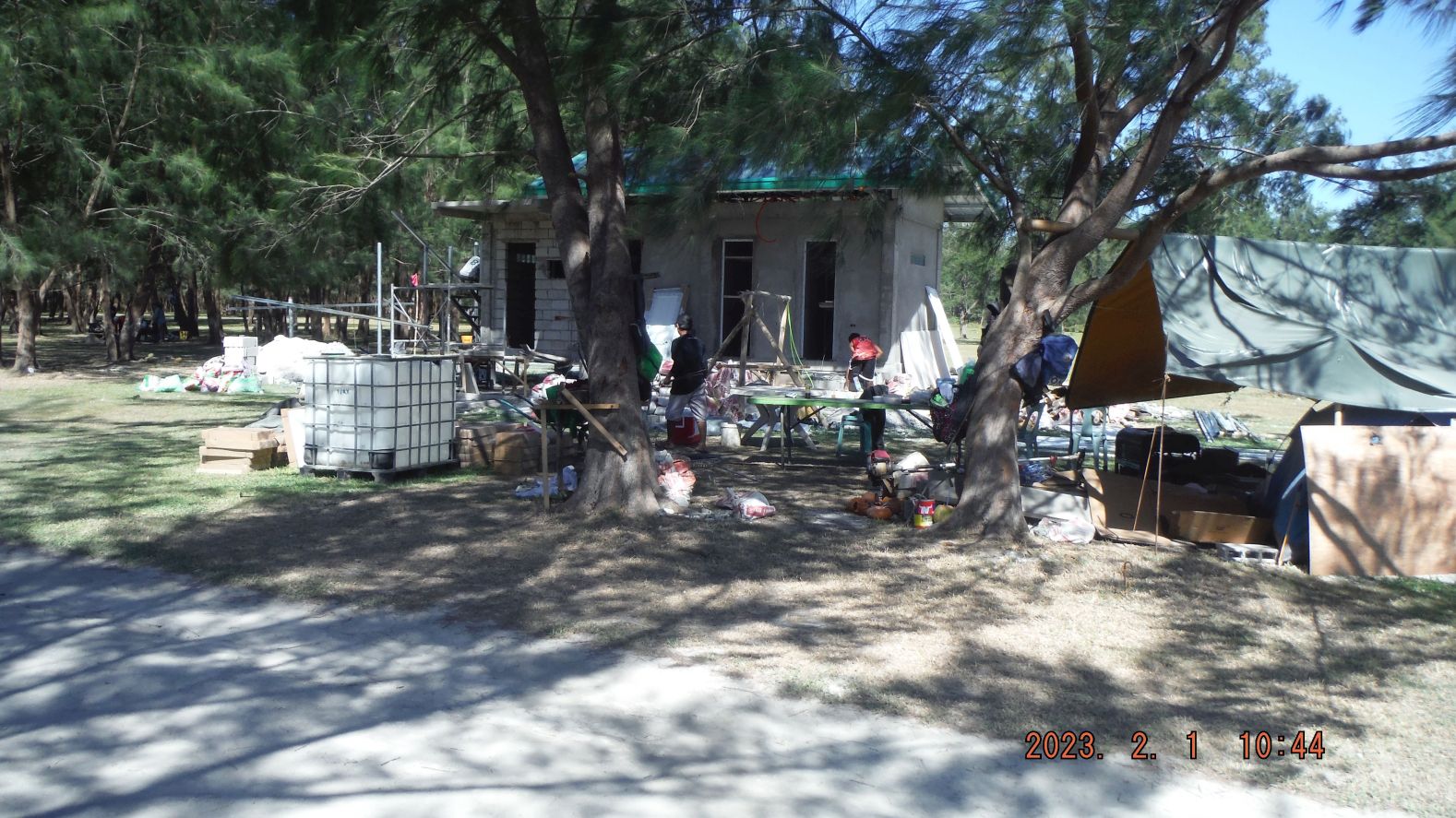
Zg117. This is picture #060 but is numbered in this album as Zg117. Pictures # 030 to 066 are of the area that people are calling and are visiting, the New Zealand tourist spot. Under those trees, in their cool shade and with the lawn type grass covering the grounds and the calm waters of the lake shores make this a lovely place. Some entrepreneurs are building toilet facilities and Sari Sari Stores, some of which can cook a limited menu. I saw a sign “No Swimming” and I speculate fishing is not recommended either; the lake most likely is contaminated from the closed Gold and Copper Dizon Mine which is upriver of this lake and the Mapanuepe River which flows into it.
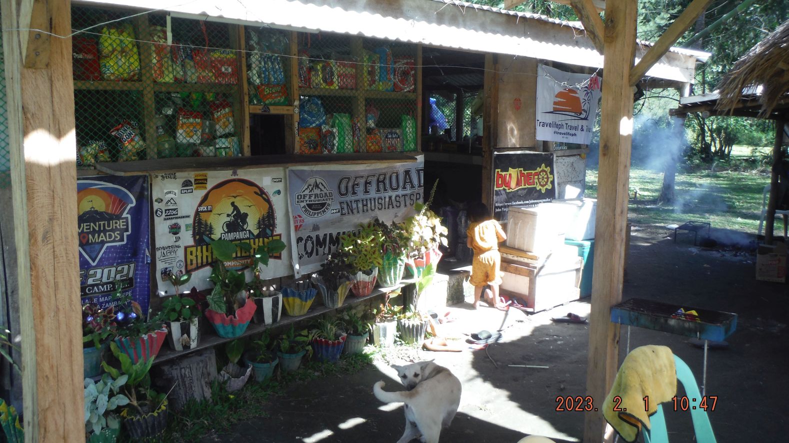
Zg118. This is picture #063 but is numbered in this album as Zg118. Pictures # 030 to 066 are of the area that people are calling and are visiting, the New Zealand tourist spot. Under those trees, in their cool shade and with the lawn type grass covering the grounds and the calm waters of the lake shores make this a lovely place. Some entrepreneurs are building toilet facilities and Sari Sari Stores, some of which can cook a limited menu. I saw a sign “No Swimming” and I speculate fishing is not recommended either; the lake most likely is contaminated from the closed Gold and Copper Dizon Mine which is upriver of this lake and the Mapanuepe River which flows into it.
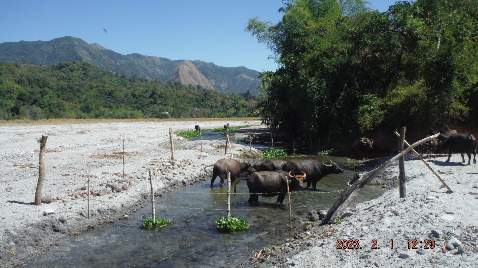
Zg119. This is picture #094 but is numbered in this album as Zg119. Pictures # 070 to 097 are images of my hike, trying to go along the shore or beach of the Mapanuepe Lake from the New Zealand tourist Spot to reach the Sitio (Small sub village) Lumibao. I was familiar with Lumibao because I had visited it before by crossing the Mapanuepe Lake by boat from Barangay (Village) Aglao. And several times Lumibao was our starting point to reach the grass plateau above which has a herd of water buffalos. Lumibao also served us hikers the goal spot, hiking across the Zambales Mountains from Pampanga. This section of hike reminded me that it was a bad idea to reach Lumibao this way. It was a zig-zag hike around water ways, fenced areas and coastal high grass places.
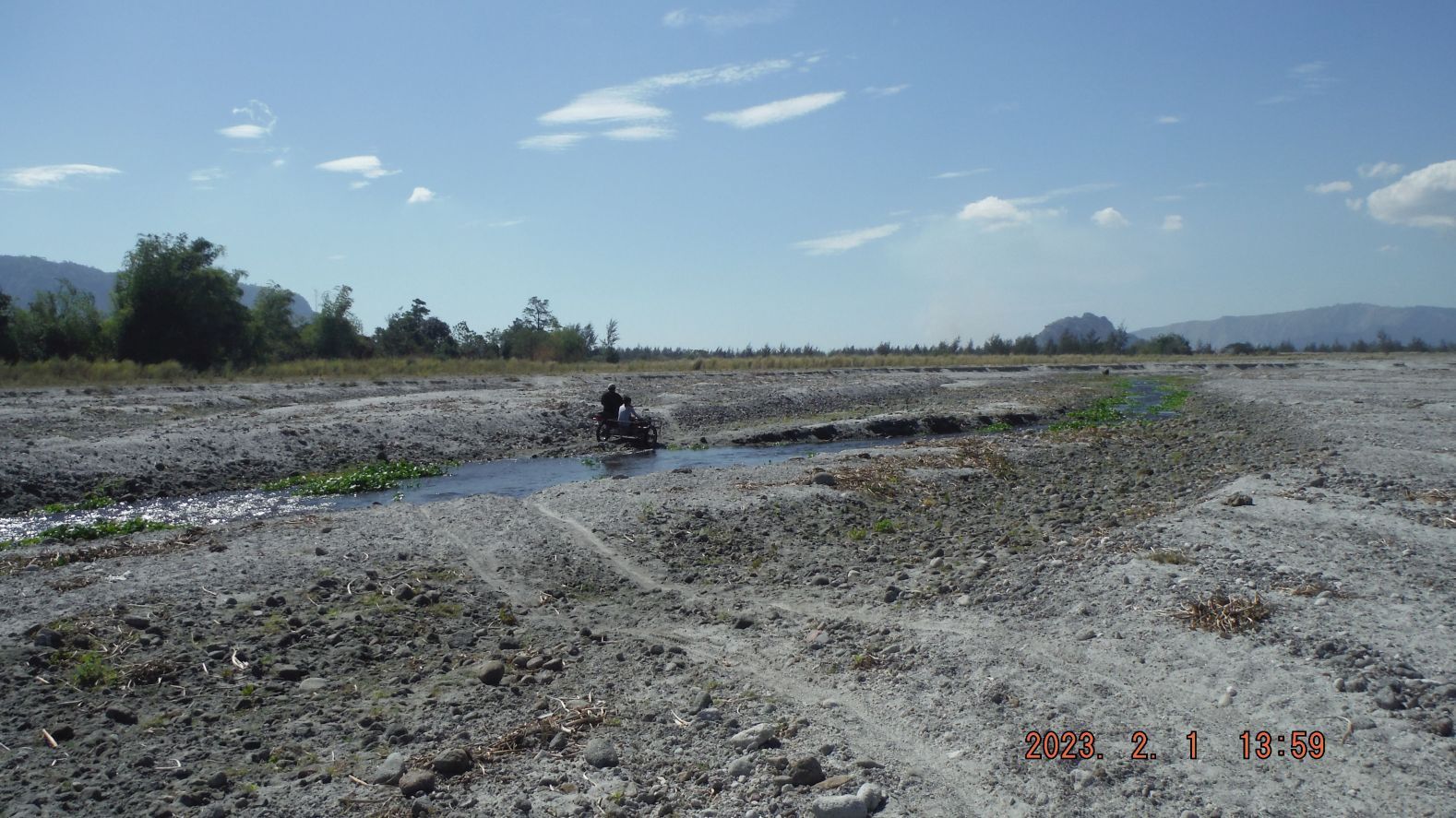
Zg120. This is picture #120 but is numbered in this album as Zg120. Pictures # 099 to 122 are images of my final stretch of hike to Lumibao. There was a drastic change in the grounds, in that new Lahar filled in a section of the Mapanuepe Lake on my track and instead of having to walk around the lake shore, there was now a straight stretch/shot of Lahar ground to Lumibao. Only one time, about 100 meter long, did I have to walk thru wet area to reach the north shore of Lake Mapanuepe, the boat landing area to reach this village from Aglao and the San Marcelino to the Dizon Mine road. Image #122 is the screen shot of my GPS device and it reads that it took me 4 hours and 23 minutes to get here and it was 14.18 km distance. Note the landmark, the 700 meter monolith Hill; it was my landmark for many of my hikes in this area.
Zg121. This is picture #121 but is numbered in this album as Zg121. Pictures # 099 to 122 are images of my final stretch of hike to Lumibao. There was a drastic change in the grounds, in that new Lahar filled in a section of the Mapanuepe Lake on my track and instead of having to walk around the lake shore, there was now a straight stretch/shot of Lahar ground to Lumibao. Only one time, about 100 meter long, did I have to walk thru wet area to reach the north shore of Lake Mapanuepe, the boat landing area to reach this village from Aglao and the San Marcelino to the Dizon Mine road. Image #122 is the screen shot of my GPS device and it reads that it took me 4 hours and 23 minutes to get here and it was 14.18 km distance. Note the landmark, the 700 meter monolith Hill; it was my landmark for many of my hikes in this area.
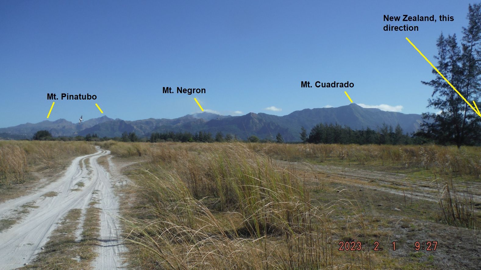
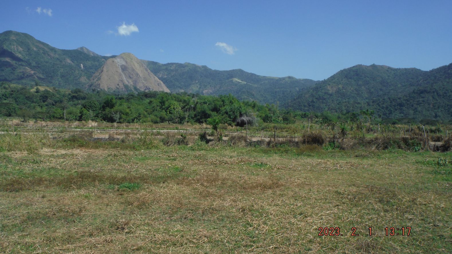
Zg122. This is picture #123 but is numbered in this album as Zg122. Pictures # 123 to 126 are only 4 images of my return march. First, I followed a tricycle, which offered me a ride but I declined, the purpose of this was walking, right! Then I cut a straight line across the Lahars, thru the pine trees and elephant grass (not difficult because cattle plow thru it all the time). Mt. Bagang was my landmark and guide. My GPS device read, that the distance was about 7 ½ km and it took me a hair under two hours. This type of walk makes me feel good and I love the view of what nature did here, Mt Pinatubo and I admire how the people struggle to make living in the hard environment. Note my Stone-Age stone bridge.
——————————————————
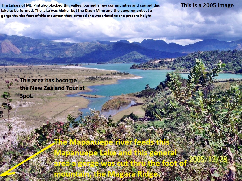
This is how the present New Zealand tourist spot used to look like in 1998 and 2005. I had a lot of feedback which caused me to add these 4 pictures.
Z123. This is how the present New Zealand tourist spot used to look like in 1998, marked-up copy.
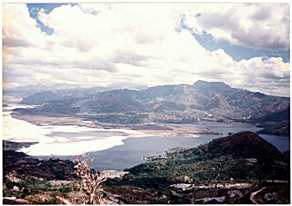
Z124. This is how the present New Zealand tourist spot used to look like in 1998.
Z125. This is how the present New Zealand tourist spot used to look like in 2005, copy marked up.
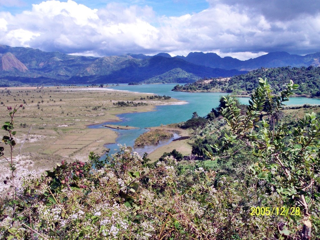
Z126. This is how the present New Zealand tourist spot used to look like in 2005.