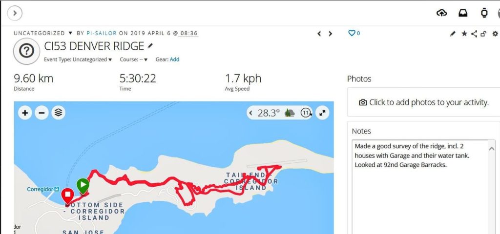
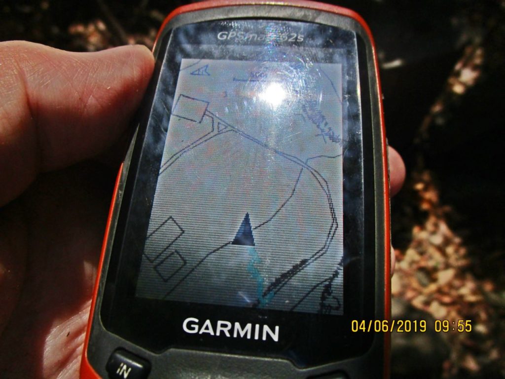
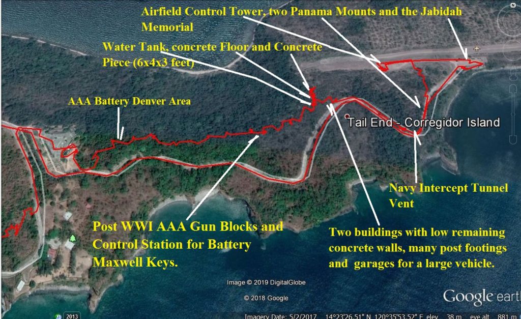
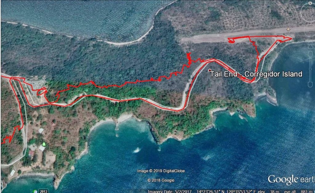
Ze257. This is my GPS track on my Corregidor Tailend Walk, 9.6 km, 5 ½ hour from my Garmin account and I used 3 liters of water.
————————————
The Tribute Day to all Filipino Heroes on Corregidor was on the 7th April 2019 but I arrived one day early and made this walk. I looked at Malinta Hill Tunnel North Exit, also called Pres. Quezon ‘s Lateral, John Moffitt’s Goal Post Hill, Telephone Hut #3, 92nd C.A. (P.S.) H.Q. and barracks, 92nd C.A. (P.S.) area, Filipino Heroes Memorial, AAA Battery Denver, Battery Denver Hill, also called Water Tank Hill, AAA Gun Blocks on Denver Hill, Battery Maxwell Keys Gun Control on Denver Hill, structures on Corregidor Denver Hill, Navy Intercept Tunnels, Battery Levagood at Monkey Point, Navy Intercept Tunnel at Monkey Point, Kindley Airfield, Kindley Airfield Control Tower, Jabidah Memorial on Corregidor, Mindanao Garden of peace on Corregidor, Corregidor Defense Position I-M-1, Corregidor Defense Position I-F-1, Gen. MacArthur, President Quezon
————————————
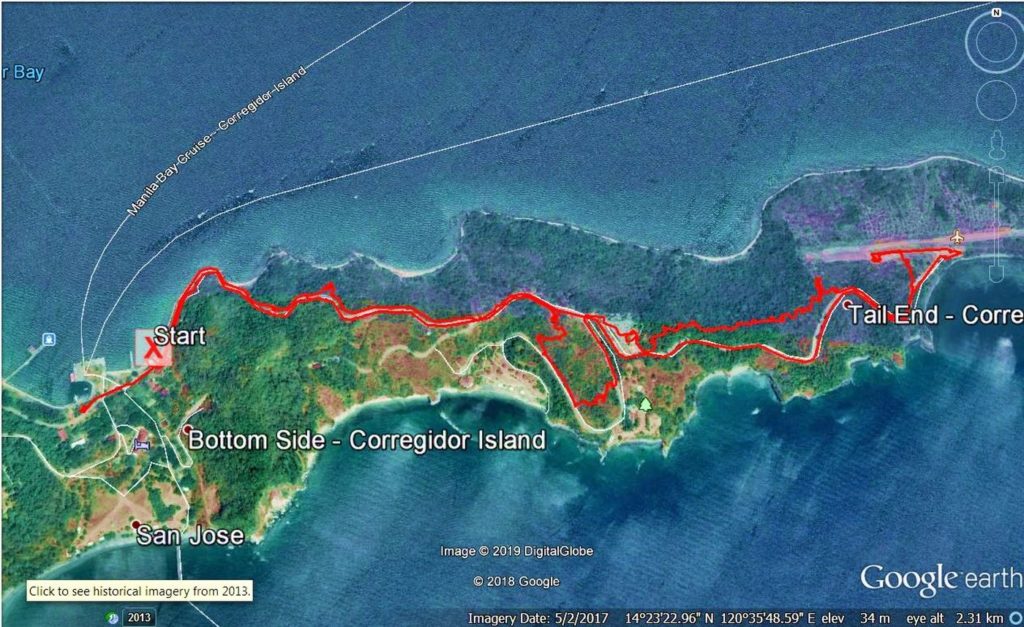
Ze258. This is my GPS track on my Corregidor Tailend Walk, 9.6 km, 5 ½ hour from my Google Earth page and I used 3 liters of water.
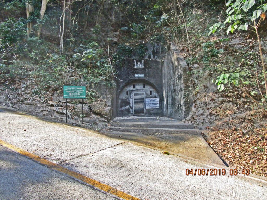
Ze259. I had a close look at the Malinta Hill Tunnel North Exit also called the Quezon‘s Lateral Tunnel.
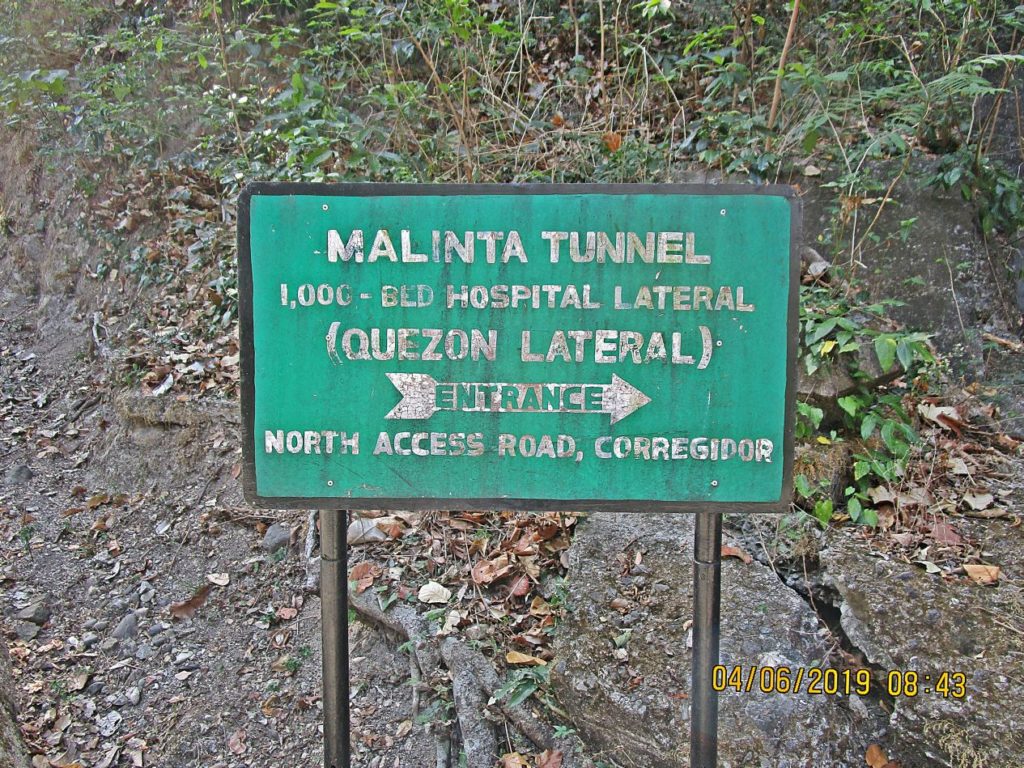
Ze260. This is one of the signs at the Malinta Hill Tunnel North Exit also called the Quezon‘s Lateral Tunnel.
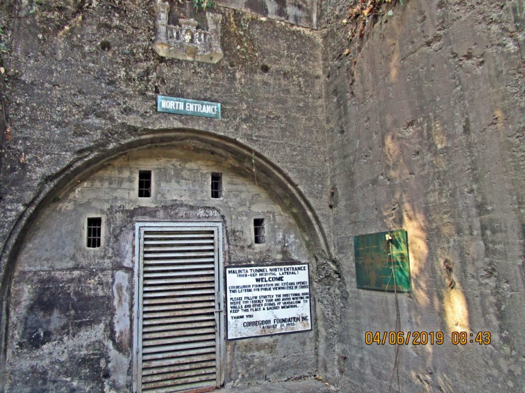
Ze261. This is a closer look at the Malinta Hill Tunnel North Exit also called the Quezon‘s Lateral Tunnel.
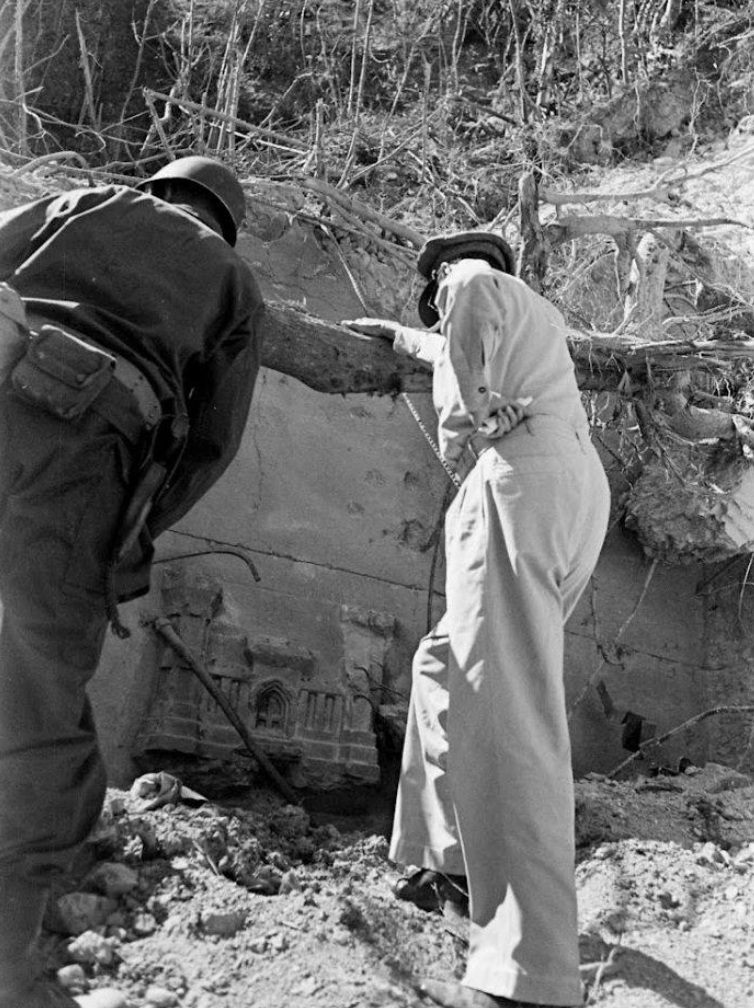
Ze262. This is a unique picture of Gen. MacArthur visiting Corregidor on the 2nd of March 1945. He is standing on rubble that almost completely buried the Malinta Hill Tunnel North Exit.
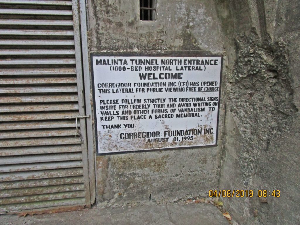
Ze263. Here is another sign at the Malinta Hill Tunnel North Exit also called the Quezon‘s Lateral Tunnel. I guess in 1995 it was allowed to look at the Malinta Hill Tunnel from here or only parts of it. That is not possible anymore. It is possible to see the main tunnel on the normal day tour or the whole thing if you are an overnight guest on the island.
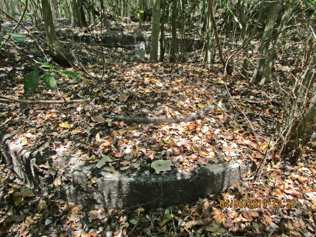
Z2264. The area outside the Malinta Hill Tunnel North Exit was in the past also used as a President Quezon Memorial. He had a stature here but it was moved to the Filipino Heroes Memorial. That concrete area was built for the purpose for the vehicles to stop safely.
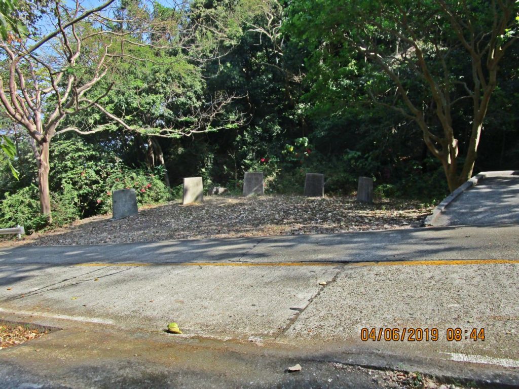
Ze265. This was the area outside the Malinta Hill Tunnel North Exit that was used as a President Quezon Memorial. He had a stature here but it was moved to the Filipino Heroes Memorial.
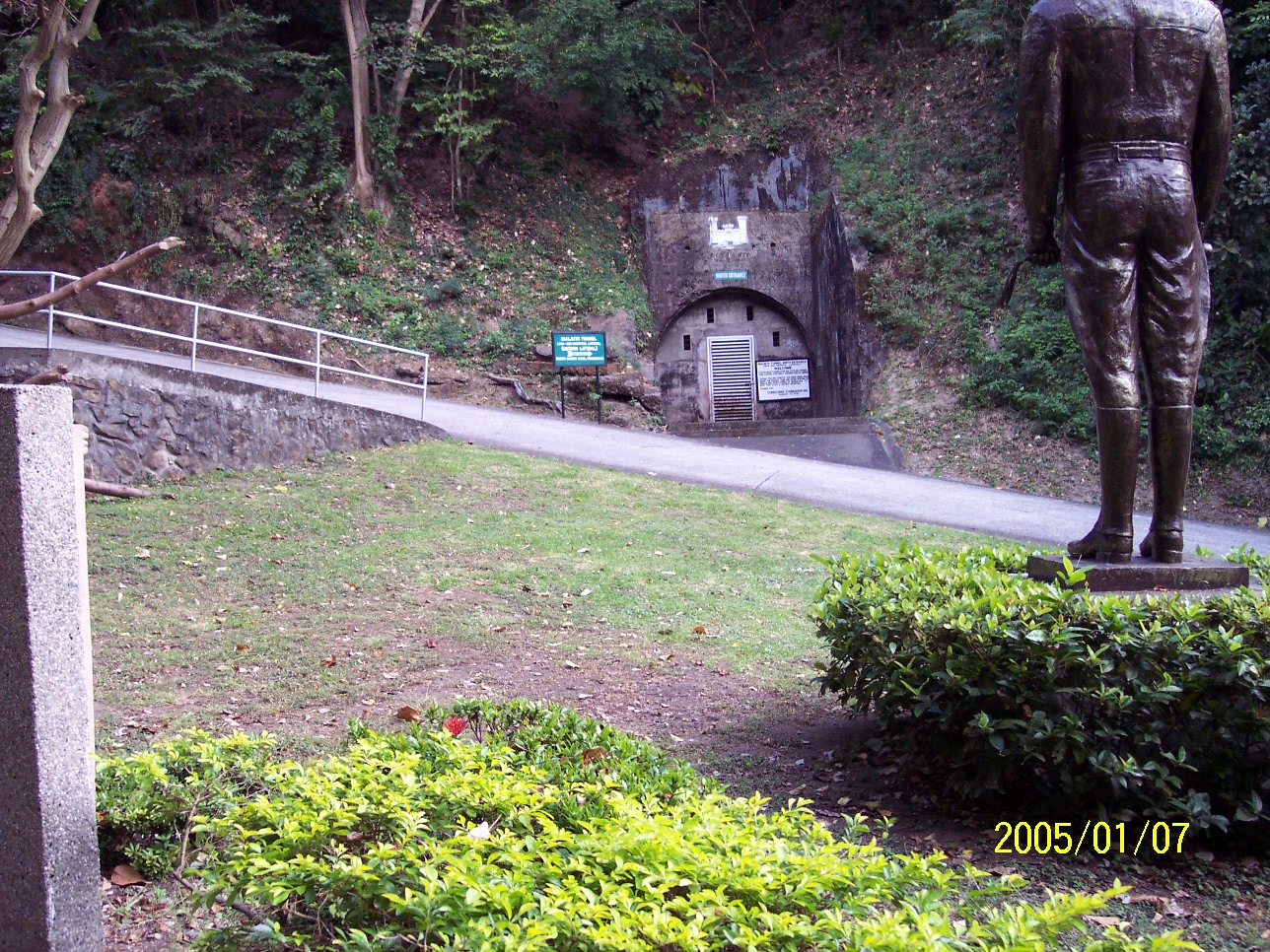
Ze266. This was the area outside the Malinta Hill Tunnel North Exit that was used as a President Quezon Memorial. In 2005 the stature was still here but was then moved to the Filipino Heroes Memorial.
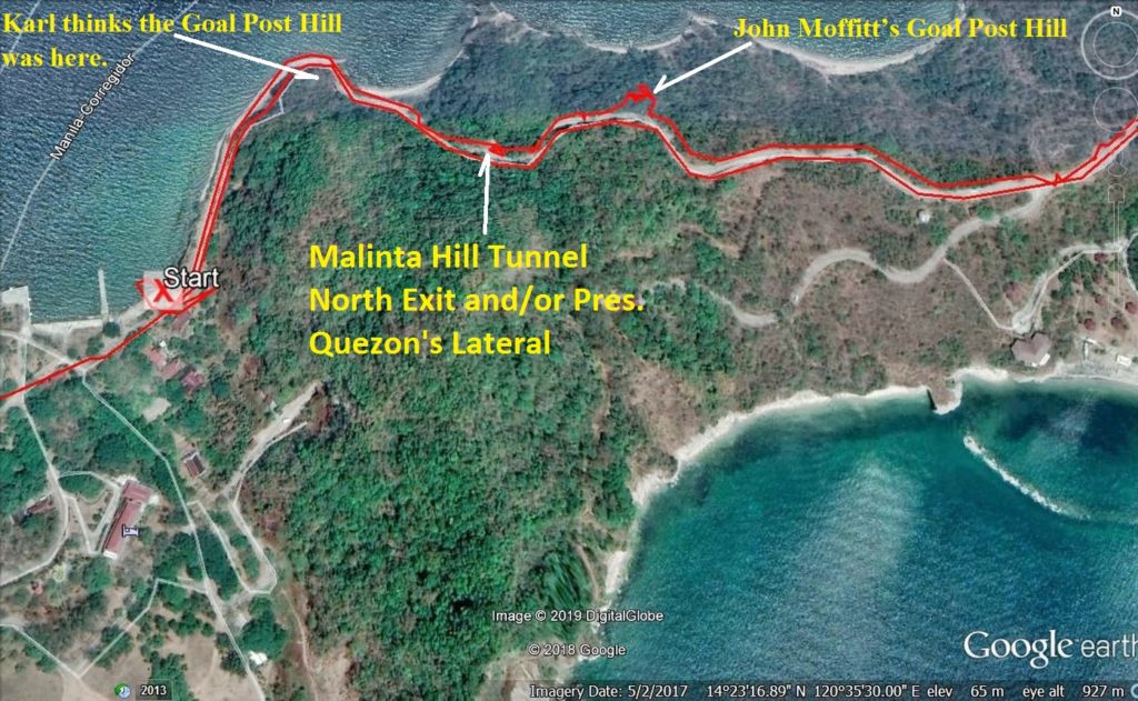
Ze267. This is a Google Earth image showing where the Malinta Hill Tunnel North Exit is and where John Moffitt and Karl think where the Goal Post Hill was.
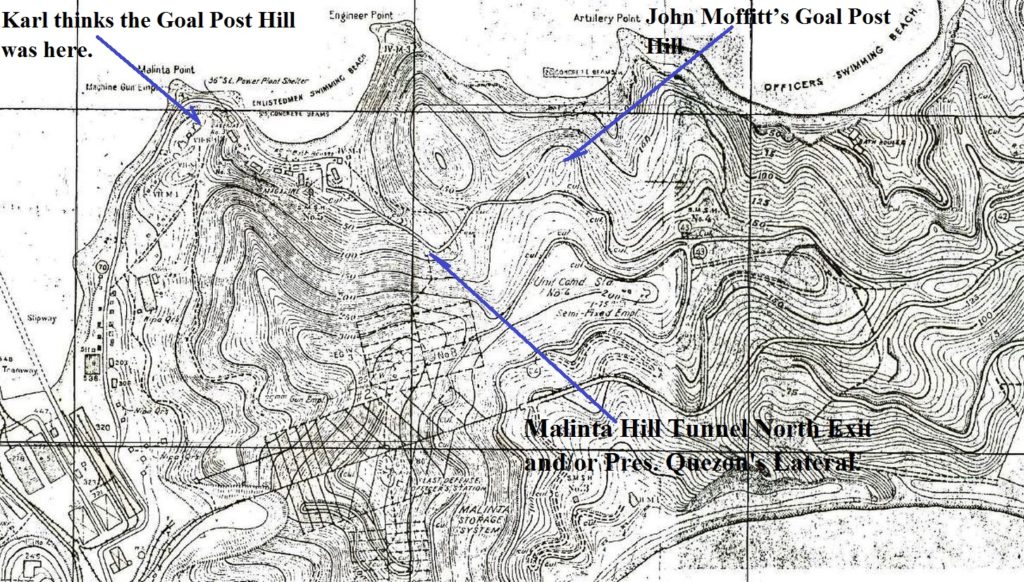
Ze268. This is a section of the 1936 Fort Mills Facility Drawing on Corregidor showing where the Malinta Hill Tunnel North Exit is and where John Moffitt and Karl think where the Goal Post Hill was.
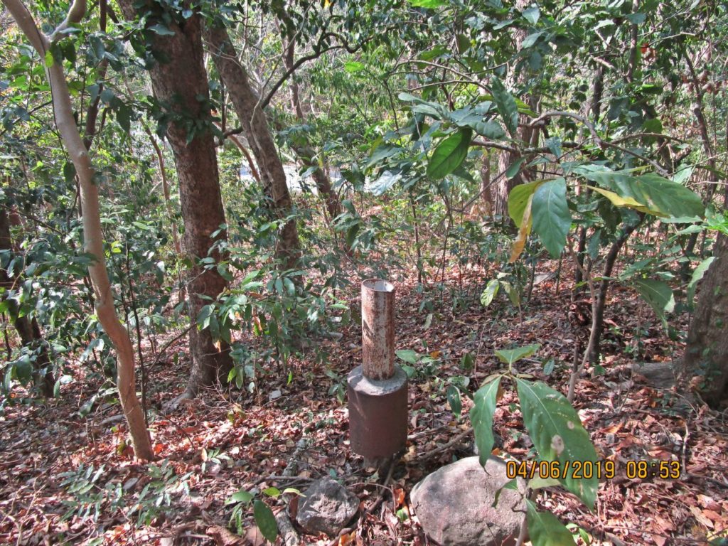
Ze269. This is the lower of the two goal posts John Moffitt found on a short knoll at the North Shore of Corregidor.
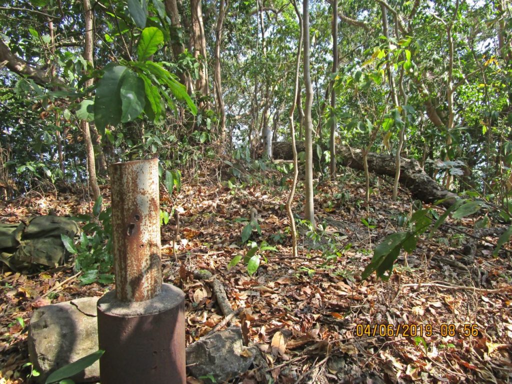
Ze270. These are the two goal posts John Moffitt found on a short knoll at the North Shore of Corregidor. The 2nd post is at this side of the fallen tree in back.
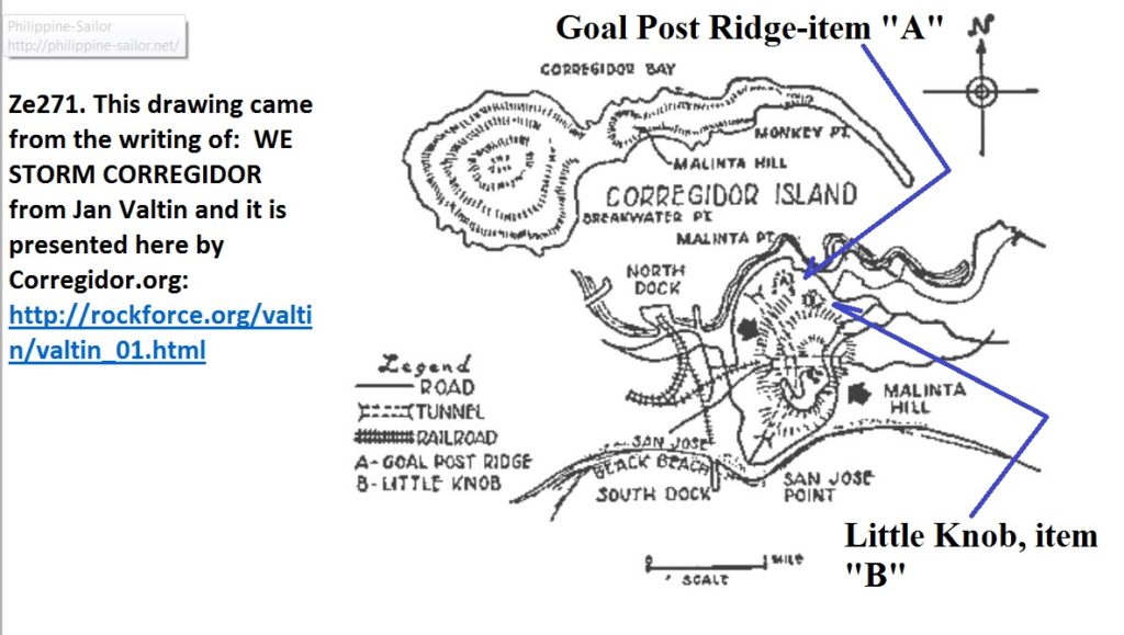
Ze271. This drawing came from the writing of: WE STORM CORREGIDOR from Jan Valtin and it is presented here by Corregidor.org: http://rockforce.org/valtin/valtin_01.html
By the way, Jan Valtin was a German American.
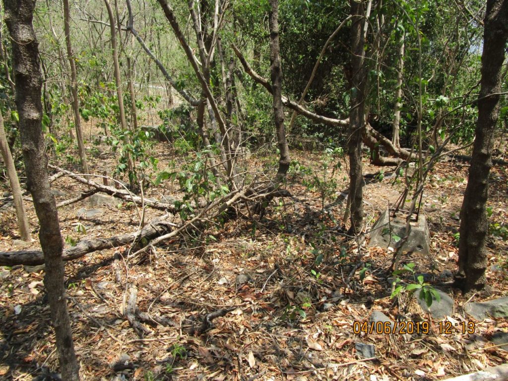
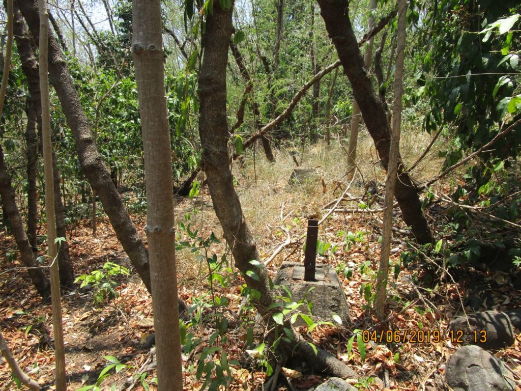
Ze272. This is just an orientation shot to show you as I was advancing on this Corregidor Tailend Walk.
Ze273. This is a close-up shot of the last picture, just an orientation shot to show you as I was advancing on this Corregidor Tailend Walk.
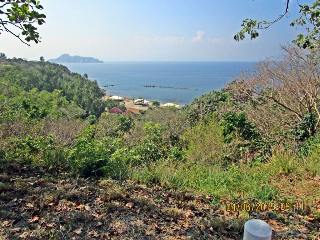
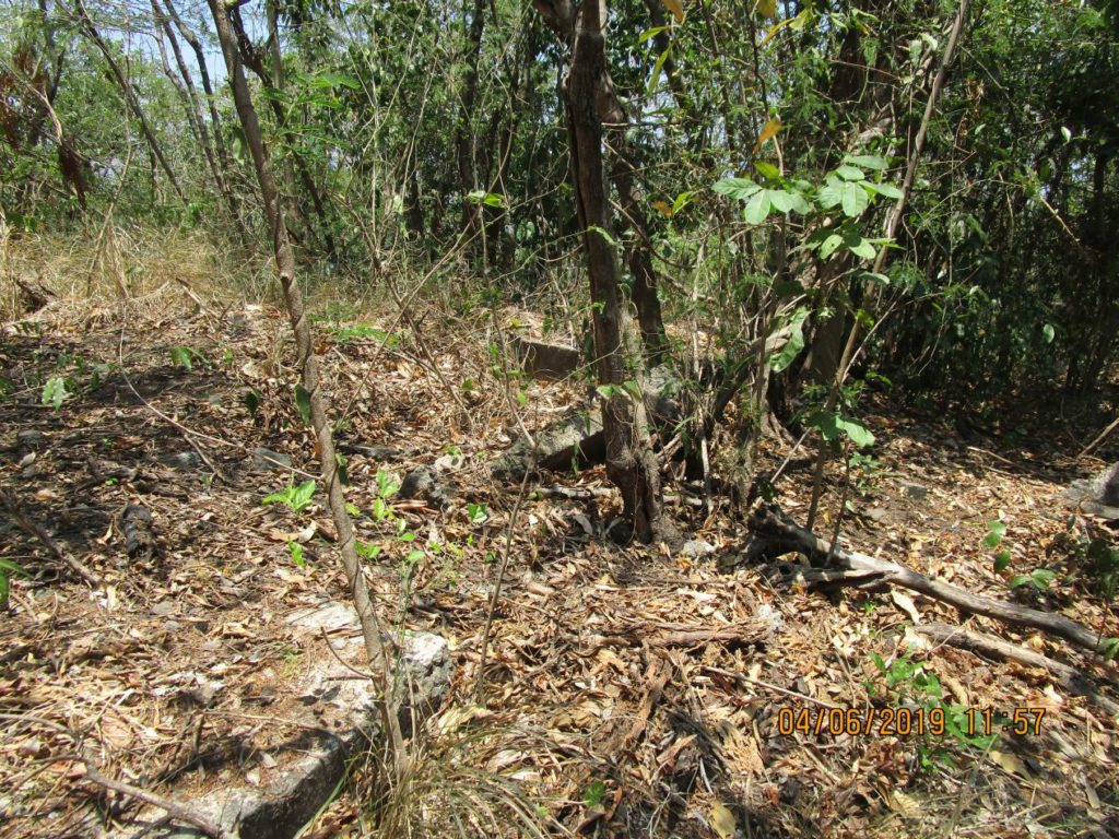
Ze274. This is always a great view of the 92nd Garage area which played the tragic role of containing the American and Filipino POWs after the fall of Corregidor. From here we can also see Caballo Island, the former Fort Hughes.
Ze275. This is the Telephone Hut #3; it was located next to the 92nd C.A. (P.S.) Head Quarter. It is also located across the street where in three houses, President Quezon, Gen MacArthur and the Philippine High Commissioner stayed after their evacuation from Manila.
Ze276 Close-up shot of the Telephone Hut #3; it was located next to the 92nd C.A. (P.S.) Head Quarter. It is also located across the street where in three houses, President Quezon, Gen MacArthur and the Philippine High Commissioner stayed after their evacuation from Manila.
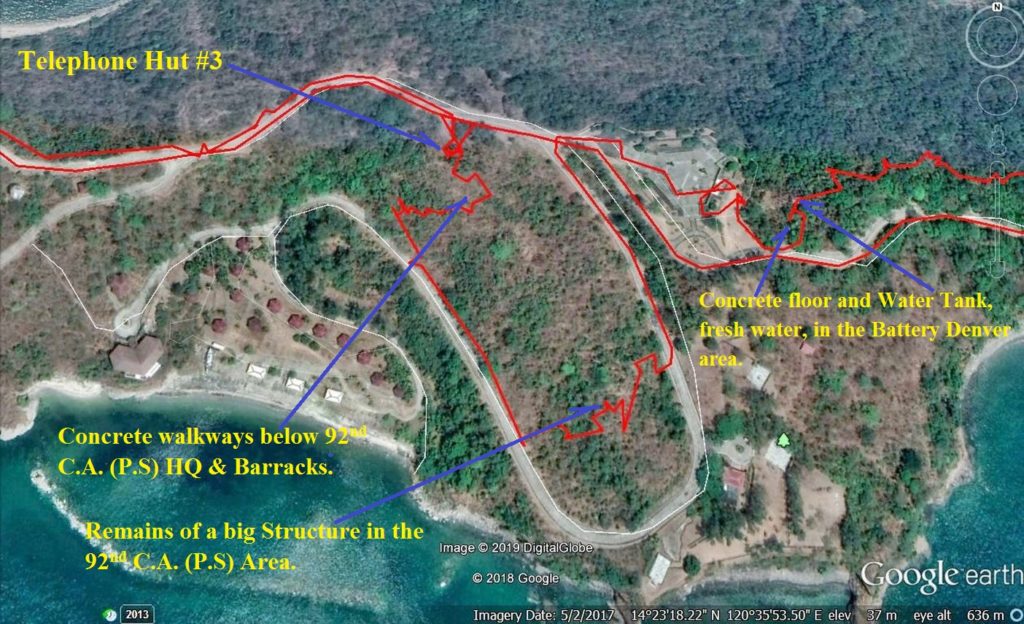
Ze277. My GPS track on a Google earth image from Telephone Hut #3 to the fresh water tank on the Battery Denver Ridge line, Ft. Mills on Corregidor Island.
[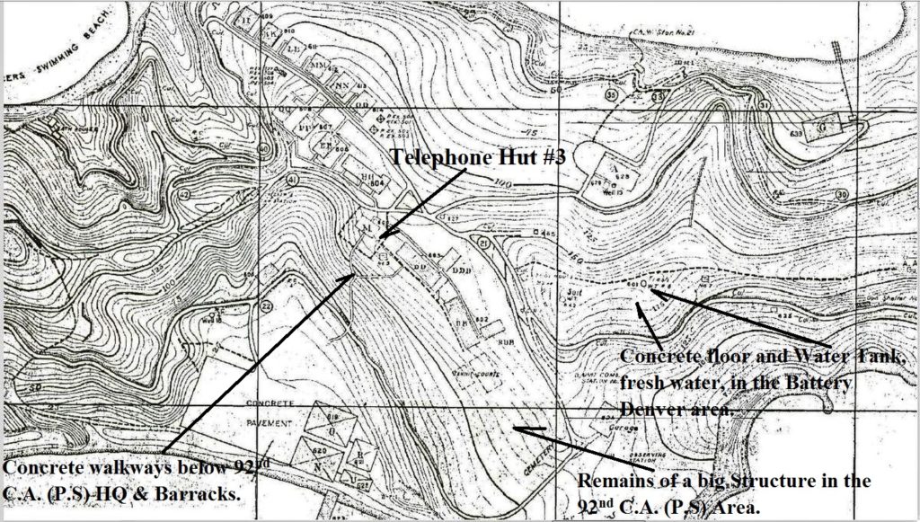
Ze278. This is a section of the Fort Mills, on Corregidor, 1936 facility drawing from Telephone Hut #3 to the fresh water tank on the Battery Denver Ridge line, Ft. Mills on Corregidor Island.
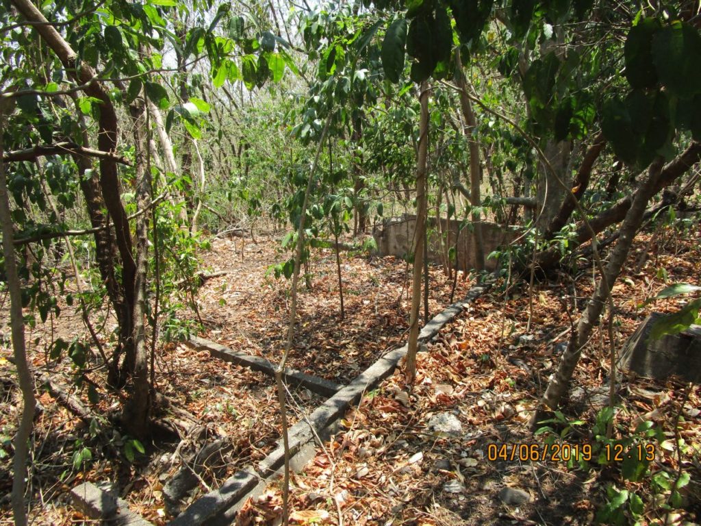
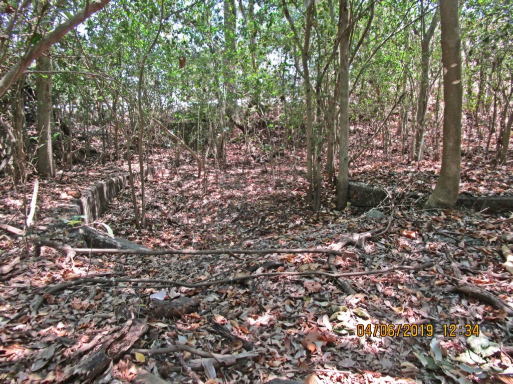
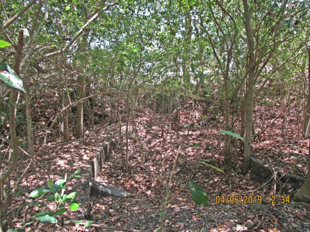
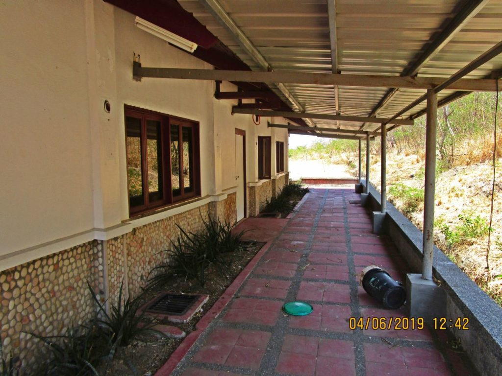
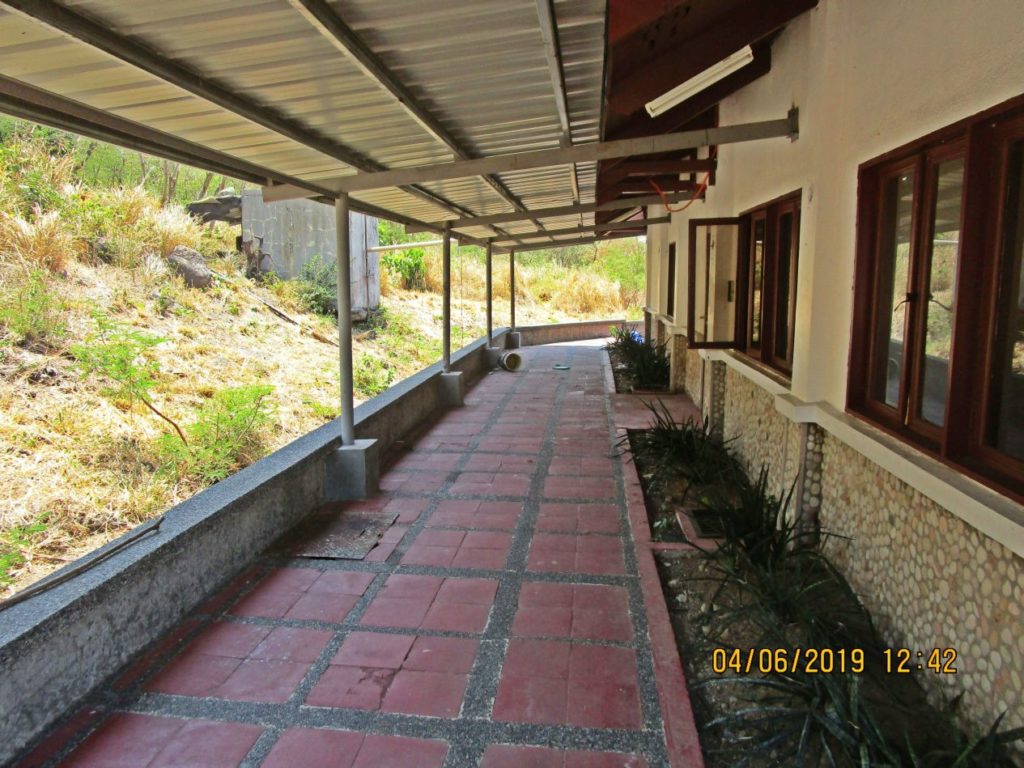
Ze279. This is one of several images of the concrete walkway below the 92nd C.A. (P.S.) Head Quarter and a barracks building leading down to the 92nd C. A. Garage area.
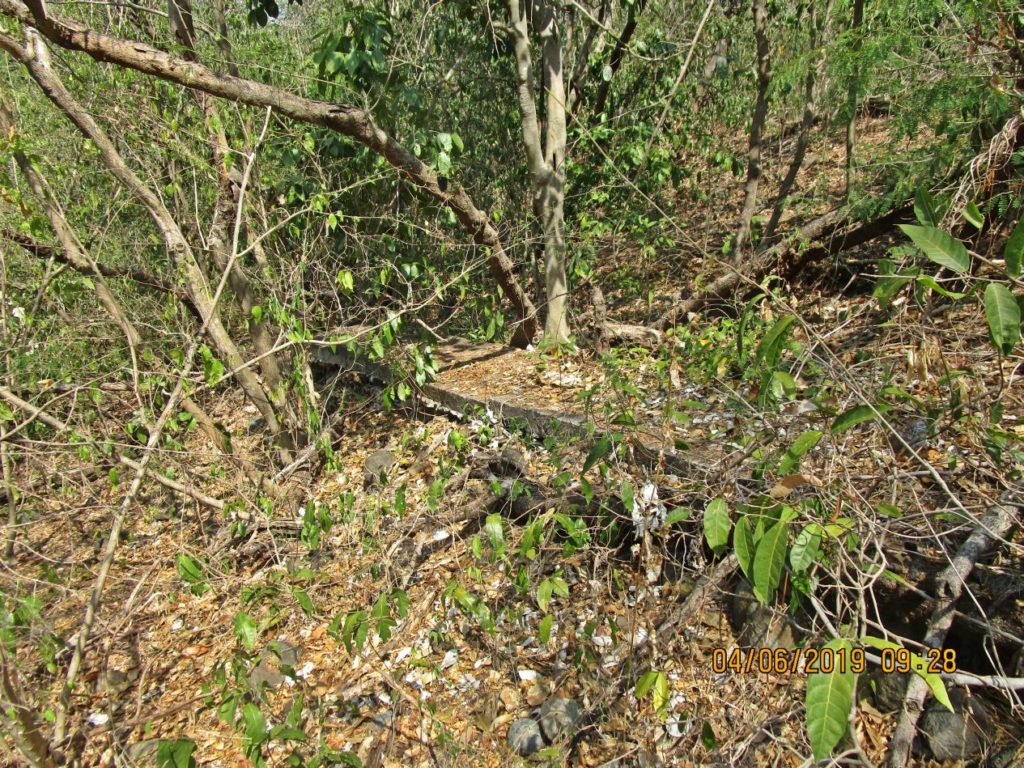
Ze280. This is one of several images of the concrete walkway below the 92nd C.A. (P.S.) Head Quarter and a barracks building leading down to the 92nd C. A. Garage area.
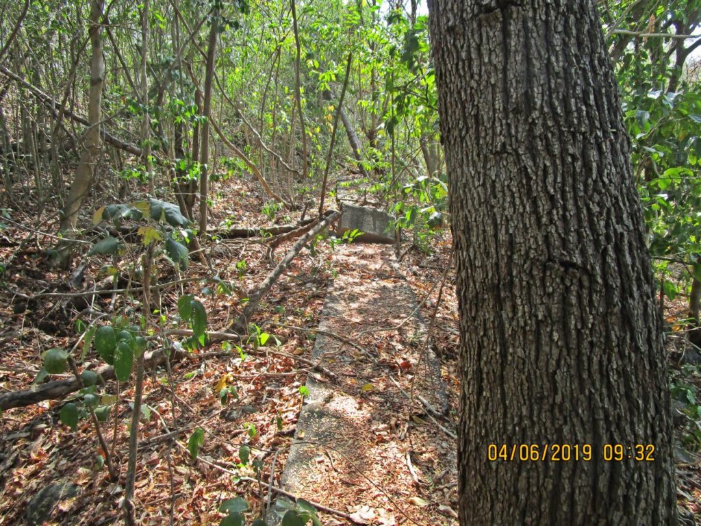
Ze281. This is one of several images of the concrete walkway below the 92nd C.A. (P.S.) Head Quarter and a barracks building leading down to the 92nd C. A. Garage area.
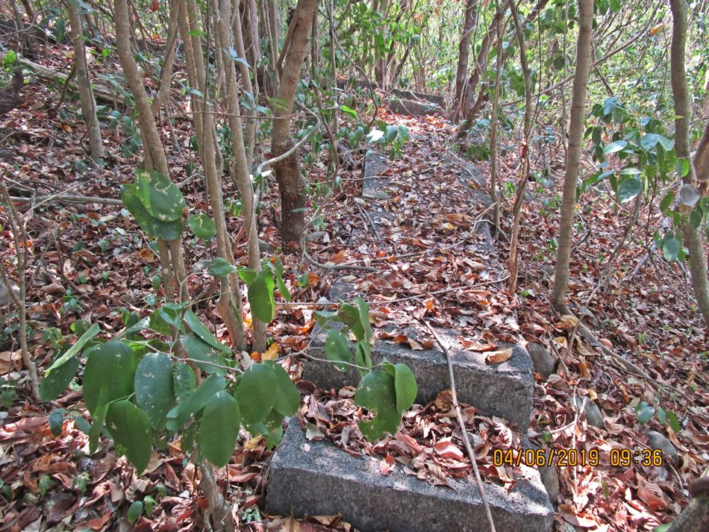
Ze282. This is one of several images of the concrete walkway below the 92nd C.A. (P.S.) Head Quarter and a barracks building leading down to the 92nd C. A. Garage area.
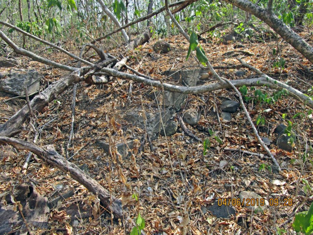
Ze283. This is one of several images of a large building in the 92nd C.A, (P.S.) are and it is not on the 1936 Fort Mills Drawing.
Ze284. This is one of several images of a large building in the 92nd C.A, (P.S.) are and it is not on the 1936 Fort Mills Drawing.
Ze285. This is one of several images of a large building in the 92nd C.A, (P.S.) are and it is not on the 1936 Fort Mills Drawing.
Ze286. This is one of several images of a large building in the 92nd C.A, (P.S.) area and it is not on the 1936 Fort Mills Drawing.
2nd segment:
Ze287. This is one of several images of a large building in the 92nd C.A, (P.S.) area and it is not on the 1936 Fort Mills Drawing.
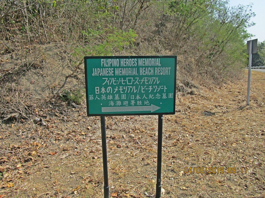
Ze288. This is the Filipino Heroes Memorial, today is the 6th of April 2019 and the Philippine Navy arrived and they will set up tents, chairs etc for tomorrow’s “Tribute to All Filipino Heroes” Commemoration. Search for: A Tribute to All Filipino Heroes or Araw ng Kagitingan.
Ze289. This is a Google Earth image with my GPS rack for the rest of my walk on the Tailend of Corregidor Island, the former Fort Mills.
Ze290. This is a section of a 1936 Fort Mills Facility Drawing and it covers the rest of my walk on the Tailend of Corregidor Island, the former Fort Mills.
Ze291. Next I climbed up to the Fresh Water Tank on the AAA Battery Denver area. I have come across this shaped column many times on Corregidor; this one was below, south, of the Fresh Water Tank. This water tank area witnessed heavy fighting both in 1942 and 1945. If you are interested you can find many interesting links here:
1942 Corregidor Siege, click here
1945 recapture of Corregidor, click here:
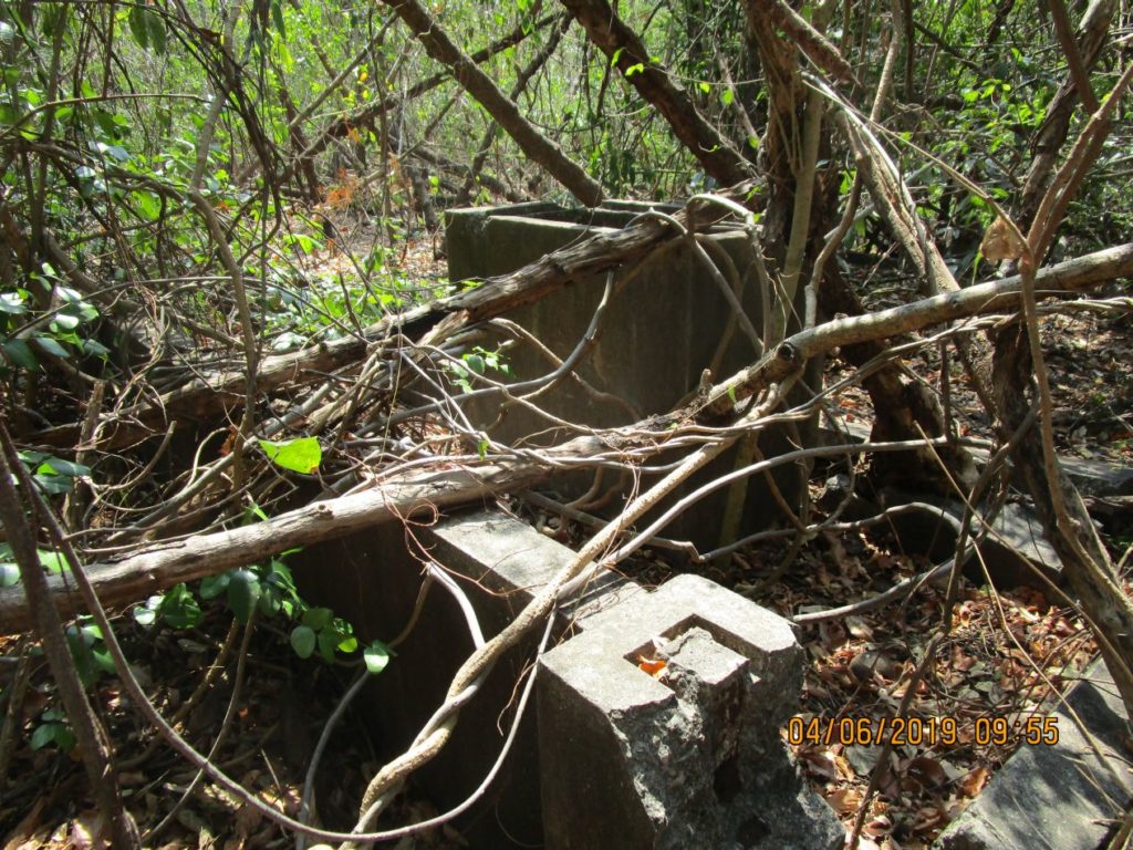
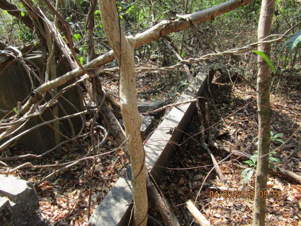
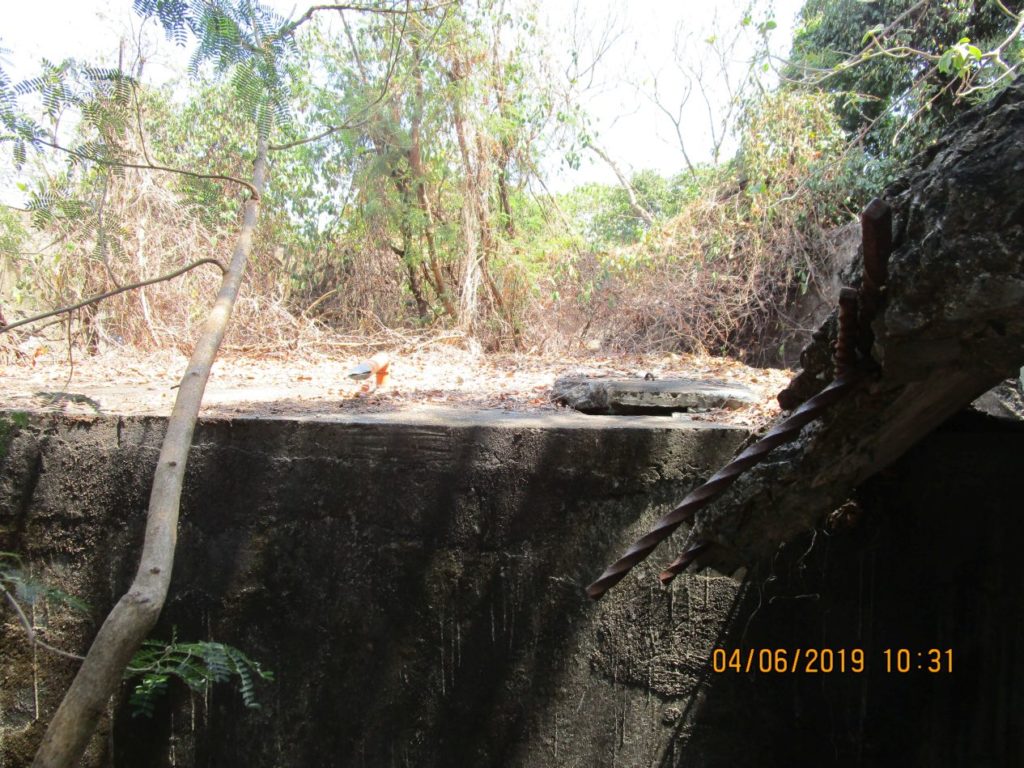
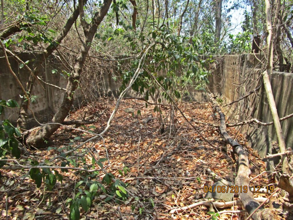
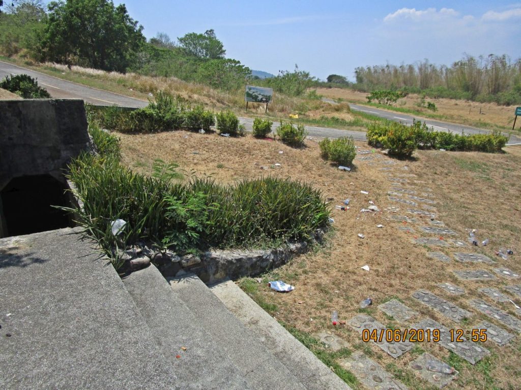
Ze292. This large concrete floor or (what is it) is located about 15 feet below, south, of the Fresh Water Tank.
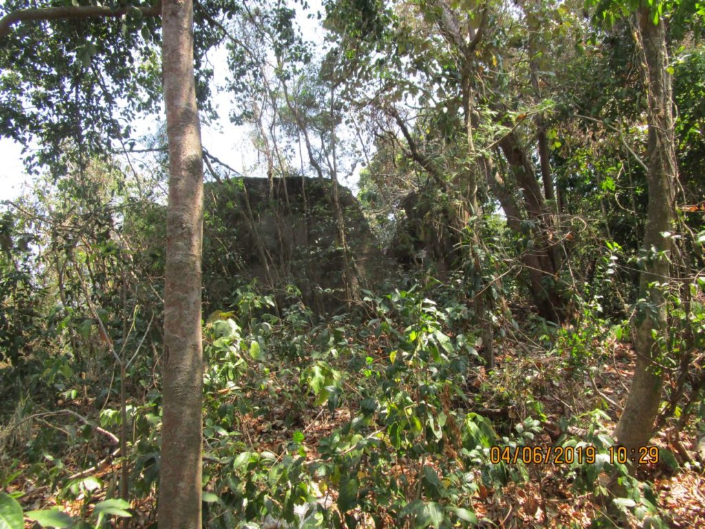
Ze293. The view of the Fresh Water Tank from the large concrete floor or (what is it) located about 15 feet below, south, of the Fresh Water Tank.
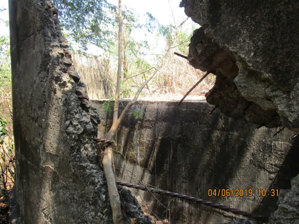
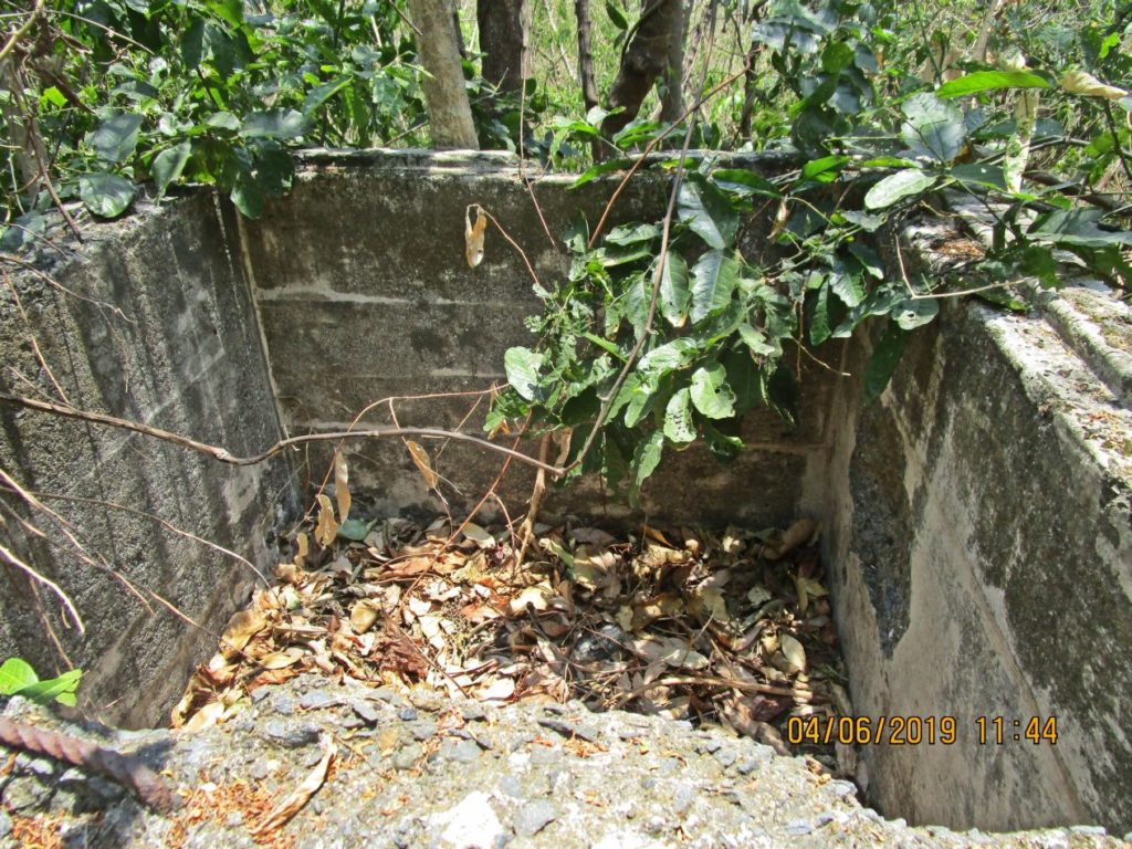
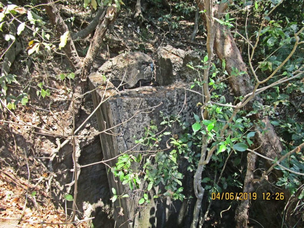
Ze294. Looking left into the Fresh Water Tank thru the damaged wall, south side of the tank. After WWII a smaller tank was built inside to support the Filipino Heroes Memorial and the Japanese Garden of Peace.
Ze295. Looking left into the Fresh Water Tank thru the damaged wall, south side of the tank. After WWII a smaller tank was built inside to support the Filipino Heroes Memorial and the Japanese Garden of Peace.
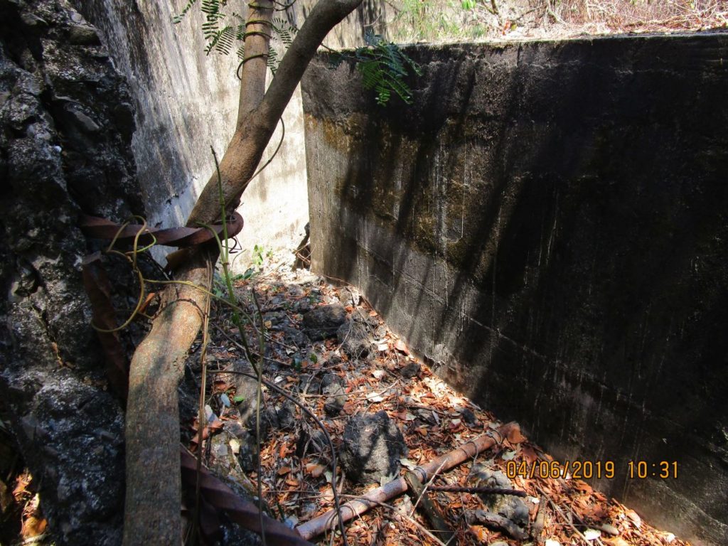
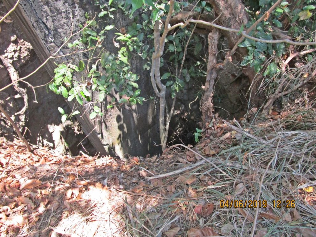
Ze296. Looking right, into the Fresh Water Tank thru the damaged wall, south side of the tank. After WWII a smaller tank was built inside to support the Filipino Heroes Memorial and the Japanese Garden of Peace. This water tank area witnessed heavy fighting both in 1942 and 1945. If you are interested you can find many interesting links here:
1942 Corregidor Siege, click here
1945 Corregidor Recapture, click here:
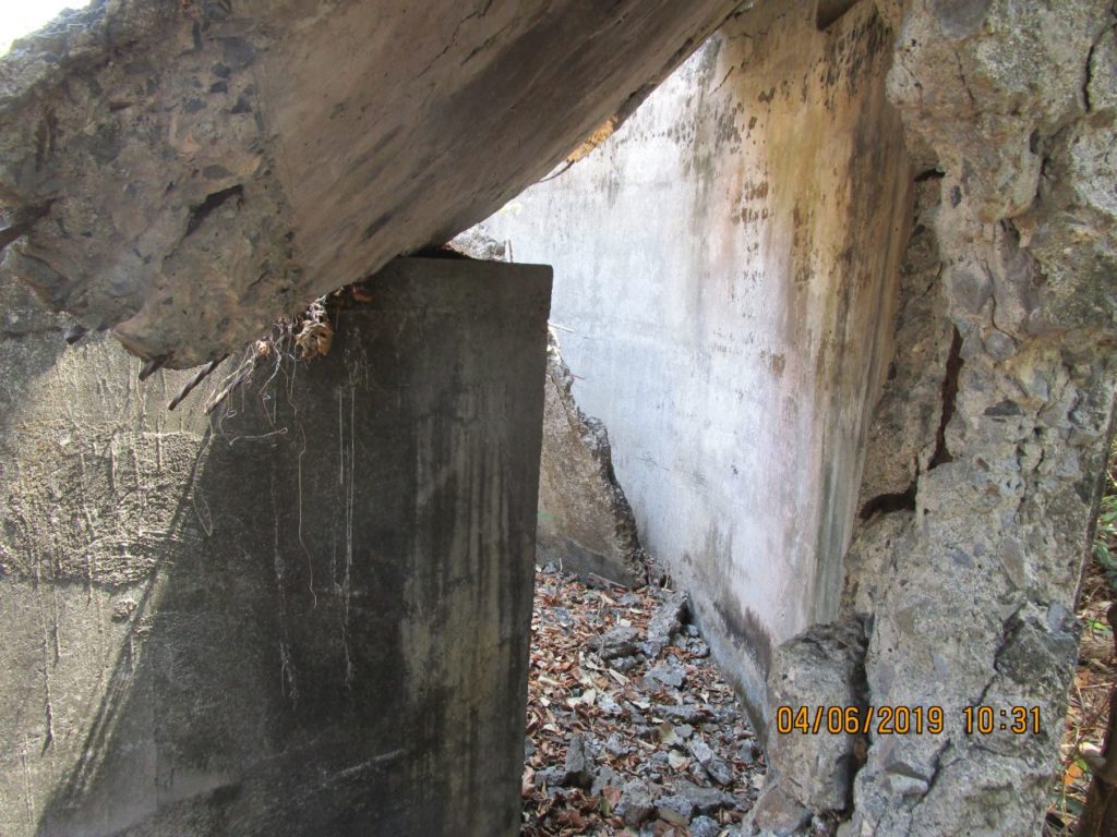
Ze297. Looking straight into the Fresh Water Tank thru the damaged wall, south side of the tank. After WWII a smaller tank was built inside to support the Filipino Heroes Memorial and the Japanese Garden of Peace.
Ze298. I was surprised to see how large the area was where the AAA Battery Denver was located, east of the Fresh Water Tank. I tried to indentify the locations of the 4 guns. Here is an example where large containers were used to house one of the guns. If you like to know more click this:
ORDER OF BATTLE, 60th Coast Artillery Regiment, Harbor Defense, Organization and Assignments.
http://corregidor.org/btty_histories/control/order_battle_60.htm
Ze299. I was surprised to see how large the area was where the AAA Battery Denver was located, east of the Fresh Water Tank. I tried to indentify the locations of the 4 guns. Here is an example where large containers were used to house one of the guns.
Ze300. I was surprised to see how large the area was where the AAA Battery Denver was located, east of the Fresh Water Tank. There were also the remains of this concrete structure.
Ze301. This is the gun control station of Battery Maxwell Keys. This image is out of order because it is located a little further east of the two gun blocks in the next picture.
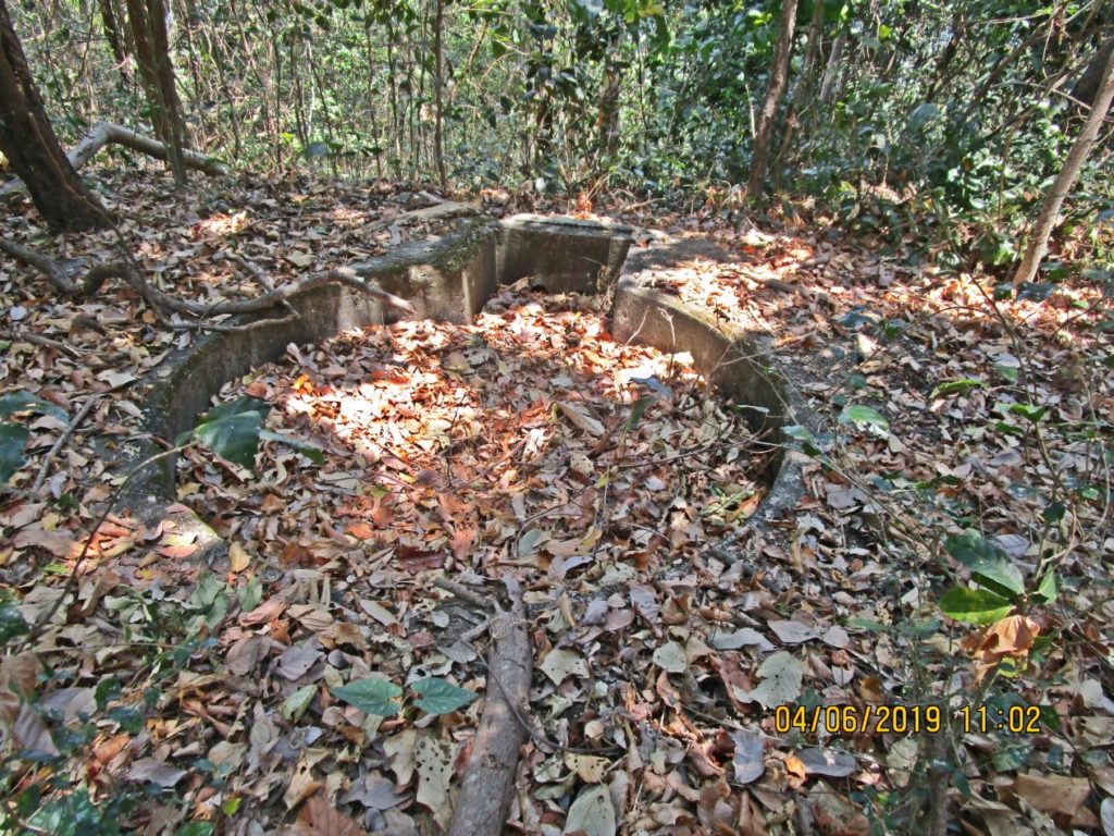
Ze302. This is one of the two AAA Gun Blocks put in place here, 19127 I believe, on top of the Denver Hill aka (earlier) Wilson Park Hill. They are located between Battery Denver and the Battery Maxwell Keys control station.
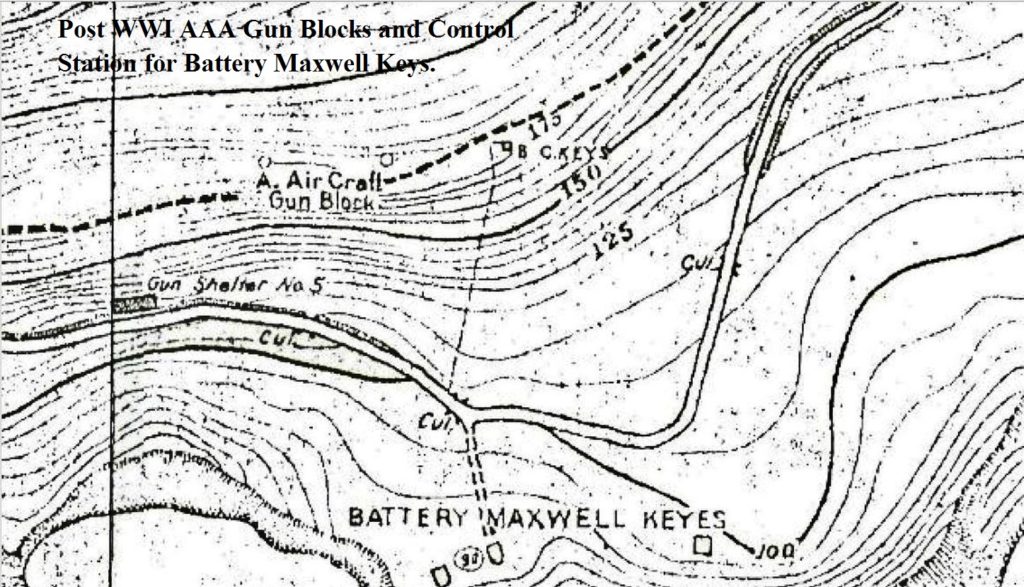
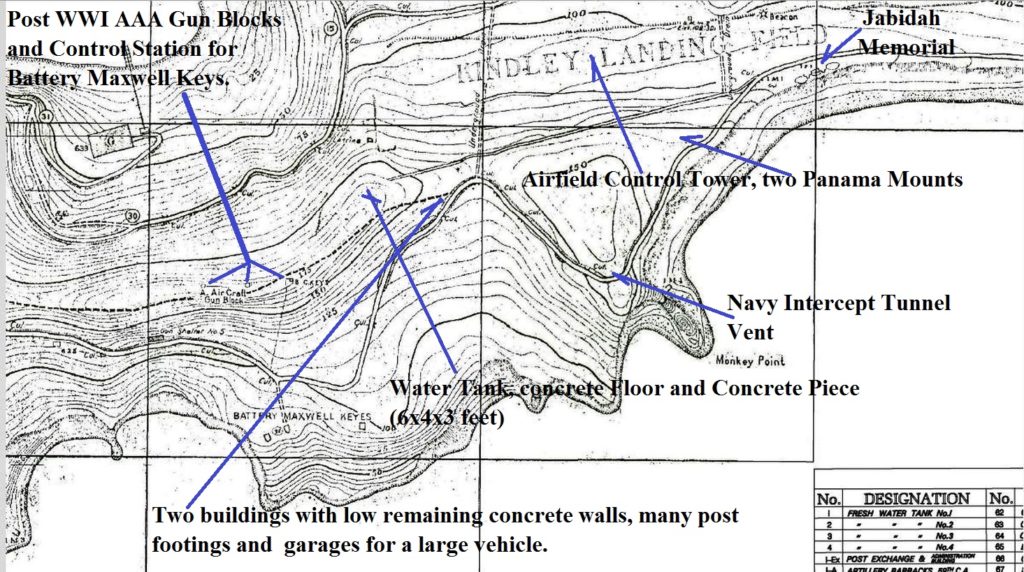
Ze303. This is a section of the 1936 Fort Mills facility drawing on Corregidor showing the location of the AAA gun blocks, Battery Maxwell Keys and its control station.
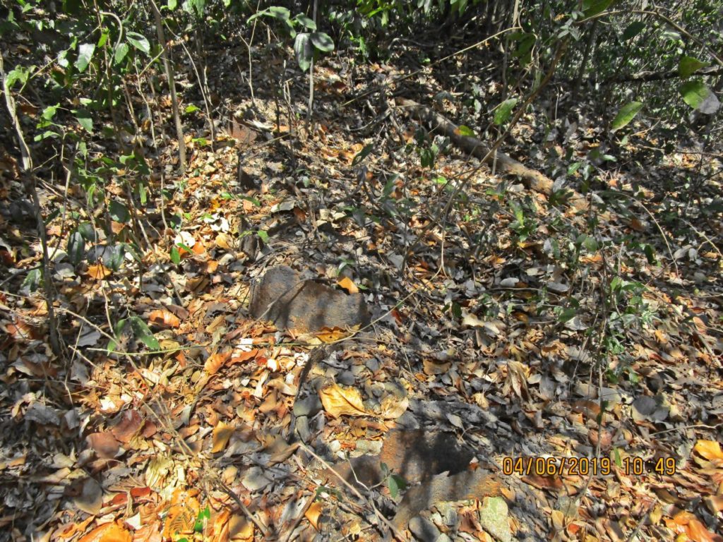
Ze304. On my walk I came across the concrete bases foe antenna masts. John Moffitt, I and others have come across many of the antenna Mast concretes bases around this general area. They must have been part of the Navy Intercept Tunnel at Monkey Point nearby. This area must have looked like forest of antenna masts but I don’t know that any pictures of that existed.
If you want to know more how the Navy Intercept Tunnel helped win the war, may you want to check out this URL:
http://corregidor.org/_admin/CTN_central/ctn_secret_index_composite.htm
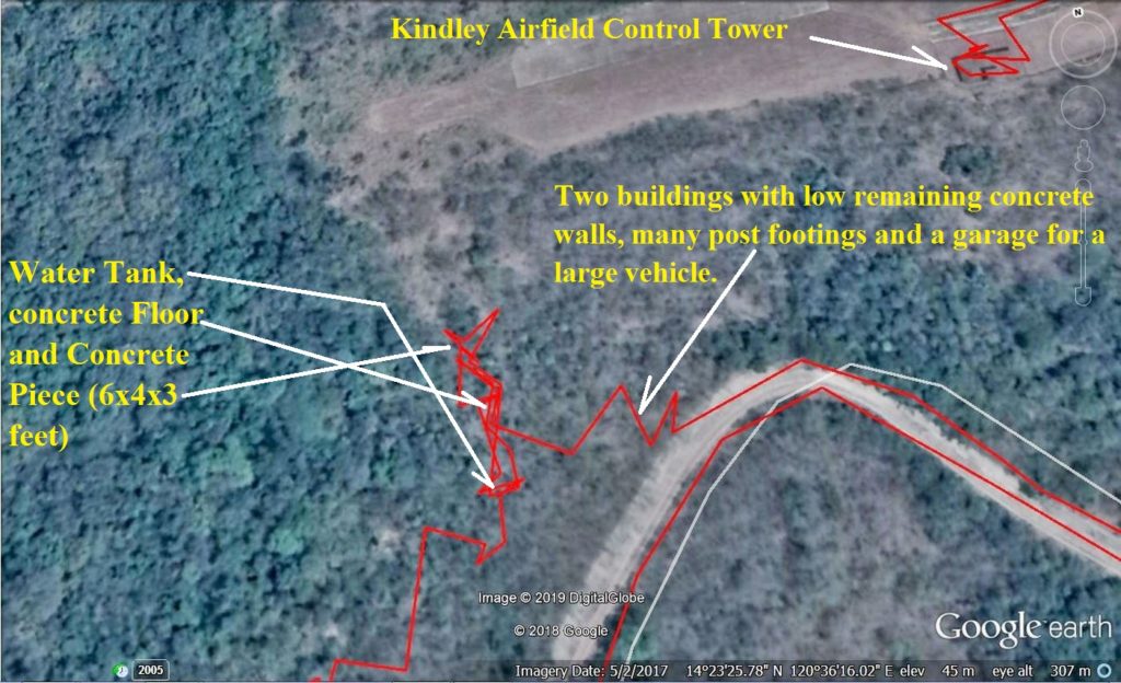
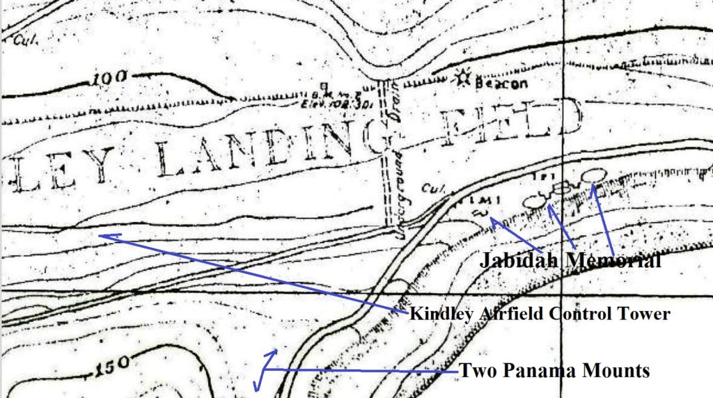
Ze305. This is a section of an image with my GPS track as I advanced on Denver Hill near the beginning of the Kindley airfield on Corregidor. I wanted to have a closer look at a water tank and two mysterious buildings.
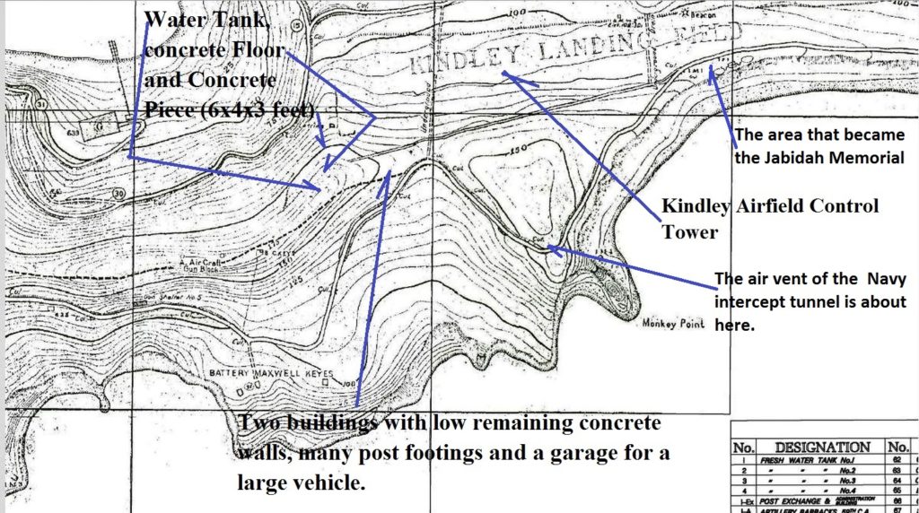
Ze306. This is a section of the 1936 Fort Mills facility drawing on Corregidor showing the location of the two mysterious buildings, Navy Intercept Tunnel, Jabidah Memorial etc.
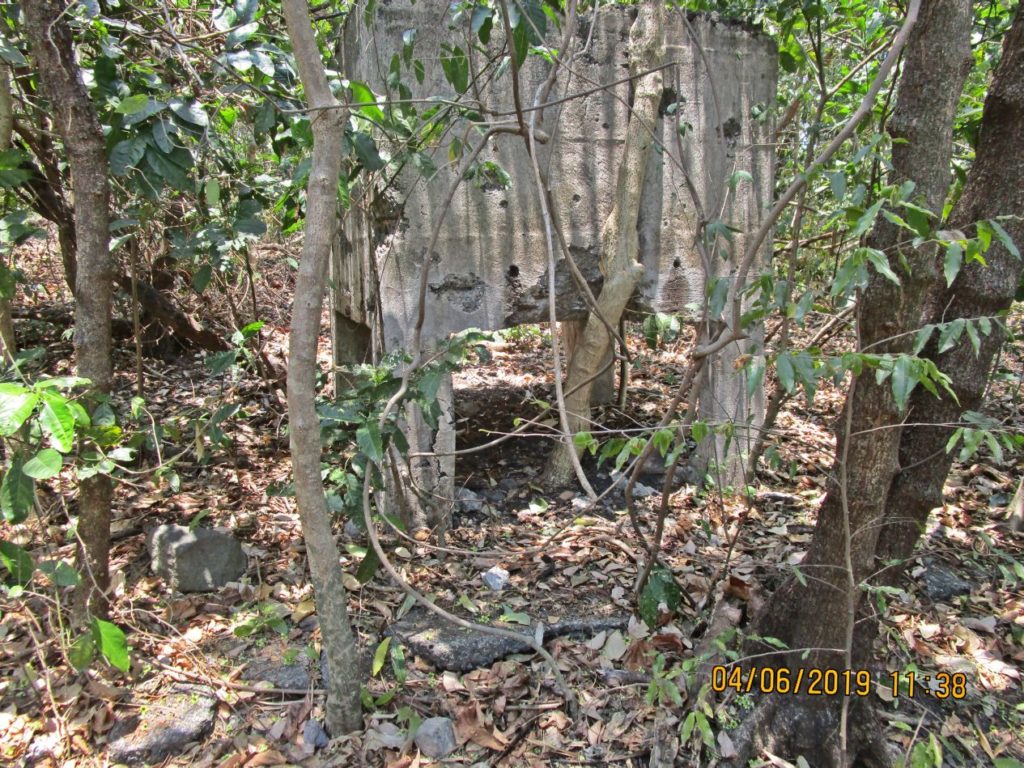
Ze307. This is one of several images of a water tank on the Battery Denver Hill, south and near the west end of the Kindley Airfield runway on Corregidor and also above the two large mystery buildings along the road to the airfield, (view is from the south).
Ze308. This is one of several images of a water tank on the Battery Denver Hill, south and near the west end of the Kindley Airfield runway on Corregidor and also above the two large mystery buildings along the road to the airfield (view is from the east).
Ze309. This is one of several images of a water tank on the Battery Denver Hill, south and near the west end of the Kindley Airfield runway on Corregidor and also above the two large mystery buildings along the road to the airfield (view is from the north).
Ze310. This is one of several images of a water tank on the Battery Denver Hill, south and near the west end of the Kindley Airfield runway on Corregidor and also above the two large mystery buildings along the road to the airfield (view is from the north).
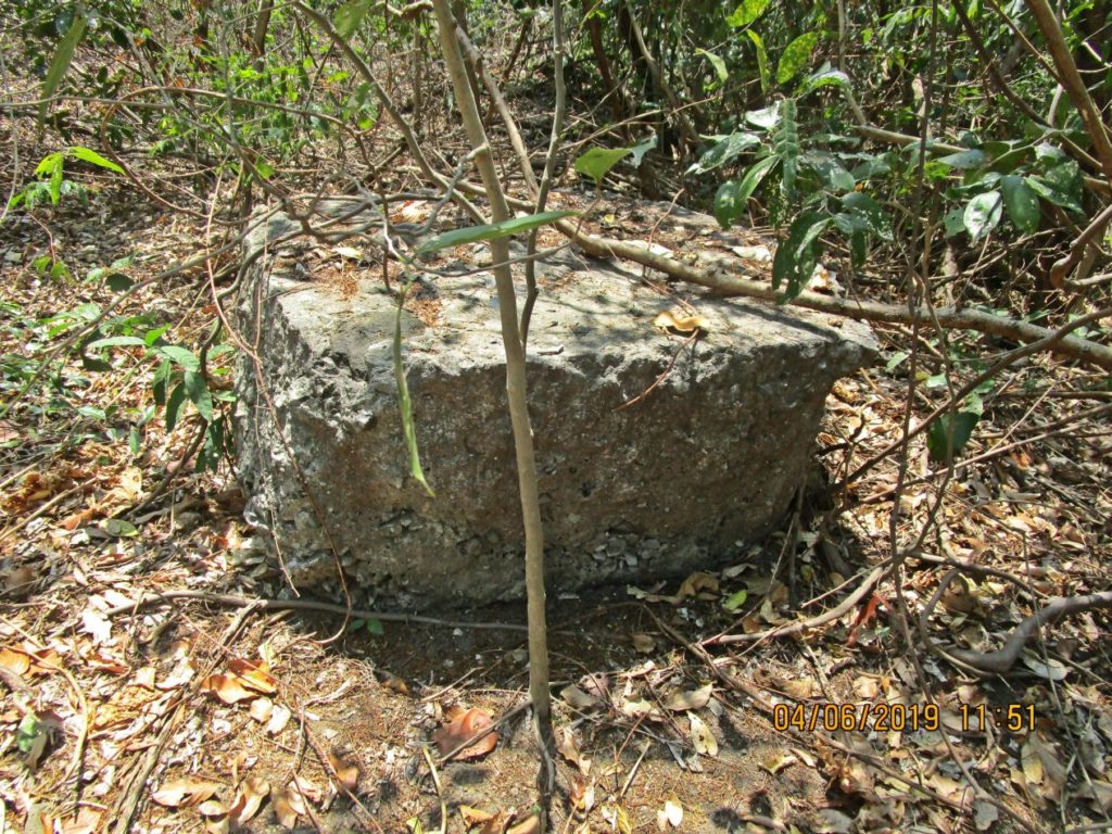
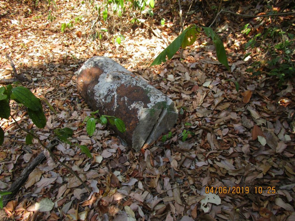
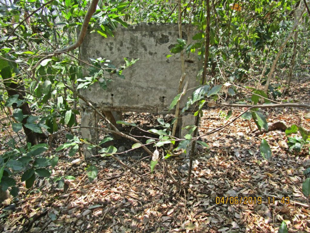
Ze311. This concrete block, about 6x4x3 feet high, is located between the water tank and the west end of the Kindley Airfield. It must have been blown here from an explosion; that reminds me of an explosion John Moffitt described in one of his trip reports in the forum. It was an explosion in 1942 at one of the defense position, north of the west end of the Kindley Field.
Ze312. This is the approximate position of the concrete block in the previous picture.
Ze313. This is the view of the west end of Kindley Airfield from near the concrete block in the previous two pictures.
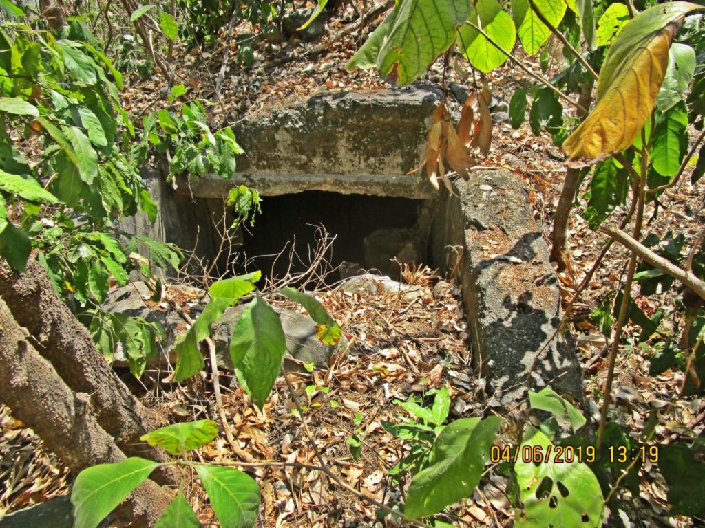
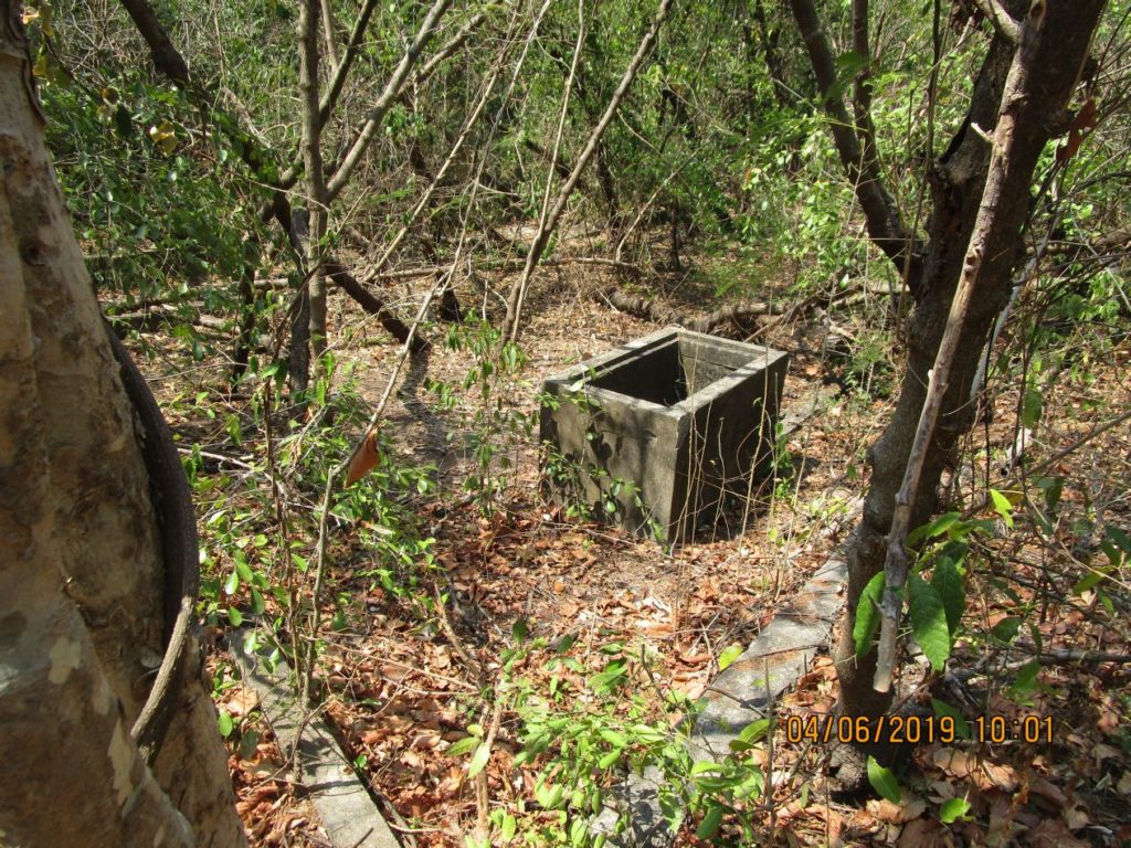
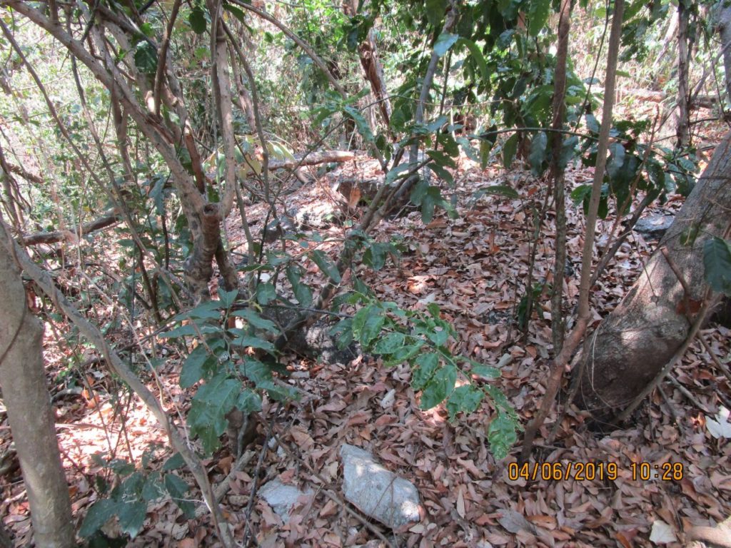
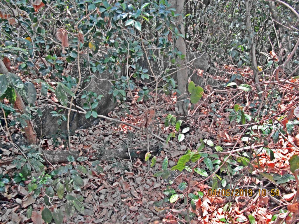
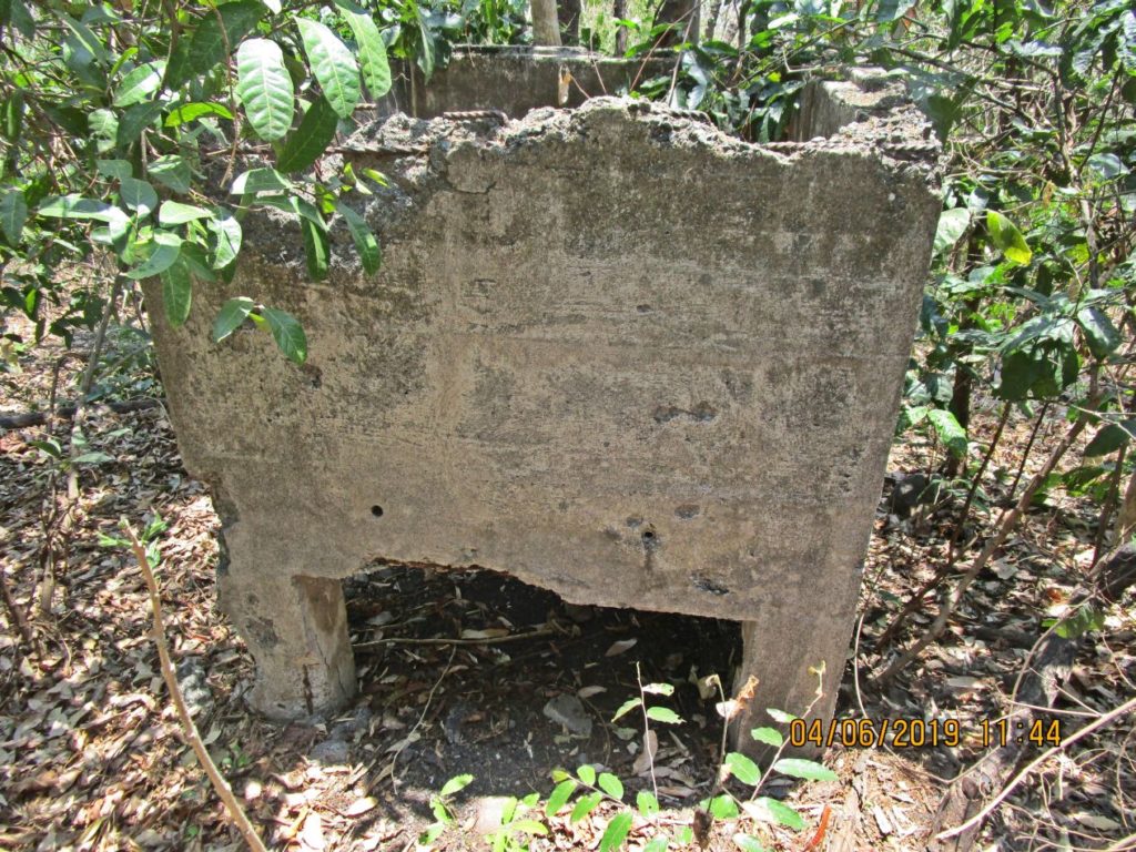
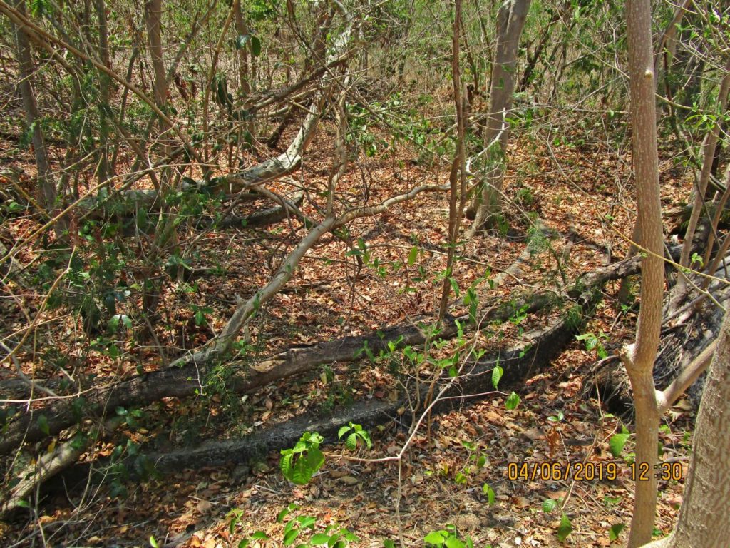
Ze314. Between the water tank and the concrete block on the Denver Hill near the west end of Kindley Field on Corregidor is this concrete floor of a structure that was never on any map or drawing.
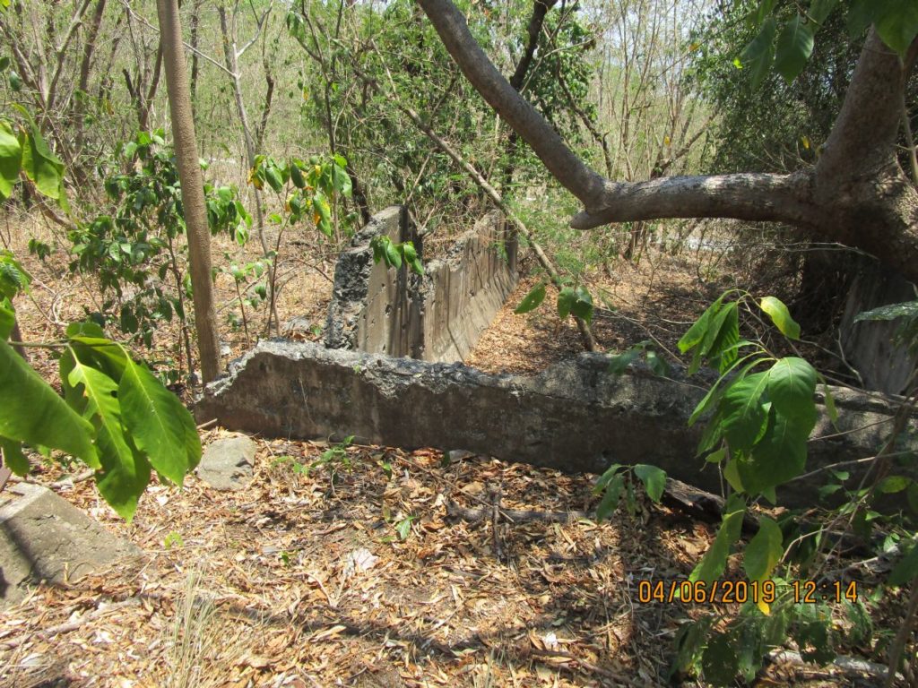
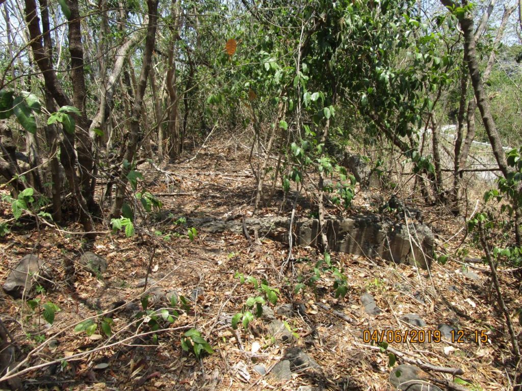
Ze315. One of several pictures of two large structures near the road going to the Kindley Airfield of Fort Mills on Corregidor Island, just before the 2nd last bend in that road. The two buildings are next to each other and seem to have a large garage for a larger vehicle at their east ends. I speculate that these structures must have been part of the Kindley Airfield; I could not find them on any map or drawing. In this picture one can see the road to the air field.
Ze316. One of several pictures of two large structures near the road going to the Kindley Airfield of Fort Mills on Corregidor Island, just before the 2nd last bend in that road. The two buildings are next to each other and seem to have a large garage for a larger vehicle at their east ends. I speculate that these structures must have been part of the Kindley Airfield; I could not find them on any map or drawing.
3rd Segment
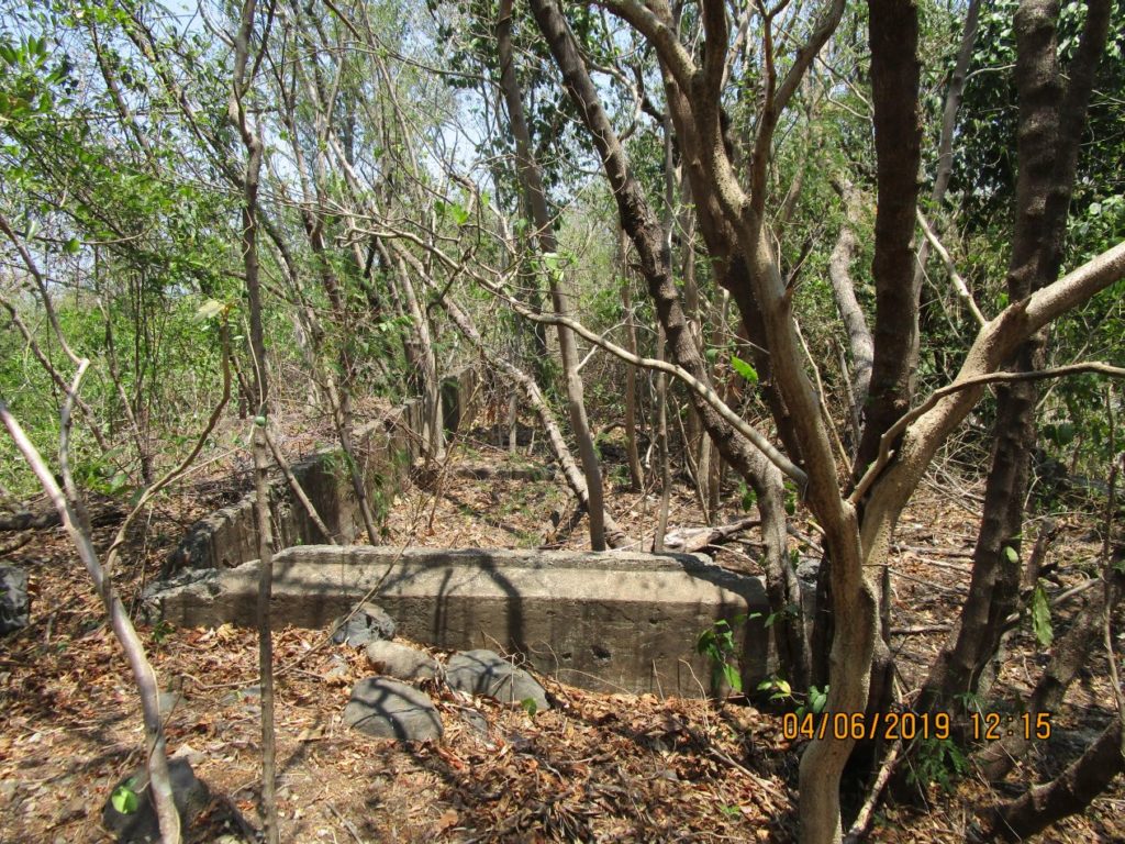
Ze317. One of several pictures of two large structures near the road going to the Kindley Airfield of Fort Mills on Corregidor Island, just before the 2nd last bend in that road. The two buildings are next to each other and seem to have a large garage for a larger vehicle at their east ends. I speculate that these structures must have been part of the Kindley Airfield; I could not find them on any map or drawing.
Ze318. One of several pictures of two large structures near the road going to the Kindley Airfield of Fort Mills on Corregidor Island, just before the 2nd last bend in that road. The two buildings are next to each other and seem to have a large garage for a larger vehicle at their east ends. I speculate that these structures must have been part of the Kindley Airfield; I could not find them on any map or drawing. Here we are looking into the garage from the rear.
Ze319. One of several pictures of two large structures near the road going to the Kindley Airfield of Fort Mills on Corregidor Island, just before the 2nd last bend in that road. The two buildings are next to each other and seem to have a large garage for a larger vehicle at their east ends. I speculate that these structures must have been part of the Kindley Airfield; I could not find them on any map or drawing. Here we are looking at the front of one building from the west; at right we see the road to Kindley Field.
Ze320. One of several pictures of two large structures near the road going to the Kindley Airfield of Fort Mills on Corregidor Island, just before the 2nd last bend in that road. The two buildings are next to each other and seem to have a large garage for a larger vehicle at their east ends. I speculate that these structures must have been part of the Kindley Airfield; I could not find them on any map or drawing.
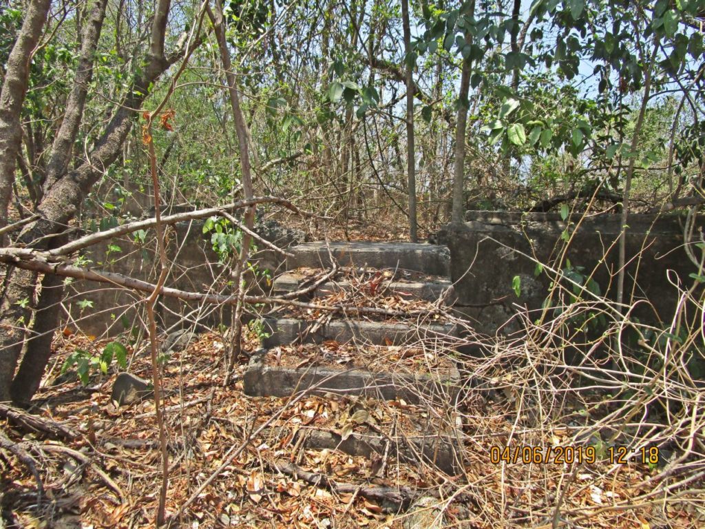
Ze321. One of several pictures of two large structures near the road going to the Kindley Airfield of Fort Mills on Corregidor Island, just before the 2nd last bend in that road. The two buildings are next to each other and seem to have a large garage for a larger vehicle at their east ends. I speculate that these structures must have been part of the Kindley Airfield; I could not find them on any map or drawing. The buildings have steps at the front side, the road side.
Ze322. One of several pictures of two large structures near the road going to the Kindley Airfield of Fort Mills on Corregidor Island, just before the 2nd last bend in that road. The two buildings are next to each other and seem to have a large garage for a larger vehicle at their east ends. I speculate that these structures must have been part of the Kindley Airfield; I could not find them on any map or drawing. Again this is one of the garages on the east side of the two buildings.
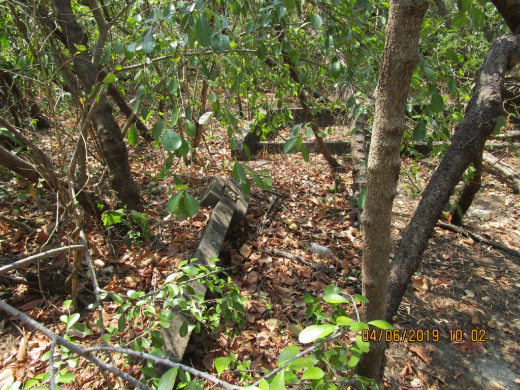
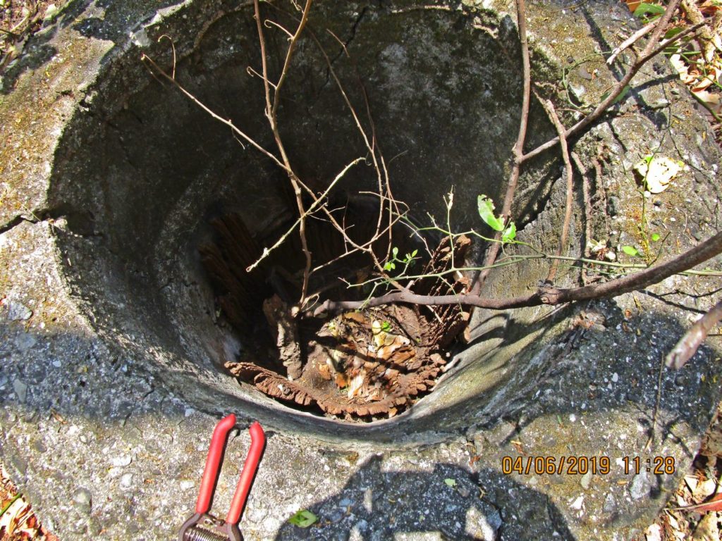
Ze323. This is one of two images of the vent to the Navy Intercept Tunnel. I got the impression that the vent is leaning, more than before
If you want to know more how the Navy Intercept Tunnel helped win the war, may you want to check out this URL, click here:
Ze324. This is one of two images of the vent to the Navy Intercept Tunnel. I got the impression that the vent is leaning, more than before
If you want to know more how the Navy Intercept Tunnel helped win the war, may you want to check out this URL, click here:
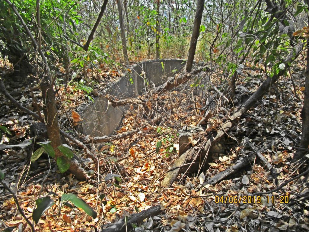
Ze325. This is the west Panama Mount of Battery Levagood.
Ze326. This is another view of the west Panama Mount of Battery Levagood.
Ze327. This is the east Panama Mount of Battery Levagood.
We have a history for Battery Levagood, click here:
Ze328. This is another view of the east Panama Mount of Battery Levagood.
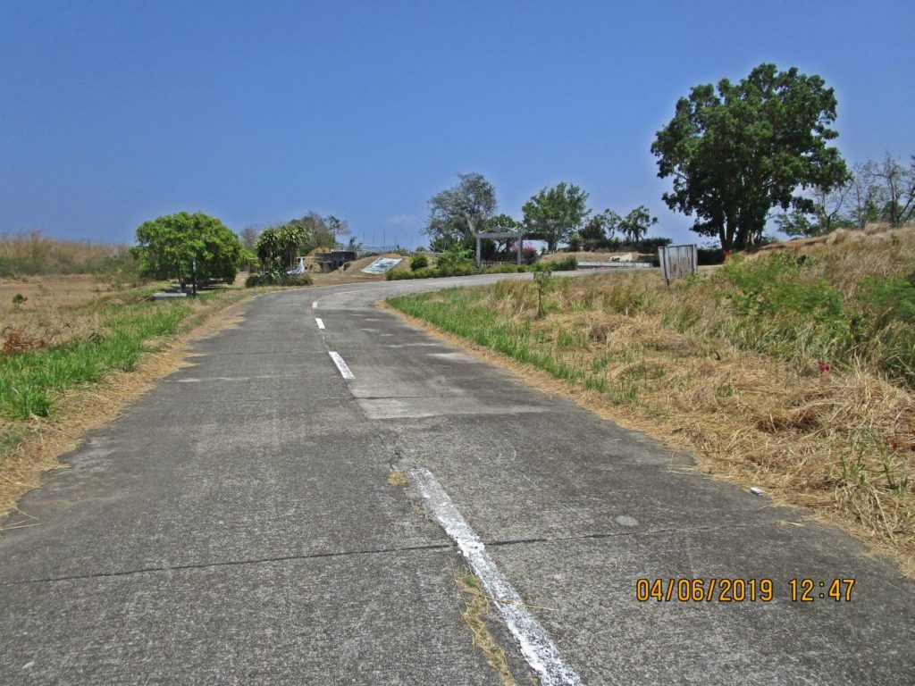
Ze329. This is a Google Earth image with my GPS track for the Corregidor Tailend walk, 2019-April, the 6th; it covers the end of the walk.
Ze330. This is a section of the 1936 Fort Mills Facility drawing for the Corregidor Tailend walk, 2019-April, the 6th; it covers the end of the walk.
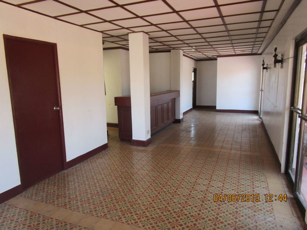
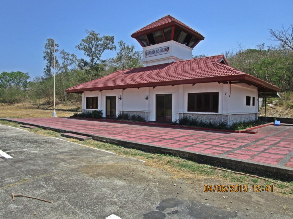
Ze331. This is a inside view of the Kindley Field Control Building (built post WWII) for the air field on Corregidor Island.
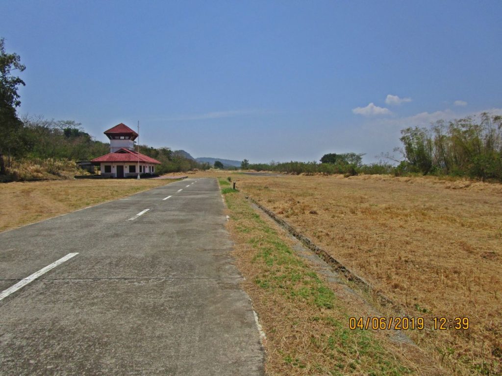
Ze332. We are looking west on the Kindley Field air field; the post WWII Control Building is left; no windsock is displayed on the windsock mast. The grass is cut and is piled up on both sided of the runway.
Ze333. This is the post WWII Control Building on the former Fort Mills on Corregidor Island Kindley Field Airfield. No windsock is displayed on the windsock mast today. The grass is cut now and is piled up on both sided of the runway. A few weeks ago two Australian Pilots with an ultra light plane landed here and the grass was a problem.
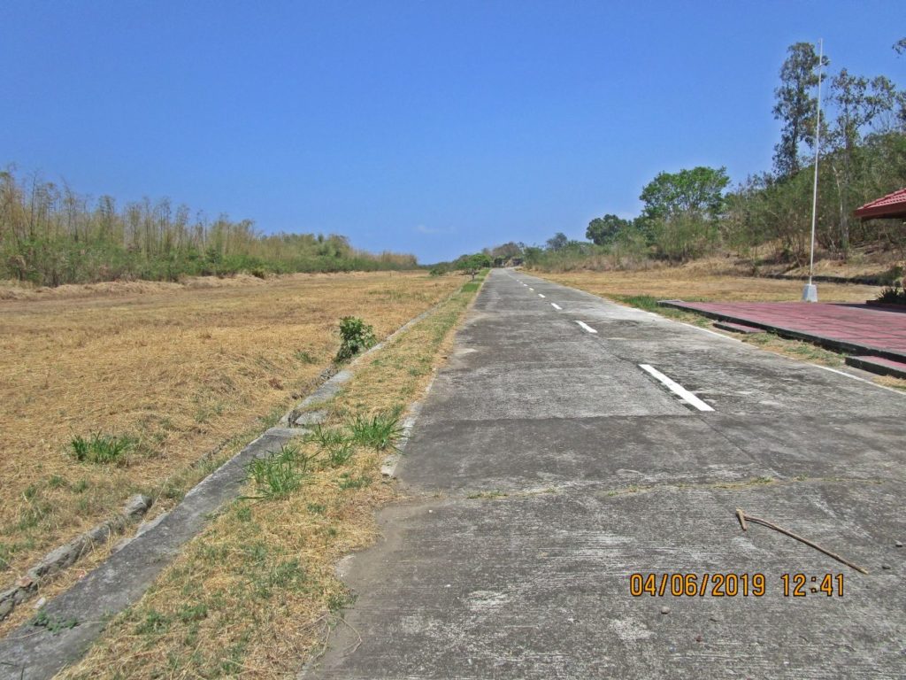
Ze334. We are looking east on the Kindley Field air field on the former Fort Mills on Corregidor Island. No windsock is displayed on the windsock mast today. The grass is cut now and is piled up on both sided of the runway. A few weeks ago two Australian Pilots with an ultra light plane landed here and the grass was a problem.
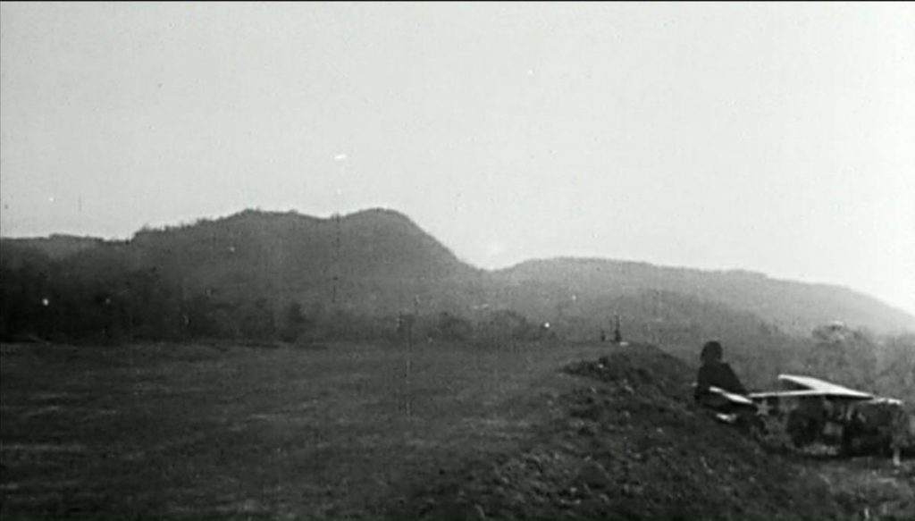
Ze335. One of two post 1942 images of the Kindley Field air field on the former Fort Mills on Corregidor Island; we are looking west and a damaged aircraft is on the right side of the runway. This picture was received from Chad Hill via Tony Feredo; it came from this URL, click here:
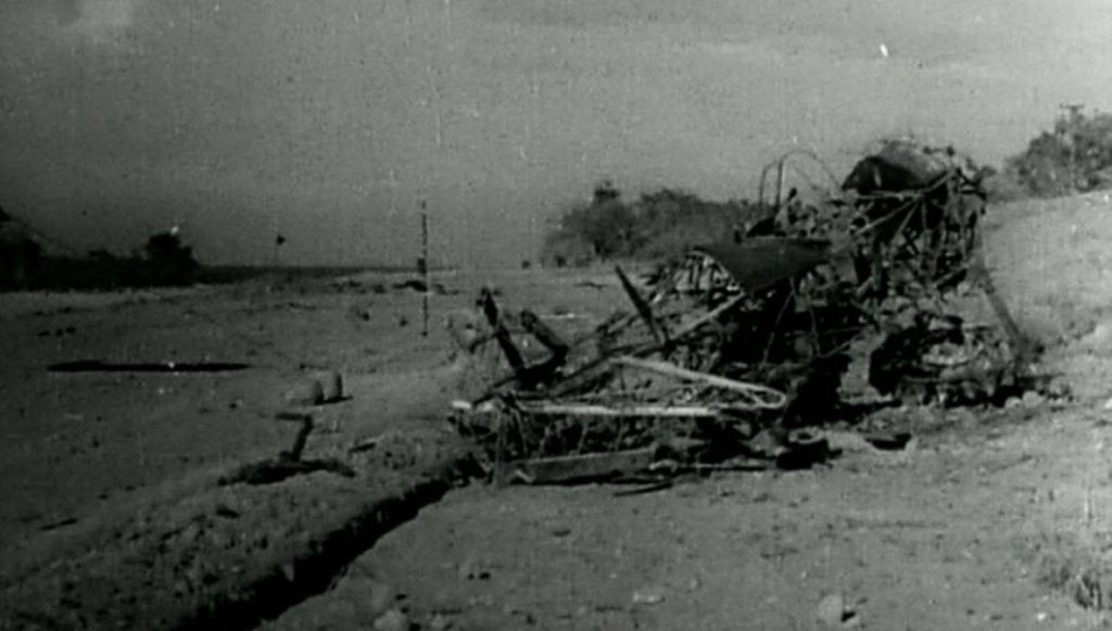
Ze336. One of two post 1942 images of the Kindley Field air field on the former Fort Mills on Corregidor Island; we are looking east, I believe, and a damaged aircraft is on the right side of the runway. This picture was received from Chad Hill via Tony Feredo; it came from this URL, click here:
Ze337. This is the rear view of the Kindley Field Control Building (built post WWII) for the air field on Corregidor Island. We are looking east.
Ze338. This is the rear view of the Kindley Field Control Building (built post WWII) for the air field on Corregidor Island. We are looking west.
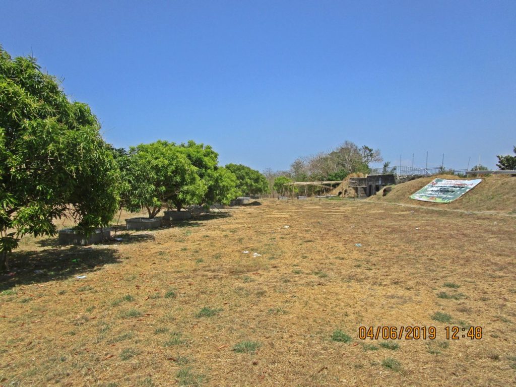
Ze339. We are looking west on the Kindley Field air field; we are standing next to the entrance of the 1917 Fort Mills Defense Position I-M-I. Left we see the Southshore Road entering the airfield. This area is now part of the Jabidah Memorial.
Ze340. We are looking east, standing on the road next to the Kindley Field runway. Left we see the runway run towards east Right we see the Southshore Road entering the airfield. And straight ahead is the Mindanao Garden of Peace occupying the area of the 1917 Fort Mills Defense Positions I-M-I and I-F-I. The Mindanao Garden of Peace is a memorial commemorating the Corregidor Massacre. Our very own EXO wrote a story about it with many links, see this URL:
“THE CORREGIDOR MASSACRE – 1968” by Paul Whitman, click here:
Ze341. The Corregidor Massacre occurred on the 18th of March and maybe for a decade now this terrible event is commemorated at this location. This is the area where it happened; in back is the 1917 Fort Mills Defense Positions I-F-I. I started a forum page of this memorial with many pictures at this URL, click here:
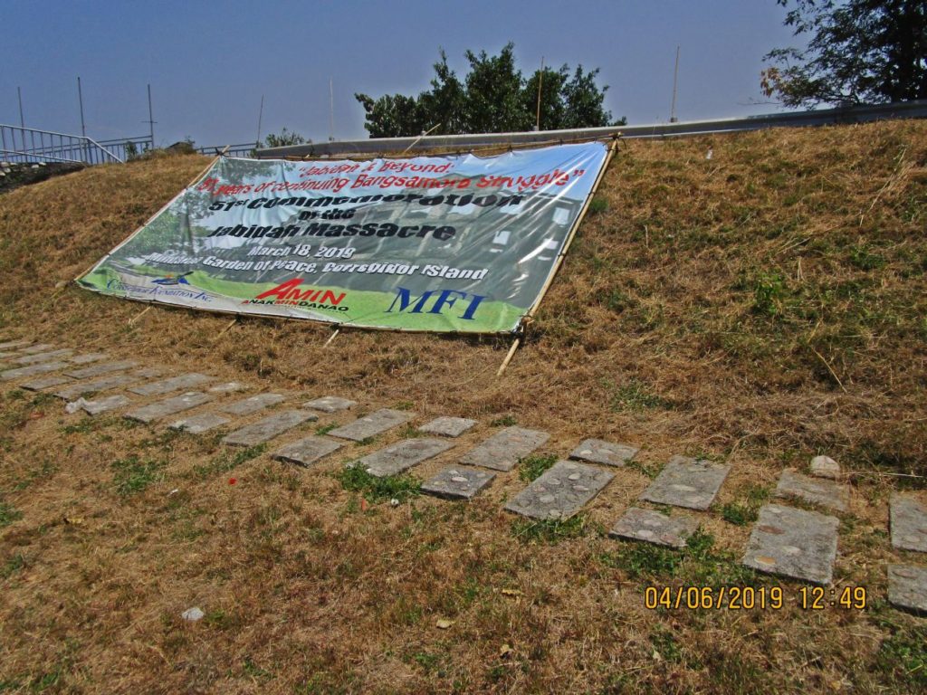
Ze342. The Corregidor Massacre occurred on the 18th of March and maybe for a decade now this terrible event is commemorated at this location. Here is the evidence that the commemoration occurred again this year on the 18th of March.
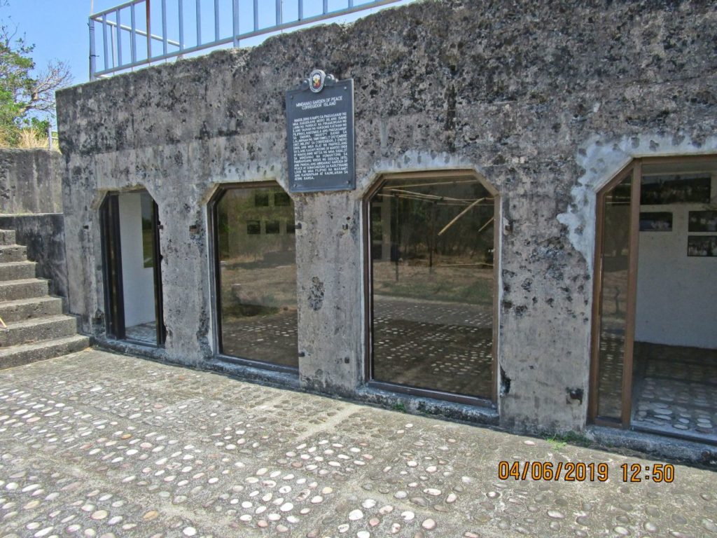
Ze343. The 1917 Fort Mills Defense Positions I-F-I has been modified for the Corregidor Massacre Jabidah Memorial and pictures are displayed.
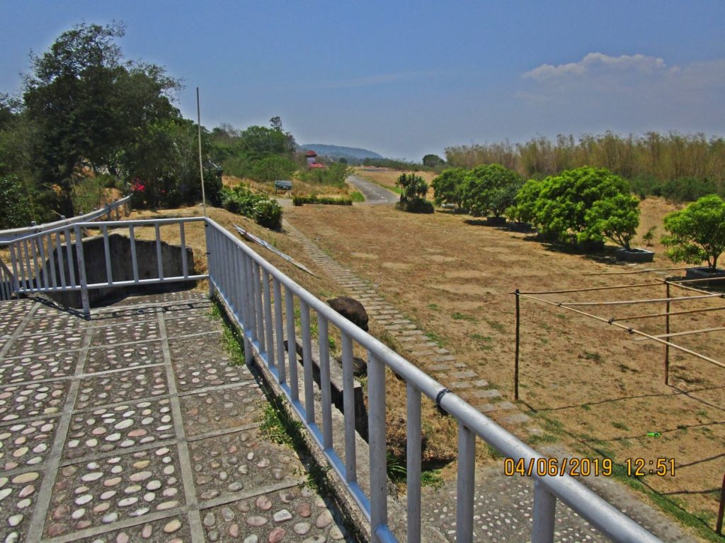
Ze344. We are standing on top of the 1917 Fort Mills Defense Positions I-F-I on Corregidor and are looking west over the Kindley Field.
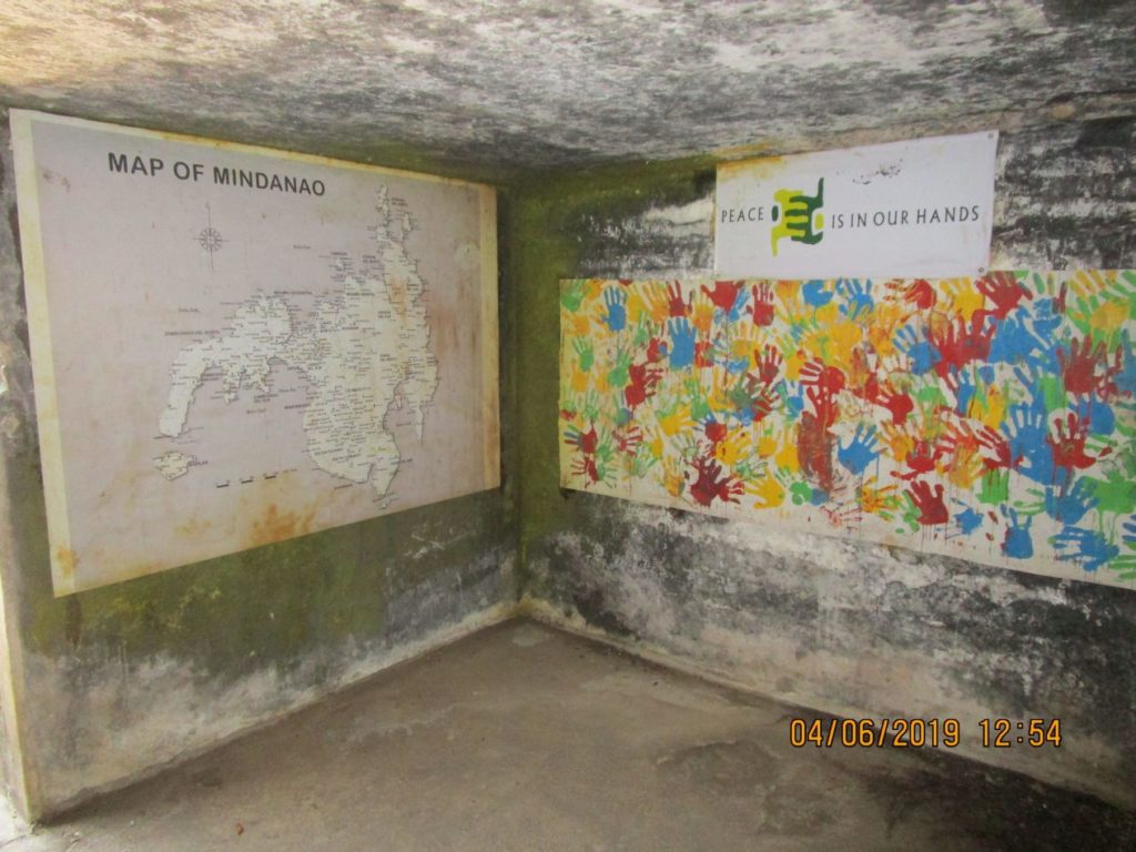
Ze345. Inside the bunker of the 1917 Fort Mills Defense Positions I-M-I on Corregidor images to commemorate the Corregidor Massacre Jabidah. It is part of the Mindanao Garden of Peace commemorating the Corregidor Massacre.