–
Zd073. Moving west along the Nimitz Beach area, the first pillbox is in sight. One of 12 images of the Nimitz Beach in the former Naval Air Station Barbers Point, from the entrance, moving west, up to the first WWII Beach Defense Pillbox. One or more images are of the new solar panel field across the Coral Sea Road from the beach entrance. The beach is closed because of the Red China Virus but surfing and walking is ok! I saw fishermen, anglers, not sure about their status.
————————————————
Walked it again, lost pictures from my 2019 walk. Walked from Kapolei to the Coast Guard Station and back the former main gate of the Barbers Point Naval Air Station.
If you are going to watch this on Photobucket, they are drowning you with advertisements. Try to click slideshow right away. Then another option might be to click full screen, then stop and look at the pictures one by one. But you won’t see the image description.
If you like to read the image description, double click the first image and then advance image by image.
Uploaded to Photobucket, Hawaii, Hawaii albums #2; click here
—————————————————
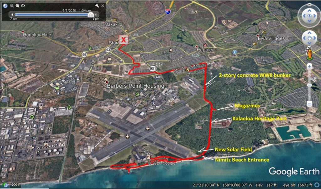
Zd066. My GE GPS track with notes along the Coral Sea Road. One of 35 images of my walk on Coral Sea Road, from the Roosevelt Ave. to the entrance of Nimitz Beach on the former Naval Air Station Barbers Point. In these 35 images, I shot a 2 story WWII above ground bunker, unused side streets, three ex Ammo Bunkers, views of the airfield, views of the east scrubby side of the Coral Sea Road and an area called Kalaeloa Heritage. Across the entrance to Nimitz Beach, a large solar panel field was installed this year.
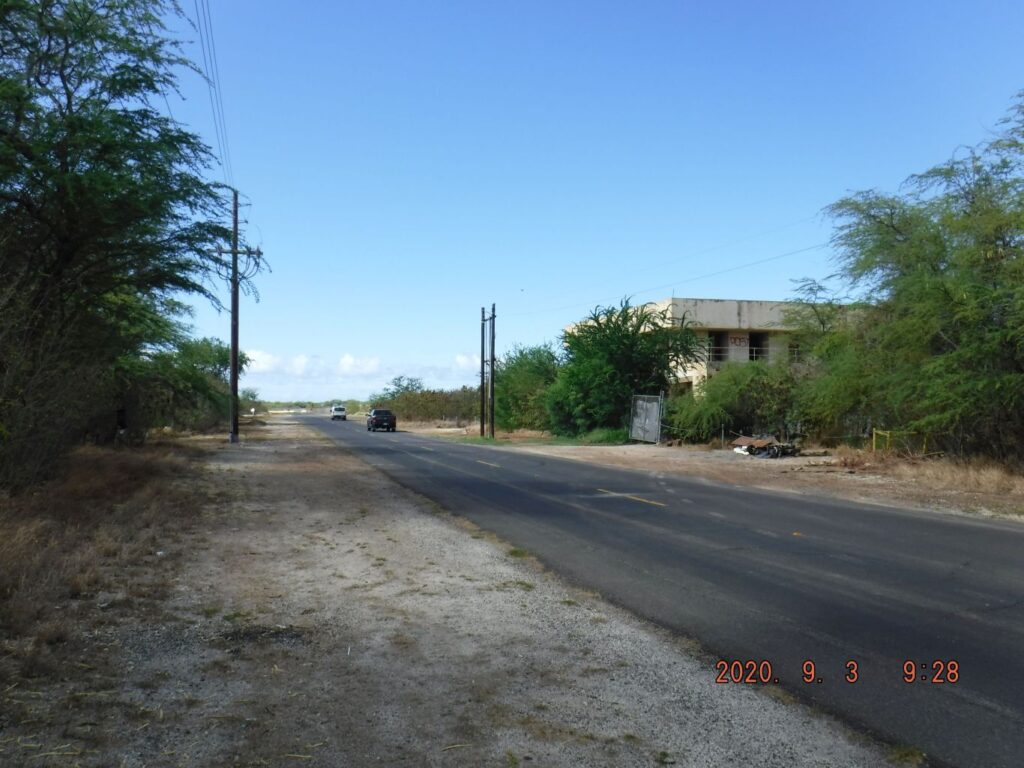
Zd067. The 2-story concrete WWII above ground bunker along the Coral Sea Road. One of 35 images of my walk on Coral Sea Road, from the Roosevelt Ave. to the entrance of Nimitz Beach on the former Naval Air Station Barbers Point. In these 35 images, I shot a 2 story WWII above ground bunker, unused side streets, three ex Ammo Bunkers, views of the airfield, views of the east scrubby side of the Coral Sea Road and an area called Kalaeloa Heritage. Across the entrance to Nimitz Beach, a large solar panel field was installed this year.
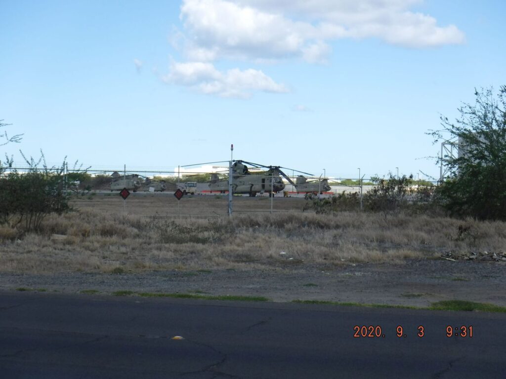
Zd068. View of the airfield along the Coral Sea Road, perhaps this is the National Guard. One of 35 images of my walk on Coral Sea Road, from the Roosevelt Ave. to the entrance of Nimitz Beach on the former Naval Air Station Barbers Point. In these 35 images, I shot a 2 story WWII above ground bunker, unused side streets, three ex Ammo Bunkers, views of the airfield, views of the east scrubby side of the Coral Sea Road and an area called Kalaeloa Heritage. Across the entrance to Nimitz Beach, a large solar panel field was installed this year.
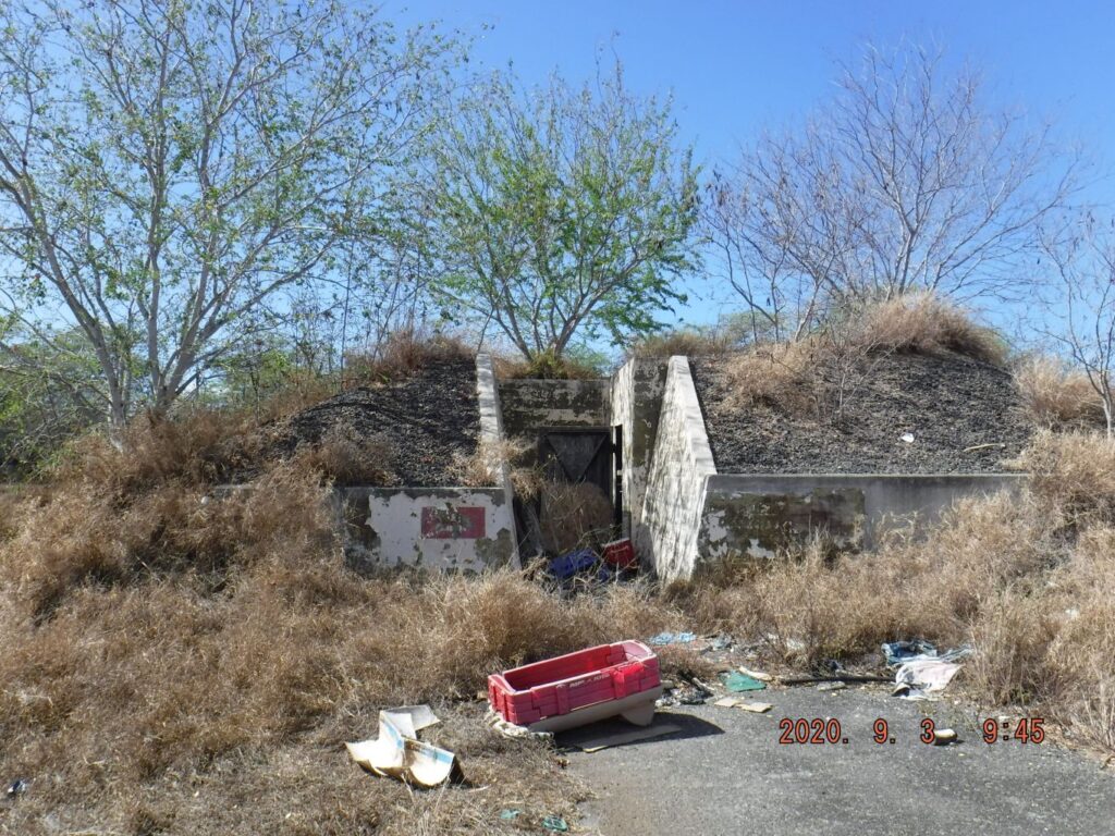
Zd069. One of three Ammo Bunkers along the Coral Sea Road, I suspect there are more and sadly a lot of trash has been dumped in many places. One of 35 images of my walk on Coral Sea Road, from the Roosevelt Ave. to the entrance of Nimitz Beach on the former Naval Air Station Barbers Point. In these 35 images, I shot a 2 story WWII above ground bunker, unused side streets, three ex Ammo Bunkers, views of the airfield, views of the east scrubby side of the Coral Sea Road and an area called Kalaeloa Heritage. Across the entrance to Nimitz Beach, a large solar panel field was installed this year.
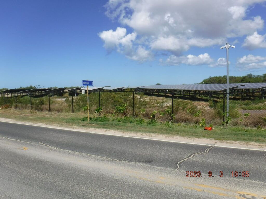
Zd070. The large solar panel field, inside the airfield fence and across the street to the entrance to the Nimitz Beach, installed this year. One of 35 images of my walk on Coral Sea Road, from the Roosevelt Ave. to the entrance of Nimitz Beach on the former Naval Air Station Barbers Point. In these 35 images, I shot a 2 story WWII above ground bunker, unused side streets, three ex Ammo Bunkers, views of the airfield, views of the east scrubby side of the Coral Sea Road and an area called Kalaeloa Heritage. Across the entrance to Nimitz Beach, a large solar panel field was installed this year.
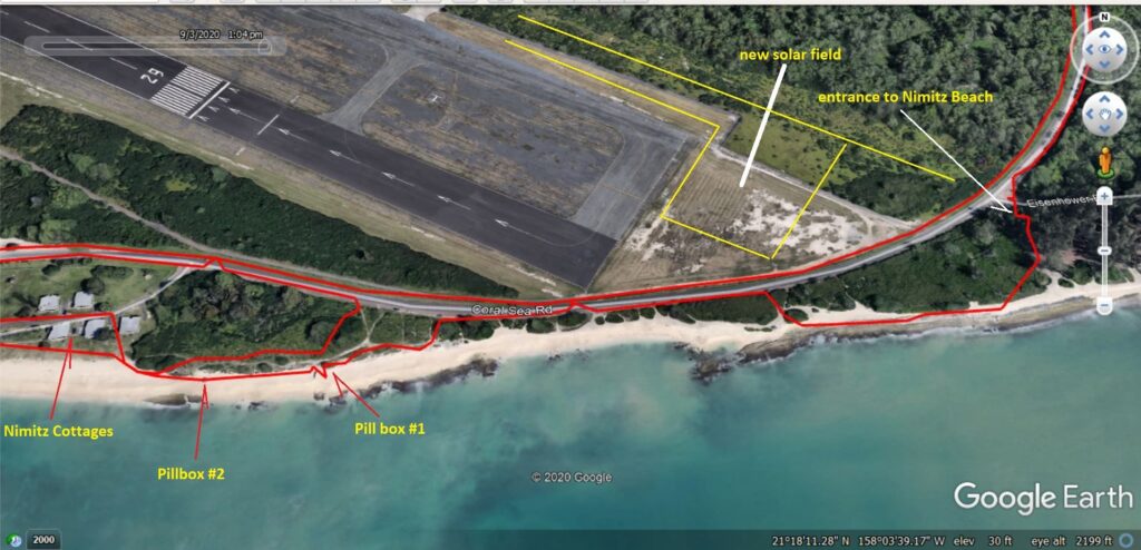
Zd071. A GE image of the Nimitz Beach area. One of 12 images of the Nimitz Beach in the former Naval Air Station Barbers Point, from the entrance, moving west, up to the first WWII Beach Defense Pillbox. One or more images are of the new solar panel field across the Coral Sea Road from the beach entrance. The beach is closed because of the Red China Virus but surfing and walking is ok! I saw fishermen, anglers, not sure about their status.
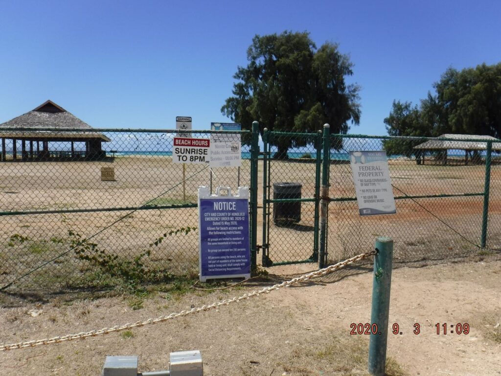
Zd072. The entrance to the Nimitz Beach area. One of 12 images of the Nimitz Beach in the former Naval Air Station Barbers Point, from the entrance, moving west, up to the first WWII Beach Defense Pillbox. One or more images are of the new solar panel field across the Coral Sea Road from the beach entrance. The beach is closed because of the Red China Virus but surfing and walking is ok! I saw fishermen, anglers, not sure about their status.
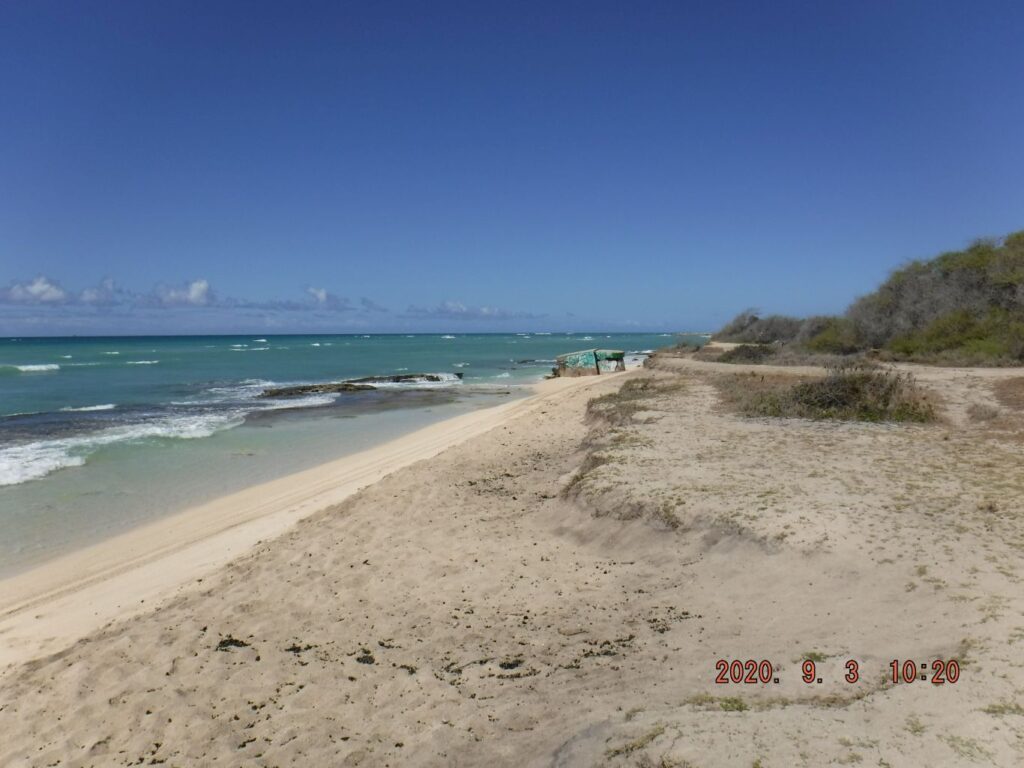
Zd073. Moving west along the Nimitz Beach area, the first pillbox is in sight. One of 12 images of the Nimitz Beach in the former Naval Air Station Barbers Point, from the entrance, moving west, up to the first WWII Beach Defense Pillbox. One or more images are of the new solar panel field across the Coral Sea Road from the beach entrance. The beach is closed because of the Red China Virus but surfing and walking is ok! I saw fishermen, anglers, not sure about their status.
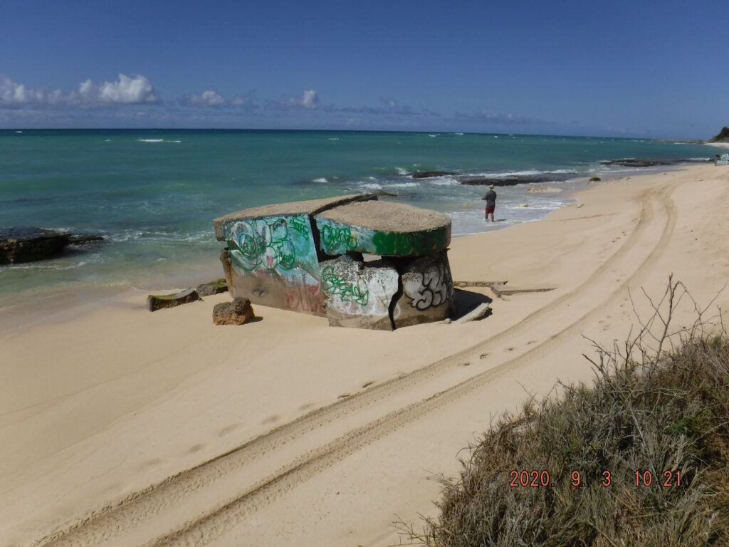
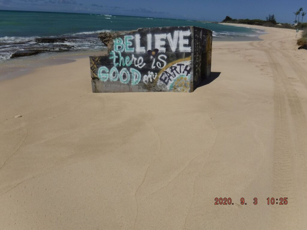
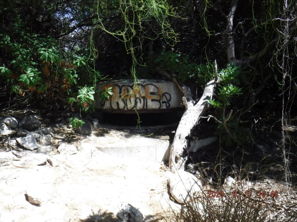
Zd074. One of 7 pictures of the first Beach Defense Pillbox, on Nimitz Beach at the former Naval Air Station Barbers Point. I saw 6 pillboxes and for this album, I numbered them #1 to #6, moving westward.
Zd075. One of 5 pictures of the Second Beach Defense Pillbox (#2), on Nimitz Beach at the former Naval Air Station Barbers Point. I saw 6 pillboxes and for this album, I numbered them #1 to #6, moving westward.
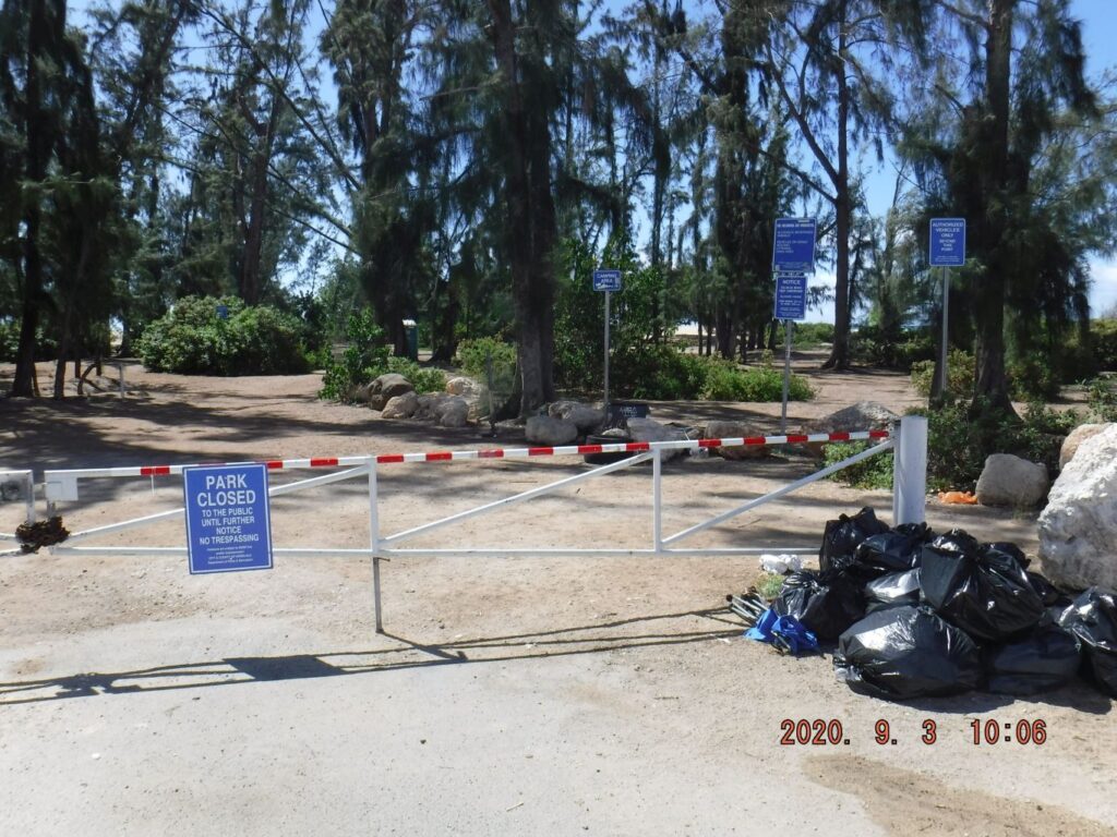
Zd076. GE map. One of 17 images of the Nimitz Beach Park at the former Naval Air Station Barbers Point. The park is secured and is fenced and all the gates were locked because of the Red China Virus. The cottages still could be rented but a key has to be issued for the gate. The park includes large picknick shades and the beach has a breakwater.
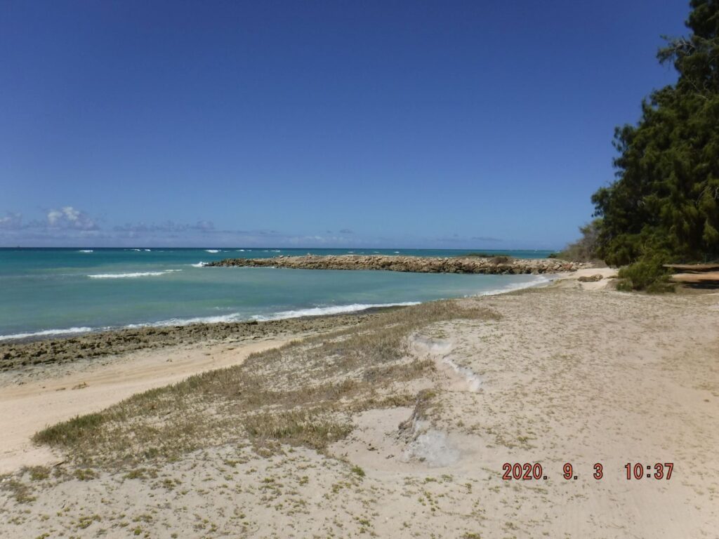
Zd077. The breakwater. One of 17 images of the Nimitz Beach Park at the former Naval Air Station Barbers Point. The park is secured and is fenced and all the gates were locked because of the Red China Virus. The cottages still could be rented but a key has to be issued for the gate. The park includes large picknick shades and the beach has a breakwater.
Zd078. One of 4 pictures of the Third Beach Defense Pillbox (#3) at the foot of the breakwater, on Nimitz Beach at the former Naval Air Station Barbers Point. I saw 6 pillboxes and for this album, I numbered them #1 to #6, moving westward.
Zd079. GE map. One of 2 pictures of the Fourth Beach Defense Pillbox (#4) near the foot and west of the breakwater, on Nimitz Beach at the former Naval Air Station Barbers Point. I saw 6 pillboxes and for this album, I numbered them #1 to #6, moving westward.
Zd080. One of 2 pictures of the Fourth Beach Defense Pillbox (#4) near the foot and west of the breakwater, on Nimitz Beach at the former Naval Air Station Barbers Point. I saw 6 pillboxes and for this album, I numbered them #1 to #6, moving westward.

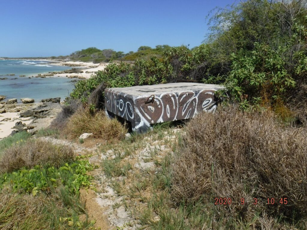
Zd081. One of 5 pictures of the Fifth Beach Defense Pillbox (#5), on Nimitz Beach at the former Naval Air Station Barbers Point. I saw 6 pillboxes and for this album, I numbered them #1 to #6, moving westward.
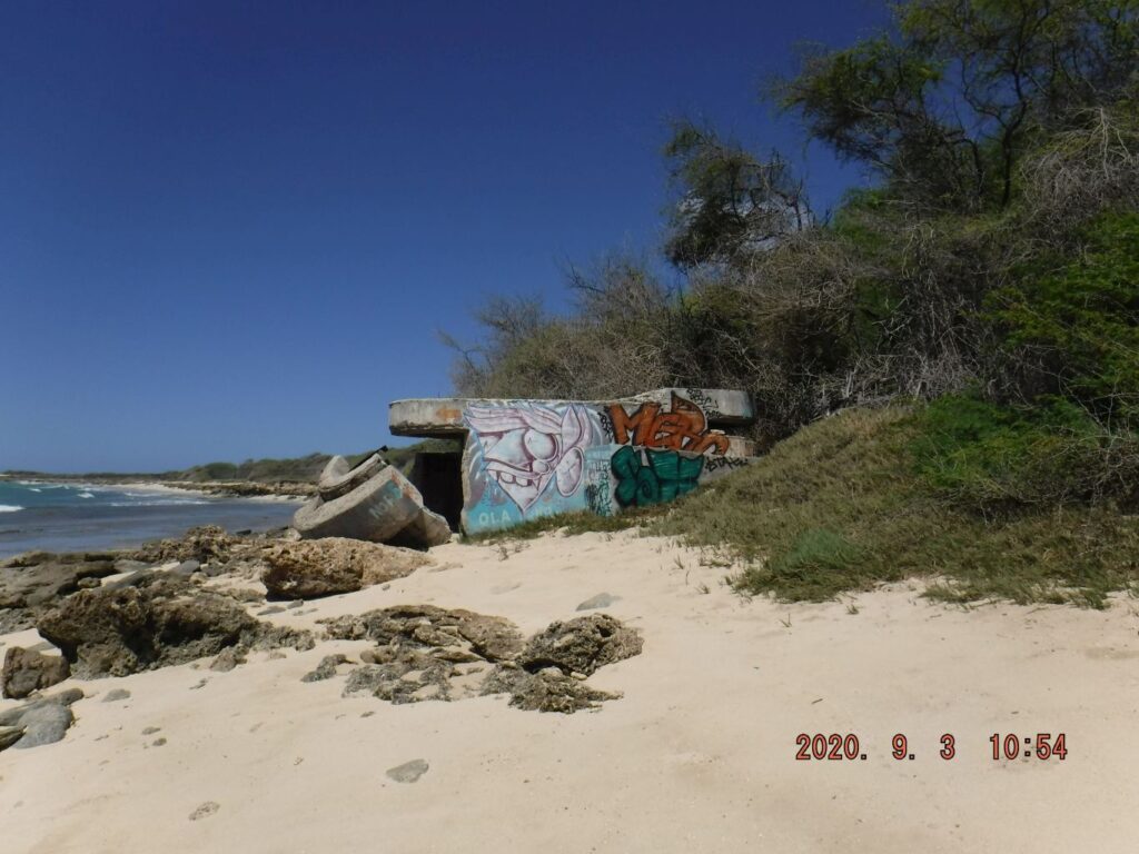
Zd082. One of 7 pictures of the Sixth Beach Defense Pillbox (#6), on Nimitz Beach at the former Naval Air Station Barbers Point. I saw 6 pillboxes and for this album, I numbered them #1 to #6, moving westward.

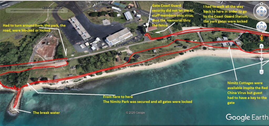
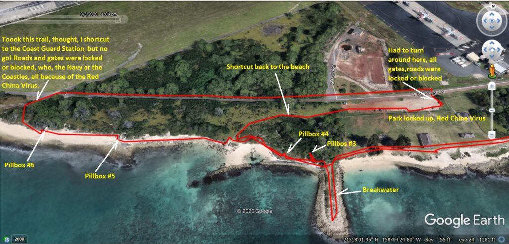
Zd083. One of 13 images from my effort to take a different trail and go to the U.S. Coast Guard Station in Barbers Point to take pictures of a memorial there. But the Government outsmarted me, the road and the park gates were locked and I had to double back.
Zd084. One of 13 images from my effort to take a different trail and go to the U.S. Coast Guard Station in Barbers Point to take pictures of a memorial there. But the Government outsmarted me, the road and the park gates were locked and I had to double back.
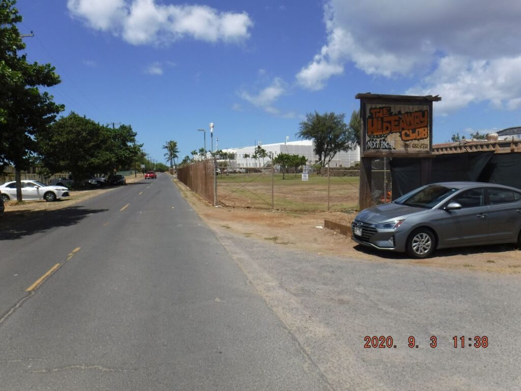
Zd085. One of 4 images, back on the road and moving to the entrance of the U.S. Coast Guard Station. I wanted to enter and take pictures of a memorial there, just inside the gate and a picture of the Hideaway Club. But the Red China Virus screwed it up again, I was not welcome, the gate is open only for staff members and official busines.

Zd086. The Coast Guard memorial, shot thru the fence. One of 4 images, back on the road and moving to the entrance of the U.S. Coast Guard Station. I wanted to enter and take pictures of a memorial there, just inside the gate and a picture of the Hideaway Club. But the Red China Virus screwed it up again, I was not welcome, the gate is open only for staff members and official busines.
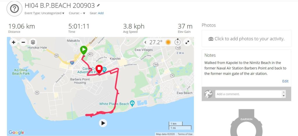
Zd087. My Garmin device GPS track. One of three pictures of my GPS track and data of my walk from Kapolei to the Coast Guard Station and back the former main gate of the Barbers Point Naval Air Station.
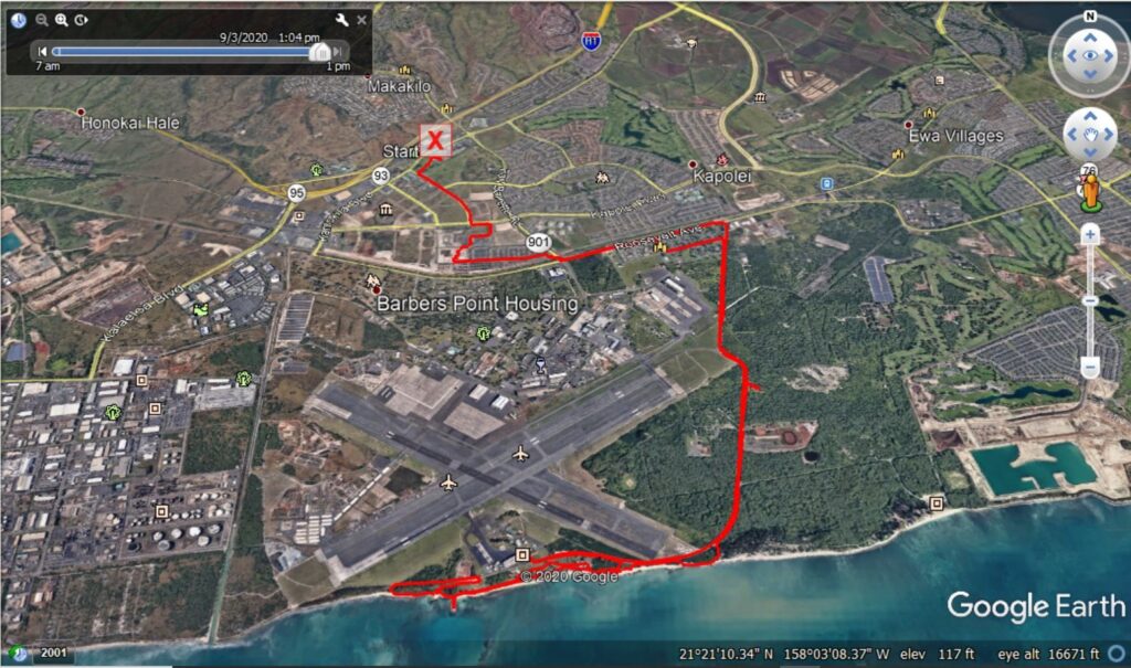
Zd088. My Google Earth GPS track. One of three pictures of my GPS track and data of my walk from Kapolei to the Coast Guard Station and back the former main gate of the Barbers Point Naval Air Station.
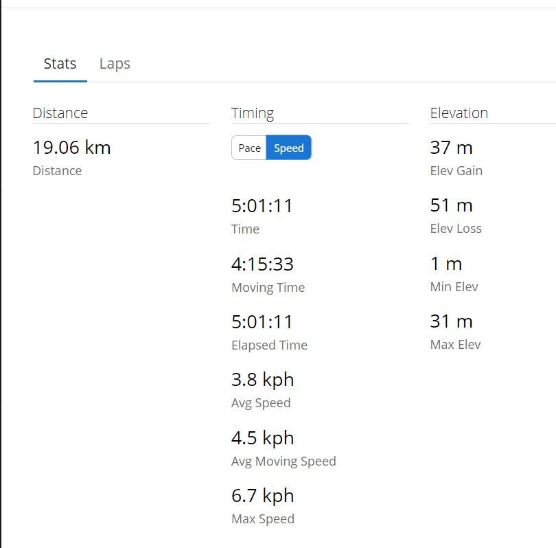
Zd089. My Garmin device walking data. One of three pictures of my GPS track and data of my walk from Kapolei to the Coast Guard Station and back the former main gate of the Barbers Point Naval Ai