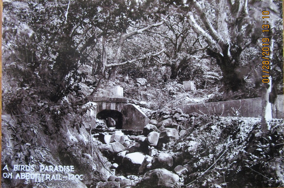
Ze049.-01a (unmarked) a pre WWII image of the Abbott Trail provided by the CDSG members, Glen Williford and Karl Schmidt.
————————————————–
A good friend from the Coastal Defense Study Group (cdsg.org), Glen Williford brought two pre WWII pictures about the Abbott Trail in Ft. Mills on Corregidor Island. So we made it project to find it.
——————————————–
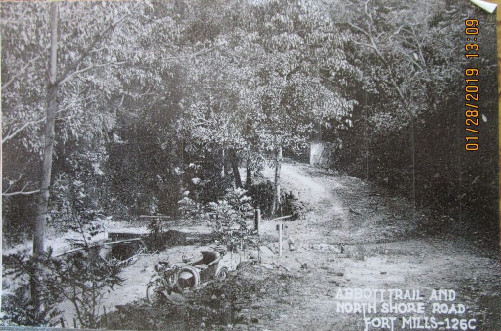
Ze050.-01c (unmarked) a pre WWII image of the Abbott Trail provided by the CDSG members, Glen Williford and Karl Schmidt.
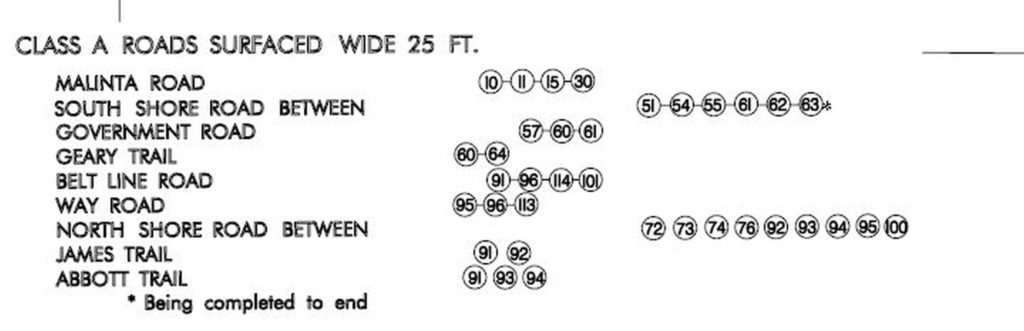
Ze051.-01 our first reaction was: Never Heard of It, but it exists. This is a copy of the list of Class A Roads Surfaced Wide 25 Feet on the Ft. Mills 1936 Facility Drawing; intersections 91, 93, 94 are part of it.
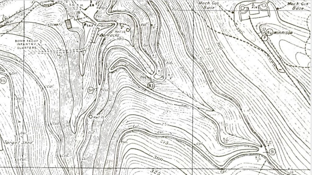
Ze052-02 a section of the Ft. Mills (Corregidor Island) 1936 Facility Drawing showing the Abbott Trail road between intersections 91 to 94 via 93. EXO and I walked this road, trail about 10 years ago and I remember the walk distinctly because we surprised 2 men sawing a good size tree and they run when they noticed us. It was also a difficult walk because the trail was grown over bad at many places and note; we did not see anything noteworthy on that trail. Re the sawing of the tree, we were told, it was to repair a structure.
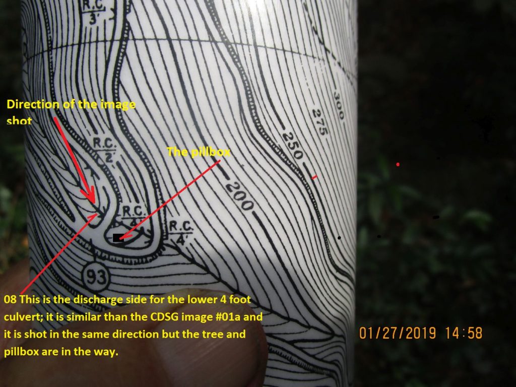
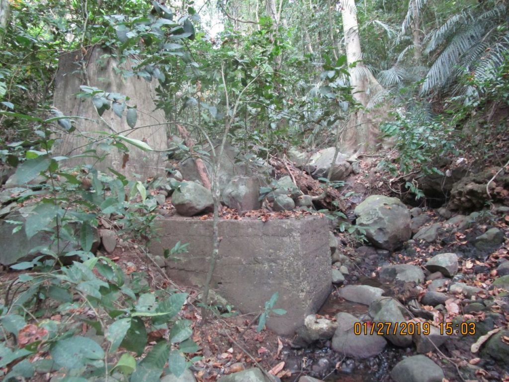
Ze053.-08 Map, this is the discharge side for the lower 4 foot culvert; it is similar than the CDSG image #01a and it is shot in the same direction but the tree and pillbox are in the way.
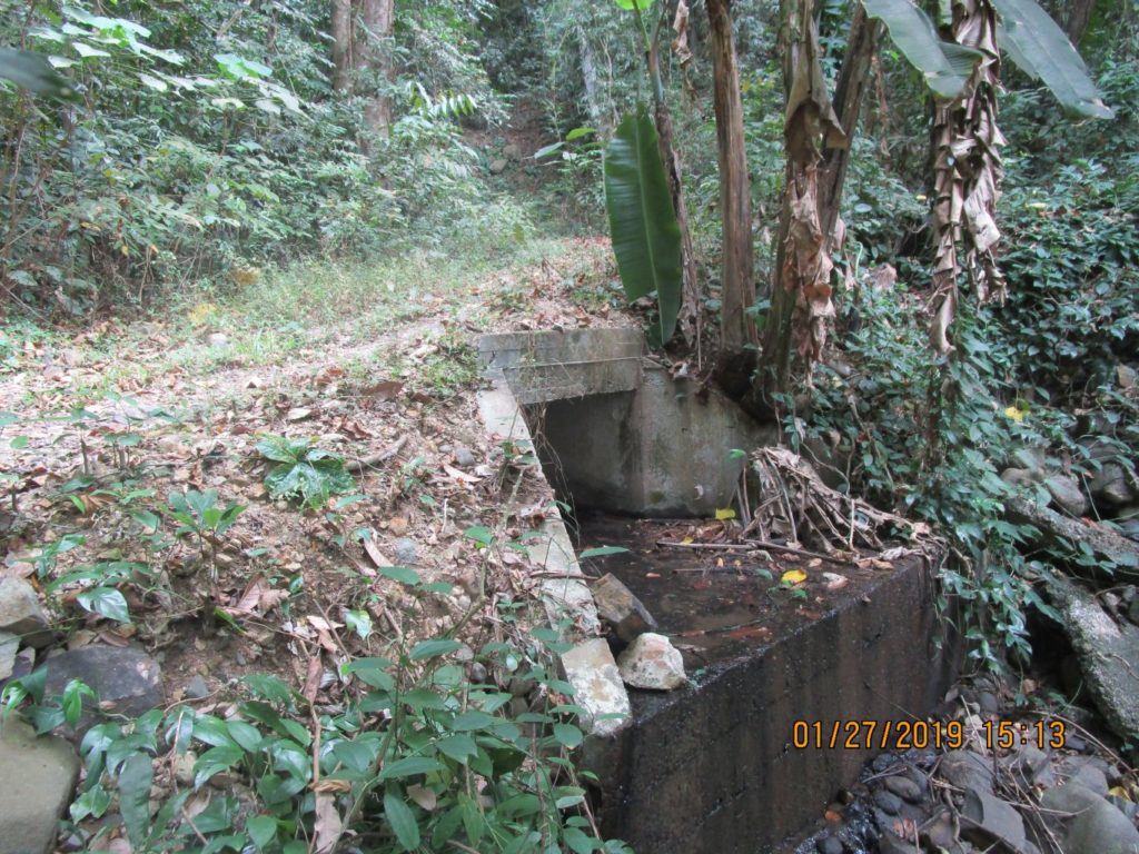
Ze054.-09 this is the discharge side for the lower 4 foot culvert; it is similar than the CDSG image #01a and it is shot in the same direction but the tree and pillbox are in the way.
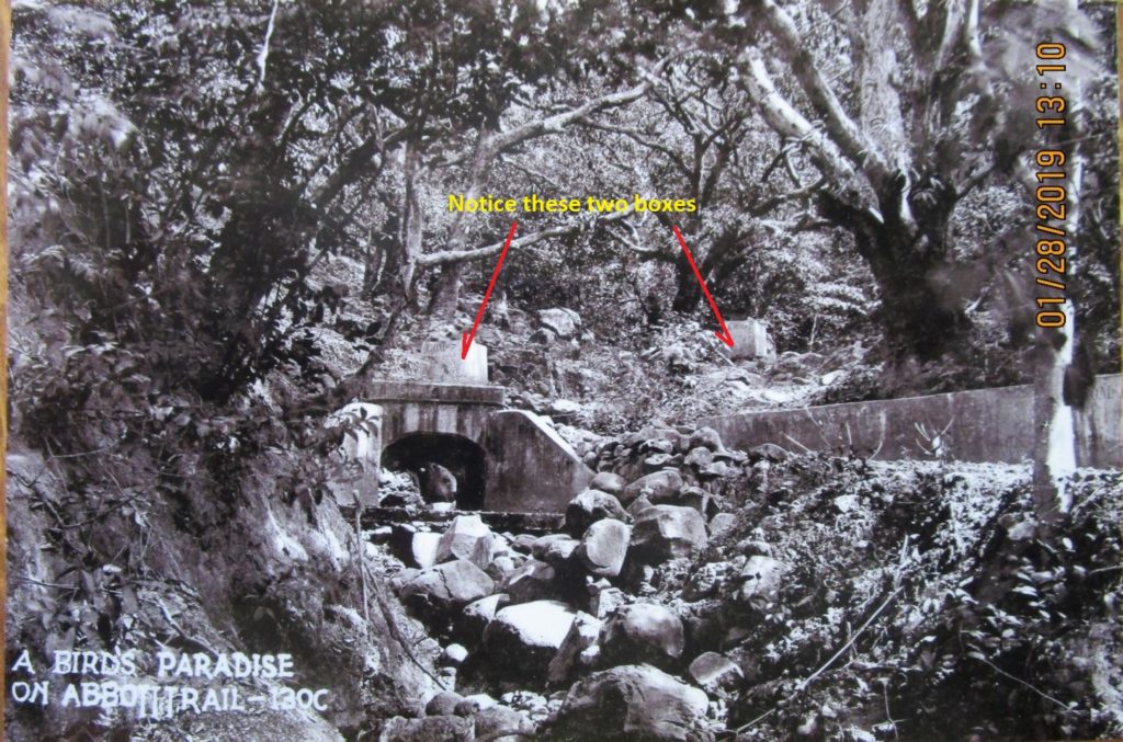
Ze055.-01a (marked) a pre WWII image of the Abbott Trail provided by the CDSG members, Glen Williford and Karl Schmidt. Notice the two boxes which are marked in this image.
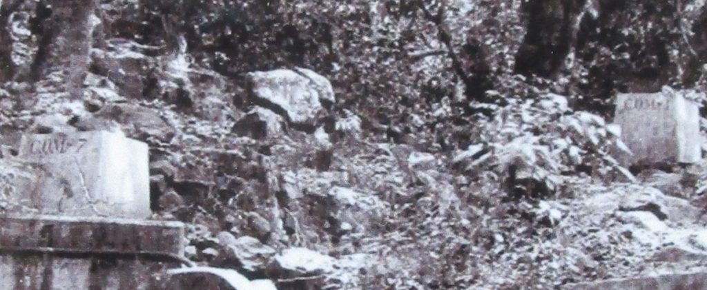
Ze056.-01b the CDSG image 01a (marked) of the Abbott Trail zoomed in, notice the writing.
Ze057.-04 shows the creek upstream from the first, upstream 4 foot culvert.
[IMG]https://philippine-sailor.net/wp-content/uploads/2019/03/Ze058.jpg[/IMG]
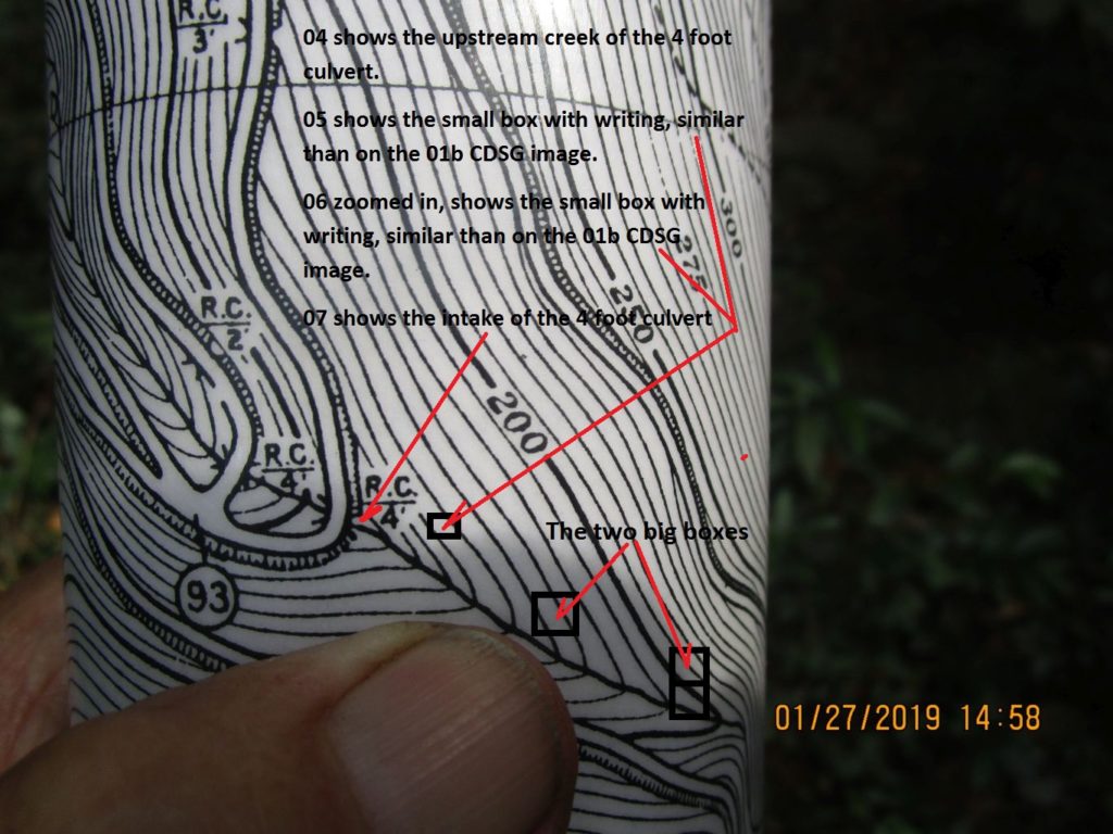
Ze058.-03 a section of the drawing, marked with the images upstream of the first culvert.
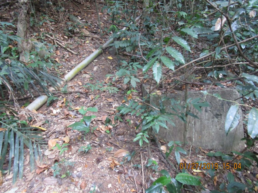
Ze059.-06 this is a 27th Jan 2019 image of the closest box to the road. Notice the present water pipe from James Ravine running up next to it.
Ze060.-06 this is a 27th Jan 2019 image of the closest box to the road. What where they for, communications?
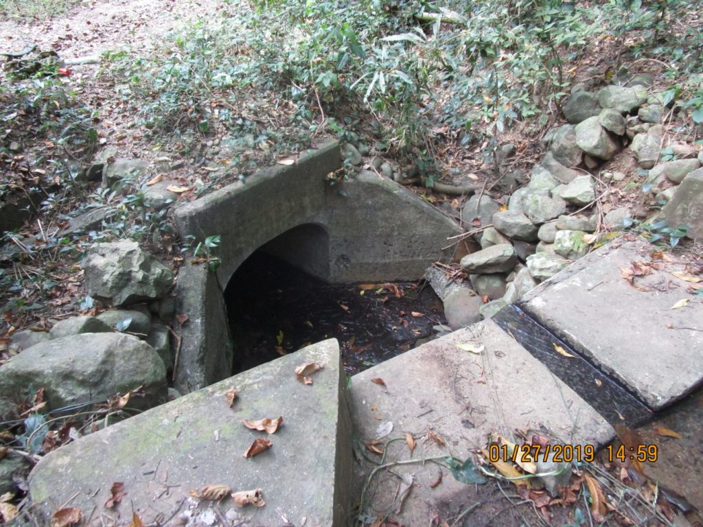
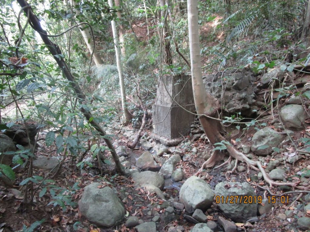
Ze061.-07 shows the intake side of the first upstream culvert, this side stream to the James Ravine runs under the James Ravine Road twice next to that pillbox we are all familiar with.
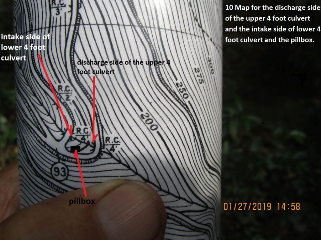
Ze063.-10 Ft Mills drawing of the culverts under the James Trail/Road near the Abbott Trail intersection 93.
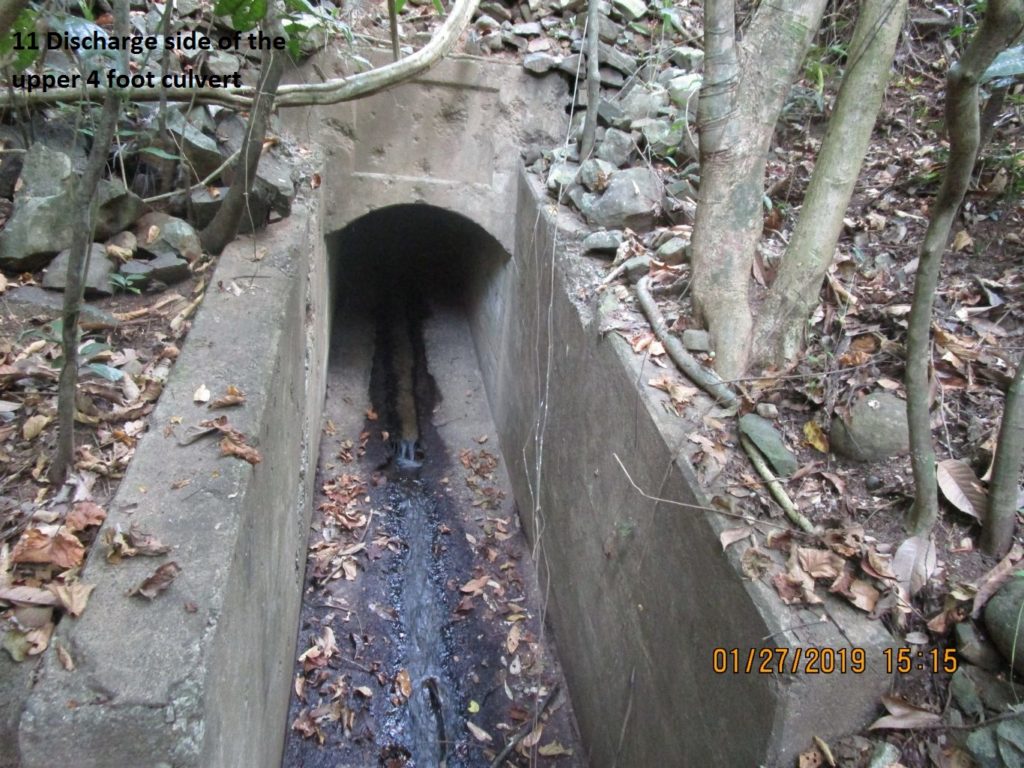
Ze064.-11 Discharge side of the upper 4 foot culvert under the James Trail/Road near the Abbott Trail intersection 93.
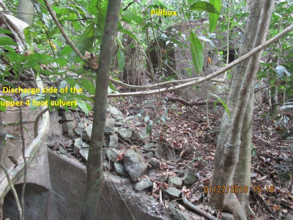
Ze065.-12 image of the discharge side of the upper 4 foot culvert under the James Trail/Road near the Abbott Trail intersection 93. For your orientation the pillbox is shown.
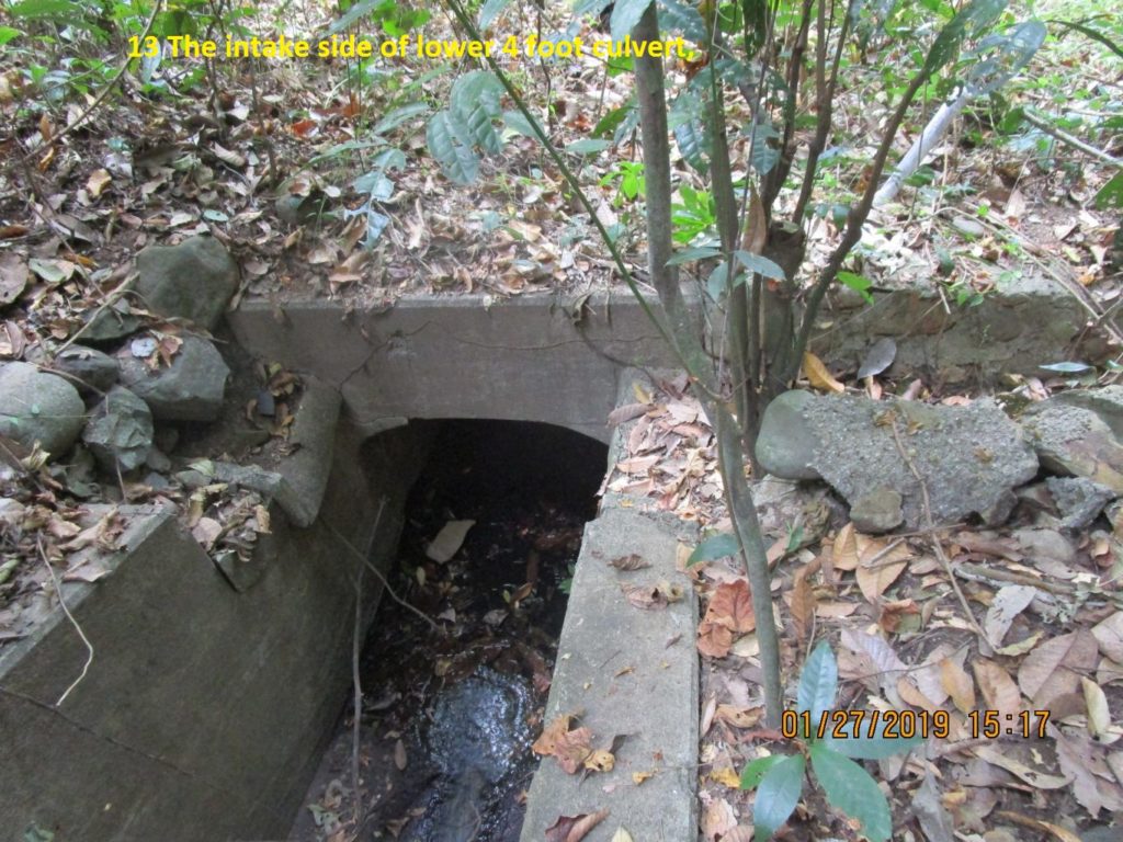
Ze066.-13 the intake side of lower 4 foot culvert under the James Trail/Road near the Abbott Trail intersection 93.
———————————
The three (3) concrete blocks/boxes upstream.
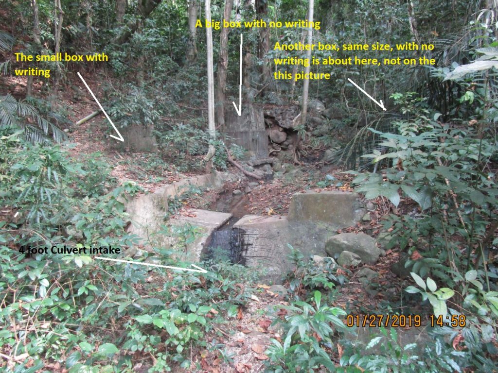
At the sharp curve of the James Ravine Trail/Road, upstream of the first 4 foot culvert are 3 concrete blocks. We don’t know what purpose they served. This is by Road Junction 93 of the Abbott Trail/Road and near the pillbox most of us are familiar with.
Ze058.-03 a section of the drawing, marked with the images upstream of the first culvert.
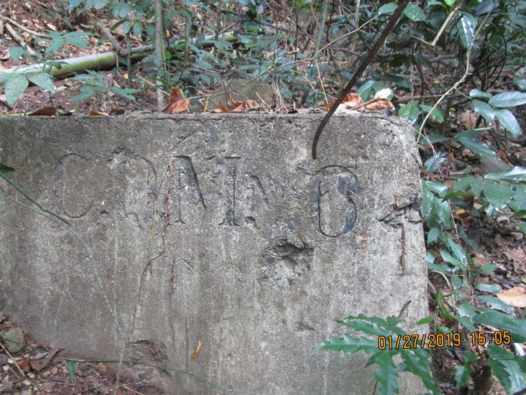
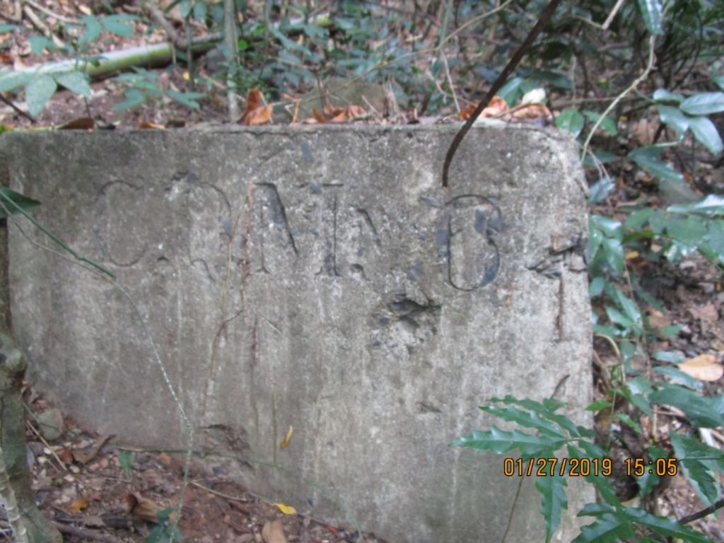
Ze067. This is a 27th Jan 2019 image of the closest box to the road. What where they for, communications? The writing seems to be the same as on the prewar picture, posted earlier in this thread.
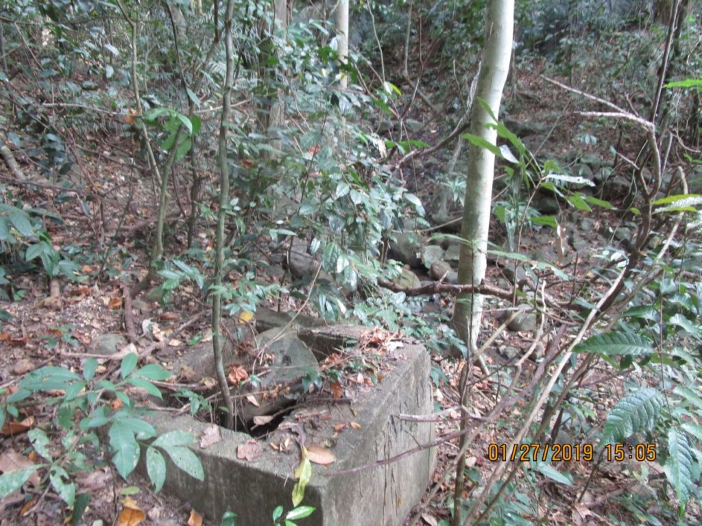
Ze068. This is a 27th Jan 2019 image of the closest box to the road from a above position. This is in the smaller, east creek/ravine contributing into the James Ravine.This is by Road Junction 93 of the Abbott Trail/Road and near the pillbox most of us are familiar with.
Ze069. This is the 2nd concrete structure in the smaller, east creek/ravine contributing into the James Ravine. This is by Road Junction 93 of the Abbott Trail/Road and near the pillbox most of us are familiar with.
Ze070. This is the 3rd concrete structure in the smaller, east creek/ravine contributing into the James Ravine. This is by Road Junction 93 of the Abbott Trail/Road and near the pillbox most of us are familiar with. I never noticed them before; what were they for?