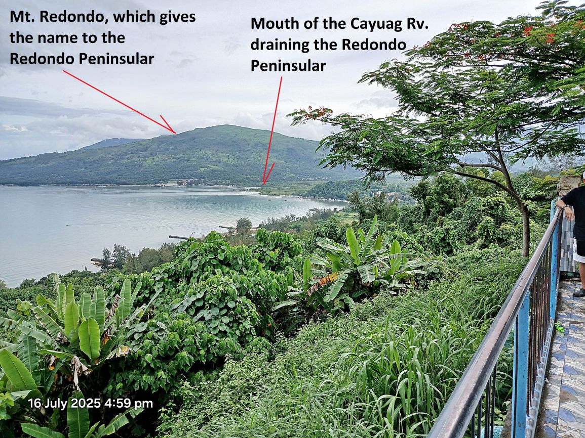
#P14.
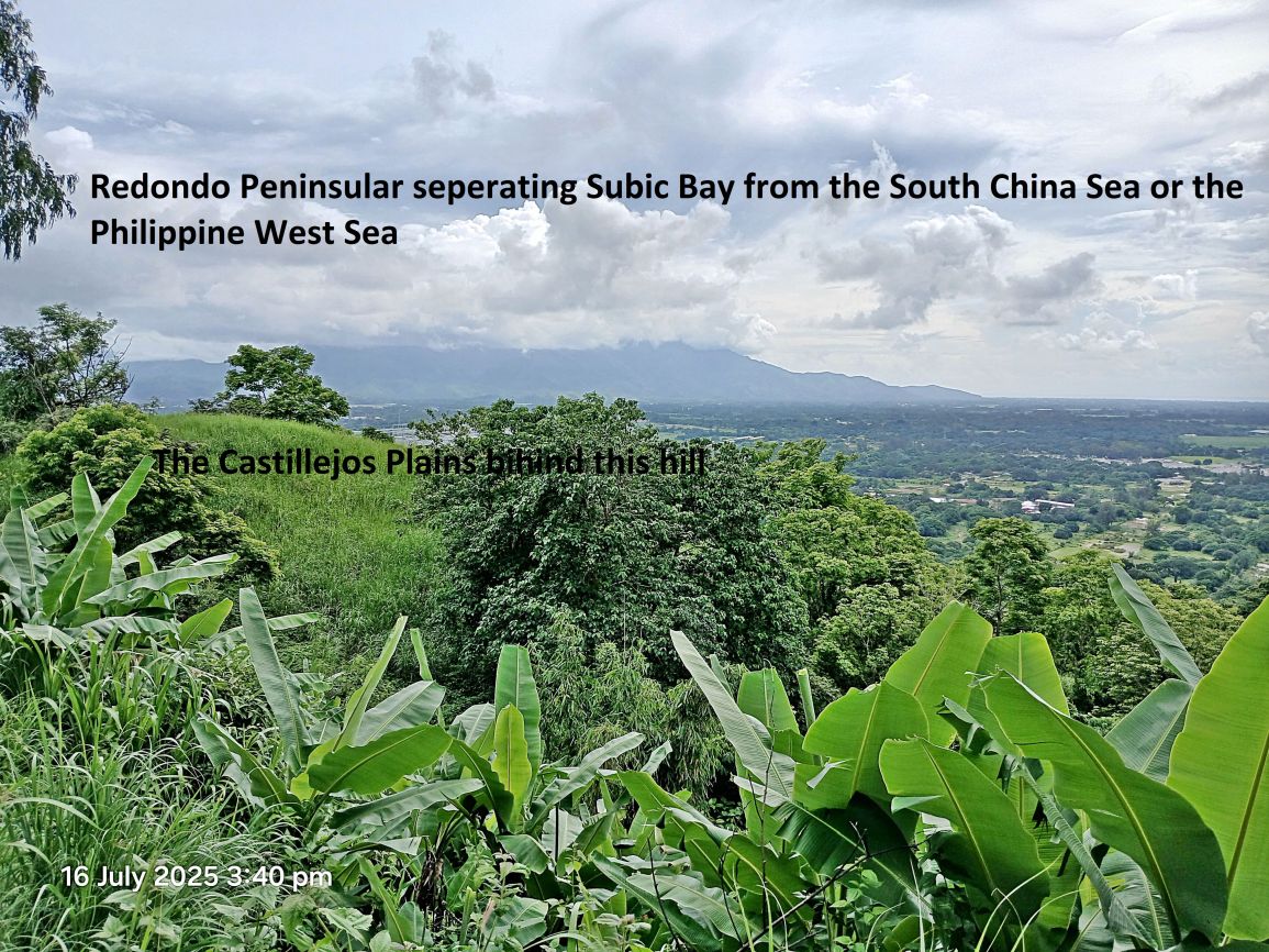
#P13 to #P16 Pictures are views of Subic Bay from the Barrio Cawag View Point at the North End of the bay. The pictures are shot from left to right.
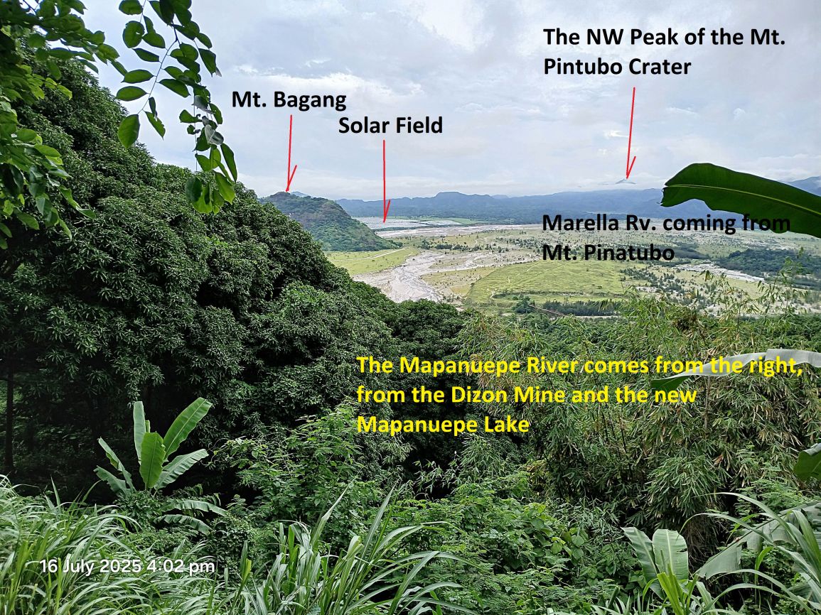
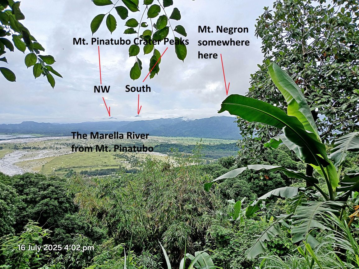
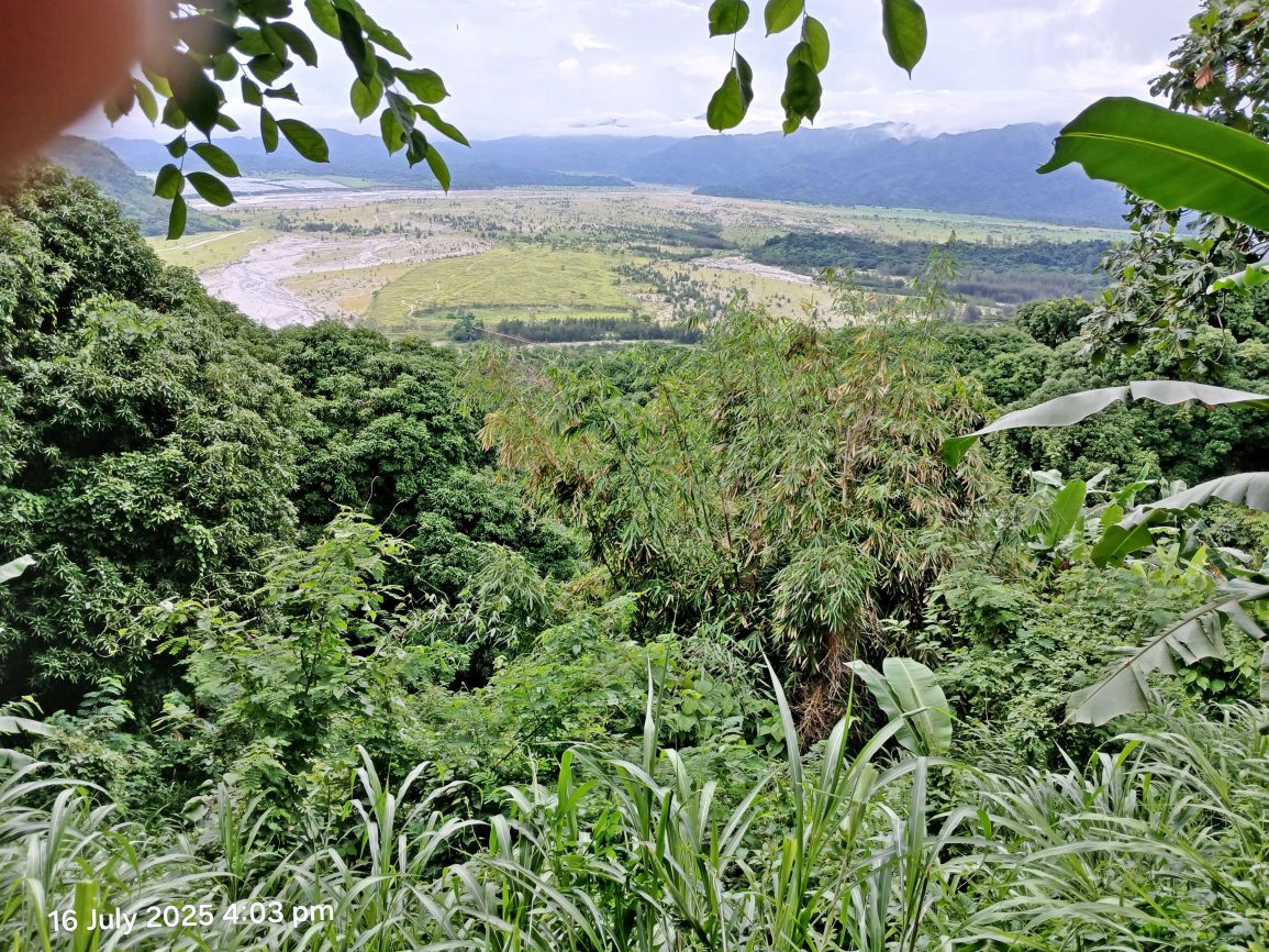
In July 2025 Paul Whitman, the Corregidor.org Webmaster stopped by and we drove around. Visited Bob Hudson, Subic Bay and the Santo Tomas Mt. Pinatubo Lahar River Area. The power of the Mt. Pinatubo Explosion is impressive.
——————————————————————–
#P01 pic. We are looking west and down river on the Santo Tomas Lahar River. It is here about 3km wide and if not for a dike it would have swallowed more land.
———————————————————————–
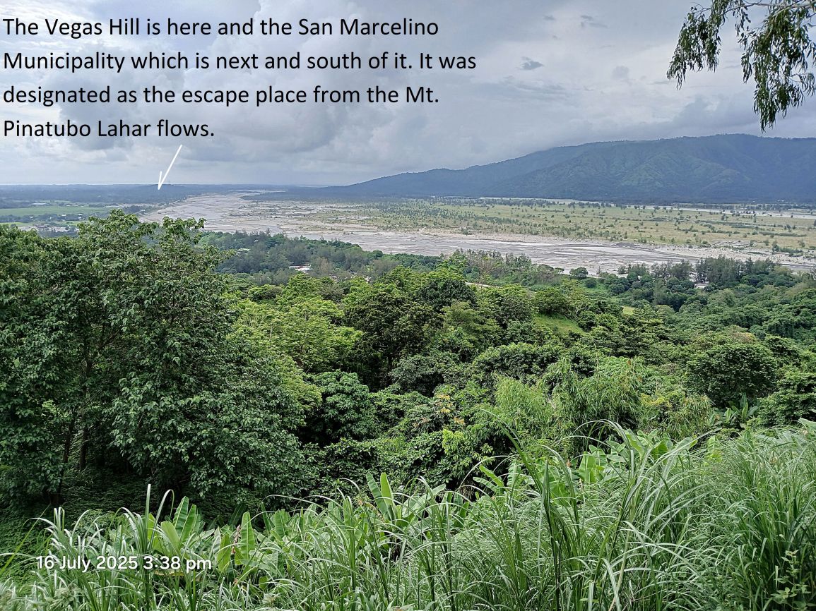
#P02 pic. This picture is shot at the same place as picture #P01 and also in the same direction. This is a view point from the new and post Mt. Pinatubo explosion road from San Rafael to the Dizon Gold & Copper Mine. Barrio San Rafael got completely buried by the Mt. Pinatubo Lahar and reestablished itself south of the South Santo Tomas River Dike.
—————————————————————————
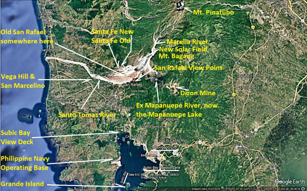
#P03 & #p04 pictures are Google graphs of the Subic Bay and lower Zambales area, with the landmarks mentioned marked in this album for your orientation.
#P03.
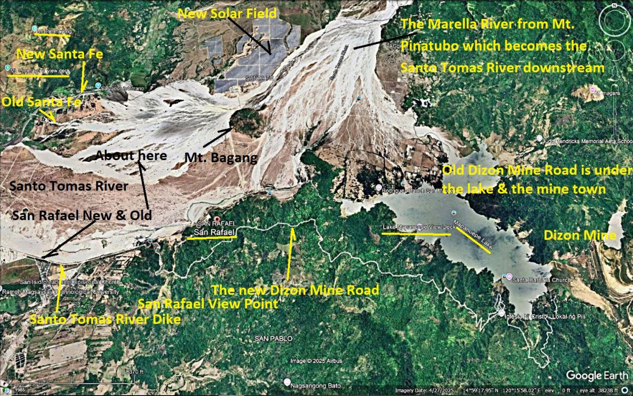
#P04.
—————————————————————————
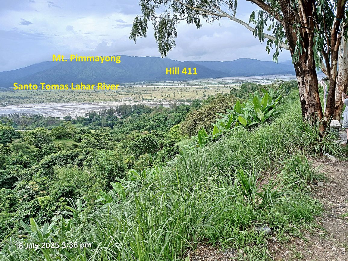
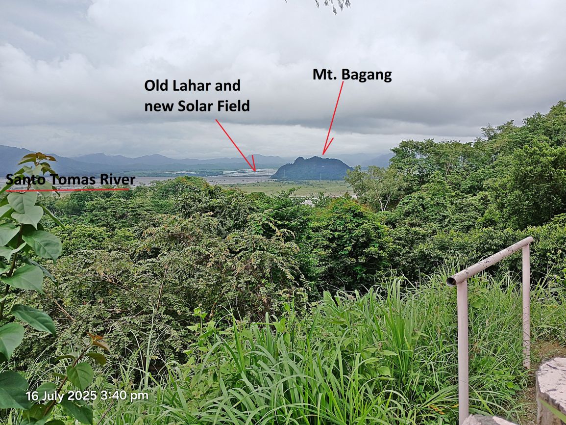
#P05 to #P12 pictures are various views from the San Rafael View Point on the new Dizon Mine Road showing the extensive Lahar floods from the 1991 Mt. Pinatubo Explosion.

#p05.
#P06.
#P07.
#P08.
#P09.
#P10.
#P11.
#P12.
——————————————————————————
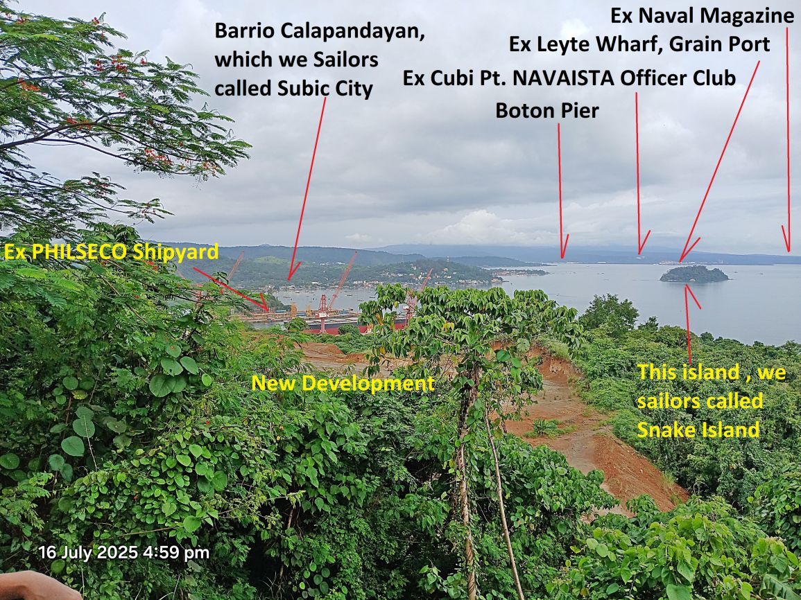
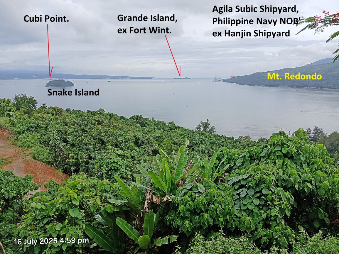
#P13 to #P16 Pictures are views of Subic Bay from the Barrio Cawag View Point at the North End of the bay. The pictures are shot from left to right.
#P13.
#P14.
#P15.
#P16.
——————————————————————-
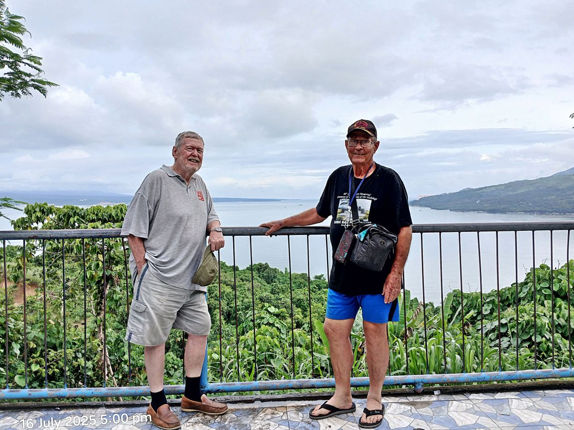
#P17 pic shows Paul Whitman the webmaster of Corregidor.org (right) and Bob Hudson (left). Both are well known historians. Bob has an interesting webpage, click here: http://bataanson.blogspot.com/http://bataanson.blogspot.com/