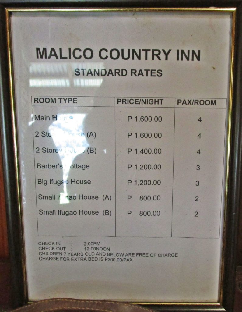
Ze371. (-01) THE MALICE COUNTRY INN, WE DECIDED TO STAY HERE, RATHER THAT IN SANTA FE.
Camping out in the Malico, the Salacsac Passes on top of the Villa Verde Trail, 2019-06-12
Two friends and I wanted to walk down the Villa Verde Trail from the top to the bottom at Pangasinan. We drove to Santa Fe Nueva Vizcaya and stopped by the Balete Pass (Dalton Pass) Memorial. We checked out commendations in Santa Fe but decided to check out a place in Malico before the final decision. We decided to stay at the Malico Country Inn in Malico and the next day start our descend marsh.
This endeavor will be divided into 5 albums and or segments. The first one, Balete Pass, is done and this second album or segment is called Salacsac Passes of the Villa Verde Trail in Malico Village.
My partners were Charlie Moser who sailed across the Pacific ALONE from Hawaii to the Philippines twice. The second partner was Randy Anderson who was the main creator of the Hell Ships Memorial in Subic Bay and who is also the author of the book: Subic Bay. From Magellan to Pinatubo.
It took the 32 Div two month to fight its way thru the passes from March to May 1945. Today the whole road from Santa Fe up to Malico (about 20 km) is concrete now. A new concrete bridge is being built now, just east of Salacsac Pass #1 over a creek there.
The prices were right and we stayed. Malico Country Inn.
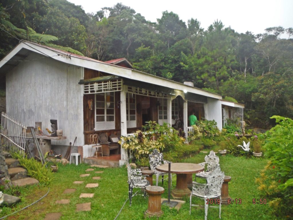
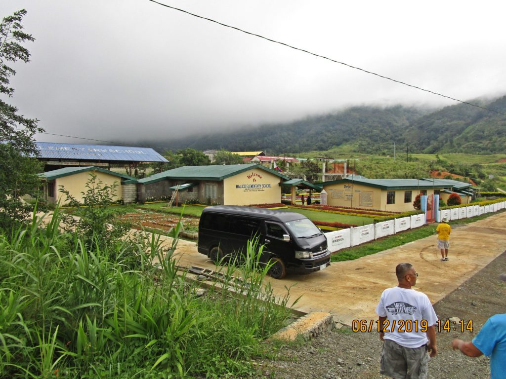
Ze372. (-03) this is a full view of the Malico Museum and Country Inn. Malico is located at the Salacsac Passes of the Villa Verde Trail.
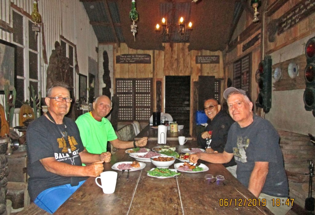
Ze373. (-05) at the Malico Museum and Country Inn; left to right Karl, Charlie, our driver and Randy. The Inn prepared food for us per our request.
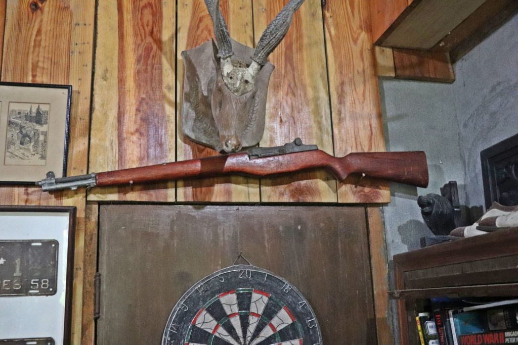
Ze374. (-08) the Malico Museum and Country Inn had a large collection of artifacts and WWII memorabilia. This picture is from Randy Anderson.
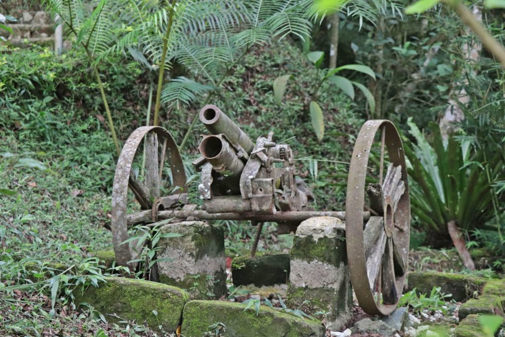
Ze375. (-10) left of the Malico Museum and Country Inn, up some steps, the WWII memorabilia included a Japanese light piece of artillery. This picture is from Randy Anderson.
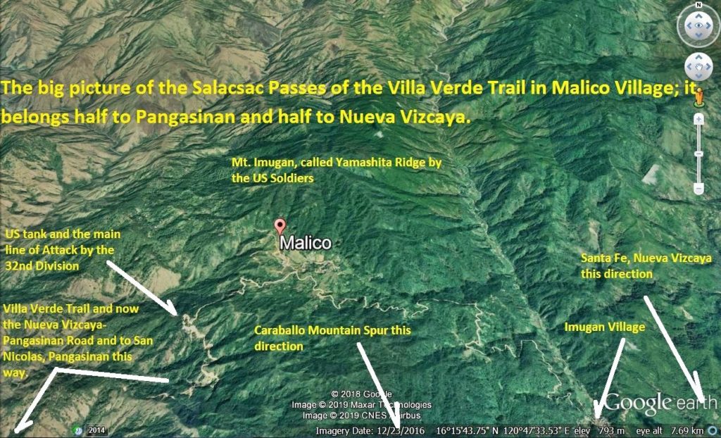
Ze376. (-11) this is a Google Earth image as the where the Malico Village and the Salacsac Passes of the Villa Verde Trail are. It took the 32nd Div two month to fight their way thru these passes.
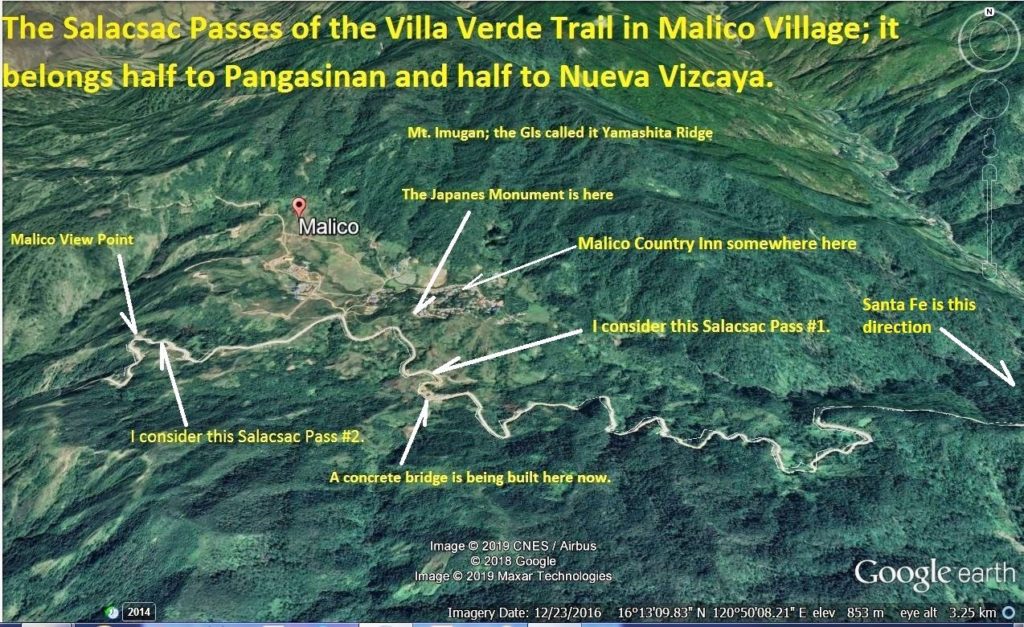
Ze377. (-12) this is a Google Earth close-up image as the where the Malico Village and the Salacsac Passes of the Villa Verde Trail are. It took the 32nd Div two month to fight their way thru these passes.
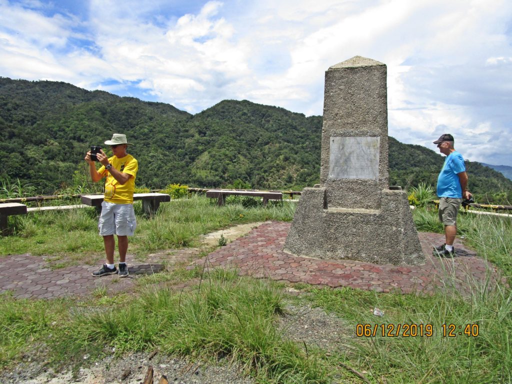
Ze378. (-13) in the middle of Malico Village and the Salacsac Passes of the Villa Verde Trail are the Japanese built this monument. My idea is that Pangasinan and Nueva Vizcaya build a memorial like the one in at the Balete Pass. They could use the US. Tank on the Villa Verde Trail, combine it with the Japanese Monument. Add the Japanese Artillery piece near the Balete Pass and use the Old 32nd Div Monument, fix it and install it here.
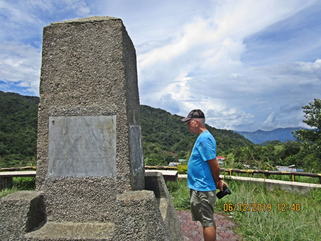
Ze379. (-14) in the middle of Malico Village and the Salacsac Passes of the Villa Verde Trail are the Japanese built this monument. If a memorial like the one in at the Balete Pass is built, it could include the tank and the old 32nd Div monument on the Villa Verde Trail.
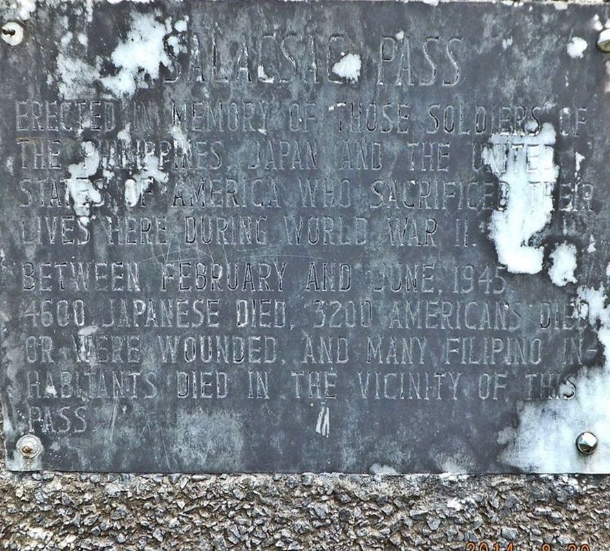
Ze380. (-15) this plaque on the Japanese Memorial says that between Feb.-June 1945 4600 Japanese died, 3200 Americans died or were wounded and many Filipino Inhabitants died in the vicinity of this Salacsac Pass.
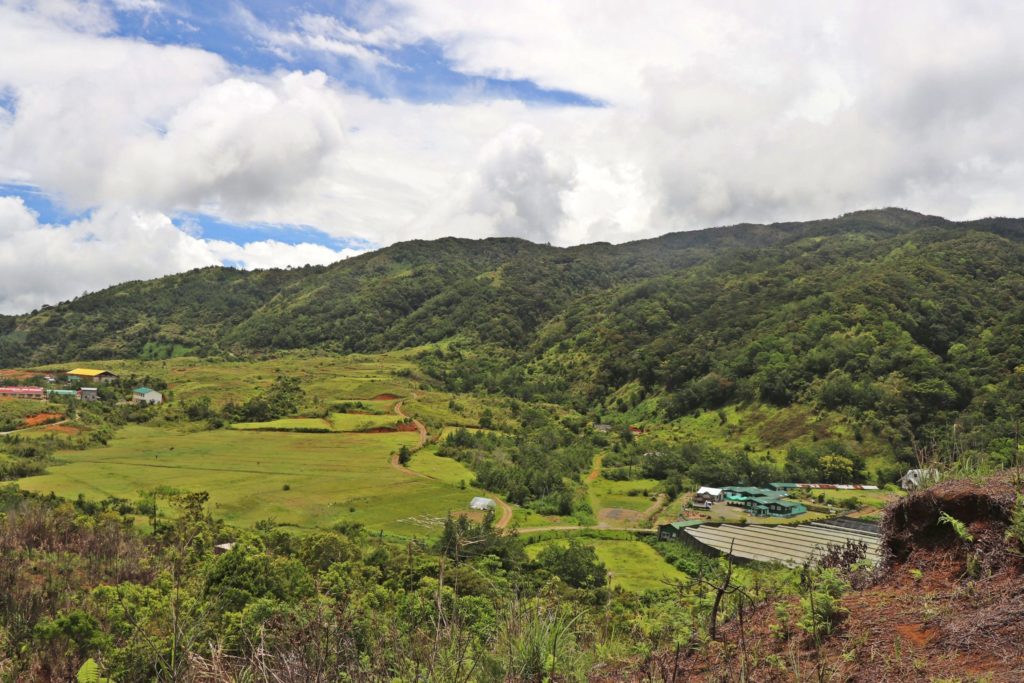
Ze381. (-18) this is a larger view of the Malico Village fields; they are between a line of low hills and the foot hills of Mt. Imugan at right. This image is from Randy Anderson.
Ze382. (-19) this is a larger view of the Malico Village fields; they are between a line of low hills and the foot hills of Mt. Imugan at right. This image is from Randy Anderson.
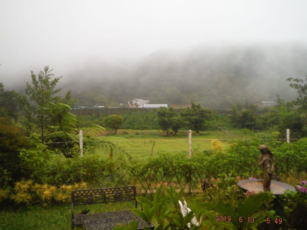
Ze383. (-20) this is a shot across the Malico Village fields; they are between a line of low hills and the foot hills of Mt. Imugan are in back; the GIs called it the Yamashita Ridge. Fog was often present; it is about 1300 meter elevation here.
Ze384. (-21) we tried to check in with the barangay office but today was a National Holyday and we learned there are two barangay Malico offices, one belongs to San Nicolas in Pangasinan and one belongs to Santa Fe in Nueva Vizcaya.
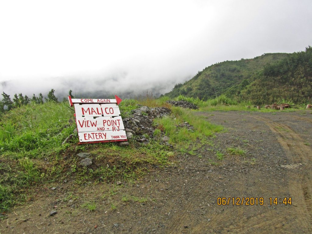
Ze385. (-23) following the new concrete road towards west about one km, at a point where you can see the Pangasinan Plain the Baguio Cordilleras is this place and it is called Malico View Point. At this moment the clouds blocked our view.
Ze386. (-24) we did get this glimpse from the Malico View Point, between clouds coming and going; this is the new Pangasinan-Nueva Vizcaya Road descending, following the Villa Verde Trail. This section is on the west side of the Caraballo Mountain Spur. This picture is from Randy Anderson.
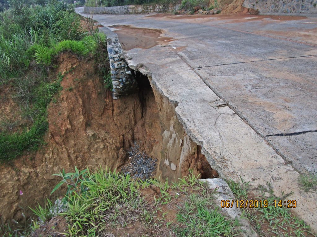
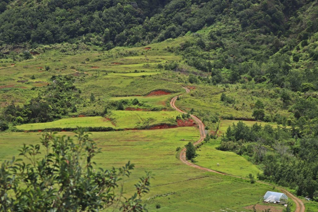
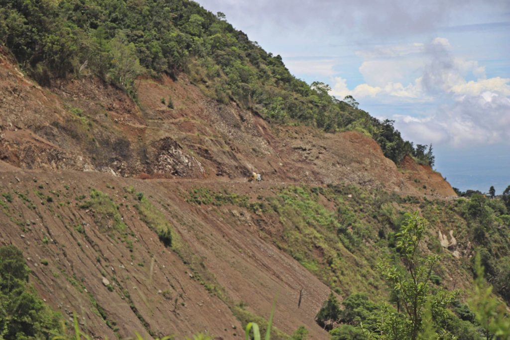
Ze387. (-25) this is the new Pangasinan-Nueva Vizcaya Road descending, following the Villa Verde Trail. This section is on the west side of the Caraballo Mountain Spur. This project is like holding a tiger by the tail; they are dealing with this kind of problem at several places already.
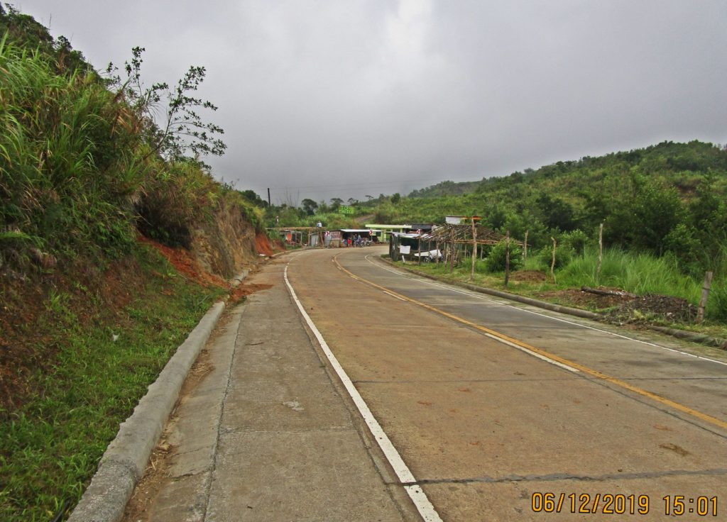
Ze388. (-26) this is one of several images of little shops having been developed within the last year, just outside the Malico Village Entrance, along the Villa Verde Trail Road. This is a view coming back from the Malico View Point.
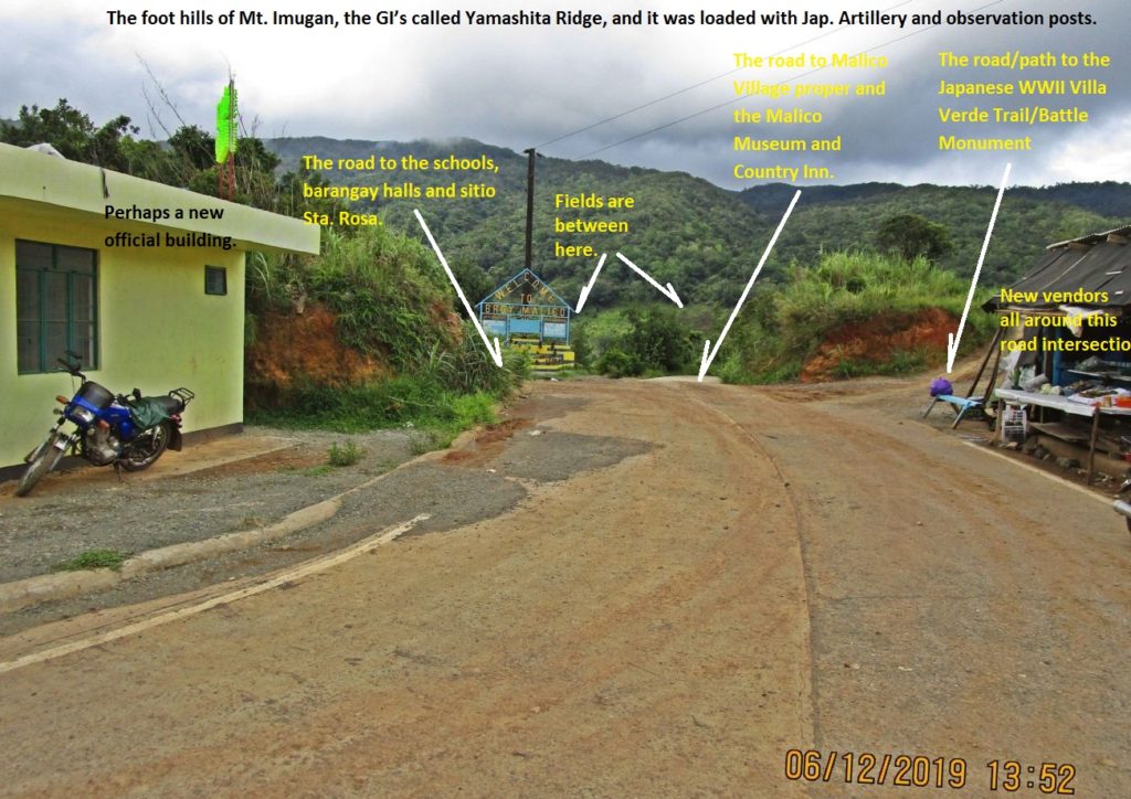
Ze389. (-27) this is the entrance road and gate to the Malico Village, the distance from the new road is only about 50 meters. This copy is marked up.
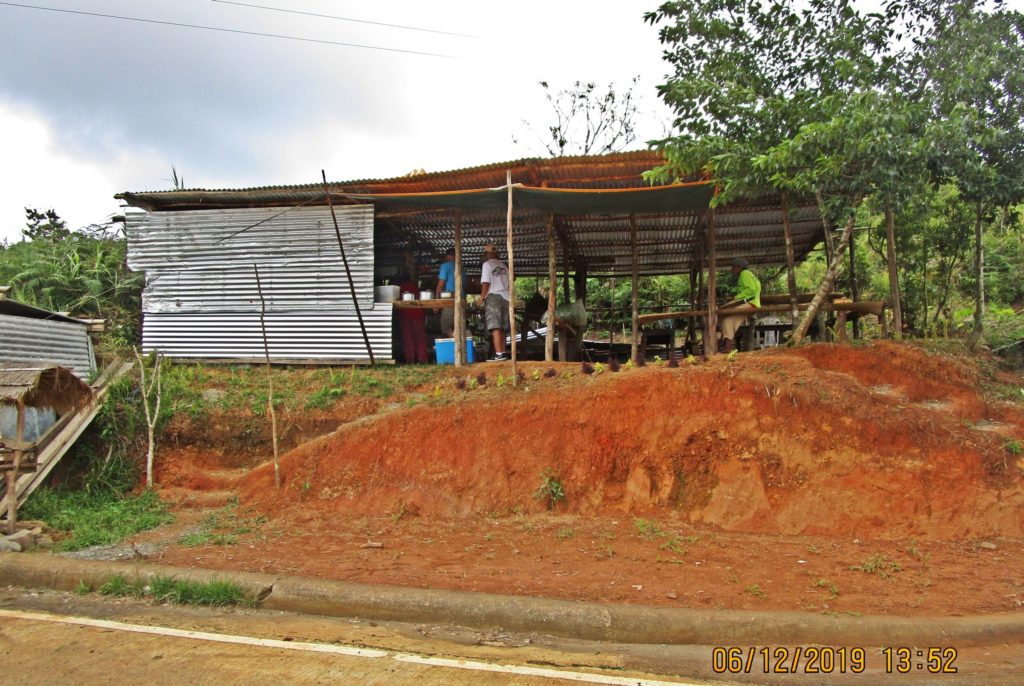
Ze390. (-29) this is one of several images of little shops having been developed within the last year, just outside the Malico Village Entrance, along the Villa Verde Trail Road. Here are two new vendors at the right side of the entrance to Malico. We had a noon snack here.
I love that you have the pics clearly labeled, so we know what we are looking at! Well alligined w/direction and adjacent landmarks.
BZ!!!
Love that pics are clearly labeled. Direction of adjacent landmarks is appreciated.
BZ!!!