—————————————————–
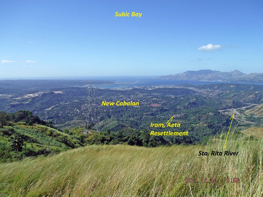
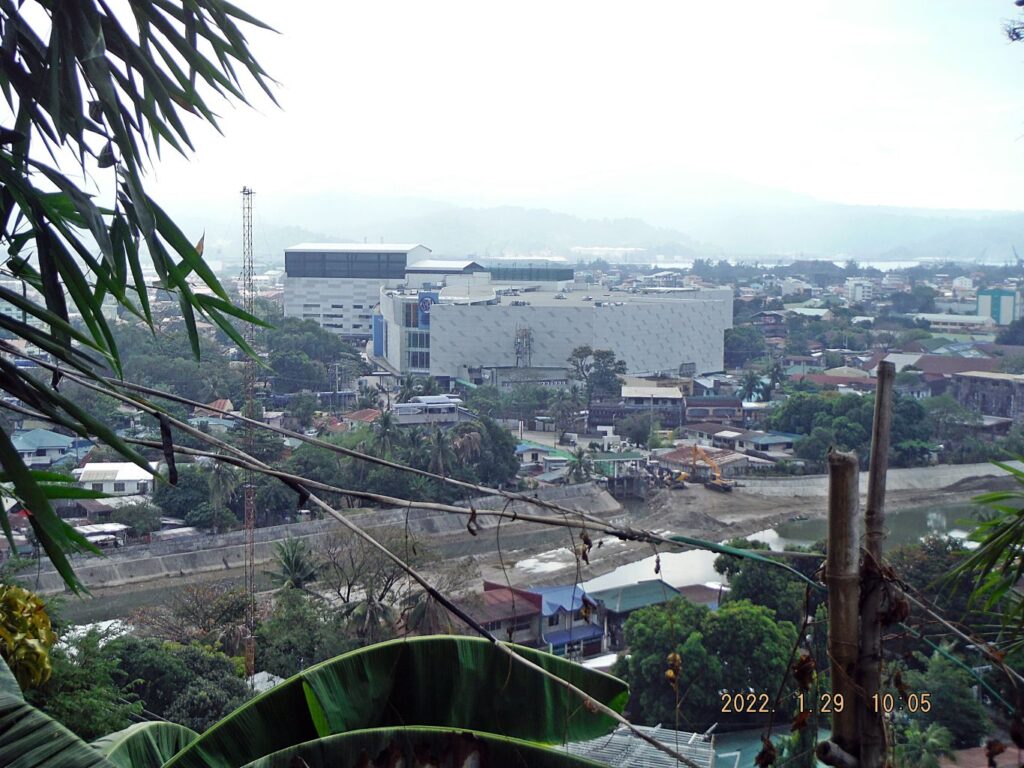
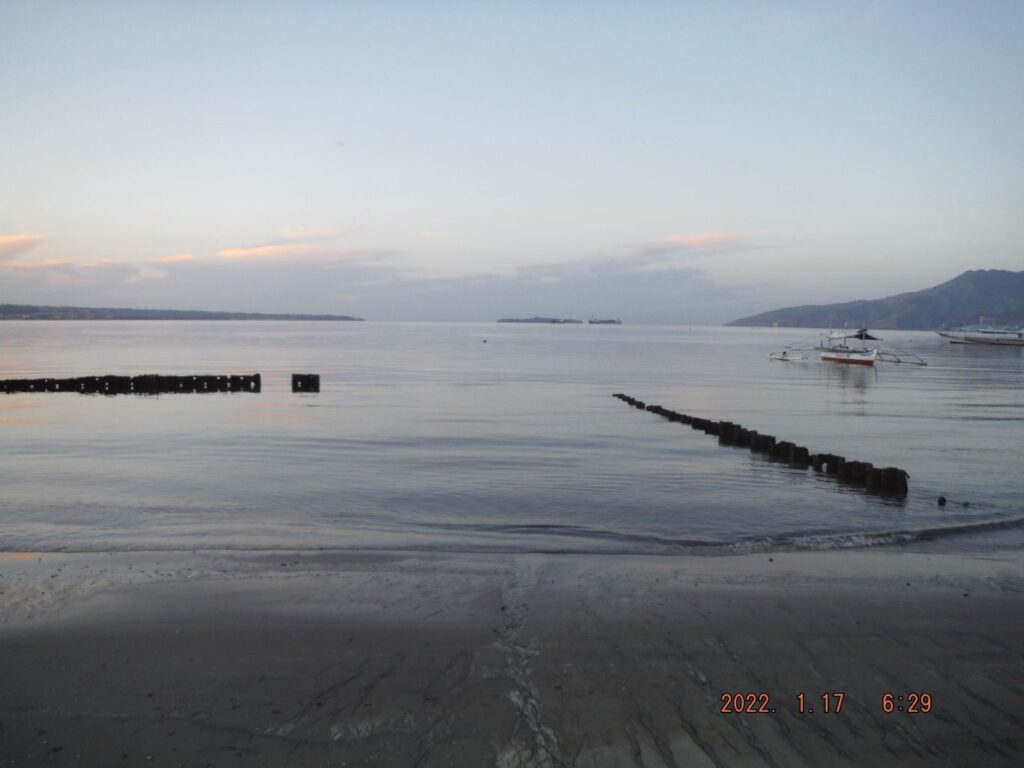
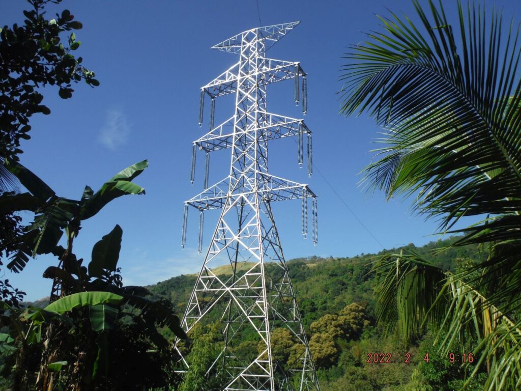
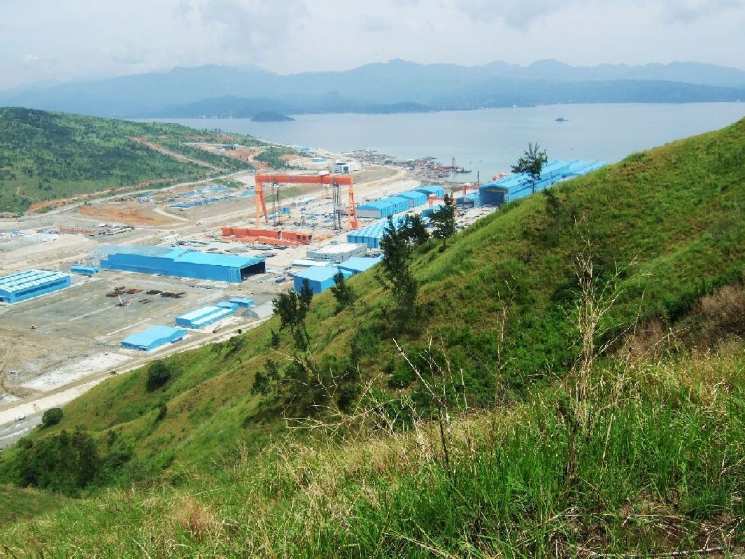
Zf470. 211230 up Mt. PLDT, down to Sta. Rita Rv., Old Cabalan 06. This is a panorama view of Subic Bay from the PLDT Mountain. We see New Cabalan that is where the 12 days infamous (hard fighting and many casualties) Zig-Zag Pass Battle was carried out in 1945.
——————————————————–
PLDT Mt. to Sta. Rita River Hike, 2021-12-30
Views of the Subic Bay area
Walked up this about 600 meter high hill again, 30th Dec. 2021, but came down at the Sta. Rita River. It was a beautiful day and I got good views from the top and on the way down to the Sta. Rita River Valley. Parked at the SN Mall Central in Olongapo, parking was open and took public transportation to the starting point in Barrio Roosevelt and returned from Old Cabalan. PLDT Mt. is the hill with all the communication towers at your right when you come to Olongapo; PLDT stands for Philippine Long Distance Telephone Co. Because the authorities are running a new high voltage line across the hill from east to west, there exists now a service road, used to built this power line. This time I used it to descend to the Sta. Rita River but came up using the original PLDT service road.
The original 103 images of this walk have been posted in Photobucket in low resolution, click here:
A short version of 17 images are uploaded in high resolution into this Flickr album, click here:
——————————————————————————
For this notification I chose these 3 images:
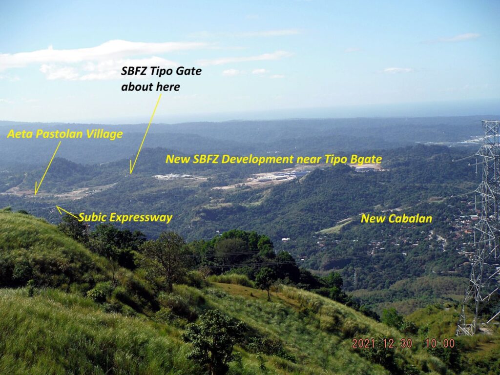
Zf471. 211230 up Mt. PLDT, down to Sta. Rita Rv., Old Cabalan 08. This is a rare view from the old PLDT Service Road because the road, now a trail, has thick woods standing on both sides of trail/road. This picture shows us that several extensive projects are being constructed next the Subic Bay Freeport Zone (SBFZ) Tipo Security Gate.
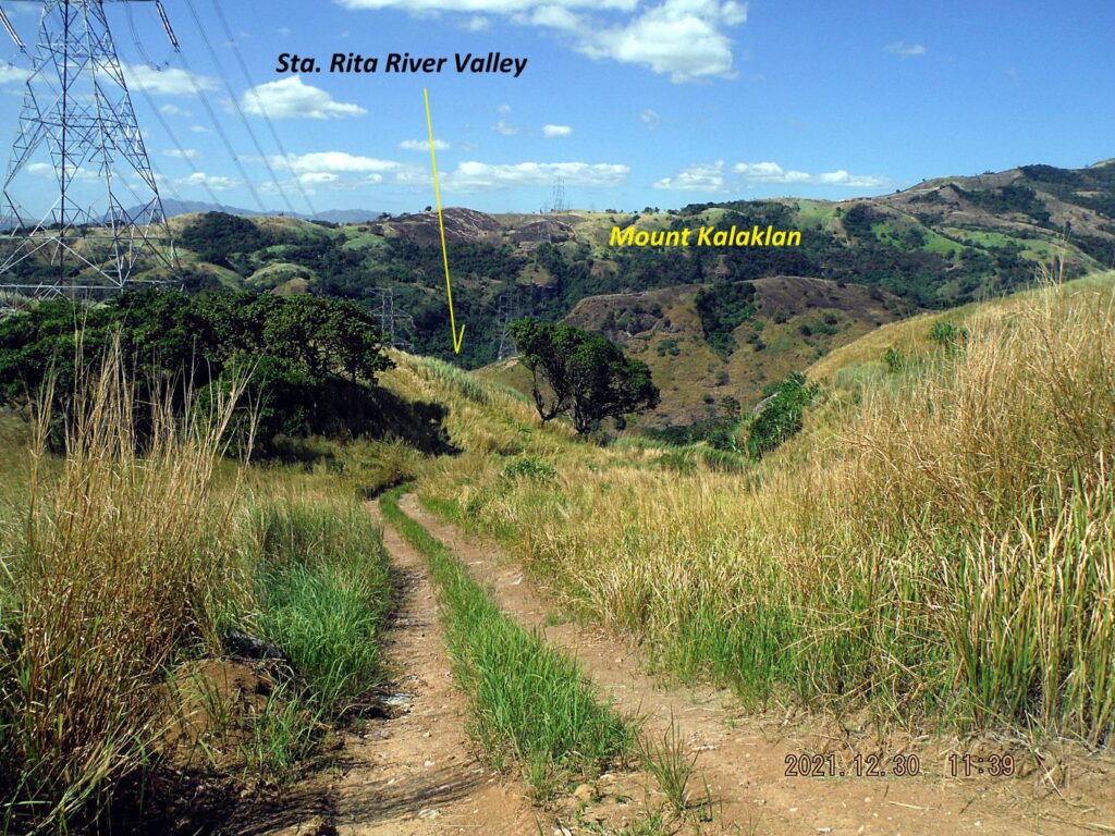
Zf472. 211230 up Mt. PLDT, down to Sta. Rita Rv., Old Cabalan 12a. This is a view of descending into the Sta. Rita River Valley from the PLDT Mountain. I used the service/building road of the new High Voltage Power Line. Notice the power line continues, crossing the Sta. Rita River Valley, then the Kalaklan Mountain. After that it crosses the Gordon Height Valley and then Kalaklan Ridge, not in view, etc.
Zf470. 211230 up Mt. PLDT, down to Sta. Rita Rv., Old Cabalan 06. This is a panorama view of Subic Bay from the PLDT Mountain. We see New Cabalan that is where the 12 days infamous (hard fighting and many casualties) Zig-Zag Pass Battle was carried out in 1945.
————————————————————————————————————–
George Dewey High School area in SBFZ, update 2022-01-18
Made a short visit to the school and took pictures and noted some observations:
At least three companies are active at this former school ground:
-The Subic Holiday Villas, they occupy most of the former open sports fields. A friend of mine had a place there, was not happy and got rid of it.
-Absolute Service Inc. seems to be a web page company. It seems to be a US company, branched out to the Philippines.
-The Manila Times College is running a college and also some basic education. Right now the large Sports Hall is being modified to classrooms inside.
The present management seems to like the old school globe and the 2016 Memorialized Plaque and indeed they make a fine historical landmark.
The new and recently widened to 4 lanes Subic-Tipo expressway runs around the former school and cuts the former road to the Kalayaan Housing Road and one has to pass under two twin bridges to get to here.
There were not any students, but I guess that is because of the virus.
The other icon, the missile in the sports field is long gone, perhaps because of the Holyday Villas project.
This is an album of 56 images, shot Jan. 2022, of the former George Dewey High School (GDHS) area in the Subic Bay Freeport Zone (SBFZ), the former US Naval Base Subic Bay. These pictures are uploaded in low resolution, are not edited and have received descriptions as groups of images, click here.
Four sample images are presented here:
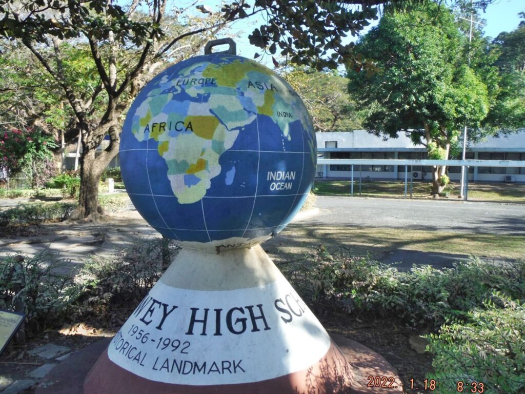
Zf505. This is the George Dewey High School Globe standing in front of the school buildings complex, 2022-01-18.
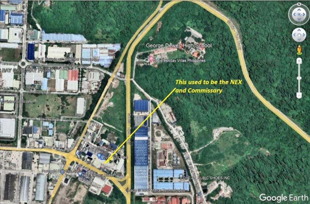
Zf506. This is Google Earth image of the former George Dewey High School area in SBFZ, 2022-01-18. Note the new Subic Tipo Express Way going around the school. I marked in the location of the former Navy Exchange and Commissary Building for your orientation. So much has been added, built or changed from our Navy days.
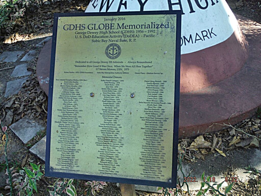
Zf507. This is the 2016 dedicated Memorialized Plaque, standing in front of the GDHS Globe. It is available in high resolution with this URL, click here:
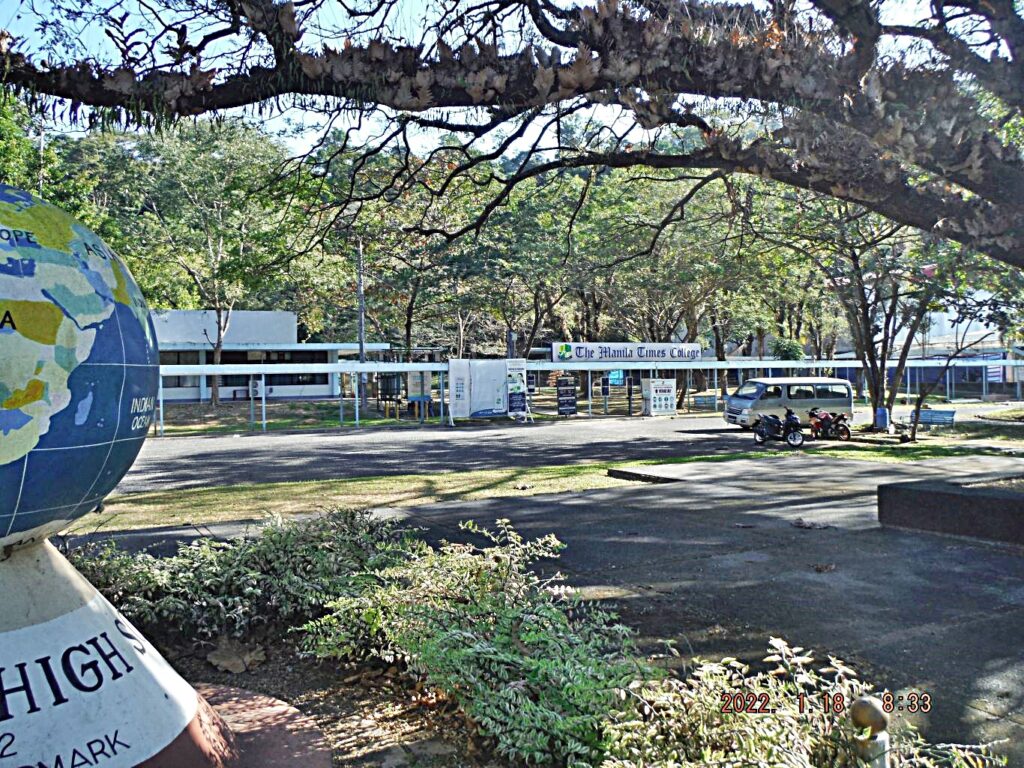
Zf508. This is the entrance to the former GDHS grounds; the new education boss is the Manila Times College.
——————————————————————————-
Barretto to Olongapo Short Walk 2022-01-29
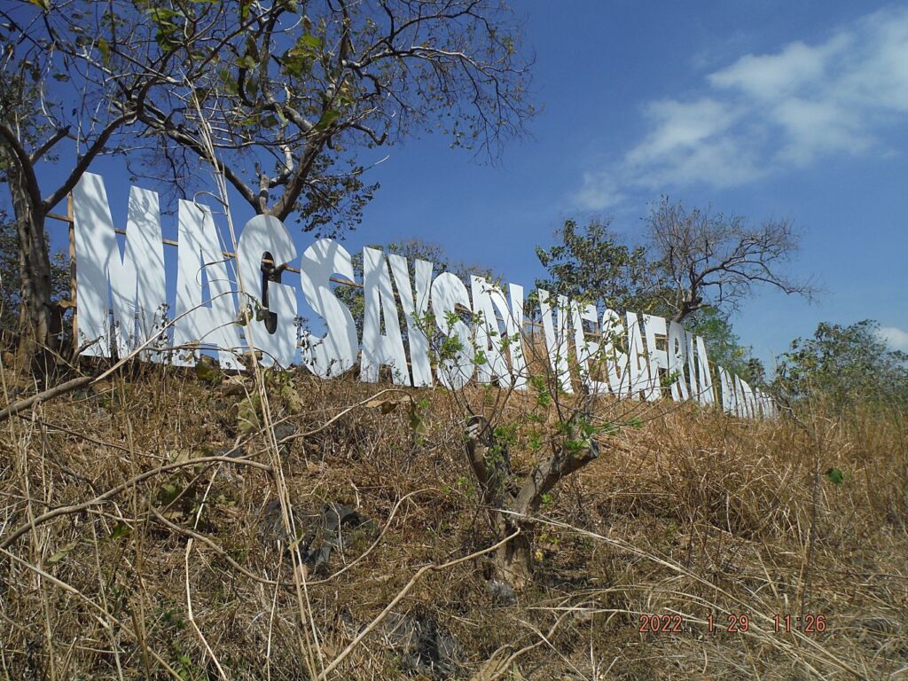
Barretto to Olongapo over Kalaklan Ridge and back, Short Walk. Started from Abra Street, up the diagonal trail to the Barretto Ridge, crossed it and down to the houses by the Kale Beach Valley Waterfall, straight up to Kalaklan Ridge, crossed it and down to Upper Kalaklan, near the bridge to Olongapo Rotunda. Walked south and checked the new bridge for tricycles and motor bikes only. Then up a trail to Kalaklan Ridge starting behind the big Iglesia ni Christos Church. Checked out the new Magsaysay election sign on top. Walked up Kalaklan Ridge about 3 km and down the diagonal trail down the Rizal Extension Street and home.
An album with 58 images of that walk was established in this Photobucket album, click here:
A shorter version with 12 images were posted in Facebook, click here:
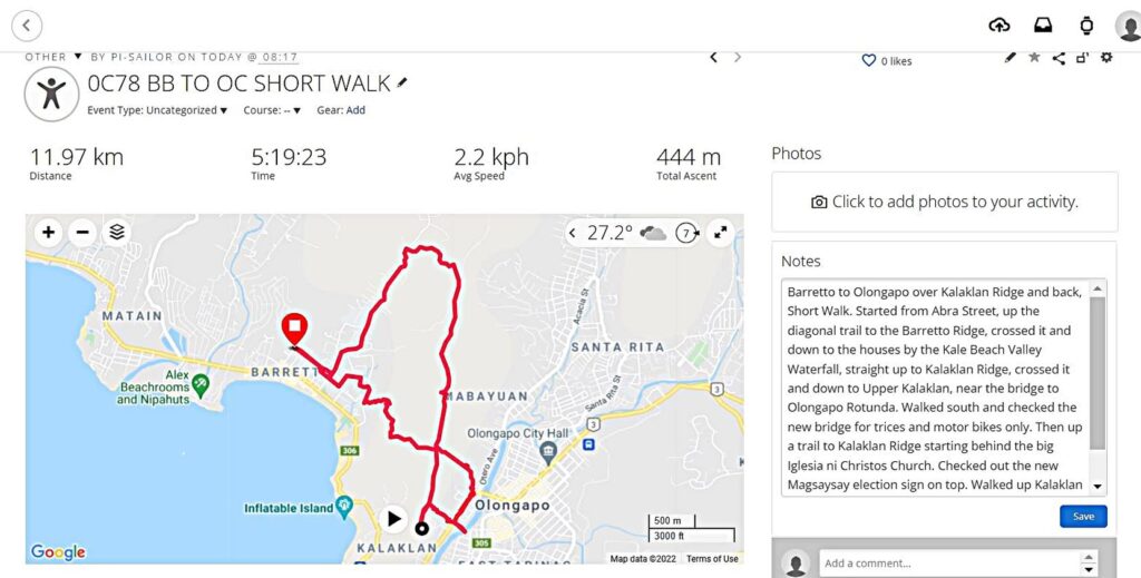
Zf525. (05b). From my Garmin account, track records! This is one of 7 images from my Garmin and Google Earth accounts that show my GPS track, elevation graph and my walking data etc, some are zoomed in.
Zf526. (10). Our 3rd and new mall in Olongapo, the SM Central. It was build at the site of the old Olongapo Quonsets Huts Hospital! This is one of 9 images of Olongapo City views during my descend from on top of Kalaklan Ridge down to near the bridge that leads into Olongapo and the Rotunda. Some shots are views of Olongapo and one shows the rear of the Victory Liner Station, the new SM Central Mall and the area of Kalaklan Ridge where I will walk up again, behind that Iglesia ni Christo Church.
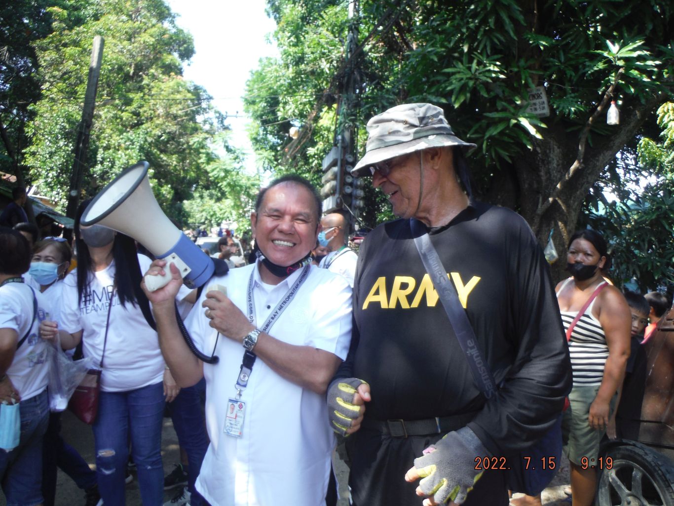
Zf5527. (34). This is one of 17 images of my climb/walk back up to Kalaklan Ridge to where the Magsaysay, and others, political campaign sign was erected. It sure reminded me at the Olongapo Sign that was located here many decades ago. Other campaign signs are pictured, in May will be the National Election for a new President etc. The trail started behind the big Iglesia ni Christ Church here, it went passed many houses on the slope. This group of pictures also includes views of Olongapo. There are 2 pictures of me with an Army shirt; hold your horses with your critique, I love the Army, they are my brother and this is a good shirt, it says: I’m military! Came across some kids, coming up with me and they were shoveling Mt. Pinatubo Sand for a family home project.
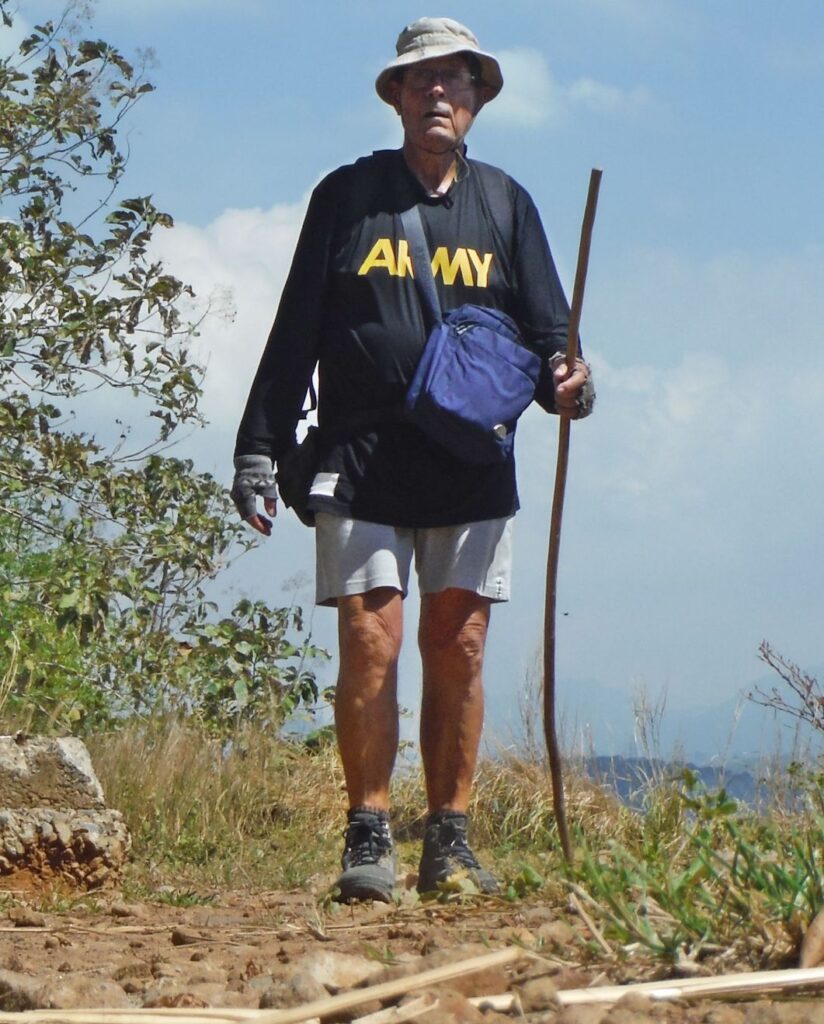
Zf528. (41). Will be 80 in March, not bad; when a Filipino asks me how old I am, I answer “binata pa” (still a youngster)! A new campaign sign, on top of Kalaklan Ridge, overlooking Olongapo! This is one of 17 images of my climb/walk back up to Kalaklan Ridge to where the Magsaysay, and others, political campaign sign was erected. It sure reminded me at the Olongapo Sign that was located here many decades ago. Other campaign signs are pictured, in May will be the National Election for a new President etc. The trail started behind the big Iglesia ni Christ Church here, it went passed many houses on the slope. This group of pictures also includes views of Olongapo. There are 2 pictures of me with an Army shirt; hold your horses with your critique, although ex Navy I love the Army, they are my brothers and this is a good shirt, it says: I’m military! Came across some kids, coming up with me and they were shoveling Mt. Pinatubo Sand for a family home project.
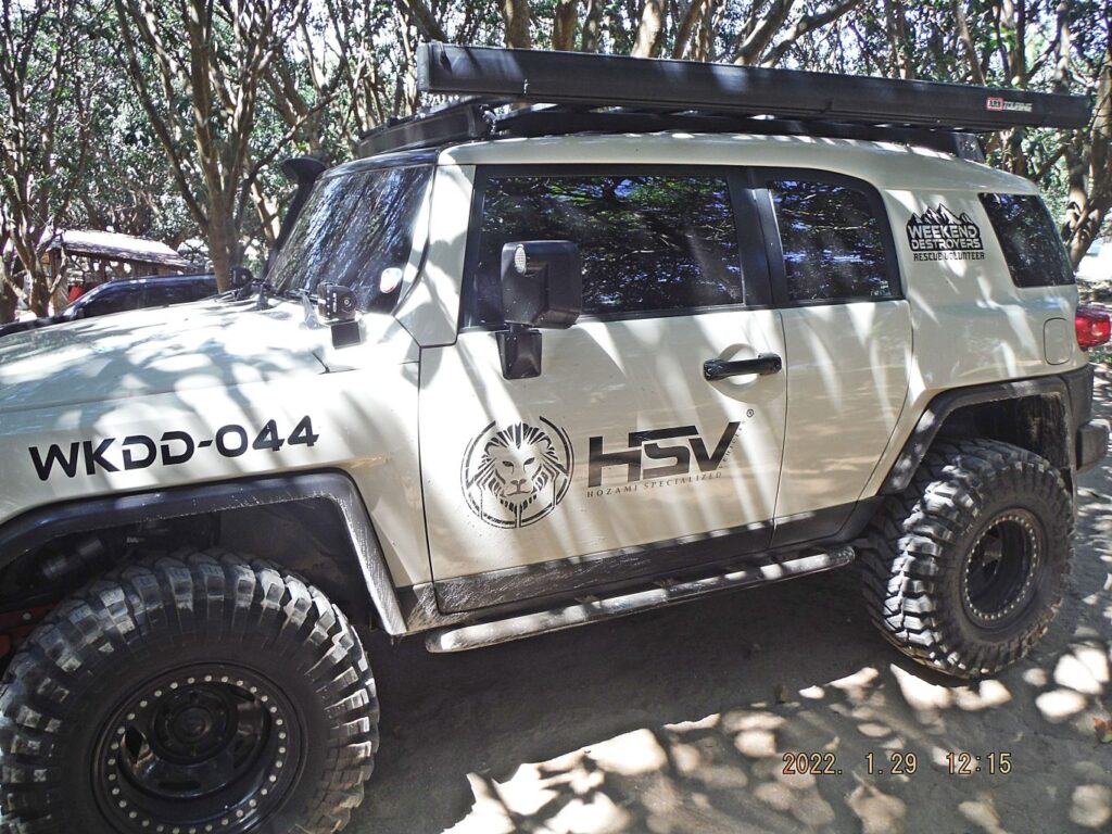
Zf529. (49). Mysterious vehicles at large lot with a pool, which catered to visitors, as late as a year ago. The pool was closed because of the virus from Red China. Very, very seldom does one see vehicles on Kalaklan Ridge because the road is bad. But because of the electrical work here an old trail from Gordon Heights is now usable for vehicles. This is one of 7 images of my walk, uphill along the Kalaklan Ridge, about 3 km up to the 235 meter level. I took two pictures of the new electrical lines. A work team has been up here for weeks and replaced all the electrical wires and fittings. I wanted to check out the swimming pool but it was not only closed, special vehicles were parked there and a man with 2 radios in his hand told me “bawal- in German verboten”. So, I moved on to my descend point the diagonal trail down to the Rizal Extension in Barretto and home.
———————————————————————–
Subic Bay 2022-January images
These are my Jan. 2022 pictures of the Subic Bay, although many are from Barrio Barretto, the former Naval Rifle Range and 1945 Supply Depot.
About 55 images were uploaded into this Photobucket album, if interested, click here:
A short version of 14 images is in my Facebook page, click here:
Three sample pictures are presented here:
Zf532. This is one of 5 images of the remains of a 1945 Navy pier at the Barrio Barretto Beach. Here, in what is now Barrio Barretto and an international vacation spot was a Naval Supply Depot in 1945 until it moved the Subic Bay Naval Base proper around the 1950s. This was a very low tide, so I took advantage and shot these images.
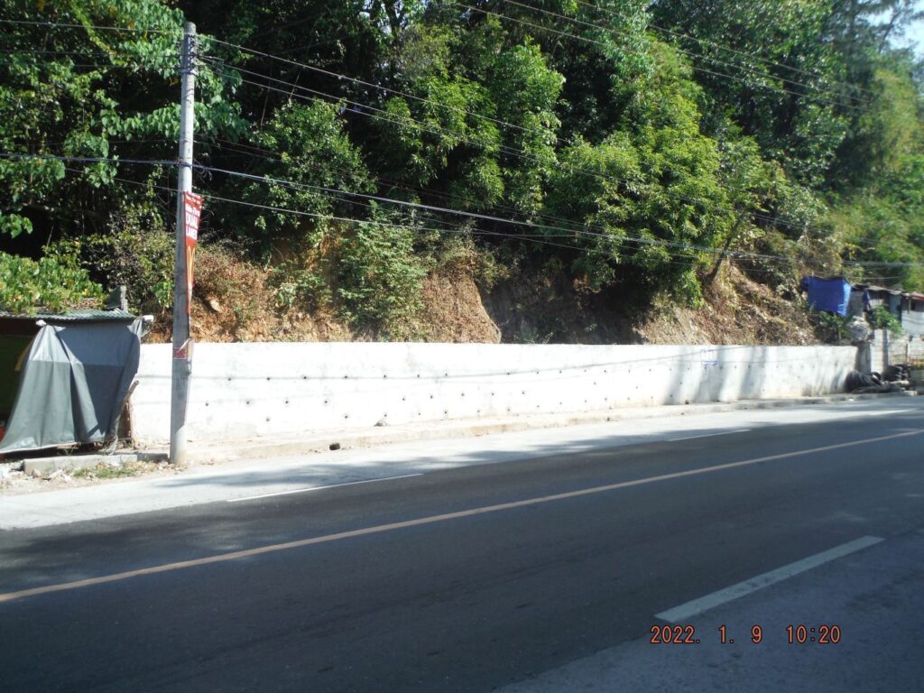
Zf533. This is the concrete embankment wall along the National Highway to Zambales. It is just short of the entrance to the Baloy Long Beach. Recently someone painted graffiti on the wall about American Imperialism. It seems shortly thereafter, someone or the authorities painted over it and got rid of that foul graffiti. Thanks, great job!
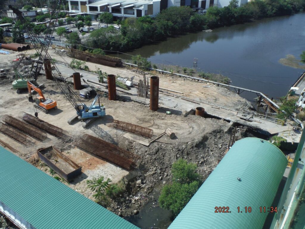
Zf534. This is the SBFZ Main Gate Bridge being rebuilt. The project is going very, very slowly but this picture shows some progress. Those big pipes are new, perhaps for pouring concrete for the bridge pilings.
———————————————————-
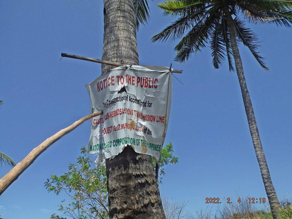
High voltage line across Mt. Kalaklan in Olongapo
This is the CASTILLEJOS-HERMOSA 500 KV TRANSMISSION LINE PROJECT. It is an important and big project and I decide to upload it high resolution, into this Flickr album.
In Olongapo drove to Gordon Heights to the end of Waterdam Road and another 1/2 km on the extension road and parked. Checked with people about parking and got a Ok. I ask and a young boy showed the start of high voltage line service road over Mount Kalaklan but anyone can find it without a guide. It is steep going up and it reaches the top where a cement ranch house is, abandoned, nobody there now. The road continues around the head of the big ravine. I stopped at the last tower before the line goes down to the Sta. Rita River and then I returned. Saw interesting things, bull taken down for slaughter, bunch of carabaos and saw a few possible trails
12 sample images in low resolution have been posted in Facebook, this is the URL, click here:
32 images have been uploaded into my Flickr album in high resolution, this is the URL, click here:
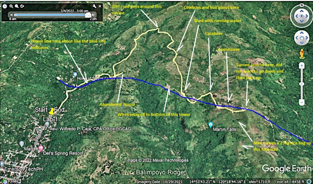
Zf535. This is one of 5 images about my walk along, under the High Voltage Transmission Line across the Mount Kalaklan at Olongapo. The pictures provide my GPS track, data of the walk and show you on maps where this project is and where the walk was.
Zf536. This is one of 6 images walking up to the first ridge of Mt. Kalaklan, starting at the Gordon Heights Valley in Olongapo. The line makes it up with three towers. It was easy to cross the Mabayuan River coming out of the Gordon Heights Valley. An 11 year boy had showed me the start of this new power line service road and then hitched up with me. On top is an abandoned ranch house, I was familiar with area of this house but it is abandon now. I convinced the young boy to return that my walk was too long, too far away from his family. There is a nice view of a deep and long ravine, not visible, at the end is the Sta. Rita River and Barrio Tabacuhan.
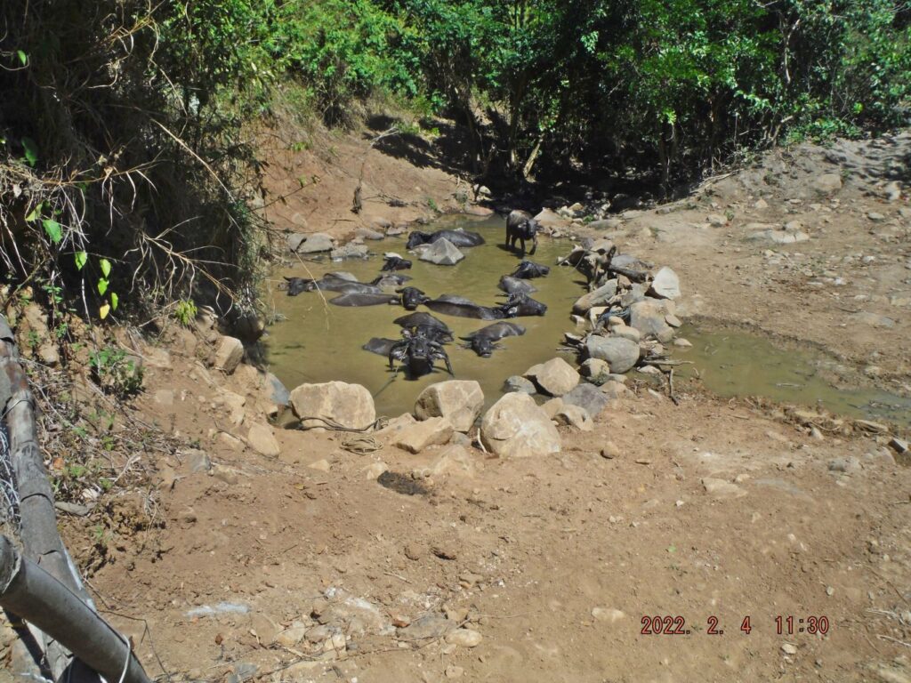
Zf537. This is one of 6 images as I walked to my turnaround point where I could see the new power line crossing the Sta. Rita River and coming/going across the PLDT Mountain. I saw 11 Carabows in their wet element, the manned farm/ranch house, view towards the north, east and south. I saw a trail, I still looking for new trail up to this Kalaklan Mountain.
Zf538. This is one of 7 images of my return walk; the pictures are in this order:
-1= a view to the ridge where I came up on and a large and short ravine between and a short ridge between those.
-2= a sign of this project, CASTILLEJOS-HERMOSA 500 KV TRANSMISSION LINE PROJECT.
-3= a man at the small ravine where the carabows were, getting ready for lunch, this is also near the farm/ranch house.
-4= the shed with running water in troughs and I saw other animals besides cattle and carabows, there were horses and goats.
-5= the bull is temporarily tied up, the cowboys are trying to catch one more.
———————————————————–
Hanjin Shipyard News as of Jan 2022.

Zf546. Hanjin Shipyard in the Subic Bay area from Google Earth.
Met an American worker today (20th Feb. 2022) in Barrio Barretto in Subic Bay. He told me this. He is setting up machinery and equipment in the former Hanjin Shipyard for something that involves the Military. He is on a 5 year contract here. He is with about 50 other Americans and they hired about 20 Filipinos so far. They started on the 3rd of Jan. this year and most of them arrived about in the middle of Jan. There is a smaller group working in Manila, doing paperwork, he said. They are quartered in 2 hotels here in Barrio Barretto and drive with a bus everyday to work.
I asked him, is that to support ships, he didn’t know or didn’t think that!
—————————————————–
SBMA inspects the on-going construction of Magsaysay Bridge.
Zf640. SBMA Chairman and Administrator Rolen C. Paulino (in white polo shirt) inspects the on-going construction of Magsaysay Bridge which links the city of Olongapo and the Subic Bay Freeport zone on Friday, March 25. He urged the contractors to expedite the construction of the said bridge as it delays the development of the Subic Bay Freeport Zone.
We called that bridge and I still do: “The Main Gate Bridge”. During our time that was the only way to Magsaysay Drive in Olongapo City and that was a top priority for many of us Marines and Sailors when Liberty Call went down.
This construction of a new bridge to replace it has been dragging on at least 2 years, I believe.
The new SBMA Chairman had a look, so the Subic News Link says, this is the URL, click here:
————————————————————–
Hanjin Sold! It’s Official Now!
SubicNewsLink reports and their source was CNN Philippines:
SubicNewsLink, click here:
CNN Philippines, click here:
Zf647 Hanjin under construction, 2007-10-27
The whole article:
United States-based private equity firm Cerberus Capital Management has completed its takeover of the shipyard previously run by Hanjin Philippines in Subic Bay with the recent conclusion of agreements on the facility, government officials confirmed.
“The completion of the Subic Bay shipyard will redound to benefits for the country, bring jobs to the local communities, increase economic activity, and at the same fortify our strategic security measure,” Philippine Ambassador to the US Jose Manuel Romualdez was quoted as saying in a press release early Friday morning.
Manila’s embassy in Washington said Romualdez made the remarks during a diplomatic reception on Apr. 19. The envoy also expressed his appreciation to officials of both countries along with executives of Cerberus for their efforts, which led to the conclusion of the deals.
“Great to see the completion of the acquisition of Hanjin shipyard in Subic Bay by a U.S.-based firm. An important example of U.S.-Philippine public-private partnership,” Ely Ratner, U.S. assistant secretary of defense for Indo-Pacific security affairs, tweeted on Thursday.
Cerberus co-founder and co-chief executive officer Steve Feinberg also recognized the support offered by both the Philippine and American governments in ensuring the agreements’ completion, said the embassy.
“Working with the United States on this project will help ensure that we are able to protect our interests not only for our country but the whole region,” Romualdez said.
The facility at the former giant U.S. naval base has caught the attention of Chinese investors given its strategic location near the West Philippine Sea.
Details of the purchase, including the price, were not disclosed. Reuters reported last month that Cerberus was buying the debt-laden shipyard for $300 million.
Foreign Affairs chief Teddyboy Locsin called the transaction the “biggest public-private partnership in the 75-year history of Philippine-US relations.” (CNN Philippines)
Source: click here:
============================================
Barrio Barretto Images, 22-06-01 to 12-31, I consider News
Various pictures I took in the last half year of 2022 in Barrio Barretto, of things that raised my interest or were noteworthy. Barrio Barretto has the best and longest beaches in Olongapo and Subic Bay and the nightlife has picked up again. No nightlife pictures are provided; I very seldom go bar hopping anymore, 81 years young now! Many US Military retirees live here, like me. Many international tourists also come here.
I uploaded 56 images to Photobucket, Philippines including my walking, No 2 Phil. Event group by years, 2022 SB.OC.BB.Zam, if you are interested, click here:
Uploaded 19 images for a short version into an album on Facebook and shared it with: RUMP,NAVFAC SB, click here:
For this K’s web presentation it is only 5 images.
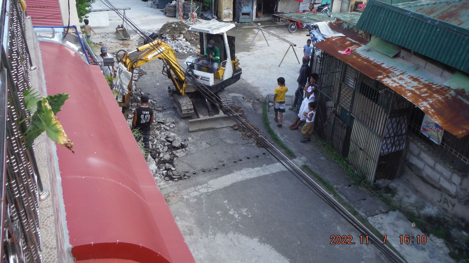
Zg176. Abra Street gets concrete and better drainage, the job, half length of the street is completed now. I met the SBFZ Chairman on Abra Street, he was handing out rice. Mr. Paulino, before this job he was the Mayor of Olongapo.
Zg177. The bankrupt hospital has a new owner and we hope it will have an emergency clinic, because there isn’t one in Barretto now.
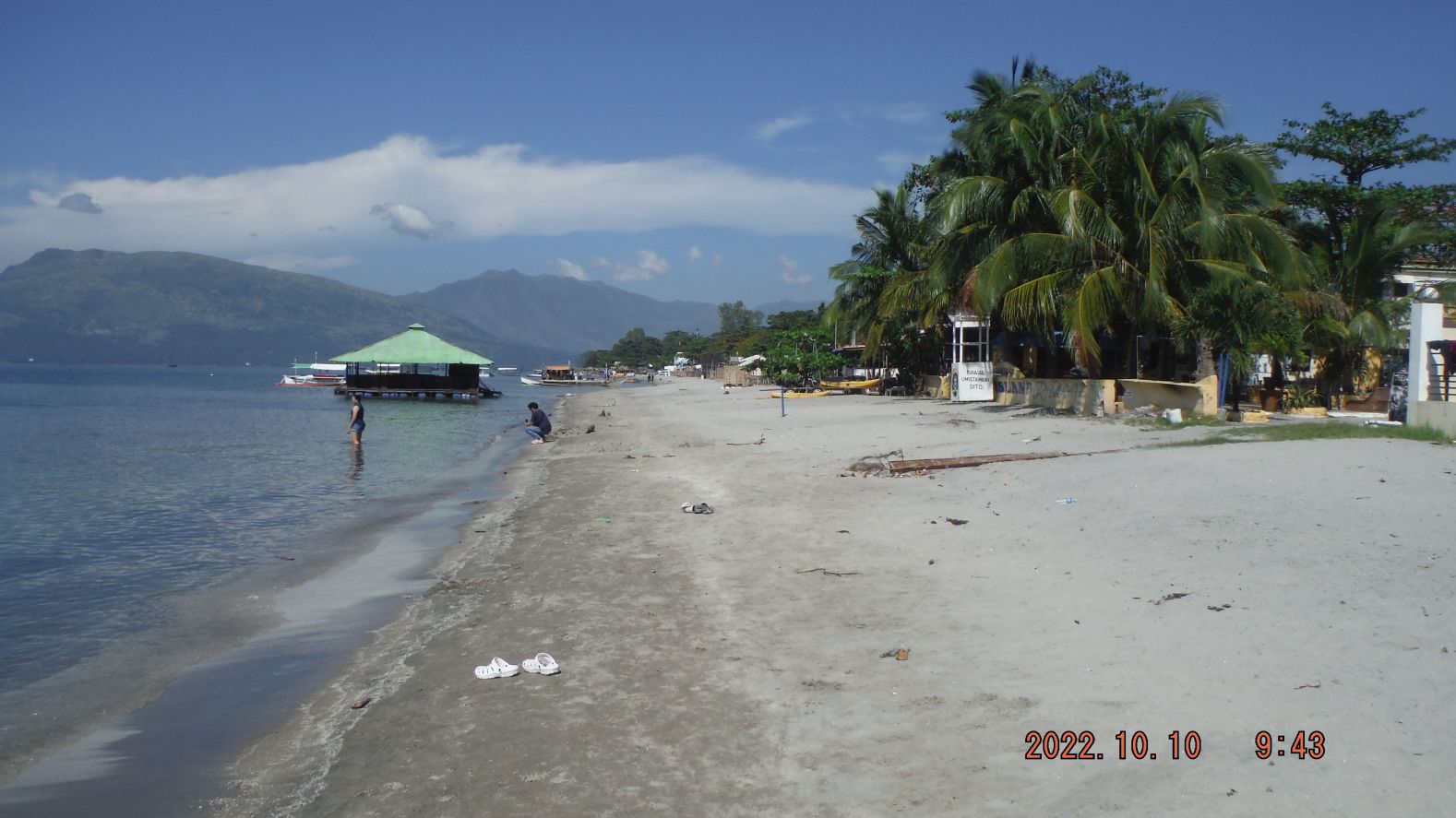
Zg178. Baloy Long Beach view, that floating bar run aground, was damaged, is repaired now and is in operation now.
Zg179. A new business, where the VFW used to be, opposite of the ex Marmont Hotel; the entertainment business has picked up since the virus from Red China is gone.
Zg180. A view from my house, this is last section of Jolo Street getting concreted. The road at right is the Del Pilar Street where the VFW and the ex Marmont Hotel used to be; it got concreted about a year ago.