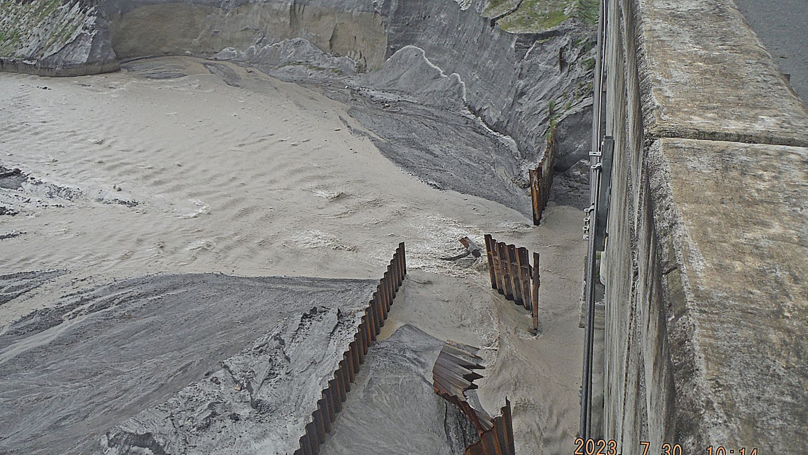
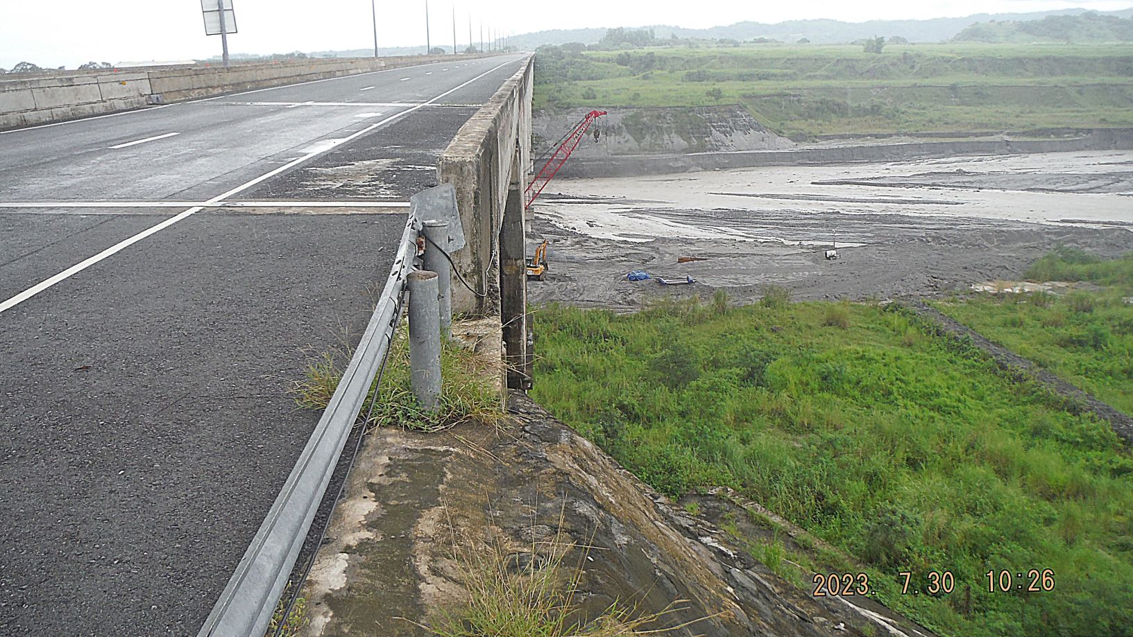
Zg425. (-Images #30 to #32) are 3 close-up images, looking down to the Pasig Potrero River from the east lanes of the bridge. It seems the iron sheeting; perhaps put in place to stable the river bed level was not good enough. I speculate they have to something similar in the near future, but better and stronger.
———————————-
This is for odd items in Pampanga that don’t deserve their own webpage.
———————————-
Pasig Potrero River Bridge, SCTEX July 2023 Problem
SCTEX has been secured July 2023 for traffic because the heavy rains are causing safety concerns; the Pasig Potrero River water is lowering the river bed around the bridge pilings. This day was a Sunday and the rains have slowed in Pampanga, so, I went to have a look. These pictures were shot on the excursion.
For this presentation I use 5 images only! Some parts of the images descriptions are based on the album image descriptions!
49 pictures are also uploaded in high resolution in this Flickr album, and in the other Luzon Albums #1 collection, click here:
Uploaded 49 images to my FB account as an album in low resolution, click here:
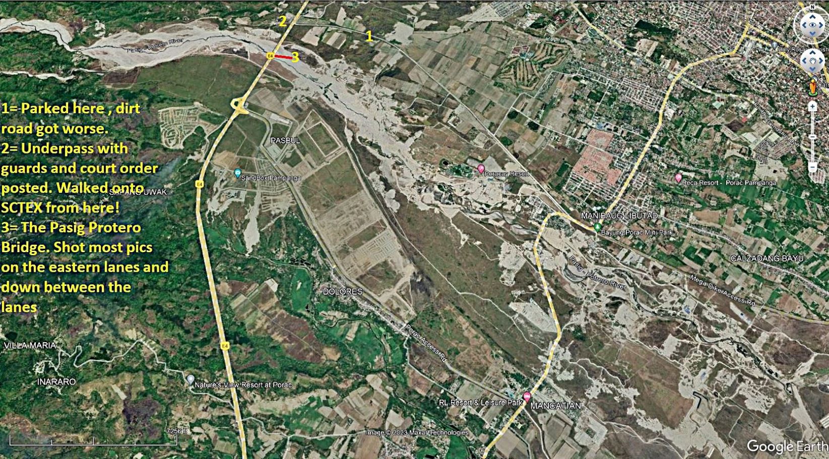
Zg423. (-Images #00 to #02) are a Google map as to where the bridge is; the name of the bridge as engraved at the bridge and your 81 year young guide. For the purpose of these image descriptions, let’s accept that the bridge runs on a north-south axis! I happen to love wearing that Army shirt, besides most Filipinos respect the Military.
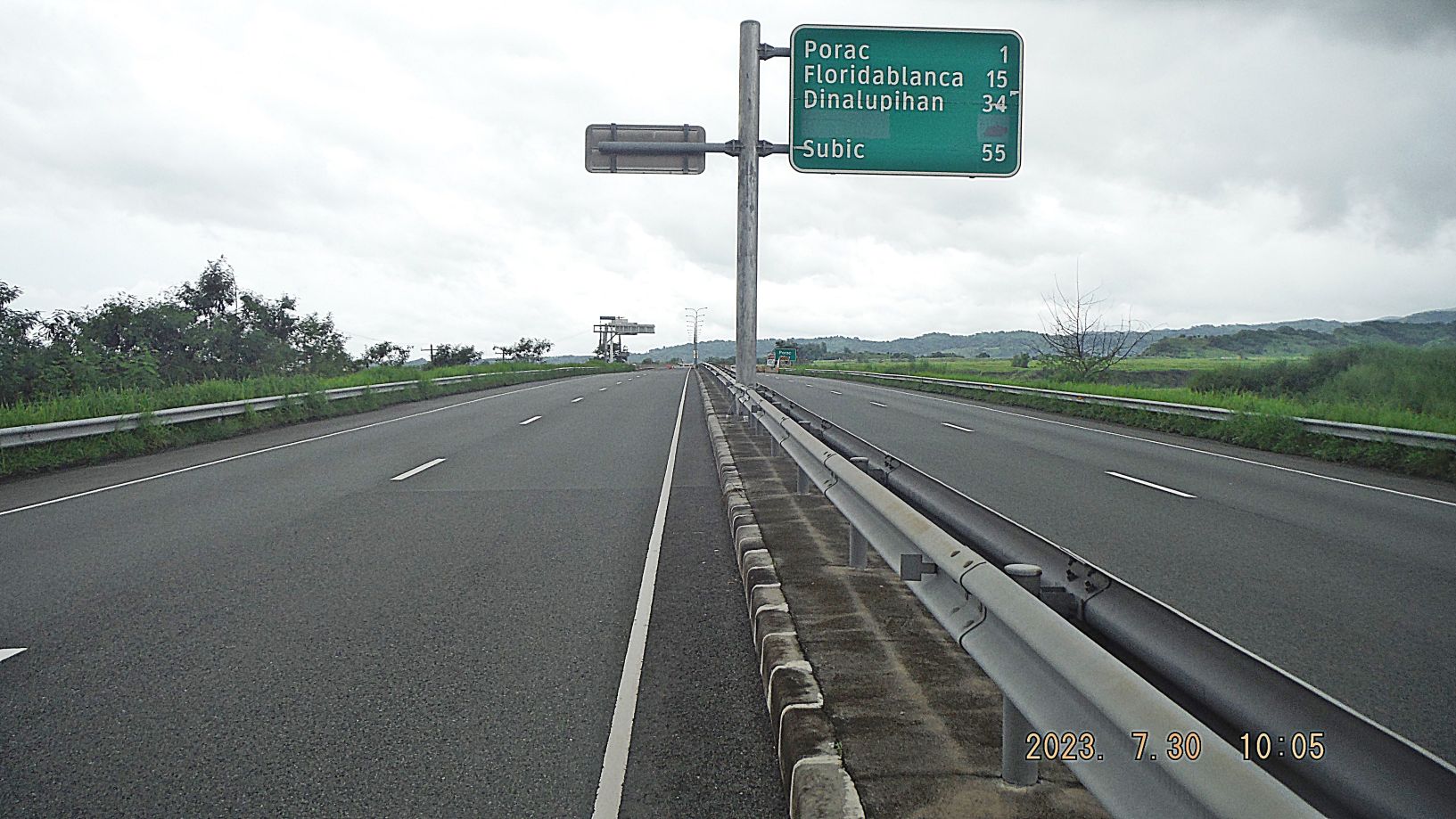
Zg424. (-Images #16 to #23) are pictures of my approach to the bridge; I had entered SCTEX about ½ Km or less north of it. I was walking on the east lanes and the west lanes a truck came by and moved thru some road blockage and he was going on the proper side, heading south. Note: some numbered pictures are not shown, because I did not use all for this presentation. Notice, there is no crack in the road as 2013 pictures show!
Zg425. (-Images #30 to #32) are 3 close-up images, looking down to the Pasig Potrero River from the east lanes of the bridge. It seems the iron sheeting; perhaps put in place to stable the river bed level was not good enough. I speculate they have to something similar in the near future, but better and stronger.
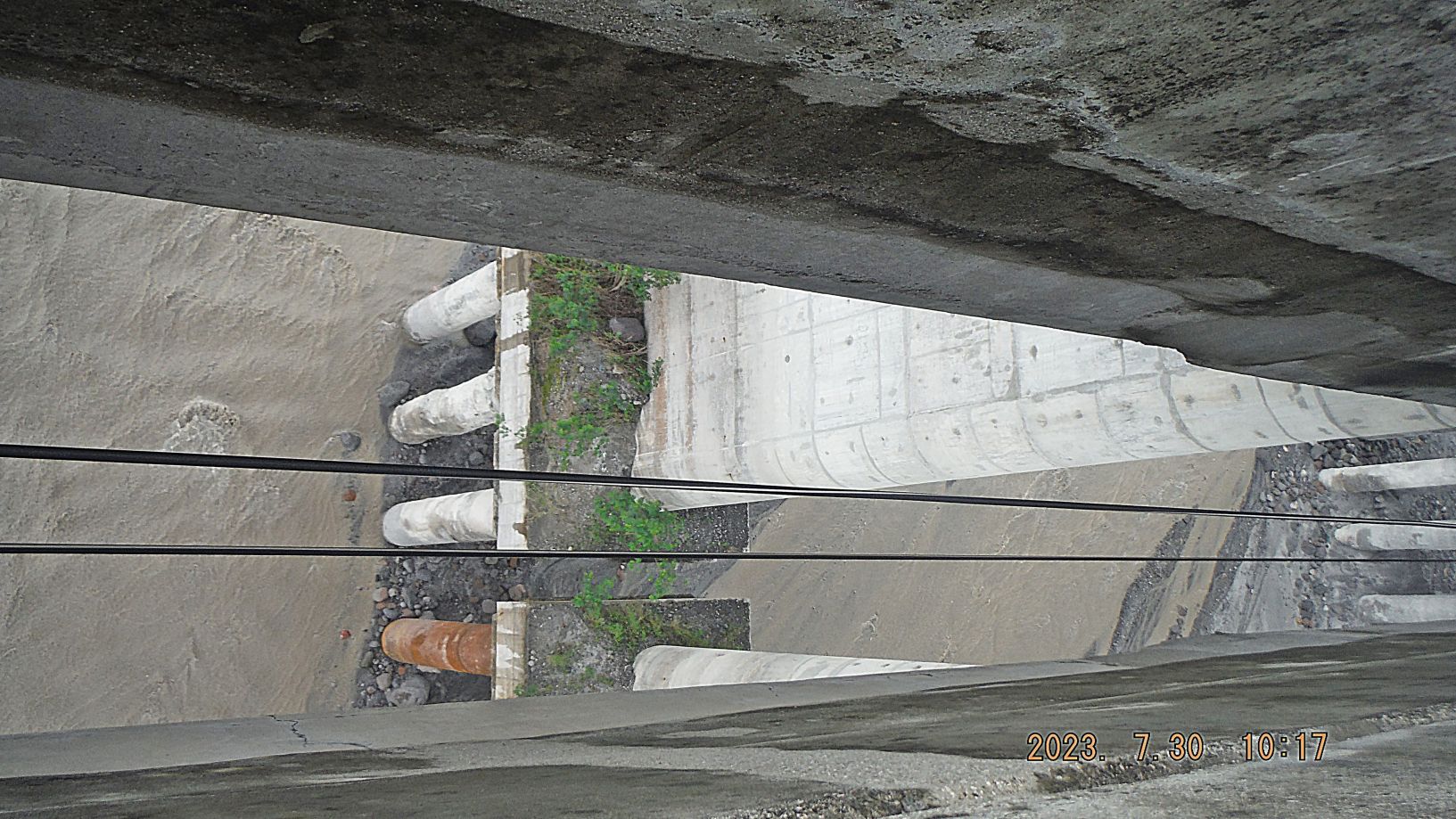
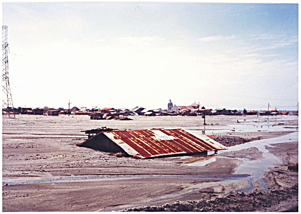
Zg426. (-Images #34 to #44) are views down the Pasig-Potrero River from the in-between space, between the west and east lanes of the Pasig Potrero River Bridge. There are two vista shots to the west. 8 shots are of the bridge pilings, important; they are the pilings under the west lanes because I was shooting from the east side. For these descriptions I will number then #1 to #5 piling sets and the run from south to north!!!
-Image #35, looking down to #2 piling set from a slightly south angle, looking at its south side! Much of the river bed at the piling base level is washed away.
Zg427. (-Images #45 to #48) are a round of shots, left to right, from the west lanes of SCTEC, on the Pasig Potrero Bridge, and mostly in the upriver direction.
————————————————————–
Bacolor got buried by the lahars in 1995
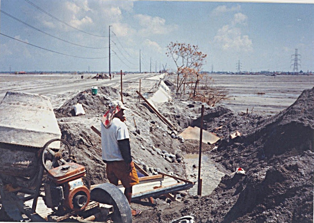
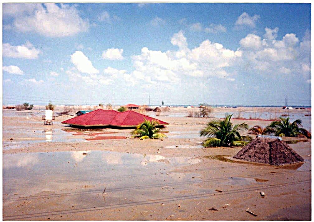
Bacolor got buried by the lahars of Mount Pinatubo several meters, the whole area became a desert. Many people died in Bacolor and the people were told to abandon their town. This flooding by lahar blocked the traffic to Bataan and Zambales for weeks. It was a nightmare for the people and government as a big struggle to go on with life. I was able to witness the situation. These are mostly 1995 images. Look in the www for “Bacolor flooded by lahar”!
This Tidbit presentation has only 6 images!
24 images have been posted as albums in these two venues, if you are interested:
Uploaded to FB as an album, click here:
Uploaded to Flickr as an album, 24 images and put in album collection “More Luzon Albums”, click here:

Zg728. (-02) this is a Bacolor town and area map, it is a section from a 1:50000 map. It is marked-up with names used in this album.

Zg729. (-07) this is the Bacolor Cockfighting Arena, partially buried by the Mt. Pinatubo lahar and it still stands today, just east of the east Megadike and just north of the Olongapo-Gapan Road.
Zg730. (-12) this is the beginning of the new Olongapo-Gapan Road in Bacolor in 1995; it is at the same place only a few meters higher now. The new official name of this road is Jose Abad Santos Ave, a true Filipino Hero! Notice the Bacolor Church at right in a distance.
Zg731. (-16) A view of the Bacolor area north of the Olongapo-Gapan Road that is the way it looked then. It has come back to life now! I don’t have a picture but I saw a Mercedes Car lifted up high and pushed against the roof and the lahar under it kept it there.
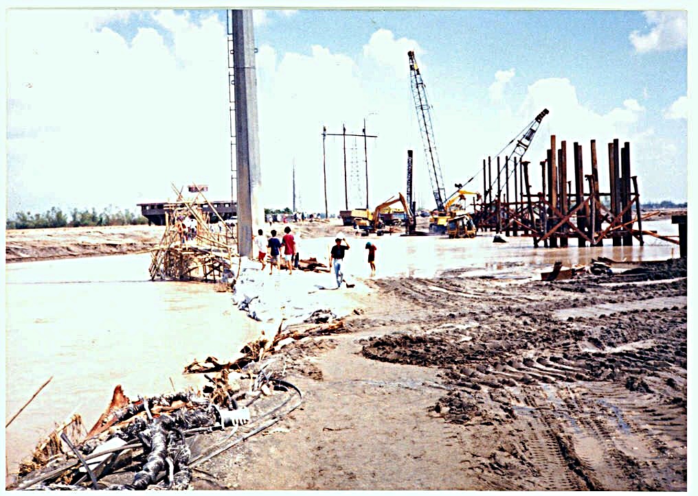
Zg732. (-20) In this picture you can clearly see why the traffic to Bataan and Zambales stopped and you can see exactly where this was because the Bacolor Cockfighting Arena is visible and it stands there today, although partially buried. The DPHW is building a temporary bridge over the Pasig Potrero River which is now flowing in the Gugu Creek bed but spilled over the banks and destroyed Barrio Cabalantian.
Zg733. (-21) A view of Bacolor Town proper south of the Olongapo-Gapan Road that is the way it looked then. It has come back to life now! We see the famous church that is buried up to the upper windows, which serve now as doors. In the future I will make a separate album of the church and other lahar albums. But I’m a busy man and it took 28 years to post this album!