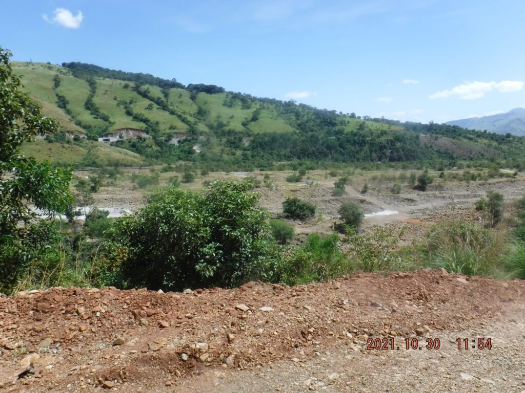
Zf383. One of 7 images of the Bucao River, where the Bucao River Dike hits the Bucao River reinforced embankment under the Baquilan Resettlement Village. We have views of the Bucao River, the Balin-Buguero River, Mt. Pinatubo and the unique irrigation intake, buried by the Mt. Pinatubo Lahars, but it still works great. We also see a recent irrigation improvement project.
+++++++++++++++++++++++++++++++++++++++++++++++++
This bridge is part of the new Botolan to Capas Road being build, however so slowly. This day, 30th Oct. 2021, several families and mine decided to make a picnic trip to Camp Kainomayan Resort. This camp is located where the Bucao River Dike starts near the Baquilan Resettlement Village. This is my WALKING AREA, I have been here many times. So, I took advantage of this family trip and explored the Baquilan River mouth to see whether there is any progress in the construction of the Botolan-Capas Road. Well, a new bridge is being constructed!
Some 90 images of this exploration trip where uploaded with high resolution into this Flickr album, click here:
+++++++++++++++++++++++++++++++++++++++++++++++++++++++++
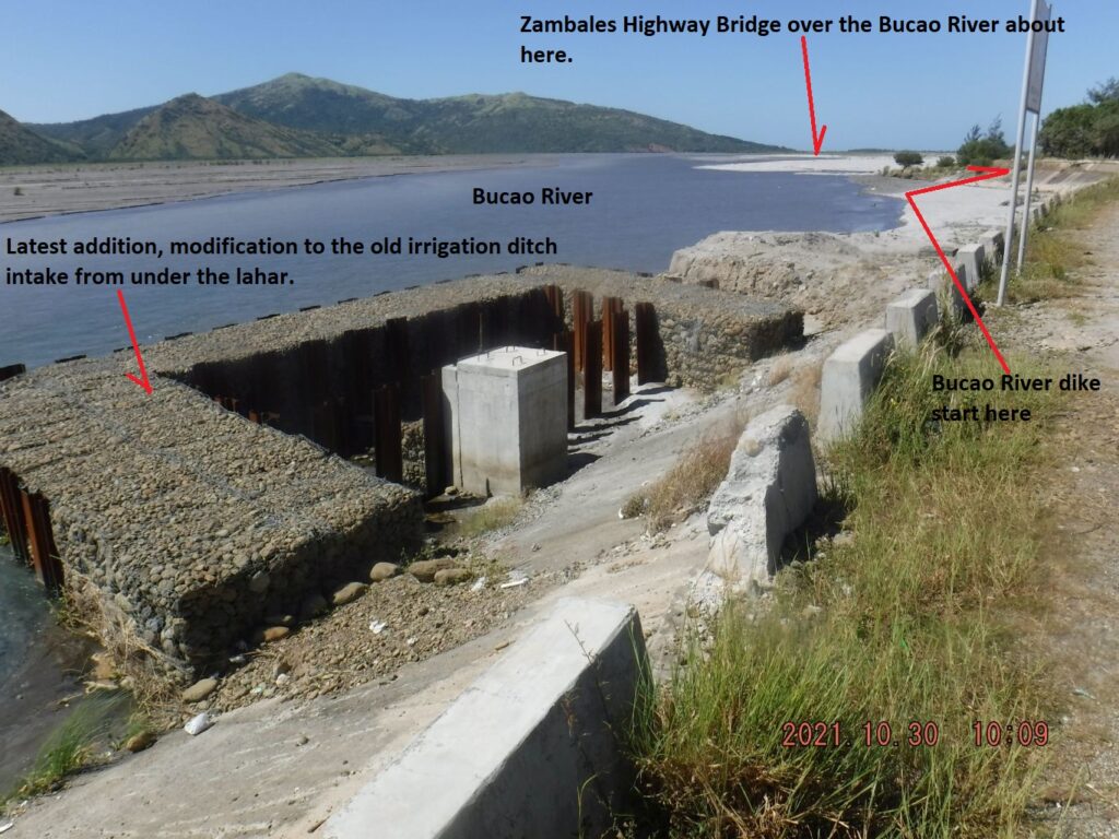
Zf384. One of 7 images of the Bucao River, where the Bucao River Dike hits the Bucao River reinforced embankment under the Baquilan Resettlement Village. We have views of the Bucao River, the Balin-Buguero River, Mt. Pinatubo and the unique irrigation intake, buried by the Mt. Pinatubo Lahars, but it still works great. We also see a recent irrigation improvement project.
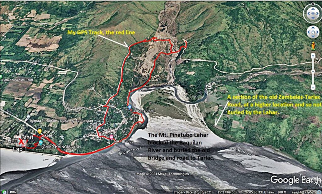
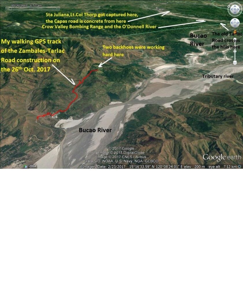
Zf385. One of 8 map or data images of the area of the Baquilan River Mouth. It shows roads that are being used now and roads to be used when the Zambales-Tarlac Road is finished. The maps also show my GPS track. The pictures show the Baquilan Resettlement village, the irrigation intakes and the irrigation ditch, the embankment reinforcement at the foot of the Baquilan Village location. The maps show the water flows of the Bucao and Baquilan Rivers. We also see the location of the Bucao River Dike and Camp Kainomayan. This is my GPS track of the 30th Oct. 2021!
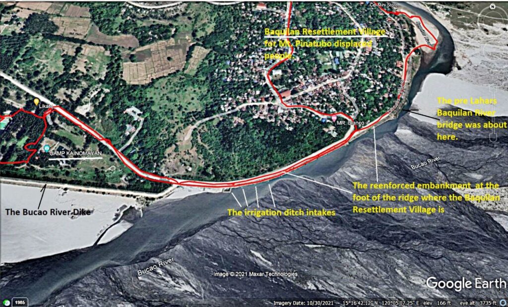
Zf386. One of 8 map or data images of the area of the Baquilan River Mouth. It shows roads that are being used now and roads to be used when the Zambales-Tarlac Road is finished. The maps also show my GPS track. The pictures show the Baquilan Resettlement village, the irrigation intakes and the irrigation ditch, the embankment reinforcement at the foot of the Baquilan Village location. The maps show the water flows of the Bucao and Baquilan Rivers. We also see the location of the Bucao River Dike and Camp Kainomayan.
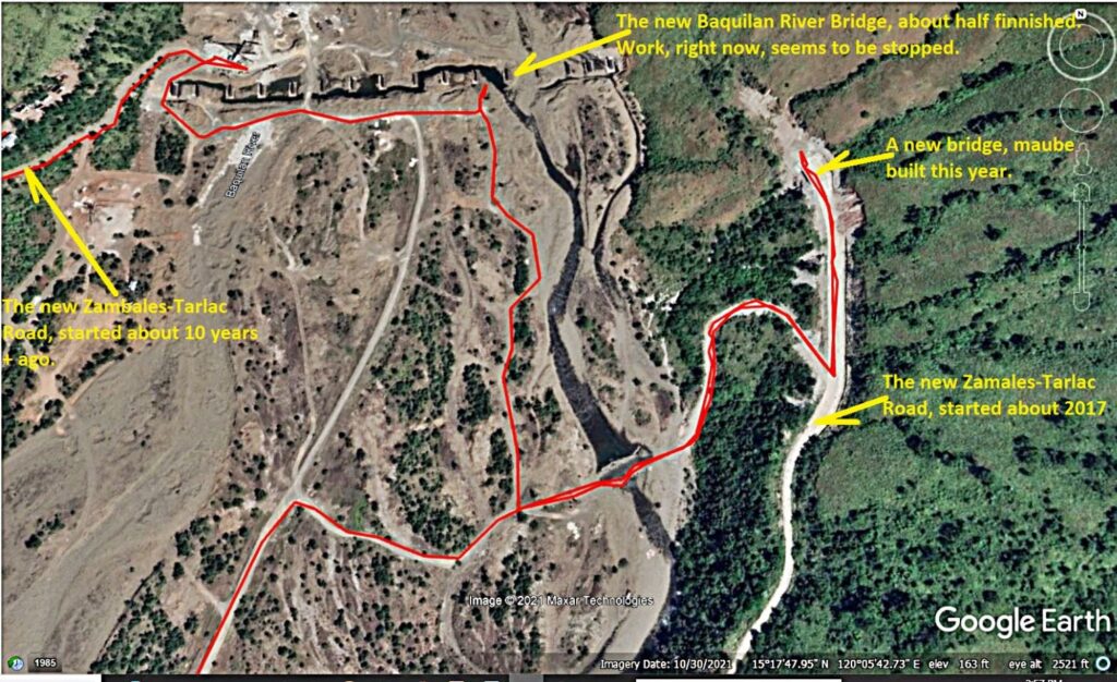
Zf387. One of 8 map or data images of the area of the Baquilan River Mouth. It shows roads that are being used now and roads to be used when the Zambales-Tarlac Road is finished. The maps also show my GPS track. The pictures show the Baquilan Resettlement village, the irrigation intakes and the irrigation ditch, the embankment reinforcement at the foot of the Baquilan Village location. The maps show the water flows of the Bucao and Baquilan Rivers. We also see the location of the Bucao River Dike and Camp Kainomayan. This is my GPS track in the vicinity of the two bridges on the 30th Oct. 2021!
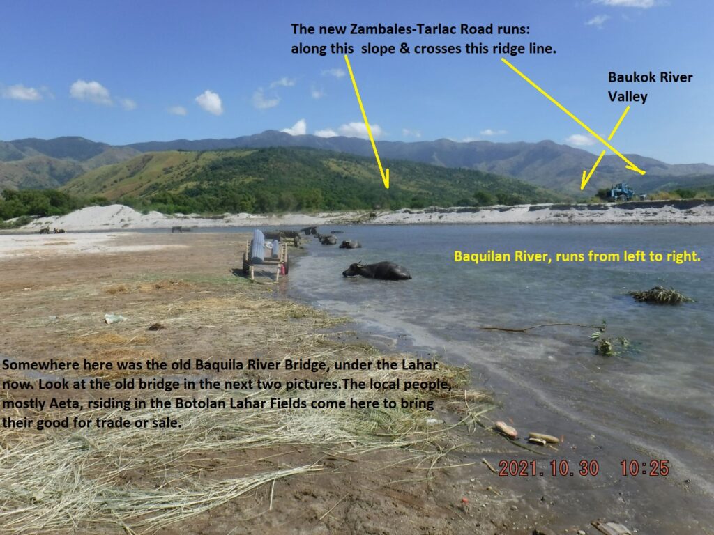
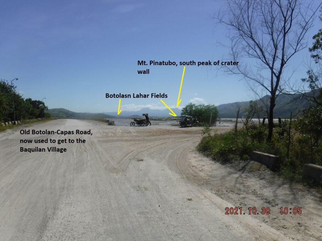
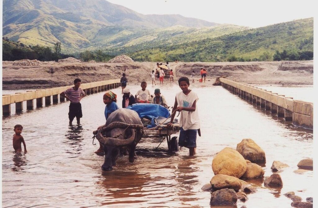
Zf388. One of 23 images of the Baquilan River Mouth area (including 2 pics from 2002), the first few pictures show the Bucao River embankment at the foot of the Baquilan Resettlement Village Ridge, under/down from the village. This is also the old Zambales to Tarlac Road, this is the area where the Bucao River Lahar blocked the Baquilan River and buried the old road and bridge. This is the place where the people from the Botolan Lahar Fields, the NW area from Mt Pinatubo, bring their material for sale or trading. The last pictures show us going upriver where vehicles cross to get to the new Botolan-Capas Road.
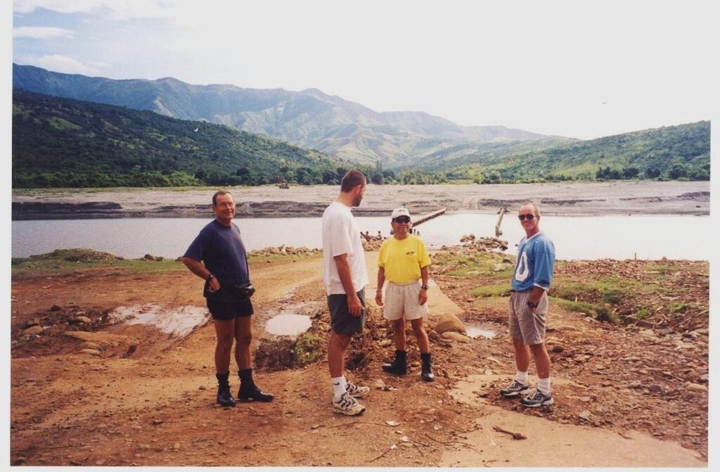
Zf389. One of 23 images of the Baquilan River Mouth area (including 2 pics from 2002), the first few pictures show the Bucao River embankment at the foot of the Baquilan Resettlement Village Ridge, under/down from the village. This is also the old Zambales to Tarlac Road, this is the area where the Bucao River Lahar blocked the Baquilan River and buried the old road and bridge. This is the place where the people from the Botolan Lahar Fields, the NW area from Mt Pinatubo, bring their material for sale or trading. The last pictures show us going upriver where vehicles cross to get to the new Botolan-Capas Road. This is a 2002 image from my friend Joss, this former Baquilan River Bridge is now deep under the Lahar. This is a 2002 image from my friend Joss, this former Baquilan River Bridge is now deep under the Lahar.
Zf390. One of 23 images of the Baquilan River Mouth area (including 2 pics from 2002), the first few pictures show the Bucao River embankment at the foot of the Baquilan Resettlement Village Ridge, under/down from the village. This is also the old Zambales to Tarlac Road, this is the area where the Bucao River Lahar blocked the Baquilan River and buried the old road and bridge. This is the place where the people from the Botolan Lahar Fields, the NW area from Mt Pinatubo, bring their material for sale or trading. The last pictures show us going upriver where vehicles cross to get to the new Botolan-Capas Road. This is a 2002 image from my friend Joss, this former Baquilan River Bridge is now deep under the Lahar.
Zf391. One of 23 images of the Baquilan River Mouth area (including 2 pics from 2002), the first few pictures show the Bucao River embankment at the foot of the Baquilan Resettlement Village Ridge, under/down from the village. This is also the old Zambales to Tarlac Road, this is the area where the Bucao River Lahar blocked the Baquilan River and buried the old road and bridge. This is the place where the people from the Botolan Lahar Fields, the NW area from Mt Pinatubo, bring their material for sale or trading. The last pictures show us going upriver where vehicles cross to get to the new Botolan-Capas Road. This is a 2002 image from my friend Joss, this former Baquilan River Bridge is now deep under the Lahar. There was considerable motor bike traffic ON THE OTHER SIDE OF THE Baquilan River, maybe one day I catch a ride with them.
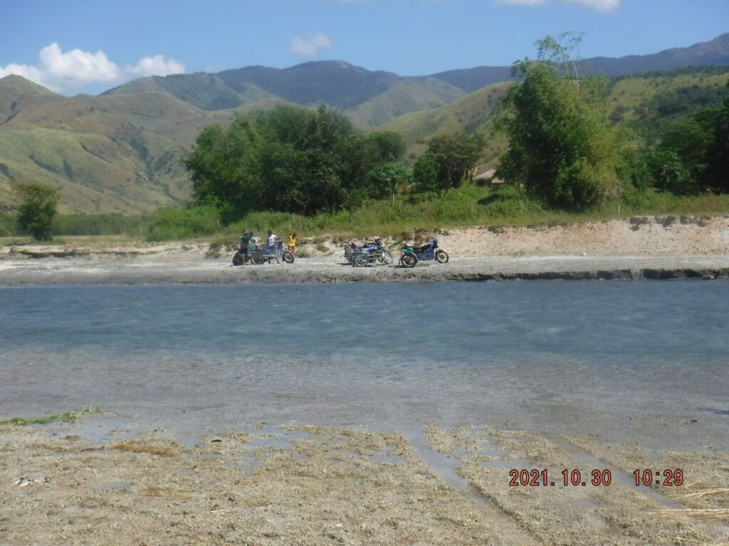
Zf392. One of 17 images of crossing the Baquilan River to get to starting point of the new Zambales-Tarlac Road that got started about 2017. I have walked that new road and reported about in our forum in this URL, click here:
I noticed considerable motorbike and tricycle traffic. Plus the river was used by many, mostly young people, for recreation. The new road is going into the Baukok River, which water is also draining into the Baquilan River. The last picture of this 17 image section is from that 2017 forum presentation.
Zf393. One of 17 images of crossing the Baquilan River to get to starting point of the new Zambales-Tarlac Road that got started about 2017. I have walked that new road and reported about in our forum in this URL, click here:
I noticed considerable motorbike and tricycle traffic. Plus the river was used by many, mostly young people, for recreation. The new road is going into the Baukok River, which water is also draining into the Baquilan River. The last picture of this 17 image section is from that 2017 forum presentation.
Zf394. One of 17 images of crossing the Baquilan River to get to starting point of the new Zambales-Tarlac Road that got started about 2017. I have walked that new road and reported about in our forum in this URL, click here:
I noticed considerable motorbike and tricycle traffic. Plus the river was used by many, mostly young people, for recreation. The new road is going into the Baukok River, which water is also draining into the Baquilan River. The last picture of this 17 image section is from that 2017 forum presentation.
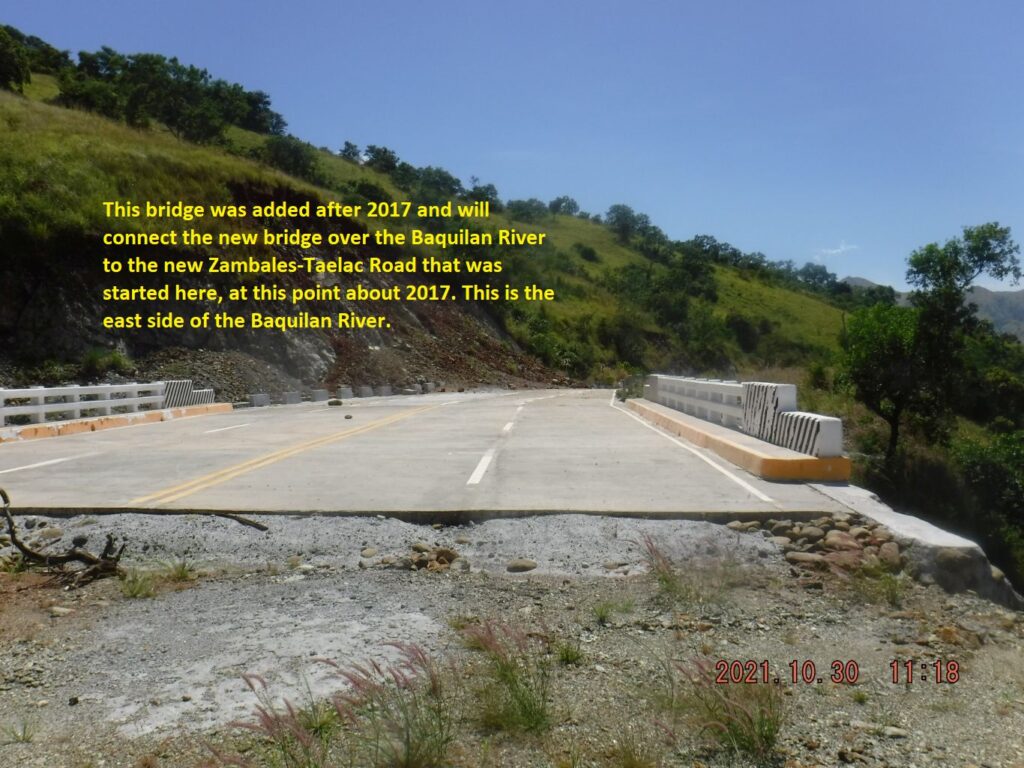
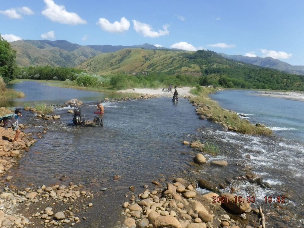
Zf395. One of 19 images of the area where two new bridges, cross the Baquilan River and connect the Zambales-Tarlac Road sections, west and east of the Baquilan River. The main river bridge is maybe 50 % finished but it seems work has stopped. A new bridge also was built on the east side of the Baquilan River to connect the river bridge with the new road on the east side. Here I crossed the Baquilan River again to return to my starting point.
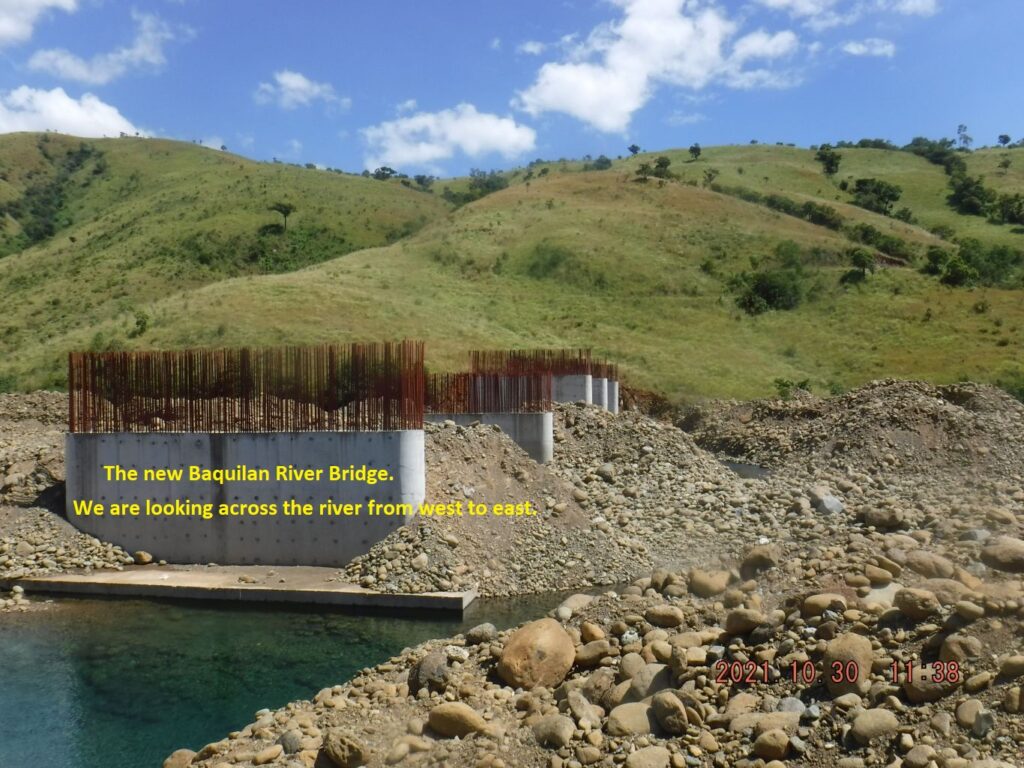
Zf396. One of 19 images of the area where two new bridges, cross the Baquilan River and connect the Zambales-Tarlac Road sections, west and east of the Baquilan River. The main river bridge is maybe 50 % finished but it seems work has stopped. A new bridge also was built on the east side of the Baquilan River to connect the river bridge with the new road on the east side. Here I crossed the Baquilan River again to return to my starting point.
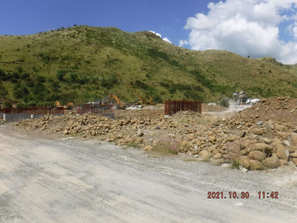
Zf397. One of 19 images of the area where two new bridges, cross the Baquilan River and connect the Zambales-Tarlac Road sections, west and east of the Baquilan River. The main river bridge is maybe 50 % finished but it seems work has stopped. A new bridge also was built on the east side of the Baquilan River to connect the river bridge with the new road on the east side. Here I crossed the Baquilan River again to return to my starting point.
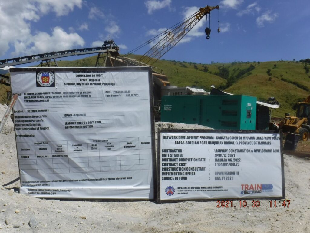
Zf398. One of 19 images of the area where two new bridges, cross the Baquilan River and connect the Zambales-Tarlac Road sections, west and east of the Baquilan River. The main river bridge is maybe 50 % finished but it seems work has stopped. A new bridge also was built on the east side of the Baquilan River to connect the river bridge with the new road on the east side. Here I crossed the Baquilan River again to return to my starting point.
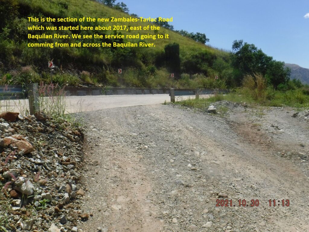
Zf399. One of 15 images of my walk from the new Baquilan Bridge, back to and down thru the Baquilan Resettlement Village. I enjoyed views of the new Baquilan River Bridge, the Baquilan River and Valley, the Baukok River Valley which the new Zambales-Tarlac Road goes into and leaves over a ridge. The mighty Bucao River came back into sight. In this picture we can see the new bridge on the east side of the Baquilan River.
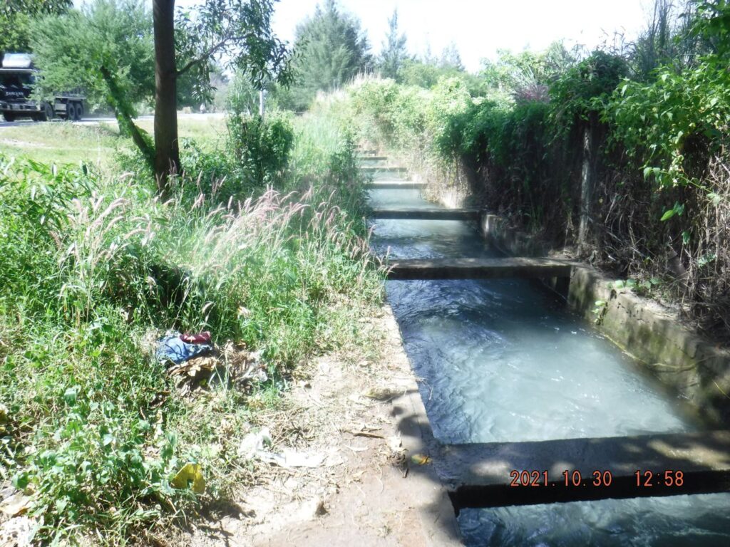
Zf400. One of 4 images of the Km Stone #202, which is 1 Km from Baquilan Village and 6 Km from Botolan, It is very close to the entrance of Camp Kainomayan. I find the irrigation system also very interesting it is taking in water from the Bucao River, runs under the Bucao River Lahar, under the Bucao River Dike, feeds some water into the stream in Camp Kainomayan and feeds an irrigation ditch with lots of water.
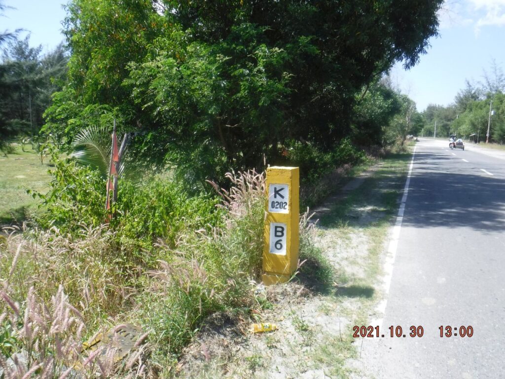
Zf401. One of 4 images of the Km Stone #202, which is 1 Km from Baquilan Village and 6 Km from Botolan, It is very close to the entrance of Camp Kainomayan. I find the irrigation system also very interesting it is taking in water from the Bucao River, runs under the Bucao River Lahar, under the Bucao River Dike, feeds some water into the stream in Camp Kainomayan and feeds an irrigation ditch with lots of water.