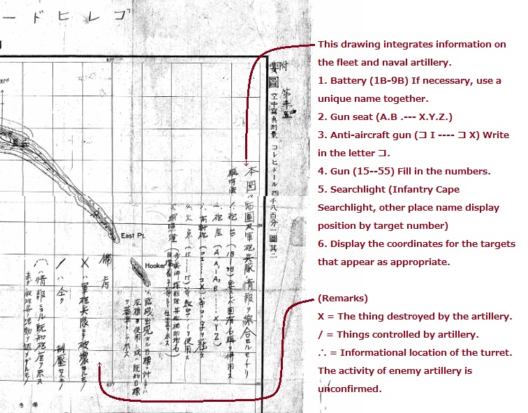
Zf122. One translated section of a Japanese WWII Corregidor Island, Fort Mills map, used by the Japanese Imperial Forces in the Siege of Corregidor. Picture courtesy, the Japanese National Archives and the Army Lt. Chester K. Britt Research Team.
Zf122. One translated section of a Japanese WWII Corregidor Island, Fort Mills map, used by the Japanese Imperial Forces in the Siege of Corregidor. Picture courtesy, the Japanese National Archives and the Army Lt. Chester K. Britt Research Team.