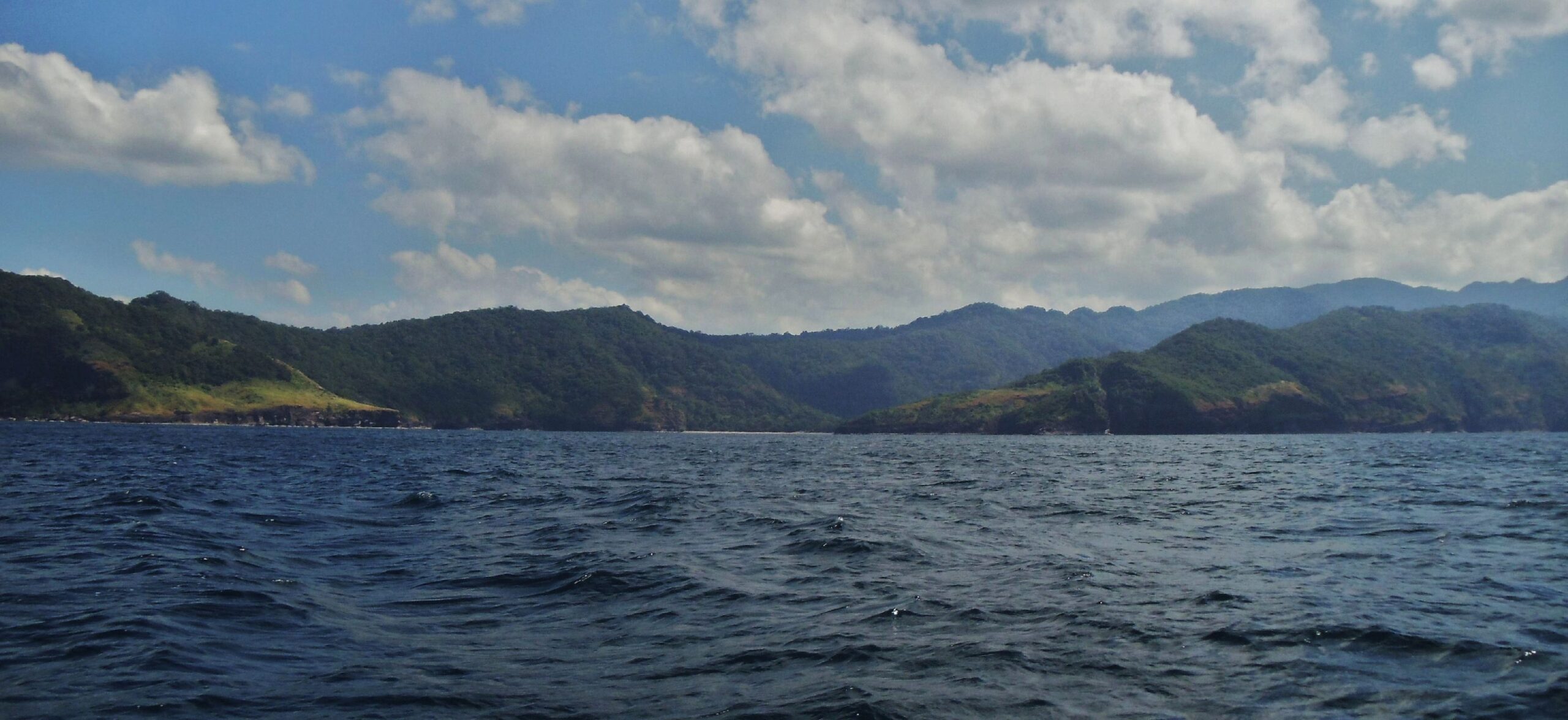
Zg633. Sinalang Cove as viewed from a boat that just departed from Carabao Island in 2012, the former Fort Frank, part of the Manila Bay Defense Command. Fort Frank got its water from there.
——————————————
Friends and I are interested in history and we wanted to check on the Fort Frank water source story. The pictures presented here are from my friend John Moffitt; we went to the Sinalang Cove on the 8th of Jan. 2024 to find the Ft. Frank Waterdam in Sinalang Cove. We learned about the Fort Frank water story from this web presentation: THE DOOMED PHILIPPINE INLAND SEAS DEFENSE PROJECT by Charles H. Bogart. This is the URL, click here:
I copied some relevant paragraphs and placed them between the pictures.
——————————————
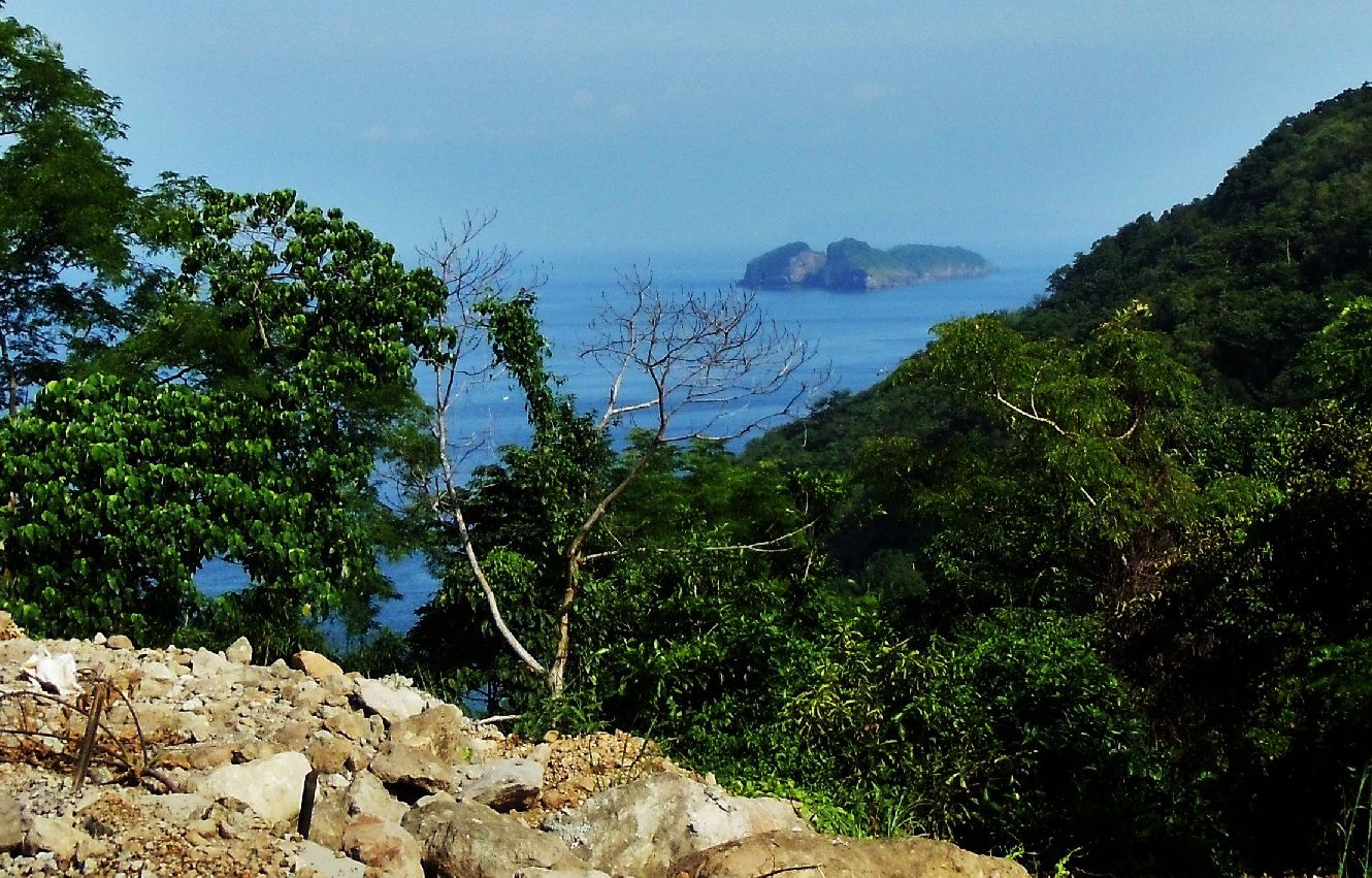
Zg634. This is a 2012 view of Carabao Island, the former Fort Frank, from the west side of the Kaybiang Tunnel when it was built and not opened yet.
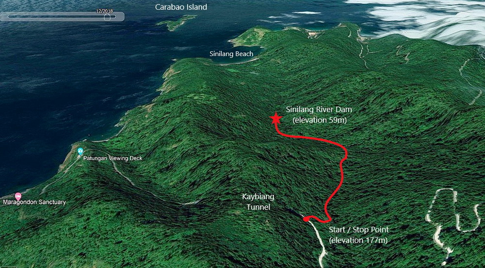
Zg635. This was our GPS track to find the Fort Frank Waterdam in the Sinalang Cove Valley as recorded by my friend John Moffitt; he spells it Sinilang. We had plans to visit Carabao Island on the 9th of Jan. 2024 and John suggested we find the water dam, by dropping down into the Sinalang Cove Valley at the east end of the Kaybiang Tunnel, the dayn before, the 8th Jan., and that is what we did and john took these pictures.
(One of many paragraphs from the above linked report at Corregidor.org)
On December 25, 1941 Colonel Boudreau reported to General Moore the abandonment of Fort Wint and the withdrawal of his troops behind the Bataan main line of resistance. As Boudreau was senior to Lieutenant Colonel Bill Stennis, commanding Fort Frank, he was ordered two days later to take Command of Fort Frank. This command Boudreau kept until the end of the battle.
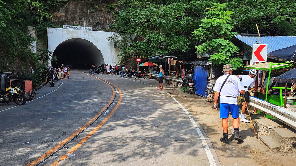
Zg636. This is the east end of the new Kaybiang Tunnel, part of the Ternate-Nasugbu Road and indeed we found a way down to the Sinalang Cove Valley, more or less right there at the entrance, going down to the right. The tunnel has become a frequent visited tourist spot!
On January 31, 1942 Battery Koehler’s 12 inch mortars, which had not been fired for a number of years, spoke in anger for the first time. Having detected Japanese preparations to bombard Fort Frank from the Pico de Lora Hills, counter fire was laid down on those positions within its range. A total 30 rounds were fired at gun positions near Ternate by the mortars to which the 155mm guns added 36 rounds. These Japanese guns were part of the Kondo Detachment and initially consisted of four 105mm and two 150mm guns. In mid-February another two l50mm guns would be added to this force.
Zg637. The opening, left in back, is the place where we come down, one can see a thin water hose strung high across the river bed.
The following day the Japanese included Fort Frank in their bombardment. From this time on, all the Manila Bay forts were to suffer from Japanese guns on the Cavite mainland. This fire was answered by all the forts and in particular Fort Frank. The lack of forward observers to adjust the first of the American guns however, greatly reduced their effectiveness. To help correct this problem on February 9 a photographic flight was made over the Cavite shore. These pictures were of some temporary help in connection with Captain Ivey’s radio reports. The pictures however became of less value after February 15 when the Japanese shifted their gun positions.
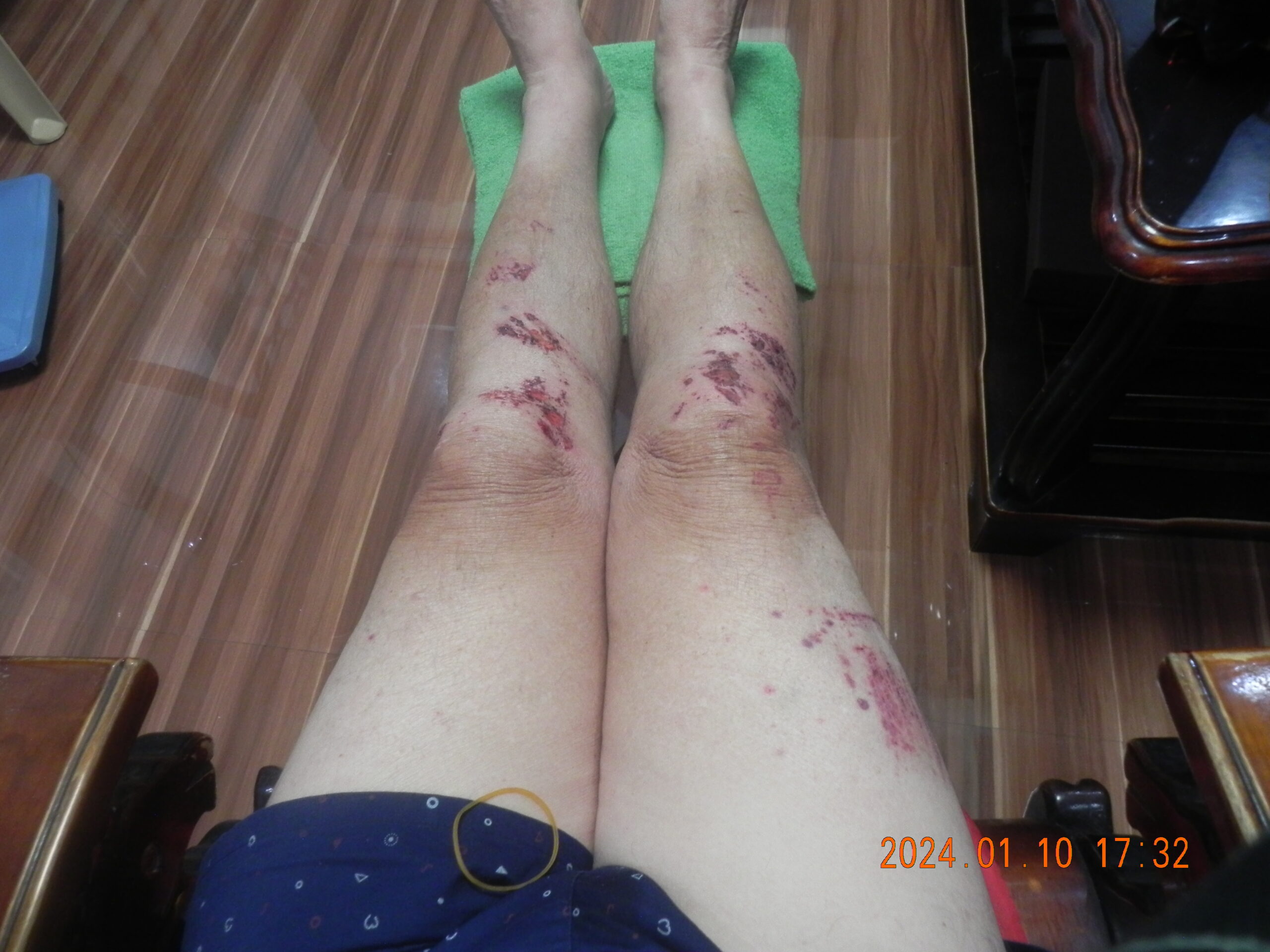
Zg638. My descent from the tunnel entrance to the valley floor was not all that smooth but it was not that serious and we continued the march.
On February 16 the Japanese struck what appeared to be a death blow to Fort Frank, by blowing up the pipeline that carried fresh water from the Calumpang Dam on the mainland to the fort (I believe the whole defense area across the mouth of Manila Bay was referred to as Calumpang Point Naval Reservation). Though Fort Frank had a distillation plant that was not put into operation, it was vulnerable to shell fire and low on fuel. Japanese troops were in such close proximity to Fort Frank that the following day the three 75mm beach defense guns were able to open on Japanese troops moving about in the open on the mainland.
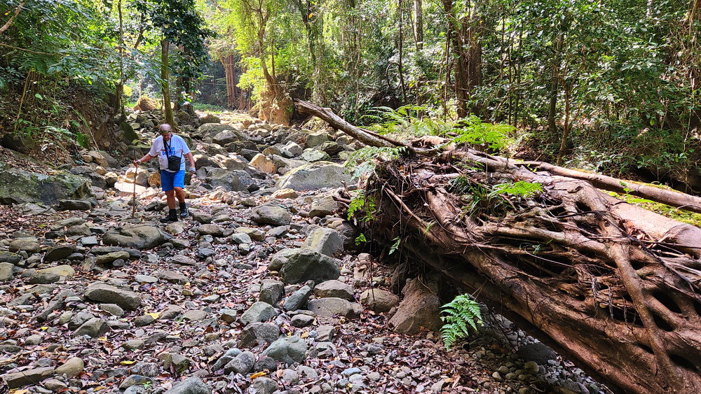
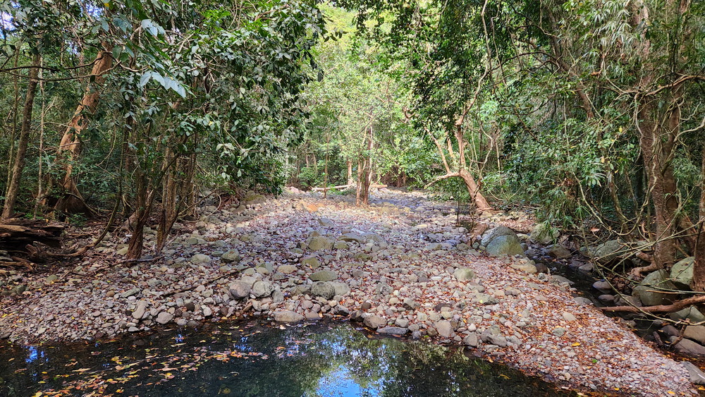
Zg639. We are on our walk down-river in the Sinalang Cove Valley, from just under the east end of the Kaybiang Tunnel, to find the Fort Frank Waterdam. A few stretches of the river valley was this easy.
On February 18 the Japanese concentrated most of their fire power on Fort Frank. At 9:30 p.m. they scored a hit on Battery Frank North Number 4 gun wounding seven of its crew. Shell fire was kept up against the fort into the night. As the shells continued to hit in and around Carabao Island the harbor boat Neptune tried to approach Fort Frank to deliver supplies. Forced to pull away from the pier once due to the shelling she returned again at 3:30 a.m. on February 19. As Neptune started to tie up to the pier she was hit on the bow by a Japanese shell that set afire 15 drums of gasoline intended for the fort’s generators, and 500 powder charges for the 155mm guns. The gasoline blaze quickly had Neptune afire from bow to stern and the crew abandoned over the side. All supplies aboard the ship were lost. In addition, floating burning gasoline came ashore and set the
island’s vegetation on fire in a number spots. It was only with great difficulty that the blazes were extinguished.
Zg640. Sometime on our walk down-river in the Sinalang Cove Valley, it was not so easy. I was hurting from my fall and I’ll be 82 years young in two month and we were sweating like pigs.
Loss of the gasoline supplies heightened Fort Frank’s critical fuel problem. To conserve fuel, Colonel Boudreau called for volunteers to return to the mainland and repair the blown water pipe. A party of 15 men landed later that day and began to repair the water pipe. While so engaged they were attacked by a number of Japanese, but assisted by Fort Frank’s 75mm gut beat off the attack, killing 25 to 30 of the enemy. The engagement however prevented the water line from being repaired.
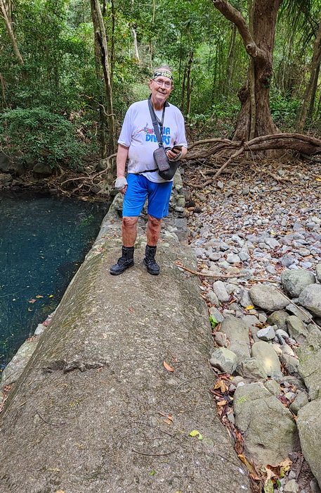
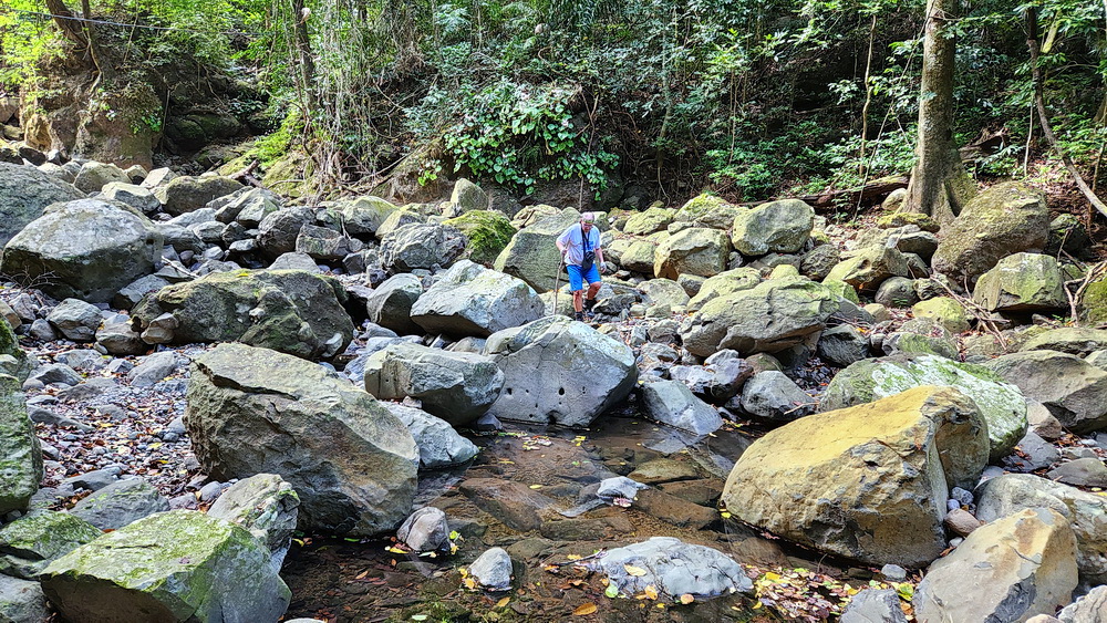
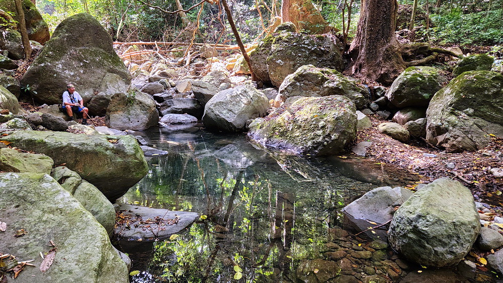
Zg641. We found the Fort Frank Waterdam in the Sinalang Valley.
Starting at 9:30 a.m. on February 20 Fort Frank along with Fort Mills and Hughes was subjected to a shelling that saw a round hitting each fort on an average of one a minute until late that afternoon. The next day was peaceful as the Japanese ceased firing to reposition their artillery. Battery Frank North however was active on February 29 taking under fire Japanese troops near Ternate and Maragondon on the Cavite mainland while the 75mm guns fired on Japanese troops at Calumpang on February 26. The lull which now took place was put to good use by Fort Frank and the other forts as they strengthened fortifications and repositioned guns.
Zg642. We found the Fort Frank Waterdam in the Sinalang Valley. I needed to rest and my friend John Moffitt looked around but did not find anything noteworthy.
A further cut in the food issue at Fort Frank and the other forts came on March 2 when each ration was cut to three-eighths normal issue. That same day an attack by two dive-bombers caused little damage to the fort but resulted in one aircraft being shot down by Battery Ermita. A few days later Battery Koehler’s 12 inch mortars hit Japanese artillery positions being prepared near Pico del Oro. Koehler’s salvos of eight 670-pound shells, when equipped with instantaneous fuses, were the most effective counter-batter instrument possessed when using high explosive shells, which were in short supply, did little real damage as most of the shells fired were armor piercing and thus exploded only after penetrating the ground for some distance. Only batteries Frank North, Ermita and 75mm guns had any large number of high explosive shells.
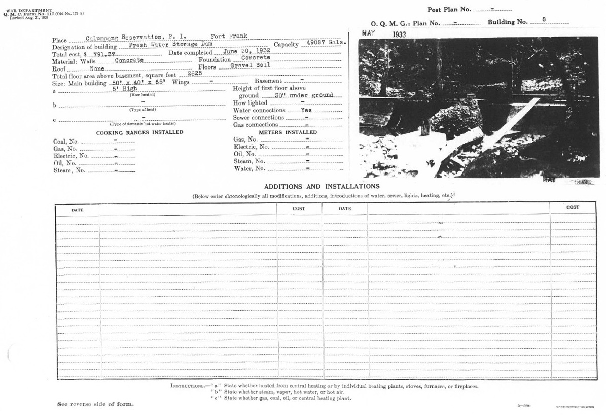
Zg643. This is a US Army project completion report 20th June 1932 of the completion of a Fresh Water Storage Dam in the Calumpang Reservation for Fort Frank; with a picture of the dam.
This document with picture was attained and shared by Tony Feredo.
Battery Ermita drew blood again on March 6 when it shot down a Japanese plane on reconnaissance over the fort. It was also on this day that a Filipino civilian delivered to the fort a Japanese demand for its surrender. The substance of the message according to General Moore was:
Surrender Carabao and save lives, the whole area along coast line of Cavite Providence is now a Japanese Military Reservation, large guns in large numbers are being massed there, Carabao will be reduced by our mighty artillery fire, likewise Drum, after reduction of Drum and Carabao our invincible artillery will pound Corregidor into submission, batter it, weaken it preparatory to a final assault by crack Japanese landing troops. Be wise, surrender now and receive preferential Japanese treatment.
Needless to say this demand for surrender was ignored.
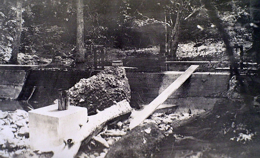
Zg644. This is a US Army project completion report 20th June 1932 of the completion of a Fresh Water Storage Dam in the Calumpang Reservation for Fort Frank; with a picture of the dam zoomed in. This document with picture was attained and shared by Tony Feredo.
With fuel stocks running low a new attempt was made on March 9 to repair the water line. Under cover of a barrage of shells from the 75mm guns a party landed on the mainland and after nine hours repaired the break. Amazingly, the Japanese did not interfere with the repair of the waterpipe though it lay on ground they occupied. For the remainder of March, Fort Frank was to have ample water.
The first part of March saw the 75mm guns firing numerous rounds of shrapnel at enemy concentrations while Battery Frank North struck at supposed Japanese gun positions. The enemy reply to these shots was feeble or non-existent. This, however changed on March 15 when the Hayakawa detachment’s two 240mm howitzers opened fire on Forts Frank and Drum. At this same time 155mm guns also hit Mills and Hughes. Hardest hit was Fort Frank which lost two guns each at Batteries Frank North and Ermita to direct hits, plus repairable damages to the other guns of these batteries. Also destroyed was a machine gun post, while Battery Koehler had seven of its mortars damaged. In all more than 500 shells hit Fort Frank this day.
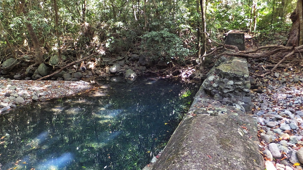
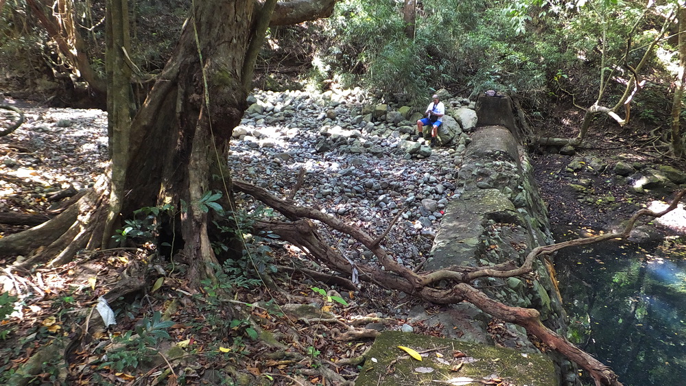
Zg645. This is the Fort Frank Fresh Water Storage Dam in the Sinalang Cove Valley, left is the down-river side; right is the up-river side, now filled to the rim with small rocks.
Next day the bombardment continued. General Moore’s after-action report stated of this continued bombardment: “A 240mm shell hit at junction of the vertical wall and emplacement floor at Battery Koehler, penetrated 18 inches of concrete, passed under a 6-foot concrete wall and exploded under the powder room. The floor was broken up and 60 cans mortar powder overturned but none was set off.”
On the following day Battery Koehler was back in action but still under fire from the Japanese. Counter fire from Fort Frank and the other forts was light in comparison with the Japanese barrage. The principal targets on Fort Frank were Batteries Koehler and Crofton. Battery Crofton from this time was to suffer on a number of occasions damaging near misses. It was able only to remain in operation by cannibalizing parts from Battery Greer. As soon as Crofton opened fire the Japanese would bring a wall of fire down around the open battery.
Zg646. This is the Fort Frank Fresh Water Storage Dam in the Sinalang Cove Valley, this is a view down-river.
The morning of March 20 brought tragedy to Fort Frank. The garrison was lined up in Crofton Tunnel to be inoculated. While waiting in line 240mm shell penetrated the roof of the tunnel and exploded. Killed were 28 men while 26 were wounded, several of these latter mortally. The wounded and dead were removed that night to Fort Mills. This did not prevent Battery Koehler from firing back at the enemy this night or the next day. The day’s shelling by the Japanese however marked the last firing of the 240mm howitzers from Cavite as the Hayakawa Detachment was disbanded on March and its guns transferred to Bataan.
The garrison of Carabao, based upon intelligence from a captured organization chart and prisoner interrogation, was estimated at 500 men. These were thought to be principally elements of a Japanese Naval landing unit. The date for the American assault landing was set for April 16, 1945. Prior to the assault the island was taken under fire from the Cavite shore 105mm and 155mrn Howitzers supported by 81mm and 4.2 inch mortars. Added to this was bombing by medium bombers and fighters dropping and 1,000 pound bombs and C-4 transports dropping 55 gallon drums Napalm. This was supported by gunfire from cruisers, destroyers and rocket ships. Principal target for the ships was the sea wall protecting the proposed landing area. This had to he knocked down if .a broad front (200 yards) was be provided for the landing. So intense was the bombardment that vegetation was stripped from the island.
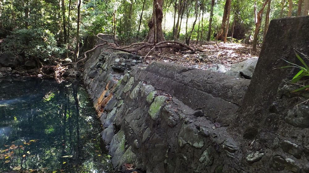
Zg647. This is the Fort Frank Fresh Water Storage Dam in the Sinalang Cove Valley, left is the down-river side; right is the up-river side, now filled to the rim with small rocks.
Assault waves of the 1st Battalion of this 151st Infantry went ashore 9:03 a.m. April 16 supported by C Company, 113th engineers. The initial wave consisted of two platoons, one securing the beachhead while the other advanced to capture the crest line. Following units placed a block across the north side of the connecting ridge and then occupied the south side of the island. This was followed by securing the western peninsula and then the northern end of the island. No enemy troops were encountered in the sweep but a number of supply dumps were found and destroyed, while all caves were sealed by engineers using explosives and a bulldozer that had been winched to the top of the hill. The only living object found on the island was a pig.
Investigation of documents found showed that the garrison had slipped ashore to Cavite the week before the assault.
Though no resistance was encountered in the capture of Fort Frank, five men were killed and 18 wounded in an undetermined explosion about 11 a.m. Three causes were suggested for the explosion: a booby trap, a short artillery round, or a premature explosion of a demolition charge.
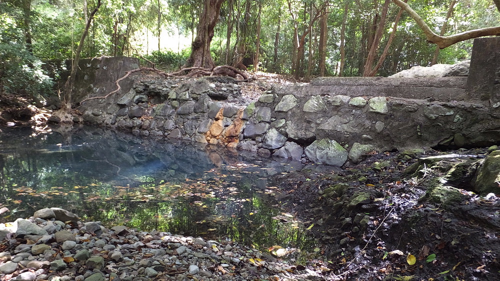
Zg648. This is the Fort Frank Fresh Water Storage Dam in the Sinalang Cove Valley, left is the down-river side; right is the up-river side, now filled to the rim with small rocks.
The post-war American and Philippine occupation of Carabao brought no attempt to restore the fortifications. When the Philippine government took possession of Carabao Island in 1946 it at first maintained a small garrison on the isIand but this was later withdrawn. Since then unauthorized scrap metal collectors have stripped Fort Frank of all its armament and have started to break up the concrete for its iron reinforcement rods. What the scavenger has not taken away is being reclaimed by the jungle.
Charles Bogart
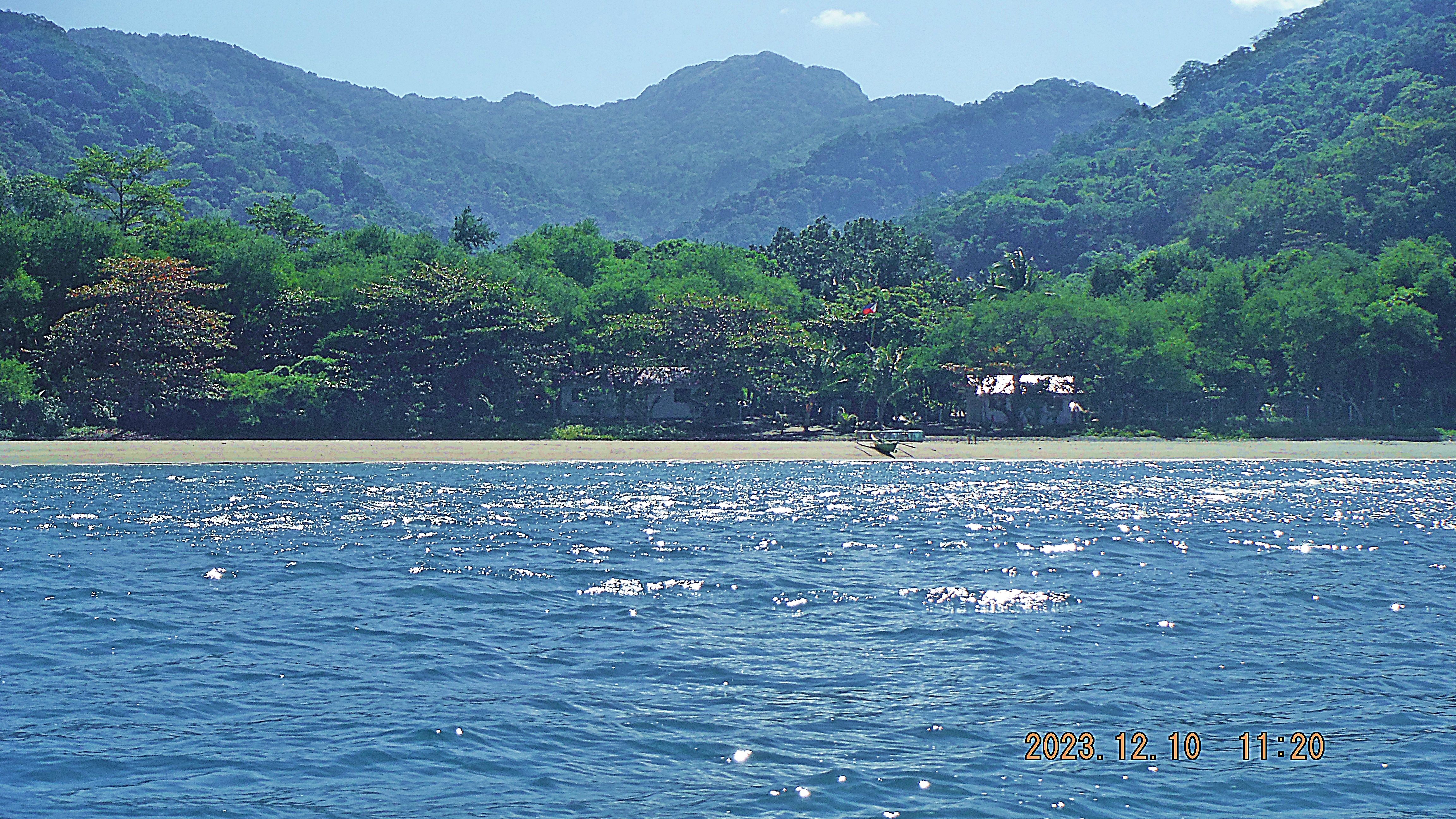
Zg649. This picture is the Sinalang Cove Beach from my exploration trip on the 10th Dec. 2023. We noticed 2 structures and a boat and I believed that on our future planed trip to Carabao Island we will check this out. We knew from history that the US Army had structures for maintenance personnel here and structures for water storage or settling.
On the 9th Jan. 2024 we did make a landing here. About 4 dogs greeted us and did their duty and tried to alert their master. It took repeated “Tao Po” until a male person came thru a fence and he turned out to be not too friendly. He was not in uniform and there was no sign as to Military property or no trespassing signs. But all he managed to say, he is a Marine Sergeant, that this beach is restricted that we have to leave immediately and that he has to contact his Commanding Officer. He was not interested as to who we were or to treat us as fellow human residents of the Philippines. Well, that what we did and now I’m really glad that John Moffitt had the plan to attack this project by going down-river from near the Kaybiang Tunnel or we would have been very much disappointed about finding the Fort Frank Waterdam.