
Zf576. Pic #01: One of 5 images with my GPS track, and walking data from my Garmin GPS device and track account.
—————————————————————
In this web presentation I chose these 9 images, picture serial numbers referred to, are based on the 155 images in the long Photobucket album.
This is a challenging hike on the Redondo Peninsular, it separates the bay of Subic Bay from the South China Sea (here in the Philippines it is now called the Philippine West Sea). This area was part of the Olongapo Naval Reservation and was used as a target site for aircrafts and ships.
Had my wife drop me off at Sitio Abot, part of Barangay Cawag, at the end of the concreted road. They just started to extend the concrete. Started the walk about 6 am and it took me about 5 hours and 50 minutes, I’m getting old! I brought with me about 50 pictures of the people at that cove which I had shot in 2008. On the way up to the north Pass, I came across two young men and one of them was a child on one of those pictures. It had rained the night before, the trail was damp but it was no problem. It turned out to be a great day. I enjoyed the views going up and going down on the other side. A lot more activity is going on now, 14 years later from my visits in 2008. I dropped of the pictures and many people were happy to see themselves again 14 years before. I hired a boat, probably for too much money, 2000 peso and went to Punduquit. I treated myself to a meal at the CMC Bar & Grill-Double Suds Car Wash and Shot the Bull with the Boss, Chris. Then trice to San Antonio and a bus to Barretto. It was another great day in the PI.
—————————————————
If you are interested I uploaded the pictures into these three albums:
Uploaded to my Facebook account as an album with 48 images, click here:
Uploaded 48 pics of my Nagsasa Hike, 2022-03-15, into this Photobucket album, Philippines. Zambales, Redondo Peninsular, short version, click here: (Same pictures as in Facebook)
Uploaded 155 images of my Nagsasa Hike, 2022-03-15, into this Photobucket album, Philippines. Zambales, Redondo Peninsular, click here:
——————————————————-
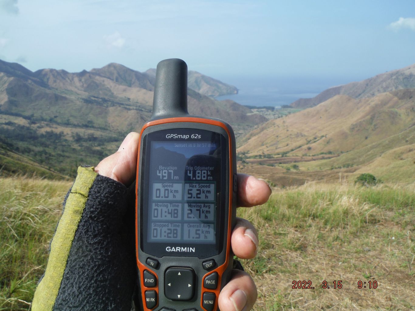
Zf577. Pic #13: One of 15 images of my hike to the Nagsasa Cove from Sitio Abot in Cawag to the North Nagsasa Ridge Pass. The Cawag Road is being extended. We see the trail on the bottom, clouds still hanging just under the Nagsasa Ridge (also spelled Nagzasa Ridge) and under the Pointed Peak (the name on my map). I meet two young men coming from Nagsasa Cove, one of them was a boy on my 2008 pictures. I reached the North Pass in about 3 hours and 16 minutes, I’m getting old! Caught the first great views of the cove. Got shots of my GPS devise and even 2 selfies with my camera.
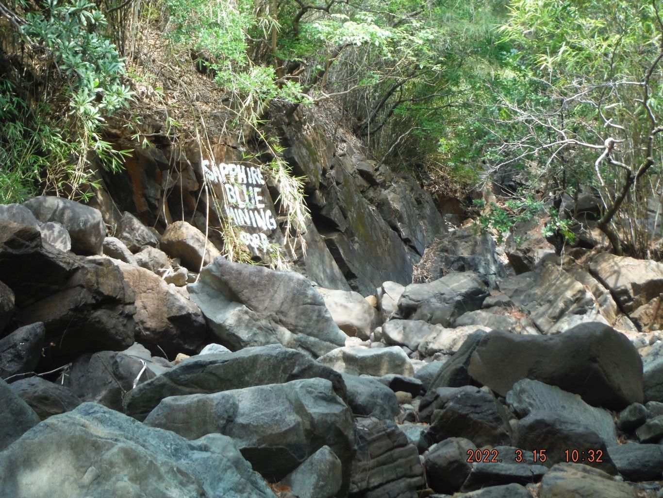
Zf578. Pic #41: One of 18 images descending down from the about 300 meter level to the 100 meter level thru woods, across the first river of stones where the chromite mine operation was going on about 15 years ago. Several piles of chromite were still in the area. These pictures are numbered #33 to #50.
Thru out this album, I shot rounds of pictures always from left right, clockwise. A piece of history, this whole valley was used by the US Navy as a Bombing and Strafing Range. For all I know, ships may have used it too. According to one Officer Friend I have, it was done pretty much to the end of our management but perhaps very few times toward the end of our stay. Around the year 2000 Canadian George and I descended to the cove via the South Pass and saw vehicles there, placed by helos, for targets. Then a lot more cattle were in the valley and we had many cow trails to descend on.
Zf579. Pics # 049. This is one of 31 images from the Ridgeline End, where the big river had to go around, where this trail had to go around and cross the river first. Then we have pictures crossing the Nagsasa Valley floor to the Sitio Nagsasa tree line. Sitio Nagsasa is sitting on a long sandbar which runs parallel to the long cove beach, along with trees that grow the whole length of the sitio and beach. Inland of the sandbar is a riverbed that has water at high tide and several bridges are now constructed to cross that water at high tide. And these pictures show as I cross the best bridge, about center of the sitio and we see the first facilities of this Nagsasa Cove. These pictures are numbered #030 to #060.
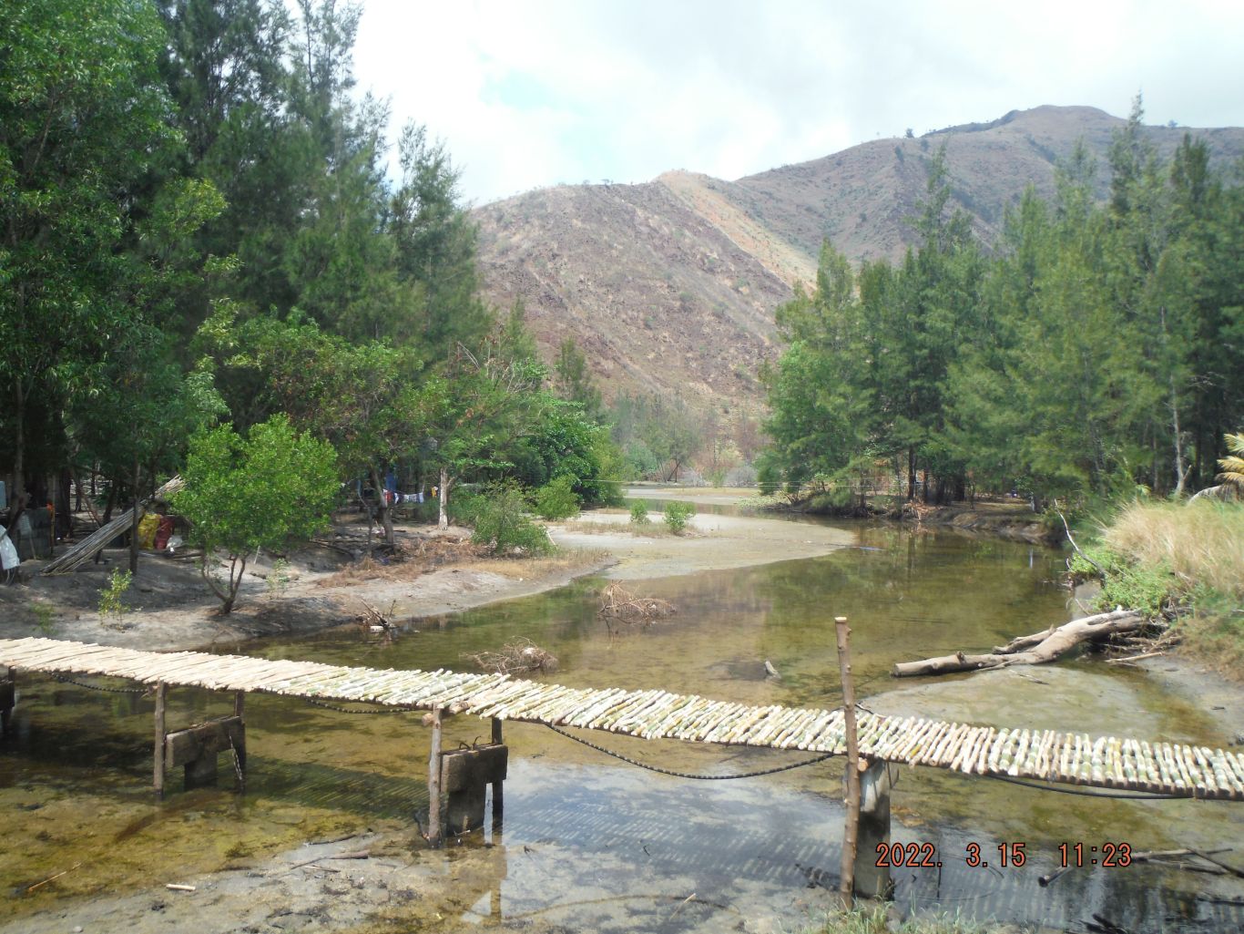
Zf580. Pics # 056. This is one of 31 images from the Ridgeline End, where the big river had to go around, where this trail had to go around and cross the river first. Then we have pictures crossing the Nagsasa Valley floor to the Sitio Nagsasa tree line. Sitio Nagsasa is sitting on a long sandbar which runs parallel to the long cove beach, along with trees that grow the whole length of the sitio and beach. Inland of the sandbar is a riverbed that has water at high tide and several bridges are now constructed to cross that water at high tide. And these pictures show as I cross the best bridge, about center of the sitio and we see the first facilities of this Nagsasa Cove. These pictures are numbered #030 to #060.
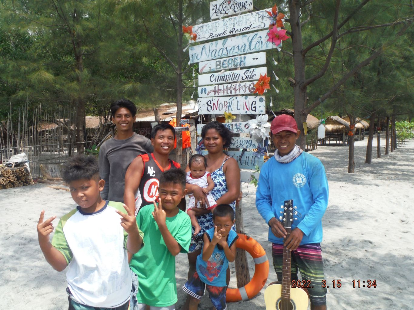
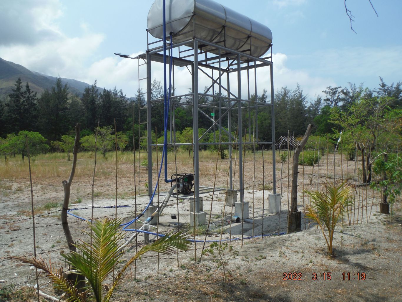
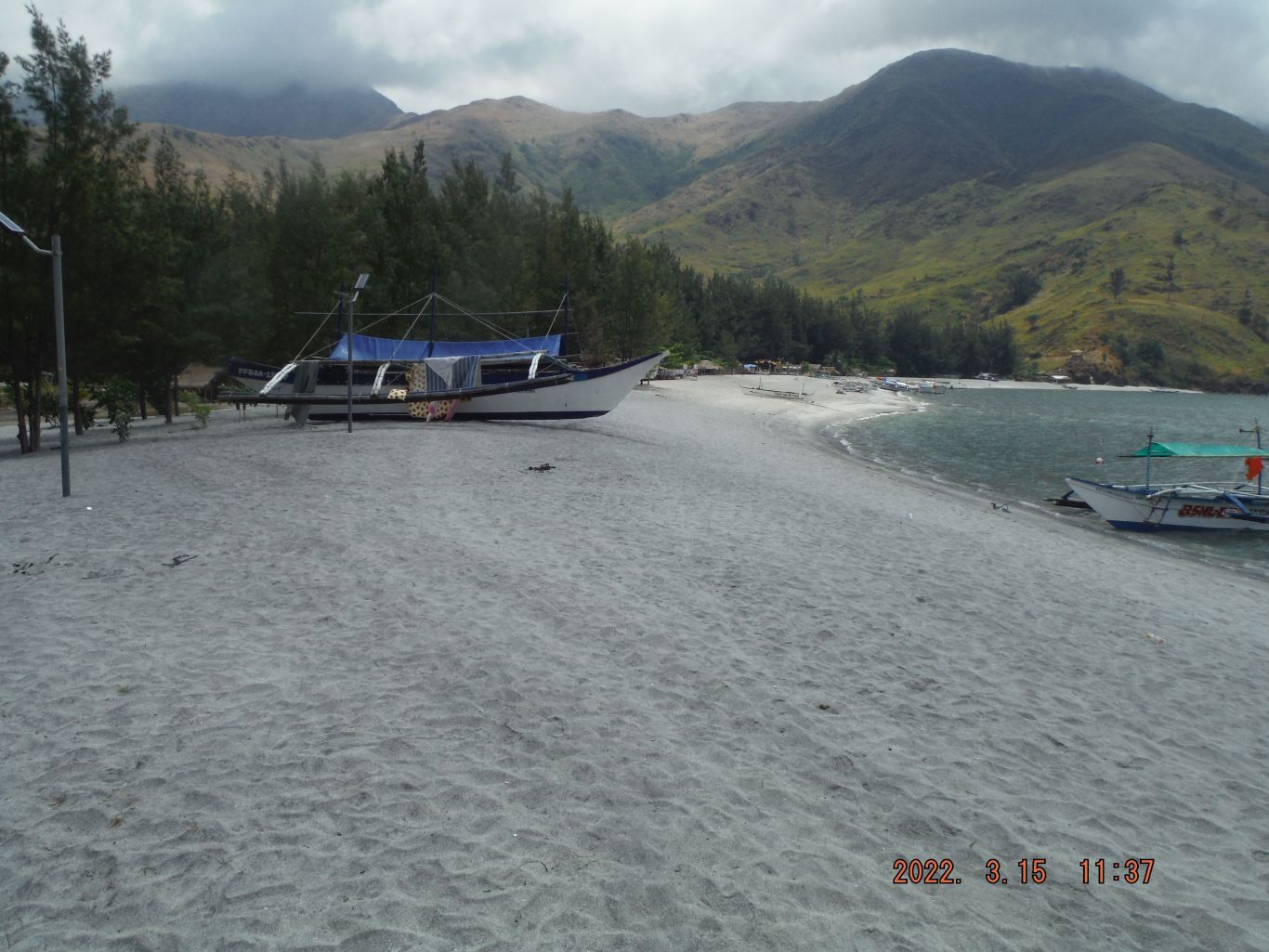
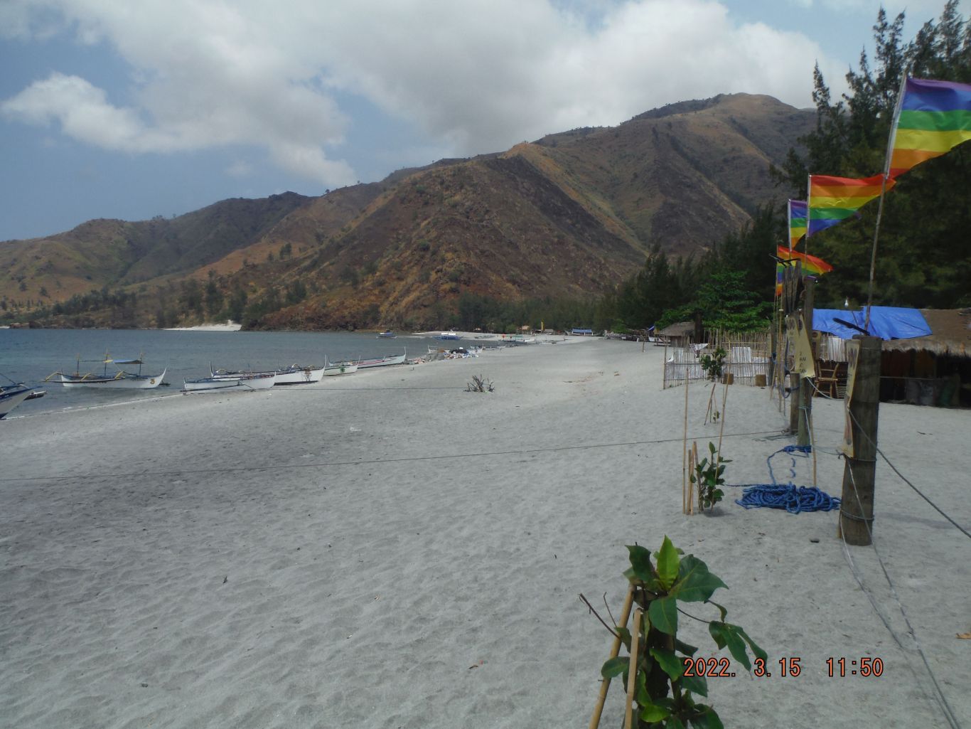
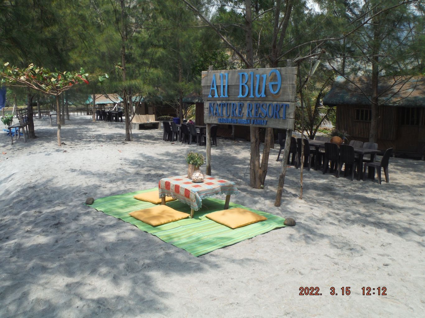
Zf581. Pics # 062. This is one of 44 images of the facilities available in Nagsasa Cove, grand views of cove and its beach and the ridge lines surrounding it. The pictures in this album are sorted alphabetical and in the order they were shot and are numbered #061 to #105. The first and last pictures show the people I shared the pictures with, which I had brought and the boat I hired to go to Pundaquit.
Zf582Pics # 063. This is one of 44 images of the facilities available in Nagsasa Cove, grand views of cove and its beach and the ridge lines surrounding it. The pictures in this album are sorted alphabetical and in the order they were shot and are numbered #061 to #105. The first and last pictures show the people I shared the pictures with, which I had brought and the boat I hired to go to Pundaquit.
Zf583. Pics # 076. This is one of 44 images of the facilities available in Nagsasa Cove, grand views of cove and its beach and the ridge lines surrounding it. The pictures in this album are sorted alphabetical and in the order they were shot and are numbered #061 to #105. The first and last pictures show the people I shared the pictures with, which I had brought and the boat I hired to go to Pundaquit.
Zf584. Pics # 099. This is one of 44 images of the facilities available in Nagsasa Cove, grand views of cove and its beach and the ridge lines surrounding it. The pictures in this album are sorted alphabetical and in the order they were shot and are numbered #061 to #105. The first and last pictures show the people I shared the pictures with, which I had brought and the boat I hired to go to Pundaquit.