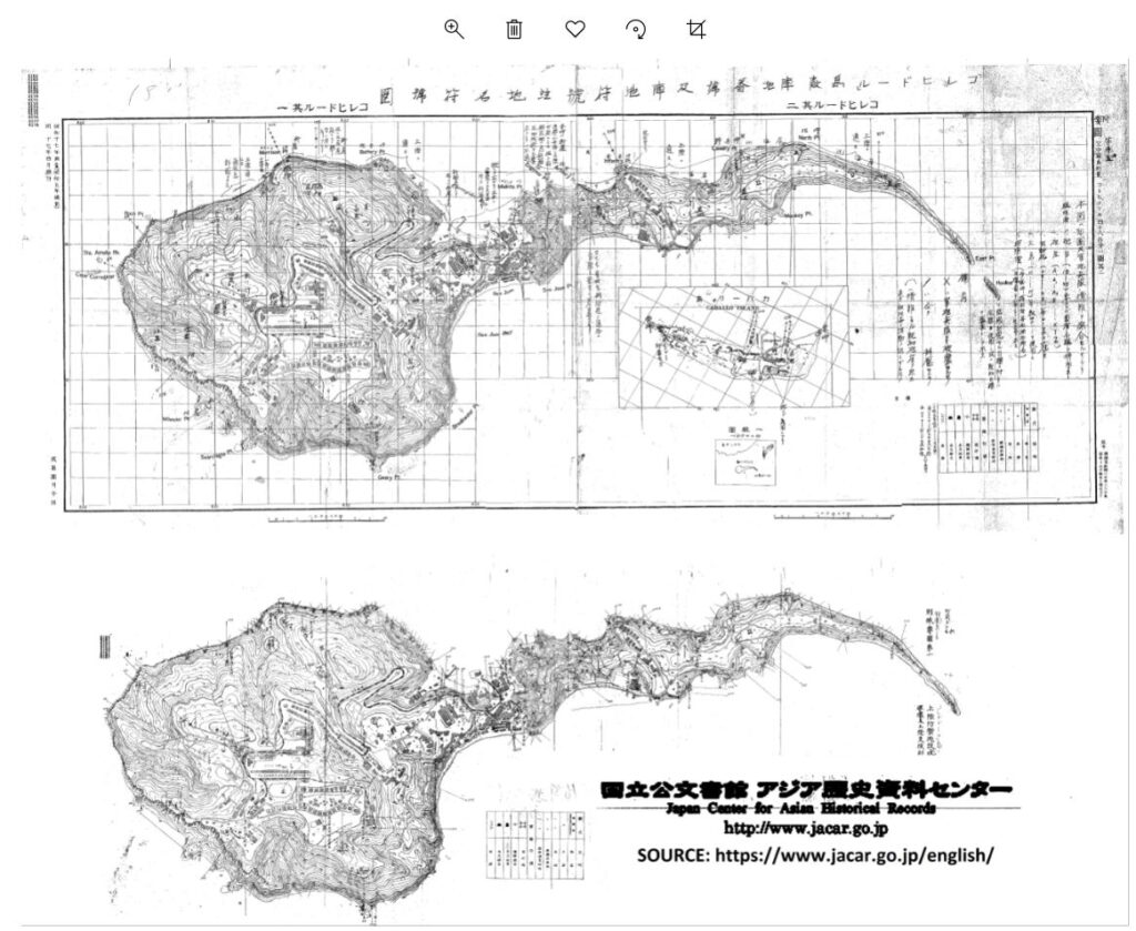
Zf117. Corregidor map, WWII, the Japanese had one. Picture courtesy, the Japanese National Archives and the Army Lt. Chester K. Britt Research Team. This picture may be downloaded in high resolution from this Flickr account, click here:
Corregidor map, WWII, the Japanese had one
During the Siege of Corregidor in WWII by the Imperial Japanese Forces, they had accurate target maps, the best one money can buy. The people of the Army Lt. Chester K. Britt Research Team found one in the Japanese archives! The Lt. Britt Team wrote this to us in the forum:
Came across the attached in the Japan National Archives! I’m sure you’ve both heard of PHOTO JOE the plane which came over Corregidor every day to do an aerial recon of the island. These maps may be the result of those photos in April, 1942. Sorry I can’t do more to translate the actual maps, but I’m hoping with your knowledge of the island you can figure most of it out.
The Lt. Britt Team wrote, using Google, the translation of the SUMMARY block comes out like this “Enemy position number and position code Corregidor code No. 1 Corregidor No. 2 14th Appendix Aerial photogrammetry (Photographed in April of the same year) Issued in April of the same year Watari Group Headquarters @ Appendix 16 Corregidor Island Nikel Landing Defense Facility and Landing Support Shooting Results Summary (Sato)”
Note from Karl, my speculation as to how the Japanese got copies of these secret Corregidor and Caballo Island maps. Either thru intelligence work or they found copies as the American, Philippine Forces retreated into Bataan.
Here are just 3 copies from the Japanese National Archive File of the Corregidor WWII Map. This PDF file is available in the Corregidor.org web pages with this URL, click here:
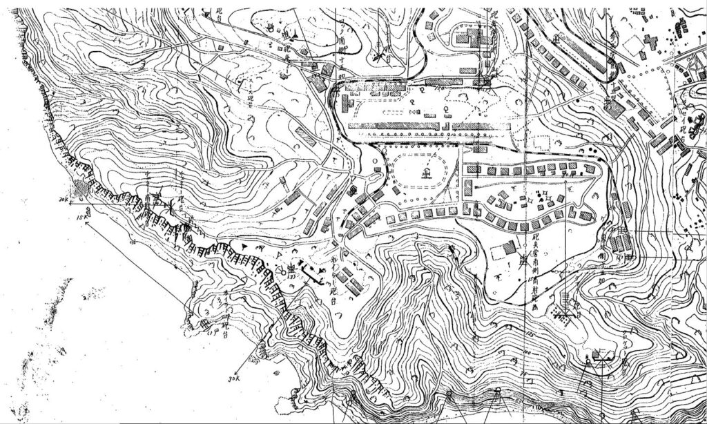
Zf118. SW section of Topside Corregidor Japanese WWII Map. Picture courtesy, the Japanese National Archives and the Army Lt. Chester K. Britt Research Team.
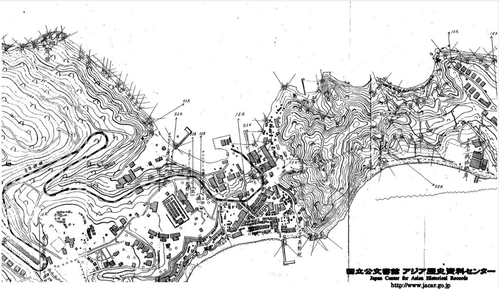
Zf119. SW section of Topside Corregidor Japanese WWII Map. Picture courtesy, the Japanese National Archives and the Army Lt. Chester K. Britt Research Team.
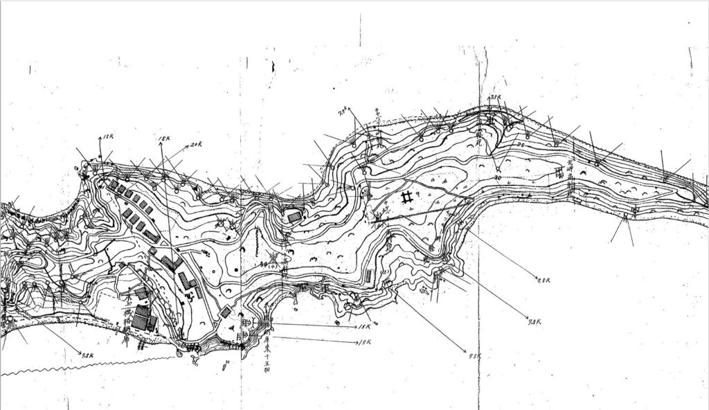
Zf120The actual Japanes landing site/beaches on Corregidor from the Corregidor Japanese WWII Map. Picture courtesy, the Japanese National Archives and the Army Lt. Chester K. Britt Research Team.
=======================================
I thank the Army Lt. Chester K. Britt Research Team for sharing the valuable find with the English Speaking World!
The people of the Army Lt. Chester K. Britt Research Team are:
First are Dave Britt, LTC USAF (Ret), son of Chester K Britt, Vickie Graham CMSGT USAF (Ret), and John Duresky. They all graduated from Logan High School in La Crosse, Wisconsin in 1967, and are doing it as a team. Chester Britt graduated from Logan in 1933 and his mother Grace in 1934. Dave wrote most of the manuscript, John editing what he wrote and doing most of the research, and Vickie is the final editor with about 20 years of professional writing in her resume, largely with Airman Magazine.
They are planning to write a book about Army Lt. Chester K. Britt soon!
Uploaded their intention to the forum, POW/MIA, Army Lt. Chester K. Britt, Hell Ship Oryoku Maru, click here:
==================================
Here are 3 translated sections of the important map. One member of the team, John Duresky, had experience of working in Japan and he asked one of his Japanese friends to translate these next three copies from the above PDF file which has 30 pages.
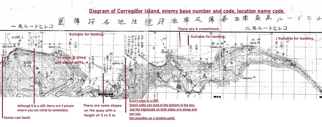
Zf121. One translated section of a Japanese WWII Corregidor Island, Fort Mills map, used by the Japanese Imperial Forces in the Siege of Corregidor. Picture courtesy, the Japanese National Archives and the Army Lt. Chester K. Britt Research Team.
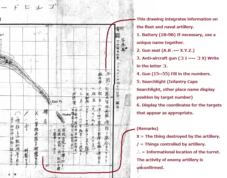
Zf122. One translated section of a Japanese WWII Corregidor Island, Fort Mills map, used by the Japanese Imperial Forces in the Siege of Corregidor. Picture courtesy, the Japanese National Archives and the Army Lt. Chester K. Britt Research Team.
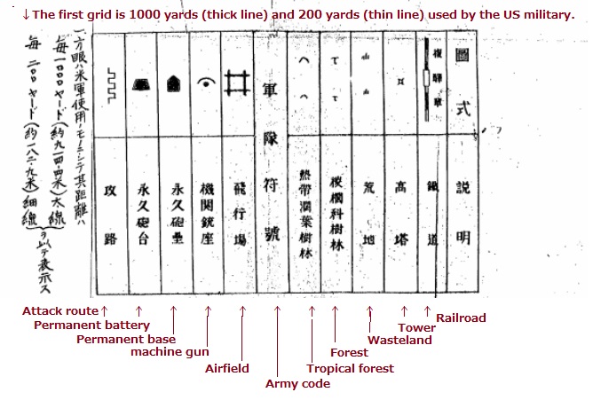
Zf122. One translated section of a Japanese WWII Corregidor Island, Fort Mills map, used by the Japanese Imperial Forces in the Siege of Corregidor. Picture courtesy, the Japanese National Archives and the Army Lt. Chester K. Britt Research Team.