Category: South Luzon
This category is for my albums from South Luzon.

Palsabangon, WWII Historical Marker
#A01 & A02 pictures are Google Earth graphs which show where the Palsabangon WWII Historical Marker is located. This is #A01 picture. —————————————————— Every year the family drives to Matnog, the ferry port to Samar on the North Shore of the San Bernardino Strait. Studying the route I saw the indicator for this […]
Read More
Bon Ot Big to Genablan Walk 2025-05-19.
#11 Image #05 to #11 images are of the stretch of road from Bon Ot Big to the point where I descend to Barangay Genablan Oriental. We see the lovely coconut areas above the San Bernadino Strait, the road concrete laid has almost reached Genablan, the mouth of the Genablan River and Genablan Occidental on […]
Read More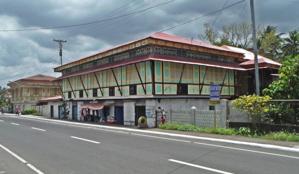
Juban Town, Old Philippine Houses, 2017-04-04
Juban Town, Old Philippine Houses, 2017-04-04 Zo031.-001. Old Philippine house in Juban Town along the Maharlika Highway, I numbered it #1. It is on the west side of Maharlika Highway. ——————————————- The Welteke Family stopped in the Municipality of Juban, Sorsogon Province, Bicol Region and Republic of the Philippines and took these pictures of 4 […]
Read More