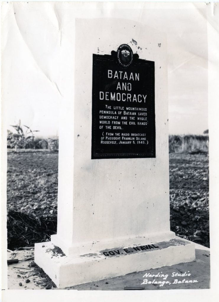
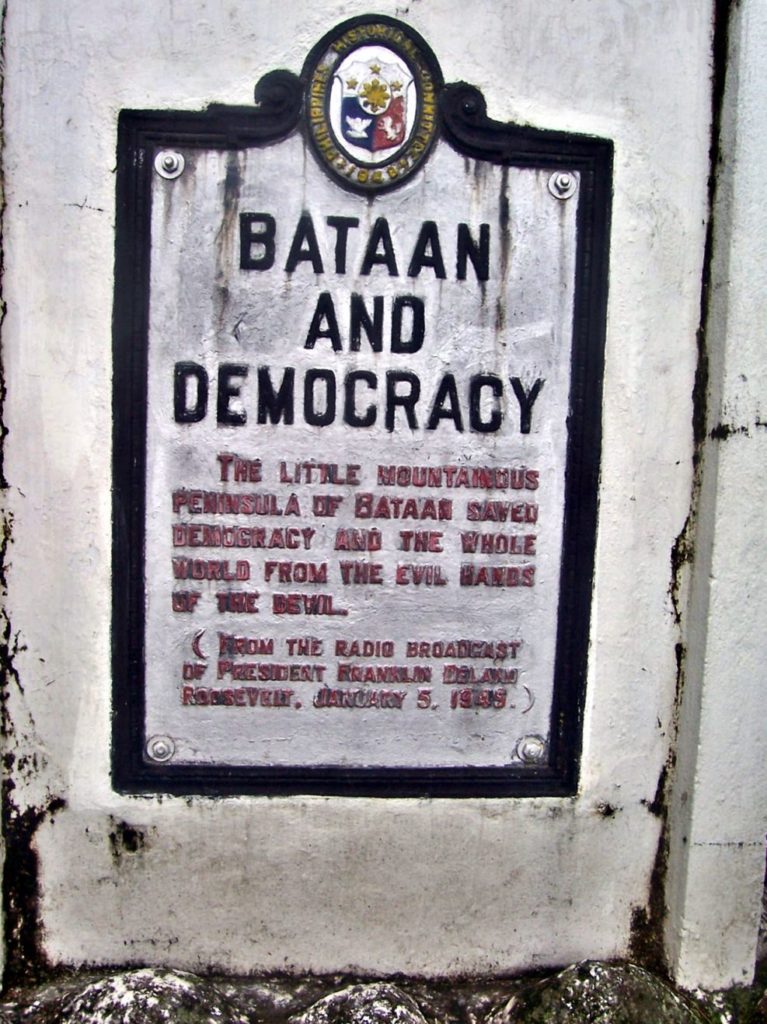
Zc959. This image of the Bataan and Democracy Historical Marker was provided by the General Douglas MacArthur Memorial in Norfolk Virginia.
————————————————-
The Gen. MacArthur Memorial was wondering where was it located and does it still exist? One of our forum members saw it and even has some pictures. We did some additional research and here is information about the Bataan and Democracy Historical Marker.
That the General Douglas MacArthur Memorial in Norfolk Virginia sent us this picture and that it has a quote from President Franklin Delano Roosevelt radio broadcast of the 5th Jan.1945 makes this Bataan Historical Marker special to me.
This is the Quote: (THIS LITTLE MOUNTAINOUS PENINSULAR SAVED DEMOCRRCY AND THE WHOLE WORLD FROM THE EVIL HANDS OF THE DEVIL)
————————————————-
The image Zc959 is also available at a higher resolution at this URL, click here!
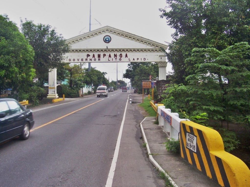
Zc960. This picture of the Bataan and Democracy Historical Marker was shot on the 4th Oct. 2007 and the marker is located on the Bataan side of the Pampanga Welcome Gate over the Gapan-Olongapo Highway. This stretch of road was also part of the Death March after the Battle of Bataan.
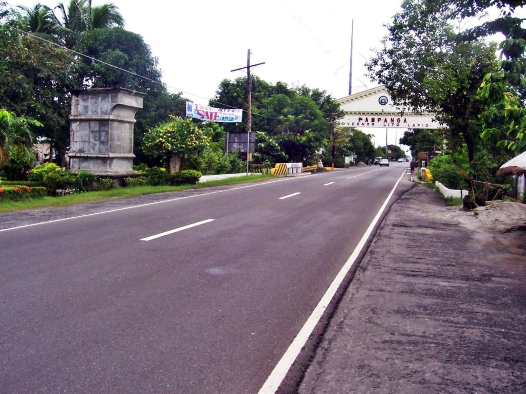
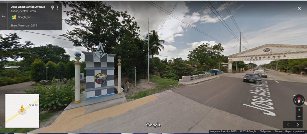
Zc961. Bataan and Democracy Historical Marker. This photo was shot on the 4th Oct. 2007 and the marker is located on the Bataan side of the Pampanga Welcome Arch (maybe 40 meter from it) over the Gapan-Olongapo Highway which was also the Death March Route at this area. Notice the massive Shriner’s Monument at left and the Bataan and Democracy Historical Marker is to the left of that and is set further back.
Zc962. Bataan and Democracy Historical Marker. This photo was shot on the 4th Oct. 2007 and the marker is located on the Bataan side of the Pampanga Welcome Arch (maybe 40 meter from it) over the Gapan-Olongapo Highway which was also the Death March Route at this area. The bridge over the creek Prado is another landmark for the marker’s location. The name of that Governor is now removed.
Zc963. Bataan and Democracy Historical Marker. This time we are looking in the Olongapo direction. This photo was shot on the 4th Oct. 2007 and the marker is located on the Bataan side of the Pampanga Welcome Arch (maybe 40 meter from it) over the Gapan-Olongapo Highway which was also the Death March Route at this area. The bridge over the creek Prado is another landmark for the marker’s location. Notice the massive Shriner’s Monument at right and the Bataan and Democracy Historical Marker is to the right of that and is set further back.
Zc964. Bataan and Democracy Historical Marker. This photo was shot on the 4th Oct. 2007 and the marker is located on the Bataan side of the Pampanga Welcome Arch (maybe 40 meter from it) over the Gapan-Olongapo Highway which was also the Death March Route at this area. This picture shows clearly the relative position of marker to the massive Shriner’s Monument.
Zc965. The wonders of the internet; the Bataan and Democracy Historical Marker is located to left of the massive the massive Shriner’s Monument and is partially blocked by a column. This images is dated 2015 and it the Shriner’s Monument is now refurbished!
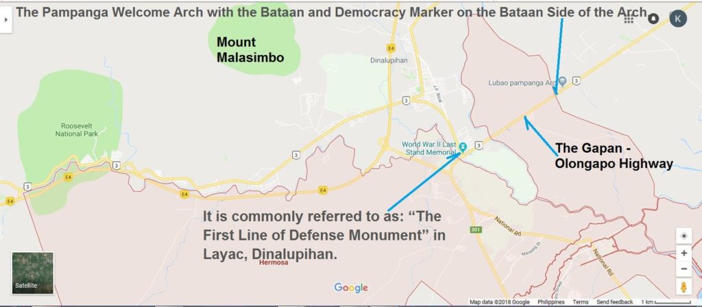
Zc966. This Google Earth map shows the outline of the Hermosa Municipality and I marked in location of the The Pampanga Welcome Arch with the Bataan and Democracy Marker on the Bataan Side of the Arch.
Zc967: We have learned that the Bataan and Democracy Historical Marker was authorized and established in 1948 by the Philippine historical Committee. Here is the URL:
List of historical markers of the Philippines in Central Luzon, click here!
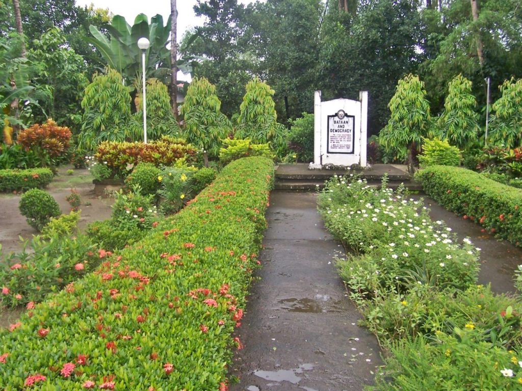
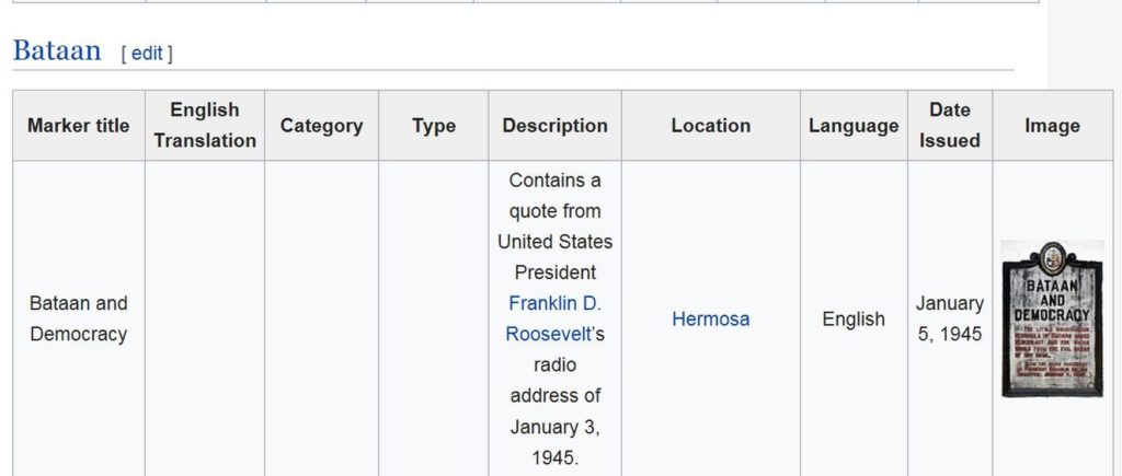
Zc968. This is the Bataan and Democracy Historical Marker downloaded from the List of historical markers of the Philippines in Central Luzon, but it is reduced in size here:
This is the URL of the List of historical markers of the Philippines in Central Luzon if you like to download it, click here!:
This image is also available here at a higher resolution at this URL, click here!
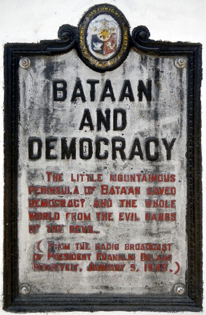
Zc969. This is the Bataan and Democracy Historical Marker as it looked on the 4th Oct. 2007 and the marker is located on the Bataan side of the Pampanga Welcome Arch (maybe 40 meter from it) over the Gapan-Olongapo Highway which was also the Death March Route at this area.
The marker looks different that the marker on the image the General Douglas MacArthur Memorial sent to us, it has the name of the Bataan Governor then. Plus the marker in this image seems to be imbedded in rocks.
I looked at both images carefully and am very much convinced that the plaques are the same. The masonry bases they are fastened to are different. Maybe that was changed and perhaps it was even located at a different place and the change occurred when the marker at the Province Boundary was established.
This image is available at a higher resolution at this URL, click here!
Bataan Democracy Marker Update.
On the 22nd April 2019 Central Luzon experienced an earth quake, Wikipedia says this:
On April 22, 2019, a 6.1 magnitude earthquake struck the island of Luzon in the Philippines, leaving at least 18 dead, 3 missing and injuring at least 256 others. Despite the fact that the epicenter was in Zambales, most of the damage to infrastructure occurred in the neighboring province of Pampanga, which suffered damage to 29 buildings and structures
This is the URL: click here
On the 4th of June 2019 I drove by and took these pictures:
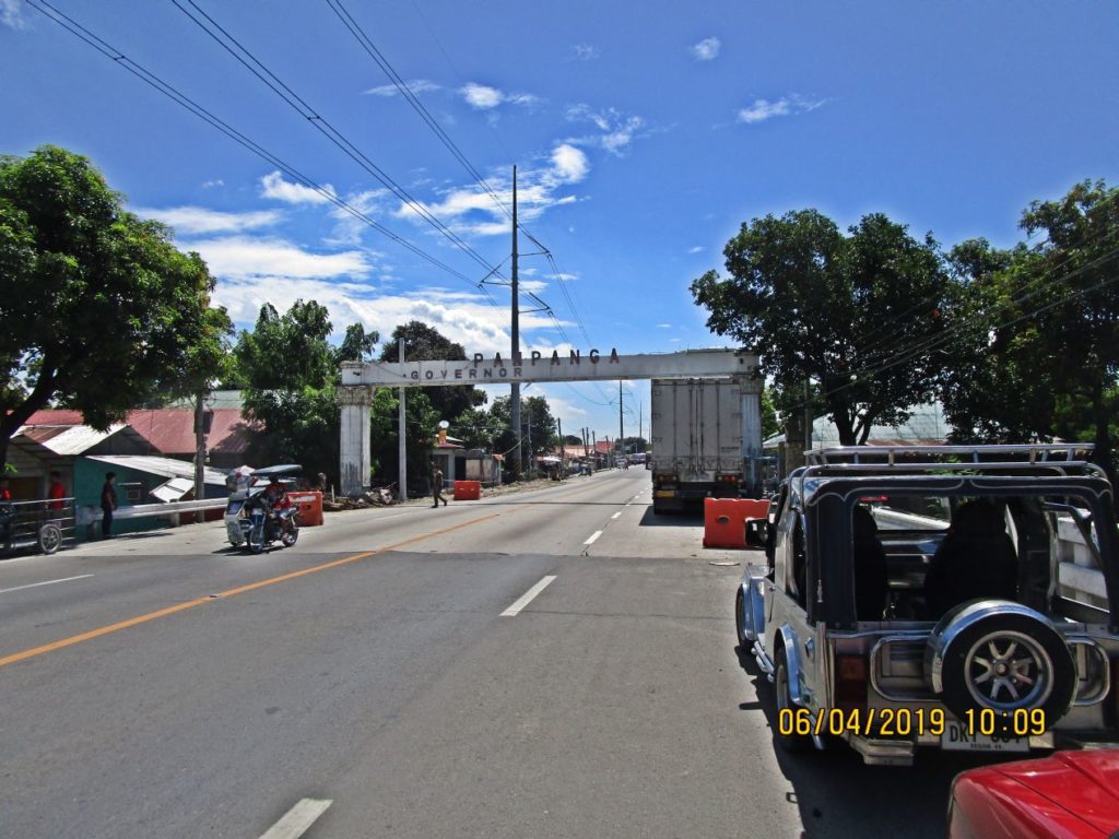
Ze362. This is one of 5 images (shot right to left) to show the geographic relationship of the Bataan Democracy Memorial Marker to the Pampanga Welcome Gate on the Olongapo-Gapan Road. We can see the gate got damaged by the earthquake.
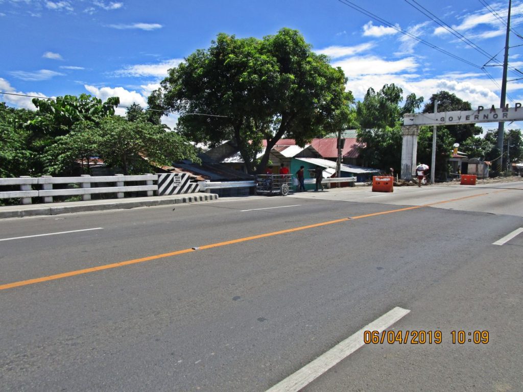
Ze363. This is one of 5 images (shot right to left) to show the geographic relationship of the Bataan Democracy Memorial Marker to the Pampanga Welcome Gate on the Olongapo-Gapan Road. We can see the gate got damaged by the earthquake.
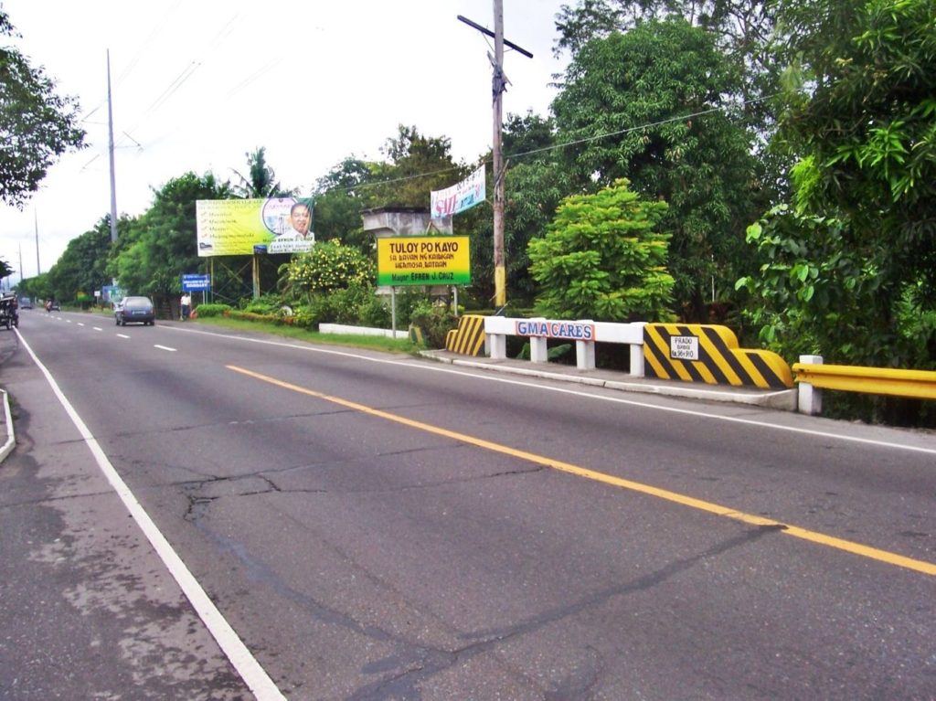
Ze364. This is one of 5 images (shot right to left) to show the geographic relationship of the Bataan Democracy Memorial Marker to the Pampanga Welcome Gate on the Olongapo-Gapan Road. We can see that there is bridge over a creek between the gate and the marker.
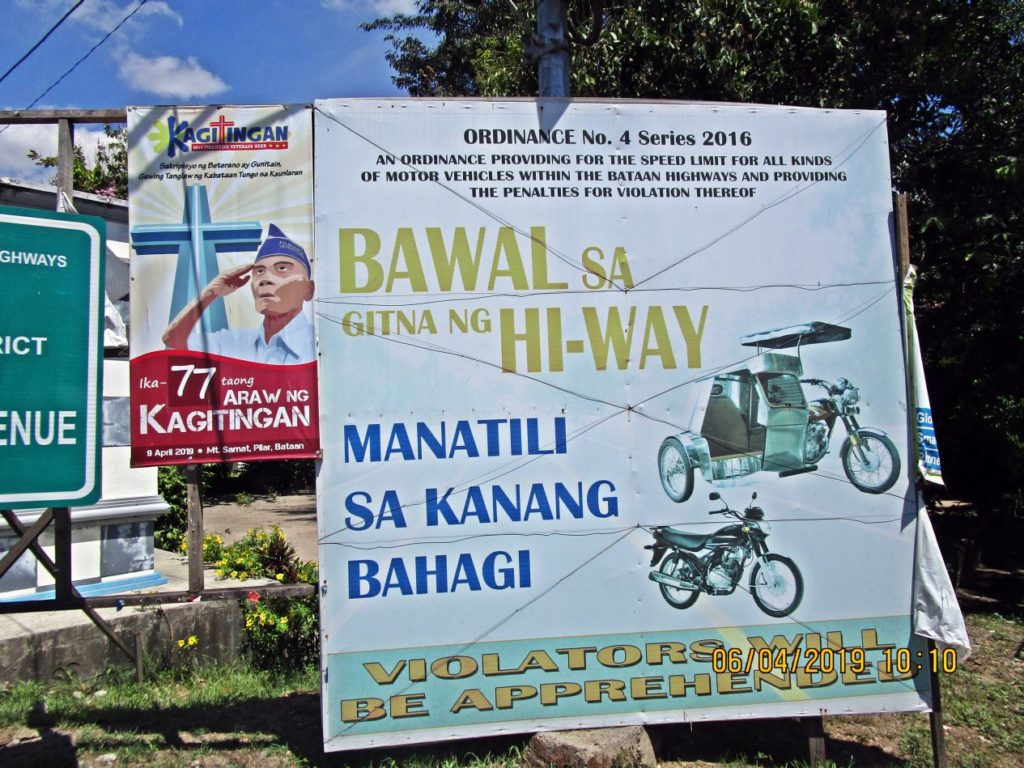
Ze365. This is one of 5 images (shot right to left) to show the geographic relationship of the Bataan Democracy Memorial Marker to the Pampanga Welcome Gate on the Olongapo-Gapan Road. This sign says for tricycles and motorbike not to drive in the middle/center of the road.
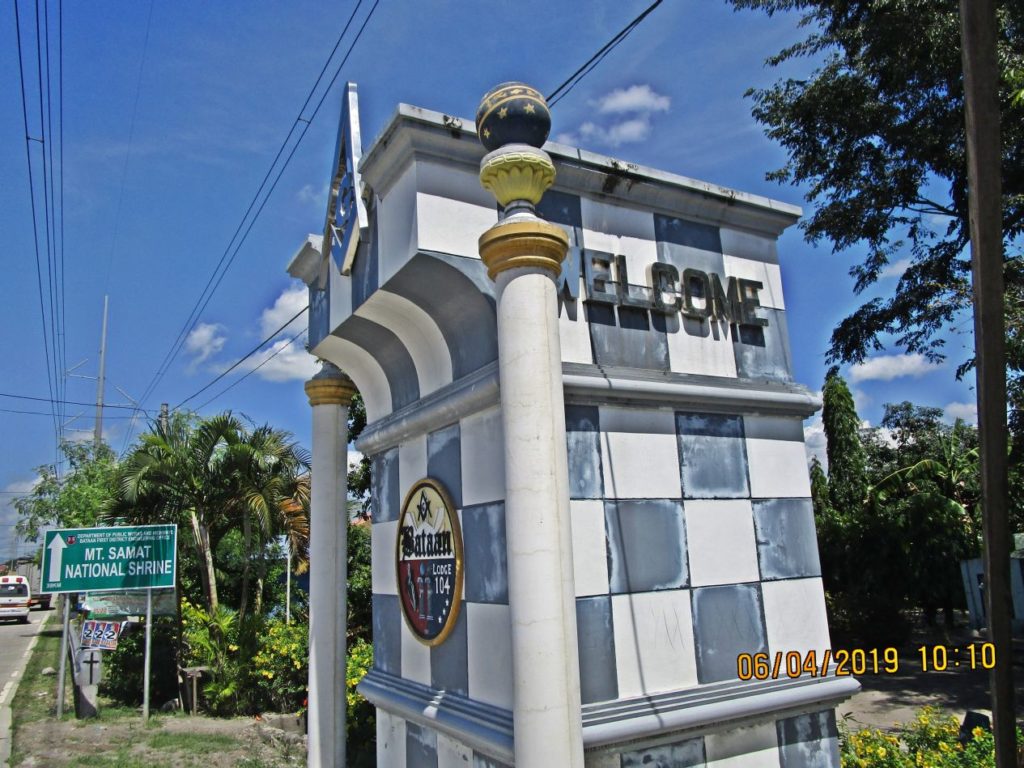
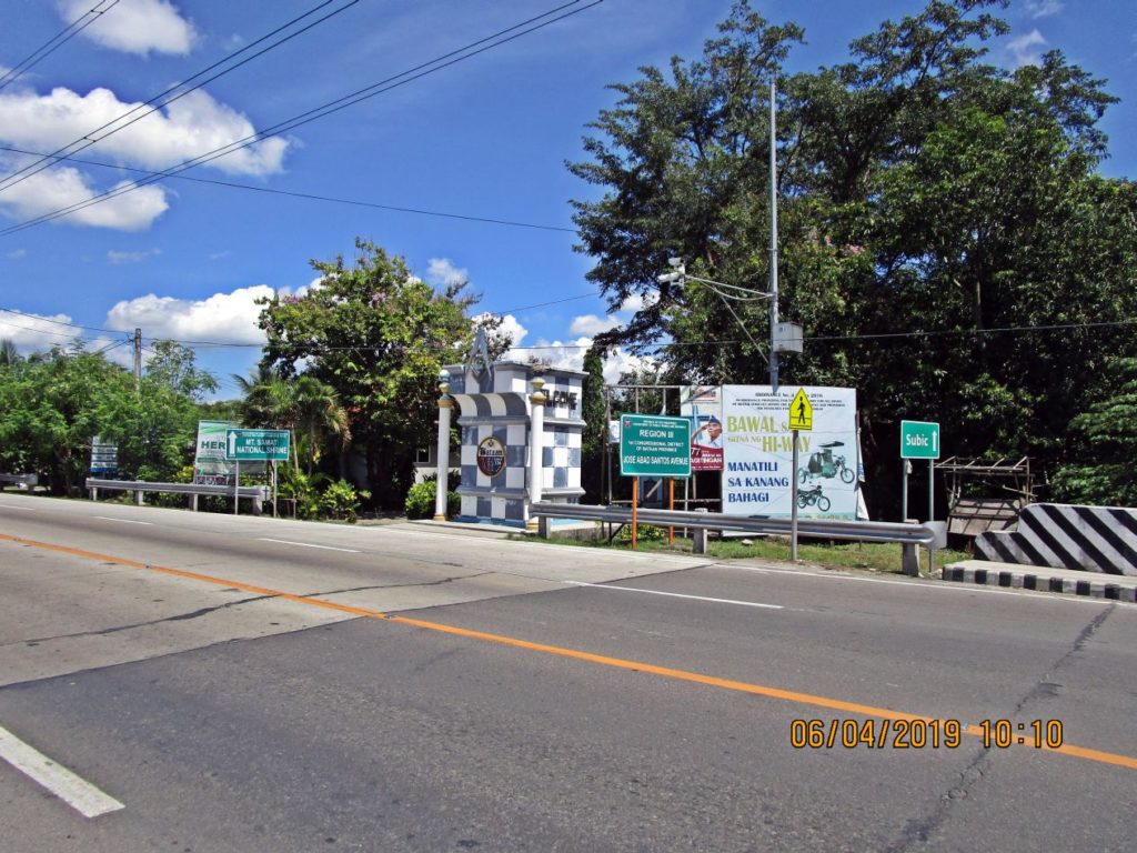
Ze366. This is one of 5 images (shot right to left) to show the geographic relationship of the Bataan Democracy Memorial Marker to the Pampanga Welcome Gate on the Olongapo-Gapan Road. The Shriner’s Monument is still in place as before.
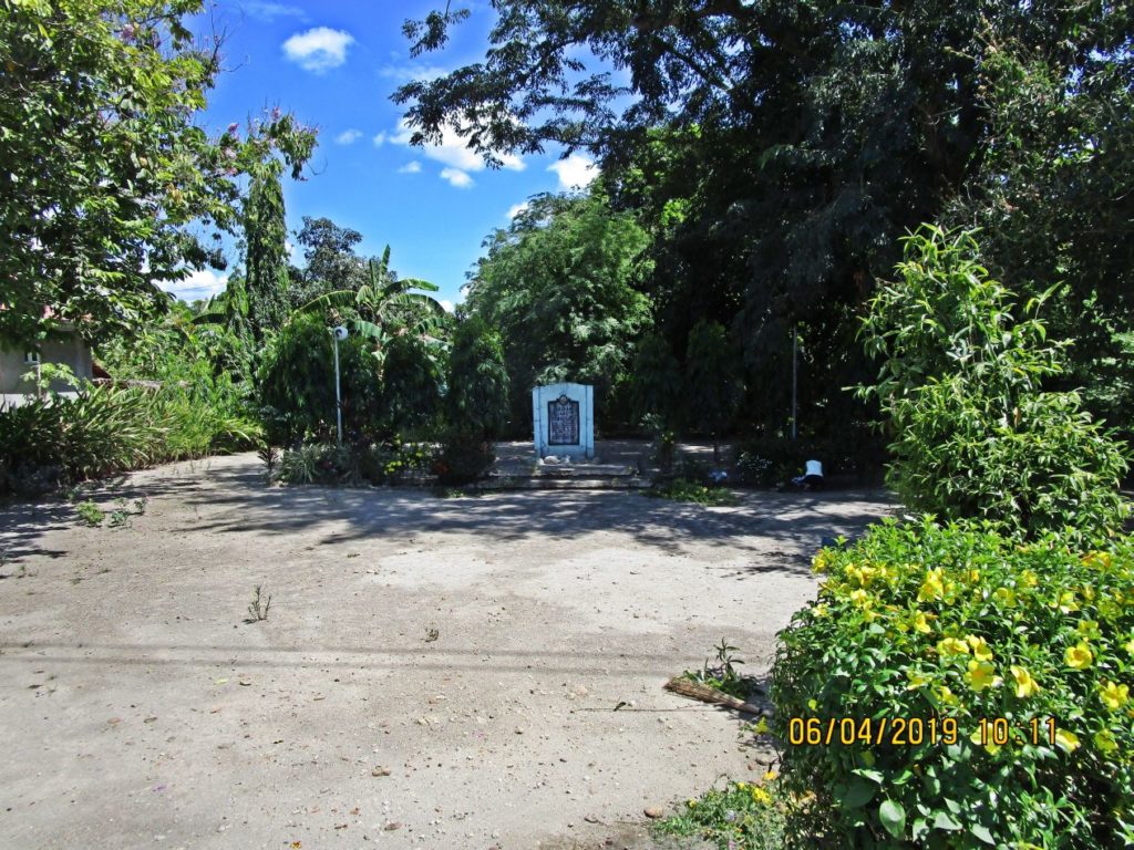
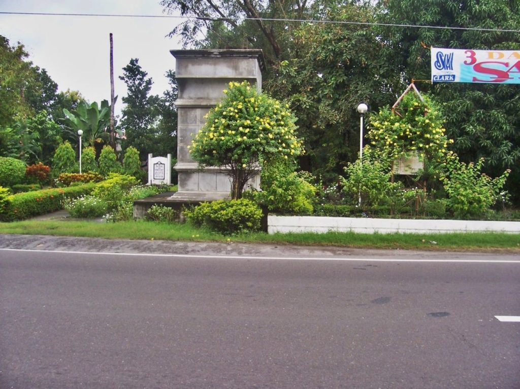
Ze367. The Bataan Democracy Memorial Marker is still in place but it used to look much nicer here in the past. It is just inside the Bataan-Pampanga boundary, the Pampanga Welcome Gate is very close but is now severely damaged by 2019 earthquake.
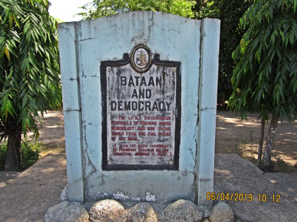
Ze368. Close-up of the image. The Bataan Democracy Memorial Marker is still in place but it used to look much nicer here in the past. It is just inside the Bataan-Pampanga boundary, the Pampanga Welcome Gate is very close but is now severely damaged by 2019 earthquake.
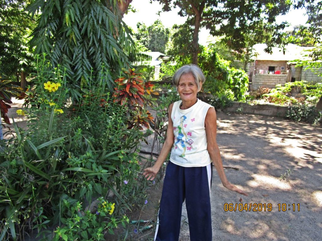
Ze369. Close-up of the image. The Bataan Democracy Memorial Marker is still in place but it used to look much nicer here in the past. This lady was pulling some weeds from the very little remaining landscape around the Bataan Democracy Memorial Marker. She said that she was paid by the barangay (village).
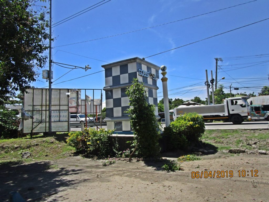
Ze370. The Bataan Democracy Memorial Marker is still in place but it used to look much nicer here in the past. This view is back to the Gapan Olongapo Road and we see the Shriner’s Monument.
I