Author: sailor_admin
Villa Verde 32nd Div. Red Arrow Monument updates 2019-06-13
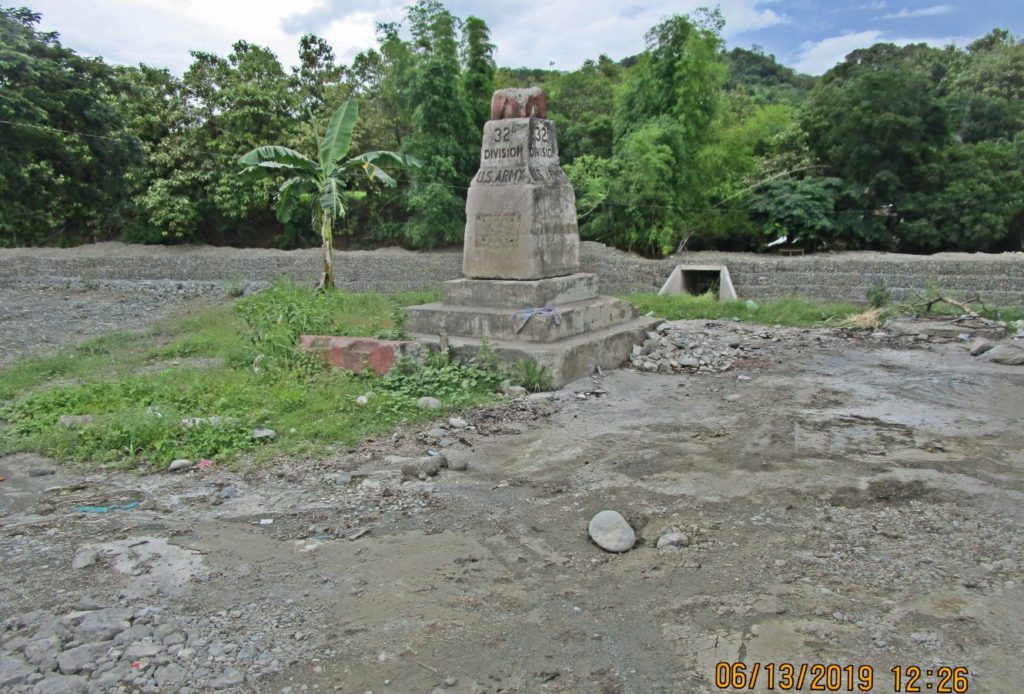
Ze391. (-01) this is the older 1945 32nd Div. Red Arrow Monument, without a plaque, and it is broken now. It has been moved by the road contractor to the left side of the Cabalisian River within the last 2 or 3 years during the new road and bridge construction. ________________________________ I changed my mind […]
Read More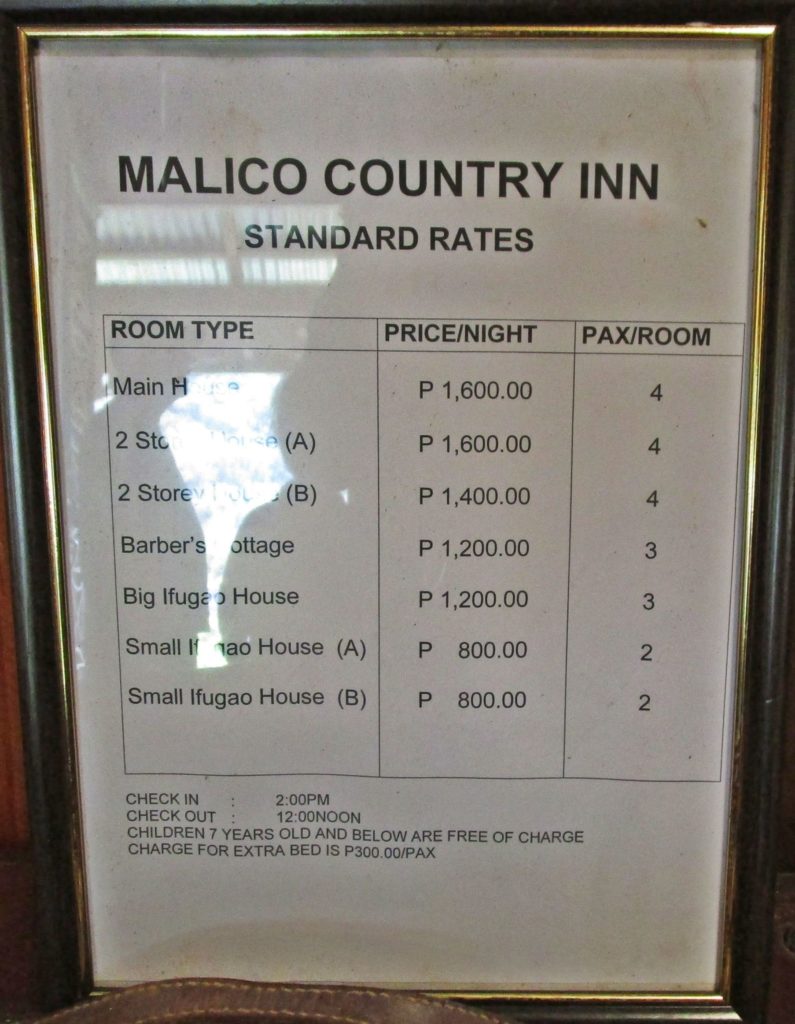
Overnight on Villa Verde Trail 2019-06-12
Ze371. (-01) THE MALICE COUNTRY INN, WE DECIDED TO STAY HERE, RATHER THAT IN SANTA FE. Camping out in the Malico, the Salacsac Passes on top of the Villa Verde Trail, 2019-06-12 Two friends and I wanted to walk down the Villa Verde Trail from the top to the bottom at Pangasinan. We drove to […]
Read More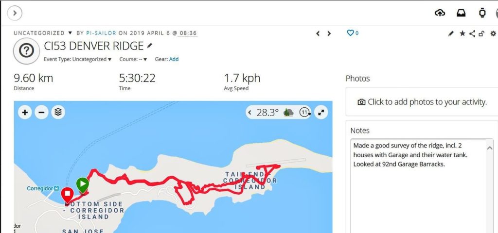
Corregidor Tailend Walk, Denver Ridge, Kindley Field and in-between 2019 Apr. 06
Ze257. This is my GPS track on my Corregidor Tailend Walk, 9.6 km, 5 ½ hour from my Garmin account and I used 3 liters of water. ———————————— The Tribute Day to all Filipino Heroes on Corregidor was on the 7th April 2019 but I arrived one day early and made this walk. I looked […]
Read More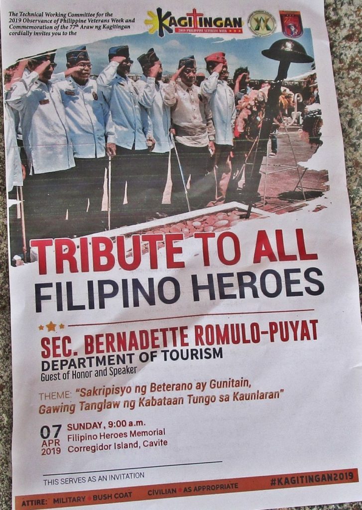
7th April 2019 Tribute to all Filipino Heroes on Corregidor.
Ze215. This is the front of the program to pay “Tribute To All Filipino Heroes” on Corregidor, at the Filipino Heroes Memorial. ———————————- The Heroes Day is on the 7th of April but I arrived one day earlier. On the 6th of April 2019 Philippine naval vessel started arriving and the majority arrived on the […]
Read More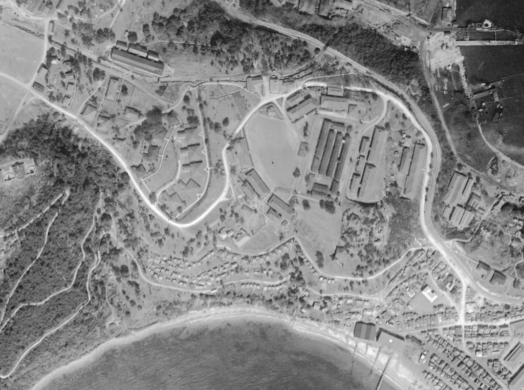
Stockade Level, Fort Mills, Shelters, Bunker etc, 2019-04-07
Z188. This is an Army prewar aerial image of the Stockade level of Corregidor Island. This picture was provided by Karl Schmidt, a leader in the Coastal Defense Study Group organization (cdsg.org) who got it from the National Archives and Records Administration (NARA). —————————————— On the Stockade Level is plenty to see, it had plenty […]
Read More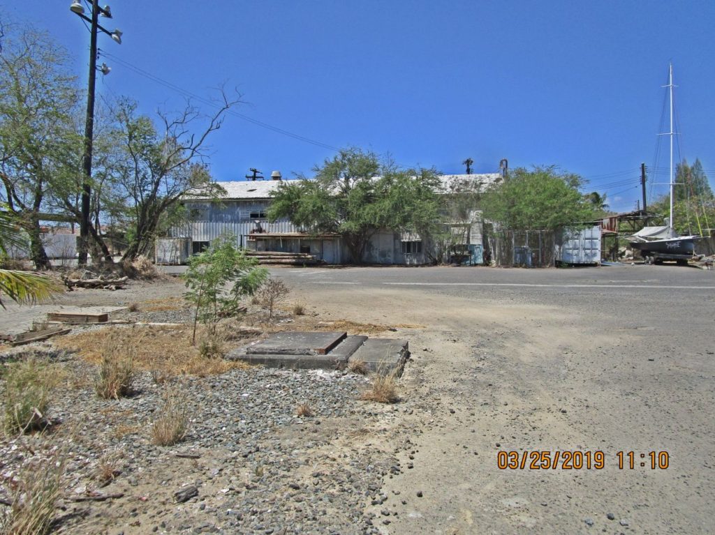
The ex Subic Bay SRF Diving Locker 2019-03-25
Ze143. This is the ex Subic Bay SRF Diving Locker from the Causeway, 2019-03-25 —————————————- My last duty station was in this building, the Ship Repair Facility (SRF) Diving Locker. When we turned over the Subic Bay Naval Facilities in Nov. 1992, the Recompression Chamber continued operating to treat diving accident victims to 2004, I […]
Read More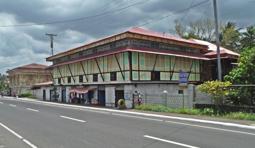
Juban Town, Old Philippine Houses, 2017-04-04
Juban Town, Old Philippine Houses, 2017-04-04 Zo031.-001. Old Philippine house in Juban Town along the Maharlika Highway, I numbered it #1. It is on the west side of Maharlika Highway. ——————————————- The Welteke Family stopped in the Municipality of Juban, Sorsogon Province, Bicol Region and Republic of the Philippines and took these pictures of 4 […]
Read More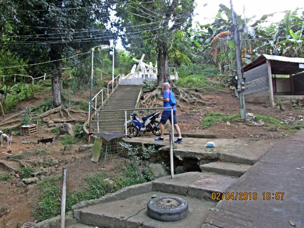
Calvary Hill, Tacloban City, Philippines, Crucifixion of Jesus
Ze083 One of many images of the Stations of Jesus Crucifixion on the Calvary Hill in Tacloban City, Philippines. I think it is well done and is worth a visit. ——————————————— Stations of Jesus Crucifixion On the last day we finally found time to walk up the Calvary Hill, Tacloban City, Philippines. The people of […]
Read More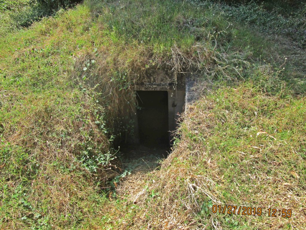
Cable Hut No. 5
Ze078. The entrance to Cable Hut No.5 in the former Fort Mills on Corregidor Island. ————————————————— Cable Hut No.5 is located at Middleside, in the former Fort Mills on Corregidor Island. I had looked at it before but not close like this time on the 27th Jan. 2019. Glen Williford wanted to see it and […]
Read More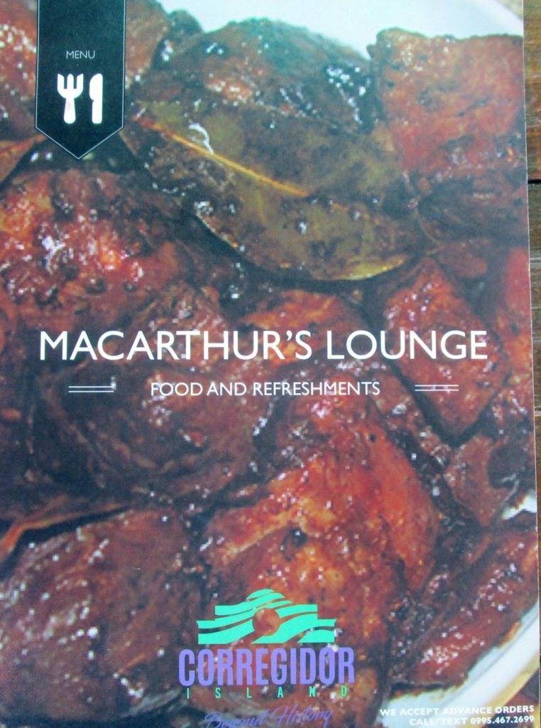
MacArthur’s Lounge, Food & Refreshments 2019.
Ze071. The new food and refreshment establishment on Corregidor Island, and located in the same premises as the former MacArthur Café has a name: MacArthur’s Lounge. ——————————————— As of this year Corregidor Island has a new establishment for food and refreshments! A friend and I visited Corregidor in 2019, Jan. 25th to the 28th and […]
Read More