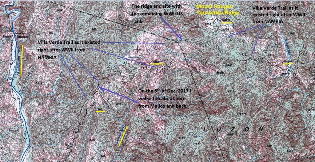
This is a map of the Villa Verde Trail from MAMRIA.
This is probably is the best map of the Villa Verde Trail as it existed right after WWII. It is a section of a 1:50000 map of the National Mapping and Resource Information Authority (NAMRIA) # 7175 II (San Nicolas). I marked in or highlighted landmarks that are mentioned in the WWII battle story or from my walks. Notice Hill 1053, I will upload one picture of this hill in this segment! Also notice Ridgeline 745, that one always blocked my view towards the Salacsac Passes when I walked up the Villa Verde Trail from San Nicolas in 2014. And I will add one picture of the area where I had to turn around from my walk on the 5th Dec. 2017 from Malico.
The map has this URL:
http://www.namria.gov.ph/7175-IISanNicolas.html